
|
|
Route |
|---|---|
|
|
37.34027°N / 113.11317°W |
|
|
Hiking |
|
|
Spring, Summer, Fall |
|
|
Most of a day |
|
|
Hike |
|
|
Overview
Hop Valley Trail is a 6.6 mile long trail in the northwestern parts of Zion National Park. It connects Kolob Terrace Road to La Verkin Creek Trail.The trail starts at Hop Valley Trailhead on Kolob Terrace Road and heads north taking you over a sage covered plateau. After 2.8 miles, the trail descends into Hop Valley, a straight, long and narrow valley that drains to the northwest where it joins La Verkin Creek Valley. Hop Valley is more than 3 miles long but it is only a few hundred feet wide. Slickrock slopes/walls rise abruptly above the edges of the valley. Sand covers much of the floor of the valley. Hiking over the sandy banks of the Hop Valley Creek is likely to make you feel as if you were hiking on a beach (in late summer, the creek may go dry). Near the northern end of Hop Valley, the trail leaves the valley and goes down a number of switchbacks to reach the junction with La Verkin Creek Trail.
Please note that if you want to continue west on La Verkin Creek Trail, you will have to cross La Verkin Creek. At times of high water, this is generally possible but might not be easy. Once you cross the creek, you can follow a 0.6 mile spur trail to Kolob Arch Viewpoint (see the page for La Verkin Creek to Kolob Arch Trail).
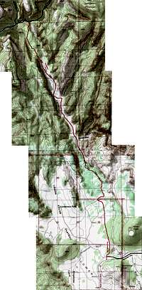 Map |
Getting There
From the southern entrance of Zion National Park in Springdale, UT, drive 13.5 miles west on Route 9 to the town of Virgin. Turn north and follow the Kolob Terrace Road 13 miles to the well-signed Hop Valley TrailheadThis is a narrow paved road. Parts of it are closed in winter, see link below:
Kolob Terrace Road Conditions November Through May.
Route Description
All distances are per my GPS.At trailhead, you will find yourself on a sage covered plateau. The most prominent feature is the slickrock summit of the Red Butte (7412 ft) to the northwest. In the northern horizon, you can see the tip of the walls of the 7535 ft Gregory Butte (where the trail ends). To the far west, you can see the long ridgeline that forms the Pine Valley Mountains (10325 ft). A couple of rounded hills known as Firepit Knoll (7265 ft) and Spendlove Knoll (6895 ft) will also be visible to the east and south. Follow the trail north. After 0.1 miles you will go by the junction of the Connector Trail on your right (east). Hop Valley Trail continues north (straight) and takes you over the plateau. You will at times go through beautiful growths of Gamble Oak.
 Gregory Butte | ||
 Red Butte | 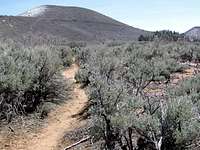 Firepit Knoll | 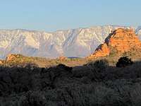 Pine Valley Mountains |
 Red Butte | ||
 | ||
At 1.5 miles, you will reach a gate through barbed wire. The land to the north of the wire is apparently an inlet of private property. Cattle is said to graze in this area (although in mid April, I did not see any cattle). Go through the gate and close it behind you. You will find yourself on an abandoned Jeep Road that takes you to a pond. Pine trees appear around you.
 Pond |
The trail begins to go downhill.
 Trail Going Downhill |
You will note a beautiful series of cliffs to the east.
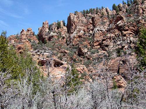 Cliffs to the East |
As you go downhill, you will get views of the long and narrow Hop Valley sitting among the slickrock slopes to the north.
 Hop Valley View |
At 2.8 miles, the abandoned Jeep Road reaches the bottom of a narrow valley. This is the northern end of Hop Valley. You may not see a trail here but you can follow the valley downhill.
 North End of Hop Valley |
As you keep going, the valley becomes wider. A trickle of water runs down its grassy floor.
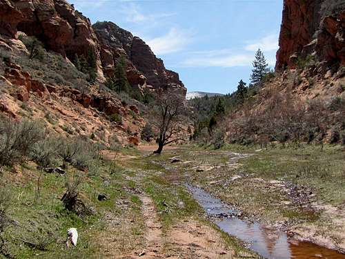 Northern Hop Valley | ||
 Northern Hop Valley |  Northern Hop Valley |  Northern Hop Valley |
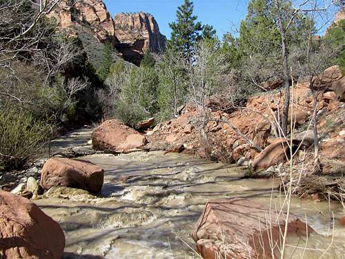
At 3.2 miles, a large tributary valley joins Hop Valley from the east bringing a creek into Hop Valley. You can see an impressive slickrock mountain at the east end of the valley.
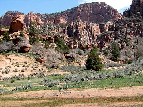 Tributary Valley |
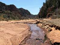
After this spot, sand covers much of the floor of the valley. You will hike on the sandy banks of the creek. Be prepared to cross the creek many times (the volume of water is little. There may not be much water in late summer).
 Hop Valley | ||
 Hop Valley |  Hop Valley |  Hop Valley |
 Hop Valley | ||
 Hop Valley | 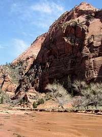 Hop Valley |  Hop Valley |
 Hop Valley | ||
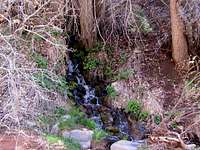
I noted what looked like a seasonal waterfall on the west wall of the valley (in mid April).
 Waterfall |  Waterfall |
At 4.95 miles, you will reach a fence that marks the northern end of private property. There is supposedly a gate here but I did not see it. I hiked in the creek right at the base of the western wall of the valley.
 Near the Fence |
After the fence, you will see a sign for a number of campsites. The trail leaves the valley floor and goes up a hill on the west side of the valley. Pay attention to see the sign that identifies the trail. You will go 100 ft up a forested slope. Look back south to see Hop Valley below you.
 Looking Back at Hop Valley |
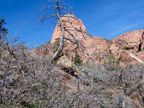
You will reach a flat forested high point. The 7682 ft Burnt Mountain will be to your west. The walls of Gregory Butte will be to the north.
 Burnt Mountain | |
 Gregory Butte |  Gregory Butte |
The trail begins to go down a number of switchbacks to reach the bottom of La Verkin Creek Valley. You will have good views of the rounded Point 6302 ft.
 Point 6302 ft from the Switcbacks |
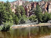
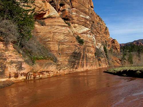
Hop Valley Trail ends at the junction of La Verkin Creek Trail 80 feet above the creek. Turn west and continue 0.1 miles to reach La Verkin Creek.
 La Verkin Creek | ||
 La Verkin Creek | 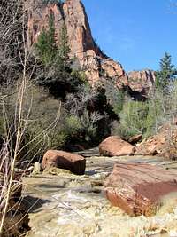 La Verkin Creek |  La Verkin Creek |
Find Beatty Spring on the south side of La Verkin Creek
 Beatty Spring |
Red Tape
You must pay park entrance fee. Please be ware that there are no fee booths on Kolob Terrace Road. You must pay in Springdale or elsewhere.No permits needed for day hikes. See link below for all rules and regulations:
http://www.nps.gov/zion/index.htm
Weather
See the forecast for Springdale, UTExternal Links
Website:Hop Valley trail
Books:
A Falcon Guide, "Hiking Zion & Bryce Canyon National Parks", Eric Molvar & Tamara Martin.
Maps:
National Geographic, "Zion National Park, Utah, USA" #214