
|
|
Route |
|---|---|
|
|
37.45125°N / 113.19165°W |
|
|
Hiking |
|
|
Spring, Summer, Fall |
|
|
Most of a day |
|
|
Hike |
|
|
Overview
La Verkin Creek Trail is located in the Kolobs Canyon portion of Zion National Park. This northwestern corner of the park has no direct road access to the Zion Canyon and has a separate road entrance than that of the main section of the park.Along its 7 mile length, the trail gives you spectacular views of the red colored walls of the buttes that rise above the valleys in this area. The hike starts at Lees Pass on the eastern rim of Timber Creek Valley. The trail quickly descends 500 vertical feet to reach Timber Creek at the bottom of the valley and then continues south following the creek downhill. After 3 miles, the trail leaves Timber Creek and goes up a hill where it turns east, then enters the La Verkin Creek Valley and follows La Verkin Creek uphill. Just before the junction with Hop Valley Trail, you will reach a 0.6 mile long spur trail that takes you into a narrow canyon to Kolob Arch View Point.
With a length of 287 ft, Kolob Arch is either the second or the third longest free standing arch in the world (see statistics). At the View Point, you can look a thousand feet up a red colored wall to see the arch near the top of a mesa.
Please note that if you want to continue onto Hop Valley Trail, you will have to cross the La Verkin Creek. At times of high water, this is generally possible but may not be easy.
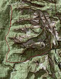 Map |
Getting There
From St George, UT, drive roughly 35 miles north on I-15 to exit 40. Turn east and enter the park. Drive 3.5 miles past the visitor center to Lees Pass Trailhead.Route Description
All distances are per my GPS.At Lees Pass, you will see the sign for the La Verkin Creek Trail. Follow the trail down into the Timber Creek Valley. You will have great views of the red colored buttes on the west side of the valley.
 Descending into Timber Creek Valley | ||
 Descending into Timber Creek Valley | 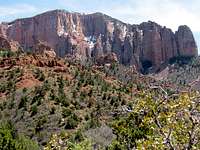 Descending into Timber Creek Valley |  Descending into Timber Creek Valley |
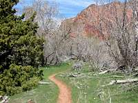
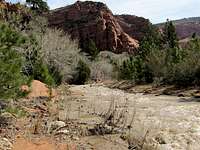
After one mile, you have descended 500 feet where you reach Timber Creek. For the next 2 miles, the trail follows the creek downhill and crosses it many times. The volume of water in Timber Creek in usually low and the crossings are generally not a problem (you obviously need appropriate hiking boots or get wet a little).
 Timber Creek Area | ||
 Timber Creek Area |  Timber Creek Area | 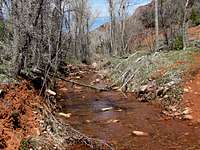 Timber Creek Area |
 Timber Creek Area | ||
 Timber Creek Area | 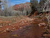 Timber Creek Area | 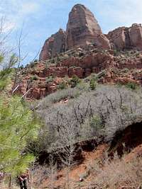 Timber Creek Area |
 Timber Creek Area | ||
 Timber Creek Area | 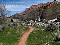 Timber Creek Area | 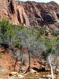 Timber Creek Area |
 Timber Creek Area | ||
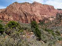
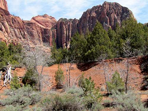
The trail then leaves Timber Creek and goes 100 vertical feet up a hill covered by Pine/Juniper Trees where it reaches a high point and turns east. It then descends into the La Verkin Creek Valley.
 Juniper Area | ||
 Juniper Area | 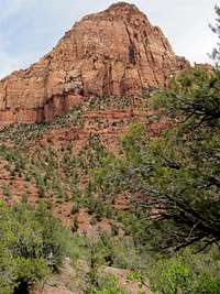 Juniper Area |  Juniper Area |
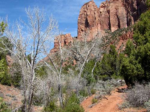
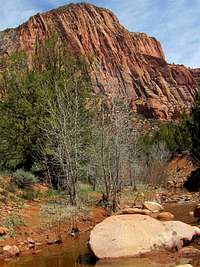
For the next 1.75 miles, the trail follows La Verkin Creek uphill on the north side of it.
 La Verkin Creek | ||
 La Verkin Creek |  La Verkin Creek |  La Verkin Creek |
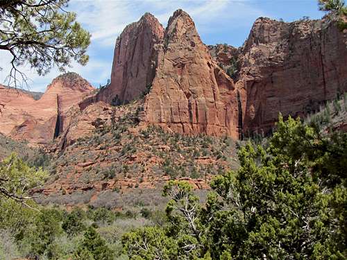
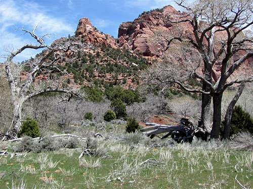
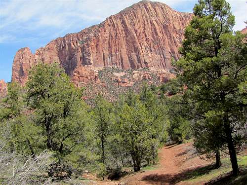
The red colored walls of Gregory Butte rise directly above you.
 Walls of Gregory Butte | ||
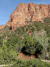 Walls of Gregory Butte |  Walls of Gregory Butte |  Walls of Gregory Butte |
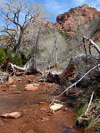
You will soon reach the signed junction with the Kolob Arch Trail. Turn north and follow the trail into a narrow canyon. This is a rough trail. .
 Kolob Arch Trail | ||
 Kolob Arch Trail |  Kolob Arch Trail |  Kolob Arch Trail |
After 0.6 miles, you will reach a sign that indicates that you have reached the Kolob Arch View Point. It also says that in order to prevent erosion, it recommends that you do not go any further. Look through the trees to see the giant Kolob Arch 1000 feet above you.
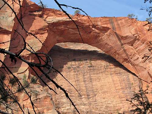 Zoomed View of Kolob Arch |
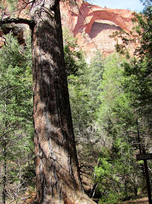 Kolob Arch and Giant Tree |
Red Tape
You must pay park entrance fee.No permits needed for day hikes. See link below for all rules and regulations:
http://www.nps.gov/zion/index.htm
Weather
See the forecast for Springdale, UTExternal Links
Website:La Verkin Creek
Books:
A Falcon Guide, "Hiking Zion & Bryce Canyon National Parks", Eric Molvar & Tamara Martin.
Maps:
National Geographic, "Zion National Park, Utah, USA" #214