
-
 3472 Hits
-
 86.85% Score
-
 23 Votes
|
|
Mountain/Rock |
|---|---|
|
|
45.06133°N / 6.49782°E |
|
|
Cerces |
|
|
Sport Climbing |
|
|
Summer, Fall |
|
|
9390 ft / 2862 m |
|
|
Overview
Crête de Moutouze
Crête de Moutouze is just one of the various fine limestone peaks belonging to the Cerces Massif, a small group situated in the Western Alps, North-West to the town of Briançon. This summit is lying in Haute Névachie, the upper part of the superb Val Clareé, a protected environment well deserving a visit, above all during the months of September and October, when fall is covering with its best colours the wonderful woods of broad-leaf, larchs and firs. This area, offering several climbing routes, is well-known not only by the French climbers but also by the Italians, by means of its relative closeness to the Piedmont region and the town of Turin. Explored by the French climbers Jean Michel Cambon and Gerard Fiaschi in 1995, this peak counts a nice route on excellent grey dolomia, with awesome views over the Haute Névachie.
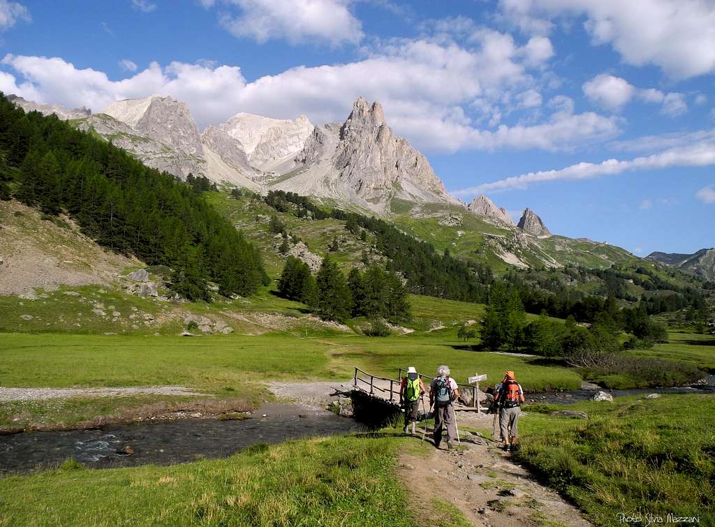
Starting point of the trail to Crête de Moutouze
Getting There
Road access
- From Turin (Italy)
Follow the A32-E70 Motorway entering Val di Susa and exit to Oulx, reach Cesana Torinese and Claviere, then Colle del Monginevro m. 1854, on Italy-France border; from here the road N94 descents towards Briancon. Some kilometres before getting to the town of Briancon, leave the main road turning right and entering Val Clareé. Follow the road, ending close to the Chalets de Laval. Parking area.
- From Grenoble (France) Follow the road N85 to Vizille, then the road N91 rising to Col du Lautaret; reach the Col du Lautaret m. 2057 and the town of Briancon. Follow the road N94 for a few kilometres, then turn to left and enter Val Clareé.


Walking approach From the parking area take on the left the path to the lake of Beraude and follow it for about 20 minutes. Left the main path and traverse to right, getting to a terrace between the Crête de Moutouze on the left and the Main de Crépin on the right. From here a steep track on a scree is rising to the base of the Nort-East ridge. About 1,30 hour from the parking .
Le Bal des vents pires route report
")
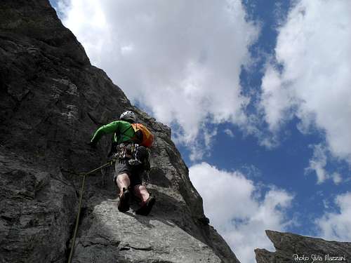
Le Bal des vents pires (Dance of worst winds) report – French scale
Summit altitude: m. 2862
Difficulty: TD, max F6b, F6a obbl.
Climbing length: 250 m., 7 pitches
Exposure: NE
Equipment: bolts
First ascent: Jean-Michel Cambon and Gerard Fiaschi 1995
Starting point: Chalets de Laval
A pleasant route on excellent grey limestone. The climbing, running on a very steep wall, is always technical. This ridge, facing North-East, may be sometimes a bit cold. Starting point just below the obvious ridge.

Route report
L1 – Climb the edge with technical moves to a belay under a yellow cave. 6a. L2 – Slanting left, climb a yellow wall and a long corner. 6a+ L3 – Again slanting left, then climb straight a superb steep slab below another steep carved wall. 6b. L4 – Up the wall, then slanting left on easier rocks to a stance below a small yellow roof. 6a, then 5b. L5 – Climb the roof on the right (little rockfall), then a thin crack cutting a smooth slab. 5c L6 – Slant to right climb a little overhang, then along the ridge leading to a stance towards a little corner. 5c. L8 - Climb the corner getting to the fine tiny summit. 5b.
Descent: rapping along the route “Le bal des vents pires” (6 abseils)
Red Tape
During the summer months the traffic of the private vehicles rising to the upper part of Val Clareeè is subject to regulation from 9 o clock to 18 o’clock. A service of public minibus is available.
When to Climb

This face is sometimes cold, even in summer. Best season goes from June to October
Where to stay
- Refuge de Laval 2030 m.

- Camping de Fontcouverte
Meteo
Guidebooks and maps

- “Oisans Noveau, Oisans Sauvage” by Jean Michel Cambon
- Map IGN 3535OT Névache - Mont Thabor - Cols du Galibier et du Lautaret
