
|
|
Mountain/Rock |
|---|---|
|
|
39.91993°N / 16.15885°E |
|
|
Hiking, Mountaineering, Skiing |
|
|
Spring, Summer, Fall, Winter |
|
|
7152 ft / 2180 m |
|
|
Serra del Prete
Serra del Prete is a very extensive mountain, with several broad and prolonged ridges leading to one of its foresummits and its summit. With a total height of 2,180 m this mountain holds also the third highest peak of the Pollino massif and the entire Southern Apennines. The actual summit and its foresummits are interconnected by broad shoulders and forming a vast central depression. The bottom and the inner slopes of this central part are relatively protected from the gales that sweep the top of this mountain frequently. Here, during the winter months, the great changes in temperature can shape massive snow cornices, and the thick ice reflecting the southern sunlight can turn this place into a furnace.On the south-east Serra del Prete is bounded by Monte Pollino, connected with the latter by the col 'Colle Gaudolino'. From its ridges the mountain offers some splendid views over the Orsomarso mountain range (south), the Lucanian Apennine (north-east) and on Serra delle Ciavole, Monte Pollino, Serra Dolcedorme (in a semicircle from north-east to south-east). On very clear days, primarily during the winter months or very early in the morning, it is sometimes possible to spot the volcano Stromboli and even the white cone of Mount Etna hovering above the dark blue of the Tyrrhenian Sea.
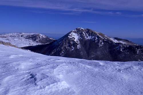 Mt. Pollino (from Serra del Prete) | 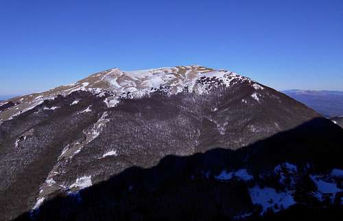 Serra del Prete (from the south-east) | 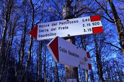 Signposting at Colle d'Impiso |
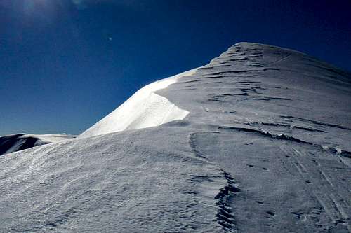
Serra del Prete is by no means a technical mountain and can be climbed without any particular problem, at least from late spring through late autumn. A winter ascent can become a completely different story, though, as its ridges are largely covered by thick layers of frozen snow, or even pure ice between the larger rocks.
Note: The term 'Serra' is another word for mountain (ital. monte) and usually indicates mountains with either a prolonged summit ridge or a main peak with a number of subsidiary summits (or non-independent peaks). It finds a use especially in the southern parts of the Apennine mountains.
Routes
1. The north ridge (from Colle d'Impiso)
The lower part of the north ridge
Indeed, at the upper end of the north ridge you have reached the highest point of Serra del Prete (2,180 m).
Note: With deep snow the part below the treeline may be exhausting. The upper parts of the actual ridge may hold some impressive but often unstable snow cornices. In this case, however, it is advisable to stay a few meters away from what appears to be the actual crest line.
2. The normal route (from Colle d'Impiso, via Colle Gaudolino)
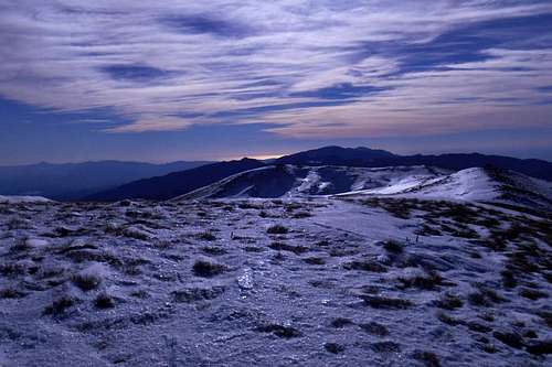
Serra del Prete (at sunset)
Soon after passing the natural spring "Fonte di Spezzavummula" you will reach a very spacious glade, i.e. the mountain pass (Colle Gaudolino) between Monte Polllino (left) and Serra del Prete (right). Also to the right, at the edge of the woods, you will spot the bivouac "Rifugio Gaudolino".
Keep direction and cross the glade until you come upon the artificial well and a large rock with some signposting. From here turn right, aim for an accumulation of larger rocks at the forest edge and keep following the signposting.
Once beyond the tree-line you may abandon trail and the still occasionally appearing signposting altogether and find your own way up to the summit instead. Keep sharp right in case you should want to follow the crest line leading from the eastern foresummits (2,104 m) to the mountain's main peak.
Note: As both trails 1. and 2. share the same trailhead, they may be combined in order to avoid the same way for both ascent and descent. This round trip is also know as "L'anello dell'Impiso", as both trails share the same trailhead.
3. The south routes (from Piano Ruggio)
3.1 The south-west ridge
South-west ridge (from Mt. Pollino)
About one hundred meters before reaching the terrace turn sharp left and follow a small but recognizable trail which traverses the beech forest of the lower slopes of Serra del Prete. Where the trail leaves the forest keep to the crest and re-enter the forest. After only a few hundred meters the forest opens again and you will find yourself on the prolonged south-west ridge leading to the south-west foresummit (2,128 m) and finally to the summit.
3.2 "Il sentiero dei Carbonai" (The "Charcoal burner's trail")
On the "Charcoal burner's trail"
The old trail is leading first in a northern direction before it starts zigzagging uphill. You will come to traverse a larger and heavily vegetated forest glade and re-enter the forest. After leaving the forest for a second time keep slightly to the right and follow the shoulder of the mountain until you come upon the south-west ridge. From here both routes 3.1 and 3.2 are identically following the ridge up to the highest peak of Serra del Prete.
Note: Also the routes 3.1 and 3.2 can be combined in order to take a somewhat more varied round trip. Both routes are making use of the upper part of the mountains south-west ridge, anyway. The only hazard during the descent may be finding the fork, i.e. the right point for leaving the crest for the "Charcoal burner's trail".
A few landmarks & impressions
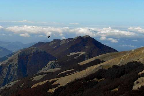
 Serra del Prete (seen from Mt. Pollino) | 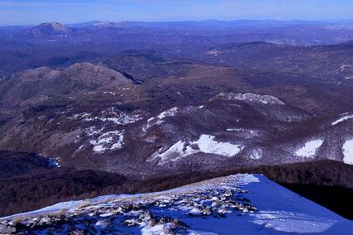 View from the north ridge | 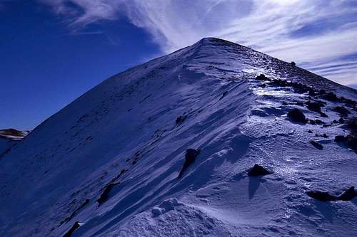 On the north ridge |
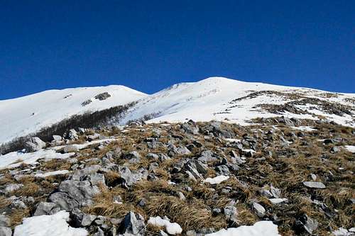
 The summit plateau | 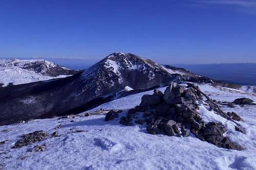 Serra del Prete (summit) | 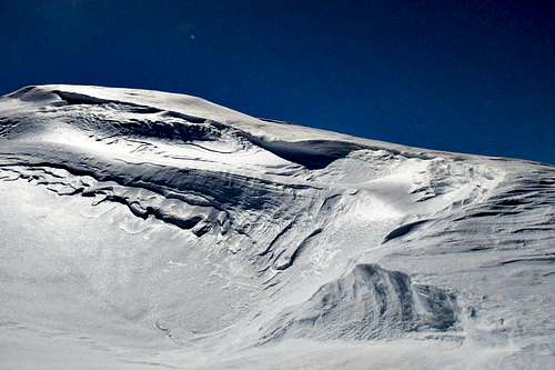 Snow and ice of the central depression |
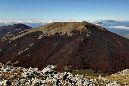
 Serra del Prete (the north ridge) | 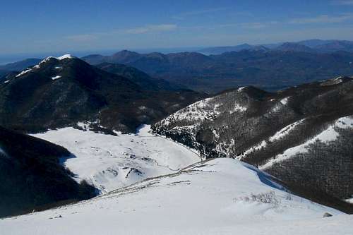 Piano Ruggio (seen from the southwest ridge) | 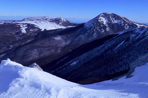 Serra delle Ciavole and Mt. Pollino |
Getting there
The nearest airports are Naples (about 230km), Bari and Brindisi (also about 220-230km). From Rome and its big international airports it is a considerably long journey of almost 450km. There is limited public transport in this region.
The actual mountain roads are largely in bad conditions, especially the high passes might become impassable after snowfalls as road patrol service is scarcely to be seen around. If you should consider to visit the Pollino Massif between late October through early May, don't forget to bring snow chains or allow extra time for the approach way.
The actual mountain roads are largely in bad conditions, especially the high passes might become impassable after snowfalls as road patrol service is scarcely to be seen around. If you should consider to visit the Pollino Massif between late October through early May, don't forget to bring snow chains or allow extra time for the approach way.
- from Naples: Take the A3/E45 in direction Reggio Calabria, Salerno (about 195 km). Take the Exit (Uscita) Lauria Sud and follow thestate the State Road SS19. At Castellucio Inferiore turn left and follow the indications for Viggianello or San Severino Lucano. - Alternatively, you may leave the A3/E45 at the location Pecorone and follow indications for the State Road SS653 (called "Sinnica"). Take the Exit Valle Frida and follow indications for San Severino Lucano. - For an approach from the south keep on the A3/E45 and take the Exit Morano Calabro or Castrovillari.
- from Bari: Take the State Road SS100 (or the highway A14/E843) for Taranto. Turn left (indications for Jonica/Palagiano/Matera/Reggio Calabria) and take the coastal road E90. After passing Policoro pay attention, as the Exit can easily be missed, and turn left, taking the State Road SS653 (indications for "Sinnica". Take the Exit Valle Frida and follow indications for San Severino Lucano. - For an approach from the south keep on the E90, take the Exit Villapiana Scalo and follow the State Road SS92 in direction Castrovillari, then Morano Calabro and Mormanno. Before reaching the latter, follow indications for "Monte Pollino", as they will take you up to "Piano Ruggio" and, further on, to "Colle d'Impiso", the two main trailheads.
- from Brindisi: Simply take the E90 for Taranto and keep on this road. After Taranto follow the same indications as above (Bari).
Red Tape
The Pollino massif, and hence Monte Pollino, is an integral part of the 'Pollino National Park'. With a total area of 1,960 square kilometres it is the most extensive national park in Italy. The park was officially founded in 1993. The same rules and regulations apply as for any other national park in Italy.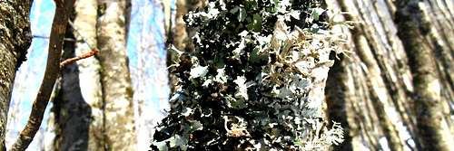
Lichen
Free camping is generally not encouraged (in other terms: it is not allowed). However, it might be tollerated from dusk until dawn and as emergency bivouac. No open fire etc. will be tollerated, though. There are no fees or permits required.
When to Climb
Serra del Prete can be climbed all year round. Summer ascents are suitable for hikers. Winter ascents, however, may require adequate mountaineering gear. Especially beyond the treeline, on the often windswept north and southwest ridges, you are very likely to encounter a hard and nasty surface of ice (or ice-covered rocks) as well as broad and unstable snow cornices, some of them not easily recognizable as such.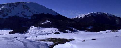
Mt. Pollino and Serra del Prete (from Piana del Pollino)
The normal route from 'Colle Gaudolino' should be the easiest, especially in winter, but after copious snow falls the path can become unrecognizable, and traversing the snowbound beech forest in a direct line and without indications is indeed a very tiresome enterprise.
Accommodation, mountain huts etc.
Most of the existing mountain huts in the area are currently closed and/or in poor conditions. As an exception can be seen the two mountain huts located on the high plain Piano Ruggio, south side of the mountain: Rifugio de Gasperi and Rifugio Fasanelli. A number of Bed & Breakfasts etc. can be found in the town centers of San Severino Lucano (to the north) or Castrovillari, Rotonda and Morano Calabro (to the south).
 Rifugio Colle Gaudolino | 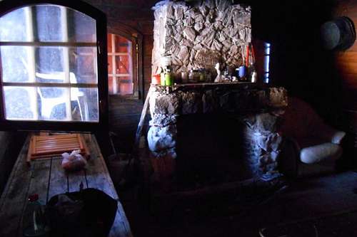 Bivouac Colle Gaudolino |
Right on the glade of the col between Serra del Prete and Monte Pollino is situated the always open bivouac 'Rifugio Gaudolino'. This spacious bivouac is quite comfortable and in acceptable conditions. It has a real brick-built fireplace and provides room for at least two to three overnight guests. Water supply can be refilled in the vicinity, either at a natural spring 'Sorgente di Spezzavummula' (on the hiking trail that traverses the beech forest for Colle d'Impiso) or, closer still, at an artificial fountain with a large trough for grazing animals.
For additional information regarding accommodation in the vicinity you may also have a look at the respective section on the Pollino massif main page.
Maps
- Maps in a scale of 1:25.000 are available for purchase directly from the IGM - Istituto Geografico Militare (search terms/key words: Viggianello, Castrovillari) or have a look at the respective section for the Pollino massif.

Trail map - Serra del Prete
1. blue (the north ridge)
2. yellow (the normal route)
3.1 red (the south-west ridge)
3.2 green (the "Charcoal burner's trail")