
-
 44829 Hits
-
 95.82% Score
-
 55 Votes
|
|
Area/Range |
|---|---|
|
|
38.60000°N / 105.2°W |
|
|
Hiking |
|
|
Spring, Summer, Fall, Winter |
|
|
12347 ft / 3763 m |
|
|
Overview

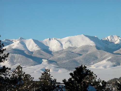
Greenhorn Mountain from Medano Pass
Photo by wanttobewest
Anchored by highpoint Greenhorn Mountain (12,346 feet), a multi-peaked, large mountain named for Comanche warrior chief Cuerno Verde, the Wet Mountains are a kinder, gentler take on the Rocky Mountains theme. One of the oldest mountain ranges in Colorado, the Wet Mountains are largely softened, rounded humps accented by occasional rugged outcrops. A 1997 Backpacker article describes the Wet Mountain scenery as “Appalachian,” and a drive along the back-roads, through the curving valleys of this range, reinforces this notion.
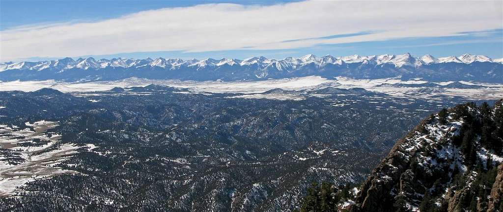
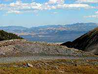
One of the best things about the Wet Mountains are the views of the Sangre de Cristo range to the west
Photo by Paul Stratmoen
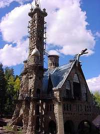
Bishop Castle provides a great diversion while touring the area
Photo by Grant
In addition to ample outdoor recreation across verdant valleys and rolling mountains, the Wet Mountains are also home to the famous
Bishop Castle. Chances are you never have experienced anything quite like this, nor will you find anything elsewhere that fits the bill. The castle itself is the result of more than 4 decades of labor by a local eclectic. Enjoy exploring the grounds and the structure and, if you are lucky, you may get to meet Mr. Bishop himself and chat politics with him.
 |
 |
| Photos by wanttobewest |
Area and Getting There
Taking in the Sangres views from the Wet Mountains
Photo by wanttobewest
Much of the Sierra Mojadas range is contained in Custer County, but also spills into Fremont, Pueblo and Heurfano Counties. The range runs from approximately Highway 50 near Cañon City the north, southward toward US 160 near Walsenburg. To the east, the Wet Mountains are bordered by the community of Pueblo and the Great Plains. To the west, the Wet Mountains meet the Wet Mountain Valley; the mighty Sangre de Cristo range rises out of the western edge of the Wet Mountain Valley.
Highway 96 cuts east-west across the range while Hwy 165 runs roughly north-to-south through the southern half of the Wet Mountains. Highway 78 runs southwest out of Pueblo straight for the southern heart of the range. Country Road 143 / Oak Creek Grade roads cuts south out of Cañon City providing access to the northern Wet Mountains.

Notable Peaks of the Wet Mountains
Wet Mountains
Photo by wwanttobewest
Wet Mountains
Photo by wwanttobewest
Sadly, the Wet Mountains are poorly represented here on SummitPost. The below table showcases just a few of the peaks in this range.
| Peak | Elevation | Image |
|---|---|---|
| Greenhorn Mountain | 12,347 ft. |  |
| Saint Charles Peak | 11,784 ft. |  |
| Deer Peak | 11,572 ft. |  |
| Hardscrabble Mountain | 10,402 ft. | No SP page |
| Rudolph Mountain | 10,334 ft. |  |
| Adobe Peak | 10,188 ft. |  |
| Stull Mountain | 10,020 ft. | No SP page |
| Mock Hill | 9,780 ft. | No SP page |
| Curley Peak | 9,622 ft. |  |
| Tanner Peak | 9,340 ft. |  |
Flora & Fauna
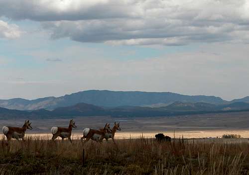
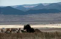
Pronhorn, Wet Mountains and valley
Photo by wwanttobewest
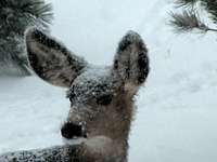
Black bear, mule deer, elk, bighorn sheep, mountain goats, beaver, wild turkey, and mountain lions are among the animals and birds that call the Wet Mountains home. (Regarding turkey, in October 2009, our caravan had to come to a stop to enable almost a dozen wild turkeys to cross the road; then stop again for a herd of mule deer.)
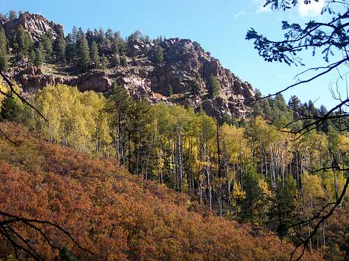
Trees include the omnipresent Ponderosa Pine and Douglas Fir along with Gambel Oak and mixed communities of Piñon and Juniper. Vast stands of Quaking Aspen color the mid-elevation hillsides.
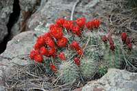
In addition to numerous wildflowers, the floors of the Ponderosa forests are often blanketed with Kinnikinnick while lower or southern-facing slopes may feature Yucca and Prickly Pear.
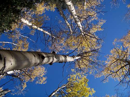 Golden Aspen reach for the sky |
 Outcrops along the Rudolph Mountain Trail |
Land Ownership & Management

South from Rudolph Mountain

Outcrops and Ponderosa Pine
The Wet Mountains are largely contained within an island of public land, but are surrounded on all sides by private holdings, especially ranches, rendering several fine peaks off limits.
The San Isabel National Forest, one of eleven National Forests in Colorado, covers much – though not all – of the terrain of the Green Mountains.
Greenhorn Wilderness covers 22,040 acres in the southern Wet Mountains. Wilderness Regulations apply to travel within these boundaries.
The Pueblo Mountain Park is owned by the City of Pueblo but managed by the Mountain Park Environmental Center. The park, outside of Beulah on the northeastern edge of the Wet Mountains, has numerous hiking trails and also contains the historic Horseshoe Lodge.
Camping & Lodging
Backpacking: The most serene backpacking can be found in the Greenhorn Wilderness. Much of the San Isabel National Forest lands in the Wet Mountains allow heavy motorized use.
National Forest Campgrounds
| Campground Name | Elevation | Sites | Nightly Rate | Season | Notes |
|---|---|---|---|---|---|
| St. Charles | 8,800 ft. | 15 | $15 | May through October | Near Lake Isabel Recreation Area |
| Ophir | 8,900 ft. | 30 | $15 | Late May to early September | Closest to Rudolph Mtn; Very close to Bishop's Castle |
| Davenport | 8,500 ft. | 12 | $13 | Late May to early September | Close to Ophir CG; next closest to Rudolph Mtn. |
| Oak Creek | 7,600 ft. | 16 | Free | Year-Round | Lowest elevation; Closest to Cañon City; No water |
| La Vista | 8,600 ft. | 27 | $15-$19 (RV) | Mid-April through Mid-October | Only CG in San Isabel NF with electric hookups |

Quaking Aspen
Cañon City
This community has a few limited lodging options, mostly on the simple end of the spectrum. This would be the idea gateway city for the northern Wet Mountains. Visit this page for more information about lodging in the Cañon City area.
Pueblo
This city of more than 100,000 residents has a reasonable selection of hotels and restaurants for visitors. Pueblo serves as a jump-off point for approaching the Wet Mountains from the east. Visit this page for more information about lodging in and around Pueblo.
Westcliffe
When approaching the Wet Mountains from the West, the twin towns of Westcliffe/Silver Cliff provide for some limited lodging options. Visit this page for more information about lodging in Westcliffe/Silver Cliff.
Weather & Seasons
Wet in comparison to the relatively arid plains to the east and the Wet Mountain Valley to the west the Wet Mountains generally tend to be warmer and drier than most mountain ranges in Colorado.
Summer: Expect summers to be relatively hot compared to other mountainous areas of Colorado.
Fall: The autumn leaf display in the Wet Mountains is simply spectacular. In addition the ubiquitous golden-hued Aspen, these mountains also boast thick stands of orange-to-crimson Gamble Oak.
Winter: Nowhere near as high or steep as the Sangre de Cristo Mountains to their west, many of the Wet Mountain summits sit below timberline. Combined with a generally smaller snow-pack, much (though not all!) of the Wet Mountains can be enjoyed in snow season without that tingling fear of avalanche experienced in much of the Colorado high country.
Spring: The snows will typically melt earlier in the Spring in the Wet Mountains than in other, higher ranges and mountains to the north.
hgrapid - Dec 11, 2009 12:42 pm - Hasn't voted
37.88150°N / 105.0133°WWet Mountains are in Colorado, not China! 37.88150°N / 105.0133°W
Sarah Simon - Dec 11, 2009 1:05 pm - Hasn't voted
Re: 37.88150°N / 105.0133°WDang missing "-" sign. Thanks, Sarah