
|
|
Route |
|---|---|
|
|
38.40425°N / 109.89833°W |
|
|
Hiking |
|
|
Spring, Fall |
|
|
Most of a day |
|
|
Hike |
|
|
Overview

Map
Wilhite Trail sits in the western parts of the Island in the Sky district of Canyonlands National Park. The trail starts on top of the Island in the Sky Mesa and then goes more than 1000 vertical feet down a steep boulder covered slope to reach the Holeman Spring Basin. It then follows a dry wash down the basin to end at the White Rim Jeep Road. A slot canyon starts at the end of the trail and goes further down toward Green River (The slot canyon is not part of the trail and will not be discussed here).
With a roundtrip distance of 12.2 miles and a vertical change of 1700 ft, Wilhite Trail is one of the longest established trails in the Island in the Sky district and gives you one of the biggest vertical drops. This trail takes you into a remote red-colored wilderness where you will find yourself on vast arid plains surrounded by walls, canyons and mesas in every direction. You are likely to feel like an astronaut exploring the surface of the planet Mars. The impressive Candlestick Tower will be visible on long sections of the trail. From the top of the mesa, you will have views of the Henry Mountains in the southwestern horizon.
Getting There
From the Visitor Center, drive 6.5 miles south and turn right (west) onto Upheaval Dome Road. After 2.1 miles, you will see the sign for Wilhite Trail on the left (south) side of the road.Route Description
Roundtrip Distance: 12.2 milesTrailhead Elevation: 5830 ft
Highest Point (0.65 miles after trailhead): 5940 ft
Lowest Point (end of trail): 4240 ft
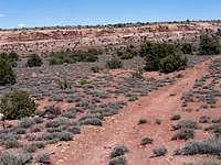
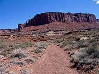
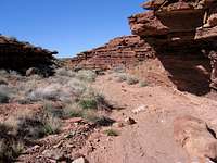
The trail leaves the road and remains on a plain on top of the Island in the Sky Mesa. It slowly goes 100 vertical feet up in elevation.
Views of the trail on the mesa top:
 |  |  |
After 0.65 miles, the trail reaches a high spot where Candlestick Tower first comes to view to the southwest:
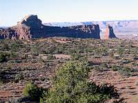
Candlestick Tower
Immediately below, you will see another plateau 120 ft lower. Deep canyons and the Henry Mountains will be visible in the distant southwest.

Henry Mountains
The trail goes down steeply to reach the lower plateau. It then follows the surface of the lower plateau going further down in elevation very slowly:
 |  |  |
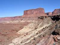
After 1.3 miles (elevation 5700 ft), you will reach the edge of a big drop-off. You will find a narrow strip of steep boulder covered slope going down between the walls of the mesa below you. The trail zigzags down this slope. Look for the cairns that identify the trail. It is easy to get lost among the boulders.
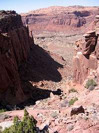 |  |  |
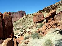
The walls around the slope put up an impressive show:

 | 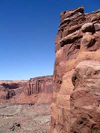 |  |
At the end of the slope you can look back to see where you came down from:
The Big Dropoff
After 2.1 miles, you will find yourself on a sandy plain at an elevation of 4750 ft.:
 |  |  |
The trail does not go into the dry wash below the plain. It actually follows the surface of the plain and gradually makes a big 180 degree turn going around and behind a wall on the left side of the trail. Once you reach the other side of the wall, Candlestick Tower comes to view again:
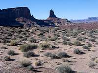
Candlestick Tower
You will then find the trail traversing a green colored slope. To your left, red colored walls rise 1000 ft above and to the right badly eroded green colored slopes go down 300 ft to the Holeman Spring Basin:
 |  |  |  |
Holeman Spring Basin is a reddish/brown colored plain:
 Holeman Spring basin |  Holeman Spring Basin |
Another view of Candlestick Tower:

Candlestick Tower
After traversing the green slopes for sometime, you will see a huge boulder. The trail starts to go down the slopes toward the boulder:

Big Boulder
You will descend more than 200 ft to reach the reddish/brown colored surface of the Holeman Spring Basin. You have now hiked 3.4 miles.

Surface of Holeman Spring Basin
Looking back at the green slopes and the red walls above them:
 |  |
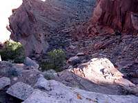
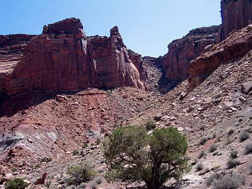
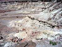
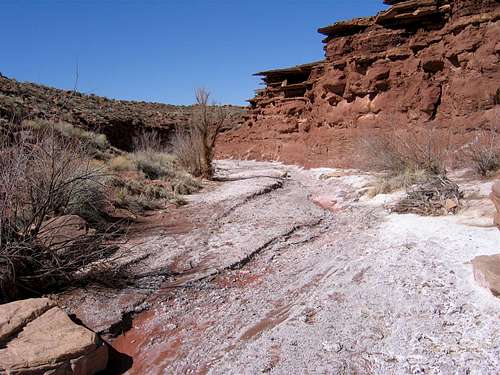
The trail takes a path over the surface of the Holeman Spring Basin and then goes into one of the many dry washes that cut mini canyons into the basin. Salt deposits can be seen in many places at the bottom of the wash. As you continue to hike down, you will note that other dry washes join the one that you are hiking in. Pay very close attention to the cairns. On your way back, you will have to identify the correct canyon to follow.
Views of the hike in the dry wash:
 | 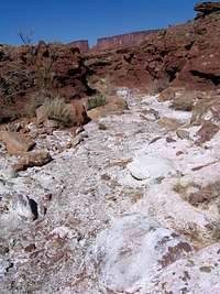 |  |

 |  |  |

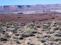
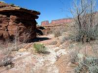
Toward the end, the canyon goes away and you will be hiking on a big barren plain:

After 6.1 miles, you will reach the end of the trail at the White Rim Jeep Road. You will see a slot canyon cutting into the white rock at the end of the trail. If you have time and energy, you can explore the canyon.
 Slot Canyon |  Slot Canyon |
Views at the end of the trail:
 |  |  |  |