
|
|
Route |
|---|---|
|
|
38.54682°N / 109.64837°W |
|
|
Overview
This is not a hiking trail. It is a four wheel drive road. It is close to but falls outside the boundaries of Canyonlands National Park and Dead Horse Point State Park.Long Canyon is a 7.5 mile long 4 wheel drive road that goes from the banks of Colorado River on Route 279, 1900 vertical feet up to the top of Island in the Sky/Dead Horse Point Mesa where Route 313 runs. The western 3 miles of the road travel over the flat top of the mesa and will not be discussed here. The eastern 4.5 miles have all the uphill and provide you with spectacular views of the nearby canyons and La Sal Mountains. Jug Handle Arch is visible at the start of the road. Along the way, the road takes you under a huge boulder that has fallen over the road creating a mini tunnel. Once you reach the top of the mesa, you can walk through a campground to reach the edge of the mesa to get fantastic views.
I hiked the road on a Wednesday in early April and saw only a few vehicles. Depending on when you hike, you may have to put up with the noise and dust of four wheel drive vehicles.
 Map
MapGetting There
From the junction of Routes 191 and 279 a few miles north of Moab, Utah, turn west and drive 13 miles on Route 279 until you see a sign for Jug Handle Arch on the right. This is the start of Long Canyon Road. There is plenty of space to park.Hike Statistics
All distances are per my GPSThe Hike
Jug Handle Arch is visible at the start of the hike. Jug Handle Arch
The first 1.25 miles of the road is gently sloped.


As you go higher, La Sal Mountains come to view behind you to the east.
 La Sal Mountains
The road then starts to make twists and turns going up more steeply.


You can then look back and get a good view of Long Canyon and where you started.
 Long Canyon
Soon you will find yourself at the base of a number of impressive fins and towers.


The road then takes you under a big boulder.


Farther up, you go through a tight area known as Pucker Pass.
 Pucker Pass
After another turn you will reach the top of the plateau.
 Top of plateau
Leave the road, turn left and go into a camp area. Keep going until you reach a slickrock peninsula.
 Camp area
 Slickrock penninsula
Views from the tip of the peninsula.
 La Sal Mountains
 South Mountain
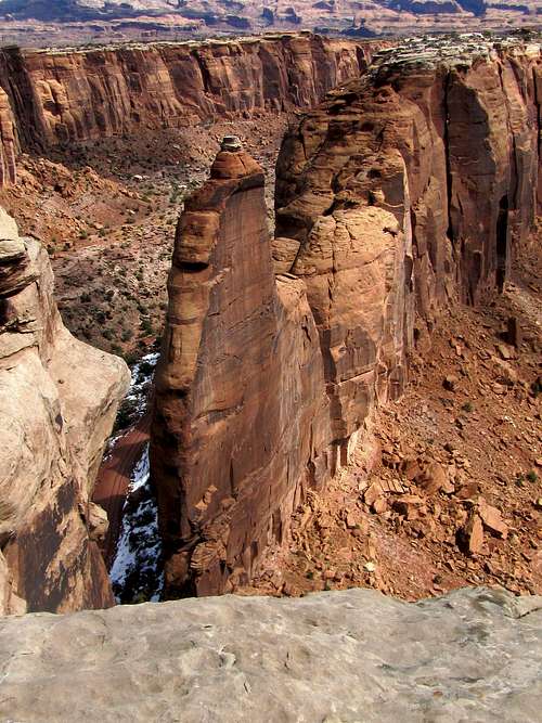 The fin and road below
 Looking south
 Looking northeast
 Long Canyon, Colorado River
 Zoomed view of Mt. Tukuhnikivatz
 Zoomed view of badlands to the west of Moab
 Looking north