
-
 45246 Hits
-
 81.83% Score
-
 14 Votes
|
|
Area/Range |
|---|---|
|
|
45.95783°N / 6.85547°E |
|
|
Hiking, Trad Climbing, Sport Climbing, Scrambling, Skiing |
|
|
Spring, Summer, Fall, Winter |
|
|
9728 ft / 2965 m |
|
|
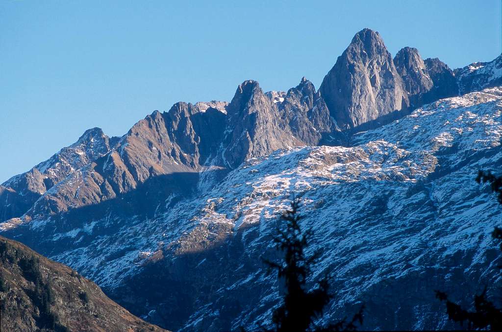
The Aiguilles Rouges
The Aiguilles Rouges - meaning Red Peaks - are a mountain range in the French Alps, located above the town of Chamonix and the Valleé de l'Arve, reaching the maximum elevation of 2,965m/9,728ft (Aiguille du Belvédère). They offer numerous objectives for climbing, hiking and mountain biking in summer, and groomed (on piste) and powder skiing/boarding in winter. The range is situated just in front of a world-famous neighbor: the Mont Blanc!
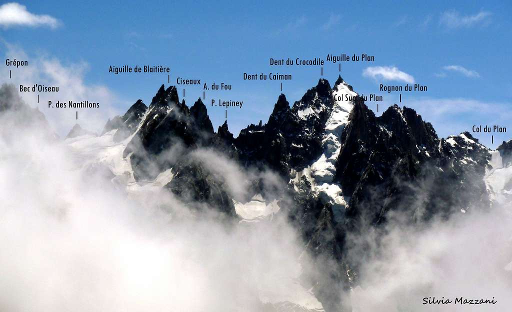
These magnificent “Aiguilles” are lying like an awesome balcony towards the Northern side of the Mont Blanc group: the view over the main summit and over the Aiguilles de Chamonix is exceptional! And this is an added value to the wonderful climbs present in the chain! From the point of view of the climb, it is to be noted that the gneiss of Aiguilles Rouges is less rough than the Mont Blanc granite, but it’s rich of sharp holds: the climbing way is very pleasant and technical. Moreover, thanks to several factors such as for example the much lower altitude, the advantage is that it's often possible to climb on the Aiguille Rouges massif when the unsettled weather precludes more serious and demanding ascents in the Mont Blanc group.
Most of the range can be easily accessed thanks to the Brévent and Flégère lifts directly from the towns of Chamonix and Les Praz, operating almost year-round. On clear days you have spectacular views of the north side of the Mont Blanc massif just across the valley. A large part of the range has been declared as the Réserves Naturelles des Aiguilles Rouges in 1974. There are two info points, the visitors center Chalet du col des Montets and a small building right on top of Le Brévent.
Getting there
The starting point is Chamonix-Mont Blanc m. 1087.
Main road approach to Chamonix
- From Aosta Valley (Italy) - Follow the E25 Motorway towards Courmayeur, then the Mont Blanc Tunnel to Chamonix (65 km. from Aosta)
- From Martigny (Switzerland) - Follow the road leading to the Switzerland – France border, then to the village of Argentiere and to Chamonix (45 km. from Martigny, 13 km. from the border)
- From Geneve (Switzerland) - Follow the E25 Motorway to St. Gervais les Bains, then the RN 205 to Chamonix
Approach to the range by lifts
- With the Brévent cable car starting from Chamonix
- With La Flégere cable car and Index lift starting from the village of Les Praz (3 km. NE from Chamonix).
Hiking
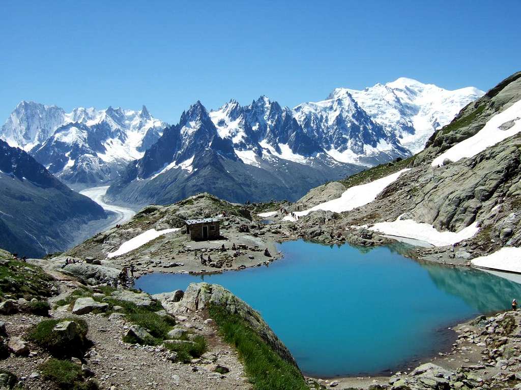
There are lots of great trails on the Aiguilles Rouges massif. You can start every hike from the bottom of the valley, or use the lifts to start higher up. From the south side of the range (Chamonix side) the views of the north side of the Mont Blanc massif are spectacular. From the north side of the range you have great views of the Fiz massif (2,802m/9,193ft) with its prominent vertical wall below the summit, as well as a number of surrounding ranges and peaks. Consequently, the main ridge offers superb round views, such as the lift accessible summit of Le Brévent.
Popular trails and sights include:
- Grand Balcon Sud trail; At around 2,000m without significant elevation difference (it's also a section of the Tour du Mont Blanc trail). (Photo album)
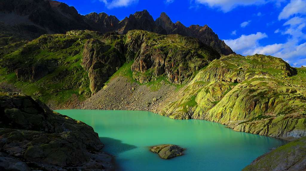
- Lac Blanc (2,353m/7,720ft); Popular lake; There's a serviced mountain hut (food and beverages) where you can stay overnight right next to it. [http://www.refuges.info/point/357/refuge-garde/aiguilles-rouges/refuge-du-lac-blanc/]
- Lac Cornu and Lacs Noirs (both 2,276m/7,467ft), two lakes close to each other.
- Chalet La Floria (1,350m/4,429ft); Cute little hut in the woods decorated with lots of flowers. Open for snacks and beverages in summer months only. Short hike from the valley.
- Le Brévent (2,525m/8,284ft)
- Petit Balcon Sud trail; Longer trail in the lower elevations from Argentière to Servoz.
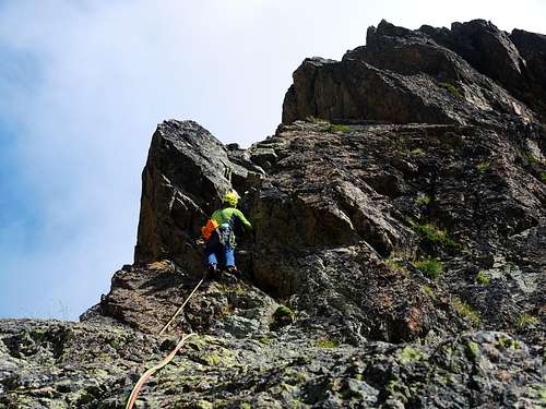
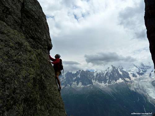
Climbing
The Aiguilles Rouges are home to several popular lower-grade rock climbing routes that are considered good introductions to alpine climbing. There is a small climbing crag close to the summit of Le Brévent (lift service from Chamonix), as well as a few other less-easily accessible crags along the south side of the range. Some of the harder climbing routes can be found on the prominent vertical south-facing wall just below the summit of Le Brévent. With the help of the lifts, virtually every outing on the Aiguilles Rouges can be done as a day trip. Note that popular routes generally get a lot of traffic. An early start is always beneficial.
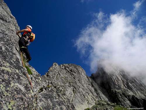
 View from Le Brévent. The shaded wall in the front left is the climbing crag.
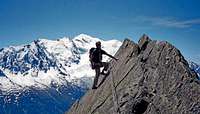 Chapelle de la Glière
Some suggestions:
Classic, Lower-Grade Climbs
- Chapelle de la Glière (IV+/5a/5.6-5.8) on the Aiguille de la Glière
- Southeast ridge (IV/4b) on the Aiguille l'Index
- Aiguilles Crochues traverse (IV)
- Several routes on La Grande Floria (can be combined with the Aiguilles Crochues traverse)
- Clocher-Clochetons traverse (V) on Le Clocher de Planpraz
- Arete Rouge Aiguillette de La Floria
- Brunat-Perroux Aiguille de l'Index
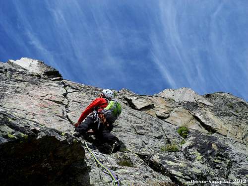
Upper-Grade Climbs
- Voie Frison-Roche (6a+, 5c obl.) on the south face of Le Brévent
- Hotel Rwanda (TD/6c, 6a+ obl.) on La Grande Floria
- Clocher de Planpraz Cocher Cochon
- Gaspard Première on Pointe Gaspard
Crags
- Les Gaillands (very close to Chamonix; parking right in front of it, generally crowded)
- Servoz (a good 10km down the valley from Chamonix, right next to a road)
- Coupeau (nearby Les Houches, close to a road)
- Le Brévent (a small crag close to the summit of Le Brévent)
- La Joux (between Chamonix and Argentière, 10 minute hike-in)
- Monolithe de la Chauffria (between Chamonix and Argentière, 30 minute hike-in)
- Aiguillette d'Argentière
Mountain Biking
Allowed on designated trails only. Mountain bikes are allowed on the Planpraz (halfway up Le Brévent) and Flégère lifts between around mid June and mid September.
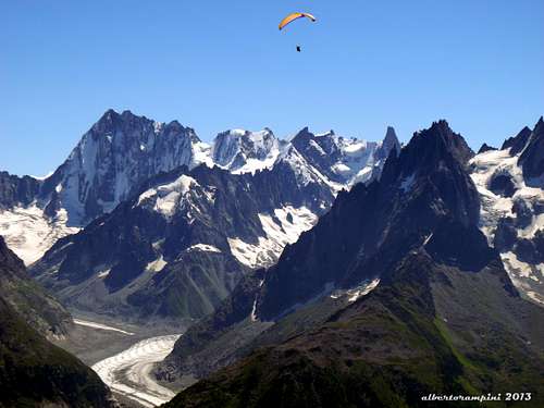
Paragliding
There is a paragliding take-off site a few minutes uphill from the Planpraz lift station (halfway up Le Brévent) at an elevation of around 2,000m/6,600ft (1,000m/3,300ft above the valley).
Red Tape
A large part of the range has been declared as the Réserves Naturelles des Aiguilles Rouges in 1974. Anyhow there is no particular restriction.
Where to stay
Chamonix is a primary destination, offering various kinds of accommodation (hotels, huts, gites, renting rooms). Numberless campsites are situated both in the Northern and Southern ends of the town.
Main campsites:
- Camping la Mer de Glace, Les Praz (3 km. North to Chamonix) +33(0)450534403
- Camping les Deux Glaciers, Les Bossons (3 km. South to Chamonix) +33(0)450531584
- Camping les Arolles, close to the centre of Chamonix - +33(0)450531430
- Camping les Cimes, Les Bossons (3 km. South to Chamonix) +33(0)450535893
- Camping les Marmottes, +33(0)450536124
- Camping Glacier d'Argentière, Argentière (8 km. North to Chamonix) +33(0)450541736
Meteo
Guidebooks and maps
There are two main book stores in Chamonix that stock loads of climbing-related literature, including guide books and maps.
Guide Books
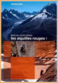
- Les Aiguilles Rouges 1 (Michel Piola). New in 2008, Volume 2 to follow. French only, but supposedly very useful even if you don't understand the text parts.
- Les Aiguilles Rouges (Thomas Dulac, Godefroy Perroux) (French only)
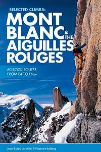
- Mont Blanc & the Aiguilles Rouges selected climbs guidebook
- The Mont Blanc Massif: The 100 Finest Routes (Gaston Rébuffat) (several editions)
- Crag Climbs in Chamonix (François Burnier, Dominique Potard). Available in English (ISBN 2910672131) and French.
- Mont Blanc Massif: Selected Climbs (Lindsay Griffin) (Volumes I and II, ISBN 0900523573 and 0900523581)
- Mont Blanc and the Aiguilles Rouges: A Guide for Skiers (Anselme Baud) (ISBN 1904207278)
|
|
Maps
The blue series maps (1:25,000) from the French Geographic Institute (IGN) are all you need. Suggestions:
- Map 3630 OT, "Chamonix massif du Mont Blanc", covers most of the Mont Blanc massif and the Aiguilles Rouges.
- Map 1344, "Col De Balme", covers most of the Aiguilles Rouges.
Other Resources
- Office du Tourism de Chamonix - Phone +33 0450 530024
- Office de la Haute Montagne de Chamonix - Phone +33 0450 532208 - A great info point about routes, conditions, and weather
- Flegere-Index cable car info - Phone +33 0450 532275
Chamonix lifts: www.compagniedumontblanc.fr
Geology
I'm not much of a geologist, so please refer to more competent sources, such as: http://www.rnaiguillesrouges.org/ http://en.wikipedia.org/wiki/Aiguilles_Rouges http://fr.wikipedia.org/wiki/Aiguilles_Rouges (in French)
Trivia
There's a French film titled "Les Aiguilles rouges" (2006) telling a fictional story of eight scouts who get lost trying to climb Le Brévent: https://www.imdb.com/title/tt0478548/
Ian Fleming, when writing the fictional biography of James Bond, mentioned that Bond's parents were killed in a mountain climbing accident in the Aiguilles Rouges near Chamonix, when the future secret agent was eleven-year-old." [http://en.wikipedia.org/wiki/Aiguilles_Rouges]
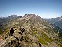
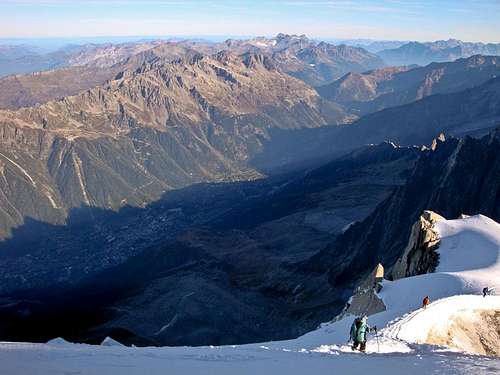 The Aiguilles Rouges in morning sunshine seen from the Aiguille du Midi east ridge.
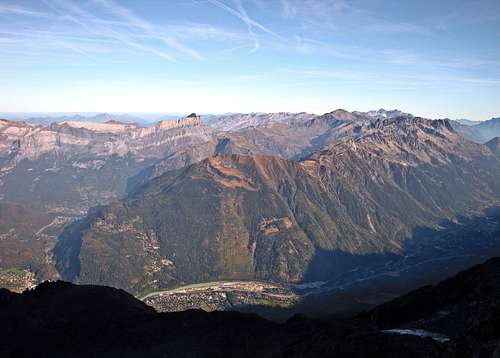 The Aiguilles Rouges as seen from the trail between Nid d'Aigle and the Tete Rousse hut.