
-
 5871 Hits
-
 84.68% Score
-
 19 Votes
|
|
Mountain/Rock |
|---|---|
|
|
45.98294°N / 6.87298°E |
|
|
Mountaineering, Trad Climbing, Sport Climbing |
|
|
Summer |
|
|
8993 ft / 2741 m |
|
|
Overview
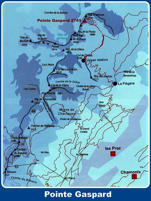
Pointe Gaspard 2741 m
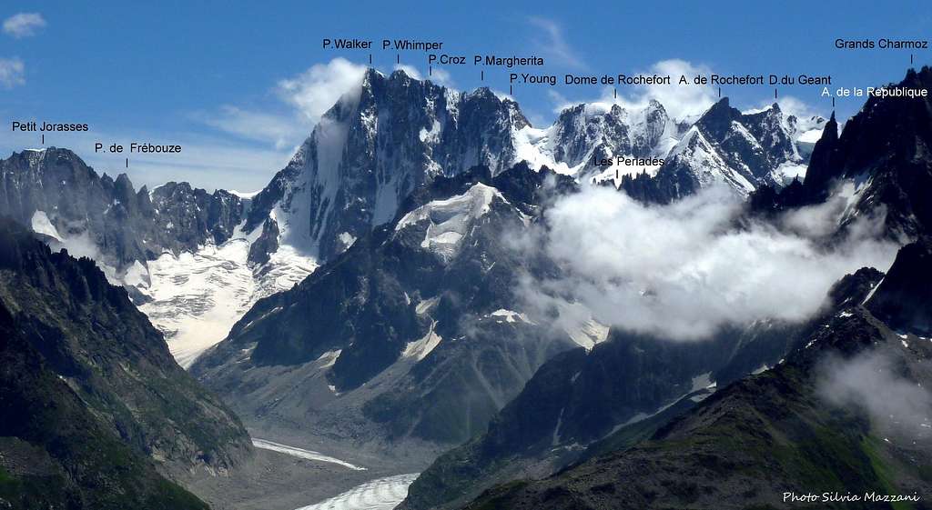
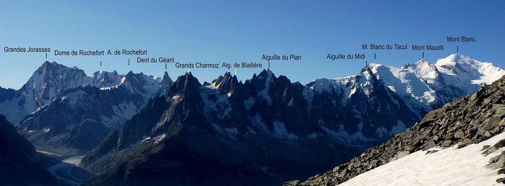
Pointe Gaspard m. 2741 is a peak belonging to the well known chain of Aiguilles Rouges, lying in front of the French side of Mont Blanc Massif and divided from this latter by the Arve Valley. The highest point of the chain is the Aiguille du Belvédère m. 2965. As well as the other summits belonging to the group, Pointe Gaspard is built in a gneiss of good quality and lies in an awesome position, just a balcony in front of the Aiguilles de Chamonix, Grandes Jorasses and Mont Blanc main summit. The view is magnificent! The gneiss of Aiguilles Rouges is less rough than the Mont Blanc granite, but it’s rich of sharp holds: the climbing way is very pleasant and technical. When the unsettled weather precludes the ascents in Mont Blanc group, on the contrary it's often possible to climb on Pointe Gaspard as well as on other summits in the same group.
In the Aiguilles Rouges group there are numberless great trad climbing routes and modern ones; these last ones, often climbed in reason of their first-class gneiss, had been realized starting from the last two ten-years periods. Aiguilles Rouge’s reputation is also due to their fine environment, the short approaches, the various multipitch routes of all standards and their extraordinary situation. On Pointe Gaspard South face we can choose amongst three excellent routes starting directly from Chamonix early in the morning.

|

|
Getting There
The starting point is the town of Chamonix-Mont Blanc m. 1087. The main road access to Chamonix Mont Blanc are:
- From Aosta Valley (Italy) - Follow the E25 Motorway towards Courmayeur, then the Mont Blanc Tunnel to Chamonix (65 km. from Aosta)
- From Martigny (Switzerland) - Follow the road leading to the Switzerland – France border, then to the village of Argentiere and to Chamonix (45 km. from Martigny, 13 km. from the border)
- From Geneve (Switzerland) - Follow the E25 Motorway to St. Gervais les Bains, then the RN 205 to Chamonix
Most of the range can be easily accessed by the Flégère and Brévent lifts directly from Les Praz (Flégère) and Chamonix (Brévent). More information here: Brevent - La Flegere
Approach
From Chamonix Mont-Blanc head towards NE and reach the village of Les Praz (3 km. from Chamonix). Take the cable-car to “La Flegere”, then the Index chair-lift. From the Index lift station follow towards right (North) the nice trail towards the Col des Crochues, skirting the Grande Floria. The views over the Aiguilles de Chamonix and Mont Blanc are breathtaking. Cross a scree - or a snow fields in early summer - walking towards the Col des Crochues, lying between Pointe Gaspard on the left and Aiguille des Crochues on the right. Rise on a few hairpins on the main trail, when getting to the level of the bottom of Pointe Gaspard spurn leave it and follow on the left a poor trail skirting the face and leading to the starting point of the various routes. 40 minutes from the Index station.

|

|
Pointe Gaspard main routes
Pointe Gaspard main routes
- Normal route via the Col des Crochues and North Ridge
Usually climbed to descent from the summit. An easy scramble up to the Col des Crochues, then a moderate climb along the North Ridge.

|

|
South face
Three excellent modern routes
- Lady in black TD- / 6a m. 150 Equipped with bolts
- Post ED- / 6b+ m. 150 Equipped with bolts
- Gaspard Premiere D+ / 6a m. 200 Equipped with bolts
Descent: from the summit downclimb on easy terrain (max UIAA III) - or make one abseil - along the North Ridge, getting the Col des Crochues between Pointe Gaspard and Aiguille des Crochues. Scramble down the gully on the East side, at first with easy climb (max UIAA I-II), then walking on a scree or a snow slope (in early summer) getting the approach path.
Red Tape

The chain of Aiguilles Rouges has been inserted since 1974 inside the Rèserve Naturelle des Aiguilles Rouges. No particulary restrictions in climbing and hiking. Free camping is not allowed.
Where to stay
Chamonix is a primary touristic destination. Hotels, huts, gites, renting rooms. Numberless campings are situated in the Northern and Southern ends of the town and in the villages of Les Praz, Les Bossons and Argentière . Main campings:
- Camping la Mer de Glace - Les Praz (3 km. North to Chamonix) +33(0)450534403
- Camping les Deux Glaciers - Les Bossons (3 km. South to Chamonix) +33(0)450531584
- Camping les Arolles - close to the centre of Chamonix - +33(0)450531430
- Camping les Cimes - Les Bossons (3 km. South to Chamonix) +33(0)450535893
- Camping Glacier d'Argentière - Argentière (8 km. North to Chamonix) +33(0)450541736
- Camping les Marmottes - +33(0)450536124
When to climb
Best season goes from middle June to the end of September.
Meteo
Chamonix Meteo
Meteo France Haute-Savoie
Useful info
Office du Tourisme de Chamonix Mont-Blanc - Phone +33 0450 530024
Office de Haute Montagne de Chamonix - Phone +33 0450 532208
CompagnieduMontBlanc Cable-car info - Phone +33 0450 532275
Guidebooks and maps
 |
 |
|
|
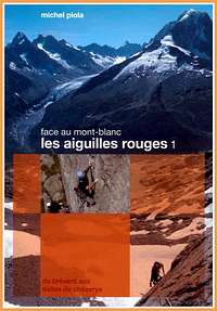
“Les Aiguilles Rouges – Face au Mont Blanc” by Michel Piola – This guidebook is in English text throughout.
"Monte Bianco classico & plaisir" by Marco Romelli, Edizioni Idea Montagna 2013
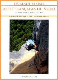
“Alpes Francaises du Nord” by Hervè Galley
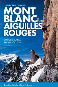
"Mont Blanc & the Aiguilles Rouges" selected climbs guidebook
Map
IGN 3630 OT Chamonix 1:25.000