La montagna chiama i suoi figli, ed essi rispondono fedelmente al suo appello…
Osvaldo Cardellina, Diario alpinistico, 1964-65
Page texts: @ OsvaldoCardellina"Osva", passed away on May 2, 2022. Page owners: Christian Cardellina e Osvaldo Cardellina. Any updates from September 12, 2022: Antonio Giani, page administrator, friend and climbing companion.
Testi della pagina: @ OsvaldoCardellina "Osva", scomparso il 2 maggio 2022. Proprietari pagina:Christian Cardellina e Osvaldo Cardellina. Eventuali aggiornamenti dal 12 settembre 2022: Antonio Giani, amministratore della pagina, amico e compagno di salite.
Always In MEMENTO of emilius
This page is dedicated to the Memory of Emilio BERTONA alias emilius in SP (* 1931 - † 2010), the Third Anniversary of his Death which occurred way back from Mount Zerbion September 20th, 2010
Questa Pagina é dedicata alla Memoria di Emilio BERTONA alias emilius in SP (* 1931 - † 2010), nel Terzo Anniversario della sua Morte avvenuta tornando dal Monte Zerbion il 20 Settembre 2010
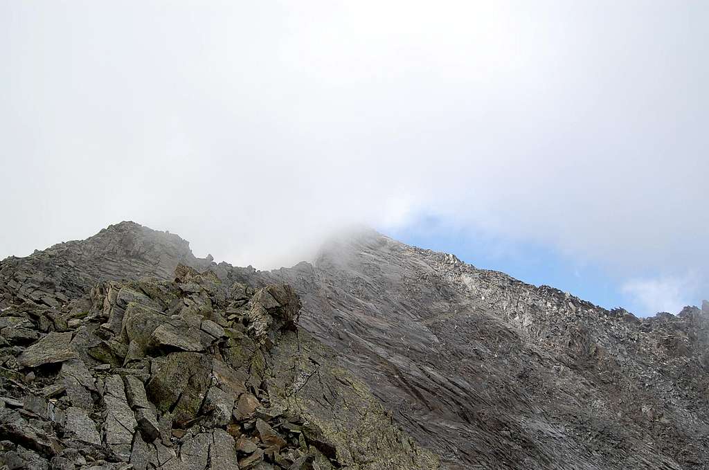
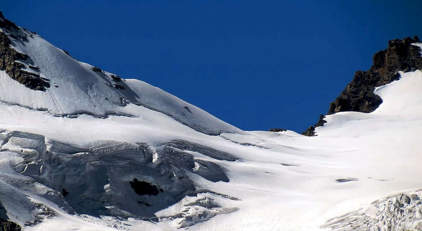
PASSES & STEINBOCKS OVERVIEW
This long Mountain Range is, as discussed here, the natural border between the Regions of Piedmont and Aosta Valley, united for a long stretch from these mountains that are after the Monviso in the Cottian Alps, in the Gran Paradiso (4.061m) maximum elevation. They are only a part of Graian, which actually terminate at the Col Ferret, over the Mont Blanc Massif. This area includes the so-called Graian of Southeast and the Group of Gran Paradiso until Nivolé Hill (2.636m), the last and gentle pass useful to step between the same two. The same also marks the point where the ridge watershed is all Italian, as well, in fact, the hills are among the Isère Valley in France and Rhêmes, Valgrisenche, La Thuile and the Little St. Bernard in Valley of Aosta, over a wide area which ideally combines the two Nations through the National Park of Gran Paradiso and thys National of the Vanoise. This watershed is almost half of the entire Chain of Graian Alps and if it has high peaks and lofty as those of Mount Blanc, offers the visitor magnificent eye-catchers for its untouched nature and a wealth of Flora and Fauna. And it is precisely in this last that we dedicate this work to the Ibex, the Chamois, Golden Eagle, the Bearded Vulture, the Marmotte and all those little Creatures that Mother Nature has placed here for many Millennia. They, who have always lived in this Paradise, and that they were the first to cross those hills and those steps that we describe. In addition, this work is dedicated to Hikers, for those who love to travel these paths, more or less important, more or less known, looking for another horizon. On the opposite side from where they came ...
Questa lunga Catena Montuosa costituisce, per quanto qui trattato, il confine naturale tra le Regioni del Piemonte e della Valle di Aosta, accomunate per lungo tratto da queste montagne che trovanosi, dopo il Monviso nelle Alpi Cozie, nel Gran Paradiso (4.061 m) la massima elevazione. Esse costituiscono sol una parte delle Alpi Graie, che in realtà terminano al Col Ferret, oltre il Massiccio del Monte Bianco. Questo settore comprende le cosiddette Alpi Graie del Sudest ed il Gruppo del Gran Paradiso insino al Colle del Nivolé (2.636 m), ultimo e comodo valico utile al passaggio tra le due medesime. Lo stesso segna anche il punto dove la cresta spartiacque é tutt'italiana; oltre, infatti, i colli son tra la Valle dell'Isère in Francia e le Valli di Rhemes, Valgrisenche, La Thuile e del Piccolo San Bernardo in Valle d'Aosta, in un'area alquanto vasta e tale da unire idealmente le due Nazioni tramite il Parco Nazionale del Gran Paradiso e quello della Nazionale della Vanoise. Questo spartiacque costituisce quasi la metà dell'intera Catena delle Alpi Graiee se non vanta vette elevate ed eccelse come quelle del Monte Bianco, propone al visitatore colpi d'occhio magnifici per la sua Natura incontaminata ed una grande ricchezza di Flora e di Fauna. Ed é proprio a questa ultima che dedichiamo questo lavoro: allo Stambecco, ai Camosci, all'Aquila Reale, al Gipeto, alle Marmotte ed a tutti quei piccoli Viventi che Madre Natura ha qui posto da tanti Millenni. Lor che in questo Paradiso han sempre vissuto e che sono stati i primi a varcare quei Colli e quei Passi che descriviamo. Inoltre, questo lavoro é dedicato agli Escursionisti, a coloro che amano percorrere questi sentieri, più o meno importanti, più o meno conosciuti, alla ricerca d'un altro orizzonte. Dal lato opposto da ove son venuti ....
ALL HILLS, PASSES, saddles, "carvings" & ROUTES from PIEDMONT towards AOSTA's VALLEY
We will make the analysis of this long, even if partial, of GRAIAN RIDGE that stretches between Piedmont and Aosta Valley giving more importance to the hills and to the passes of any kind ( saddles, collars, carvings etc.), provided useful to the passage and that can attend on both sides. In addition to the maximum of which way to go, all paths will be reported on by highlighting them in red and in many cases the abbreviation pertaining to being added further that may relate Intervalleys trails or paths designed parts of the regions (High Routes) or by local communities (Haute Route Glaciaire, TVC etc.). Generally on-site for the Valley of Aosta yellow panels, we find that supplant the old blue signs with white signals, of which there is still some residual rare. The same are of three forms: circular to local trails , rectangular paths between multiple walloons or valleys, triangular for the High Routes (two in the Aosta Valley, of which the Number One for the Orographic and Hydrographic North and the Two for the Southern hemisphere, which, in this case, there competes). The inscriptions upon them, in black, reported locations, alpine huts, refuges, occasional shelters, necks and rarely reach heights from giving indications of the altitude, the travel time and the average difficulty according to the U.I.A.A. Scale, generally this is based on acronyms E (Hiking), EE (Hikers Experts), EEA ( Hikers Experts with Equipment and therefore almost Mountaineering ), F ( Easy) and also T (Tourist). In this paper we add, on our own initiative, the signs in English with M (Medium Difficulty ) or Good Exp. (ie for Hikers in possession of a Good Experience ), always knowing that the information and suggestions are never too many. In addition, so as not to fracture the continuity of the listing description, were included steps and hills are not for hikers but, and definitely, aimed at climbers with appropriate equipment, so in these cases have been used the abbreviations of A (Mountaineering) and AEXP. (For Mountaineers Expert). Relate in particular to those sections of the chain so close to the High Peak and, specifically, the coast to the East of the same, that is, between the Grande-Arolla and Ape Pass; same goes for the distance between the Roc (Vaccarone Pass, or better Carving) until Grand-Etret the two hills in the Southwest of the Grand Massif. These crossings are to be considered almost all Mountaineering and Climbing both for the presence of glaciers or to the difficulty of the passages and, in some cases, for both components. Some packages may be addressed to Expert Hikers, however always equipped with the necessary sports. Are we missing the travel time because, in our opinion, is a very personal factor in relationship capabilities and the level of training, and the same, as already mentioned, is located on signs and typically involves a slight time dilation, just for the reasons above expressed. Concerning the Slope of Piedmont reports of the paths are not consistent with those of the Valley of Aosta having shapes, numbers, and different character, it is not surprising, therefore, that you make the climb with a numbering while the descent into the valley occurs via an other completely different, although both belonging to the same itinerary. Moreover, the same, on both sides, as well as on the panels can be found on houses, cottages, pastures or relating stables or natural shelters, trees, rocks and even boulders or stones isolated. Generally follow and agree with the design shown in the panels. In order to make a complete job and organically valid and exhaustive have not neglected those initial parts that do not allow the passage to the Valley of Aosta, but within the same Piedmont walloons between secondary sometimes little known, so how in the first part, we turned to the natural Appendages from the watershed down in the direction of the Po's Plaine towards Castellamonte, Ivrea and other smaller towns, on other occasions will make a brief reference to areas within minors. As for the border, of course evidenced by downflow water, there is to be noted that on the Piedmont side is characterized by the path of the Stream Orco flowing in the homonym Valley or Val Soana, with the end also called the Valley of Ceresole Reale, this ends after the Great Dam Ceresole (1.582m), with major lakes ( Serrù and Agnel, 2.278m, 2.297m) on the border with the Isère Valley in the West, through the three Passes of Galisia (2.987m) of the Losa and the Vacca and Oin's Hill. In addition, the Italian borders to Nivolé wide Hill with its two lakes of the same name (2.537m, 2.533m) , between the two Chivasso Refuges (2.600m) and Savoia (2.610m) at the beginning of long Nivolé Tableland and on the slopes of the very important node topography of the Point Galisia (3.346m), with the Valsavarenche in Aosta Valley. A whole series of vallons turned down at first East and then to Southeast, almost arranged radially in the direction of this important and large torrent, which feed. The walloons and valleys of the Valley of Aosta however, always starting from the bottom or East, down perpendicular to the Dora Baltea River trend with South/North, except the Valleys of Cogne and Champorcher who have a distant location, but almost parallel to it, ie Northeast and then the first North-northeast and East and then North second, to finally necessarily converge toward the same and the Central Valley. As for the mountains, in the secondary intent of this work, but important to be able to follow the logic succession of hills, here given an arbitrary division into four parts, going back further with a more complete explanation, although abbreviated, and that concerns the focal nodes.
GENERAL into four parts CHAIN
1) - Appendices Eastern outside the boundary line (Punta Cavalcurt-Cima Vallone-Cima Bracca-Cima Biolley-Monte Gregorio Monte-Betogne).
2) - Graian Eastern (Bec-Renon Cima of Bonze-Bec of the Strije-Mount Debat-Cima Dondogna-Cima Prel-Mount of Corni-Mount Marzo-Mount Nero-Bec Mollère-Monte Rosa of Banchi).
3) - Graian of Southeast (Point of Asgelas-Cima of Peradzà-Testa of Nouva-Testa of Arietta-Point Miserino-Point of Echellette-Points of Rancio-Lavina's Tower-Lavinetta-Grande Arolla).
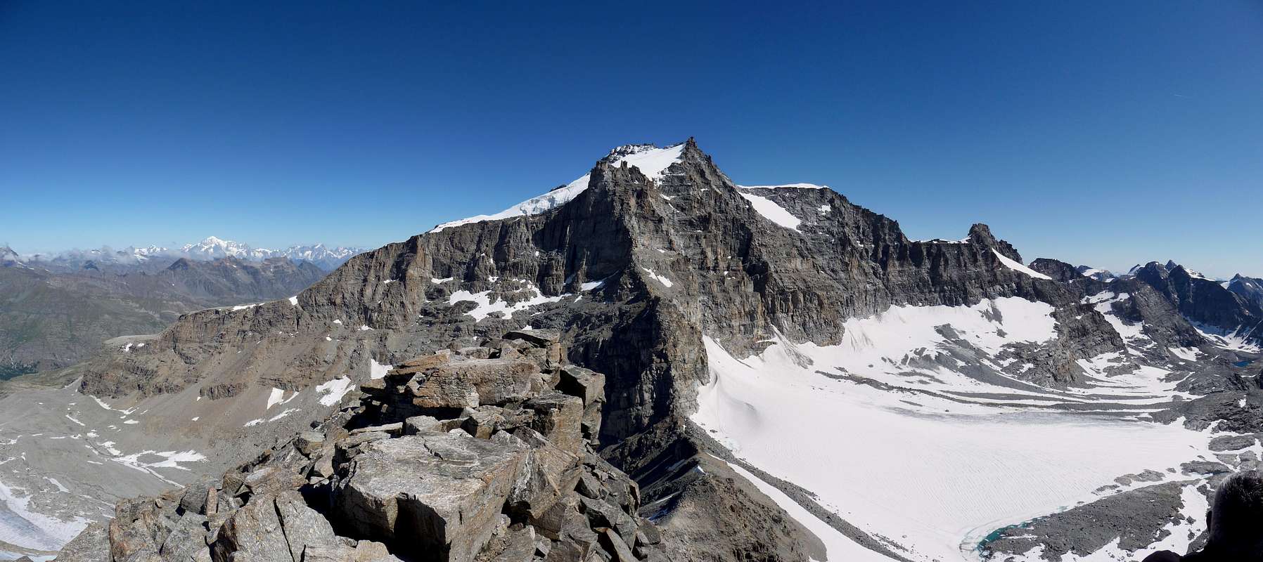
4) - The Gran Paradiso Massif (Point of Forzo-Point of Sengie-Cime of Valeille-Point Scatiglion-Point of Ondezana-Gran San Pietro-Becco of Pazienza-Roccia Viva-Becca of Gay-Testa of Tribolazione-Point of Ceresole-The Roc of Gran Paradiso-Becca of Moncorvé-Tresenta-Ciarforon-Becca of Monciair-Denti of Broglio-Punta Fourà). *** On the basis of this division the hills and passes can be classified as an AVERAGE and progressive
1) - For Tourists and Hikers (T and E).
2) - For Hikers or Hikers Experts with equipment (EE/A).
3) - For Experienced Hikers and Mountaineers (EE/A and A).
4) - For Climbers and Mountaineers Experts (A and AEXP).
Effettueremo l'analisi di questa lunga, anche se parziale, dorsale delle ALPI GRAIE nel tratto tra Piemonte e Valle di Aosta donando maggior rilievo ai colli ed ai valichi di qualsiasi tipo (selle, colletti, intagli ecc.), purchè utili al passaggio nonché frequentabili su di entrambi i versanti. Oltre all'indicazione di massima dell'itinerario da percorrersi, saran segnalati tutti i sentieri relativi evidenziandoli in color rosso; in molti casi alla sigla di pertinenza ne vengon aggiunte ulteriori che possono riguardare sentieri Intervallivi o percorsi particolari disegnati dalle regioni (Alte Vie) o dalle comunità locali (Haute Route Glaciaire, TVC ecc.). Generalmente in loco per la Valle di Aosta riscontriamo panneaux di color giallo, che soppiantano i vecchi cartelli in blù con indicazioni in bianco, dei quali si trova ancora qualche raro residuo. Gli stessi sono di tre forme: circolare per i sentieri locali, rettangolari per i percorsi tra più valloni o valli, triangolari per le Alte Vie (due in Valle di Aosta, delle quali la Numero Uno per il lato Orografico ed Idrografico Settentrionale e la Due per quello Meridionale, che, in questo caso, ci compete). Le scritte sui medesimi, in nero, riportano località, baite, alpeggi, ripari naturali, bivacchi, rifugi, colli e, raramente, vette da raggiungere dando indicazioni dell'altitudine, del tempo di percorrenza e della difficoltà media secondo la Scala U.I.A.A.; generalmente questa si basa sulle sigle E (Escursionistico), EE (Escursionisti Esperti), EEA (Escursionisti Esperti con Attrezzatura e quindi quasi Alpinistico), F (Facile) ed anche T (Turistico). In questo lavoro v'aggiungiamo, di nostra iniziativa, le indicazioni in Inglese con M (Media Difficoltà) o Good Exp. (cioé per Escursionisti in possesso d'una Buona Esperienza), sempre consci del fatto che le indicazioni ed i suggerimenti non son mai troppi. Inoltre, onde non fratturare la continuità nell'elencazione descrittiva, son stati inseriti dei passi e dei colli che non son per Escursionisti bensì, e decisamente, rivolti ad Alpinisti e con adeguata attrezzatura; quindi in questi casi sono state utilizzate le sigle di A (Alpinistico) e AExp. (Alpinistico per Esperti). Riguardano in particolare modo quei tratti della catena vicini alla Vetta Massima ed, in specifico, la costiera ad Oriente del medesimo, cioé tra la Grande-Arolla ed il Colle dell'Ape; ugual discorso per i passi tra il Roc (Colle o, meglio, Intaglio Vaccarone) sino ai due Colli del Grand Etret a Sudovest del Massiccio. Queste traversate son da considerarsi quasi tutte Alpinistiche sia per la presenza di ghiacciai oppure per la difficoltà dei passaggi ed, in alcuni casi, per entrambe le componenti. Alcuni colli possono essere rivolti ad Escursionisti Esperti, comunque sempre equipaggiati con l'Attrezzatura necessaria. Abbiam tralasciato il tempo di percorrenza poiché, a nostro avviso, é un fattore alquanto personale in realazione alle capacità ed al grado d'allenamento; lo stesso, come già dettosi, si trova sulla segnaletica ed in genere comporta una leggera dilatazione dell'orario, proprio per i motivi testé espressi. Per quanto riguarda il Versante del Piemonte le segnalazioni dei sentieri non collimano con quelle della Valle di Aosta avendo forme, carattere e numerazioni diversificate; non deve sorprendere, quindi, che si effettui la salita con una numerazione mentre la discesa verso la Valle avvenga tramite un'altra completamente diversa, anche se entrambe appartenenti al medesimo itinerario. Inoltre le stesse, su entrambi i versanti, oltre che sui pannelli sono riscontrabili su case, baite o ripari naturali, alpeggi o relative stalle, alberi, rocce ed anche massi o sassi isolati. In genere seguono e concordano con il design riportato nei panneaux. Per poter effettuare un lavoro completo ed organicamente valido ed esaustivo non abbiamo tralasciato quelle parti iniziali che permettono il passaggio non verso la Valle di Aosta, bensì all'interno del Piemonte medesimo tra valloni secondari, a volte poco noti; così, come in questa prima parte, ci siam rivolti alle Appendici naturali che dallo spartiacque scendono in direzione della Pianura verso Castellamonte, Ivrea ed altre località più piccole, in altre occasioni effettueremo un breve accenno ad aree interne minori. Per quanto concerne il confine, naturalmente evidenziato dal defluvio delle acque, vi é da notare che sul versante piemontese é contraddistinto dal percorso del Torrente Orco che scorre nell'omonima valle o Val Soana, con la parte terminale chiamata anche Valle di Ceresole Reale; questa termina, dopo la Grande Diga di Ceresole (1.582 m), con laghi importanti (Serrù ed Agnel, 2.278 m, 2.297 m) al confine con la Valle dell'Isère ad Occidente, tramite i tre Passi della Galisia (2.987 m), della Losa e della Vacca ed il Col d'Oin. Inoltre confina con quello italiano al Colle di Nivolé con i suoi due omonimi laghi (2.537 m, 2.533 m), tra i due Rifugi Chivasso (2.600 m) e Savoia (2.610 m), all'ingresso con il lungo Pian del Nivolé ed alle pendici dell'importantantissimo nodo topografico della Punta di Galisia (3.346 m), con la Valsavarenche in Valle di Aosta. Tutt'una serie di valloni scendono rivolti dapprima a Sudest e poi ad Est, quasi disposti a raggiera, in direzione di questo importante e grande torrente, che van ad alimentare. Le valli della Valle di Aosta invece, sempre partendo dal basso od Est, scendono perpendicolari verso la Dora Baltea con andamento Sud/Nord; tranne le Valli di Champorcher e Cogne aventi un percorso distante, ma quasi parallelo alla medesima, ovvero Nordest e poi Nord la prima e Est-nordest e poi Nord la seconda, per infine obbligatoriamente convergere verso la stessa e la Valle Centrale. Per quanto concerne le montagne, secondarie negli intenti di questo lavoro, ma importanti per poter seguire la logica successione dei colli, diam qui un'arbitraria divisione in quattro tronconi, ritornando più in là con una esplicitazione più completa, anche se sintetica, e che ne riguarda i nodi focali.
SUDDIVISIONE in quattro parti della CATENA
1) - Appendici Orientali esterne alla linea di confine (Punta Cavalcurt-Cima Vallone-Cima Bracca-Cima Biolley-Monte Gregorio-Monte Betogne).
2) - Alpi Graie Orientali (Bec Renon-Cima di Bonze-Bec delle Strije-Mont Debat-Cima Dondogna-Cima Prel-Monte dei Corni-Monte Marzo-Monte Nero-Bec Mollère-Rosa dei Banchi).
3) - Alpi Graie di Sudest (Punta dell'Asgelas-Cima di Peradzà-Testa della Nouva-Testa di Arietta-Punta Miserino-Pointe d'Echellette-Punte del Rancio-Torre di Lavina-Lavinetta-Grande Arolla).
4) - Gruppo del Gran Paradiso (Punta di Forzo-Punta delle Sengie-Cime di Valeille-Punta Scatiglion-Ondezana-Gran San Pietro-Becco della Pazienza-Roccia Viva-Becca di Gay-Testa della Tribolazione-Punta di Ceresole-Il Roc del Gran Paradiso-Becca di Moncorvé-Tresenta-Ciarforon-Becca di Monciair-Denti del Broglio-Punta Fourà). *** In base a questa suddivisione i colli ed i passi possono essere classificati con una VALUTAZIONE MEDIA e progressiva in
1) - Turistici/Escursionistici (T ed E).
2) - Per Escursionisti od Escursionisti Esperti con attrezzatura (EE/A).
3) - Per Escursionisti Esperti ed Alpinisti (EE/A e A).
4) - Per Alpinisti ed Alpinisti Esperti (A e AEXP).
BETWEEN AOSTA VALLEY-Southeastern Appendages (North) and PIEDMONT-Northern Appendages and Chiusella Valley (South):
from Donnas/Pont Saint Martin/Quincinetto/Tavagnasco/Quassolo/Baio Dora/Lessolo/Fiorano Canavese, Banchette, Salerano Canavese, Samone little Towns in IVREA City Area, by regional (main roads) routes, to Quagliuzzo/Strambinello (374m; + S. Ilario)/Vistrorio (468-494m; + S. Bartolomeo, S. Rocco; Roman Bridge; near Lugnacco/Pecco) /Alice Superiore/Meugliano Lake/Meugliano/Vico Canavese (602-618m; + S. Rocco, S. Martino Vescovo; near Brosso) /Novareglia/Drusacco/Traversella little Towns. Or to Vidracco/Issiglio/Rueglio (664m; + S. Filippo, S. Giacomo)/Trausella (656m; + S. Grato)/Traversella Villages or little Towns in Chiusella Valley.
INSIDE and PERIMETRAL AREA:
Bonze Valley from North (Hone/Donnas Town) to Southwest (Valchiusella/Succinto Villages) and from Southwest to East (Pont Saint Martin/Quincinetto little Towns).
a) - From Donnas-S. Orso, bridge up Dora Baltea , by route, to Praz Proussaz, Sainte Marie Madeleina, Chanton, Saddle 1.254m in Rio Fer Valley, Borettaz Torrent; from saddle to Frint, Lecchia, S. Maria, S. Rocco to Quincinetto. FER(T)/BONZE Valleys Mountain Chain: Tête Tome or Tita Toimà (1.656m), Bec Saint Jean, Bec Cormoney, Cima Cocor(e), Pussuy or Pousseuill Pass (2.110m) (+; between Brenve/Fer(t) Valleys; Retempio Sanctuary/Mouillà Alp crossing by path---> n° 2, Alta Via 2, 4), Mont Pussuy or Pousseuil, Mombrignon or Mont Brignon, Mont Debat (2.618m; +), Mont Vailet, Andelmel (2.354m), Finestra Pass (2.295m), Bec delle Stri(j)e, Cima di Bonze (2.516m; +), Bonze Pass (2.258m) (between Bonze/Muande Sup-Gugliasco-Giassetto Alps), Cima Battaglia, Corno Battaglia, Bec Renon (2.265m; +), Bric Vert (1.047m; up Pont Saint Martin/Carema and Dora Baltea.
INSIDE and PERIMETRAL AREA:
Scalaro-Renanchio Valley: from Northeast (Pont Saint Martin/Quincinetto) to Southwest (Succinto) and from Southwest to Southeast (Quassolo/Baio Dora little Towns).
b) - From Donnas-Bourg S. Orso by route to Donnes (or from Moulin Vieux 400m), by path ---> n° 4, Alta Via (= High Route) n° 2; from Donnes (894m) to Montat Village, by path---> n° 3A, and Southeast direction, by path---> n° 3, to Roussa, Mont Mayoux, Bonze 1.859m Pastures. By traces in moraine to Bonze Pass (2.258m) and from pass, by moraine and path---> C3, to Gugliasco Alps and, by route, to Scalaro (1.423m; + S. Quirico), between Scalaro, Battaglia Rios/Le Capanne/Probagnolo/S. Maria/Quincinetto (290m-319m; + S. Salvatore, S. Marta). *** Connection's path---> "Sentiero Garin" between Scalaro/Prabagnolo. Also from Le Capanne (1.374m), by route, to Grange Prato del Goglio, Grange Pratonero, Feipian Pastures (1.136m-1.173m); from Alp, by path---> n° B2 to S. Bernardo (394m; +) to Tavagnasco (265m-272m; + S. Caterina, S. Annunziata, S. Margherita, Cuore del Gesù; Roman Graves).
SCALARO-RENANCHIO Mountain Chain:
from Northeast to Southwest ad from Southwest to Southeast: Bric Vert, Bec Renon, Corno Battaglia, Cima Battaglia, Bonze Pass (in South path---> n° C3), Cima di Bonze, Bocchetta di Valbona Pass (2.328m) (between Gugliasco/Carnei Inf.-Succinto Alps), Punta Cavalcurt, Cima Vallone, Chiaromonte Refuge (2.017m, in South with Cima Chiaromonte, 2.144m), Vallone Pass (2.043m) (between Scalaro-Muande Inf./Chiaromonte-Traversella by paths---> n° 831 GTA and in descent by---> n° 719, GTA, 719, Cima Bracca, Cima Biollay (1.984m; +; X ironmines in Southwest), Pian del Gallo Pass (1.891m) (between Tavagnasco-Barzino Sup./Grange di Pian Gallo in Northeast, by path---> n° C6, /Traversella (Mineralogic Museum; X iron and coppermines in quota 997m), Pian dei Francesi Pass (1.945m), Naverano Pass (1.871m); from Tavagnasco also Quassolo (261m-322m), by main routes to S. Maria Maddalena, Ugiasso, Grange Reali (1.685m), in Northeast by path---> n° 724, B1/Grangia Crose-Traversella), Monte Gregorio, (1.953m; +), le Colme; Monte Betogne, Torretta delle Cime (1.564m) in South between Assa/Savanca Valleys; Mule Pian Pass (1.448m)) (between Tavagnasco-Quassolo/Brosso (767m) in Assa Valley), Monte Cavallaria (1.478m; +; up Quassolo/Baio Dora (250m-258m) little Towns).
From Southern AOSTA Valley to CHIUSELLA Valley:
c1) - From Donnes (858m) by route near Bonze Torrent and path---> n° 4, AV n° 2 to Plan Mery Desot, Damon, Mont Meillant, Mognissola (1.350m), Bochet, Giassit-de-Mouilla, Posseuil, Mouillà, quota 1.837m, Yves Damon (2.082m); from quota 1.837m in Southeas by traces to Finestra Pass (2.295m); from pass to Tonfrà, Miassa, crossing Finestra Rio, Varanda, Cappia Alps, Chiara Molino (= Chiara Watermill; 926m, near Camping) in Chiusella Valley.
c2) - From quota 1.837m, by South direction and moraine, to Andelmel Pass (2.354m). From pass, by South direction and doubtfouls traces along Rio (= Torrent) Tagliante, to Vailet Tableland in quota 2.150m~ (below Vailet Alp, 2.229m), Truch, S. Pietro in Vincoli/Pianezza, Vaccares, Sotre, Vernei, Chioso Alps and to Succinto Village (1.155m; + S.S. Trinità). From village, by regional route, to Traversella Village in Chiusella Valley.
c3) - From Yves Damon Alp to quota 2.175m by path---> n° 4 and, by South direction and moraine, to Vailet Pass (2.556m)/Mount Vailet (2.618m); from pass, before by traces, after path, to Vallera Alp (2.229m), Pietrafraccia, Reia di Vico, Saut, Canton Tissone Pastures and Tissone Village (1.307m; + S. Domenico) to Fondo Village (1.075m), Mount Marzo Refuge (1.074m) in South.
B) - BETWEEN PIEDMONT-Chiusella Valley (South) and AOSTA VALLEY-CHAMPORCHER Valley (North) and: Savenca, Acra or Sacra, Verdassa Valleys, INSIDE AREAS:
1) - from Banchette d'Ivrea (259m; Exit out Autoroute A5 from Torino or Milano Citys to Aosta Town; S. Cristofero Castle) to Finrano Canavese, Lessolo, Alice Lake, Alice Superiore, Meugliano, Vico Canavese, Drusacco, Traversella (817m; +; SS. Trinity; X iron and coppermines) Villages.
2) - From Banchette, by SS.565 to Castellamonte, Strambinello, Vidracco artificial Lake, Vistrorio, Gauna, Alice Superiore (602m; Camping Valchiusella; + S. Martino, S. Rocco).
3) - From crossroads 581m before Alice Sup.Rueglio little Town (664m; + SS. Filippo and Giacomo), Calcinasca, Case Frascallo, Case Piaz, Trausella little Town (643-661m; + S. Grato), Case Veise, Case Ciapei, Case Frescale, Inverso (740-774m; + Visitazione) Case Guarda, Prelle Bridge, Traversella.
4) - From Turin City SS.565 to Rivarolo Canavese, Baldissero, Castellamonte little Towns, Vidracco artificial Lake and Bridge, Quaglie Bridge up Quaglia Rio, Vistrorio little Town (468-489m; + S. Bartolomeo; + Jesus Presentation , next to Lugnacco 547m) and preceding routes to Traversella in Chiusella Valley. From Traversella to Fornello (983m) Village in North-northwest, near Bersella Rio, in small valley. Towards Chiara/Succinto/Fondo/Valchiusella/Tallorno Villages, by main road in Northwest. d1, d2, d3, d4, d5, d6) From Traversella, along Chiusella Torrent, by main road, Case Meugliasco, Molino di Chiara (Roman Bridge; + Vacci Chapel, 928m), S. Antonio, Fondo (Roman Bridge) in Chiusella Valley towards:
d1) - by main road to Molino di Chiara (Chiara Camping, 870m), S. Antonio, Fondo (1.075m); in Northwest by path, Tissone-S. Domenico (1.307m) Village. From village towards Canton Tissone, Saut, Reia di Vico, Pietrafraccia (1.996m) Alp between Pietrafraccia/Maras Torrents, Vallera (2.229m) Alp and, by moraine, to Vallera Pass (2.369m); from pass, by traces, Northwest direction, towards Cholire little Lake (2.017m) and Alp. From Cholire to Balma, Sest, Creppa, Buriana, Vieille, Valsemma Desot Alps, and, by path---> n° 2, to Retempio Sanctuary (Retempio's Refuge (1.445m), in Brenve Combe (= little walloon). From refuge, by path---> n° 2, AV n° 2 to Penna, Glair, Crest Damon - S.S. Giorgio and Caterina Alps (Dortoir or Dormitory); by path to Crest Village and, by route, to Arberey Alp, near Ratus Ravine/Gorge in Brenve Torrent (850m~), Creux, Foilettaz, Pont Bozet (780m) Villages in Champorcher Valley.
d2) - From Tallorno (1.214m), by North-northwest direction and path, to Pian Grande, Pera di Cros (+), Dondogna Inf. and Sup. (2.135m) Alps, near Dondogna Torrent, Dondogna Pass (2.389m); from pass, by North direction and traces in moraine in small walloon towards Cholire Lake and same route. *** Connection path "Sentiero dei Mufloni" (= Mouf(f)lons Path), between Reia di Vico (1.755m) / Dondogna Inf. (1.805m) Alps.
d3) - From Tallorno by main route to Roman Bridge (1.597m) up Chiusella Torrent and Pasquère Alp (1.489m), in West up Valbella Rio; by North direction and of path-traces in Valbella's little Valley to Valbella Inf., Sup., (1.923, 2.167m) and Valbella Pass (2.345m). From pass, by rubbles, debris, moraine and a sheer in diagonal, to Northwest Leseney Lake (2.188m). From lake (source), by evident path, to Reya-di- Cré (source), Brengole d'Arby also Bréngole or Grangia Derby and, by path---> AV n °2, Créton, Lettaz Desot, Lavassey, Mial(l)et, Fontana, Crest in Brenve Combe and, by main route Pont Bozet.
d4) - From Roman Bridge by path---> n° 708, GTA (= Alps Great Traverse or Crossing) to 1.549 m Alp and Pra Alp and by traces in Corni double small walloon to Prel, Corni Inf., 2.513m Alps, Cornits Pass (2.548m); from pass, by moraine, to Breuil, Barme Alps (2.088m) and, by path---> n° AV 2, to Brengole d'Arby, Fontana, Crest, Pont Bozet.
d5) - From Corni Inferiore Alp (2.089m) by path-traces and Corni Pass (2.619m) to, by moraine, in quota 2.385 mpath---> n° AV 2, below the inside of Fricolla Pass (2.542m); by path to Legna Vallon in crossroads with path---> n° 4D, near Chenessy Alp. And by this path--->n° 4B to Saint Antoine-Maisons Vieilles, Sanavens, Ourty, Plan Bouch, Porte Alps, Cret Chapel and Outre l'Eve Village (1.229m) in Champorcher Valley.
d6) - From Pra Alp (1.624m) by path---> n° 708, GTA to crossroads 2.208m and by traces and moraine in terminal part to Orti Pass (2.626m); from pass, by moraine, to three Gelés Lakes and by traces/path---> n° 4D, AV n° 2 to Legna Valley and Outre l'Eve Village.
CHIUSELLA Mountain Chain PERIMETRAL and INSIDE AREAS from Southeast to Northwest and from Northwest to South:
Monte Cavallaria (1.478m; +), Monte Gregorio (1.953m; +); le Colme, Monte Betogne, Torretta delle Cime up Traversella/Vico Canavese little Towns (817m, 695m-759m); la Cima, Cima Biolley, Cima Bracca, Cima Vallone, Chiaromonte Refuge (2.017m) in South, Punta Cavalcurt, Cima di Bonze (2.516m), +), Bec delle Stri(j)e, Mont Vailet (2.613m; +), Mont Debat (2.618m; +), Punta Dondogna, Pointe de Pasquère, Cima Prel, i Tre Denti, Monte Arbueil, Monte dei Corni (2.778m; +), Monte Marzo (2.755m; +), Cima delle Chiose, Buffa Pass or "Bocchetta" (2.482m) through paths---> n° 8 and connection 14a, Arlèns Pass (2.462m) by a small trace-link with the preceding above Valprato-Soana Valley, Punta Liamau (2.727m; +), Monfandì (2.816m; +), Pra Pass (2.647m) with path---> n° 8/"Alpine Route", Monte Giavino, Bordevolo Coastline, Cima di Pal, Punta Rama, Monte Cavallo, Punta Prafoura, Punta di Verzel, Fornetto Refuge (2.140m) in East, le Rocce Bianche (1.942m), Monte Calvo, Truc Cravaria or delle Piane.
INSIDE AREA:
Savenca Valley. From Ivrea/Alice Superiore/Rueglio or from Issiglio also from Castelnuovo Nigra, by main roads, to little Savenca Valley, between Valchiusella in East and Sacra or Acra Valley in West.
d7) - From Rueglio (678m) routes to Baracco Pass (1.335/45m around) and, by path, Bossola Pass (1.362m), both with unnumberd paths, and Cima di Bossola (1.510m; +). d8) - From Castelnuovo Nigra (825m), by route, to "Visitazione" (1.049m) and, by North direction and path---> n° 2VP, to Monte Calvo (1.359m; +).
d9) - From Issiglio (482m) and by route to Miglierano, Sauvetti, Alp 772m and, by path along Savenca Torrent, to Maria Maddalena Sanctuary (1.044m).
SAVENCA Mountain Chain from East to West:
Bric di Lavesso, Cima Spinalbo (909m, above Rueglio-Issiglio little Towns, 664 and 490m), Cima di Bossola (1.510m; +), Bossola Pass (1.237m), between Chiusella/Savenca Valleys), Mont Lion (2.010m), Loetto Pass (1.930m), between Chiusella/Savenca Valleys and by path---> n° 2 from Succinto-S. Antonio (1.063m). Or from> Vachiusella-Fondo (1.075m, by main route to Piera Alp (1.678m) and path---> n° 2 to Granairol, Miunda (1.744m) Alps). Gran Munt, Cima la Rubbia, Quota 2.619m, Cima di Pal, Punta Rama, Monte Cavallo, Punta di Verzel, Fornetto Refuge (2.140m) in East; Bric Pistone (1.899m, inside in Southeast), le Rocce Bianche (= White Rocks; quartzmines in Northwest 1.942m and in Southeast 1.895m), Monte Calvo, Truc delle Piane or Cravaria (931m) above Castelnuovo Nigra little Town (811m, S. Vittore and S. Sebastiano; +).
INSIDE AREA:
Acra or Sacra Valley. From Castellamonte/Cuorgné (414m) little Towns to Borgiallo, Colleretto Castelnuovo, Cintano, Castelnuovo Nigra (S. Sebastiano-S. Vittore), Scandosio, Caretto Inf, Caretto Sup. Villages, Visitaziones Sanctary (1.049m), Fontanefredde, Vernetto Alps and il Colletto (1.270m), le Nere, Frera (1.462m), Alps and by Northywest direction and path---> n° 913 to Fornetto Refuge (2.140m), below Punta di Verzel (2.405m).
ACRA or SACRA Mountain Chain from East to West:
Truc delle Piane or Cravaria (931m), Monte Calvo (1.539m; +), Punta di Verzel (2.405m; +), French Tableland and small Pass 2.168m, Quinseina North Point, South or Saint Elisabeth, i Tre Denti.
INSIDE AREA:
Verdassa Valley. From IVREA City, Castellamonte, Cuorgné, Pont Canavese (451m) little Towns, by State Road n°565, 460 and main routes, to Epiallo, Canteletto, Bausano, Configlie, Gea, Stroba (710m) little Villages and from quota 880m~ in main route (+) by Northeast direction to Verdassa Valley: Alberetto, Beirasso, Fenoglia, Monteu, Quenio, Balma di Chir, Cavanna, Alp 1.860m. Also from Pont Canavese towards Fontanagrossa, Madonna Bellosguardo (983m; +), Capelli (1.043m), Frassinetto, Borgiallo, Molini, Tetti, Cereser, Lassere, Berchiotto, Fraschietto, Balma, Monteu (1.240m) in Verdassa Valley.
VERDASSA Mountain Chain:
from East to West: i Tre Denti (1.766m), Quinseina Points: South or S. Elisabetta (2.224m, +) and North (2.312m; +), Punta di Verzel (2.405m; +), Punta Prafoura, Monte Cavallo, Punta Rama, Savenco Pass (2.375m) (traces, between Savenca/Verdassa Valleys), Cima di Pal, Bordevolo Coastline, Monte Giavino (2.765m; +), Prà Pass (2.678m), between Chiusella/Valprato Soana Valleys by path---> n° 8, VA and near Quota 2.712m to Verdassa Valley and above Verdassa Lake (2.381m), Cima Carpior, Monte Alto, Monte Bettassa (1.273m).
C) - BETWEEN PIEDMONT - LOCANA-Soana (Piamprato/Campiglia/Forzo) Walloons (South) and AOSTA VALLEY - CHAMPORCHER-COGNE-SAVARENCHE Valleys (North)
BETWEEN PIEDMONT - LOCANA-Ceresole Reale Valley (from Northeast to Southwest) and besides: EXTERNAL AREA between LOCANA or ORCO (North) / FORNO-Groscavallo (Southeast) Walloons.STATE and Main Roads APPROACHS: from IVREA City to Castellamonte (by SS.n°565) and to Cuorgné little Towns to Pont Canavese, Sparone, Locana, Rosone, Noasca, Ceresole Reale Villages in LOCANA or ORCO Valley, by State Road n° 460 (SS.n°460). From Pont towards Verdassa Valley in North-northeast and, by main route in Northwest, Ingria in Soana Valley. From Ingria/Viretto/Rastut/Villanuova/Bosco Villages, by main road, to Ronco Canavese Village. From Ronco in Northwest , by main route, to Tressi. In North, by main road to Valprato Soana, Campiglia Soana, San Besso Villages and in Northeast, by main road, from Valprato Village to Piamprato Soana Village in Soana Valley.
SOANA-Piamprato/CHAMPORCHER Valleys:
e1) - from Valprato Soana (1.116m) Village to, by route, Cugnone, Ronchietto, Fontanetta, Gran Beirano-Madonna della Neve, Pianprato (1.551m) in Pianprato Valley. From Pianprato Village in Northeast and by path---> n° 631 to Grange Santanel and Morto Lake (2.252m); from lake by steep grassland slopes and Bocchetta (small pass) del Lago Morto (2.550m) to Three Frozen mini Ponds (2400m~) and by path---> n° 4 to Chenessy, Ourty Alp (2.051m) and Outre l'Eve Village in Legna Valley.
e2) - From Grange (Pastures) Santanel (1.981m) by path---> n° 631 directly to Santanel Pass (2.464m), near Teppon, Santanel Lakes or by passing to Morto Lake and Morto Grange. From pass, by path---> n° 4e, to Chiletto or Chilet Lake (2.322m), Perosa, Case Nuove, Sant'Antonio, Ourty, Porte Alps and Outre l'Eve Village.
e3) - From Santanel Lake (2.361m) in Northwest by little traces and moraine to Santana Pass (2.650m~); from pass, by moraine with path small traces in North, to Molera, Piana, Vercoche Lakes, near Pescatori (Fishermans Bivouac) Bivouac (2.202m). From lakes by paths---> n° 5 to little Laris Valley and Champorcher-Chardonney Village; by path---> n° 41 in Legna Valley to Vercoche, Ourty, Porte and Outre l'Eve Village in Champorcher Valley.
e4) - From Piamprato in North by path---> n° 630 to Grange Prariond, Grange Giavannassa, Grange la Reale, la Reale Lake (2.412m), Larissa or Laris Pass (2.584m); from pass by path---> n° 6 to Laris little Lake (2.486m) and from lake two possibility: one: by Cimetta Rossa farm dirt road-path n° 6 to Pendent Inf., Grand Bese Alps, Dondena Refuge (2.186m), Caserma, Albergo, Dondena Village (2.110m) in Champorcher Valley. From Dondena by ---> Royal Route, n° 9, Alta Via n° 2, "Alpine Route" to Grand Letuiri, Grand Champlong, Brenvei, Vardette Pastures and Mont Blanc, Chardonney, Champorcher-Chateau Villages (1.427m). two: from lake, crossroads 2.400m~ by path---> n° 5b to Laris di Sopra, Laris, Prarion Sotto (Higher and Lower), Prarion, Pian di Greus Alps, near Laris Chair-Lift, and Chardonney Village (1.455m).
e5) - From Grange la Reale (2.095m) la Reale Lake, by path---> n° 630 and path-traces in moraine to large Saddle 2.901m or Bocchetta del Marmo Bianco (White Marble Pass); from pass by slender path to Alpi Pendent III° or Damon (2.414m) and, by groundroute-path---> n° 6, to Pendent II° or du Meitin also Mentein, Pendent I° or Desot Pastures, Dondena Village.
SOANA-Campiglia/CHAMPORCHER Valleys:
from Valprato Soana-Corzonera Villages (1.116m), by route, to Campiglia Soana Village (1.350m); by dirt road-path---> n° 626 to Grange Randonero, Grange Ciavanis, San Besso and San Besso Refuge (Saint Besso Sanctuary; +; 2019m).
f1) - From San Besso, la Balma Alp, by path mixted-traces, to Rosa Pass (2.957m). From pass in North-nothwest direction by before a slender trace (a pass immediately below in mobile rock slab; I°+, delicate) toward Miserin Lake (2.578m) and Miserin Alp, Refuge and Sanctuary (2.582m); from Miserin through path---> n° 7 to Grand Bese Alp and Dondena Refuge, above Dondena Village. Also, by dirt road-path---> n° 7b, Alta Via n° 2, Alpine Route, to Dondena.
f2) - From la Balma Alp (2.152m) by crossing path to Grange Arietta (2.288m); or more directly from Campiglia Soana by path to Azaria Tableland, Barmaion Alp to grange. From grange to Balma Pass (2.936m); from pass by slim path to Gelé Lake ad a second little lake and Miserin Loch and Refuge, near the Sanctuary.
SOANA-Campiglia/COGNE Valleys.
g1) - from Balma Pass, by Peradzà Point, SE easy Crest, to quota 2.978m, Saddle 2.946m, and, by Bassa of Peradzà with snowfields and moraines, Sogno du Berdzé/Peradzà Refuge (2.526m) in COGNE-Urtier Valley and Vallon; from refuge, by dirt road-path---> Royal Route, n° 10, Alta Via n° 2, TVC (= Tour of Cogne Valley) to Manda, Tsavanis (Waterfall), Cret (Alpine Troops Chapel; fountain), Gollies Dessus or Damon Alps (short cut-path near Gollies Desot or Dessous Alps to Lillaz) and Lillaz Tourist Village (1.612m) in Cogne Valley. The best, more direct and speed passage between Soana-Campiglia/Peradzà-Sogno du Berdzé Refuge in Cogne-Urtier Valley-Vallon.
g2) - From Grange Arietta by Northwest direction and path and traces n° 624 VA to Arietta Pass (2.947m) (very ancient passage for iron and others transports by Romans and, before, by Salasses, Aosta Valley Celtic People to and from Piedmont). From pass in descent to Cogne Valley by two possibility: Higher (old) and Lower (better, more safe for rocks failing; steep snowfields in initial part)---> n° 13b, VA and, by North-northwest direction between Gratton and Peradzà Cotes (Coastline) in Nouva little Walloon, to 2.480m~ crossroads (in East path-ramification---> n° 13, Alta Via n° 2, TVC to Sogno du Berdzé Refuge); from cross, near Nouva Torrent, to Broillot Alp (2.399m) and by dirt road to Lillaz Village.
g3) - From crossroads near Grange Barmaion (1.651m) in Northwest direction by path---> n° 620 and and small path from crossroads 2.070m~, near Rancio Rio and below Grange Giardino of Rancio, and slim traces from quota 2.400m~ to crossroads quota 2.703m and in North direction by moraine and ten metres in rock (I°-) in terminal part to Miserino Pass (2.842m); from pass in North by fragments rocks, moraine with little traces to Three Miserino(i)'s Lakes. Between II° (2.665m) and III° lakes in Northeast path-ramification---> n° 13c to Sogno du Berdzé Refuge. From lakes in North by path to crossroads 2.425m~, near Nouva/Miserino Torrents and in West by path---> 13a to Broillot Pastures.
g4) - From crossroads 2.703m in West, by slim trace, to Scaletta and amongst Arietta (Cogne)/Campiglia (Soana) Walloons", Colle della Scaletta or Echellettes Pass (2.849m); from pass in Northwest by slender trace to crossroads 2.608m of path n° 13d, near Eaux Rousses Torrent in Eaux Rousses Vallon. From cross before in Northwest direction, after Northeast to Broillot Pastures.
g5) - From crossroads 2.070m~, near Grange Giardino of Rancio (2.152m) in West direction by path---> n° 620 to Grange Rancio di Sopra, alternative in quota 2.740m and, by easy traces, frantumes and a small couloir in terminal part, Bocchetta del Rancio Eastern Pass (2.886m). From pass in Northwest direction by snowfields, frantumes and moraine (small traces) to Three Rancio Lakes, crossroads 2.608m, near a little lake, and, by path--->n° 13d, to Broillot Alpages.
g6) - From cross roads 2.740m by Southwest direction and, path---> n° 620 and very very ancient traces (Salasses and Roman Route) in terminal part, Eaux Rousses Pass or Acque Rosse (2.947m). From pass by North direction and a snowfield, typical old path and---> n° 13d in Eaux Rousses Walloon to Broillot Pastures.
SOANA-Forzo/COGNE Valleys and CANAVESE INSIDE AREAS from East to West:
from Bosco Village (900m), near Ronco Canavese, by regional route in Northwest to Quandin, Pessetto, Forzo, Tressi Villages:
h1)- from Tressi (1.185m) by path---> n° 608 to Grange Giaverte, Cabanes Trasi, Grange Nasasse, Boscietto, Boschettiera, Grange Pian Lavina, Costa and Lavinetta Alps, Pier Mario Davito Bivouac (2.293m) in Forzo-Lavina Vallon. From bivouac by Northwest direction and path---> n° 608 to Bardoney Pass (2.833m). From pass (Just in West important inside Murailles Rouges Pass 3.187m to Valeille Vallon) by North direction and Lavinetta small Glacier (dangerous for rocks fallings), and by path---> n° 13g, along Bardoney Torrent, Bardoney Alp (2.245m) and crossroads 2.217m. From cross three possibility:
1) - to, before in North, after in East, by path---> n° 13, Alta Via n° 2, TVC to Casotto PNGP (2.156m) in Teppe Longhe Area, Peradzà and Sogno du Berdzé Refuge;
2) - in North from alternatives 2.357m by path to Broillot Pastures;
3) - in Northwest to, by path---> n° 12, TVC Loye or Loee Lake and Torrent, Lillaz Tourist Village.
h2) - From Davito Refuge by West direction and traces in moraine to Forzo Pass (3.169m); from pass by West-northwest direction Sengie Glacier, moraine, path---> n° 15b, 15 to crossroasds 2.150m~ in Valeille Walloon, Valeille Alp (1.902m, to right), Lillaz Village. Route for mountaineers experts or MExp. *** For ascents h3, h4, h5, h6 departure possibilities from Gino Revelli-Viano Bivouac (2.610m) in Pian delle Mule (Mule Tableland) by path---> n° 606 from Boschettiera Alp (1.486m).
h3) - From Forzo Village (1.178m) by West direction and path---> n° 604 to Boschietto, Boschiettera, Grange Pianasse, Grange Vellerei, Grange Fumà, fork 2.292m (ex Forzo Refuge) above la Muanda of Forzo and in Nortwest to Muanda Walloon, Valletta mini Lake, crossroads 2.400m~ towards Monveso Pass (3.151m). From pass to Valeille Vallon, with same preceding route and remarks. Mexp.
h4) - From Valletta Lake, crossroads 2.400m~ to Pian della Valletta Walloon and by Northwest direction at base SE Slope in quota 2.990/5m~ Roccia Azzurra Pass (3.175m); by rocks before in left, after right (I°/II°+) and a snowfield in terminal part to pass.
h4bis) - Direct Variant in right, by one pass IV° and two III+; 3 pitons in first ascent 1947 or '48. Descent by steep snowfields and small couloirs (160/170m diff. in level) to Sengie Glacier, with same route and considerations towards Valeille Vallon. MExp.
h5) - From Valletta Lake same preceding route to quota 2.700/50m~; by moraine, Ancient Ciardonei Glacier and large couloir (35°/40°) to Sengie Superior or Northern Pass (3.328m); descent with West direction and a snowy couloir (30°/42°, uneven; difference in level 395/410 meters) to Valeille Glacier between quota 2.800/2.900m. Cross in West and by small ascent to Laura Malvezzi-Guido Antoldi Bivouac (2.920m); also by North direction and path---> n° 15 to Valeille. For MExp.
h6) - From same route to quota 2.836m at base Sengies Ago (Sengie Needle) E-SE Crest; after in West, by moraine, Ciardonei Glacier in little Comba and a large couloir in lower and enough steep in final part (38°/42°; diff. in lev. 310/30m) to Sengies Inf. or Southern Pass (3.262m). In descent, by gully more close in high and large in lower, to Valeille Glacier and same route. MExp.
h7) - From Revelli-Viano Bivouac (2.610m), by West-southwest direction and path---> n° 606, to Ciardonei Southern Glacier and in quota 2.950m~, by West direction and moraine, to Eastern (better NE) Valeille Pass (3.191m); in descent, by W-NW gully, steep (38°/45°, even 50°; diff. in lev. 240/60m) and dangerous for rocks falls, to Valeille Glacier and same route. MExp.
h8) - From bivouac by Southwest direction, glacier, path---> n° 606 and broken rocks to Western Valeille Pass (better SW; 3.201m); in descent by large couloir (38°/42°; dangerous for rocks falls) to glacier in quota 3.020/5m and, with Northwest direction to bivouac, also to path---> n° 15. MExp.
h9) - From preceding route to Ciardonei Glacier terminal part and by easy and snowy couloir in SE Slope of Scatiglion Pass (3.291m). Or from Valsoera Walloon, Pocchiola-Meneghello Refuge (2.240m; see ahead), near Valsoera Lake and Alp. MExp; LOOK OUT!: in descent the NW Face to Valeille Glacier impracticable for rock friable and steep. NEVER MADE.
ORCO or LOCANA / COGNE Valleys and ORCO INSIDE AREAS:
from Pont Canavese, by route, to Sparone (537m) and Boiretto little Vallon.
INSIDE AREA:
from Sparone, by route, deviation in North to Ribordone Village (1.027m) and Talosio-Posio Villages (1.225m, 1.392m). Prascondù Sanctuary (1.321m), nearby Schiaroglio Village (1.360m) in North; Monte Colombo (2.848m) little Mountain Chain in Northwest. From Sparone/Locana/Rosone/Noasca great and little Villages, by regional route, towards Ceresole Reale. From Rosone (691m), by route in Northwest to Rosone Vecchio, Bugi di Sotto and di Sopra, Buriat, Villanova, San Lorenzo, Valsoani, Ghiglieri, San Giacomo (1.125m) Villages at the beginning of thys valley.
INSIDE AREA:
from San Lorenzo Village (1.045m), by path---> GTA (= Alps Great Traverse) A.V.C. (= Canavese High Route) to Praghetta Vallon, Pragetta Pass (2.359m), Eugio Lake in Eugio Walloon.
INSIDE AREA:
from San Lorenzo by previous route to alternative 1.178m (alps) and by slim path near Alpuggio Rio to Destrera Pass (2.539m) and Destrera Mount (2.596m) in Alpuggio Vallon.
INSIDE AREA:
from San Giacomo Village (1.125m), by North direction and path---> n° 559, A.V.C., to Balma Alp, Balma Lake, Pison Pasture, Pocchiola-Meneghello Refuge (2.440m), between Nero, Valsoera Lakes in Valsoera Walloon. To Northeast: Moncimour (3.167m), Gialin Point (3.270m), by traces Motta Pass (3.001m) (from refuge and Motta Lake (2.656m) in Motta Combe); Ciardonei Great Uje (Aiguille) (3.325m) and Ujes Pass (3.224m), to Southern Ciardonei Glacier. To Northwest: Valsoera Points (3.206m, 3.234m), Ciardonei Little Uje (3.228m), by path---> n° 559Ciardonei Pass (3.152m), to Ciardonei Glacier, near SW Valeille Pass (3.201m) to Lillaz in Cogne Valley, Teleccio Point (3.372m), Becco di Valsoera in Valsoera Vallon. From San Giacomo, by route along Piantonetto Torrent, Ronco, Casette, Sernior, Trucco Alps and Teleccio or Telessio Dam (1.917m) in Piantonetto Vallon. From lake, by North direction and path---> n° 560 to Valsoera Bocchetta (2.683m) in East, Pontese Refuge (2.193m) and, by North-northwest and path---> n° 558, to Muanda Alp, two little lakes, Telessio Muanda Alp (2.217m) and Carpano Bivouac (2.865m). From bivouac to Saddle 3.433m or Eastern Ondezana, Western Telessio or Ondezana (3.212m), Money (3.420m), Pazienza (3.606m), Baretti (3.427m) Passes, among Ondezana Point (3.487m), Great Saint Peter Tower (3.692m; towards North Apostoli Mountain Chain), Money Crest-Bell Tower, Testa (3.573m), Becco della Pazienza (3.606m), Gemini, Roccia Viva (3.650m), Becca di Gay (3.620m) MOUNTAIN CHAIN.
i1) - From bivouac by Northeast direction, moraine and rocks to Saddle 3.433m; advised against that route; the descent in North to Valeille Glacier most dangerous for rocks falling and friables. NEVER MADE; for MExp.
i2) - From bivouac by North-northeast direction, traces in moraine to reach a glacial snowy cone and a couloir between two spurs; crossing in Teleccio Glacier and easily to Teleccio Pass (3.312m); in descent to cross, with Northeast direction, the Western Valeille Glacier and *) -: by large tour in Eastern Glacier before, after by return in West direction to go up 100 meters~ to Antoldi-Malvezzi Refuge in shoulder 2.920m of the East Ridge North Point of the Saint Andreas Tower (3.643m). **) -: From pass directly by North-northeast direction and glacier to narrowing 2.985/2.900m~ and preceding same route. From bivouac, by path---> n° 15, towards Valeille Alp (near; 1.902m) in Valeille Vallon and Lillaz Tourist Village (1.617m), in Cogne Valley. For Mountaineers.
i3) - From bivouac, by North direction, moraines in Agnelère Tableland, debris slope and little snowy and easy couloirs, in terminal part, to Money Pass (3.420m); in descent by sweet slopes in Money Glacier toward:
a) - by North-northwest direction to Coupé of Money Glacier (below West Faces Apostoli Mountain Chain; crevices doubling Paganini Crest) and, by trace in moraine and slim ascent in traverse, to Money Bivouac (2.872m); from bivouac, by North-northwest direction and path---> n° 22E to Money Alp (near, 2.334m) in crossroads 2.340m and, by path---> n°22D, to Valnontey. Along Valnontey Torrent, Eurfelet Bridge, Valmiana or Vermiana Alps (1.729m; +), and, by mule/horsetrack---> n° 22/TVC, to Valnontey Tourist Village (1.666m) and after Cogne (1.534m) in Cogne Valley.
b) - From pass by East-northwest direction in Money Glacier and trace in moraine to Alessandro Martinotti Bivouac (2.588m; below Becco della Pazienza-Roccia Viva Gemini-Roccia Viva); from bivouac by path---> n° 22E to Valnontey and previous route.
c) - From Money Glacier/Great Crou Glaciers to Borghi Bivouac (2.686m; below Roccia Viva-Becca di Gay-Testa Gran Crou-Testa di Valnontey; Testa = Head); from bivouac through glacier in lower part, path---> n° 22F to preceding routes. For Expert Hikers (EE) the South Side; for Mountaineers (A) the North. In three routes to be careful and to pay attention on the crevasses.
i4) - From bivouac, by trace in Southwest direction, to cross Agnelère Tableland doubling in South and in Southwest Mount Nero SW Spur and, through moraines, to Roccia Viva Glacier (crevices in center) in quota 3.120m~. With North-northeast direction to cross at pass base in quota 3.370m~ and, by South Face little snowy couloir and rocks (40°; I/II°; 150/60 meters diff: in level), to Pazienza Pass (3.530m); descent to North, by steep rock and icelopes (45°/60°; certainly "verglass" presence), NEVER MADE; for MExp..
i5) - From Roccia Viva Glacier, by Northwest direction, at base in quota 3.330/5m~ of small cirque, between Roccia Viva-Becca di Gay; from cirque to choose between two snowy little couloirs and to turn in diagonal to the right (North). By gully or rocks in edges (35°/40°; I°/II°) to Baretti Pass (3.427 m). In descent, by fairly large steep gully (45°/60°; terminal part by rocks in left or North, II°/II°+; more large crevice at base, with possibility to "lean" counter Roccia Viva SW Face rocks). From Great Crou Glacier two chances:
1) - directly to go down in glacier to Borghi Bivouac and previous route;
2) - to cross, by North-northwest direction, to snowy little saddle 3.077m of the Roccia Viva W-NW great Ridge; after to double, by North direction and brief snowy slope (38°/40°), and to descend in Hanging Roccia Viva Glacier. Cross, by slight descent and North-northwest direction (30°/35°), to narrowing 2.770/80m~ and, by trace in right side, to Martinotti Bivouac and preceding route to Valnontey. For M a lot Exp...
ORCO-Noasca / COGNE / VALSAVARENCHE Valleys.
From Noasca to Noaschetta, Gias of the Losa, Goi, Ciamosseretto or Ciamousseretto, Roc Vallons: from Noasca Village (Parking 1.058m) by path to Case Sengie, Scialer, Lavassai Alps to Noaschetta Refuge (1.520m), alternative 1.594m; or from regional route in quota 1.077m by muletrack---> n° 548 to Bettasse, Arcula, Casotto PNGP, Gorgi (2.317m), Ruine Alps in small Noaschetta Vallon. From Vallon to la Bruna (2.464m), Goi (2.562m) between Losa/Goi Vallons (in right); by muletrack---> n° 548, AVC to La Motta Alp (2.647m), Ivrea Bivacco (2.745m), at entrance of Gay, Noaschetta small Vallons.
l1) - From bivouac, by North-northeast direction and moraines, near Gay Lake (2.960m), to Gay Glacier in quota 3.090/3.100m~; through small couloir of fragments rocks easily at Great Croux Pass (3.305m), between Becca di Gay-Testa di Grand Croux. From pass in descent, by steep snowfields (40°/45°; very often in late season verglass), to Western ramification of Great Croux Glacier (séracs and noumerous crevices). To "aim" at base 2.753m of Becca Gay Northwest Ridge; by North-northeast direction, of Great Croux Glaciers junction with Eastern ramification and moraine to Borghi Bivouac; from bivouac crossing, by trace in moraine and small path, toward Martinotti Bivouac. Also directly, by path---> n° 22F, in Valeille and preceding routes to Valnontey and, by main road, Cogne Tourist little Town. Rarely popular.
l2) - From bivouac, by preceding route to quota 3.140/50m~ and, by Northwest direction, terminal strips of Gay Glacier and final short couloir (30/35°) easily to small Saddle 3.382m or Northern Noaschetta Pass, between Great Croux Testa-Valnontey Testa. Complex descent to Western Great Croux Glacier: before in right (East; 40m~) countra Great Croux Testa North Face; after through steep snowfields, below the higher and hanging sérac in left (W; 40°/45°; dangerous for icefalls possible; only just one ascent in July 1939?) and rocks with verglass in terminal part up bergsrunde (1020m; II°+). South Slope for M (EE/A); North Face for Mountaineers Good Exp.
l3) - From bivouac, by previous route, to quota 3.140/50m~ and, through West-northwest direction, crossing in Western ramification of Gay Glacier to quota 3.350m~; by snowfields a slight difference and easily to Valnontey Pass (3.382m), between Valnontey Testa-Tribulation Testa. From pass in descent, by steep snowfields (38°/40°; 270/80m; bergsrounde large and often difficult), in Tribulation Glacier and crossing, among numerous tours (many larges crevices), towards Gerard-Grappein/Carlo Pol Bivouacs (3.183m), sited in great rocky promontory between terminal parts of Southern-Northern strips Tribulation Glacier. To go down, by traces, steep balconies and rocks (I°/I°; in snow presence delicate), to Bouquetins Barma (2.698m; Steinbocks Balcony); to continue, same direction, to Vanontey Head by moraines with small path towards Valnontey Torrent, near West side. In quota 2.200m~ to reach the connection of paths---> n° 22D, 22E, 22F (Money, Martinotti, Borghi Bivouacs); by path---> n° 22 towards Eurfelets Bridge, Valmiana or Vermiana Alps, before to Valnontey and after Cogne. Seldom busy.
l4) - From bivouac, by Northwest direction, moraine, along Noaschetta Torrent, to cross the Noaschetta Glacier at large terminal crevice in quota 3.297m; to climb, by a couloir (third from SE Face of Ceresole Point) or through of two shores rocks before in left, after right (40°; I°/II°/II°+), to Luna (Moon Pass) Pass (3.533m), between Tribulation Head-Ceresole Point. In descent see above 14bis.
l4bis) - Variation from Vittorio Emanuele II° Refuge (2.734m) in Savarenche Valley, by Great Paradiso Pass (3.335m); (see more later on). From pass to descend towards Noaschetta Glacier and, by East direction, to cross to quota 3.165m; changing direction in North-northeast to be reunited at preceding route. In descent, by gentle slope (25°/30°), to Eastern Tribulation Glacier and, through large tour before in East after in North; also directly in North (dangerous: hidden crevices), to Gerard-Grappein/Pol Bivouacs and same previous route by path to Valnontey and Cogne Tourist Town. For MExp. Necessity: under of weather favourable conditions for non to lose one's bearings. l5) - From bivouac, by West-northwest direction, moraine, Western Noaschetta Glacier in quota 3.300m~ turn in North-northeast direction to Ceresole Point Southwest Face. At beginning of a large couloir, or by easy rocks in left, to reach the small Hanging Glacier in quota 3.500m~ and, through Northwest direction, easy slope (30°/35°) to West-southwest Crest; by brief descent at Chamonin Pass (3.688m). Absolutely to avoid the direct ascent (1874 and very rarely busy), by steep of pass South Face; difficult and rocks fall exposed.
l5bis) - Variant from Vittorio Emanuele II° Refuge in Valsavarenche, by Great Paradiso Pass, Northeast direction and same preceding route to Chamonin Pass, between Ceresole Point-Gastaldi Ridge. In descent, by North direction, easy slope in snowfields (30°) to Central Tribulation Glacier; in quota about 3.580/90m turn right (East-northeast, below Ceresole Point) and through a more steep stretch (100m; 38°/42°; crevices) to link up with Luna Pass, in quota 3.480m~ of Eastern Great Croux Glacier. Routes for MExp., with same observations.
l6) - From Ivrea Bivouac, by same route of Chamonin Pass to quota around 3.465/75m at base of S Face Abeille (Bee Pass) Pass (3.873m).
16bis) - Variation from Vittorio Emanuele II° Refuge, through Great Paradiso Pass, Western Noaschetta Glacier, to base. Ascent two chanches:
16a) - from the base to climb, by alluvial cone, and to start in West in little snowy couloir, or by lateral rocks, to jutting in the shape of a small shoulder, near of higher séracs edge of Hanging Abeille Glacier. From this point to cross right, by steep snowy wall (45°/50°; verglass possibilities), joing the pass.
16b) - From alluvial cone to to go up, by a great couloir in the shape of funnel, below the hanging sérac; in terminal part before to move left, after to cross, up glacier, in right towards the pass. The second non good route, because too many rocks and ice falls exposed; first (1888, in descent) route, never again repeated. In descent, by North direction, Soutwestern lower strip of Tribulation Glacier at base of N-NW Ridge of Gastaldi Crest in quota 3.625m; then by long crossing in East between Central-Eastern Tribulation Glaciers and to joing with Chamonin-Luna Passes routes. For M lots Exp. for S Face; MExp. for N traverse (generally to Great Paradiso Roc route); numerous, great and large crevices, with of place alterations from year to year; no ascents absolutely in bad weather !
l7) - With 16a)/16b), previous routes by SE Wall of Great Paradiso Roc up to the of sérac top and great traverse of face through balconies in left (West; I°/II°/II°+; Bobba-Thérisod 1890 route) towards (Becca of Mon(t)corvé Pass (3.851m), between The Roc-Becca of Moncorvé.
l7bis) - Direct Variations 1929 and 1949. From Noaschetta Glacier directly by Southeast Wall (400m; II°/III°, one passage of IV°?, for a group of rope climbers 1949), saddle between Moncorvé Becca (3.869m)/Roc (4.026m). From pass easily, by West direction to Great Paradiso Glacier, Summit normal route or towards Vittorio Emanuele II° Refuge. Routes for M a good Exp.; rarely repeated.
l8) - From Ivrea Bivouac and preceding routes to Noschetta Glacier and, through West direction and modest slopes, to Great Paradiso Pass (3.335m), betwween Moncorvé Becca-The Tresenta. For M (EE/A).
l8bis) - From La Bruna Alp, by Northwest direction, Goi Alp (2.562m) at beginning Goi Vallon; along Goi Torrent, through trace, Goi Lake (2.726m), moraine among Noaschetta Sources, Glacier to same route. In descent, by West direction, Moncorvé Glacier (numerous narrow crevices), moraine in quota 3.075/100m~ and small path, above edge of right lateral moraine, to Moncorvé Lake, near V. Emanuele II° Refuge. From refuge, by path---> n° 1 to Chanté Alp (2.372m), Beuil Bridge up Savara Doire Stream, Pont little Tourist Village (1.952m; Casotto PNGP; Hotels, Pont Breuil Camping; Valsavarenche Mountain Guides Informations Cabine; excursions by horses; fountain in great Parking). From Pont in Valsavarenche, by main (regional) road to Gran Paradiso Camping (1.814m) in Pesse Tableland, Eaux Rousse, Valsavarenche, Dégioz, Rovenaud, Molère, Chevrère, Introd Villages and Villeneuve little Town and, by SS.26, to Aymavilles Municipality and, finally, with Motorway A5 to Courmayeur-Mount Blanc, Aosta Town, Milan, Turin Cities. For M (EE/A).
INSIDE and PERIMETRAL AREA:
from Arcula (1.904m) Alp, Casotto P.N.G.P. in Noaschetta Walloon and near Noaschetta Torrent, by Northwest direction and path---> n° 548, to fork 2.421m. From cross by Southwest direction and path in North direction to Bocchetta del Ges Pass (2.692m); from pass by West-southwest direction and path---> AVC to crossroads 2.439m in Ciamousseretto Walloon. From alternative 2.421m by Southwest direction and path to Bocchetta dell'Alpetto Pass (2.585m); from pass with West direction and path-traces to Casotto P.N.G.P. 2.222m in Ciamousseretto Vallon. From Goi Alps at beginnig of Goi Walloon. By traces, near Goi Torrent to Goi Lake (2.711m), Noaschetta Glacier below Grand Paradiso, Ape, Chamonin Passes.
INSIDE and PERIMETRAL AREA:
from Noasca by route regional to Fragno di Sotto and by municipal route to Fragno di Sopra (1.442m; Parking before the Village). From parking by West direction and path---> n° 552 to Crestet (1.535; crossroads; +) and, by Northwest direction, to Muracci di Sotto, di Sopra, ex Hounting House-Casotto P.N.G.P. (2.222m), Gran Piano (2.230m~), Alps in Ciamousseretto Vallon.
m1) - From alp up and near Ciamousseretto Torrent, two little lakes, Ciamousseretto Lower Lake and by North-northwest direction and path to Ciamousseretto Higher Lake (2.839m); from lake, by moraine in left (traces) to Terra Pass in quota 2.980/3.000m~. Turn right and, by Northwest direction and moraine, doubling in left (West) quota 3.081m, below Ciarforon E Face (rocks falling danger), to change direction right (Northwest) towards Ciamousseretto Glacier in quota 3.129/30m~, below Mon(t)corvé Pass (3.299m), between Tresenta-Ciarforon. From glacier to cross the terminal crevice in right (North) of little jag 3.347m at beginning Ciarforon Northeast Ridge; through broken rocks and debris traces in right diagonal to pass. From pass to go down in Moncorvé Glacier and, with Northwest direction and halfcircular right route (to be careful: increase in crevices year after year), to previous l8bis route. For MExp.; of route knowledge claim, good weather necessary.
INSIDE AREA:
from Noasca-Pianchetti (1.176m; Cubo and Pyramid) by Northwest direction and path to Fregai, Ertà, Borgo Vecchio (1.534m; small bridge up Roc Torrent) Alps, Potes, Roc, Pianes, la Balma, Foges Alps, crossroads 2.265m with paths---> n° 542 (from Sià Pass and path---> n° 650, AVC (from Casotto 2.222m). From cross by Northwest direction and path---> n° 542, AVC to Breuil Alp and Giraudo Bivouac, Broglio Glacier, Torre Pass (3.186m) (inside Roc/Ciamousseretto), Ciarforon Pass (3.317m) (between Ciarforon-Becca di Monciair), Monciair Pass (3.298m) (between Becca di Monciair-Denti del Broglio), Eastern Great Etret Pass (3.152m) (between Denti del Broglio-Tête du Grand Etret) and inside Porta Pass (3.003m), to Lillet and Ceresole Lakes.
ORCO-Ceresole / VALSAVARENCHE and Ceresole Valleys:
from Ceresole Reale (1.620m) (La Peschiera and Villa Campings), near the Ceresole Lake (1.573m): by North direction and path---> n° 542, Gta, VA and by Sià Pass (2.278m) to Loserai di Sotto, Breuillet Alps, Giraudo Bivouac (2.620m). Also from regional route, after Ceresole Reale-Mua Village in quota 1.599m, by path---> n° 540 AVC and North direction to Pisson, Miellet, del Medico (2.486m) Alps, Lillet Lake; by East Direction to Porta Pass (3.003m). From pass, by path---> n° 550, AVC to Piatto Lake (2.668m), Giraudo Bivouac (2.620m). From bivouac and from North to Southwest:
n1) - from bivouac, with North-northeast direction, path and traces to Terra Pass in quota 3.080/3.100m~; turn left and, by West direction and moraine, to cross the Broglio Glacier at bergsrunde in quota 3.120m~. To overcome a small snowy and rocky gully (40°/45°; I°/II°/II°+) to Saddle 3.333m, and by brief descent, to Ciarforon Pass (3.317m). In descent from pass, by Northwest direction, steep snowyfields, a rocky band (I°+, but often in verglass) to Monciair Glacier in quota 3.225m; double, crossing below Southwestern and Western Ciarforon Faces, the Northwest Ridge at quota 2.940m, up tiny Lake 2.830m in West. By Moncorvé Glacier to moraine in quota 3.000m~, Chanté Torrent and Emanuele Refuges. For M Exp.
n2) - From Giraudo Bivouac, by Northwest direction, grassyland, moraine, junction of two Broglio Torrents, small snowfield in quota 2.700m~ at base of E Couloir in quota 2.765m; through the gully dangerous and complex ascent (steep snowfield 40°/45°; various little waterfalls or verglass slopes; great danger rocks fallings) to a drived rock; supere and turn right (North) into a Southeast Wall of Becca Monciair. By a balconies series (ability of to seek the route) to climb (II°/II°+/III°-) to quota 3.280/5m~ and to turn left (Southwest); through easy diagonal in left to Monciair Pass (3.298m), between Broglio Northern Jag-Monciair Becca. In descent, by Northwest enclosed couloir, or right/left rocky shores, between Southwest Monciair Wall and Northwest Broglio Face (400m; 40°/45° in terminal part, below the pass; rocks falls danger) to Broglio Glacier in quota (2.900m~). Cross, by Northwest direction, at Monciair Northeast Ridge base in quota (2.913m) and, through small trace in edge of right lateral moraine, descend in quota (2.723m) (little lakes 2.652, 2.735m in South and in North. After "falling" amongst various little torrents, by steep moraine and grassyland (430m diference in level), to Seyvaz Vallon in quota (2.300m~). By path---> n° 2 and North direction, along West side of Savara Torrent, to Great Etret Alp (2.178m), crossroads with path---> n° 2A (inside, route to Great Collet Pass (2.382m) in Southwest), Pont Breuil Camping. For M a good Exp. route; rocks fallings exposed; very rarely popular; good weather undoubtedly.
n2bis) - Also from quota (2.913m) (Monciair Northeast Ridge base) by long traverse in North direction to Monciair, Moncorvé Glaciers, Chanté Torrent, Moncorvé Lake, V. Emanuele Refuges and preceding routes. Same observations; for M (EE/A) the simple crossing from Emanuele Refuges towards the Glaciers.
ORCO-Ceresole / VALSAVARENCHE and Ceresole Valleys:
n3) - From bivouac, by Southwest direction and path---> n° AVC to Piatto Lake (2.668m); from lake, through path---> n° 550, AVC to winding road in quota 2.860m; with North direction, steep moraine at base of SE Wall in quota 2.950m~. Climb by rocky couloir, in the shape cone a snowy or debris slope, a short higher rocky couloir; turn left (West) in diagonal ascent (balcony with plates; II°/II°+; delicate) and by rocks in small terminal couloir to Eastern Grand(t) Etret Pass (3.152m). From pass through North-northwest direction, crossing Great Etret Glacier (35°/30°) in quota 2.780m~, moraine, path and in quota 2.413mpath---> n° 2 to Great Etret Pastures in Seyvaz Vallon, Pont Breuil Camping, Pont in Valsavarenche. For MExp the SE Wall; for M (EE/A) NW Slope.
n4) - From Lillet Lake (2.765m; see above), by path---> n° 540, AVC, East direction to quota 2.840m~ and moraine to Western Great Etret Pass (3.139m). In descent, by North direction and previous route. For M (EE/A); narrow crevices in the E'tret Glacier.
n4bis) - Varyng. From Passes Western or Eastern, by Northeast direction in quota route at base of glaciers: Great E'tret, Breuil, Monciair, 2.842m, 2.830m small lakes Moncorvé, Moncorvé Lake to Vittorio Emanuele II° Refuge. Little Glacial Haute Route for M (EE/A). From regional route in quota 1.755m~ between Chiapili di Sotto (Muzio Refuge) and Chiapili di Sopra (1.779m) Villages, by North-northeast direction and path---> n° 539 "Sentiero Videsot", to Fumetta, Pianas, Comba (2.553m) Alps. Or from regional route in quota 2.150m~, near Madonna della Neve (+), by East direction and path---> n° 538, "Sentiero Tempo" to Rosal, Ramus, Muanda, Comba Alps. Also, same departure, by North direction and path---> n° 537, "Sentiero Chabod" and East-southeast direction to Bastalon Alp (2.431m), Casotto P.N.G.P., crossroads 2.500m~ and path---> n° 550 to Combetta, Comba (2.553m), Terra Pass (2.911m). In quota 2.624m, near Percia Rio, and by Northwest direction and traces in moraine, along the small walloon, to Gias di Beu (2.798m), 2.904m, 2.969m little Lochs, Ferauda Pass (3.033m). From pass, by North direction and traces in moraine, to Seyvaz Lake (2.938m). For Hikers-Trippers (E).
a) - From lake: in cross to West below Punta Violetta, Mentà Coastline, Nivolé Rocks to Chivasso Town, Savoia Refuges (2.600m and 2.610m) between Nivolé two Lakes, and near Nivolé Pass (2.597m), by main (regional) route.
b) - With Northwest direction and traces in moraine, direct descent, near Grande Ferande or Fer(r)auda Torrent, to crossroads 2.418m, above Nivolé Doire Stream, Nivolé(t) Alp (2.407m). By North-northeast direction and path--->n° 3 to Grand Collet Alp (2.409m), Roley Croix (2.313m; +), Pont Valsavarenche (1.952m; Hotels Gran Paradiso, Genzianella; Parking; Casotto P.N.G.P. and Valsavarenche Mountain Guides Informations; Camping Pont Breuil; typical wooden fountain) in Valsavarenche Valley. From Ceresole Reale, by main (regional) route, to Serrù and Agnel Lochs and Nivolé Pass to crossroads 2.522m; from cross, by Northeast direction and path---> n° 3 to Nivolé Tableland and preceding route towards Pont, Valsavarenche and Aosta Valley. For tourist and pirates in Piedmont; à vatzè (= for cows) in Aosta Valley.
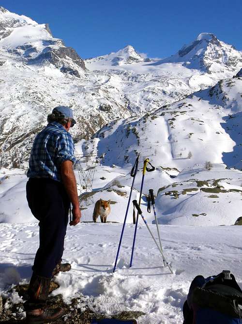
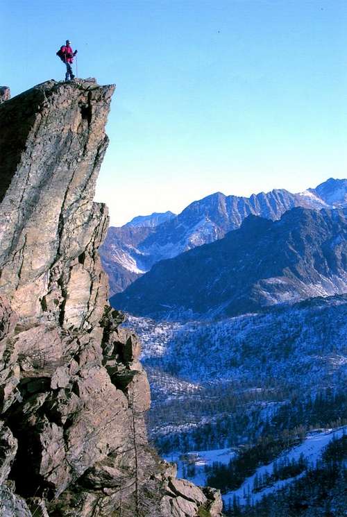
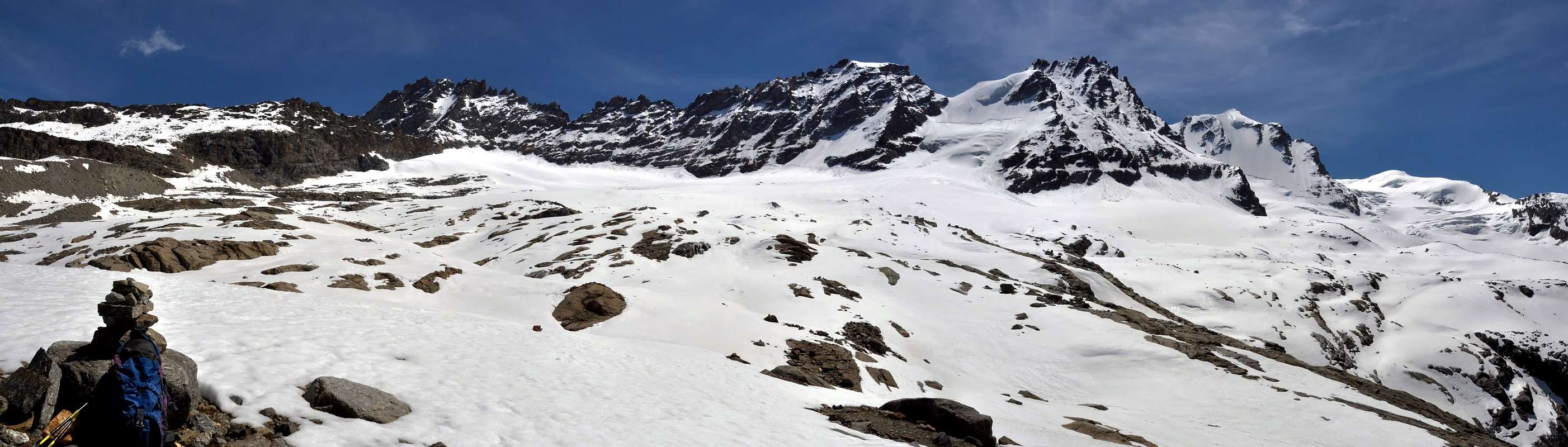
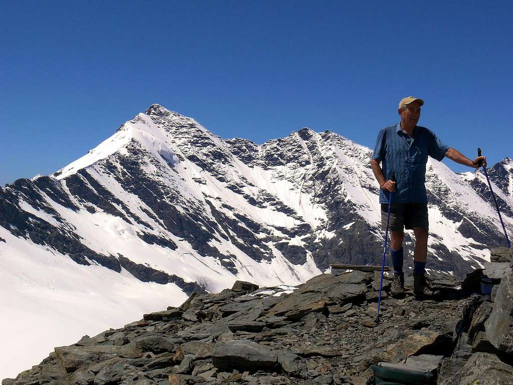
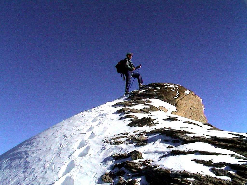
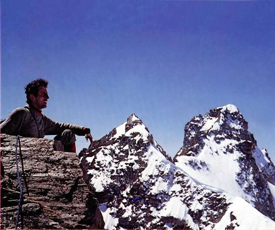
Men on Passes & Hills
Books and Maps
BOOKS:
"Guida dei Monti d'Italia-Gran Paradiso Parco Nazionale" E. Andreis, R. Chabod, M. C. Santis, Club Alpino Italiano/Touring Club Italiano, prima Ed. 1939; seconda Ed. 1963; terza Ed. 1980.
"Guida delle Alpi Occidentali", di Giovanni Bobba e Luigi Vaccarone C.A.I. Sezione di Torino Volume II (parte II), 25 Maggio 1896.
"Il Parco Nazionale del Gran Paradiso" di G. Berruto, volume 2° Ed. I.G.C. Torino 1981, 2000.
"80 itinerari di Escursionismo Alpinismo e Sci Alpinismo in Valle d'Aosta", di Osvaldo Cardellina, Ed. Musumeci, Giugno 1977 (in Italian); seconda Ed. Luglio 1981; terza Ed. Luglio 1984; (in French), prima Ed. Febbraio 1978; seconda Ed. Marzo 1980.
"Gran Paradiso" A. Gegenfurtner, G. Klotz, F. Müller, Ed. Bergverlag Rudolf Rother, Monaco 1980 (in tedesco).
"Gran Paradiso" G. Klotz Ed. Bergverlag GmbH Rother, Monaco 2005 (in tedesco).
"Rifugi e bivacchi in Valle d'Aosta", di Cosimo Zappelli aggiornata da Pietro Giglio, Musumeci Editore, Luglio 2002.
MAPS:
Kompass "Gran Paradiso Valle d'Aosta" Sentieri e rifugi-Carta turistica 1:50.000.
I.G.C. Istituto Geografico Centrale "Gran Paradiso La Grivola Cogne" Carta 1:25.000.
I.G.C. Istituto Geografico Centrale "Il Parco Nazionale del Gran Paradiso" 1:50.000.
I.G.M. Istituto Geografico Militare Foglio 41 "Gran Paradiso-Cogne" 1:25.000.
Protezione Civile Valdostana località Aeroporto n° 7/A Saint Christophe (Ao) Tel. 0165-238222.
Bollettino Meteo (weather info) Tel. 0165-44113.
Unità Operativa di Soccorso Sanitario Tel. 118.
External Links
Gran Paradiso at 4000er.de 4000er.de has a page for each alpine fourthousander and lets you check your peaks summited so that you can get statistics according to the different peak compilations
Mountain Guide Adventure - Chamonix Mont-Blanc Mountain Guide - France A Mountain Guide team will help you to realize your mountain and adventure dreams. A Mountain Guide team in Chamonix propose: mountaineering, alpine rock climbing, ice climbing, heliskiing, ski touring, off piste skiing and expeditions all over the world.
Parents refers to a larger category under which an object falls. For example, theAconcagua mountain page has the 'Aconcagua Group' and the 'Seven Summits' asparents and is a parent itself to many routes, photos, and Trip Reports.


 9904 Hits
 83.69% Score
 17 Votes