


-
 3098 Hits
-
 77.48% Score
-
 8 Votes
|
|
Area/Range |
|---|---|
|
|
45.67860°N / 7.40690°E |
|
|
Hiking, Mountaineering, Trad Climbing |
|
|
Spring, Summer, Fall, Winter |
|
|
11676 ft / 3559 m |
|
|
Note
La montagna chiama i suoi figli, ed essi rispondono fedelmente al suo appello… Osvaldo Cardellina, Diario alpinistico, 1964-65 Page texts: @ OsvaldoCardellina "Osva", passed away on May 2, 2022. Page owners: Christian Cardellina e Osvaldo Cardellina. Any updates from September 12, 2022: Antonio Giani, page administrator, friend and climbing companion. Testi della pagina: @ OsvaldoCardellina "Osva", scomparso il 2 maggio 2022. Proprietari pagina: Christian Cardellina e Osvaldo Cardellina. Eventuali aggiornamenti dal 12 settembre 2022: Antonio Giani, amministratore della pagina, amico e compagno di salite. |
Three Overview Lochs
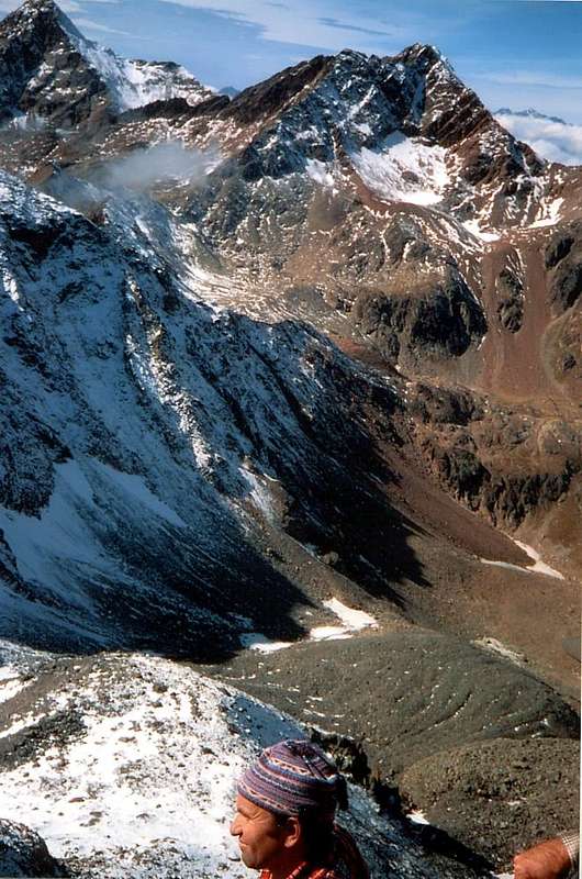
This beautiful vallon belongs to the Municipality of Grand Brissogne (827m). Rises behind the same with a great rampart which reaches the rocky promontory just before a short descent to the Shelter Ernesto Ménabreaz (2.546m), at the Eastern shore of Lac des Laures Dessous, the first of three that contains this vallon yet all pristine. It can be rightly regarded as one of the last natural wonders of the entire Valley of Aosta, thanks to the fact that the lack of farm private dirt roads, reach such high altitudes, it has significantly preserved in time. In fact the only existing reaches the Pastures of Gramonenche and L'Arp (1.112m, 1.310/20m) at a relatively low altitude and that does not allow a mass influx, besides the fact of preserving intact the Nature. Sited between the Chain of Roises or Rouèses to the East and Mount Emilius, which flaunts its vertical Eastern Wall of 500 meters, stretches toward the South and, after passing two other beautiful lakes or Long and Dessus, reaches Col des Laures (3.035m) on the border with the Vallon Grauson, branch Lussert, in the North of the Valley of Cogne. From one watershed to another unfold, like a halo, numerous hills, in the East the first is to Salé (3.025m; on site told Salì) or of the Great Roise, that in the past was also known as Col Leppy or of Brissogne. It leads to secondary Arpisson Vallon (not to be confused with the same name in the walloon above the adjacent Municipality of Pollein) in the Valley of St. Marcel. Located between Becca di Salé and Petite Roise is the only crossing passable until the end of this chain, where, between Punta Ilario Antonio Garzotto (3.273/4m) and Punta di Leppe, opens the next Leppe Hill (3.108/10m), which leads, always into the Saint Marcel Valley, towards Grande Chaux Hunting House (2.370m) in the Preserve Grand Avert, by Marquis Attilio Turati. The watershed opposite or Western open the Arbolle Hill (3.154m) and the Pass of Tre Cappuccini (3.242m), between the two "Normal Routes" at Punta Rossa and the Mount Emilius and also above the head of the adjacent Vallon of Arbolle or Arbole. Finally, and to the North of this last Col Peccoz or Peckoz (3.042m), net carving on the North Ridge-northeast of the same and also known as the "Three Curates Crest" recalls the Baron Egon Beck Peckoz Gressoney first owner of this Reserve that in '800 also extended to the neighboring Vallon of Arpisson to the West reaching Carrel Hill (2.916m) between Monte Emilius and "Becca", while expanded Southward to the foot of the Glacier Tessonet below the Punta Tersiva (3.515m).
![]()
![]()
Questo splendido vallone appartiene al Comune di Grand Brissogne (827m). S'innalza alle spalle del medesimo con un grande spalto raggiungente il promontorio roccioso subito prima d'una breve discesa verso il Rifugio Ernesto Ménabreaz (2.546 m), presso la sponda Orientale del Lac des Laures Dessous, il primo dei tre che contiene questa valle ancora del tutto incontaminata. Può essere giustamente considerato come una delle ultime meraviglie naturali dell'intera Valle di Aosta, grazie al fatto che la mancanza di strade poderali, tali raggiungere altitudini elevate, lo ha notevolmente preservato nel tempo. Infatti l'unica esistente raggiunge gli Alpeggi di Gramonenche e l'Arp (1.112 m, 1.310/20 m) ad una quota relativamente bassa e tale da inibire un afflusso di massa, oltre al fatto di conservare intatta la Natura. Collocato tra la Catena delle Roises o Rouèses ad Est ed il Monte Emilius, che ostenta la sua verticale Parete Est di 500 metri, si distende verso Mezzogiorno e, dopo aver superato altri due splendidi Laghi o Lungo e Dessus, raggiunge il Colle des Laures (3.035 m) al confine con il Vallone del Grauson, ramo Lussert, nel settore Settentrionale della Valle di Cogne. Da uno spartiacque all'altro si dispiegano, a guisa di raggiera, numerosi colli: ad Est il primo é quello di Salé (3.025 m; in loco detto di Salì) o della Grande Roise, che nei tempi passati era anche conosciuto come Col Leppy o di Brissogne. Conduce al Vallone secondario di Arpisson (da non confondere con l'omonimo nel vallone adiacente sopra il Comune di Pollein) nella Valle di Saint Marcel. Situato tra la Becca di Salé e la Petite Roise risulta l'unico valico transitabile fino al termine di questa catena dove, tra la Punta Ilario Antonio Garzotto e la Punta di Leppe, si apre il successivo di Leppe (3.108/10 m), che porta alla Casa di Caccia di Grande Chaux (2.370 m) nella Riserva del Grand Avert, di proprietà del Marchese Attilio Turati. Sullo spartiacque opposto od Occidentale s'aprono il Colle di Arbolle (3.154 m) ed il Passo dei Tre Cappuccini (3.242 m), tra le due "Vie Normali" alla Punta Rossa ed all'Emilius nonchè sopra la testata del Vallone d'Arbolle o Arbole. In ultimo ed a Nord di questo ultimo il Col Peccoz o Peckoz (3.042 m), netto intaglio sulla Cresta Nord-nordest del medesimo e conosciuta come "Cresta dei Tre Curati", ricorda il Barone di Gressoney Egon Beck Peckoz primo tenutario di questa Riserva che nell'800 si estendeva sino al limitrofo Vallone di Arpisson ad Ovest, mentre si espandeva verso Sud fino al Vallone Grauson-Doreire sul Ghiacciaio del Tessonet ai piedi della piramide della Tersiva (3.515 m).
Getting There
BY CAR:
- From TORINO, MILANO, etc: Motorway A5. Exit at IVREA or Quincinetto (PIEDMONT) From IVREA Town: in West (Northern side) towards Pont Saint Martin, Donnas, Bard, Arnad, Champdepraz, Saint Vincent, Châtillon, Nus and Quart; also in Southern side in respect to the Dora Baltea Stream: Pontey, Fénis, Saint Marcel, Grand Brissogne Municipalities. From Courmayeur Resort: in East and in Norhern side respect to Baltea towards: Pré St. Didier, Morgex, La Salle, Arvier, Villeneuve, Saint Pierre, Sarre, Aosta Municipalities.From Aosta Town or by Châtillon/Nus towards Grand Brissogne Commons From Grand Brissogne (827m) to L'Arp, dirt road, Les Laures small Valley-Ernesto Ménabreaz Shelter at Lower Laures Lake (2.546m), path-muletrack.
- From FRANCE: through the Mont Blanc Tunnel to Entrèves-crossroads to Vény/Ferret Valleys - Mountain Guides of Courmayeur - La Saxe Rock Gym - Courmayeur. By Little Saint Bernard Pass, closed since November until half May to La Thuile Valley - Pré Saint Didier - Courmayeur.
- From FRANCE: through the Mont Blanc Tunnel to Entrèves-crossroads to Vény/Ferret Valleys - Mountain Guides of Courmayeur - La Saxe Rock Gym - Courmayeur. By Little Saint Bernard Pass, closed since November until half May to La Thuile Valley - Pré Saint Didier - Courmayeur. It is not necessary to take Motorway A5: you can drive on SS.26, in the direction of AOSTA - IVREA - TURIN.
BY PLANE:
- Aeroporto "Corrado Gex" Saint Christophe (Aosta).
Better and more easy the Hikes towards the various hills
 |
 |
 |
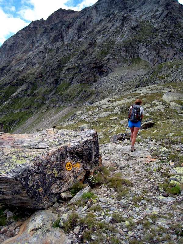
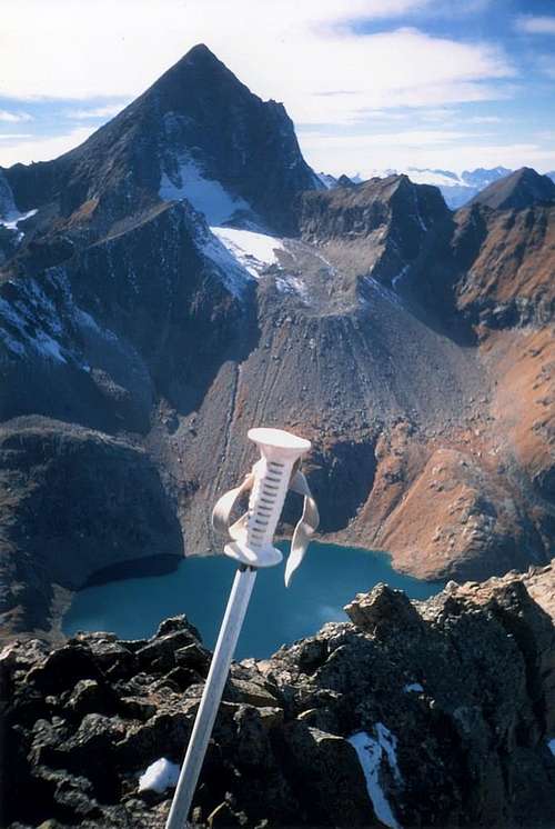
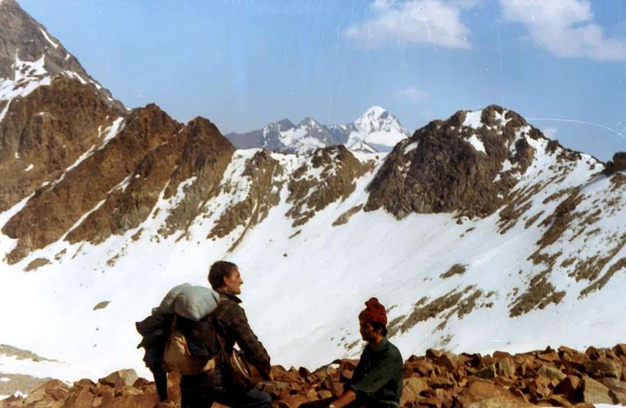
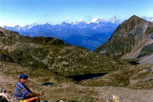
As regards the Excursions are preferred those to Hills and Passes not to the Summits. In fact all have difficulties that exceed the concept of Hiking, beginning with the "Normal Via" to the Monte Emilius through Crest South-southeast, which coincides with the route that comes from Vallon Arbolle but this side more complicated and, if in the presence of hard snow, certainly for the achievement of the Pass of Tre Cappuccini (3.242m). Turning to the other and starting to the East with the watershed of Roises, the only "affordable" are the first and the last, or Becca di Salé to the North, just above the Rifugio Menabreaz, and Punta Ilario Antonio Garzotto on the opposite side of the same partition. The Becca di Salé which is more easy by the eponymous hill (3.008m) and through the easy South Ridge; but the latter has some small passage upwards, if in the presence of snow, it can create some problems. The Punta Garzotto is just more challenging with the climb by Leppe Hill (3.110m), just below the Summit, however, presents some brief passage that requires the ability to choose the path; also in the middle part must be careful not to dislodge stones. To disregard the trio of Roises, all mountaineering and more exposed passages that difficult. The watershed South, that the Tip Leppe reaches the Col des Laures then getting up in the homonymous Summit and in the Eastern Punta Rossa of Emilius, presents the opportunity of two beautiful trips to Leppe Hill, partially with the path and then through the moraine with tracks and in the final part snowfields and the Col des Laures (3.035m), always with good path and the possibility by means of a short descent to go visit the third and fourth Lake Lussert (2.906m, 2.923m) in the highest part of this vallon that descends to Cogne Valley. The Punta di Leppe is easily accessible via the Northeast Ridge from Colle di Leppe, while on the opposite side or Western of the watershed can quite easily climb the nearby Mont des Laures. Col des Laures the watershed reaches the homonym Summit before heading to Emilius's Punta Rossa inserting the West watershed, attached Vallon of Laures first with that of Arbolle and then, from the Top of Emilius, with that of Arpisson.
![]()
![]()
This whole area is in practice little for Mountaineering and grants to Hiking. Discarded a priori these two Summit you get to Arbolle Hill (3.154m), which gives a beautiful crossing between the first two vallons; while the rising phase is easy and simple via a good path becomes a track in the last 70-80 meters, the other side offers a descent to Lake Gelato (2.956/7m) is not always primary and simple. In fact, you can find the "verglass" in the first section and in the crossing of the pitiful remains of the ancient Glacier Emilius also called of Lac Gelé you must pay attention to the fall of stones that come from the North Face of the three Punta Rossa. Then the ridge crosses Punta Tre Cappuccini or altitude 3.284 meters reaching the eponymous pass (3.242m). But of this we have already said. Besides descends towards the North-northeast an edge, very steep, after the Black Triangle, reaches below Col Blantsette (3.126m) and the head of the same name, also called Becca des Boucs (3.140m); the path on the side Laures is not difficult but you have to pay attention in the last 50/60 meters, where a steep gully earthy wedged into the rock reaches carving. Here come the crossing to North ridge is easy and fun. The next Peckoz Pass (3.042m) offers an easy hike starting from the shelter with a good path that goes between the Testa (Head) Blantsette and Becca of Seneva; trip is recommended for beautiful views of the East and North Walls of Emilius and the impressive Black Triangle; from the hill, just under the crest to the East, without great difficulty to reach the Becca di Seneva (3.086m), from where the views are even more grandiose and also above the range below the City of Aosta. Finally the rounded Mont Père Laurent (3.086m), where he completed the watershed "falling" over the Municipality of Grand Brissogne (827m) and Château, Grand and Petit Pollein Fractions (639m, 617m, 587m) not be reached by continuing on the ridge. An old path, starting from Le Tramouail (1.975m) before arriving at Les Laures, reached him with a long crossing to the West-northwest. At first large landslides from North-northeast Wall of Seneva and subsequently vegetation have made it practically unusable and almost impassable.
 |
 |
 |
Per quanto concerne le escursioni son da preferirsi quelle verso i colli che non alla Cime. In effetti tutte possiedono delle difficoltà che superano il concetto d'Escursionismo, incominciando dalla "Via Normale" all'Emilius per la Cresta Sud-sudest, coincidente con l'itinerario proveniente dal Vallone di Arbolle ma da questo lato più complicata e, se in presenza di neve dura, sicuramente per il raggiungimento del Passo dei Tre Cappuccini (3.242 m). Riguardo alle altre ed iniziando ad Est con lo spartiacque delle Roises, le uniche "abbordabili" risultano la prima e l'ultima, ovvero la Becca di Salé a Settentrione, giusto sopra il Rifugio Mènabreaz, e la Punta Ilario Antonio Garzotto sulla parte opposta del medesimo divisorio. La Becca di Salé risulta più che facile dall'omonimo colle e tramite la Cresta Sud; ma questo ultimo presenta qualche piccolo passaggio verso l'alto che, se in presenza di neve fresca, può creare qualche problema. La Punta Garzotto é appena più impegnativa con salita dal Colle di Leppe, però presenta subito sotto alla Sommità qualche breve Passaggio tale da richiedere la capacità di scelta del percorso; inoltre nel tratto medio bisogna fare attenzione a non smuovere pietre. Da escludere invece il trio delle Roises, tutte alpinistiche e con passaggi più esposti che difficili. Lo spartiacque Meridionale, che dalla Punta di Leppe raggiunge il Col des Laures rialzandosi poi nell'omonima punta ed in quella Orientale della Punta Rossa dello Emilius, presenta l'opportunità di due belle gite al Colle di Leppe, parzialmente con sentiero e quindi tramite morena con tracce e nella parte finale nevati, nonché al Colle des Laures, sempre con buon sentiero e la possibilità per mezzo d'una breve discesa di andare a far visita al terzo ed al quarto Lago di Lussert (2.906 m, 2.923 m) nella parte più elevata di questo vallone discendente verso Cogne. La Punta di Leppe risulta facilmente raggiungibile tramite la Cresta Nordest dal Colle di Leppe, mentre dalla parte opposta od Occidentale dello spartiacque si può abbastanza agevolmente salire il vicino Mont des Laures. Dal Col des Laures lo spartiacque raggiunge l'omonima Cima per poi raggiungere la Punta Rossa inserendosi sullo spartiacque Occidentale, divisorio il Vallone des Laures dapprima con quello di Arbolle e poi, dalla Sommità dell'Emilius, con quello dell'Arpisson. Tutta questa area è in pratica alpinistica e poco concede all'Escursionismo.
Scartate a priori queste due Vette si arriva al Colle di Arbolle (3.154 m), che concede una bella traversata tra i primi due valloni; mentre la fase di salita é facile e semplice tramite un buon sentiero tramutantesi in traccia negli ultimi 70/80 metri, il versante opposto di Arbolle offre una discesa verso il Lago Gelato (2.956/7 m) non sempre elementare o semplice. Infatti é possibile trovare del "verglass" nel primo tratto e nella traversata dei miseri resti dell'antico Ghiacciaio dell'Emilius o del Lac Gelé si deve far attenzione alla caduta di pietre che provengono dalla Parete Settentrionale delle tre Punta Rossa. Poi la cresta scavalca la Punta dei Tre Cappuccini o Quota 3.284 metri raggiungendo l'omonimo passo. Ma di questo abbiamo già detto sopra. Oltre scende verso Nord-nordest uno spigolo molto ripido che, dopo il Triangolo Nero, raggiunge il sottostante Col Blantsette e l'omonima Testa, detta anche Becca des Boucs; il percorso sul versante Laures non é difficile ma bisogna prestare attenzione negli ultimi 50/60 metri, dove un ripido canalino terroso incuneato nella roccia raggiunge l'intaglio. Qui giunti la traversata verso Nord in cresta é facile e divertente. Il successivo Col Peckoz (3.042 m) offre una facile escursione partendo proprio dal rifugio con un buon sentiero che sale tra la Testa Blantsette e la Becca di Seneva; é gita raccomandabile per le splendide vedute sulle Pareti Est e Nord dell'Emilius nonché sull'imponente Triangolo Nero; dal colle, restando appena sottocresta ad Oriente, senza grandi difficoltà si raggiunge la Becca di Seneva, da dove le viste diventano ancora più grandiose spaziando anche sopra la sottostante Città di Aosta. Infine il tondeggiante Mont Père Laurent, dove ha termine lo spartiacque "precipitando" sopra il Comune di Grand Brissogne e le Frazioni di Pollein di Château, Grand e Petit Pollein (639m, 631m, 587 m), non é raggiungibile continuando sulla cresta; un vecchio sentiero, partendo da Le Tramouail (1.975 m) prima di arrivare alle Laures, lo raggiungeva con lunga traversata verso Ovest-nordovest. Dapprima le grandi frane dalla Parete Nord-nordest della Becca di Seneva e successivamente la vegetazione l'han reso in pratica inutilizzabile e quasi impercorribile.
 |
 |
 |
Campings
Remember that free camping is forbidden (except for emergency reasons, over 2.500m, from darkness until dawn).Mountain Condition
- Meteo: you can find all the needed informations at the official site of the Valle d'Aosta Region:
- Valle d'Aosta Meteo
Important Information
- REGIONE AUTONOMA VALLE D'AOSTA the official site.
- FONDAZIONE MONTAGNA SICURA Villa Cameron, località Villard de la Palud n° 1 Courmayeur (AO) Tel: 39 0165 897602 - Fax: 39 0165 897647.
- A.I.NE.VA. (Associazione Interregionale Neve e Valanghe).
Useful numbers
- Protezione Civile Valdostana località Aeroporto n° 7/A Saint Christophe (Ao) Tel. 0165-238222.
- Bollettino Valanghe Tel. 0165-776300.
- Bollettino Meteo Tel. 0165-44113.
- Unità Operativa di Soccorso Sanitario Tel. 118.