Hiking, Mountaineering, Trad Climbing, Sport Climbing, Bouldering, Ice Climbing, Aid Climbing, Big Wall, Mixed, Scrambling, Via Ferrata, Canyoneering, Skiing
La montagna chiama i suoi figli, ed essi rispondono fedelmente al suo appello…
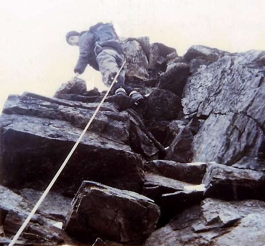
Osvaldo Cardellina, Diario alpinistico, 1964-65
Page texts: @ OsvaldoCardellina"Osva", passed away on May 2, 2022. Page owners: Christian Cardellina e Osvaldo Cardellina. Any updates from September 12, 2022: Antonio Giani, page administrator, friend and climbing companion.
Testi della pagina: @ OsvaldoCardellina "Osva", scomparso il 2 maggio 2022. Proprietari pagina:Christian Cardellina e Osvaldo Cardellina. Eventuali aggiornamenti dal 12 settembre 2022: Antonio Giani, amministratore della pagina, amico e compagno di salite.
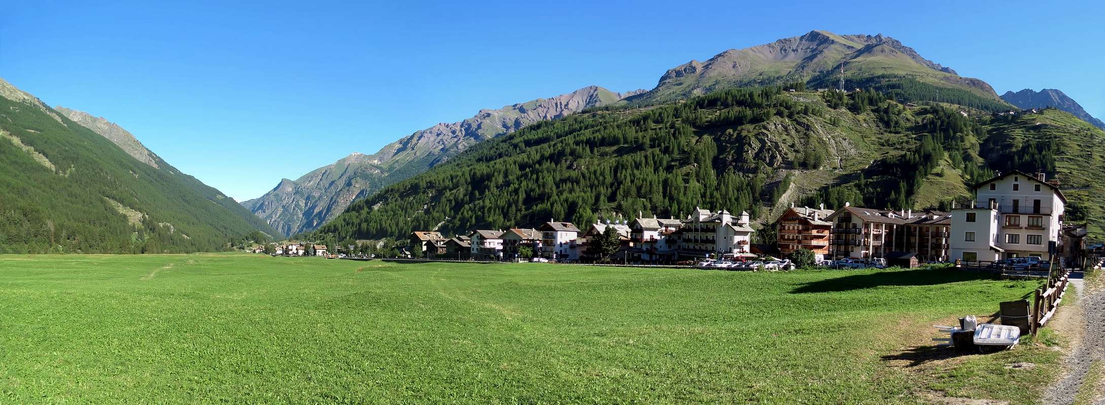
Coing with Iseran Overview
Cogne: we already know that it is the Navel of the World. If you ask a "real" inhabitant of Cogne if he is Italian will tell you, "Do not I know"; if you ask him if there is Valdotain say "It can be". But in the end always will tell you, to take away from your feet your curiosity: "Me sò de Cogne" (I'm from Cogne). At the end of Second World War I was born a "Mouvement" for founding the "Repubblecca de Cogne" (the Republic of Cogne; it is not a joke. He did a service R.A.I. Channel 3 last week). It is true Historical Truth. Then Tourism and Advertising have killed Cogne and "Cogneins". As Spider-Man. Already were not okay with the Salassi, much less with the Romans, who had come to dig beneath Mount Creià (current Creya, ie laundry) to take the precious magnetite with which to forge coins to the Empire, Caesars & Emperors. So they called Conia, minting. But they were always already Coing, which means voice Celtic corner. A site such as Cuneo (Cuneum) in Piedmont, which constitutes a wedge inserted in the heart of the mountains dividing distinctly the same and their valleys; dividing who is here who is beyond. Friends from Enemies, those who are at the "Adret" (in the sun) from those that inhabit the "Envers" (in the shade). Cogne also presents this situation, for which it our choice to split the work is carried through into reality. Places are "cut" with the ax and with well-defined positions and safe: divide the inhabitants von only by "Voella" (the most important), but also between fraction and fraction, between the village and the village, by alp 'other. Those of Lillaz are not those of Crétaz and those of Epinel are not "others" of Valnontey. Not to mention those who are down to Vyeies or Sylvenoire, the entrance of the valley, or of those who are "clinging" up there Dzimillan. Are almost identical of different worlds in this corner of Aosta Valley. What angle that the mountains have always hid from all over the Rest of the World.Cogne: sappiam già esser l'Ombelico del Mondo. Se voi chiedete ad un "vero" abitante di Cogne se lui é Italiano vi risponderà: "Non lo sò"; se chiedete se é Valdostano vi dirà: "Può darsi". Ma alla fine sempre vi dirà, per toglier dai piedi la vostra curiosità: "Me sò de Cogne" (Io son di Cogne). Fine della Seconda Guerra Mondiale era sorto un "Mouvement" per fondare la "Repubblecca de Cogne" (la Repubblica di Cogne; non é una barzelletta. Ha fatto un servizio la R.A.I. Canale 3 la scorsa settimana). Si tratta di vera Verità Storica. Poi il Turismo e la Pubblicità han ammazzato Cogne ed i "Cogneins". Come per l'Uomo Ragno. Già non andavano daccordo con i Salassi, tanto meno coi Romani, ch'eran venuti a scavar sotto il Monte Creià (attuale Creya, cioé bucato) per prendere la pregiata magnetite con la qual forgiare monete per l'Impero, Cesari ed Imperatori. Così la chiamarono Conia, da conio. Ma loro eran già da sempre Coing, voce Celtica che significa angolo. Un posto, come Cuneo (Cuneum) in Piemonte, che costituisce appunto un cuneo inserito nel cuore delle montagne dividendo distintamente le stesse e le loro valli; spartendo chi é di qua da chi é di là. Gli Amici dai Nemici, quelli che sono all'"Adret" (al sole) da quelli che abitano l'"Envers" (all'ombra). Anche Cogne presenta questa situazione, per la qual cosa la nostra scelta di dividere in due il lavoro trova praticamente riscontro nella realtà. Sono luoghi "tagliati" con la scure e con le posizioni bene definite e sicure: dividono anche gli abitanti von solo dalla "Voella" (il centro più importante), ma anche tra frazione e frazione, tra villaggio e villaggio, un'alpe dall'altra. Quelli di Lillaz non son quelli di Crètaz e quelli d'Epinel gli "altri" di Valnontey. Non parliam poi di chi é giù a Vyeies o Sylvenoire, all'ingresso, oppur di quelli che son "abbarbicati" lassù a Dzimillan. Son quasi dei mondi diversi in questo identico angolo della Valle di Aosta. Angolo che le Montagne nascondevan da tutto il Resto del Mondo.
^^^^^^
They were in fact to separate corner from the valley floor, where flows the Dora Baltea. They had the Grand'Eyvia (Great Water) and others Torrents de Arpisson, Grua, Lussert, Grauson, Doreire, Urtier, Eaux Rouges, Bardoney, Valeille, Valnontey, Lauzon and Nomenon, but not called in this way "Frenchified". What were the names we do not know, but we know that the old Cogne was upward to Cret, where today has remained only a small Church with the ruins of an ancient mountain pasture. Sheltered by the floods, was spread in the small plain that reaches Champlong and Lillaz and, above the Quertatset, the Etsélei, the Bouc and the two Goilles Dessous and Damon. Over there rose the great mountain of Iseran and there, but a lot more besides, Gaul. There were many other small Iseran with different names which usually bore the name of the owner who owned pastures at the base, as Becca Montandayné, ie the Mountain Dayné. Or marked a passage as les Laures, Fénis, Pontonnet Fenetre de Champorcher and other possessions as a name Piedmont Ciarforòn, Monciair and Gay. The Gran Paradiso did not exist. They invented in '800. But Coing was a perfect angle from which divided all the walloons of this great valley that descends to the Dora. But parallel and not perpendicular. From birth the "Cogneins" required due respect and did not accept any subjection. With "Ciamporcieri" there was always a certain rivalry; as with "Valsaverains" with whom they competed to win The Grivola, the only virgin left in the Valley of Aosta. But they were okay with the "Piemùnteis" with whom exchanged goods, carried the ore down to Eporedia and maybe even marrying. stepping over the waters of the Acque Rosse, the Arietta and the Bocchetta of Rancio (Nozzle or Pass above the alp where the shepherds eat rations). Power of Love, the real one "Highlander", which also bypasses the Mountains, even the 4.000 metres by Granpa.
Erano infatti quell'angolo separato dal fondovalle, dove scorre la Dora Baltea. Loro avevano la Grand'Eyvia (la Grande Acqua) e gli altri Torrents de Arpisson, Grua, Lussert, Grauson, Doreire, Urtier, Eaux Rouges, Bardoney, Valeille, Valnontey, Lauzon e Nomenon, che però non si chiamavano in sto modo "francesizzato". Come si chiamavan non lo sappiamo, ma sappiamo che la vecchia Cogne era sù al Cret, dove oggi é rimasta solo una Chiesetta con il rudere d'una antichissima alpe. Al riparo dalle inondazioni, si distendeva nella piccola pianura che raggiunge Lillaz e Champlong e, più sopra il Quertatset, l'Etsélei, il Bouc ed i due Goilles Dessous e Damon. Là in fondo si alzava la grande montagna dell'Iseran e laggiù, ma molto più oltre, la Gallia. C'eran tanti altri piccoli Iseran con diversi nomi in genere assumenti il nome del proprietario che possedeva i pascoli alla base, come la Becca di Montandayné, cioé la Montagna di Dayné. Oppure segnavano un passaggio come Les Laures, Fénis, Pontonnet Fenetre de Champorcher ed altre che possedevano un nome piemontese come Ciarforòn, Monciair e Gay. Il Gran Paradiso non esisteva. L'hanno inventato nell'800. Ma Coing era un perfetto angolo dal quale dividevansi tutti i valloni di questa grande vallata che scende verso la Dora. Ma parallela e non in modo perpendicolare. Già dalla nascita i "Cogneins" richiedevano dovuto rispetto e non accettavan nessuna sudditanza. Con i Ciamporcieri c'era stata sempre una certa rivalità; come con i Valsaverains con i quali avevano gareggiato per conquistare la Grivola, l'unica Vergine rimasta in Valle di Aosta. Ma andavano daccordo con i "Piemùnteis" con i quali scambiavano le merci, portavano il minerale giù a Eporedia e magari anche prendevano moglie. scavalcando i Colli di Acque Rosse, della Arietta e la Bocchetta del Rancio. Potenza dello Amore, quello vero "Montanaro", che scavalca anche i Monti, anche i 4.000 metri del "Granpa"
Getting There
BY CAR:
From TORINO, MILANO, etc: Motorway A5. Exit at IVREA or Quincinetto (PIEDMONT) AOSTA West/Aymavilles, Cogne Municipalities.
From Aymavilles (646m) towards Cogne Valley: Vieyes (1.158m) or Sylvenoire Village (1.331m), Mario Gontier private Shelter, through path in Nomenon Walloon. To Cogne(1.534m); through Main Road. To Valnontey(1.678m); Money, Alessandro Martinotti, Stefano Borghi, Carlo Pol, Marcello Gerard-Ettore Grappein, Lionello e Lucio Leonessa, Mario Balzola, Luciano Gratton, at the base of the district that goes from Punte Patrì East to the West to Punta Rossa, passing under the Gran Paradiso. (This last from Epinel(1.436m) or Crétaz(1.494m) Fractions) Bivouacs, through paths, moraines and glacier, & Vittorio Sella Refuge, through muletrack). From Lillaz Fraction (1.607m) to "Sogno di Berdzé", under the Fenêtre of Champorcher, and Guido Antoldi-Laura Malvezzi Refuges, by dirt road, muletrack or paths in Urtier and Valeille Vallon. To Gimillan Village(1.785m), Franco Nebbia Bivouac, with path in Arpisson Vallon. All the three last through Regional Roads from Cogne.
From FRANCE: through the Mont Blanc Tunnel to Entrèves-crossroads to Vény/Ferret Valleys - Mountain Guides of Courmayeur - La Saxe Rock Gym - Courmayeur.
By Little Saint Bernard Hill, closed since November until half May to La Thuile Valley - Pré Saint Didier - Courmayeur. It is not necessary to take Motorway A5: you can drive on SS.26, in the direction of AOSTA - IVREA - TURIN.
BY PLANE:
Aeroporto "Corrado Gex" Saint Christophe (Aosta).
Miserino's Conca
The Miserino is not the Miserin. The root is common, but while the first is located in the Vallon of Urtier in Val de Cogne, the second is located in the adjoining Valley Champorcher. The Hill Fenêtre connects these two in a short time allowing the passage. But the transit between the two centers of population and Lillaz Dondena is somewhat distant, not to mention the descent Château Champorcher, the Cief Town. This name bears witness of the labors and hardships of those people in the past that the "Misery" united in daily living. But it also has appurtenances latin with the "Miserere", or seeking forgiveness for the sins and human injustice. Anticipating far "Les Miserables" by Victor Hugo. That's why the Miserin, at the namesake lake, was built in 1658, by Pantaleon Savin, the Sanctuary of Notre-Dame-des-Neiges above the ancient chapel famous for miracles performed during the "Plague of 1630". Instituted a Procession still in vogue, the 5th of August. Nowadays, dominated Science and Rationality, one would say only that they were not miracles, but simply redeeming those that salt upward to breathe the pure air of the Rosa dei Banchi drinking water uncontaminated Torrent Ayasse. However, after 150 years, became famous also for the inhabitants of Cogne and Campiglia Soana in Canavese (Piedmont) and the King of Italy Vittorio Emanuele II° was upwards from Dondena Sunday, in order to attend the Mass. Even these last two populations instituted a Procession route, but with backward going to San Besso in the nearby Walloon of Rancio above Campiglia and Valprato Soana. Traditional destination for meetings between the two valleys on August 10th, even today. But to transit was not used and not using the Colle del Miserino, at the end of this basin, but that immediately adjacent to the East of the Arietta. In this basin occurs, for those who are sensitive, even the "Rite of Purification with Water" hence the name, thanks to the presence of two beautiful small lakes at the feet of the district that embraces them between Head of Arietta, and Punta of Miserino and Pass, Punta della Scaletta and Nera. Have nothing to envy to the largest Miserin, indeed their banks propagate a sense of Peace and Spirituality even greater. (Note: in the Seventeenth Century was built the shrine dedicated it to San Besso, was completed in 1669 and major renovations took place in 1857 and 1985.) If you come here, this is what we found. Do not think a large rock climbing very solid but rather to a beautiful Hike. Also here is already past George in 1912 along with his Guides Valtournanche Benjamin and Anselm Pession to climb the Ridge Northwest of the Punta Nera. Preceded by two days only R.I.G. Irving and H.E.G. Tyndale that August 10th had made the first ascent absolute of the Punta of the Scaletta through the same from East to Northwest. But even before they were passed Carlo Ratti and Ercole Daniele, July 22th, 1896, to make the first of Punta del Miserino, and even before, July 13th, 1880, Captain Cloza to go with his soldiers of Engineers Punta Nera. And even before the first? The Time, as evidenced by the many colors of these ancient stones transformed by wind, water and ice. Then we passed even us, but long after and something of good we have more or less combined. It certainly will not pass to History as accomplished, but still it was something new after so many years of silence. It's better than nothing. Then there is nothing left? Always something remains for those who knows try ...
The Vallons most important & the recommended Excursions (4)
.
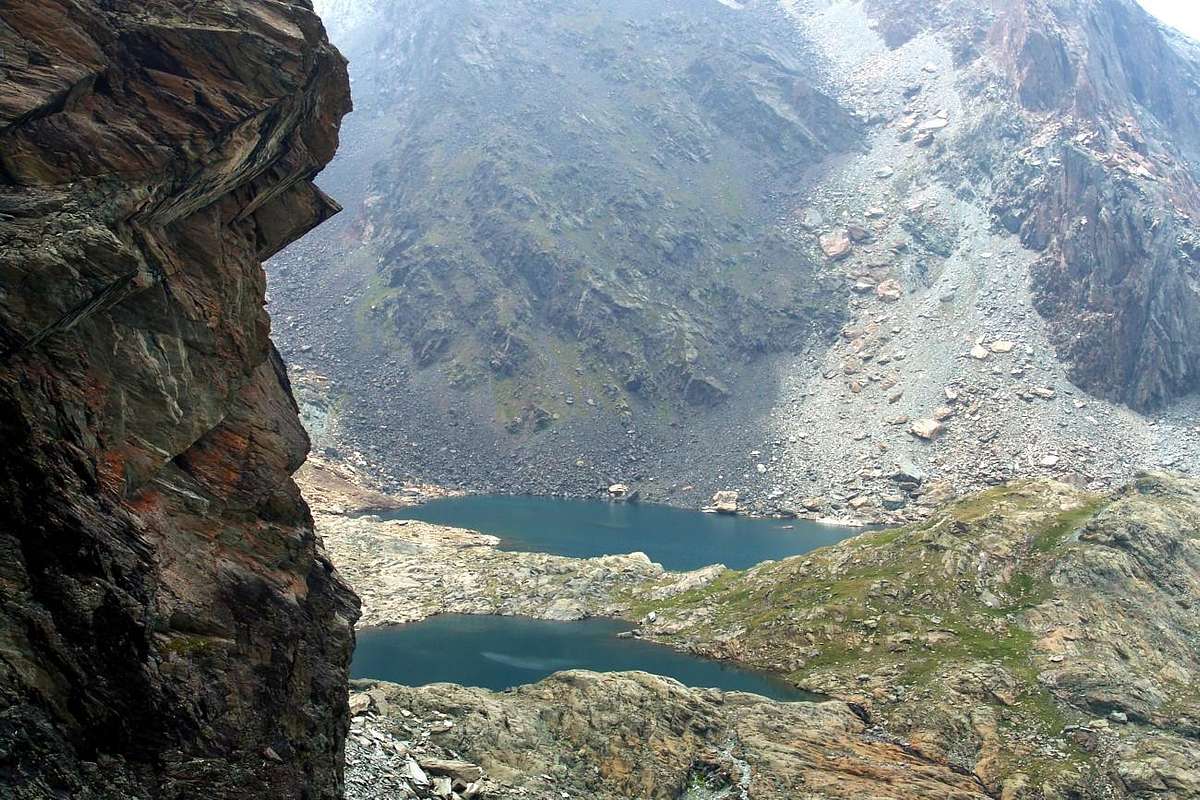
1) - Lillaz Hamlet, Goilles Damon, Tsavanis Pastures (1.607m, 1.869m, 2.293m), fork 2.363 meters, Broillot Alpage (2.399m): Excursion with paths before in East, after South-southeast to two Miserino's Lakes (2.664m, 2.665m), amongst Punta Miserino, Punta della Scaletta and Punta Nera (E/F; 3h'00/3h'30).
2) - Miserino's Lakes: Excursion from Lillaz with path before in East-southeast to Alp Broillot, after in South to Miserino Lakes and Pass (2.842m) (EE/F; 4h'00/4h'20).
3) - Miserino Pass: Excursion-Climbing from Miserino Pass to Punta del Miserino (3.010m), through West-southwest Ridge (EE/A/F+; 1h'00/1h'15).
4) - Miserino's Lakes: Excursion-Climbing from Lillaz with path before in East to Alp Broillot, after in Southeast and South to Miserino two Lakes; from Western Lake through steep moraines to a small carving about 2.980 meters. By Northern Ridge in terminal part to Punta Nera (3.063/4m) (EE/A/F+; 2h'00/2h'15).
^^^^^^
Il Miserino non é il Miserin. La radice é comune, ma mentre il primo trovasi nel Vallone dell'Urtier in Val de Cogne, il secondo è collocato nell'attigua Valle di Champorcher. Il Colle Fenêtre collega questi due permettendo in breve tempo il passaggio. Ma il transito tra i due centri abitati di Lillaz e Dondena è alquanto distante, per non parlar della discesa a Château di Champorcher, il Capoluogo. Questo toponimo testimonia delle fatiche e degli stenti di quelle popolazioni nel Passato che la "Miseria" univa nel viver quotidiano. Ma possiede anche attinenze latineggianti con il "Miserere", ovvero la ricerca del perdono per i peccati e l'umane ingiustizie. Anticipando di gran lunga "Les Miserables" di Victor Hugo. Ecco perché al Miserin, presso l'omonimo Lago, é stato costruito nel 1658, da parte di Pantaleone Savin, il Santuario di Notre-Dame-des-Neiges al di sopra dell'antica cappella famosa per i Miracoli compiuti durante la "Peste del 1630". Istituirono una Processione ancor oggi in auge, il 5 del mese di Agosto. Oggigiorno, dove dominano la Scienza e la Razionalità, si direbbe soltanto che non eran Miracoli, ma semplicemente si salvava chi salisse a respirar l'aria pura della Rosa dei Banchi bevendo l'acqua incontaminata del Torrent Ayasse. Comunque, dopo 150 anni, diventò famoso anche per gli abitanti di Cogne e di Campiglia Soana in Canavese (Piemonte) e lo stesso Re d'Italia Vittorio Emanuele II° si recava da Dondena la Domenica, onde assistere alla S. Messa. Anche queste due ultime popolazioni istituirono una Processione, ma con percorso a rovescio recandosi a San Besso nel vicino Vallone del Rancio sopra Campiglia e Valprato Soana. Punto d'incontro, ancor oggi, del 10 d'Agosto tra le due vallate. Ma per transitare non s'usava e non s'usa il Colle del Miserino, al termine di questa conca, bensì quello subito attiguo ad Oriente dell'Arietta. In questo bacino ricorre, per chi é sensibile, anche il "Rito della Purificazione con l'Acqua" donde il nome, grazie alla presenza di due splendidi laghetti posti ai piedi del circondario racchiudentili tra Testa dell'Arietta, Punta del Miserino e Colle, Punta della Scaletta e Punta Nera. Nulla han da invidiar al più esteso Miserin, anzi le lor sponde propagano un senso di Pace e di Spiritualità ancor maggiore. (Nota: nel XVII° Secolo venne edificato il Santuario dedicandolo a San Besso; fu completato nel 1669 ed importanti restauri avvennero nel 1857 e nel 1985) Se venite da queste parti, ciò é ciò che trovate. Non pensate a grandi arrampicate su roccia solidissima ma piuttosto ad una bell'Escursione. Anche qui é già passato George nel 1912 insieme alle sue Guide di Valtournanche Beniamino ed Anselmo Pession per salir la Cresta Nordovest della Punta Nera. Preceduto di due giorni soltanto da R.I.G. Irving e H.E.G. Tyndale che il 10 di Agosto avevan effettuato la prima ascensione assoluta della Punta della Scaletta attraversando la medesima da Est verso Nordovest. Ma prima ancora erano passati Carlo Ratti ed Ercole Daniele, il 22 Luglio 1896, per fare la prima della Punta del Miserino, ed ancor prima, il 13 Luglio 1880, il Capitano Cloza per salire coi suoi soldati del Genio la Punta Nera. E prima ancor di prima? Il Tempo, come dimostrano i variopinti colori di queste antichissime pietre trasformate dal vento, dall'acqua e dai ghiacci. Poi siam passati noi, molto tempo dopo ed ancor qualcosa di buono, più o meno, abbiam pur combinato. Certamente non passeremo alla Storia per quanto compiuto, ma pur sempre era qualche cosa di nuovo dopo tanti anni di silenzio assoluto. Sempre meglio che niente, sempre meglio che arrivar sin qui solamente per sdraiarsi a prender sole. Allora non riman più nulla? Sempre qualcosa c'é per chi sà cercar ...
Acque Rosse Vallon
An old track for Mineral through the Red Waters. When from the small Church of Cret reach the Waterfall and the Alp of Tsavanis or Chavanis you pass below the Cote Piemont. Went there on the ancient route that carried the ore veins of Mines of Larsinaz, Costa del Pino and Colonna, below Mont Creya, that "traveling" to the Canavese and Eporedia (Ivrea) in Piedmont. In those days there was no tunnel, drilling the mountain crossed with that long tunnel of 11 kilometres, comes out to Eaux Froides (Pila Basin); and then transported by cable car in Aosta at Ansaldo (current Cogne S.P.A.). But it is something of the past century. But first? First, came the next Broillot or Broillà Pastures, was loaded on a beautiful carriageway (still the remains), then the trail, taking the road to the Arietta Pass, just more to the East of the Basin of Miserino. From there they did go down to San Besso and the Walloon of Rancio which in turn flows into the much more important than Locana Valley, also called the Valley of the Orco named after its main stream. A long and dangerous because, passing under the walls of the Testa (Head) of the Nouva or Noua was somewhat exposed to falling rocks. Also a crossing exposed immediately below the hill, with a diagonal descent, increased even more risk. Yet they passed. Continuously. But this was only one of the transport routes, or in anticipation of a deep valley, is passed to the Hill of the Scaletta (Ladder) or to that of the Bocchetta (Nozzle) of Rancio. But above that of Acque Rosse (Red Water, due to the iron in the same) at the end of the namesake vallon and at the foot of the Tower of Lavina. To "enter" this must be, always starting from Broillot, dubbed the Punta Nera on the right following a path beginning at the Southwest and Southeast while reaching a series of ponds. From here the carriageway is dispersed in a great heap of stones; riding the "rump" of that we reach the end where the road, now reduced to a simple path, is wedged between rocks left in disrepair reaching the narrow passage. It was not to be easy to get up here with the ore, although the main effort was definitely one done by mules. Followed even here the long descent into the Vallon of Rancio and Piedmont, as in the previous route. A particular valley and "flat", content to the East by the great watershed connecting Punta Nera to the Tower of Lavina. On the opposite side, however, after a ridge that descends to the North-northwest of this forming the various small Summits of Acque Rosse, relax quieter "slipping" progressively towards West on the next Vallone Bardoney.
The Vallons most important & the recommended Excursions (4)
.
1) - Broillot Alp (2.399m): Excursion-Climbing from Lillaz Village with path before in East to Alp Broillot, after in Southwest and South entering in Acque Rosse Walloon; reached the ponds (2.586m, 2.626m) to large saddle 2.926 meters, through Western Slope. By Southern Crest in final part to Punta Nera (3.063/4m) (EE/A/F+; 2h'15/2h'30).
2) - Broillot Alp (2.399m): Excursion-Climbing from Lillaz Village with path before in East to Alp Broillot, after in Southwest and South entering in Acque Rosse Vallon; reached the two small lakes (2.655m, 2.660m) towards the end of the vallon and Acque Rosse Pass (2.947m), through Northern Slope (EE/A/F+; 5h'15/5h'30).
3) - Lillaz Hamlet, Goilles Dèsott, (1.607m, 1.831m): Excursion with paths in East-southeast on Alta Via n°2 and along Urtier Torrent to two following forks to Bouc and Planes Pastures (1.861m, 2.023m); (2.156m) at the beginning of Acque Rosse Vallon (E/F; 2h'00/2h'30).
4) - Acque Rosse Pass: Excursion-Climbing in West from pass through Northeast Ridge with two workarounds first South then North (more difficult on edge) towards North Ante Top (3.206m) and traverse to North Summit (3.277m), by North Ridge; descent to carving 3.245 meters and North Crest in final part (A/PD+/PD-/PD+; 1h'20/1h'40).
^^^^^^
Un'antica pista per il Minerale attraverso le Acque Rosse. Quando dalla Chiesetta del Cret raggiungi la Cascata e l'Alpe del Tsavanis o Chavanis tu passi al di sotto della Cote Piemont. Là sopra passava l'antica via trasportante il minerale delle Vene di Larsinaz, Costa del Pino e Colonna che "viaggiava" verso il Canavese ed Eporedia (Ivrea) in Piemonte. A quei tempi non esisteva la galleria che, trapanando la montagna attraversava con quel lungo tunnel di 11 Kilometri, esce fuori ad Eaux Froides (Pila); per poi essere trasportato con la funicolare ad Aosta allo Stabilimento Ansaldo (attuale Cogne S.P.A.). Ma é cosa del secolo passato. Ma prima? Prima, giunto alla successiva Alpe Broillot o Broillà, veniva caricato su una bella strada carraia (ne rimangono i resti), poi mulattiera, prendendo la strada per il Colle dell'Arietta, appena più ad Oriente della Conca del Miserino. Da lì lo facevan scendere verso San Besso ed il Vallone del Rancio che a sua volta sfocia in quello ben più importante della Valle di Locana, chiamata anche Valle dell'Orco dal nome del suo principale torrente. Una via lunga e pericolosa poiché, passando sotto le pareti della Testa de la Nouva o Noua era alquanto esposta alla caduta di pietre. Inoltre una traversata esposta subito appresso al colle, con un diagonale in discesa, aumentava ancor più i rischi. Eppur passavano. Continuamente. Ma questa era soltanto una delle vie di trasporto, altrimenti, anticipando d'un vallone, si passava al Colle della Scaletta od a quello della Bocchetta del Rancio. Ma soprattutto a quello di Acque Rosse (causa il ferro) al termine dell'omonimo vallone ed ai piedi della Torre di Lavina. Per "entrare" in questo si deve, partendo sempre dal Broillot, doppiare sulla destra la Punta Nera seguendo un sentiero dapprima a Sudovest e poi a Sudest raggiungendo una serie di laghetti. Da qui la strada carraia si disperde in grande pietraia; cavalcando la "groppa" della stessa si raggiunge la parte finale ove la via, ormai ridotta a semplice sentiero, s'incunea a sinistra tra nevati e rocce in sfacelo raggiungendo lo stretto passo. Non doveva esser facile arrivar quassù col minerale, anche se lo sforzo maggiore era sicuramente quello fatto dai muli. Seguiva anche qui la lunga discesa verso il Vallone del Rancio e Piemonte, come nella precedente via. Un vallone particolare e "piatto", contenuto ad Est da questo grande spartiacque che unisce la Punta Nera alla Torre di Lavina. Sul lato opposto invece, dopo una cresta che scende a Nord-nordovest di questa formando le varie Punte d'Acque Rosse, si distende più tranquillo "scivolando" progressivamente verso il successivo Vallone del Bardoney.
Bardoney Vallon
A little known walloon, almost forgotten . Not many people attending the Walloon Bardoney, except that the initial part, diverting to South High Route n° 2, goes to the Casotto P.N.G.P. then reach the Alp Bardoney to about a third of the development of the same. Many reached the Plan des Goilles, immediately below the Cabin, they turn to their right and reach the beautiful Lake of Loie or Loee; an easy descent, also in the Northwest, leading them back to Lillaz closing a wonderful hiking tour. In addition, the paths is no longer suited to this practice. Yes, there is still that the crossing via the Col Arolla, passing under the South Ridge of Punta Tsesère, reaches into the other side of the Alp Valeille; but is the only one. On the East, towards the small Tops of Acque Rosse and to the Tower of Lavina, small vallons descend steep and rough, most turned to goats than men, they do not offer paths. On the Western side, before the Col Arolla, vallons abandoned by God and men reach the Summits of Loie, Bardoney and Rossin. Not finding trails on site, no one is wrong. Or almost. Later the speech becomes purely mountaineering is that, after a tiny pond, you want to reach the Bardoney Pass to fall Bivouac Davito in Canavese, whether you want to reach the remains of the Glacier Lavinetta. In the first case you can go to the Tower Lavina by Normal, or from the same hill climb through the beautiful and rugged Ridge Southwest. In the second, leaning to the West, you can reach more than wild Col des Murailles Rouges, placed between the South Crest of the Grande Arolla and Punta of Forzo. By the same, in a short time, you can reach both Summit. But the path, especially in the lower part, is very exposed to falling rocks and recent Maps report it conspicuously in red. If you are not climbers, stop Bardoney, or take the Tour of Lake Loie. If you are an expert hikers cross the Col Arolla and go down Valeille. If you are neither the one nor the other went to find the Ranger with his German shepherd dog to Cabin. While Lillaz you got this far, you have been good. It just ...
The Vallons most important & the recommended Excursions (7)
.
1) - Lillaz Hamlet, Goilles Dèsott, (1.607m, 1.831m): Excursion with paths in East-southeast on Alta Via n° 2 towards Casotto P.N.G.P. (2.156m) at the beginning of Acque Rosse Vallon; from this with path in South to Bardoney Alp (2.245m), near Plan des Goilles and below Cime-de-Bardoney/Pointe Rossin (E/F; 2h'30/2h'45).
2) - Casotto P.N.G.P., Bardoney Alp (2.156m, 2.245m): Excursion with paths in South to Bardoney Alp; from this with path in West to Northern Arolla Pass (2.915m), between South Crest of Punta delle Tsesère and Southern Arolla-Petite Arolla Passes and Summits of Petite and Grande Arolla (EE/F; 2h'45/3h'15).
3) - Northern Arolla Pass: Excursion-Climbing through Southern Ridge to South Ante Top (3.033m) and Summit of Punta delle Tsesère also called Punta Cesera; some small circumventions in West in initial part up to the connection with Western Crest, through grassy slopes mixed with small rocks (EE/F+; 1h'00/1h'15).
4) - Bardoney Alp (2.245m): Excursion-Climbing with paths in South to Glacier Lavinetta; from this pathless in West to Murailles Rouges Pass (3.187m), between South Crest of Grande Arolla (3.238m) and North-northwestern Crest of Punta di Forzo (3.298m) (A/F+; 3h'45/4h'15; an hour and a half more for the crossing of two Summit).
5) - Bardoney Alp: Excursion pathless in South from Glacier de la Lavinetta to Bardoney Pass (2.833m), between Southwest Ridge of Torre di Lavina (3.308m), Col des Murailles Rouges (3.187m) and East-northeastern Crest of Punta di Forzo (3.298m) (EE/F; 2h'15/2h'30).
6) - Bardoney Pass: Climbing in Northeast from Pass through Southwest Ridge of South Torre di Lavina (3.308m), crossing La Tourelle (2.939m), Tourelle Pass, Lavinetta (3.012m), Lavina Pass (A/PD+/AD; 6h'30/7h'00; time and difficulty vary widely depending on the via followed, with different possibilities of circumvention on West Wall).
7) - Côte Torsa Vallon: Climbing in East from Bardoney Tableland in fork 2.216 meters; crossing Bardoney Torrent to small glacier. After through West Slope towards North Ante Top (3.206m) and traverse to North Summit (3.277m), by North Ridge; descent to carving 3.245 meters and North Crest of Lavina Tower (A/PD-/PD; 2h'30/3h'00).
^^^^^^
Un vallone poco frequentato, quasi dimenticato. Non sono in molti che frequentano il Vallone del Bardoney, tranne la parte iniziale che, deviando a Sud dall'Alta Via n° 2, si porta al Casotto del P.N.G.P. per poi raggiungere l'Alpe del Bardoney a circa un terzo dello sviluppo del medesimo. Molti arrivati al Plan des Goilles, subito appresso al Casotto, giran sulla loro destra e raggiungono il bel Lago delle Loie o di Loee; una facile discesa, sempre a Nordovest, li conduce nuovamente a Lillaz chiudendo uno splendido giro escursionistico. Oltre, non é più sentiero particolarmente adatto a questa pratica. Si, esiste ancora la traversata che tramite il Colle di Arolla, passando sotto la Cresta Sud della Punta delle Tsesère, raggiunge dall'altra parte l'Alpe di Valeille; ma é l'unica. Dalla parte Est, verso le Punte di Acque Rosse e fino alla Torre di Lavina, scendon valloncelli dirupati e selvatici, più rivolti alle capre che agli uomini, e non offerenti sentieri. Sul lato Occidentale, prima del Colle d'Arolla, valloni abbandonati da Dio e dagli uomini raggiungono le Sommità delle Loie, di Bardoney e del Rossin; non trovando in loco sentieri, non ci và nessuno. O quasi. Più avanti il discorso diventa prettamente alpinistico sia che, dopo un laghetto, si voglia raggiungere il Colle di Bardoney per scendere al Bivacco Davito in Canavese, sia che si voglia raggiungere i resti del Ghiacciaio di Lavinetta. Nel primo caso si può andare alla Torre di Lavina per la Via Normale, oppure dal colle medesimo salire tramite la bella e frastagliata Cresta Sudovest. Nel secondo, appoggiando ad Ovest, si può raggiungere il più che selvaggio Col des Murailles Rouges, posto tra la Cresta Sud della Grande Arolla e la Punta di Forzo. Dallo stesso, in breve tempo, si possono raggiungere entrambe le Sommità. Ma il percorso, soprattutto nella parte bassa, é molto esposto alla caduta di pietre e le recenti Carte lo segnalan vistosamente in color rosso. Se non siete alpinisti, fermatevi all'Alpe del Bardoney, oppur fate il Giro del Lago delle Loie. Se siete degli Escursionisti Esperti attraversate il Colle di Arolla e scendete in Valeille. Se non siete né l'uno né l'altro andate a trovare il Guardiaparco con il suo cane pastore tedesco al Casotto. Se da Lillaz siete arrivati fin qui, siete già stati bravi. E basta ...
Valeille
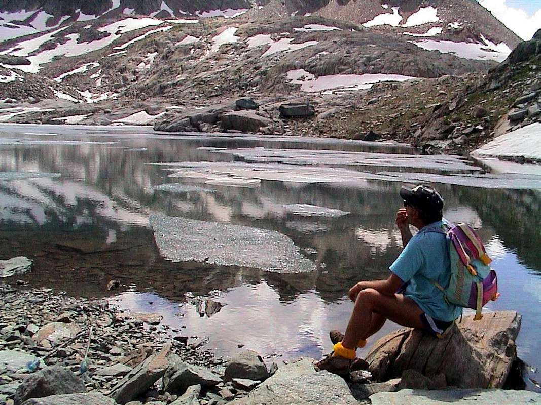
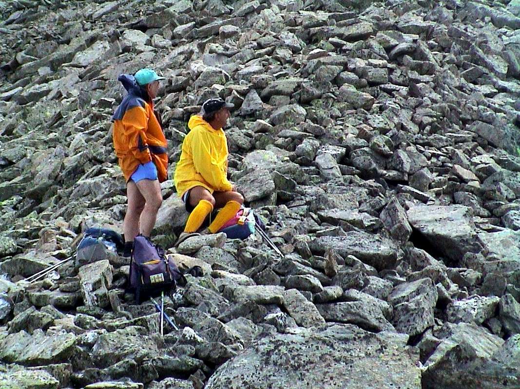
A valley truly "wild". When parts to climb Valeille you is bad. The thought of along this narrow and endless valley becomes stressful. When he gets to the moraines, which lead to the promontory where is located the Bivouac Antoldi-Malvezzi, you're even worse. I can not forget the insults that I threw Emilio in October 2006, asking when we would arrive. But if they had moved the bivouac higher, because the other two before the avalanche had swept plunging them on the underlying westerner Glacier Valeille, it certainly was not my fault. However arrived. I arrived there on other occasions, but I can not forget that time in August of 1981 in which, just arrived from a full month of the sea and therefore without training, "Crevassino" I was "forced" to do the Ondezana. In the day, from Lillaz. They were his jokes, true "Scoundrel". In comparison in 1984 when I was "drunk" the entire journey of the three drills Valeille, to Punta Scatiglion and the Ondezana and return to Lillaz had seemed almost a walk. Despite the horrid Western Gully and complaints of "Lupetto" and Maurizio, who bet that we would never come. Ah, these young people are never happy! Yet we had a good sleep at the bivouac. Incidentally if the call Valeille a plea must also exist. to me that final "radical eille" was added in a pejorative. Not because it is a bad vallon. Nevertheless, indeed is so wild, how wonderful. But it was certainly the maximum for the villagers of past centuries, when the mountaineering was not yet born, and nobody cares. There were no mines, pastures were small and confined between those two impressive coastal find their climax in the final of the Tower Gran San Pietro and also the Teleccio Pass to go Piedmont, some nice problem created. We do not speak of the other to the East in the stretch that goes from Bardoney Hill, (after passing the Lavina Tower, Grande Arolla, the three Forzo Top., Roccia Azzura and Sengie) coming this far. On the opposite side there are only internal crossings with Valnontey and to navigate it's best to go around below. Above the mountain range becomes "more bitter and bad" going up to the Apostles Group. The credit then to have enhanced this valley lies with the Mountaineers, but then maybe not too much, because upward around here you can count them on your fingers. So is the Hunters of Alps, but before the opening of the National Park of Gran Paradiso. In 1922 ...
The Vallons most important & the recommended Excursions (9)
.
1) - Lillaz Hamlet, Great Boulder (1.607m, 1.750m): Walk with path in South to the Great Boulder at the beginning of Valeille Vallon (T/F; 0h'45/1h'00).
2) - Lillaz, Valeille Alp (1.607m, 1.902m): Walk-Excursion with path in South to fork 1.910 meters, near Valeille Alp (E/F; 1h'15/1h'30).
3) - Valeille, Arolla Alps near Casotto P.N.G.P. (1.902m, 2.258m): Excursion with path in East to Arolla Northern Pass (2.915m) (E/F+; 3h'45/4h'15).
4) - Fork 1.910 meters near Valeille Alp: Excursion with path and traces in terminal part in South to Guido Antoldi-Laura Malvezzi Bivouac (2.920m) (EE/F; 3h'45/4h'15).
5) - Antoldi-Malvezzi Bivouac: Climbing in Southwest crossing Valeille Western Glacier to Teleccio Pass (3.312m), below Gran San Pietro Tower (A/F+; 1h'45/2h'00).
6) - Teleccio Pass: Climbing in Southeast through Northwest Ridge to Punta Ondezana (3.487m), in East of Apostles (A/F+; 1h'00/1h'15).
7) - Antoldi-Malvezzi Bivouac, Eastern Valeille Glacier: Climbing with great traverse crossing in East the glacier and through Western Gully of Northeast Valeille Pass (3.121m) and subsequent traverse on watershed through Valeille Northeast, Central Summits, Valeille Southwest Pass, Southwest Top, Scatiglion Pass and Punta (3.298m, 3.311m, 3.201m, 3.357m, 3.291, 3.397m) to Punta Ondezana and Teleccio Pass (A/PD+/AD; approximately from 8 to 10 hours).
8) - Fork 1.910 meters neighbor the Valeille Alp: Excursion-Climbing pathless in West into Gran Val with scarce traces in terminal part to Valmiana or Vermiana Pass (3.090m); from this by South-southeast Ridge to Punta Valmiana (3.202m) (EE/A/F+/PD-; 4h'15/4h'45). Also from altitude about 3.200 meters in Gran Val direcly by Southeast Slope (EE/F+; 3h'45/4h'15). And moreover from the path before the cross in West without paths into Maqueneille Vallon and previous route EE/F+; same time)
9) - Lillaz Hamlet, fork 2.350m: Excursion with path in Southwest towards the alternative 2.350 meters (path from Cogne) to Punta Fenilia (+; 3.053m) (E/F; 3h'45/4h'15).
Un vallone veramente "selvaggio". Quando parti per salire la Valeille ti vien male. Il pensiero di percorrere questo stretto ed interminabile vallone diventa stressante. Quando poi arrivi alle morene, conducenti al promontorio dove é collocato il Bivacco Antoldi-Malvezzi, stai ancor peggio. Non posso dimenticare gli improperi che mi lanciava l'Emilio nell'Ottobre 2006, chiedendomi quando saremmo arrivati. Ma se avevan spostato il bivacco più in alto, perchè gli altri due precedenti la valanga aveva spazzato facendoli precipitare sul sottostante Ghiacciaio Occidentale di Valeille, non era certamente colpa mia. Comunque arrivammo. Lì ero giunto già in altre occasioni, ma non posso dimenticar quella volta nell'Agosto del 1981 in cui, appena arrivato da un mese completo di mare e quindi senza allenamento, "Crevassino" mi aveva "obbligato" a far l'Ondezana. In giornata, da Lillaz. Erano i suoi scherzi, da vero Birbone". In confronto quando nel 1984 m'ero "bevuto" l'intera traversata delle tre Punte Valeille, fino alla Punta Scatiglion ed all'Ondezana e ritorno a Lillaz m'era sembrata quasi una passeggiata. Nonostante quell'orrido Western Canalone ed i piagnistei di "Lupetto" e del Maurizio, che scommettevano che mai saremmo arrivati. Ah, questi giovani non son mai contenti! Eppure avevamo fatto una bella dormita al bivacco. Daltronde se la chiamano Valeille un motivo deve pur esserci. Per me quel terminale "radical eille" é stato aggiunto in modo spregiativo. Non perchè sia un brutto vallone. Tuttaltro, anzi è tanto selvaggio, quanto splendido. Ma non era certamente l'ultra top per i valligiani dei secoli passati, quando l'Alpinismo non era ancor nato e non fregava a nessuno. Non c'eran miniere, i pascoli eran piccoli e ristretti tra quelle due impressionanti costiere che trovano il loro apice finale nella Torre del Gran San Pietro ed anche il Colle di Teleccio, per andar in Piemonte, qualche bel problema lo creava. Non parliamo degli altri ad Oriente nel tratto che và dal Colle di Bardoney, (dopo la Lavina passando la Grande Arolla, le tre Sommità del Forzo, la Roccia Azzurra e le Sengie) giungendo fino a questo punto. Dalla parte opposta esistono solo valichi interni con la Valnontey e per traversar é meglio fare il giro sotto. Sopra la catena montuosa diventa sempre "più aspra e cattiva" salendo verso gli Apostoli. Il merito quindi di avere valorizzato questo vallone spetta agli Alpinisti, ma poi forse neanche troppo, perché sù da queste parti li potete contar sulla punta delle dita. Allora é dei Cacciador d'Alpe, ma prima dell'apertura del Parco Nazionale del Gran Paradiso. Nel 1922 ...
Valnontey
A valley too busy. Surely it is the walloon, almost a valley, the most popular of the whole Val de Cogne or at least the most characteristic. Indeed, even if Lillaz, at least in the summer, knows a large influx, for Valnontey this fact occurs throughout the year. The "Marciagranparadiso" reaches them both, but while "touches" the first, "wraps" the second completely. In summer, however, are the masters of the Horses, offering great walks, starting and arriving in a few tourist stall. But his true calling is another; its essence is Mountaineering. Big and beautiful mountains unfold from East to West, where end with the slender pyramids of Grivola and Gran Nomenon. If it goes to Gimillan Dzimillan or you can see it all. Without even paying a cent or, if you like, a dollar. Start on the left with the tracks of downhill skiing under the Montseuc and above the beautiful forest of Sylvenoire. Then, slowly, goes forming pyramids of Fenilia, of Vermiana and Valletta. Here begin the ice that spread at the foot of Pointe Tsissettaz and two Punte Patrì. Then "explodes" the Chain of the Apostles with the Towers of Sant'Orso, St. Andrea and Gran San Pietro, now the border with Piedmont. With a turn off and the patient reaches the watershed Becco of the Pazienza, the Roccia Viva and, down there down, Becca of Gay. The name makes it clear to us that we are increasingly projected towards this region. But the three North Walls, with their steep chutes, remind us that we are always on the ground Aosta Valley, with its glaciers that reach from Money Grand Crou to turn into a massive flood with the upset of the Tribolazione (Tribulation) Glacier. At the foot of the Punta Ceresole, but especially those in the Gran Paradiso, which falls on the same with his beautiful and icy East Wall. From here the watershed with the adjacent Valsavarenche drops very long towards the North, reaching the first Herbetet then La Grivola and Gran Nomenon, where "dies" over the Central Valley of Dora Baltea. Here, as in Savarenche, to see the top you have to "get out" from population centers: one discovers gradually that you follow the valley that goes to his heart, like a big wedge. Or go upwards to Gimillan Hamlet. The Bivouacs of Money, Martinotti, Borghi, Gerard-Grappein and Pol "heartened" a little the Mountaineers should expect great labors. But on this side of the "Granpa" not allowed" so easily and you should ask the pass bypassing the Roc to put your foot on the Glacier of the Gran Paradiso, on the Normal Way from Valsavara, passing through the Vittorio Emanuele II° Refuge. Or face hard walls or walk along the long ridge that rises North by Piccolo (Little) Paradiso. Here nothing is given to you, even if you face the first easy excursions to the beginning: they are long and require good hocks ...
The Vallons most important & the recommended Excursions (19)
.
1) - Valnontey Hamlet, Vermiana Alpage (1.674m, 1.729m): Walk with path in South to the Pasture at the beginning of Valnontey Vallon (T/F; 0h'40/0h'50).
2) - Vermiana Alp, fork before Eurfalets Bridge (about 1.800 meters, 1.826m): Excursion-Climbing from Valnontey Village with path in Southeast through Comba Couteleina towards Money Alp and Bivouac (2.334m, 2.872m), below Southern Punte Patrì and Patrì/Coupè de Money Glaciers (EE/A/F+; 3h'15/3h'30).
3) - Vermiana Alp: Excursion-Climbing from Valnontey Village before with path in South, after pathless through Comba Valletta towards Tsissettaz or Cissetta Glacier and Punta (3.417m), by North Slope (A/F+; 4h'00/4h'30).
4) - Money Bivouac: Excursion-Climbing from bivouac with traverse in Northeast to Patrì Pass (3.359m) (A/PD/PD+; 4h'00/4h'15).
5) - Money Bivouac: Climbing from bivouac to South and North Punte Patrì (3.579m, 3.558m), by Northwest Face right side, above Patrì Glacier (A/PD+/AD; 3h'15/3h'45).
6) - Money Bivouac: Climbing bivouac, crossing Coupé de Money Glacier to Pass (3.383m) and Sant'Orso Tower (3.618m), by West-northwest Face (A/PD-; 3h'15/3h'30).
7) - Money Bivouac: Climbing bivouac, crossing Coupé de Money and Money Glaciers to Gran San Pietro Tower (3.692m) by West-northwest Face and crossing (Apostles Great Traverse) to Sant'Andrea Southern and Northern, Sant'Orso Tower (3.640m, 3.643m, 3.610m) (A/PD-/PD+; 5h'30/6h'30).
8) - Alessandro Martinotti Bivouac: Excursion before in South from Valnontey towards Eurfalets Bridge (1.825m-1.846m) along Valnontey Torrent, after in Southeast towards Alessandro Martinotti Bivouac (2.588m), below Roccia Viva, Becca di Gay and two Eastern Gran Crou Glaciers (EE/F; 3h'00/3h'15).
9) - Alessandro Martinotti Bivouac: Climbing from bivouac to Low Gran Crou Glacier and crossing in South Hanging Gran Crou Glacier, by West-northwest Spur (avoiding initially with workarounds on Southern side, and after completely in edge) of Roccia Viva (3.383m) or Standard Route by Cogne (A/F+PD-; 5h'00/5h'30).
10) - Alessandro Martinotti Bivouac: Climbing from bivouac to Lower Gran Crou Glacier and crossing in South Hanging Gran Crou Glacier, by West-northwest "Crestone" on Northwest Wall of Roccia Viva in parallel to the North than the Standard Route (A/PD+/AD+/AD-; 6h'15/6h'30).
11) - Stefano Borghi Bivouac: Excursion in South from Valnontey towards Eurfalets Bridge (1.825m-1.846m) along Valnontey Torrent to Stefano Borghi Bivouac (2.684m), on Gran Crou Western Glacier below Roccia Viva western Face and Becca di Gay Northern Wall (EE/F; 3h'15/3h'30).
12) - Stefano Borghi Bivouac: crossing in South Gran Crou Glacier to North Wall of Becca di Gay (3.621m), by icy Central Gully direct to Top (A/D-; 5h'30/6h'30).
13) - Stefano Borghi Bivouac: crossing in South Gran Crou Glacier to Gran Crou Pass (3.305m), by West Ridge of Becca di Gay or Normal from Cogne (A/D-; 5h'00/5h'30).
14) - Carlo Pol and Ettore Grappein-Marcello Gerard Bivouacs: Excursion in South from Valnontey towards Eurfalets Bridge (1.825m-1.846m) before along Valnontey Torrent with path and after with traces on hanging rocky promontory to two bivouacs (3.183m), near "Barma des Bouquetins" at the beginning of Ghiacciaio della Tribolazione (A/F+; 5h'00/5h'30).
15) - Carlo Pol and Grappein-Gerard Bivouacs: Crossing in South on Glacier de la Tribolazione to Punta di Ceresole (3.777m), through North Slope (A/F+; 2h'30/3h'00).
16) - Carlo Pol and Grappein-Gerard Bivouacs: Crossing South on glacier to Cresta Gastaldi (3.894m), Col de l'Abeille (3.873m), by North Slope (A/F+; 2h'40/3h'10).
17) - Col de l'Abeille (3.873m): Clinbing in West, through East Face and Eastern "Crestone", to Roc del Gran Paradiso (4.026m) and traverse towards the Gran Paradiso (4.061m), through Normal Route on South Slope by Gran Paradiso Glacier (Valsavarenche Via from Vittorio Emanuele II° Refuge) (A/F+; 1h'15/1h'30).
18) - Carlo Pol and Grappein-Gerard Bivouacs: Crossing in West-southwest on Tribulation Glacier to East icy Face Gran Paradiso (4.061m) (A/AD/AD+; 4h'30/5h'00).
19) - Carlo Pol and Grappein-Gerard Bivouacs: Crossing in West on Tribolazione Glacier to East icy Face Piccolo Paradiso Northern and Southern Summits (N or Punta Farrar 3.925m, S or Méridional 3.926m) and traverse towards Col du Petit Paradis (3.870m) and final part through indented Nort-northeast Ridge (A/PD/PD+; 5h'30/7h'00).
Un vallone anche troppo frequentato. Sicuramente é il vallone, quasi una valle, più frequentato dell'intera Val de Cogne o perlomeno il più caratterizzante. Infatti anche se la Frazione di Lillaz, almen in estate, conosce un grande afflusso, per Valnontey questo fatto si verifica per tutto l'anno. La "Marciagranparadiso" le raggiunge entrambe, ma, mentre "sfiora" la prima, "avvolge" completamente la seconda. In estate invece la fan da padroni i Cavalli, che propongono grandi passeggiate, partendo ed arrivando tra qualche bancarella turistica. Ma la sua vera vocazione é altra; la sua essenza é Alpinistica. Grandi e belle montagne si dispiegano da Oriente ad Occidente, dove terminano con le slanciate piramidi della Grivola e del Gran Nomenon. Se si và a Gimillan o Dzimillan si può ammirar il tutto. Senza neppure pagare un centesimo o, se volete, un dollaro. Inizia a sinistra con le piste di Sci da discesa sotto il Montseuc e sopra il bel bosco di Sylvenoire. Poi, pian piano, sale formando le piramidi della Fenilia, di Vermiana e Valletta. Qui iniziano i ghiacci che s'allargano ai piedi della Tsissettaz e delle Patrì. Poi "esplode" la Catena degli Apostoli con le Torri di Sant'Orso, Sant'Andrea e del Gran San Pietro, ormai al confine con il Piemonte. Con un giro largo e paziente lo spartiacque raggiunge il Becco della Pazienza, la Roccia Viva e laggiù, in fondo, la Becca di Gay. Il nome ci fà capire che siam sempre più proiettati verso questa regione. Ma le tre Pareti Nord, con i loro ripidissimi scivoli, ci ricordano che siamo sempre in terra valdostana, con i suoi ghiacciai che da Money raggiungon quelli di Grand Crou per tramutarsi in un'immane fiumana con lo sconvolto Ghiacciaio della Tribolazione. Ai piedi della Punta di Ceresole, ma, soprattutto, a quelli del Gran Paradiso, che scende sopra il medesimo con la sua bella e ghiacciata Parete Est. Da qui lo spartiacque con l'adiacente Valsavarenche scende lunghissimo verso Settentrione raggiungendo dapprima l'Herbetet e poi La Grivola ed il Gran Nomenon, dove "muore" sopra la Valle Centrale della Dora Baltea. Anche qui, come nella Savarenche, per veder la cima devi "uscire" dai centri abitati: si scopre a poco a poco che tu segui la valle dirigentesi verso il suo cuore, come un grande cuneo. Oppure vai sù a Gimillan. I Bivacchi di Money, Martinotti, Borghi, Gerard-Grappein e Pol "rincuorano" un pò gli Alpinisti che debbon aspettarsi grandi faticate. Ma da questa parte il "Granpa" non si concede" sì facilmente e devi chiedere il lasciapassare scavalcando il Roc per mettere piede sul Ghiacciaio del Gran Paradiso, sulla Via Normale da Valsavara dall'Emanuele II°. Oppure affronti ostiche pareti o percorri la lunga Cresta Nord che sale dal Piccolo. Qui nulla viene a te regalato, anche se affronti le prime facili escursioni all'inizio: son lunghe e richiedono buoni garretti ...
Lauson Tableland
Friendship doing with Ibex. When you climb the Rifugio Vittorio Sella with that mule full of people, which increases even more the level of dust, you know you're coming out of the Gran Paradiso. If you mean by this term that sea of ice that extends in a large district that goes from Punta Tsissettaz Gran Serra or Grand Sertz. The long North Buttress coming down from the Summit to form four elevations of the Piccolo Paradiso, the Herbetet and Grand Sertz slopes with other top seeds unknown reaching the Col Lauson or Lauzon. This opens up a new world, "more Human". What you see above? No, only those at the top to "Granpa", indeed even because they are hidden behind the Madonna, hidden from the true Top. But here you go back to normality with a multitude of people. Even too much. And you can also see many animals. In every sense. Everywhere marmots, chamois and ibex in herds that approach even up to two/three meters. Then blow with the nostrils to make it clear to you that you are bothering them and turn away from the Lake of the Lauson then move towards the Pastures of Herbetet, well below the Leonessa Bivouac. The close Col Lauson, over there in front and bottom of the vallon, awaits the masses, who, arriving punctually from Valnontey and Eaux Rousses Valsavarenche. Yes, because in the end we are still in Valnontey, two steps from Cogne, and this our subdivision is completely arbitrary. Hopefully it will not get upset the Mayor and its "Cogneins", inhabitants. Why, speaking tourists, this is the place that "attracts more". Then come Lillaz and Gimillan. Only that there are those who want to eat "polenta" (mash of cornmeal with chamois) and suede or lie in the sun on the terrace of Dzimillan to enjoy a coffee watching the postcard of Valnontey, that unfolds in the face. At best, ranging upward to fish to the Lakes Lussert or the Corona, but they come in a few; because my friend Antonio looks at them in the wrong way. If you make noise fish remain hidden and are not older. And that Antonio knows him well, for which thing, if they ask for road travel time, it doubles. So almost all come back. But if the "run" just bad, "pas des problèmes". Salt Lakes of Middle, Upper and High, where everyone disappear. Every now and then, out of desperation, continues towards Col des Laures. Those who goes to Lillaz, in addition to eating well, he went to see the Falls, arrives at the great boulder at the beginning of Valeille or, just walk, go to the Refuge "Sogno di Berdzé" ("Dream by Shepherd"). Some brave and "desperate" climb the ice falls, there are also Valnontey. However, coming back to us, if you want to go out when you're at Sella Shelter from the slopes of the mass is not a problem. Bypasses the hills of the Nera or the Rossa and you face the "La Grivola Bella" by Giosuè Carducci, in a large balcony above the Glacier Trayo or Trajo and still Traso and in a flash reach the Punta Rossa or even the Grivola. If you own the big problems and you are a little misanthropic, go left upwards to the wild walloon that leads to the Grand Sertz or, worse, you make a buck from large camel and join the Leonessa Bivouac. At the foot of The Herbetet and Becca of Montandayné. But you are a person who has great existential problems. Then, finally, we have already met the "Crazy People" that there are in a day from Valnontey. Perhaps under a beautiful and heavy snowfall. It also managed to arrive ...
The Vallons most important & the recommended Excursions (10)
1) - Valnontey Hamlet, Vittorio Sella Shelter (1.674m, 2.579m): Walk-Excursion with path-muletrack in Westsouthwest towards "Alpine Gardner Paradisia", Waterfall 1991 metres, Toule Pasture (2.111m) and Gran Lauson Alpages (2.506m), Casotto P.N.G.P. and refuge, at the beginning of Lauson Tableland (T/E/F; 1h'40/2h'00). 2) - Vittorio Sella Refuge: Walk-Excursion "Tour of Herbetet" with path-muletrack in South towards two Lauson Ponds (2.655m, 2.636m), Penna Sengia (2.660m), Grand Vallon, Plan de Resellaz (2.526m), l'Herbetet Alp (2.441m), Casotto P.N.G.P. (2.395m) and descent to fork 2.060 meters over Valnontey Torrent (T/E/F; 2h'00/2h'30). 3) - L'Herbetet Alp, Casotto P.N.G.P.: Excursion with a) - muletrack-path before in West-northwest, after Southwest towards Lionello and Lucio Leonessa Bivouac (2.910m). Or from b) - Valnontey, Vermiana, Pont des Eurfalets, fork 2.060 meters, Herbetet Alp also called "Casolari dell'Herbetet" (EE/F; 4h'30/5h'30 and by b) - 3h'45/4h'15). 4) - Lionello and Lucio Leonessa Bivouac: Climbing from bivouac in Southwest, through saddle 3.272 meters, crossing Tsasset Glacier, passing in East under Fenêtre de Tsasset (3.673m), to Becca di Montandayné (3.840m), by Northeast Face or Normal Route by Cogne (A/F+/PD-; 3h'45/4h'15). 5) - Leonessa Bivouac: Climbing from bivouac in West, through Eastern Crest of Herbetet (3.778m), or Standard Route by Cogne (A/PD-/PD; 3h'30/4h'00). 6) - Sella Refuge: Climbing pathless in Southwest through Lauson, Grand Vallon Glaciers to Gran Serra or Sertz (3.553m) by Northeast Face (A/F+; 3h'30/4h'00). 7) - Sella Refuge: Excursion with path-muletrack in West towards Lauson or Loson Hill (3.296m), between Pointe du Tuf/Becca de Vermianaz (T/E/F; 1h'45/2h'15). 8) - Sella Refuge: Climbing before with path in Northwest, after traces through moraines to Col de la Noire (3.487m), by South-southeast Slope (EE/A/F+; 2h'15/2h'45). Crossing possibilities to Punta Nera and Bianca (3.683m, 3.787m), by Northeast Ridge or in right to Punta Rossa (3.625m), by Northwest Face (A/F+; both 1h'00/1h'15). 9) - Sella Refuge: Climbing before with path in Northwest to fork 3.094 meters, after North to Rossa Hill (3.190m), by South Slope (EE/F+; 2h'15/2h'45). Crossing possibility to Punta Rossa (3.625m), doubling right East Wall connecting with North-northeast Ridge in altitude 3.364 meters (Route from Gratton Bivouac) (EE/A/F+; 1h'30/1h'45). 10) - Sella Refuge: Excursion before with path in Northeast to Tête Crocheneuille (2.638m), after North with traverse to saddle 2.492 meters, between Monte Herban (3.001m) and Pointe-de-l'Ouille (2.522m) (E/F; 1h'30/1h'45). Chance to get both the Tops by the Northeast Slope (Herban) or South Crest of l'Ouille (EE/F+; calculate 1h'30 more).
Facendo Amicizia con gli Stambecchi. Quando si sale al Rifugio Vittorio Sella con quella mulattiera piena di gente, che aumenta ancor più il livello della polvere, capisci che stai uscendo dal Gran Paradiso. Se per questo termine tu intendi quel mare di ghiacci che s'estende in un grande circondario che và dalla Punta Tsissetta alla Gran Serra o Grand Sertz. Il lungo Contrafforte Settentrionale che scende dalla Sommità formando le quattro elevazioni del Piccolo Paradiso, l'Herbetet ed il Grand Sertz digrada con altre cime semi sconosciute raggiungendo il Col Lauson o Lauzon. Qui s'apre un nuovo mondo, "più Umano". Cosa vedi in precedenza? Nessuno, solo quelli in vetta al "Granpa", anzi neppur loro perché son nascosti dietro la Madonnina, occultati dalla vera Sommità. Qui invece si torna alla Normalità con una infinità di Gente. Anche troppa. E si vedono anche molti Animali. In tutti i sensi. Marmotte dappertutto, camosci a branchi e stambecchi che s'avvicinano anche fino a due o tre metri. Poi soffian con le narici per farti capire che li stai disturbando e s'allontanano verso il Laghetto del Lauson per poi indirizzarsi verso i pascoli dell'Herbetet, ben sotto il Bivacco Leonessa. Lo stretto Col Lauson, laggiù davanti ed in fondo al vallone, attende le masse, che, puntualmente arrivano da Valnontey e da Eaux Rousses in Valsavarenche. Si, perché alla fin fine siamo ancora nella Valnontey, a due passi da Cogne, e questa nostra suddivisione risulta completamente arbitraria. Speriamo che non si arrabbin il Sindaco ed i "Cogneins". Perché, turisticamente parlando, questo è il posto che "tira di più". Poi vengon Lillaz e Gimillan. Soltanto che là van quelli che voglion mangiar polenta e camoscio oppure stendersi al sole sui dehors di Dzimillan per gustarsi un buon caffé guardando la cartolina della Valnontey, dispiegantesi a fronte. Al massimo van sù a pescare ai Laghi Lussert od al Corona, ma arrivan pochi; perché il mio amico Antonio li guarda in malo modo. Se fan baccano i pesci rimangono nascosti e non vengon sù. E questo Antonio lo sà bene, per la qual cosa, se gli chiedon per strada il tempo di percorrenza, lo raddoppia. Così tornan quasi tutti indietro. Ma se gli "gira" proprio male, "pas des problèmes". Sale ai Laghi di Mezzo, di Sopra e Alto, dove spariscon proprio tutti. Ogni tanto, per disperazione, continua verso il Col des Laures. Chi invece và a Lillaz, oltre a mangiar bene, si reca a veder le Cascate, arriva al gran masso all'inizio della Valeille oppure, pochi a piedi, vanno al Rifugio "Sogno di Berdzé" o "Sogno del Pastore". Alcuni "bravi e disperati" salgon le belle cascate di ghiaccio, che ci sono pur in Valnontey. Però, tornando a noi, se quando sei al Sella vuoi uscir dalle piste della massa non é un problema. Scavalchi i Colli della Nera oppure della Rossa e ti trovi davanti "La Grivola Bella" di Giosuè Carducci, in un grande balcone al di sopra del Ghiacciaio del Trayo o del Trajo ed ancora del Traso e in un attimo raggiungi la Punta Rossa od addirittura la Grivola. Se proprio hai dei grandi problemi e sei un pò misantropo, vai a sinistra sù pel selvaggio vallone che conduce al Grand Sertz o, peggio, ti fai 'na bella cammellata e raggiungi il Bivacco Leonessa. Ai piedi dell'Herbetet e della Montandayné. Ma sei già persona con grandi problemi esistenziali. Poi, per finir, abbiam già incontrato dei "Mattacchioni" che lì ci van in giornata da Valnontey. Magari sotto fitta nevicata. E vi son anche arrivati ...
Vermiana-Pousset-Trajo-Nomenon's small Valleys
"These are places to Ghosts, Spirits & Devils". f you meet someone upward around here or is a Poor Man who is lost, or an Adventurer with A capital. You may not jokes but also, if it is true that you're Wandering around here. Forget the first walloon that rises to the Pastures of Pousset. This is a safe area, suitable for hikers who climb from Epinel or Crétaz. But in the first case the crossing of the forest of the Grand Bois, with those trees that seems to speak, and the next Phantom of Pousset Lower Alp, with the splendid "Rascards" wooden totally abandoned, some small thrill already do arise. Then above all opens up and you can go to the ancient Punta of Pousset, looming on Epinel, Crétaz and also Cogne. Passing amid large, isolated and lazy ibex, lying on the path, which hardly allow to clear the passage. Higher up, but painfully far away, we find the Bivouac Gratton that allows us an easy journey to Punta Rossa watching Grivola and reconnecting us with the old road that comes from the saddle. Yes, because then this is not merely a continuation of the Lauson Tableland; is only "turned" more to the North and the middle there is the grassy Monte Herban, accompanied by the blade Rocky Pointe-de-l'Ouille. What a contrast! Everything above Cogne. But farther to the Southwest the music changes: a harsh and desolate vallon rises against Glacier Trayo under the "Arete des Clochettes" or the Northeast, the North Ridge in the guise of a "Scimitar" and the beautiful Northeast wall between the two, it stops forcing him to turn to the West. The terrain becomes lunar and the terminal Trayo Pass, with its rocks and crumbling ocher, opens between the homonymous Top and Punta Crevasse with opposite the "Transylvanian" Cathedral Grand Nomenon. The environment becomes spectral and only Gontier Bivouac, naively lying between green meadows, a little reassured by contrast the looming seracs of the Grivola, the jagged spiers of Nomenon certainly inhabited by Devils, and the Ocean of stones coming down from the Passes Belleface and Charbonnière. The descent down to Sylvenoire is in tune with that little path everything turns, as the spiral stairs of Notre-Dame. Imagine us the climb. Ah, let's not forget the vipers that found down even in the country, rolled up on the roadside, now paved, of Sylvenoire ...
The Vallons most important & the recommended Excursions (17)
^^^^^^
Vermiana-Pousset Vallons
1) - Crétaz Hamlet (1.494m): Excursion before with path in Southwest to Ronc, Les Ors Dèsott and Dessus, Vermiana Dèsott (1.663m, 1.944m, 2.052m, 2.093m) Pastures, after Southeast to saddle 2.492 meters, between Monte Herban (3.001m) and Pointe-de-l'Ouille (2.522m) (E/F; 1h'30/1h'45). Chance to get both the Tops by the Northeast Slope (Herban) or South Crest of l'Ouille (EE/F+; calculate 1h'30 more).
2) - Epinel Hamlet (1.436m): Excursion before with path in South to Pianes (1.694m) Pastures, after Southeast, crossing Grand Bois, to Eyfiè and Lower Pousset Alpages (1.950m, 2.176m), below Pointe Pousset (3.045m) (T/E/F; 1h'45/2h'15).
3) - Pousset Inferiore Alps (2.176m): Excursion before with path in Southwest to Upper o Superiore Pousset (2.520m) Alpages and following fork 2.669 meters; after in Northwest with more small path to Pointe Pousset (3.045m), by Southeast Slope and south Crest (EE/F+; 2h'40/3h'10).
4) - Upper o Superiore Pousset (2.520m): Excursion with path in Southwest to fork 2.669 meters, Barme isolated Alp (2.986m), Pousset Pass (3.201m) neighbor Luciano Gratton Bivouac (3.198m), by Northeast Slope (EE/F; 2h'15/2h'30).
5) - Luciano Gratton Bivouac (3.198m): Excursion-Climbing pathless in South-southwest to Punta Rossa (3.625m), by North-northeast Ridge (EEA/F+; 1h'45/2h'00).
Trajo Vallon
6) - Epinel Hamlet (1.436m): Walk with path in South-southwest towards Pianes (1.694m) Pastures, fork 1.995 meters, Trajo Alp (2.035m) (T/E/F; 1h'50/2h'00).
7) - Trajo Alp (2.035m): Excursion with path in West-southwest to Casotto P.N.G.P. (2.155m) and Trajo or Trayo Pass (2.873m) (EE/F+; 2h'15/2h'45).
8) - Trayo Pass (2.873m): Climbing in South through Northern Ridge, with some circumvention in West in final part, to Punta Crevasse (3.302m) (A/F+/PD-; 2h'15/2h'30).
9) - Trayo Pass (2.873m): Climbing in North-northeast through South-southwestern Ridge to Punta del Trayo (3.124m) (A/F+/PD-PD; 1h'00/1h'30).
Nomenon Vallon
10) - Vieyes (1.158m) or Sylvenoire Villages (1.331m): Excursion with path in South towards Petit Nomenon Pasture (1.986m), unnamed Alp (2.027m), footbridge up Grand Nomenon Torrent (2.197m), Mario Gontier Bivouac, neighbor Grand Nomenon Alp (2.323m) (E/F; 1h'30/1h'45).
11) - Gontier Bivouac (2.323m): Excursion with path before in South to sources of Nomenon Torrent; after East with path to Trajo Pass (2.873m) (EE/F+; 1h'20/1h'40).
12) - Gontier Bivouac (2.323m): Excursion with path before in South to fork 2.372 meters ; after Southwest with traces to Belleface Pass (3.095m) (EE/F+; 2h'15/2h'30).
13) - Belleface Pass: Climbing through West-northwest Ridge to La Grivola (3.969m) (A/PD/PD+/AD/AD+; 7h'15/7h'45).
14) - Gontier Bivouac (2.323m): Excursion with path in West-southwest with traces along meadows and moraines to Charbonnière Pass (2.916m) (EE/F+; 1h'45/2h'15).
15) - Charbonnière Pass: Climbing through Northern Crest, with workarounds to the East in the initial part and Southwest in final, to Grand Nomenon (3.488m) (A/PD/PD+; 2h'00/2h'30). As well, by North-northeast "Crestone", starting from traces in altitude 2.596 meters to the base in altitude around 2.750 meters (A/PD-/PD; 3h'00/3h'15).
16) - Charbonnière Pass: Climbing by South-southeast Crest, with various workarounds to the West in West-southwest Slope, to Mont Favret (3.159m) and traverse on watershed to the Top also called Monte Ruje (3.171m) (A/PD-; 2h'00/2h'15).
17) - Vieyes or Sylvenoire Hamlets: Excursion with path in South towards Plan Pessey (1.373m, 1.382m) Pastures; from fork, just after, in West to Casotto P.N.G.P., near Arpissonet also called Chantel Alp (+; 1.999m) and Piana or Plana Hill (2.256m). From this briefly to Becca (2.296m) through short South Crest (E/F; 3h'45/4h'15).
"Questi son posti per Fantasmi, Spiriti & Diavoli." Se incontri qualcuno sù da queste parti o é un Pover'Uomo che s'é sperduto, oppur n'Avventuriero con la A maiuscola. Ma pur Tu non scherzi, se é vero che stai Vagabondando da ste parti. Lasciamo perdere il primo vallone che sale agli Alpeggi del Pousset. Questa é zona sicura, adatta agli Escursionisti che salgon da Epinel o da Crétaz. Però nel primo caso l'attraversamento della foresta del Grand Bois, con quegli alberi secolari che sembra parlin, ed il successivo Villaggio Fantasma del Pousset Inferiore, con gli splendidi "Rascards" in legno totalmente abbandonati, qualche piccolo brivido già fan insorgere. Poi sopra tutto s'apre e si può andare all'antica Punta del Pousset, incombente su Epinel, Crètaz ed anche Cogne. Passando in mezzo a grandi, isolati e pigri stambecchi, adagiati sul sentiero, che a fatica concedono di sgomberare il passaggio. Più in sù, ma faticosamente lontano, troviamo il Bivacco Gratton che ci permette una facile traversata alla Punta Rossa guardando la Grivola e ricollegandoci con la precedente via dal Sella. Si, perché poi questa altri non é che la continuazione del Pianoro del Lauson; é soltanto "girata" più a Settentrione e di mezzo c'é l'erboso Monte Herban, accompagnato dalla lama rocciosa della Pointe-de-l'Ouille. Che contrasto! Il tutto sopra Cogne. Ma più in là verso Sudovest la musica cambia: un aspro e desolato vallone sale contro il Ghiacciaio del Trayo, sotto l'Arete des Clochettes" o Nordest, la Cresta Nord a guisa di "Scimitarra" e la bella Parete Nordest compresa tra le due, che lo arresta obbligandolo a girar ad Ovest. Il terreno diventa lunare ed il terminale Colle del Trayo, con le sue rocce sgretolate e color ocra, s'apre tra l'omonima sommità e la Punta Crevasse con di fronte la Cattedrale "Transilvanica" Gran Nomenon. L'ambiente diventa spettrale e soltanto il Bivacco Gontier, ingenuamente sdraiato tra pascoli verdeggianti, rassicura un poco facendo da contrasto all'incombenti seraccate della Grivola, alle frastagliate guglie del Nomenon, sicuramente abitate dai Diavoli, e l'Oceano di pietrame giù dai Colli Belleface e Charbonnière. La calata giù a Sylvenoire é in sintonia con quel sentierucolo tutto giravolte, come le scale a chiocciola di Notre-Dame. Immaginiamo la salita. Ah, non dimentichiamoci delle vipere che trovate giù anche in paese, arrotolate sul ciglio della strada, ormai in asfalto, di Sylvenoire ...
But what is the True & Sex Symbol of Cogne?
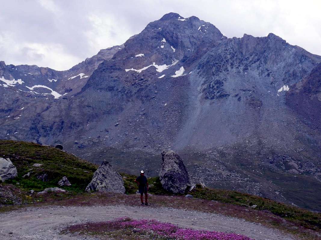
But which is the best representation Mountain Cogne and its Valley? What makes "turn hormones" and enhances the adrenaline for the Mountaineer? What makes him think that he must return to Val de Cogne why must scale at any cost and no makes him sleep at night Logically His Majesty the Gran Paradiso. Easy answer, obvious and almost self-evident. But my grandson Pietro is not okay. For him it is Mont Blanc. But we were sitting on the bench in the square in Lillaz and for him between Cogne and Lillaz there is no difference. Incidentally we told him that we were going in Val de Cogne and not in Lillaz Valley. Problems of elementary logic. But Mont Blanc that appears down there, as in a frame, hence it is not so great. Indeed the Penne Blanche, just above, appears much imposing and more impressive. Always a matter of logic rational ... and perspective. But when we go down to Cogne Peter has no longer any doubt. The Mountain is definitely the biggest Punta Pousset, here hangs over our heads. The "Granpa" not even seen and Grivola now disappears into the shadows of the afternoon progresses. To clarify to him the ideas we bring to Gimillan upward. From there you should understand a little better. Gran Paradiso reddish stands kissed by the last winter sun that illuminates but only a small slice of its Northern Ridge, while the Eastern Wall now is in total shade and does not say anything. The same for the two North Faces of Roccia Viva Becca of Gay now in full sleep. Over there sparkle Tower Lavina and Arolla, but they are too far away. Definitely not "belong" in Cogne. When we return to Cogne Pietro has definitely decided: it is Pousset precisely the most important Symbolic Mountain by Val de Cogne. And, perhaps, was completely right ...
Ma qual'é la Montagna che meglio rappresenta Cogne e la sua Valle? Quella che fà "girar gli ormoni" ed esalta l'adrenalina per l'Alpinista? Quella che gli fà pensar che deve assolutamente ritornare in Val de Cogne perché la deve scalare ad ogni costo e che di notte non lo fà dormire. Logicamente Sua Maestà il Gran Paradiso. Risposta facile, scontata e quasi lapalissiana. Ma il mio nipotino Pietro non é daccordo. Per lui si tratta del Monte Bianco. Ma eravam seduti sulla panchina del piazzale di Lillaz e per lui tra Cogne e Lillaz non c'é differenza. Daltronde gli avevam detto che andavam in Val di Cogne e non in Val di Lillaz. Problemi di logica elementare. Ma il Monte Bianco che appar laggiù in fondo, come in una cornice, da qui non é così grande. Anzi il Penne Blanche, appena qui sopra, appare molto più maestoso. Sempre questione di logica razionale e ... di prospettiva. Però quando scendiamo a Cogne Pietro non ha più alcun dubbio. La Montagna più grande é sicuramente il Pousset, che qui pende sopra le nostre teste. Il Granpa neppur si vede e la Grivola ormai scompar nell'ombra del pomeriggio avanzante. Per chiarirgli l'idee lo portiamo sù a Gimillan. Da lì dovrebbe capire un pò meglio. Il Gran Paradiso rossastro si staglia baciato dall'ultimo sole d'inverno che però illumina solo una piccola fetta della sua Cresta Settentrionale, mentre la Parete Orientale ormai trovasi in ombra totale e non dice più niente. Lo stesso per le due Pareti Nord di Roccia Viva e della Becca di Gay ormai in pien sonno. Laggiù scintillano la Torre di Lavina e le Arolla, ma son troppo lontane. Sicuramente non "appartengono" a Cogne. Quando torniamo a Cogne Pietro ha decisamente deciso: é proprio il Pousset la Montagna più importante di Cogne. E, forse, aveva pienamente ragione ...
Within the borders of the P.N.G.P. (Parco Nazionale del Gran Paradiso), at the moment (summer 2004), dogs generally are not allowed, except on a couple of trails, and camping is forbidden (except for climbers from sunset till dawn). No fees are due.
Books and Maps
BOOKS:
"Gran Paradiso itinerari escursionistici" di Franco Brevini, Ed. Musumeci, Luglio 1982.
"Il Parco Nazionale del Gran Paradiso (Valli di Champorcher-Clavalitè-Saint Marcel-Laures-Cogne-Valsavarenche-Conca di Pila" di Giulio Berutto 3/volume 2°, I.G.C., Torino 1981, 2a Ed. 2000.
"I Rifugi della Valle d'Aosta" di Stefano Ardito, Ed. Guide iter, Febbraio 2003.
"A piedi in Valle d'Aosta" (Vol. 2), di Stefano Ardito, Ed. Guide iter, Giugno 2004.
"Diari Alpinistici" di Osvaldo Cardellina e Indice Generale accompagnato da Schedario Relazioni Ascensioni 1964-2019 (inediti).
"Guida dei Monti d'Italia-Gran Paradiso Parco Nazionale" E. Andreis, R. Chabod, M. C. Santis, Club Alpino Italiano/Touring Club Italiano, prima Ed. 1939; seconda Ed. 1963; terza Ed. 1980.
"Guida delle Alpi Occidentali", di Giovanni Bobba e Luigi Vaccarone C.A.I. Sezione di Torino Volume II (parte II), 25 Maggio 1896.
"Rifugi e bivacchi in Valle d'Aosta", di Cosimo Zappelli aggiornata da Pietro Giglio, Musumeci Editore, Luglio 2002.
MAPS:
Kompass "Gran Paradiso Valle d'Aosta Sentieri e Rifugi" Carta Turistica 1:50.000.
Enrico Editore Ivrea-Aosta "Gruppo del Gran Paradiso" 1:50.000.
I.G.C. Istituto Geografico Centrale "Il Parco Nazionale del Gran Paradiso" 1:50.000.
L'Escursionista "Valle di Cogne Carta dei Sentieri" (n° 10) 1:25.000.
L'Escursionista "Tour de la Vallée de Cogne Grand Paradis" 1:25.000.
Parents refers to a larger category under which an object falls. For example, theAconcagua mountain page has the 'Aconcagua Group' and the 'Seven Summits' asparents and is a parent itself to many routes, photos, and Trip Reports.


 4736 Hits
 79.78% Score
 11 Votes