


-
 3648 Hits
-
 79.78% Score
-
 11 Votes
|
|
Area/Range |
|---|---|
|
|
45.73580°N / 7.31375°E |
|
|
Hiking, Mountaineering, Trad Climbing |
|
|
Spring, Summer, Fall, Winter |
|
|
10738 ft / 3273 m |
|
|
Note
La montagna chiama i suoi figli, ed essi rispondono fedelmente al suo appello… Osvaldo Cardellina, Diario alpinistico, 1964-65 Page texts: @ OsvaldoCardellina "Osva", passed away on May 2, 2022. Page owners: Christian Cardellina e Osvaldo Cardellina. Any updates from September 12, 2022: Antonio Giani, page administrator, friend and climbing companion. Testi della pagina: @ OsvaldoCardellina "Osva", scomparso il 2 maggio 2022. Proprietari pagina: Christian Cardellina e Osvaldo Cardellina. Eventuali aggiornamenti dal 12 settembre 2022: Antonio Giani, amministratore della pagina, amico e compagno di salite. |
Arps Alps Alpen Alpages & Pastures GreenOverview
But how many of Arpisson Vallons are in Aosta Valley? For all we know four, in addition to that of Arp above Pré Saint Didier/Courmayeur-Dolonne Municipalities and between Mont Crammont/Tête du Grand Mont and the watershed that descends in Southeast from Tête d'Arp towards Tête de l'Ane, Têtes des Jeunes and des Vieux. To these must be added the "Conca" Arpy above the Common of Morgex and the border to La Thuile, at the foot of Mont Colmet and containing two lakes of Arpy and Pietra Rossa (Red Stone). Keeping the overview clockwise and always starting from the East, let us see what are the other four of their Arpisson: the Vallon Eastern between the Summit of Vauvire and those of Praborna, Petite Roise, Col, Becca and Tour of Salé. Secondary Valley Saint Marcel rises somewhat wild in the direction of the Northern sector of the Group of Grande Roise or Roize and still Roizà or Rouèse (3.357m). After the Vallon middle of Les Laures (three splendid lakes!) above the Municipality of Grand Brissogne, we find the counterpart Western Arpisson, above Pollein Common and between Mont Père Laurent, Becca di Seneva, Col Peckoz, Tête (Head) and Col Blantsette East and Becca di Nona and the Dent West. Closes the valley toward the South, the Monte Emilius (3.559m), which stretches from East to West always with its great Wall North 2 Km long and that goes down by the Black Triangle (3.378m), and Emilius with Little Emilius (3.342m), Mont Ròss de Comboé (3.301m) reaching Col Carrel, which is positioned since July 1984 the Federigo Camp Zullo (2.907m). To find the third or Vallon Southern Arpisson they should, leaving the Central Valley of Dora Baltea, back in Cogne Valley: above the Hamlet of Gimillan or Dzimillan (1.785m) open two large vallons. The first, more to the East, goes up with the name of Grauson opening at the top, in the form of large leaf, towards the branches of Doreire-Tessonet (East) and Lussert the opposite with its four and homonyms lakes (Low, Middle, High and Upper) under the Col des Laures (3.035m).
![]()
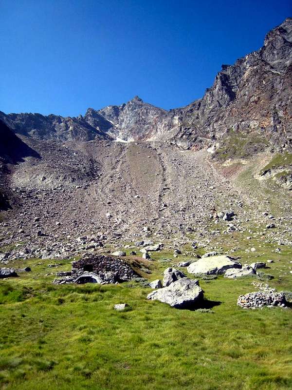
Arpisson Eastern & Western Glaciers into the homonym Western Vallon above Pollein Common by Antonio
![]()
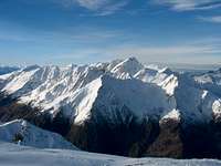
From Epinel or Gimillan Hamlets (Cogne Common & Valley) towards Southern Arpisson Vallon, by livioz
![]()
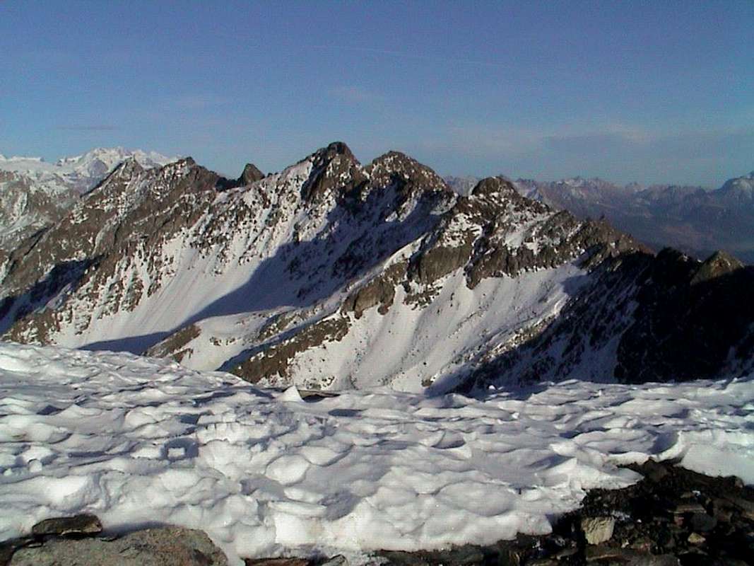
Northern Arpisson Vallon under the Becca of Viou & above Valpelline Municipality, by emilio Bertona aka emilius
![]()
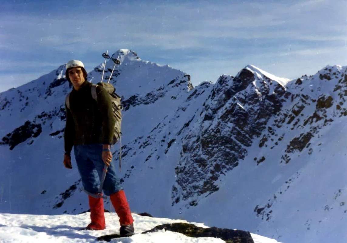
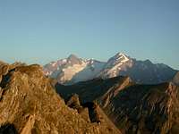
L'Arp Vallon from Mont Crammont and in Southeast under the Mont Blanc Mountain Chain, by Osw
The second, to the West, is to Arpisson, which in turn splits "giving birth" even in the West Vallon of the secondary Tsa Setze (possibility of crossing towards Pila-Resort), above the Hamlet of Epinel. These two are among the congealed Buttress South-southwest of Punta Garin East and Tips Tsavanis and Vadaille or Vedaille West; the head of the valley is closed by the watershed, this time from the Southwest to the Northeast, divides the Valley of Cogne from Vallone Arbolle (Charvensod) and by Basin Pila (Gressan and Charvensod Commons). It stretches from Tsa Setze Hill forming the district of Punta Valletta (3.090m), Punta Pian Bessey towards the Col Garin, immediately above the bivouac Franco Nebbia (2.740m), before rising to Mont Valaisan and still conclude with the Pic Garin (3.451m). Finally, to achieve the ultimate Arpisson or North we cross the Dora Baltea bringing on shore hydrographic left or North and the town of Aosta Valpelline reaching back towards the common of the same name. Immediately to the Southeast of this unfolding of the Vallon Arpisson up to the Hills of Fouillou in Southeast and Viou South-southwest at the Bivouac "Penne Nere or Black Feathers" (2.760m). This, together with Federigo Zullo and Franco Nebbia, are the only points of support included in all of the Vallons Arpisson; otherwise you have to turn to the pastures, as we shall see whence the name of "Arp", while the radical "isson" seems to be aimed at something bigger or better (see Damon or above). The ring of mountains goes from North-northwest (Becca Noail, Colle Fouillou, Punta di Sénevé) to then turn to the Southwest (Tête d'Arpisson, Col Chaudière Northeast, Les Prèles little Summits, Punta di Chamerod, Col Chaudière Southwest and Mont Mary) to finally close to the Northwest (Hill and Becca Viou, Col and Becca di Blavy, Col and Becca Roisan, Tête de Valfreyde or Valfredda).
Ma quanti Valloni dell'Arpisson ci sono in Valle di Aosta? Per quello che ne sappiamo quattro, oltre a quello d'Arp sopra ai Comuni di Pré Saint Didier e Courmayeur-Dolonne e tra il Mont Crammont/Tête du Grand Mont e lo spartiacque che discende a Sudest dalla Tête d'Arp in direzione delle Têtes des Jeunes e des Vieux. A questi si deve aggiungere la piccola "Conca" d'Arpy sopra il Comune di Morgex nonché al confine con quello di La Thuile alla quale é connessa tramite il Colle San Carlo, ai piedi del Mont Colmet e contenente i due splendidi Laghi di Arpy e Pietra Rossa. Mantenendo la descrizione in senso orario e partendo sempre da Est, vediamo quali sono gli altri quattro propri dell'Arpisson: il Vallone Orientale compreso tra la Punta di Vauvire e quelle di Praborna, Petite Roise, Colle, Becca e Tour di Salé. Secondario della Valle di Saint Marcel si innalza verso Sudovest alquanto selvaggio in direzione del settore Settentrionale del Gruppo della Grande Roise o Roize ed ancora Roizà o Rouèse (3.357 m). Dopo il Vallone intermedio de Les Laures (tre splendidi laghi!) sopra il Comune di Grand Brissogne, troviamo l'omologo Vallone Occidentale di Arpisson, sopra il Comune di Pollein e compreso tra Mont Père Laurent, Becca di Seneva, Col Peckoz, Tête e Col Blantsette ad Est e Becca di Nona e La Dent ad Ovest. Chiude la vallata verso Mezzogiorno il Monte Emilius (3.559 m), che si distende sempre da Oriente ad Occidente con la sua grande Parete Nord lunga circa 2 Km. e discendente dal Triangolo Nero (3.378 m), Emilius e Piccolo Emilius (3.342 m), Mont Ròss de Comboé (3.301 m)fino a raggiungere il Colle Carrel, dov'é posizionato dal 28 Luglio 1984 il Bivacco Federigo Zullo (2.907 m). Per trovare il terzo o Vallone Meridionale di Arpisson si deve, abbandonando la Valle Centrale della Dora Baltea, risalire l'intera Valle di Cogne: sopra la Frazione di Gimillan o Dzimillan (1.785 m) esistono due grandi valloni. Il primo, più ad Oriente, sale con il nome di Grauson aprendosi in alto, a guisa di grande foglia, verso i rami di Doreire-Tessonet (Oriente) e Lussert, con i suoi quattro lagni al di sotto del Col des Laures (3.035 m), all'opposto. Il secondo, verso Occidente, costituisce quello di Arpisson, che a sua volta si sdoppia "partorendo" ancora più ad Ovest il secondario Valloncello di Tsa Setze, sopra la Frazione di Epinel (dal colle omonimo traversata a Pila). Questi due sono rappresi tra il Contrafforte Sud-sudovest della Punta Garin ad Est e dalle Punte di Tsavanis e Vadaille o Vedaille ad Ovest; la testata della vallata é chiusa dallo spartiacque che, questa volta da Sudovest a Nordest, divide la Valle di Cogne dal Vallone di Arbolle (Charvensod) dalla Conca di Pila (Comuni di Charvensod e Gressan). Esso si distende dal Colle Tsa Setze formando il circondario Punta della Valletta (3.090 m) e Punta di Pian Bessey fino al Col Garin, appena al di sopra del Bivacco Nebbia (2.740 m), per poi risalire al Mont Valaisan e terminare con il Pic Garin (3.451 m).

Infine per raggiungere l'ultimo Arpisson o Settentrionale dobbiamo attraversare la Dora Baltea portandoci sulla sponda idrografica sinistra o Settentrionale e dalla Città di Aosta risalire piegando verso Nordest alla Valpelline raggiungendo l'omonimo comune. Subito a Sudest di questo si dischiude il Vallone di Arpisson fino a raggiungere i Colli di Fouillou a Sudest sul Contrafforte Settentrionale della Punta di Senevé e di Viou a Sud-sudovest presso il Bivacco "Penne Nere" (2.760 m). Questo, insieme al Federigo ed al Nebbia, costituiscono gli unici punti di appoggio inseriti in tutti i Valloni dell'Arpisson; diversamente bisogna rivolgersi agli alpeggi, donde come vedremo il toponimo di "Arp", mentre il radicale "isson" sembra rivolto a qualche cosa di più grande oppure di superiore (vedi Damon o di Sopra). La cerchia di montagne si distende da Nord-nordovest (Becca Noail, Colle Fouillou, Punta di Senevé) per poi piegare a Sudovest (Tête d'Arpisson, Colle Chaudière Nordest, le due Puntine delle Les Prèles, Punta di Chamerod, Colle Chaudière Sudovest e Mont Mary) per infine chiudersi verso Nordovest (Colle e Becca di Viou, Col e Becca di Blavy, Colle e Becca di Roisan e Tête de Valfreyde o Valfredda).
Little Toponymic Remarks
But what does Arpisson? It sounds simple because the radical Arp is easy to assimilate at Arps, Alps, Alpage, Alpen and so on and so forth. And that suffix "Isson"? Attributable to something larger or which is located in the highest part, type Damon or di Sopra (Upper). From here are the derivations Arpy, Arsy, Ars, Arnouva or Arp Nouva, Lardamon or Arp Damon and Lardamoun ie The Arp Damont. So Arpisson wants to mean a large vallon above. But all the valleys we have above them something and then something does not. Regardless that the Alps are differentiated Le Tramouail, Tramail or Trémail and Tremaille for the intermediate pasture, while the highest, that is the last, is called the La Tsa the word Arpisson may have a different origin and farther then that has been adapted to as I said above. The good Umberto Pelazza in his book "Who knows why they call it so as a walk in the vocabulary of the mountains of Aosta Valley", published by the C.A.I. Aosta in 2011, that the name comes at the root ALP ie "high pasture", this as a result of a migration of peoples Uralo-Altaitici of 3000 BC. In Hungary-Ugric linguistic family anoint this population, coming from Central Asia via Turkey and the Balkans to the North beyond the Engadine Alps and enters in the territories of the Ligurian; these emigrated in France and in Spain (specifically in the Basque Country). It all seems resolved but it is not so, because on page 109, about the Mont Ormelune, speaks of the root OR as a variant of Ar, Arp who along with MEL, ie elevation, then gave "the pasture of the rocks". This mountain is also called Archeboc but could also told Artsabouc scilicet Ar, Tsa and Bouc tying together three words in Alpine style. Others indicate Artse or wooded area but also from Latin Arcta, viz an area with narrow and difficult passage. But still on page 58 Arpisson is connected to Pissevache and Pisonet where to peson, pison and pisonet indicates a stream with small waterfalls see Sorapiss in the Dolomites. The story is not over yet because the Cima d'Entrelor come into play OR and AUR, French variations of Ar and Arp as the underlying Orvieille which was originally Arvieille. In fact, even in the Vallon of Planavalle Pennine Alps we find a Tramail des Ors, while in the adjoining Vertosan just after Col Felita or Fetita (from "feyes" ie sheep) are the Or dei Frà or the Pasture of the Friars. Finally for to conclude, with regard to the Colle dell'Arietta is not a hill quite breezy but Ayette ie small alp between the Valleys of Cogne and Val Soana, while the name Laures (Vallon, Lakes, Hill Punta, Mont) we have the radical Aur as variable of Ar, Arp. This little discussion choose what you like, so you can not please everyone ...
![]()
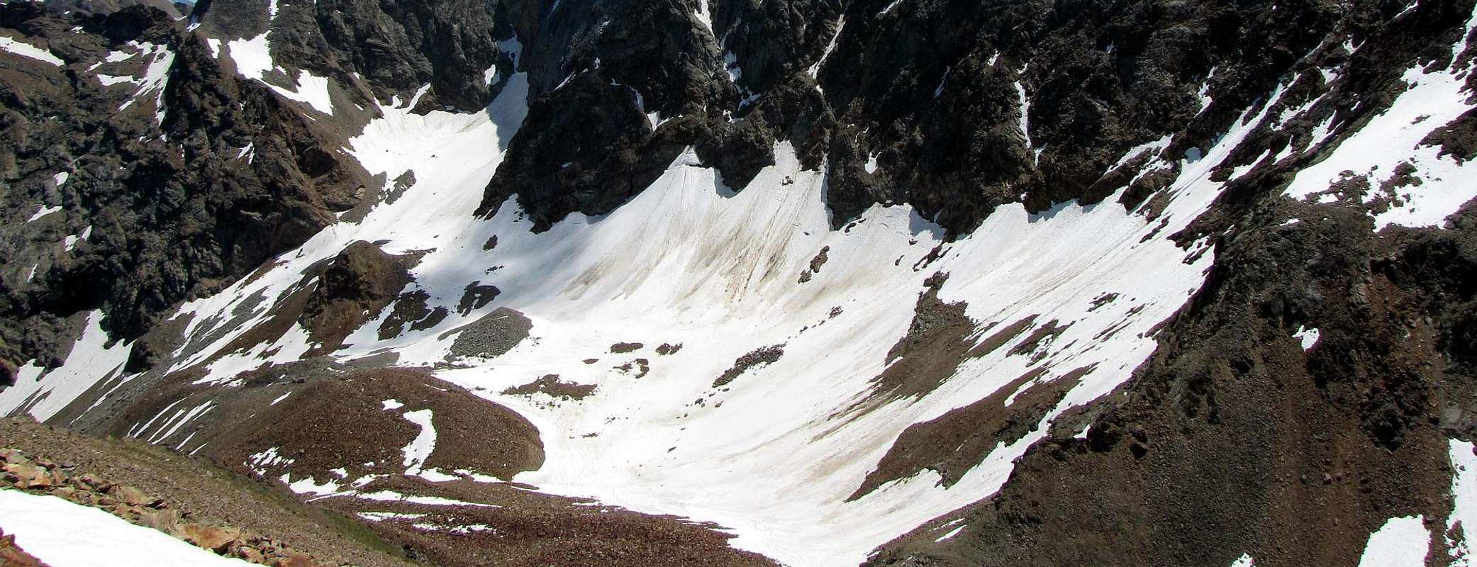
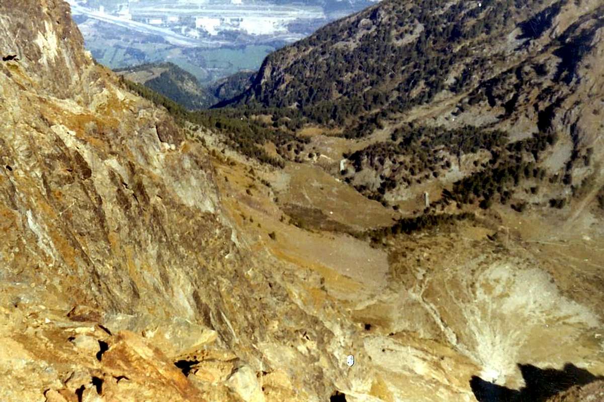
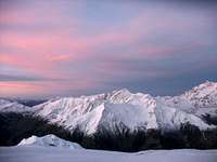
But what does Northern Arpisson?, by Osw
![]()
Eastern Arpisson Vallon above Saint Marcel Municipality, by Cristina Bellone
East Arpisson Vallon up to the Salé Pass (3.008m) and Pt. Roise (3.273m), by Cristina Bellone & Emilio Bertona aka emilius
![]()
Western Arpisson Vallon above Pollein Municipality, by Osw
![]()
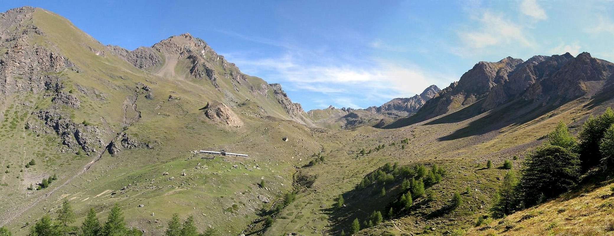
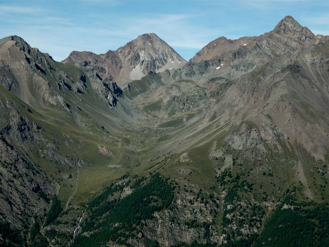
West Arpisson under Emilius & over Pollein, by Camillo Roberto Ferronato
![]()
South Arpisson Vallon with connection (right) above Cogne Common, by Lupino
![]()
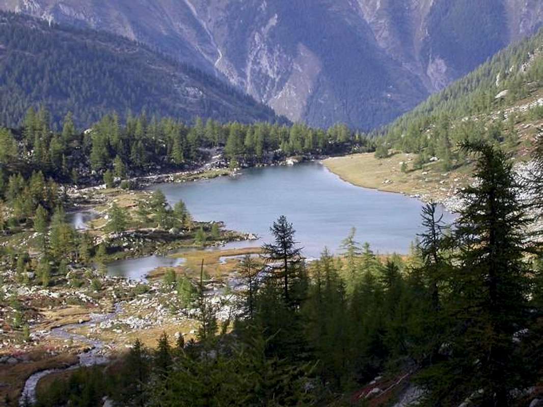
Lake Garin in Upper Southern Vallon Arpisson, by ronfo
Ma cosa significa Arpisson? Sembra semplice poiché il radicale Arp é facile assimilarlo ad Alpe, Alpeggio, Alpage, Alpen e chi più ne ha più ne metta. E quel suffisso "isson"? Da ricondurre a qualcosa di più grande o che si trova nella parte più elevata, tipo Damon ovvero di Sopra. Da qui abbiamo le derivzioni di Arpy, Arsy, Ars, Arnouva o Arp Nouva, Lardamon o l'Arp Damon e Lardamoun cioé L'Arp Damont. Quindi Arpisson vuole significare un grande vallone soprastante. Ma tutti i valloni sono soprastanti a qualcosa ed allora qualcosa non torna. A prescindere che le Alpi vengono differenziate in Le Tramouail, Tramail o Trémail e Tremaille per quelle posizionate in un settore di pascolo intermedio, mentre quella più elevata, cioé l'ultima, vien chiamata La Tsa, la parola Arpisson potrebbe avere un'origine diversa e più lontana che successivamente é stata adattata a quanto detto sopra. Il bravo Umberto Pelazza nel suo libro "Chissà perché si chiama così a spasso nel vocabolario dei monti valdostani", edito dal C.A.I. di Aosta nel 2011, riconduce il toponimo alla radice ALP cioè "alto pascolo", questo a seguito di una migrazione di popoli Uralo-Altaitici del 3000 avanti Cristo. Di ceppo linguistico ungaro-finnico questa popolazione, arrivando dall'Asia Centrale attraverso la Turchia ed i Balcani, oltrepassa a Settentrione le Alpi Retiche ed entra nei territori dei Liguri; da questi emigra in Francia ed in Spagna (precisamente nei Paesi Baschi). Sembra tutto risolto ma non é così, perché a pagina 109, a proposito del Mont Ormelune, parla della radice OR come variante di Ar,Arp che insieme a MEL, cioè elevazione, davano quindi "l'Alpeggio delle rocce". Questo monte é chiamato anche Archeboc ma potrebbe anche detto Artsabouc cioè Ar, Tsa e Bouc legando insieme tre vocaboli prettamente di stile alpino. Altri invece indicano in Artse ovvero zona boschiva, ma anche dalla derivazione latina di Arcta, cioé una zona dal passaggio stretto nonché alquanto difficoltoso. Ma ancora a pagina 58 Arpisson viene collegato a Pissevache e Pisonet dove per peson, pison e pisonet s'indica un corso d'acqua con piccole cascate: vedi il Sorapiss in Dolomiti. La storia non é ancora finita perché per la Cima di Entrelor entrano in gioco OR e AUR, varianti francesi di Ar ed Arp come nella sottostante Orvieille che in origine era Arvieille. In effetti anche nel Vallone di Planavalle nelle Alpi Pennine riscontriamo un Tramail des Ors, mentre in quello adiacente di Vertosan subito dopo il Col Felita o Fetita (da "feyes" cioé pecore) troviamo l'Or dei Frà ovvero l'Alpe dei Frati. Infine e per concludere, per quanto concerne il Colle dell'Arietta non si tratta di un passo alquanto ventilato bensì Ayette ossia piccola alpe tra la Valle di Cogne e la Val Soana, mentre per il toponimo Laures (Vallone, tre Laghi, Colle, Mont e Punta) abbiamo il radicale Aur come variabile di Ar ed Arp. Di questa piccola disamina scegliete ciò che preferite ...
Getting There
BY CAR:
- From TORINO, MILANO, etc: Motorway A5. Exit at IVREA or Quincinetto (PIEDMONT) From IVREA Town: in West towards Pont Saint Martin, Donnas, Bard, Fénis, Saint Marcel, Grand Brissogne, Pollein, Charvensod, Gressan, Jovençan, Aymavilles, Villeneuve, Arvier, Avise, Morgex, Pré Saint Didier Municipalities (Western side). From Courmayeur Resort: in East to Morgex, La Salle, Saint Pierre, Sarre, Aosta, Gignod and Valpelline Municipalities.
- From Saint Marcel (630m) towards Saint Marcel Vallon and Turati Reserve up to the Mulac & Grande Chaux Hunting Houses & Alp (1.937m, 2.370m), by path n° 3. From Pollein (575m; secondary road) or Charvensod (746m; main road and connection) to Martsaouchy Damon (1.416m) at entrance on Arpisson Vallon, through dirt road, and to Arpisson Upper (2.010m) Alps with path n° 13. Towards Federigo Bivouac (2.907m), pathless and through moraines on West Arpisson Glacier. From Charvensod to Dard-Comboé-Arbolle Vallons towards Ponteilles (1.697m) Alp with Waterfall, through private dirt road, Comboé Alp/Saint Ours Shelter (2.114m), through dirt road, and Arbolle Refuge (2.516m), near Lakes (2.497m), by Chair Lift to Chamolé Station (2.309m), Lake (2.325m) and path-muletrack. From Charvensod (Main Road from Pont Suaz 567m) up to the fork 951 meters, the dirt road towards Reverier du Tzat, Dessous, Rongachet, Gorrettaz, Barmes, Martsaouchy Dèsott, Martsaouchy du Meitin Villages or Pastures and Martsaouchy Damon and the subsequent path n° 13 towards Arpisson Upper Pasture. Or from Pollein near Chenaux Fraction with Municipal Road towards Rongachet Village (1.092m) and previous route in the middle-upper part. From Gressan (alternaive Regional Road by the small square Chez-le Ru 610m) towards Leysettaz Dèsott, Tivet Villages and Pila-Resort up to Les Fleurs Fraction (1.414m). But in this case, then you must descend to the Regional Road from Charvensod to the junction 951 meters for Reverier du Tzat and Dessous Alpages. From Aymavilles Municipality (646m) towards Cogne Valley: Vieyes Village (1.132m), Epinel Fraction (1.470m), Crétaz Fraction (1.494m) and Cogne Commune (1.534m) through the main Road and towards Montroz Village (1.707m) and Gimillan Hamlet (1.785m) by Regional Road; from this last towards the Franco Nebbia Bivouac (2.740m), with path (connection) n° 3/TVC in Arpisson Southeastern Vallon and with trail n° 2/3 more in South by Epinel Hamlet. From Morgex (920m), crossing the bridge above Baltea with Regional in South, towards Liarey, Pre Villair, Mont Rotie small Villages, crossroads around 1.275m) just before Tirecagne Pasture (1.532m) and the Main Roads towards Arpy Basin and paths n° 15/16 to Pietra Rossa Loch (2.559m) or Colle della Croce (2.381m). By Pré Saint Didier Common (1.010m) with a short deviation on SS.26 towards the Mont Blanc to reach the Municipal to Champex Hamlet (1.036m), after through paths n° 1/2A. or directly with the trail 2A starting from Dolonne Fraction, la Vittoria locality (1.211m), always reached by the State towards Courmayeur. From Aosta (583m) towards Variney Fraction, just before Gignod Common (994m) and Valpelline Municipality (580m). From this last through the dirt road in Southeast concomitant with the path n° 5/105 towards Planes, Arpisson, Fouillou Pastures up to the Viou Hill and Penne Nere Bivouac (2.698m, 2.760m).
- From FRANCE: through the Mont Blanc Tunnel to Entrèves-crossroads to Vény/Ferret Valleys - Mountain Guides of Courmayeur - La Saxe Rock Gym - Courmayeur. By Little Saint Bernard Pass, closed since November until half May to La Thuile Valley - Pré Saint Didier - Courmayeur. It is not necessary to take Motorway A5: you can drive on SS.26, in the direction of AOSTA - IVREA - TURIN.
BY PLANE:
- Aeroporto "Corrado Gex" Saint Christophe (Aosta).
Eastern Arpisson Vallon
The Eastern Vallon between the Points of Vauvire and those of Praborna (2.852m, 3.128m), Little Roise, Pass, Becca and Tower of Salé. Secondary Valley Saint Marcel rises somewhat wild in the direction of the Northeastern sector of the small Mountain Chain of Grande Roise or Roize and still Rouèse and Roizà (3.357m). Specific Regional Road towards St. Marcel Valley: from the rotunda to the entry of the Country of Saint Marcel, to go up over on a wide bridge the River Dora Baltea, bringing himself in the center of the same in direction of his great Church; to edge it and to continue (manifold indications for which thing, with the purpose not to be wrong, to follow the poster of brown color with the wording "Sanctuary of Plout". To go up again toward South with the regional road in succession toward the Fractions of Crétaz (653m) and then, decidedly toward East, of Jayer (693m) and Mezein (793m); immediately after this point, leaving on the left a ramification that goes down to the Country of Fénis (prohibition of transit for the cars), the road changes completely direction toward Southwest to reach the Village of Réan (898m) and, through a long diagonal, the famous Sanctuary of Plout (898m; * splendid "Via Crucis" in the covered communication trench and before), where from centuries a procession happens departing really from Saint Marcel. Doubling it same the road is again addressed to thin East to a wide hairpin-road, where it reenters toward the preceding direction reaching the Village of Seissogne (1.066m) and, through great grasslands, the following one of Sazailland (1.220m); they follow those of Ronc (1.359m), Viplana (1.346m), Champremier (1.383m), over which he leaves on the left a deviation for the tall alpis of the Commune of Fénis (passable and open to the traffic) to reach the alternative for Porteron and the following place of Leycher (1.506m; famous "Inn of the Devil"). Returning to East, the road leaves in low the short deviation for Low Les Druges (1.567m) to reach later immediately to High Les Druges (1.600m around; beautiful fountain near a small square "rascard" in wood and votive tiny Chapel dedicated to Saint Bernard; path n° 14 to Fontanafredda Pasture (1810m). From Les Druges through the Salé Pass: from upper Les Druges Hamlet locality Pouria Alp (1.586m after the "Les Druges Picnic Area) along the coincident earth road with the path n° 3 that, passing through Vargney Pasture (1.676m; various iron and copper dumpings of mine) and doubling from West to South the terminal rocky-woody promontory of Mont Roux (2.277m), it forwards him in the long Vallon of Saint Marcel, that arrives to homonym hill before the Cogne Valley (* Preserve of Hunting Marquis Turati and the Baron ex Reserve Beck Peck(c)oz) passing under the abandoned coppermines of Servette, among the 1.720 meters and the 1.810 meters. Beautiful turn tourist-excursion through paths n° 15/16, as well as different small paths of connection between the entrance of the various mines and huts in stone of the miners, protected from cyclopic great boundaries and supporting walls, and remains of great cableways. Wanting to effect complete to turn reconnaissance with different departures and slightly crossed to slighty more elevated quota. Departing from the near of the Alp Pouria (place "garages" in to beautiful clearing of lawns with demolished pasture, just immediately under the road; present system of signs as soon as awry near the small torrent) and reaching the first one dark or lower part and old hand the miners' installation, in downfall but with fireplace to standing wall still, for finally to connect him to the precedent itinerary. Besides possibility of prosecution and variation of excursion for the Alpe Lavanché (2.271m), with the path n° 18, along the forest, through the muletrack uses to the transport of the copper and iron minerals ones, with a characteristic passage on stony wall; from the same reenter to soil road through the small path n° 3 to crossroads 1.836m, near Praborna Pasture (1.882m) and its manganesemine. From just before Praborna take trail n° 4G, via the Alp Choulet (1.822m) reach the promontory with Cross over to Arpisson Pasture (1.846m) and, bending more to the West, reaches the Alp Salé (2.215m) right at the mouth of the valley. From here to abandoned Bonplan Upper Alpage (2.383m) and, after transit near the miserable ruins of an alp oldest, through steep moraines and in final small rocks to Salé or of Brissogne Hill and even in old times called Pass of the Grande Roise (3.008m), between Becca Salé (3.137m) and Petite Roise (3.273/4m).

Trattasi del Vallone Orientale, compreso tra la Punta di Vauvire e quelle di Praborna (2.852 m, 3.128 m), Petite Roise, Colle, Becca e Tour di Salé. Secondario della Valle di Saint Marcel si innalza alquanto selvaggio in direzione del settore Nordorientale del Gruppo montuoso della Grande Roise o Roize ed ancora Rouèse e Roizà (3.357 m). Strada Regionale specifica verso il Vallone di Saint Marcel: dalla rotonda all'ingresso del Paese di Saint Marcel, scavalcare su di un largo ponte il Fiume Dora Baltea, portandosi nel centro dello stesso in direzione della sua grande Chiesa; contornarla e proseguire (molteplici indicazioni per la quale cosa, al fine di non sbagliare, seguire i cartelli di colore marrone con la dicitura "Santuario di Plout". Risalire verso Sud con la strada regionale in successione verso le Frazioni di Crétaz (653 m) e poi, decisamente verso Est, di Jayer (693 m) e Mezein (793 m); subito dopo questo punto, lasciando sulla sinistra una diramazione che scende al Paese di Fénis (divieto di transito per gli automezzi), la strada cambia completamente direzione verso Sudovest per raggiungere il Villaggio di Réan (898 m) e, tramite un lungo diagonale, il celebre Santuario di Plout (898 m; * splendida Via Crucis nel camminatoio ricoperto ed antistante), dove da secoli avviene una processione partendo proprio da Saint Marcel. Doppiando lo stesso la strada si indirizza nuovamente ad Oriente fino ad un largo tornante, dove rientra verso la precedente direzione raggiungendo il Villaggio di Seissogne (1.066 m) ed, attraverso grandi praterie, il successivo di Sazailland (1.220 m). Seguono quelli di Ronc (1.359 m), Viplana (1.346 m), Champremier (1.383 m), oltre il quale si lascia sulla sinistra una deviazione per le alte alpi del Comune di Fénis (transitabile ed aperta al traffico) per raggiungere il bivio per Porteron e la successiva località di Leycher (1.506 m; rinomata "Locanda del Diavolo"). Ritornando ad Est, la strada lascia in basso la breve deviazione per Les Druges Basse (1.567 m) per pervenire subito dopo a Les Druges Alte (1.600 m circa; bella fontana presso un piccolo e squadrato "rascard" in legno e Cappelletta votiva dedicata a San Bernardo, all'inizio del sentiero n° 14 per l'Alpeggio di Fontanafredda (1.810 m). Dal Villaggio di Les Druges Alte e Col di Salé: da Les Druges Alte località Pouria (1.586 m) lungo la poderale coincidente con il sentiero n° 3 che, doppiato il roccioso e boschivo promontorio terminale del Mont Roux (2.277 m), si inoltra nel lungo Vallone di Saint Marcel, pervenente sino all'omonimo colle a cavallo con la Valle di Cogne ( * Riserva di Caccia Marchese Turati ed ex riserva del Barone Beck Peck(c)oz; passando al di sotto delle miniere abbandonate di rame di Servette tra i 1.720 metri ed i 1.810. Bel giro turistico-escursionistico tramite sentieri n° 15/16, nonché diversi sentierucoli di collegamento tra l'imbocco delle varie miniere, resti di grandi teleferiche e baracche in pietra dei minatori, protette da ciclopici muraglioni di cinta, nonché di sostegno. Volendo effettuare un giro perlustrativo più completo, con partenze diverse, ed attraversata a quota leggermente più elevata: partendo dai pressi dell'Alpe Pouria (località "garages" in una bella radura prativa con alpe diroccata, subito sotto la strada; segnaletica presente appena a monte, presso il torrentello) e raggiungendo il primo o più basso e vecchio insediamento dei minatori, in rovina ma con camino a muro ancora in piedi, per infine ricollegarsi al precedente itinerario. Inoltre possibilità di prosecuzione per l'Alpe Lavanché (2.271 m) con sentiero n° 18, lungo la foresta per mezzo della mulattiera usa al traporto dei minerali del ferro e del rame, con un caratteristico passaggio su di un muraglione di pietra; dall'alpeggio rientrare sulla poderale per mezzo del sentierino n° 3 in direzione dell'incrocio 1.836 m, nei pressi dell'Alpe di Praborna (1.882 m) e della sua miniera di manganese. Da appena prima di Praborna prendere il sentiero n° 4G che, passando per l'Alpe Choulet (1.822 m) raggiunge il promontorio con Croce sopra quella di Arpisson (1.846 m) e, piegando più ad Ovest, raggiunge l'Alpe Salé (2.215 m) proprio all'imbocco del vallone. Da qui a Bonplan (2.383 m) e, dopo esser transitati nei pressi dei miseri resti di un alpe ancora più antica, per ripida morena e roccette finali al Colle di Salé o di Brissogne (3.008 m).
 |
 |
 |
 |
 |
Western Arpisson Vallon
The very wild Western Arpisson, between Mont Père Laurent, Becca di Seneva, Col Peckoz, Tête (Head) and Col Blantsette East and Becca di Nona and the La Dent to the West; closes the vallon toward the South, the Monte Emilius (3.559m), which stretches from East to West always with its great Wall North 2 Km long and that goes down by the Black Triangle, and Emilius with Little Emilius, Mont Ròss de Comboé reaching Col Carrel, which is positioned since July 28th, 1984 the Federigo Zullo Bivouac (2.907m). Specific Regional Road towards Arpisson Vallon: you are reached starting from the Regional Road for Pila-Resort to the junction 951 meters where a farm road in asphalt (ban) leads to the Pastures of Reverier du Tzat and Dessous (1.042m). From here, continue past the small bridge Rongachet (1.100m) above the Torrent de Comboé reaching the nearby small village of the same name (1.092m; *** here comes also a Municipal Road that goes by the Municipality of Pollein departing from Fraction Chenaux at 626 meters); continuing with the private dirt road you reach the isolated House of Gorrettaz (1.089m) and subsequent Pastures of Barmes (1.255m). After through a long diagonal route more in East towards Martsaouchy Dèsott (1.310 meters around), du Meitin (1.349m) and Damon (1.416m). From this point to the South-southwest begins the trail n° 13, which, passing first to the ruins of Alpe Plan Croix (1.744m) reached after the locality called Combué (1.852m), the small tableland of Plan de l'Eitze, the taking of Water and Pastures of Arpisson Lower and Upper (1.951m, 2.010m), where it ends as it continues through a small track for pasture until the steep moraine at the mysterious "Sources of Emilius". Going this on its side left bank (West) with adventurous but tiring path you reach the small basin, where there is a pond, called Pond Peckoz, at the new shelter renovated but always private and closed (2.873m; ex Shelter of Gamekeeper Baron Beck Peckoz of Gressoney Valley, owner of the Reserve then and now Attilio Turati) immediately below the Colle Carrel (2.912m) and near Federigo Zullo Camp (2.907m) at the beginning of the "Via Ferrata" on the West-northwest Ridge Monte Emilius.
Si tratta del più che selvaggio Vallone Occidentale di Arpisson, compreso tra Mont Père Laurent, Becca di Seneva, Col Peckoz, Tête e Col Blantsette ad Est e Becca di Nona e La Dent ad Ovest; chiude la vallata verso Mezzogiorno il Monte Emilius (3.559 m), che si distende sempre da Est ad Ovest con la sua grande Parete Nord lunga circa 2 Km. discendente dal Triangolo Nero, Emilius e Piccolo Emilius, Mont Ròss de Comboé sin al Colle Carrel, dov'é posto dal 24 Luglio 1984 il Bivacco Federigo Zullo (2.907 m). Strada Regionale specifica verso il Vallone Occidentale di Arpisson: si raggiunge partendo dalla Strada Regionale per Pila fino al bivio 951 metri dove una strada poderale in asfalto (divieto di transito) conduce agli Alpeggi di Reverier du Tzat e Dessous (1.042 m). Da qui si continua superando il piccolo Ponte di Rongachet (1.100 m) sopra il Torrent de Comboé raggiungendo il vicino Villaggetto omonimo (1.092 m; *** qui arriva anche una Strada che sale dal Comune di Pollein con partenza dalla Frazione di Chenaux a 626 metri); continuando con la poderale si giunge alla Casa isolata di Gorrettaz (1.089 m)ed ai successivi Alpeggi di Barmes (1.255 m). Indi per mezzo d'un lungo diagonale maggiormente ad Est verso Martsaouchy Dèsott (circa 1.310 metri), du Meitin (1.349 m) e Damon (1.416 m). Da questo punto parte verso Sud-sudovest il sentiero n° 13 che, passando dapprima per l'Alpe diroccata di Plan Croix (1.744 m) raggiunge poi il Combué (1.852 m), il piccolo pianoro del Plan de l'Eitze, la presa dell'acqua e gli Alpeggi di Arpisson Inferiore e Superiore (1.951 m, 2.010 m), ove termina mentre continua una piccola traccia da pascolo fino alla scoscesa morena presso le "Sorgenti dell'Emilius". Risalendo questa sul suo lato orografico sinistro (Ovest) con percorso avventuroso ma faticoso si raggiunge la piccola giogaia, dove esiste un laghetto, chiamato Peckoz, presso il nuovo rifugio ristrutturato ma privato e sempre chiuso (2.873 m; ex Ricovero dei Guardiacaccia del Gressonaro Barone Beck Peckoz , proprietario della Riserva ed oggi Attilio Turati) subito al di sotto del Colle Carrel (2.912 m) e del vicino Bivacco Federigo Zullo (2.907 m) all'inizio della "Via Ferrata" sulla Cresta Ovest-nordovest dell'Emilius.

Southern Arpisson Vallon & connection with Grauson
To find the third or Vallon Southern Arpisson they should, leaving the Central Valley of Dora Baltea, back entirely in the adjacent Cogne Valley, under Gran Paradiso. Specific Regional Road towards Cogne Valley and Gimillan Fraction: from the Municipality of Aymavilles (646m) towards Cogne Valley: Vieyes Village (1.132m), Epinel (1.470m), Crétaz (1.494m) and Cogne Commune (1.534m) through the main Road and towards Montroz Village (1.707m) and Gimillan Hamlet (1.785m) by Regional Road; from this last towards the Franco Nebbia Bivouac (2.740m), with path n° 3/TVC in Arpisson Southeastern Vallon and with trail n° 2/3 more in South by Epinel Fraction. Above the Hamlet of Gimillan or Dzimillan open two large vallons. The first, more to the East, goes up with the name of Grauson opening at the top, in the form of large leaf, towards the branches of Doreire-Tessonet (East) and Lussert the opposite. The second, to the West, is to Arpisson, which in turn splits "giving birth" even in the West Vallon of the secondary Tsa Setze, above Epinel. These two are among the congealed Buttress South-southwest of Punta Garin East and Tips Tsavanis and Vadaille or Vedaille West; the head of the vallon is closed by the watershed, this time from the Southwest to the Northeast, divides the Valley of Cogne from Vallone Arbolle (Charvensod) and by Basin Pila (Gressan Charvensod Municipalities). It stretches from Tsa Setze Hill forming the district of Punta Valletta (3.090m), Punta Pian Bessey towards the Col Garin, above the Franco Nebbia Bivouac (2.740m), before rising to Mont Valaisan and still conclude with the Pic Garin (3.451m). To walk to reach all these goals and also the beautiful and secluded Lake Garin (2.854m) using the route n° 3/TVC, starting from the Hamlet of Gimillan (1785m) and n° 2/3 starting from Epinel Fraction (1.470m) or immediately below the junction with Cross 1.491 meters to Maison-Forte de Tarambel (+; 1.518m) through unnumbered small path that connects to the preceding, just before Crétaz and Cogne.
Per trovare il terzo o Vallone Meridionale di Arpisson si deve, abbandonando la Valle Centrale della Dora Baltea, risalire interamente verso l'attigua e bella Valle di Cogne. Strada Regionale specifica verso Cogne e Gimillan: dal Comune di Aymavilles (646 m) verso la Val di Cogne: Frazioni di Vieyes (1.132 m), Epinel (1.470 m), Crétaz (1.494 m) sino al Comune di Cogne (1.534 m) con la Strada Regionale; quindi in direzione Nord verso i Villaggi di Montroz (1.707 m) e Gimillan (1.785 m) sempre con la stessa. Da quest'ultimo al Bivacco Franco Nebbia (2.740 m), con sentiero n° 3/TVC nel Vallone più a Sudest di Arpisson o tramite sentiero n° 2/3 maggiormente a Sud di Epinel. Sopra alla Frazione di Gimillan o Dzimillan esistono due grandi valloni. Il primo, più ad Oriente, sale con il nome di Grauson aprendosi in alto, a guisa di grande foglia, verso i rami di Doreire-Tessonet (Est) e Lussert all'opposto. Il secondo, verso Occidente, costituisce quello di Arpisson, che a sua volta si sdoppia "partorendo" ancora più ad Ovest il secondario Vallone di Tsa Setze, sopra la Frazione di Epinel. Questi due sono rappresi tra il Contrafforte Sud-sudovest della Punta Garin ad Est e dalle Punte di Tsavanis e Vadaille o Vedaille ad Ovest; la testata della vallata é chiusa dallo spartiacque che, questa volta da Sudovest a Nordest, divide la Valle di Cogne dal Vallone di Arbolle (Charvensod) dalla Conca di Pila (Charvensod-Gressan). Si distende dal Colle Tsa Setze formando il circondario Punta della Valletta (3.090m) e Punta di Pian Bessey fino al Col Garin, sopra il Bivacco Franco Nebbia (2.740 m), per poi risalire al Mont Valaisan e concludere ancora con il Pic Garin (3.451 m). Per percorrerlo raggiungendo tutti questi obiettivi ed inoltre il bel ed appartato Lago Garin s'utilizza il sentiero n° 3/TVC partendo dalla Frazione di Gimillan (1.787 m) e quello n° 2/3 iniziando da Epinel (1.470 m) o subito dopo dal bivio con Croce 1.491 metri per Maison-Forte de Tarambel (+, 1.518 m) tamite sentierino non numerato collegantesi al precedente, appena prima della Frazione di Crétaz e Cogne.

Arpy "Conca"
"Conca" or Arpy Basin. This small vallon that looms over the Municipaly of Morgex is located amongst Becca Pougnenta, Ameran Crest, Mont Colmet and the Tête d'Arpy. Specific Regional Road towards "Conca" d'Arpy up to the San Carlo Hill: from Morgex (920m), crossing the bridge above Dora Baltea with Regional Road in South, towards Liarey, Pre Villair, Mont Rotie small Villages and the alternative around 1.275m) just before Tirecagne Pasture (1.532m) and the Main Roads towards the Arpy Basin. This can be divided into three specific areas of which the first from this center up the hill with the Regional Road first reaching the Village of Arpy (1.680m; small Church of Notre Dame des Neiges) and then, via a private dirt road to the South, the Pastures of Arpy Dèsott and Dessus (1.743m) in front of a beautiful waterfall that comes from the eponymous lake. From the village the road asphalt continues to the right, or the Southwest, reaching San Carlo Hill (1.971m), important pass that leads to the Valley of La Thuile. Just below the pass there is the Hotel-Restaurant "La Genzianella", very well known and frequented by Tourists in the summer, as well as starting point for the Lake Arpy (2.063m) where the site is in a large plateau with the lake of the same name and which is the second section of this small valley. Subject of attendance by the masses, thanks to its convenient and large farm road, offers exceptional views of the Mont Blanc Mountain Chain, during the first part of the ascent, and then across the divide that by the Colle del Gigante reaches the Gr. Jorasses to then head up to Pt. Jorasses, Aig. de Leschaux, Mont Greuvetta, Aig. de Talèfre, Triolet and Dolent until the end of Val Ferret. This last part is a little "blanket" from the pyramid of Gr. Rochère (3.326m). Is from the Colle San Carlo through the trail n° 15, which leads in turn to Arpy Lake and the upper Pietra Rossa (2.559m) under the Ameran Pass and Becca Pougnenta (2.680m, 2.825m) to the Northeast and in South it opens the Comba Sorda Pass (2.836m) towards the Refuge Albert Deffeyes (2.494m), now in La Thuile Valley. While the deviation n° 16 leads further West to the Col della Croce (2.381m) below the Northern Mont Colmet (3.020m).
![]()
Lago d'Arpy in "Conca" with the same name above Morgex Common, by Antonio
"Conca" or Basin of Arpy up to the Colle della Croce and Mont Colmet, by Emilio Bertona aka emilius, Gangolf Haub & Osw
![]()
Arp Vallon (in the middle) above Pré St. Didier-Courmayeur Communes, by andrea.it
Mont Crammont with "Satellites" from Northeast, by Signorelli, Maria Grazia Schiapparelli, livioz & msudars
![]()
Upper part of Northern Arpisson Vallon from Becca Viou (2.856m), by Emilio Bertona aka emilius
![]()
North Arpisson Vallon under Tête d'Arpisson (2.856m) & over Valpelline, by emilius
La "Conca" o Bacino d'Arpy. Questo valloncello che incombe sopra il Comune di Morgex é compreso tra la Becca Pougnenta, cresta d'Ameran, Mont Colmet e Testa d'Arpy. Strada Regionale specifica verso la Conca d'Arpy al Colle San Carlo: dal Comune di Morgex (920 m), attraversando il ponte sulla Dora si prosegue tramite la Regionale a Sud raggiungendo in successione i Villaggetti di Liarey, Pre Villair, Mont Rotie sino al bivio 1.275 metri circa) appena prima dell'Alpe Tirecagne (1.532 m) donde al Bacino d'Arpy. Questo può essere suddiviso in tre specifici settori, dei quali il primo da questo centro risale la collina con la Strada Regionale raggiungendo dapprima il Villaggio di Arpy (1.680 m; piccola Chiesa di "Notre Dame des Neiges") e successivamente, tramite una strada poderale verso Sud, gli Alpeggi di Arpy Dèsott e Dessus (1.743 m) di fronte ad una bella cascata proveniente dall'omonimo lago. Dal villaggio la strada in asfalto continua verso destra, o Sudovest, arrivando al Colle San Carlo (1.971 m) importante valico che conduce nella Valle di La Thuile. Appena al di sotto del passo esiste l'Albergo-Ristorante "La Genzianella", molto conosciuto e frequentato dai Turisti in estate, nonché punto di partenza, presso un parcheggio con adiacente fontana in legno, per il Lago di Arpy (2.063 m), dove é sito in un grande pianoro il lago dallo stesso nome e costituente la seconda sezione di questo vallone. Oggetto di frequentazione da parte delle masse, grazie soprattutto alla sua comoda e larga strada poderale, offre eccezionali vedute sulla Catena del Monte Bianco, durante la prima parte della salita, e poi su tutta lo spartiacque che dal Colle del Gigante raggiunge le Grandes Jorasses per poi dirigersi verso le Petite Jorasses, Aiguille de Leschaux, Mont Greuvetta, Aiguilles de Talèfre, Triolet ed al Mont Dolent insino al termine della Val Ferret italiana. Ma l'ultima parte rimane leggermente occultata, se non si sale un pò più in alto, dalla piramide della Grande Rochère (3.326m). Si raggiunge dal Colle San Carlo tramite il sentiero n° 15 che porta in successione al Lago d'Arpy ed a quello superiore di Pietra Rossa (2.559 m) sotto il Passo d'Ameran e la Becca Pougnenta (2.680 m, 2.825m) verso Nordest ed a Sud si apre il Colle della Comba Sorda (2.836 m) verso il Rifugio Albert Deffeyes ormai in Valle di La Thuile; mentre la deviazione n° 16 conduce più ad Ovest al Colle della Croce (2.381 m) sotto il Mont Colmet Settentrionale (3.020 m).
 |
 |
 |
 |
 |
L'Arp Vallon
The lonely Vallon of Arp is located above Pré Saint Didier (1.010m) and Courmayeur (Dolonne Fraction, 1.211m) Municipalities and under the Mont Crammont (2.737m). Specific Regional Road towards the Vallon of Arp: by Pré Saint Didier with a short deviation on State n°26 towards Mont Blanc to reach the Municipal for Champex Hamlet (1.036m), after through the paths n° 1/2A. Or directly with trail 2A starting Dolonne, la Vittoria locality (1.211m), always reached by the State road to Courmayeur. More precisely amongst Mont Crammont/Tête du Grand Mont (2.737m, 2.749m) and the small range that goes down from Tête d'Arp towards Tête de l'Âne (2.789m) and the two nearby twins Têtes des Vieux (2.872 m), des Jeunes (2.785 m). The same holds little interest in mountaineering, due to poor rock quality on all Summit of the district; the same is often crumbly or flaky with dangerously sharp blades and unstable on the ridges. Even with regard to hiking the same considerations as being totally devoid of trails, if not in the approach phase, they have very steep gullies and debris, or treacherous slopes with grass. It is a vallon more suitable for grazing and hunting that indicated by the ascents, unlike the adjacent Vallon of Dolonne-Chécrouit popular for skiing and also for the "Via Ferrata" that rises to Mont Chétif (2.343m). So all the other mountains of this area are definitely not recommended, as it is quite interesting the crossing in the Vallon of Youla through Col d'Arp (2.570m) and the subsequent connection to the Val Veny with the nearby Hill of Youla or Youlaz (2.661m). It is from Pré Saint Didier with the Municipal for Champex (1.036m) and then first with the path n° 1 who reaches the Val Planey and later via the n° 2A that is linked to the dirt road to Alp Cré (1.486m) in Plan de la Dzer and then to that of Arpettaz Pasture (1.577m). Here comes the path n° 1A that comes from Dolonne-Victory (1.211m); continuing to the Southwest with the latter you get to Col d'Arp (2.570m) along the entire vallon to the West of the Torrent Arpettaz.

Il solitario Vallone d'Arp é collocato sopra i Comuni di Pré Saint Didier (1.010 m) e Coumayeur (Frazione di Dolonne, 1.211 m) e sottostante al Mont Crammont (2.737 m). Specifica Strada Regionale pel Vallone d'Arp: Da Pré Saint Didier con piccola deviazione dalla Statale n°26 del Monte Bianco si raggiunge con la Municipale Champex (1.036 m), quindi con sentieri n° 1/2A. Oppure direttamente su sentiero 2A con partenza da Dolonne, località la Vittoria (1.211 m), raggiungibile sempre dalla Statale per Courmayeur. Più precisamente tra il Mont Crammont/Tête du Grand Mont (2.737 m, 2.749 m) e la piccola catena montuosa che dalla Testa d'Arp (2.747 m) scende verso Sudest in direzione della Tête de l'Âne (2.789 m), e le due vicine e gemelle Têtes des Vieux (2.872 m) e des Jeunes (2.785 m). Lo stesso possiede scarso interesse alpinistico, a causa della cattiva qualità della roccia su tutte le Sommità del circondario; questa risulta spesso friabile o sfaldata con lame pericolosamente taglienti ed instabili sulle creste. Anche per quanto concerne l’escursionismo valgono le identiche considerazioni, poiché essendo totalmente prive di sentieri, se non nella fase di avvicinamento, presentano canaloni alquanto ripidi e detritici, oppure insidiosi e scivolosi pendii erbosi. Si tratta di un vallone più idoneo al pascolo ed alla caccia che non indicato all'ascensioni, a differenza dell'adiacente Vallone di Dolonne-Chécrouit frequentato per lo sci ed inoltre per la "Via Ferrata" che sale al Mont Chétif (2.343 m). Quindi tutte le altre montagne di questa area sono decisamente sconsigliate, mentre é abbastanza interessante la traversata nel Vallone della Youla tramite il Col d'Arp (2.570 m) ed il successivo collegamento con la Val Veny con il vicino Colle della Youla o Youlaz (2.661 m). Si raggiunge da Pré saint Didier con la Strada Municipale per Champex (1.036 m), quindi dapprima con il sentiero n° 1 raggiungente la Val Planey ed in seguito tramite il n° 2A allacciantesi alla poderale per l'Alpe Cré (1.486 m) nel Plan de la Dzer indi all'Alpe Arpettaz (1.577 m). Qui arriva anche il sentiero n° 1A proveniente da Dolonne-la Vittoria (1.211 m); continuando a Sudovest con quest'ultimo si arriva al Col d'Arp (2.570 m) percorrendone l'intero vallone ad Ovest del Torrent Arpettaz.
 |
 |
 |
 |
 |
Northern Arpisson Vallon
To achieve the ultimate Arpisson or Northern we cross the Dora Baltea bringing on shore hydrographic left or Northern and by Aosta reaching Valpelline Municipality. Specific Regional Road towards the Valpelline: from Aosta City towards Variney Fraction up to the alternative 786 meters nearby Savin Hamlet. Continue North with the Regional Road before towards Moulins Village between the two Torrents Rio Artanavaz also called Buthier de Bosses and Buthier de Valpelline; after towards Rhins, Collin, Creusevy, Chanodaz, Liarey, Fabrique, Chez-les-Chuc Villages reaching in the Northeast Valpelline Municipality, locality "Les Ansermins" (996m). From this through the private dirt road in Southeast concomitant with the path n° 5/105 towards Planes, Arpisson and Fouillou Pastures up to the Viou Hill and the nearby "Penne Nere" Bivouac. Immediately to the Southeast of this unfolding of the Vallon Arpisson up to the Hills of Fouillou in Southeast, that descends by Punta di Senevé, and Viou South-southwest at the Bivouac "Penne Nere or Black Feathers" (2.760m). The ring of mountains goes from North-northwest (Becca Noail, Colle Fouillou, Punta di Sénevé) to then turn to the Southwest (Tête d'Arpisson, Col Chaudière Northeast, Les Prèles little Summits, Punta di Chamerod, Col Chaudière Southwest and Mont Mary to finally close to the Northwest (Hill and Becca Viou, Col and Becca di Blavy, Colle and Becca of Roisan and Tête de Valfreyde or Valfredda). It can be reached starting from Valpelline Municipality in locality called "Les Ansermins" (996m) to the junction 942 meters above the Torrent Buthier de Valpelline in Plan de la Ressa via trail n° 5/105 and through the Alps Planes, Verney, Arpisson (1.838m), Porillon-Alpe-Neuve and Fouillou (+ 2.087m), just below Fouillou Pass (2.437m) and Arpisson Lake (2.484m) with above Viou Hill (2.698m) and Viou Becca (2.856m).
Per raggiungere l'ultimo Arpisson o Settentrionale dobbiamo attraversare la Dora Baltea portandoci sulla sponda idrografica sinistra e da Aosta risalire verso la Valpelline. Strada Regionale specifica verso la Valpelline: da Aosta Città verso la vicina Frazione di Variney raggiungendo il bivio 786 metri (Villaggio di Savin); donde continuare a Nord con la Strada Regionale in direzione del Villaggetto di Moulins fra il Rio Artanavaz, anche detto Buthier de Bosses, ed il Buthier de Valpelline; quindi raggiungere verso Nord i Villaggi di Rhins, Collin, Creusevy, Chanodaz, Liarey, Fabrique, Chez-les-Chuc e più a Nordest il Comune di Valpelline-"Les Ansermins" (996m). Da questa località con la poderale verso Sudest concomitante col sentiero n° 5/105 verso le Alpi di Planes, Arpisson e l'ultimo di Fouillou sino al Colle di Viou ed al vicino Bivacco "Penne Nere". Subito a Sudest di questo si dischiude il Vallone di Arpisson fino a raggiungere i Colli di Fouillou sulla costiera a Sudest, che proviene dalla Punta di Senevé, e di Viou a Sud-sudovest presso il Bivacco "Penne Nere" (2.760 m). La cerchia di montagne và da Nord-nordovest (Becca Noail, Colle Fouillou, Punta di Senevé) per poi piegare a Sudovest (Tête d'Arpisson, Colle Chaudière Nordest, le due piccole Les Prèles, l'altrettanto minuscola Punta di Chamerod, Colle Chaudière Sudovest e Mont Mary per infine chiudersi verso Nordovest (Colle e Becca di Viou, Col e Becca di Blavy, Colle e Becca di Roisan e Tête de Valfreyde o Valfredda). Si raggiunge partendo dal Comune di Valpelline in località "Les Ansermins" (996 m) per il bivio 942 metri sopra il Torrent Buthier de Valpelline in Plan de la Ressa tramite il sentiero n° 5/105 ed attraverso le Alpi Planes, Verney, Arpisson (1.838 m), Porillon-Alpe-Neuve e Fouillou (+, 2.087 m), subito al di sotto del Col de Fouillou e del Lago di Arpisson (2.484 m) e soprastante Colle di Viou (2.698m).

Campings
Remember that free camping is forbidden (except for emergency reasons, over 2.500m, from darkness until dawn).Mountain Condition
- Meteo: you can find all the needed informations at the official site of the Valle d'Aosta Region:
- Valle d'Aosta Meteo
Important Information
- REGIONE AUTONOMA VALLE D'AOSTA the official site.
- FONDAZIONE MONTAGNA SICURA Villa Cameron, località Villard de la Palud n° 1 Courmayeur (AO) Tel: 39 0165 897602 - Fax: 39 0165 897647.
- A.I.NE.VA. (Associazione Interregionale Neve e Valanghe).
Useful numbers
- Protezione Civile Valdostana località Aeroporto n° 7/A Saint Christophe (Ao) Tel. 0165-238222.
- Bollettino Valanghe Tel. 0165-776300.
- Bollettino Meteo Tel. 0165-44113.
- Unità Operativa di Soccorso Sanitario Tel. 118.