
-
 8486 Hits
-
 79.04% Score
-
 10 Votes
|
|
Canyon |
|---|---|
|
|
38.37862°N / 110.56016°W |
|
|
Hiking, Scrambling, Canyoneering |
|
|
Spring, Summer, Fall, Winter |
|
|
Overview
Buck Canyon is an awesome slot canyon located about 7.5 miles east of Hanksville, Utah in the heart of Robbers Roost Country. The canyon drains from north to south into the Dirty Devil River downstream of Hanksville. Despite its close proximity to Highways 24 and 95, it requires quite the drive on dirt roads to get to and will take at least a full half-day to make the tour. The west fork is a fun, narrow slot canyon with just one rappel near the top while the east fork is an excellent hike, and makes for a fantastic return route as it also passes by two large arches.
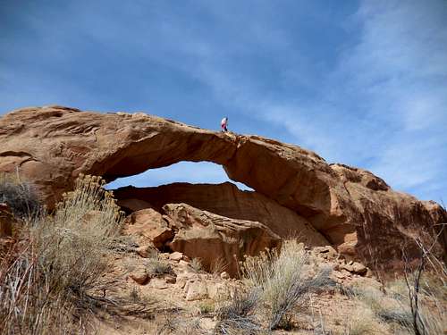 Myself on the lower arch in the east fork of Buck Canyon
Getting There
Getting to the trailhead for Buck Canyon will involve at least 30 minutes of driving on dirt roads once you leave the highway. From the town of Green River, along I-70, head west on the interstate for 10 miles and take exit 149 for Utah Highway 24 and continue left (south) on UT 24. Go south for 25 miles and just after you pass the turnoff for Goblin Valley State Park (which heads right) look for a left on a good dirt road (Hans Flat/The Maze Road) where a sign says 80 miles to The Maze 4WD. Turn left on this road and go 6.7 miles to a small ranch, where the road will turn sharply left and begin heading east. Just over a mile from this 90 degree turn, turn right onto a lesser used dirt road heading south. Do not continue on the Hans Flat Road through the Flat Tops.
Go south on this sandy but still decent road for 5.5 miles to a Y junction and stay left. You'll head over a hill in the process where you might have to drive fast through some loose sand. Continue 5 more miles past the Y junction along a very straight section of road along a fence to a 4 way intersection and turn left. From this intersection, it's 1.3 miles to the trailhead. The final mile heads down a steep hill and the road curves east right as it reaches the north rim of the upper west fork of Buck Canyon. Park at a nice open area next to the rim as the road curves left (east). This is the trailhead.
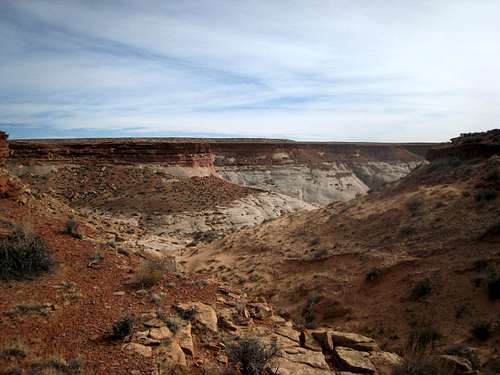
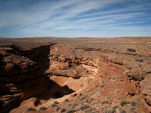 Looking down Buck Canyon from the TH
Route Description
From the trailhead, hike a short distance east along the rim until you see a large cairn marking the entrance into the canyon. There is only one scramble route down so you must find it; it's near the base of a series of red Carmel hills. The scramble drops around 80 feet and once in the canyon, head right (downstream) and quickly enter a short narrows that offer easy scrambling. The canyon turns south and you will quickly encounter an 8 meter drop. This is the only rappel in the canyon, and since it's only a few minutes away from the car, the easiest thing to do is to set your rope and leave it while you finish the canyon. One person from your group can then run back and grab it when you return to the car.
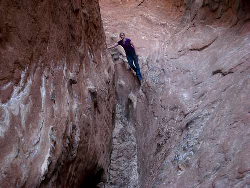
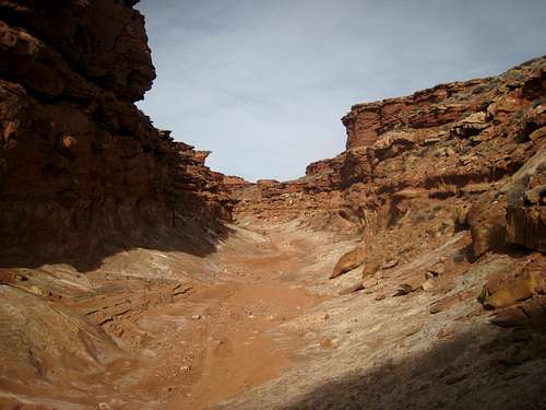 Upper part of the west fork Upper part of the west fork |
Although it's an 8 meter drop, the only rappel anchor is a couple large rocks above and to the right side of the canyon (LDC). Scramble about 30 feet up the slickrock to locate the long slings wrapped around the rocks. If you have a 30 meter rope you can do a single strand rappel by tying the end of the rope into the anchor, or you can made a double strand rappel id you have a 50 or 60 meter rope. Note that the rappel is 26 meters long from the anchor to the ground below the dryfall. At least 30 meters of rope is required!
Once past this only rappel, continue down the now narrow slot and scramble through various narrows and reach a 10 foot drop that you can carefully down climb. Beginners may want a hand here but it's not too bad. Beyond that much of the canyon is a nice hike, with one more difficulty in the form of a narrow squeeze. Here you can just slide down the slot (jeans and long sleeves may help prevent scraping your skin). About two miles from the car you will reach a large opening and a side canyon coming in from the right (west). This side canyon can be used as a good exit where a short scramble northward brings you back to the rim where you can walk along the open desert to your car. This is only recommended if you're short on time or the weather is turning bad. If you have the time, continue south down the wide open canyon, through various tall grass and bushes at this point (and possible standing water) until you can see the east fork of Buck Canyon coming in from the left. Turn left and begin heading up this drainage. There will be some bushwhacking you will likely have to contend with, but a few minutes after starting up the east fork, you will see a large natural arch off to the left. This beautiful arch has maybe a 100 foot span and can easily be scrambled up.
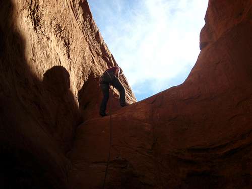 The lone rappel in Buck Canyon The lone rappel in Buck Canyon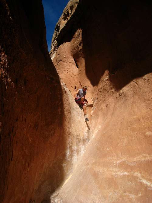 Starting down the 10 foot drop in Buck Canyon Starting down the 10 foot drop in Buck Canyon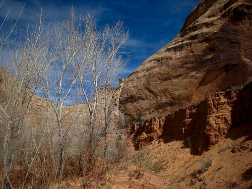 Trees at the end of narrows Trees at the end of narrows |
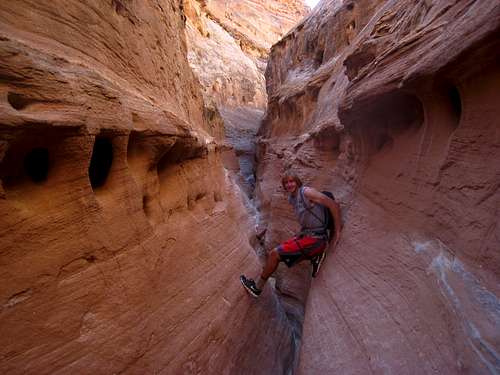 Working through Buck Canyon Working through Buck Canyon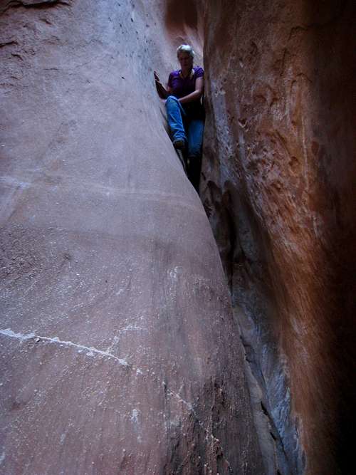 The squeeze section in Buck Canyon The squeeze section in Buck Canyon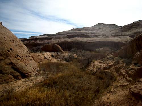 Looking down the east fork of Buck Canyon Looking down the east fork of Buck Canyon |
 Buck Canyon narrows Buck Canyon narrows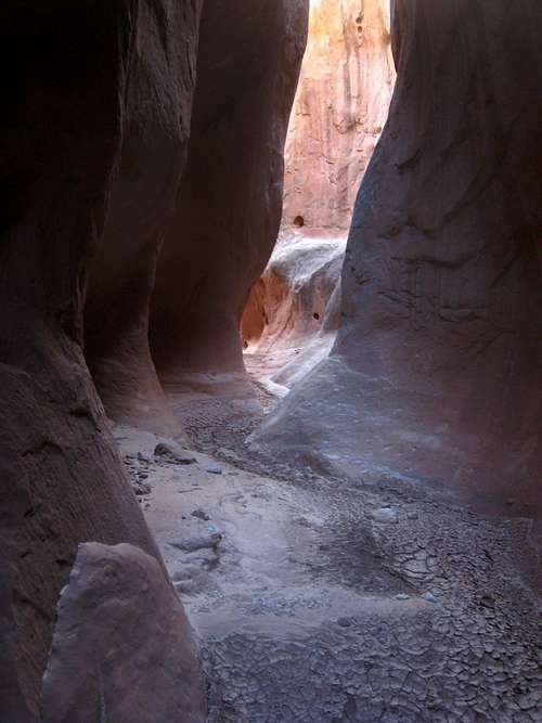 Buck Canyon Narrows Buck Canyon Narrows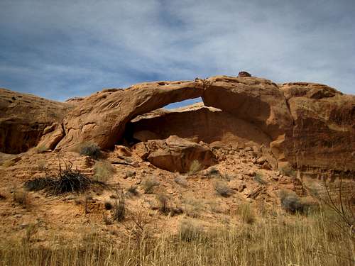 Unnamed arch in Buck Canyon Unnamed arch in Buck Canyon |
Another 20 minutes of hiking up the east fork you'll run into Buck Canyon Arch; a large natural bridge. Scrambling into the circular opening makes for a great photo opportunity. A half-mile past Buck Canyon Arch the canyon bottom will end at a 20 meter dryfall that cannot be ascended. Locate a large sandy slope to the right of the dryfall and hike steeply up loose sand. At the top you can descend a few feet to re-gain the sandy wash. The rest of the hike up the east fork is straightforward, and you will reach a small side drainage to the left, a mile or so beyond the dryfall bypass trail. Hike up this drainage and scramble easily to the north and emerge on the rim. Once you reach the open desert, it's another 0.8 mile northward to the upper end of the west fork. There is a small drainage you must cross about halfway back to the car where cattle appear to hang out. To get back to the north rim of the west fork, locate a cairn marking the steep, loose scramble down. Be careful here as refrigerator sized rocks were moving underfoot. Have someone retreive your rope and scramble up 80 feet to your car.
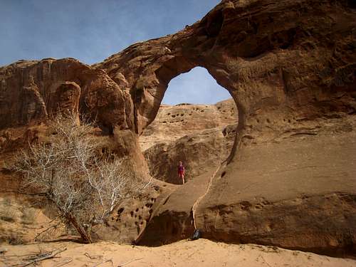 Buck Canyon Arch Buck Canyon Arch |
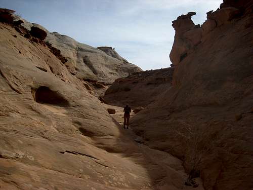 Hiking up the east fork of Buck Canyon Hiking up the east fork of Buck Canyon |
 Nearing the rim above the east fork Nearing the rim above the east fork |
Camping/Red Tape
Camping can be had anywhere in the entire region. The trailhead, along the rim of the west fork, has a nice open spot overlooking the canyon and the Henry Mountains to the west. Many other spots can be found along the roads leading to the trailhead as well. Robbers Roost Country is all on open BLM land and has no permits, fees or camping regulations.
Map
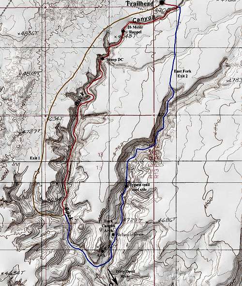 Buck Canyon Map