
-
 7675 Hits
-
 77.48% Score
-
 8 Votes
|
|
Mountain/Rock |
|---|---|
|
|
39.66065°N / 77.5383°W |
|
|
Washington |
|
|
Hiking, Bouldering, Scrambling |
|
|
Spring, Summer, Fall, Winter |
|
|
1560 ft / 475 m |
|
|
Overview
Buzzard Knob is a minor high point on the long South Mountain ridge in Maryland. The nearest town is Smithburg. Buzzard Knob happens to be just a few miles west of the presidential retreat at Camp David, which lies atop Catoctin Mountain. My estimation is that Buzzard Knob would be of little interest to all but shameless peakbaggers, and those who climb something just because they like its name. However, it is indeed a local high point, and it offers somewhat of a view. And to make it sporting, reaching the summit requires a brief amount of scrambling.
The summit of Buzzard Knob actually reminds me of Wolf Rock, a very popular destination in Catoctin Mountain Park, which is just a few miles to the east. However, Buzzard Peak is not in a park, and no trail leads to the top. It is not even visible from the nearby Appalachian Trail (AT), due to dense vegetation. But, if you know where it is, there is some fun scrambling to be found, and some (limited) views. The best views are probably the partial views to the northwest from the northern part of the summit area.
Getting There
From Washington, DC:
Take 270 north, continue onto 15 north, then turn west onto MD 77 (Foxville Road) and go about 7.5 miles.
Parking is available on the south side of the road, near the AT crossing point. The AT crosses MD 77 between Hopkins Lane and Pleasant Valley Road. This parking area happens to be about six miles west of the trailhead for Cat Rock.
Route
This route approaches Buzzard Knob from the south via the Appalachian Trail.
Cross MD 77 (Foxville Road) and head north on the AT. At first the trail heads straight across an open field, but within a few minutes it enters the woods and becomes sinuous, with moderate ascents and descents. The hiking is pleasant, and in the summer it is much cooler in the woods than in open areas.
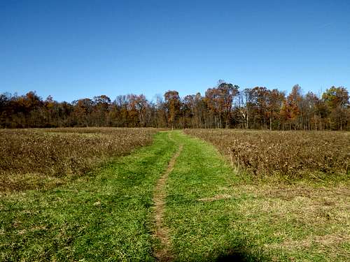
The open field across from the parking area.
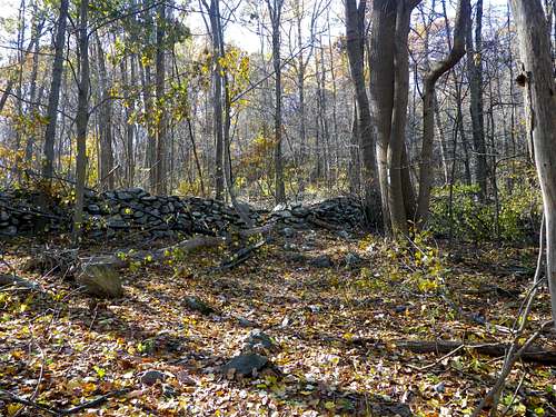
An old stone wall in the woods.
In about 1.5 miles there is a stream to cross, immediately followed by a crossing of Warner Hollow Road. Turn left (west) on the road and walk a short distance to find the AT again. Here the AT ascends steeply on the north side of the road, eventually passing a mere tenth of a mile east of Buzzard Knob at its closest point.
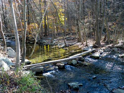
The stream just south of Buzzard Knob.
There is a summit candidate on the south side of the rock formation, and also one on the north side. Both are easy to surmount. There are limited views from the top, mainly to the west and northwest.
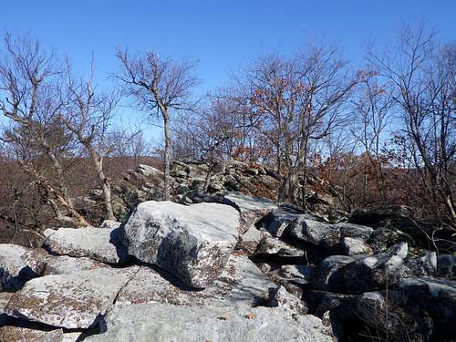
Looking from south to north on the summit.
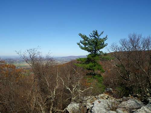
View to the northwest from the summit.