
|
|
Mountain/Rock |
|---|---|
|
|
15.4898°S / 72.1796°W |
|
|
Hiking, Mountaineering, Trad Climbing, Bouldering, Ice Climbing, Mixed, Scrambling |
|
|
Spring, Fall, Winter |
|
|
17224 ft / 5250 m |
|
|
Overview
Cerro Cerani is an interesting and isolated peak in the Colca Canyon/Andagua area of Southern Peru. Unlike most of the peaks in the area, Cerro Cerani is not a volcano, but is made of granite and is in an area of quite rugged mountains. The peaks just to the east are all volcanoes.
The mountain range here is mostly made of granite and has some rugged peaks, but there seems to be confusion on what the name of the range is. It may be the Cordillera Chila? The peak names seem to be in confusion too, but at least everyone agrees which peak is Cerro Cerani! Names for other peaks can be taken off the IGM 1:100,000 maps. No spot elevation is given on the maps so 5250 is just an estimate.
This is a dry area and sits in part of the Atacama Desert, but the area is still wetter than areas farther south around Arequipa or the Peru/Chile/Bolivia border. Most peaks in the area seem absent of permanent snowcaps, though snow can fall down to 4000 meters at times.
Cerro Cerani lies just north of Paso Cerani and is a short detour from the fantastic Colca to Andagua Route. Assuming the weather is good, you will have some fantastic views of all the surrounding rugged peaks from the summit and slopes.
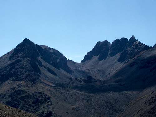 Cerro Cerani is to the left. Paso Cerani is in the center. As viewed from the west.
Getting There
I would highly recommend going up one route and down the other. If you are already acclimatized, the route from the west and Andagua would be easiest. If you are not acclimatized, the route from the south and Cabanaconde or Puente Colgado is the best route.
Regardless of your route, your first destination will be the large city of Arequipa. The city is served by several buses and flights every day of the year.
Via Cabanaconde
As of November 2007, several bus lines and tourist buses are visiting Cabanaconde. For the public bus, several (3-4) buses a day leave from Terminal Terreste. Buses leave anywhere from the middle of the night to early afternoon. As of 2007, the bus company names are Transportes Reyna, Transportes Andalucia, and Turismo Milagros. All buses stop in Chivay along the way. Expect to take 5-6 hours from Arequipa.
From Cabanaconde there are several options to get to the Puente Colgado (bridge) on the Rio Colca. The first option is to walk the entire section (see the route page). About every other day a supply truck heads from Cabanaconde to the “Change of Slope to Llanca” about half way to the bridge. Enquire in Cabanaconde for the supply truck which leaves from the main square in the morning.
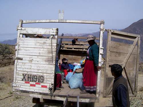 Besides foot travel, this supply truck is currently the only transport to Llanca "change of slope". There are no buses and the supply truck only goes a few days a week.
The chances of getting a ride to the Puente Colgado are slim, but we got a ride with the army. They were mighty curious and amused as to what this five year old gringo and his dad were doing out in the middle of nowhere in a remote corner of Peru and they gave us a ride down to Puente Colgado!
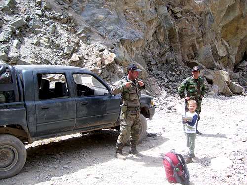 We were out in the middle of the desert when the Peruvian Army came by. They were mighty curious what a five year old "gringo" was doing out in the middle of no where in a remote corner of Peru. They were quite amused by Kessler and gave us a ride down to the Colca River, which saved us a long dusty part of the trek. They even gave Kessler some of their candy rations.
Via Andagua
Theoretically there are two buses a day reaching Andagua, but there was only one when we were there. Transportes Reyna and Turismo Milagros supposedly each make the trip once a day, but as we found out, this is not always the case. It’s a long 10 hour bumpy and dusty bus ride. Return buses always ridge throughout the night. Dress warm because the bus reaches 4915 meters/16,125 feet! This must be one of the highest bus rides in the world.
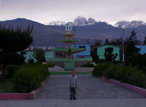 This is the trailhead at Andagua. It's a nice, but off the beaten track village. If you climb Cerro Cerani you will likely either begin or end the trip here. Cerani is in the group of peaks to the right.
Routes Overview
As mentioned, there are two main access routes; Andagua from the west and Cabanaconde from the south. Since bus service is good to either location, you might as well go up one route and down the other.
Either way, climbing just this peak is a 4-5 day trip and there are many other peaks in the area that can be climbed for a longer trip.
Either way, your destination will be Paso Cerani at about 5125 meters (16,814 feet). The route up the peak directly from the pass requires a rock climb or climbing a frozen waterfall (when present) just to the west. There are non-technical routes on either side of the pass, but they involve scree and some traversing. If you have the right equipment the shorter technical route would be more fun.
See the Route Page for all needed details.
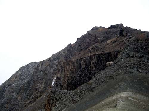 This is Cerro Cerani as viewed in bad weather right from Paso Cerani. One route up the peak is up the gully on the left right where the snow is.
Red Tape
Supposedly you are supposed to get a tourist ticket in Cabanaconde to visit the Colca region, but we never got one because I don’t know where to get it.
Camping
There are many campsites along either route. Specific campsites will be mentioned on the route pages. You could camp at Andagua or Cabanaconde, but hotels are so cheap in Peru that it’s pretty pointless.
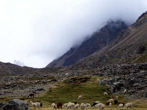 Cerro Cerani is to the right and in the clouds. This is as viewed from 4550 meters at the Quebrada Cerani. The area is a good place to camp, but with all the llamas, purify the water!
When to Climb
This is a dry area, so the peak can be climbed year round, though some times are more ideal than others. Mid April through October is considered the ideal time to climb the peak with normally good weather, though night temperatures June through early September can be pretty cold but with normally clear skies.
November, early December, and April are in between times with some good weather, but more frequent cloud and snow. January through March are the wettest months and are not recommended. In November we had pretty good weather the first two days, bad weather the next and a mixed bag the next two days.
There are no weather forecast links to this region.
 Bad weather just east of Cerani. The weather really turned foul so we only got to Paso Cerani rather than the summit of Cerro Cerani. November 2007.