-
 21486 Hits
-
 81.18% Score
-
 13 Votes
|
|
Mountain/Rock |
|---|---|
|
|
38.98190°N / 77.2432°W |
|
|
Trad Climbing, Toprope, Bouldering, Aid Climbing, Scrambling |
|
|
Spring, Summer, Fall, Winter |
|
|
145 ft / 44 m |
|
|

Overview
Set back in the woods a bit and being about a mile from the parking areas most frequently used by Great Falls climbers, Cow Hoof gets far less attention than the crags upstream of it do. It is not as visually spectacular as many of the riverside crags at Great Falls are, and the routes are shorter than most of those at the popular areas, but Cow Hoof offers shaded climbing (very nice during the hot, sticky days from late May through early September) and interesting, challenging routes in the moderate to difficult range. Cow Hoof also has one of only two aid routes in the Great Falls area.
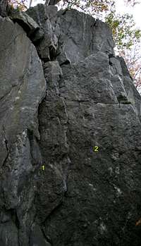
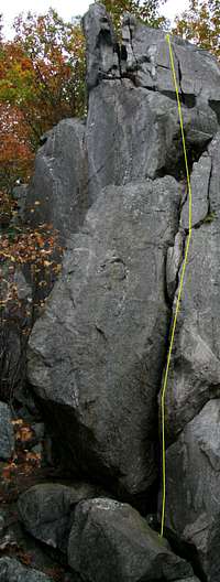
With the exception of the short but interesting Cow Pie (5.8; please see this page’s primary image for a look and more information), all the routes at Cow Hoof are on the cliffs back in the woods. Those routes are listed below, from left to right as one faces the cliffs from beneath them. The routes mostly range from 30-40’, with the longer ones being those on the left side of the crag. Some photos on this page contain diagrams and/or descriptions of some of the routes.
•F.I.S.T. (5.9-)—At 50’, this is the longest climb at Cow Hoof and considered among the best climbs in the Great Falls area; a crack route with hand and finger jams.
•Hemlock (5.10+)
•Hard Nut (A3)—As the name implies, climbers aid this one with nuts; the route climbs a thin crack.
•Socrates’ Downfall (5.8)—Another considered among the best in the area.
•Claws (5.12)—NOTE: My guidebook says a crux hold has broken and warns that this route may therefore be harder than its rating. Face climb.
•Titania (5.10-)
•Ariel (5.9)
•Caliban (5.8)
•It’s the Feet (5.10-)
Some notes about climbing at Great Falls: Most people toprope the routes, but the ratings are based on lead conditions, so topropers may think some routes are easier than their ratings suggest.
Climbing below or between the three major overlooks is prohibited.
The climbs at Great Falls are short ones, but they are not sport routes. Most old bolts have been removed, and it is illegal to alter the rock by drilling or other means. Toproping is the predominant style here, but many routes are leadable. The rule at Great Falls: if you can't lead it with natural gear, toprope it just as everyone else does. This is the local ethic and was before the Park Service tightened rules about bolting and altering the rock.
Getting There
This is not the shortest but is rather the easiest and safest way to approach the crag.
From the western part of I-495, a piece of the Capital Beltway, take Exit 44 for Route 193, Georgetown Pike; this is the second exit south of the Maryland border. Drive west for a few miles until you see the well-signed road leading to Great Falls Park. Turn right and follow the road about a mile to the entrance station. Enter and take an immediate right to reach a large parking area used by most climbers and boaters here; this is commonly called the Lower Lot since it is downhill from the entrance station. Don't expect to find a parking spot here after 10 on a nice weekend day.
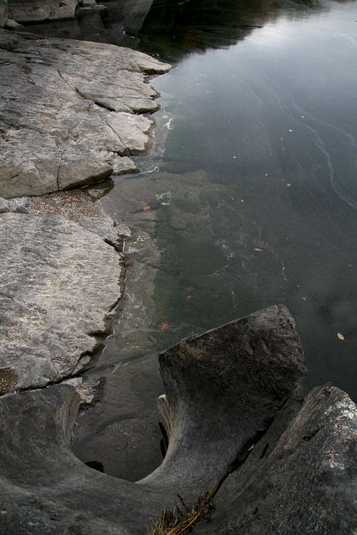
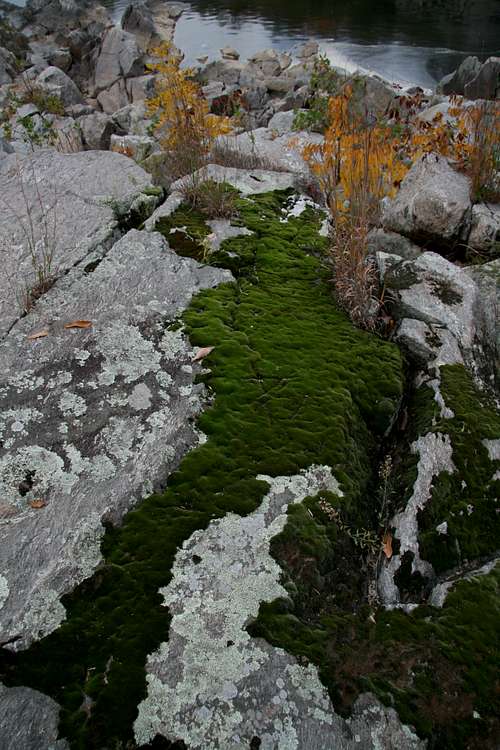
Hike toward the river and turn right on the River Trail. About a mile from the parking area, the trail drops to the river where a road (not open to the public) ends at the water’s edge. Follow the trail further downstream to an obvious rocky area and start looking for the crags pictured on this page.
Red Tape, Camping, and Links
The park is open from 7 A.M. until dark every day except Christmas. There is an admission fee, good for three days, of $5 per vehicle or $3 per person entering on foot or by bicycle. Annual and interagency passes are also available (the latter costs $80).
Altering the rock to place gear is prohibited.
The park is home to copperheads. It’s unlikely that they hang out in holds on the cliffs themselves, but be aware. The danger, though slim, is greatest near the clifftops, where there are more places for snakes to be.
Poison ivy is abundant, especially along the descent route. The humid period from late spring through early fall features gnats, mosquitoes, and other biting insects.
No camping.
Great Falls NPS Site
A great resource is the PATC Climbers' Guide, which focuses just on the Great Falls area.