
-
 12060 Hits
-
 85.87% Score
-
 21 Votes
|
|
Mountain/Rock |
|---|---|
|
|
38.12254°N / 119.33706°W |
|
|
Mono |
|
|
Hiking, Scrambling |
|
|
Spring, Summer, Fall, Winter |
|
|
11394 ft / 3473 m |
|
|
Overview
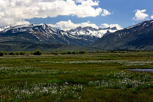
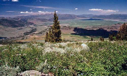
Crater Crest, Matterhorn Peak and Sawtooth Ridge from Bridgeport Valley
Apparently this peak is volcanic in nature although when I climbed it it appeared to be composed of the typical metamorphic rock characteristic of many peaks along the eastern scarp of the northeast Sierra. It is reported to have several small craters along the summit ridge and a small crater a half mile north northwest of Tamarack Lake at 9,800' that might be of some curiosity.
The east slope is a class 1-2 dayhike from Upper Summer Meadows or the northeast Twin Lake. The northeast ridge looks to be a class 1-2 dayhike from the northeast Twin Lake. The north and northwest ridges look pretty staight forward also but steeper. The north summit is the highpoint.
The Crater Crest has outstanding views of the north face of Twin Peaks, Matterhorn Peak and the Sawtooth Ridge.
Getting There
Crater Crest from Tamarack Lake Trail
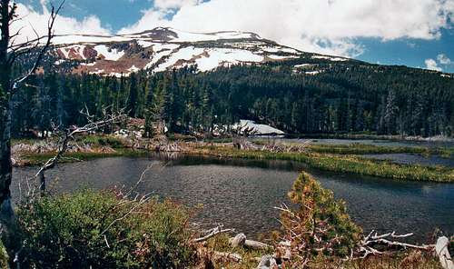
Drive (if you have 4WD) or hike the road up 1 mile where a trail goes right for .5 miles and joins the Tamarack Lake Trail. Go left 1.5 miles up to Tamarack Lake at 9.630'. Climb the east slope 1.4 miles to the north summit on the right.
East slope via Twin Lakes: From Bridgeport go 10 miles southwest on the Twin Lakes Road to the Sawmill Campground on the left at the northeast end of the first lake. Turn right and go .5 mile to the trailhead at the Twin Lakes Campground at 7,100'. Hike up staying to the right at a fork (.1 mile) and go up 1 mile to the junction with the Tamarack Lake Trail. Go left and follow the Tamarack Lake Trail 3 miles to the lake and take the east slope.
Northeast ridge: Follow the same directions as the east slope via Twin Lakes and at the junction to the Tamarack Lake Trail, at 1 mile, continue straight approximately 1 mile on the trail that runs above the south side of the lakes and break trail (8,000') up the northeast ridge to the north summit.
Red Tape
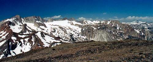
West pano from Crater Crest
For Toiyabe National Forest camping contact:
Bridgeport Ranger District
P.O. Box 595 (Hwy. 395)
Bridgeport, Ca. 93517
(760) 932-7070
Camping

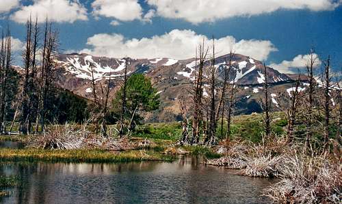
Whorl Mtn. from Crater Crest

Matterhorn Peak from Crater Crest
Upper Summer Meadows is a beautiful area to camp with no facilities.
Bridgeport weather and 5 day forecast
Victoria and Eagle Peak from the Tamarack Lake trail
Upper Summer Meadows
Etymology
Crater Crest (11,394)Several craters on a mile-long ridge. Probably named by the USGS during the 1905-09 survey for the Bridgeport 30'map; the name is on the first edition, 1911. (TNF)
Place Names of the Sierra Nevada- Peter Browning