
|
|
Mountain/Rock |
|---|---|
|
|
38.04080°N / 119.2457°W |
|
|
Mono |
|
|
Spring, Summer, Fall, Winter |
|
|
11086 ft / 3379 m |
|
|
Overview
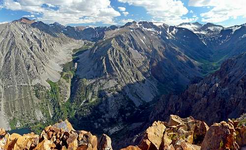
Southwest over Lundy Canyon from Mt. Olsen
Mount Olsen rises just southeast of the Virginia Lakes Trailhead; one of the Eastern High Sierra's most accessible jumping off points. The trailhead leading into the back country is 9,800'. The area is dotted with numerous lakes and surrounded by a horseshoe cirque of 11-12,000' peaks.
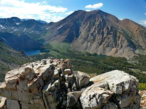
Mount Olsen is the first peak on the left when driving up to the parking area. This is a rather humble and easily approachable summit with 395' of prominence. Mount Olsen is often combined with South Peak and Black Mountain, the higher peaks along the ridge to the west.
The views over Lundy Canyon and the peaks beyond are outstanding. All the peaks in the area are excellent for skiing as well.
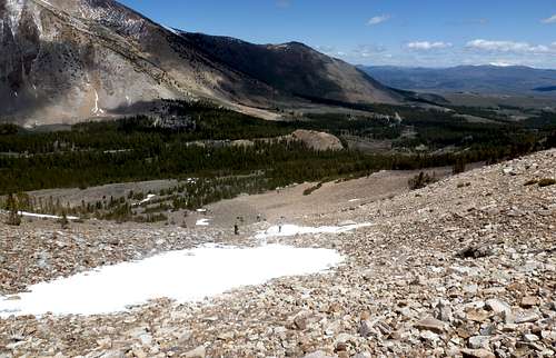
Depending on snow conditions, Mount Olsen can be hiked as early as Memorial Day Weekend; but often hiking here is done starting mid-June and going through early October.
Appreciation is owed to Windsor Riley (aka Noondueler) who created this page, and who passed away in 2016.
Getting There
From the junction with Hwy. 120, go north 12 miles on Hwy. 395 to Conway Summit, 8,143', (the highest pass of Hwy 395 in the eastern Sierra).
From Bridgeport take 395 south 13 miles to Conway Summit.
At Conway Summit take the Virginia Lakes Road 6 miles (west) to the trailhead at roads end.
Take the short trail going to Red Lake (south) a few hundred yards. Break off before Red Lake and traverse left between the base of South Peak and an unnamed lake half a mile to the easy chute between South Peak and Mount Olsen. Take the chute to the saddle and go 0.3 miles (left) to Mount Olsen.
Despite requiring off-trail hiking, this is a pretty easy peak. From the trailhead, it is only about 1.5 miles to the summit gaining less than 1,300'. A fun 5-mile loop can be done over Mount Olsen, South Peak, and Black Mountain back to the trailhead, gaining 2,700'.
There isn't an accessible nor desirable route from the Lundy Canyon.
Red Tape

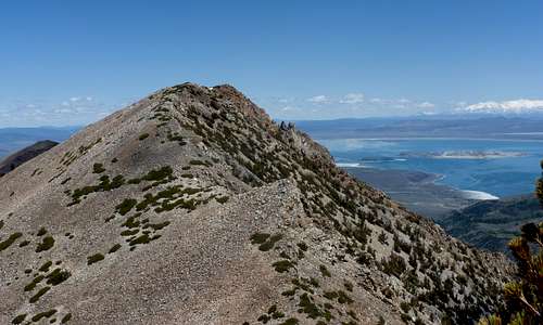
Mono Lake from Mt. Olsen
This is Inyo National Forest and no permits are required.
Camping
The only campground in the area is the Trumbull Lake (9,745') campground less than a mile from the trailhead. However, people may sleep in their car at the Virginia Lakes Trailhead. Tent camping at the trailhead isn't allowed.