Overview
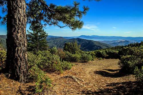
Southeast to Clear Lake from Elk Mtn. summit ridgeThis is a big forested peak that rises almost 3,000' above the west fork of Middle Creek in the southwest part of the Mendocino National Forest. Elk Mountain Road (or 301) from Upper Lake switchbacks up the southeast face of Elk Mountain and comes to a pass. From here a dirt road leads to the top via a brief hike. The open summit commands outstanding views south over Middle Creek Valley out to Clear Lake and east to the mountains of the southern part of the Mendocino National Forest.
Getting There
Trail head at the passFrom the Junction of Hwy 20 and Hwy. 29 at Upper Lake take Hwy 20 a half mile east to Mendenhall Ave. Go north on Mendenhall which becomes Elk Mountain Rd. (or 301). Continue on Elk Mtn Rd (paved) for approximately 14 miles until it switchbacks up the side of Elk Mountain all the way to a pass and park.
Route
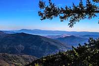
Southwest from Elk Mtn. summitTake the fire road on the left less than a mile up to the open summit. The hike is 1.5 round trip with 400' of gain. 3 miles and 1,000' gain if you do the whole summit ridge.
Red Tape
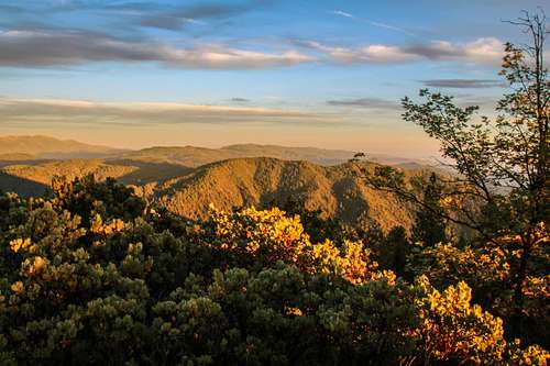
Sunset on Elk Mtn. from Horse Mtn.There was an old sign at the trail head implying private access restrictions but this is clearly within the boundaries of the
Mendocino National Forest.
When to Climb
Southwest from Elk Mtn.Year around. The mountain and the road to it could be snowed in for periods in winter. Temps get dry and hot in summer.
Camping
South from ElkThere is the Middle Creek Campground at 8.5 miles up Elk Mountain Road at the foot of the south slope of Elk Mountain.
Click here for Mendocino National Forest camping.
Current weather and 10 day forecast
Click here for the Upper Lake weather report.