
-
 4854 Hits
-
 81.84% Score
-
 14 Votes
|
|
Mountain/Rock |
|---|---|
|
|
39.11018°N / 122.76339°W |
|
|
Lake |
|
|
Hiking |
|
|
Spring, Summer, Fall, Winter |
|
|
3491 ft / 1064 m |
|
|
Overview
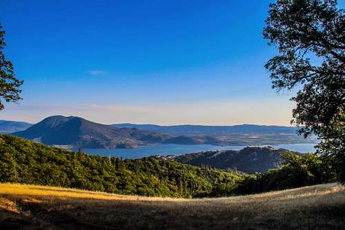
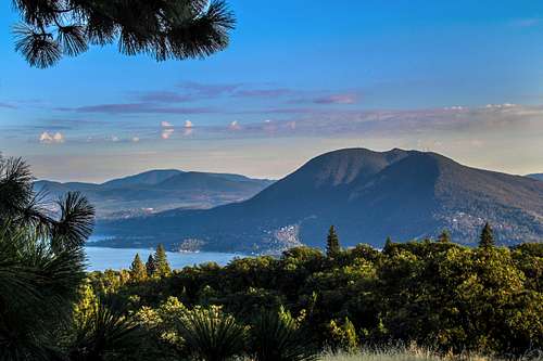
Clear Lake from High Valley Ridge
The High Valley Road runs most of the length of the ridge from High Valley to the Bartlett Springs Road. The high point is towards the northwest end of the ridge less than 2 miles from Bartlett Springs Road. The road is well graded and passable to all cars albeit quite dusty in places during the dry season. This makes for a moderate but long walk up the road from High Valley or a short one from Barltlett Springs Rd. to outstanding views out over Clear Lake, Mt. Konocti and the Mayacamas Mountains beyond.
Getting There
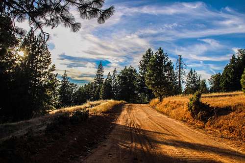
High Valley Road
From Bartlett Springs Road From the junction of Hwy. 53 and Hwy. 20 go west on 20 14.5 miles along the lake to Bartlett Springs Road. Go right on Bartlett Springs Road (passable to all cars) as it winds and switchbacks up to the junction with High Valley Road at 5 miles.
The road could possibly get washed out and unpassable with winter storms.
![Sunset over Clear :Lake]()
Mt. Konocti from High Valley RidgeFrom High Valley: From the base of the ridge in High Valley hike up the road to the left as it gradually gains elevation with a few dips to a forested high point at 7 miles.
This involves about 14 miles round trip and 2,100' foot gain.
From Bartlett Springs Road: From the junction of Bartlett Springs Road and High Valley Road hike 1.5 miles to the forested high point up to the right. This is 3 miles round trip and about 500' gain.
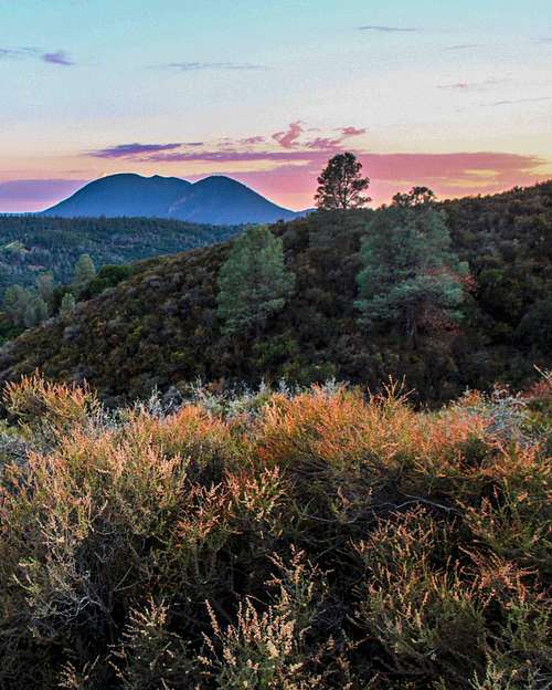
Of course you can drive the whole ridge, get out, enjoy the views, have a picnic and be done with it.![Sunset on High Valley]()
Sunset over High ValleyThe ridge is open to all traffic but it runs through private lands. Please respect no trespassing signs.![Mt. Konocti from High Valley Ridge]()
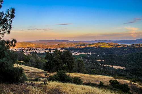
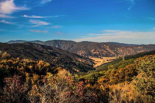
South from High Valley RidgeYear round. It can get upwards of 100 degrees in summer. The ridge could get snowed in in winter.![Long Valley and Wolf Creek Ridge from High Valley Ridge]()
Long Valley and Wolf Creek Ridge from High Valley RidgeThere is no camping in the immediate area. The nearest area would be Cache Creek Wilderness. The campground page is down as of 3-21-14. Some backpacking suggestions for that area can be found here. ![High Valley Ridge from Pine Mtn.]()
High Valley Ridge from Pine Mtn. ![Cobb Mtn. and Mt. Hannah from High Valley Ridge]()
Cobb Mtn. and Mt. Hannah from High Valley RidgeFor the current weather and 5 days forecast for Clearlake Oaks click here.
Route
Mt. Konocti from High Valley Ridge
This involves about 14 miles round trip and 2,100' foot gain.
From Bartlett Springs Road: From the junction of Bartlett Springs Road and High Valley Road hike 1.5 miles to the forested high point up to the right. This is 3 miles round trip and about 500' gain.
Of course you can drive the whole ridge, get out, enjoy the views, have a picnic and be done with it.
Red Tape
Sunset over High Valley
When to Climb
South from High Valley Ridge
Camping
Long Valley and Wolf Creek Ridge from High Valley Ridge
Current weather and forecast

High Valley Ridge from Pine Mtn.

Cobb Mtn. and Mt. Hannah from High Valley Ridge