
-
 8689 Hits
-
 93.04% Score
-
 41 Votes
|
|
Mountain/Rock |
|---|---|
|
|
44.39717°N / 9.99602°E |
|
|
Emilia Romagna |
|
|
Hiking, Mountaineering, Ice Climbing, Scrambling, Skiing |
|
|
Spring, Summer, Fall, Winter |
|
|
6073 ft / 1851 m |
|
|
Overview
Geographical classification: Appennino Tosco-Emiliano e Tosco-Romagnolo > Appennino Parmense > Marmagna
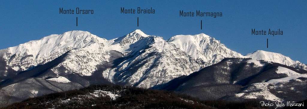
Marmagna 1851 m
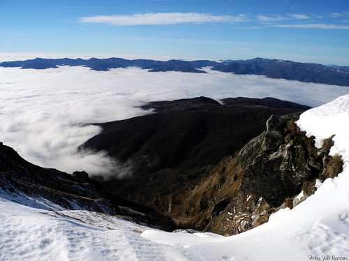
Monte Marmagna is not the highest mountain in the Appennino Parmense, but without any doubts it is far apart the best known and more frequently climbed summit. The reason of its popularity is mainly due to three important factors: its closeness to Rifugio Giovanni Mariotti, a popular hiking, mountaineering and ski-mountaineering destination; the easy access both in winter time and in the other seasons along its Normal route starting from Rifugio Mariotti and rising to the Marmagna saddle, which separates the mountain from Monte Aquilotto, lying on the left of the saddle; the renowned view over the Alpi Apuane and the Tyrrhenian Sea which appears from the summit in the clear days, including the Gulf of La Spezia, the isle of Palmaria and sometimes also the Corsica.
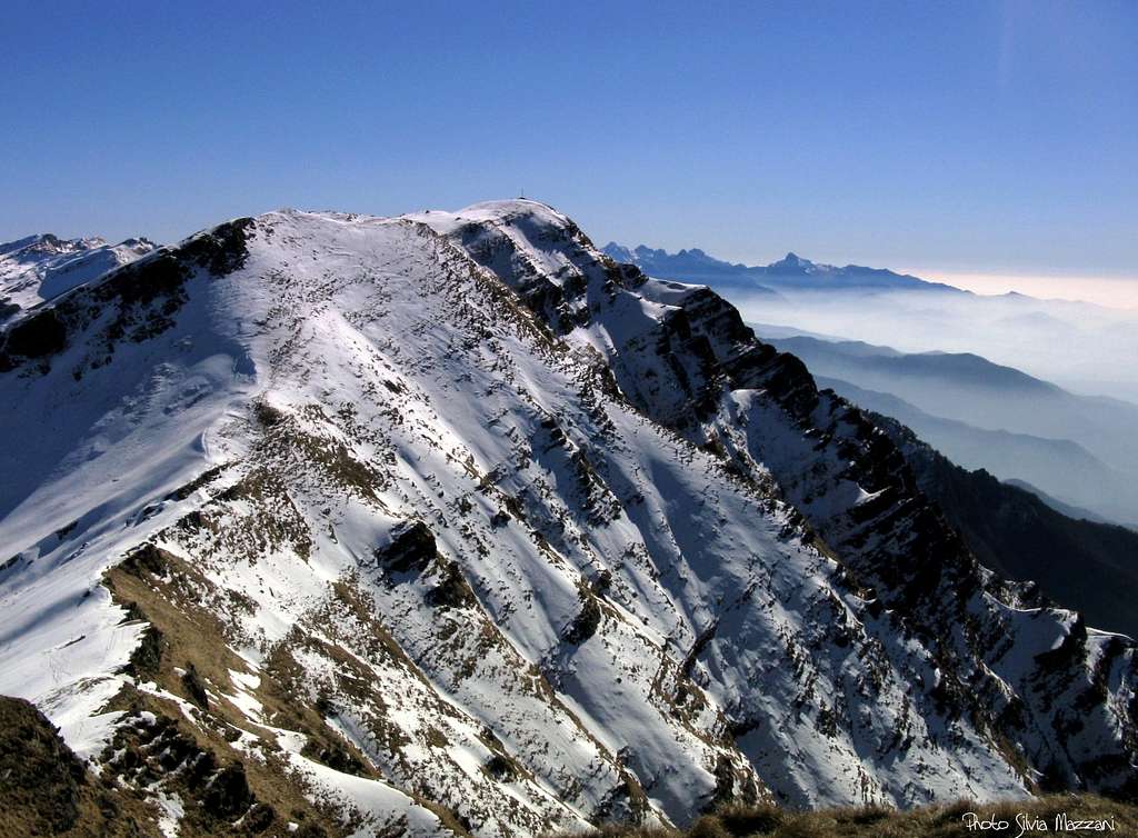
The Parmense side is gently sloping towards the attractive basin of Lago Santo (Holy Lake), while the side facing to Tuscany is higher and steeper, but very rarely climbed because of its long approaches.
Getting There
Road approach
Parma is the nearest town to the area; it’s a 200.000 inhabitants town with a small airport, offering some domestic flies and only a few international ones. A good choice of international flies is provided by Milan and Bologna International Airports, both situated at a reasonable distance (Milan 110 km., Bologna 90 km.). Parma is linked to other Italian and European towns by A1 and A15 motorways, so logistic is not a problem.
- Approach from A15 (Autocisa Motorway) – If you’re driving on A15 towards North, exit Pontremoli and follow the road to Passo del Cirone and Bosco di Corniglio. From here follow the road towards the locality named Cancelli. If you’re driving on A15 towards South it’s better to exit Borgo Val di Taro and follow the road to Passo del Sillara and Bosco di Corniglio.
- Approach from Parma
Follow the SP 665 (Massese) towards Langhirano and Capoponte; here turn to right, reaching Corniglio, Bosco di Corniglio, the locality named Cancelli and finally Lagdei (wide parking).
Orsaro-Marmagna sub-group seen from Tuscany
Walking approach to Rifugio Giovanni Mariotti
There are two possibilities to get to Rifugo Mariotti from Lagdei basin:
- Via the Panoramico Path n. 723a, a bit longer, but allowing fine views (1,15 hour in winter time, 45 minutes without snow).
- Via the path n. 727 (1 hour in winter time, 30 minutes without snow)


Walking approach to Capanna Roberto Schiaffino
From Rifugio Lagdei follow the path n. 727, starting just near the shelter and rising inside the beautiful beech-wood; after the fork with the path leading to Rifugio Mariotti, starting on the left at about 1400 m. of altitude, the trail is getting to Ponte Rotto, so named in reason of a broken stones-bridge. Carry on always on the main path, without following the tracks starting from the main path, both on the left side and on the right, reaching the wild basin lying at the footh of Monte Marmagna, Monte Braiola and Monte Orsaro triad. Here is situated the small and secluded Capanna Schiaffino m. 1610, an emergency cabin always open (no beds).
Main routes to the summit
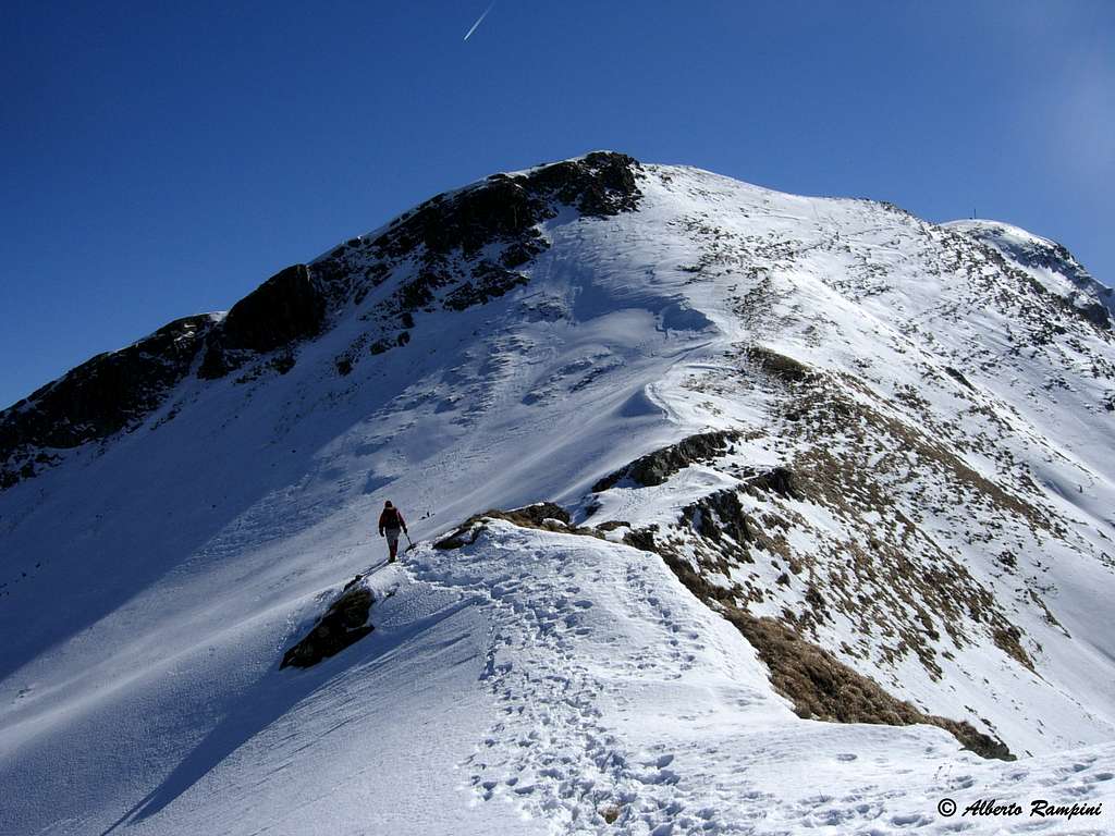
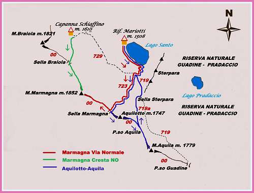
South-East Ridge or Normal Route from Rif. Mariotti
Difficulty: Alpine F in winter condition, otherwise E
Vertical gain: 350 m. from Rif. Mariotti, 600 m from Lagdei
From Rifugio Mariotti follow the right shore of Lago Santo (Holy Lake) - towards SE - getting to the South end of the lake. Here leave the path running around the lake and follow another one starting on the right and rising inside the beautiful beech-wood. Don’t follow the first junction on the left, neither the second one on the right, but keep the main trail (n. 723), exiting the wood and getting to a wide basin between Monte Marmagna on the right and Monte Aquilotto on the left. The itinerary rises to Sella Marmagna, then turns to right, following a wide rounded ridge leading to the huge summit cross.
")

North-West Ridge
Difficulty: Alpine F+ in winter condition, otherwise E
Vertical gain: 600 m. from Lagdei
From Capanna Schiaffino rise straightly toward the boundary ridge getting to the Braiola Saddle, separating Monte Braiola (on the right) from Monte Marmagna (on the left). Turn to left and follow the wide ridge, sometimes steep, to a narrow saddle from which the summit cross is appearing. Climb the last slopes, frequently iced in winter, to the summit.


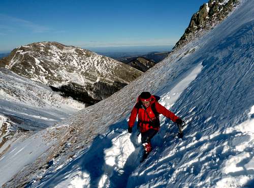
NW Marmagna Little Gully ("Canalino del Marmagna") and N Ridge
Difficulty: Alpine PD
Vertical gain: 600 m. from Lagdei
From the basin where Capanna Schiaffino lies, turn immediately to left (South) without reaching the shelter, heading towards the steep slopes below the obvious narrow and short gully, getting to its base. Rope up when the gully is on ice. Climb the gully and exit on the North ridge of the peak; follow it to the summit cross.


Descent: the best route suitable for the descent is the easy and panoramic Normal Route running on the SE ridge, leading to Sella Marmagna and then to Rifugio Mariotti.


Red Tape

Monte Marmagna is located inside Parco Nazionale Appennino Tosco-Emiliano, established in 1922. Fires are strictly forbidden and the whole fauna and flora is protected. Don’t disturb fauna and other mountaineering and hikers’ peacefulness with every kind of noise.
Huts and Bivouacs
")
- Rifugio Giovanni Mariotti al Lago Santo Parmense m. 1507 – Club Alpino Italiano Sez. di Parma (40 beds) Phone +390521889334 – 0,30-1,15 hours from Lagdei
- Rifugio Lagdei m. 1250 – Always open, 11 beds (60 km. from Parma) Phone +390521889353; wide parking

- Capanna Roberto Schiaffino al Monte Braiola m. 1610
Emergency cabin - 1 to 1,45 hours from Lagdei – The hut is an ancient stone alp which had been restored and re-named in the memory of Roberto Schiaffino, a climber dead because of a stone-fall, while he was climbing a rocky tower in Grigna.
When to hike and climb
It’s possible to climb and hike all round year on Monte Marmagna; winter ascents require the essential gear as crampons, an ice-axe, a rope for the less experienced on the route Canalino
Climate
Subcontinental, with cold and snowing winters and good summertime, dry but not too hot, because of the mitigating influence of the Tyrrenian Sea and the action of the winds.
Meteo
Guidebooks
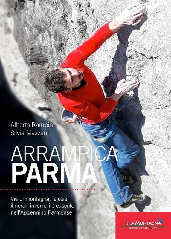
APPENNINO PARMENSE NEW GUIDEBOOK 2019
"Arrampicaparma" III edition - Alberto Rampini and Silvia Mazzani - Idea Montagna ed. 2019
A detailed guidebook including Multipitches, Crags, Ice-falls and winter mountaineering in Appennino Parmense
Guida dettagliata, completa e aggiornata comprendente vie lunghe, falesie, cascate di ghiaccio e itinerari di alpinismo invernale nell'Appennino Parmense


"Arrampicaparma - Climbing, bouldering & mountaineering" by Silvia Mazzani and Alberto Rampini - Pareti e Montagne Edizioni, II ed. 2011
"Arrampicaparma - montagna, falesie, bouldering" by Alberto Rampini and Silvia Mazzani - Pareti e Montagne Edizioni, 2003
“Appennino Ligure e Tosco-Emiliano” by M. Salvo and D. Canossini - Collana Guide dei Monti d'Italia CAI-TCI
Maps
“Le valli del Cedra e del Parma (The Cedra and Parma Valleys)” Map 1:25.000 (CAI-Regione Emilia-Romagna)
“Alto Appennino Parmense Est” Map 1:50.000 (CAI-Regione Emilia-Romagna)
External Links
Club Alpino Italiano Sez. Parma
Parco Nazionale Appennino Tosco-Emiliano