
-
 5274 Hits
-
 87.31% Score
-
 24 Votes
|
|
Mountain/Rock |
|---|---|
|
|
44.41027°N / 9.99166°E |
|
|
Emilia-Romagna, Tuscany |
|
|
Hiking, Mountaineering, Ice Climbing, Scrambling, Skiing |
|
|
Spring, Summer, Fall, Winter |
|
|
6007 ft / 1831 m |
|
|
Overview
Geographical classification: Appennino Tosco-Emiliano e Tosco-Romagnolo > Appennino Parmense > Orsaro
Orsaro 1831 m
The Appennino Parmense Orientale is a chain located in the Northern Apennines, lined up on the Emilia-Romagna and Tuscany border ridge, in the section included between Passo del Cirone in the North-Western end and Passo del Lagastrello in the South-Eastern end. The group belongs to the Eastern part of Parma Province administrative boundaries. Even if not the highest one (the highest summit being Sillara), Monte Orsaro is the symbolic peak of the whole Appennino Parmense in reason of its shape and location. The mountain lies between Monte Fosco to the North, from which it’s separated by a saddle named Foce del Fosco 1600 m, and Monte Braiola to the South, from which it’s separated by another narrow saddle named Bocchetta dell’Orsaro 1722 m. The Normal route, starting from the Rifugio Lagdei and running on the North-North-East side, gently sloping towards the Foce del Fosco, is a popular summer walking, while in winter time and early spring it becomes a fine and not difficult mountaineering and ski-mountaineering destination.

The other sides of the peak, particularly the West side, facing towards Tuscany, are higher and steeper and climbed along interesting routes. The wide summit view over Alpi Apuane and Tirrenian Sea with Gulf of La Spezia, which appears from the summit, is best know, as the one towards the other peaks of the area, located South-East to Monte Orsaro.
Getting There
Parma is the nearest town to the area; its small airport provides some domestic flies and only a few international ones. A good choice of international flies is provided by Milan and Bologna International Airports, both situated at a reasonable distance (Milan 110 km., Bologna 90 km.). Parma is linked to other Italian and European towns by A1 and A15 motorways, so logistic is not a problem.
Road Approach
Approach from A15 (Autocisa Motorway) – If you’re driving on A15 towards North exit Pontremoli and follow the road to Passo del Cirone and Bosco di Corniglio. From here follow the road towards the locality named Cancelli. If you’re driving on A15 towards South it’s better to exit Borgo Val di Taro and follow the road to Passo del Silara and Bosco di Corniglio.


Approach from Parma Follow the SP 665 (Massese) towards Langhirano and Corniglio; pass Langhirano and at the Pastorello roundabout turn to right, reaching Beduzzo, Marra, Bosco di Corniglio, the locality named Cancelli and finally Lagdei (wide parking).
Walking Approach to Capanna Schiaffino
From Lagdei m. 1250 follow the path n. 727, starting just near the hut and rising inside the beautiful beech-wood; after the fork with the path to Rifugio Mariotti, starting on the left at about 1400 m., the track is getting to Ponte Rotto, so named in reason of a broken stones-bridge. Carry on always on the main path, without follow the tracks starting from the main one both on the left side and on the right, reaching the wild basin lying at the footh of Monte Marmagna, Monte Braiola and Monte Orsaro triad. Here is situated the small and secluded Capanna Schiaffino m. 1610, an emergency stone-shelter, always open.
Routes overview

***North-North-East side Normal Route from Lagdei
Difficulty: Alpine F in winter conditions, otherwise E
Vertical Gain: 581 m.
Starting Point: Lagdei m. 1250
From Lagdei m. 1250 follow the path n. 725, starting on the right of the wooden bridge. After 5 minutes by walk, take the path n. 725/A (signposts Monte Orsaro) entering the beech-wood. At the next fork at about 1370 meters of quote (with the path n. 723 running from Ponterotto to Bosco) turn to left and after some meters, then turn soon to right keeping the path 725/A (signposts Monte Orsaro), rising with wide hairpins in the beech-wood and getting to another fork. Keep the left, reaching the saddle named Foce del Fosco m. 1600. Head to left, then to right, exiting the beech-wood and rising along an open slope, sometimes icy, leading to a characteristic basin surrounded by some boulders. Above the basin climb the last slope, leading to the summit Madonna.


***South Ridge (Direttissima)
Difficulty: Alpine F+ in winter conditions, otherwise EE
Vertical Gain: 581 m.
Starting point: Lagdei m. 1250
From Lagdei m. 1250 follow the path n. 727, starting just near the hut, crossing soon a wooden bridge and rising inside the beautiful beech-wood; after the fork with the path to Rifugio Mariotti, starting on the left at about 1400 m., the trail is getting to Ponte Rotto, so named in reason of a broken stones-bridge. Carry on always on the main path, without follow the trails forking from the main one both on the left side and on the right, reaching the wild basin lying at the footh of Monte Marmagna, Monte Braiola and Monte Orsaro triad. Here is situated the small and secluded Capanna Schiaffino. From the shelter head to North, traversing a steep slope and reaching the narrow saddle named Bocchetta dell’Orsaro m. 1722, located between Monte Orsaro and Monte Braiola on the boundary between Emilia on the right and Tuscany on the left. From the saddle you can climb directly the first rocks of the South ridge, starting just above the saddle, or alternatively descent a few meters on the Tuscany side (left) and skirt the first part of the South ridge traversing on steep slopes, then up on the slope to join the middle section of South Ridge, just above the rocks. Follow the S ridge to the summit.
")
***East Slopes
Difficulty: Alpine F+ in winter conditions
Vertical Gain: 581 m.
Starting point: Lagdei m. 1250
From Lagdei m. 1250 follow the path n. 727, starting just near the hut, crossing soon a wooden bridge and rising inside the beautiful beech-wood; after the fork with the path to Rifugio Mariotti, starting on the left at about 1400 m. (ignore it), the trail is getting to Ponte Rotto, so named in reason of a broken stones-bridge. Carry on always on the main path, reaching a second join. Here follow briefly the trail n. 727A, then head to the wide East slopes, reaching the bottom. Climb the gentle snow-slopes (40° max), reaching the last section of the South ridge and the summit.


***West Face
Difficulty: Alpine PD+, 40°- 45°
Vertical Gain: 581 m., longer develop
Climbing length: 250 meters from the bottom of the face
Starting point: Lagdei m. 1250
Note: only in winter
From Lagdei m. 1250 follow the path n. 727, starting just near the hut, crossing soon a wooden bridge and rising inside the beautiful beech-wood; after the fork with the path to Rifugio Mariotti, starting on the left at about 1400 m., the trail is getting to Ponte Rotto, so named in reason of a broken stones-bridge. Carry on always on the main path, without follow the trails forking from the main one both on the left side and on the right, reaching the wild basin lying at the footh of Monte Marmagna, Monte Braiola and Monte Orsaro triad. Here is situated the small and secluded Capanna Schiaffino. From the shelter head to North, traversing a steep slope and reaching the narrow saddle named Bocchetta dell’Orsaro m. 1722, located between Monte Orsaro and Monte Braiola on the boundary between Emilia on the right and Tuscany on the left. From the saddle descent to the left side (Tuscany), getting the base of the West Face. Skirt the face, reaching a narrow saddle in the lowest point of the SW ridge. From here traverse left about 100 meters to gain the starting point of the route. Climb the snowy or icy slope, becoming more and more steep, near the SW ridge, reaching the summit ridge and the top.


Descent: along the easy and panoramic NNE to Sella del Fosco and Lagdei
Huts and Bivouacs
")

- Rifugio Giovanni Mariotti m. 1507 C.A.I. Sez. Parma, 50 beds Phone +390521889334
- Capanna Roberto Schiaffino m. 1610 emergency shelter – 1 hour from Lagdei without snow, from 1,10 to 1,45 hours in winter, depending by the snow conditions - Rifugio Lagdei m. 1250 Always open on Saturday and Sunday - From 15 June to 15 September and from 26 December to 6 January, 25 beds (60 km. from Parma); wide parking
Red Tape

Since 1995 Monte Orsaro and all the area surrounding the peak are situated under the regulation of a Natural Regional park having the evocative name of Parco dei Cento Laghi (One Hundred Lakes Park), in reason of quite a lot of small lakes existing inside the park’s boundaries. In late years this area was included inside a National Park, named Parco Nazionale Appennino Tosco Emiliano (Tosco-Emiliano National Park); wood fires are prohibited as well as free camping and other harmful activity. Walking, mountaineering and climbing are allowed. The whole fauna and flora are protected. Don’t disturb fauna and other mountaineering and hikers’ peacefulness with every kind of noise.
When to Hike and Climb

It’s possible to hike and climb all around the year on Monte Orsaro; winter ascents require the essential gear, as rope, crampons, an ice-axe, technical garments.
Climate
Subcontinental, with cold and snowing winters and pleasant summers, in reason of the mitigating influence of the Tyrrenian Sea and the action of the winds.
Meteo
Meteo Lagdei
Meteo ARPA Emilia-Romagna
Guidebooks
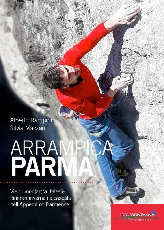
APPENNINO PARMENSE NEW GUIDEBOOK 2019
"Arrampicaparma" III edition - Alberto Rampini and Silvia Mazzani - Idea Montagna ed. 2019
A detailed guidebook including Multipitches, Crags, Ice-falls and winter mountaineering in Appennino Parmense
Guida dettagliata, completa e aggiornata comprendente vie lunghe, falesie, cascate di ghiaccio e itinerari di alpinismo invernale nell'Appennino Parmense


"Arrampicaparma - climbing, bouldering & mountaineering" by Silvia Mazzani and Alberto Rampini Pareti e Montagne Edizioni, II ed. 2011
"Arrampicaparma - montagna, falesie, bouldering" by Alberto Rampini and Silvia Mazzani Pareti e Montagne Edizioni, 2003
“Appennino Ligure e Tosco-Emiliano” by M. Salvo and D. Canossini Collana Guide dei Monti d'Italia CAI-TCI
"Appennino di neve e di ghiaccio" by Andrea Greci - Ed. Idea Montagna 2014
Maps
Click below on the link to the CAI PARMA website to see the
Appennino Parmense online maps
Maps
“Le valli del Cedra e del Parma (The Cedra and Parma Valleys)” Map 1:25.000 (CAI-Regione Emilia-Romagna)
“Alto Appennino Parmense Est” Map 1:50.000 (CAI-Regione Emilia-Romagna)
External Links
CLUB ALPINO ITALIANO SEZ. DI PARMA
PARCO NAZIONALE APPENNINO TOSCO EMILIANO