
|
|
Mountain/Rock |
|---|---|
|
|
40.69800°N / 110.979°W |
|
|
11527 ft / 3513 m |
|
|
Overview
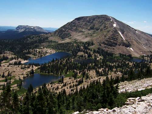
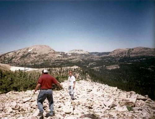
The Uinta Mountains are one of the few mountain ranges in North America that run east to west rather than north to south. Within the Uinta Mountains are about 2000 lakes, and some 900-1000 are full of trout. Along with the San Juans in Colorado, the Uintas have more contiguous area above timberline than any other area in the Continental United States. This is a beautiful area with many lakes, meadows, wildflowers, and some rugged peaks. Solitude is usually easy to come by once you leave the popular fishing holes behind.
Mt. Watson is an enjoyable climb in the Western Uinta Mountains. Many fishing lakes surround the peak, and dozens of them are visible from the summit. The peak is fairly easy to reach, but most of the time the hike still offers solitude.
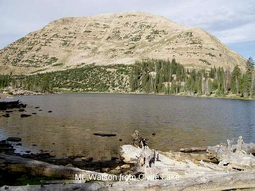
 Mt Watson from the west summit ridge of Notch Mountain
Getting There
Crystal Lake Trailhead
The most popular trailhead for those climbing the peak is the one at Crystal Lake. Crystal Lake is reached from the Trial Lake spur road off Highway 150 25.7 miles east and north of Kamas. Follow the signs along the spur road to Crystal Lake. This gravel road is good for all vehicles. This is the trailhead for both the Watson Pass/South Ridge and North-East Ridge routes.
Middle Fork Weber River Trailhead
From Oakley (State Route 32), turn east on the Weber Canyon Road. Follow this road east for about 12 miles to where the Smith and Morehouse Road turns south. Go straight and pass under the big ranch gate that says "Thousand Oaks Ranch". This is a public road, the ranch just wants to make it look private. Read the sign that informs you that either side of the road is private land for the next several miles. The land between Thousand Oaks and Holiday Park is private, so stay on the main road and don't camp along it. Follow the good gravel road to Holiday Park. Once at Holiday Park, follow Uinta Road to the parking lot and outhouse at the trailhead. Do not cross the river on the 4wd road, look for a sign pointing out the trail to Abes Lake and Crystal Lake.
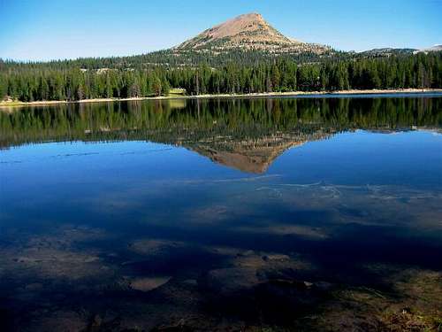 Mount Watson from the south and Washington Lake.
Routes Overview
There are many routes available to climb the Mount Watson, and the peak can be climbed from almost every direction.
The easiest route is from Watson Pass and the South Ridge. The route heads west from Crystal Lake to Watson Pass, and then follows the ridge north to the summit. This route is about 4.5 miles round trip with 1700 feet elevation gain.
The second easiest route is probably the Northwest Ridge from Clyde Lake. The route follows the Notch Mountain trail north, past Wall and Hope Lakes to the base of the Notch. The route then heads west to Clyde Lake and climbs the NE Ridge of Watson to the summit. This route is about 8 miles round trip with 1700 feet elevation gain.
Perhaps the most beautiful route, and my favorite one, is from the West Ridge and Middle Fork Weber River. This is the longest route described and is climbed very seldom. The trails in the Middle Fork Basin are not well defined and route-finding skills are needed. The round trip distance is 16 miles for this route.
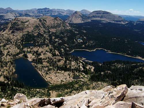 View Northeast from the summit.
Guidebook Available
More details about the area can be found in the book Western Uinta Backcountry Guide, including many routes to the summit, and hiking trails to the many lakes, and fishing information. Just send me a PM if you want to purchase the book.
SP members can have the book for 1/2 price, and there is no shipping cost.

Guidebook
Red Tape
There is a $3 entrance fee for all recreational use along Highway 150.
When To Climb
July through September is the normal season. Highway 150 is closed in winter, and it is a long snowshoe or ski in, making it a multi day trip in winter unless you have access to a snowmobile.
 Mt Watson, Utah from Haystack Mtn in late July.
Camping
There are many campgrounds along Highway 150, but they can get crowded on summer weekends, especially during holidays. There are many campsites in the backcountry along the trails.
Mountain Conditions
Contact the ranger station in Kamas for current road and trail conditions. Their phone number is 801-783-4338.
WEATHER FORECAST FOR WESTERN UINTA MOUNTAINS
Here are some average highs and lows from Mirror Lake at 10,190 feet :
| MONTH | HIGH | LOW |
| JAN | 23 | 0 |
| FEB | 25 | 2 |
| MAR | 29 | 6 |
| APR | 38 | 14 |
| MAY | 47 | 22 |
| JUN | 57 | 31 |
| JUL | 67 | 38 |
| AUG | 65 | 37 |
| SEP | 57 | 30 |
| OCT | 46 | 19 |
| NOV | 32 | 10 |
| DEC | 26 | 4 |
External Links
- Climb Utah
Updated information on hikes, climbs, and trail conditions. - Death in the Uintas