
|
|
Mountain/Rock |
|---|---|
|
|
33.62205°N / 116.67729°W |
|
|
Riverside |
|
|
Hiking |
|
|
Spring, Summer, Fall, Winter |
|
|
6825 ft / 2080 m |
|
|
Overview
Thomas Mountain is a very broad and prominent mountain located in the Santa Rosa Mountains in the Peninsular Range of Southern California. Thomas Mountain can be seen from just about anywhere in the Inland Empire of Southern California. Thomas Mountain commands awesome presence over Garner Valley and Anza Valley. Located right next to the San Jacinto Mountains, the views from Thomas Mountain of these peaks are spectacular. Although Thomas Mountain is not close to being one of the highest peaks, it has around 1,950 feet of prominence making it one of the most prominent mountains in the area. Because of this, Thomas Mountain has awesome views of Toro Peak, the San Bernardino Mountains, San Gabriel Mountains, Santa Ana Mountains and the Pacific Ocean.
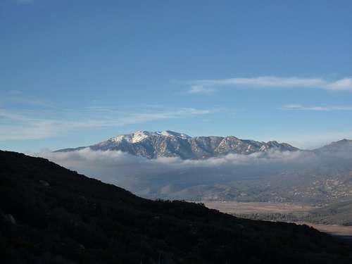 San Jacinto Massif from Thomas Mountain |
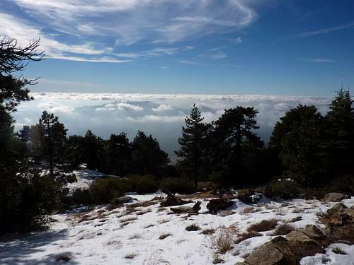 Inversion layer of what would normal be a view of Southern California |
Hiking Info
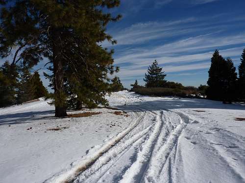
Thomas Mountain has a few ways to reach its summit. One could take the Thomas Mountain Road, which goes straight to the summit. On the summit, there is the Thomas Mountain Campground, which is a very popular spot for locals to camp due to the amazing views and solitude. Because of this fact, the summit is very easy to reach because you could drive to it. You could also hike the road or ride the road on a mountain bike, but that might be pretty boring. However, for those wanting to hike to the summit, there is the Ramona Trail, which begins in Garner Valley and climbs up the north side of Thomas Mountain.
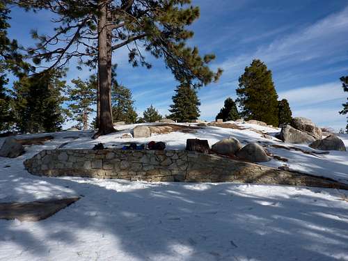 Thomas Mountain Campground
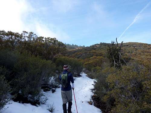
Romona Trail- This trail is 12-13 miles round-trip and gains over 2200ft in elevation. The trail starts out in a wash and starts switchbacking up. It then follows a ridge to more switchbacks. Above this section you will reach pine trees and begin to move away from the manzanita/sage landscape. The trail will start to level out once you reach Tool Box Springs, where there is a spring coming out of spigot (we didn't find it because of snow). From here, the trail is confusing. You could either just hop on the road and follow north towards the summit or you could take your first right onto a trail directing you towards the summit of Thomas Mountain.
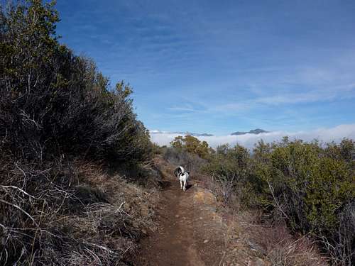 Awesome Views along the Romona Trail |
 Looking Up Towards Thomas Mountain from the Romona Trail |
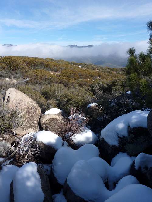 Snow cover rocks along the rail |
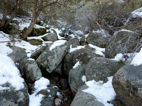 Ephermal spring along the trail |
We really didn't have issues following the trails but apparently people have in the past. The trail we took ended up putting us on a Forest Road which then lead us to the summit. A GPS and/or a map and compass would be helpful. From Toolbox Springs, it is pretty easy hiking until you come closer to the actual summit of Thomas Mountain because it becomes a little bit steeper. There are a maze of roads in this area so if you get off route, locate the main road and keep following that until you reach the summit.
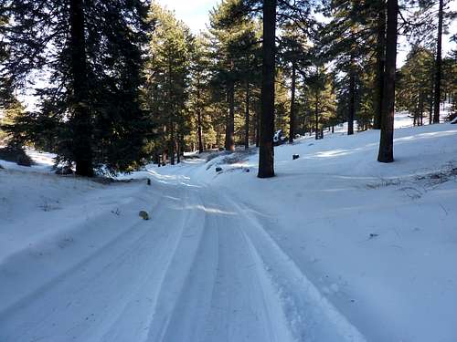 Forest Roads |
 Nearing the summit |
Red Tape
If your attempting to drive the Thomas Mountain Road or access a point from the road, it may be closed seasonally due to snow or maintenance. Click HERE for current conditions of the roads in the area. Unlike other parts of the San Jacinto Mountains and surrounding area, you do not need a Adventure Pass to park at the trailhead. There were no signs at the trailhead indicating that we need one and no one else at the trailhead had one in their car.
Camping
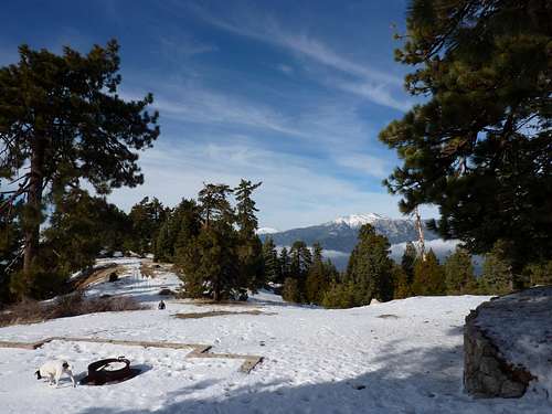
Views towards San Jacinto from Thomas Mountain Campground
Camping can be done all around Thomas Mountain. Established camping can be found at Lake Hemet Campground. This is a very nice place to camp with good fishing. Less established camping can be found on the summit of Thomas Mountain at Thomas Mountain Campground and also below the summit at Tool Box Springs Campground. These campground require an Adventure Pass in order to camp thre. Also, there numerous other places on the mountain where one could also camp primitively. For more information about dispersed camping, click HERE.
Getting There

The start of the Romona Trail
From the 215 Freeway- take HWY 74 east from around Romoland and follow it through Hemet,through Mountain Center. Go past Lake Helmet and drive 2.5 miles until you see a pullout on the right side of the road. Park here and begin hiking!
External Links
Current Weather
The current weather conditions for Thomas Mountain Provided by NOAA
San Bernardino National Forest
Information on the surrounding San Bernardino National Forest
Misc
If you have any more additional information or photos, please contact me or add them to this page. Thank you!
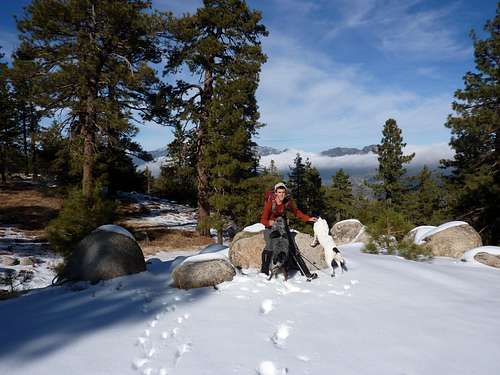 Yours truly near Tool Box Springs
surgent - Dec 3, 2011 2:34 pm - Voted 10/10
Corrected prom figureThe actual prom is about 1,950 feet +/-, still a good figure. Thanks for putting this page up. I've driven by it coming from Hemet to Palm Desert, but there's always something else on my agenda. This looks like a nice place to camp, too.
Alex Wood - Dec 4, 2011 1:31 pm - Hasn't voted
Re: Corrected prom figureAlright I will fix that. I was having a hard time measuring it on my own for some reason. Yeah that was my thought with climbing it to. I always drive by it. Its worth the hike and its gorgeous in the winter!