
|
|
Mountain/Rock |
|---|---|
|
|
37.04568°N / 121.43958°W |
|
|
Download GPX » View Route on Map |
|
|
Santa Clara |
|
|
Hiking |
|
|
Spring, Summer, Fall, Winter |
|
|
1988 ft / 606 m |
|
|
Overview
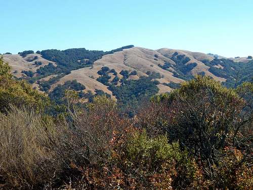
Bills Hill rises to a modest height of 1,988 feet above sea level, and is the high point of Osos Ridge located at the extreme southwestern corner of Henry W. Coe State Park. In spite of its relatively low altitude, the quality of views from the summit can be pretty amazing on a clear day. Extending from the San Francisco Peninsula ranges in the north to the higher peaks in Pinnacles National Park to the south one can see a seemingly endless variety of landscapes in between. These include ranches, farms, towns and an endless succession of mountain ranges and hills. A partial list of the high points that are visible would include Santa Ana Mountain, North and South Chalone Peaks, Junipero Serra Peak, Fremont Peak, Carlyle Hills, Mount Madonna, Loma Prieta, Mount Umunhum, El Toro, Palassou Ridge, Pine Ridge, Mount Hamilton, Copernicus Peak, Mount Sizor, Willson Peak, and Phegley Ridge. A small grove of oak trees on the east side of the summit hides the views in that direction, but by moving a bit north or south, one can see other peaks such as Kickham Peak, and Pacheco Peak.
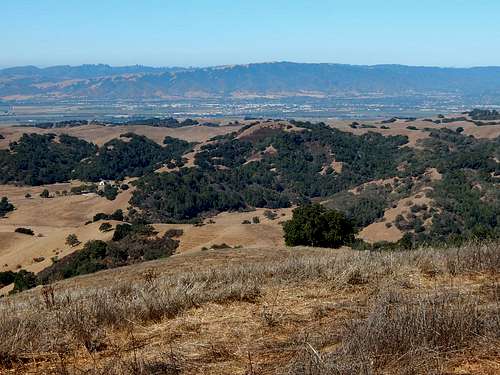 The town of Gilroy on the floor of Pajaro Valley from Bills Hill. | 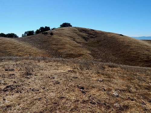 Bills Hill from the north. | 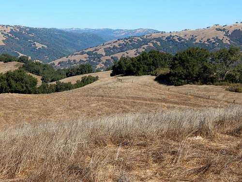 Looking north from the summit towards the northern reaches of Coe Park and Mount Hamilton. |
Bills Hill has 648 feet of prominence and is ranked at number 2485 in California according to Lists of John.
Getting There
The best legal route to the top of Bills Hill starts from the Hunting Hollow trailhead in Henry W. Coe State Park.
Drive to the town of Gilroy on US 101 and take Exit 357- Leavesley Road. Follow Leavesley Road east for about 2.2 miles to where one can make a left turn on New Avenue. After about 0.6 miles turn right (east) on Roop Road. This is followed for about 2.9 miles and beyond where it becomes Gilroy Hot Springs road near the Mendoza trailhead turnoff for Coyote Lake County Park. Simply stay on Gilroy Hot Springs Road for another 4 miles as it drops down into Coyote Creek canyon to the Hunting Hollow trailhead parking lot. This is a huge lot with plenty of parking. The total distance from US 101 to the trailhead is a little less than 10 miles.
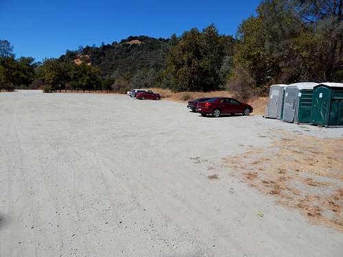
Trailhead parking (and facilities) at Hunting Hollow.
Routes
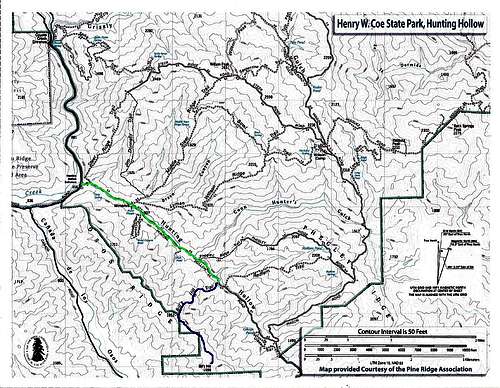
Green = Hunting Hollow Trail
Blue = Bills Hill Trail
Bills Hill Trail:
Some maps of Henry W. Coe State Park- including the ones available from the trailhead kiosk- show a trail leading to the top of Bills Hill from the Hunting Hollow Trail. Aptly named the Bills Hill Trail, this trail hasn't been maintained for a very long time and the start is somewhat difficult to locate. It is well worth the effort to find and follow this trail, though, because the alternatives from Hunting Hollow will involve a lot of steep bushwhacking through significant amounts of brush and poison oak. Ugh!
Follow the Hunting Hollow Trail for about 2.2 miles until you see this:
Faux Bills Hill Trail entrance.
Then, simply slide under the barbed wire and carefully crawl through that tunnel in the poison oak for about an eighth of a mile or so. HA! Just kidding! I wish I could see the looks on your faces :-). This is actually a typical view of the lower portion of Osos Ridge from along Hunting Hollow canyon. Pretty good incentive for finding the real Bills Hill Trail, eh?
Here's how to find the real Bills Hill Trail junction:
After passing the junction with the Phegley Ridge Trail, look for this stump on the east side of the Hunting Hollow Trail about 2.2 miles from the trailhead.
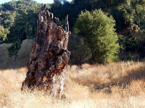
Old Stump in Hunting Hollow Canyon
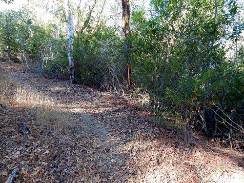
Continue on a short distance and you may see a large cairn on the west side of the trail. This marks the beginning of the Bills Hill Trail. If you get to the Redfern Trail junction, then you've gone too far and you will need to back-track.
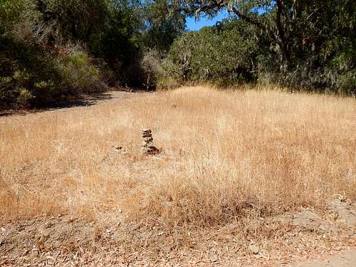
Bills Hill trail junction.
According to my GPS, the coordinates of the Bills Hill Trail junction are:
N37 03.551 W121 26.278
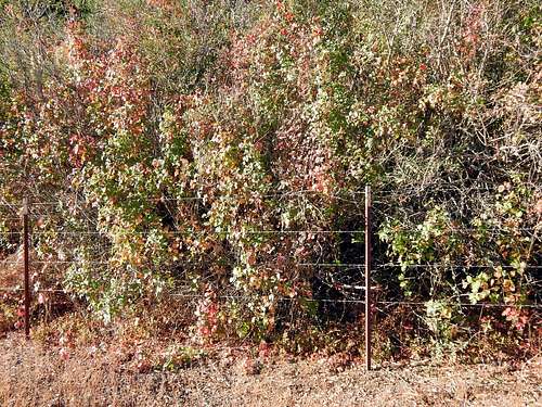
The Bills Hill Trail (actually more of an old road than a trail) is in reasonably good condition and is pretty consistently flagged. There is a lot of poison oak, but I found it to be very easy to identify and avoid. The trail is often very steep- even by Coe standards, so be prepared for a pretty good workout.
 Flagging along the Bills Hill Trail. | 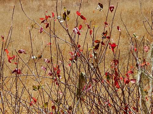 Poison Oak |
Eventually, the crest of Osos Ridge is reached and Bills Hill itself becomes visible a short distance to the south. There is a barbed wire fence running along the crest of the ridge. I made the mistake of not looking at my map and I assumed that the fence defined the park boundary with the west side being private property, but actually most of the crest on both sides of the fence is part of Coe park. This is good to know because the west side has an old road that can be easily followed most of the way to the top of Bills Hill, so I highly recommend sliding under the fence and traveling on the west side of the crest.
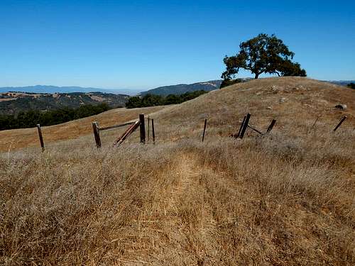 View north along Osos Ridge. | 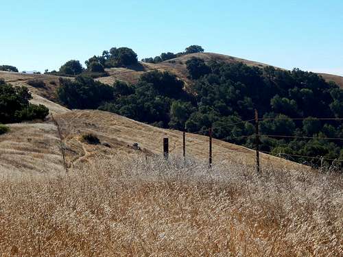 Bills Hill from north along Osos Ridge. |
From the East:
Satellite views show a dirt road that comes surprisingly close to the summit from the private property to the south. It's possible that it may also connect to the Gibson Pond Trail just off Wagon Road to the east. Much of the terrain between the two trails is hidden by vegetation. Might be fun to explore this sometime.
 Phegley Ridge | 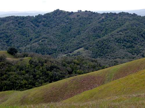 Bills Hill from Phegley Ridge |
Cañada de Los Osos:
All approaches from this canyon involve trespassing on private property or crossing through an open space preserve that is not yet open to the public. Proceed at your own risk.
Red Tape
- Trailhead parking at Hunting Hollow is $6.00 per vehicle. Self payment envelopes are available at the kiosk.
- Car camping is not allowed in the parking area.
- Dogs are not allowed on any of the trails beyond the parking area.
- Drinking water is not available at the trailhead. Bring plenty of water for your hike.
- The Hunting Hollow Trail crosses the creek several times as it goes up the canyon from the trailhead. During times of high water (remember those?), these crossings can be very difficult and possibly dangerous.
- The Hunting Hollow entrance is open 24 hours a day, seven days a week all year making it nice for those who like to get an early start for their hikes.
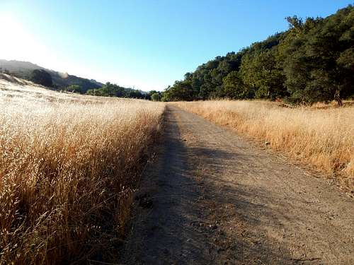 Hunting Hollow Trail | 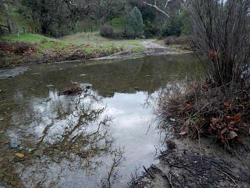 High water conditions in Hunting Hollow. |
More information about the Hunting Hollow entrance can be found here:
Information about Henry W. Coe State Park in general can be found here:
When to Hike
Bills Hill can be hiked year round, though winter and spring are the best times due to much more pleasant temperatures and the eye-pleasing presence of wildflowers.
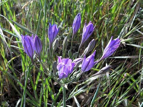 Spring flowers near Hunting Hollow Canyon. | 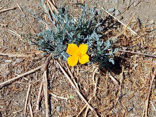 Golden Poppy prevailing in 90+ degrees during drought. |
Summer temps often get up into the 90's or 100's (it was about 98 most of the day of my hike). Bring plenty of water!
External Links
My inspiration for this hike: Bob Burd's trip report.An excellent report detailing the difficulties of climbing Osos Ridge and Bills Hill from Hunting Hollow without the trail can be found here.