

-
 14522 Hits
-
 85% Score
-
 20 Votes
|
|
Mountain/Rock |
|---|---|
|
|
47.50120°N / 10.61430°E |
|
|
7129 ft / 2173 m |
|
|
Overview
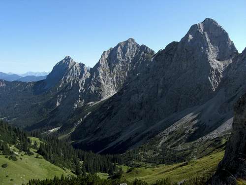
Gimpel is not the highest but the most well-known and boldest looking summit of Tannheimer Berge, this easternmost subrange of Allgäu Alps. Its south, west and north faces with many subridges and arêtes host many famous and well-known climbing routes, about 20 climbing routes on the south and west side (about 200 to 300 meters of altitude difference), 4 routes through the north face (600 meters of altitude difference); many of them are "historic" routes. Thus Gimpel is a real classic mountain.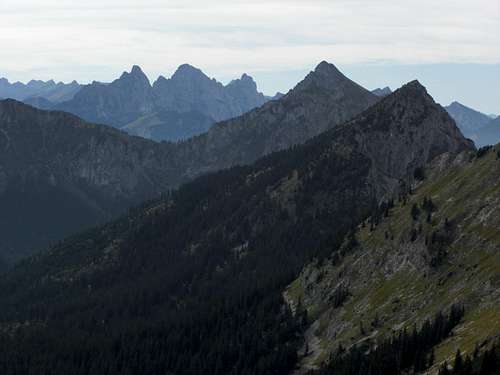 Gimpel (right) with Köllenspitze (center) and Gehrenspitze | 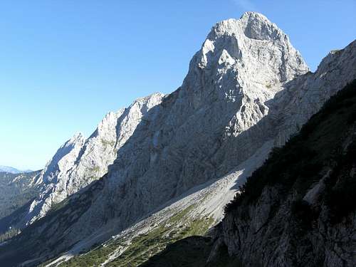 Gimpel as seen from Schartschrofen (September 2012) |
To the north Gimpel has a near perpendicular huge rock face, dominating the end of Raintal valley. Gelbe Scharte separates Gimpel from Rote Flüh, the western neighbour summit. The west face is a steep rock face which gives Gimpel a spire-like appearance. When viewed from the south, a broad southern rock face rises 200 to 300 meters above the meadows and wood slopes of Tannheim valley.
As the snow does not linger long on the south side of Gimpel, the southern climbing routes are a good option for early or late in the year climbs. To the east there is a long arête connecting Gimpel with Zwerchwand and Köllenspitze (also called Kellespitze or, less attracive, Metzenarsch (the whore´s ass)), the highest peak of Tannheim mountains. Within this arête there is “Gimpelvorbau” another famous climbers aim.
User Lampi, the first author of this page, states, that Gimpel looks like an ant- stack on nice summer days??? I don´t know. The denomination Gimpel does not derive neither from an ant nor from the bullfinch. It is named after the hollow south of the summit which was named “Comba” in Celtic times. Local idiom changed Comba to Gimpel.
The normal route to Gimpel uses a system of easy chutes, rock, meadow and scree ledges which start on the south side of the mountain and goes diagonally up to the ridge between Gimpel and Gimpelvorbau. The crux of this normal route, which is marked with red dots and some yellow triangles, is a 5 to 10 meter traverse in steep rock with some UIAA grade II moves.
 Gimpel as seen from Große Schlicke |  Gimpel and Rote Flüh south and east face |  Gimpel and Köllenspitze (left) |
Gimpel summit offers great views and on nearly all routes much climbing pleasure. The southern routes are by far the favourite routes so expect traffic jams on days with good weather. For the experienced hikers and mountaineers: do the normal route early in the morning, its just great to sit alone on this bold mountain top.
Getting There
Gimpel and Rote Flüh (right) as seen from Schartschrofen (September 2012)
Trailheads for Gimpel:
Northern routes
Southern, western and eastern routes
By train and bus:
Railway stations near trailheads are: Musau and Vils.
See the ÖBB schedule here.
Every trailhead has its bus station. See the schedule for bus line 4262 here .
Routes Overview
Gimpel with its west arete as seen from Rote Flüh (September 2012)
Gimpel normal route:
Starting at the southeast pillar of Gimpel south face the normal route uses a system of oblique running chutes and broad meadow ledges up to the east ridge and the upper east ridge to the summit. In parts UIAA grade I, some moves grade II, the rest is steep and exposed hiking terrain.
Gimpel Nord:
Best base camp and information about rock condition: Otto Mayr Hütte
Trailheads: Musau or Füssener Jöchl
Trail to routes:
Starting at the hut descend on forest road tot he first switchback. Leave the road to your right, traverse the wood tot he scree field below the rock face. Ascend the scree to the starting points of the routes.
Famous north face routes:
More Internet information: http://www.walter-hoelzler.de.
Gimpel south and west routes:
Best base camp and information about rock condition: Gimpelhaus or Tannheimer Hütte
Trailheads: all trailheads within Tannheim valley
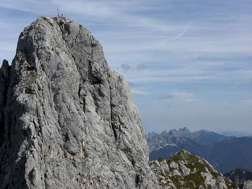
 Gimpel north face |  Gimpel summit |  Tannheimer Hütte as seen from Gimpelhaus |
Trail to routes:
From Gimpelhaus follow trail number 415 in the direction to Rote Flüh. From Tannheimer Hütte do the same on trail number 417. Both trail meet in the Gimpel sink. From there follow trail 417 in the direction of Judenscharte, the col between Gimpel and Rote Flüh. There is a lower and an upper trail to the col. For the climbing routes take the upper trail near the bottom of the south face to your route starting points.
Some famous routes:
The Freudig, T.: Klettern auf der Tannheimer Sonnenseite – guide book has some more south, east and west face routes of Gimpel.
Red Tape & Accommodation
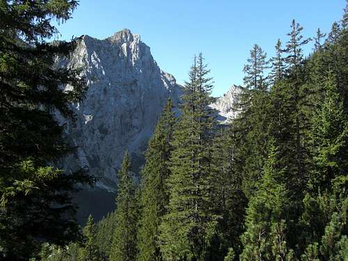
Gimpel north face as seen from Raintal (September 2012)
Red Tape
No restrictions as far as I know.
Accommodation
You find hotels, campgrounds and other accommodation at
Vils
Musau
Reutte/Tirol
Tannheimer Tal (Grän, Haldensee, Haller, Nesselwängle)
Mountain huts:
Musauer Alm
Vilser Alm
Otto Mayr Hütte
Füssener Hütte
Gimpelhaus
Tannheimer Hütte
Gear & Mountain Condition
Bold Gimpel summit
Gimpel for experienced hikers on the normal route is a late spring, summer and autumn summit, depending on the snow conditions.
You need a helmet for Gimpel normal route as there is frequent rockfall near the south faces of Tannheim mountains. Yor need to master UIAA grade II in exposed terrain.
All other routes are for the experienced climbers. Most routes have fixed pegs. Take nuts and friends with you. Rope / double rope with 50 meters, helmet, slings, quickdraws, screwgate carabiners and a figure eight descender, in case you don´t use the normal route as descent, are recommended.
Current Weather:
Mpas & Guide Books
Gimpel (right) with Köllen- and Gehrenspitze and upper Raintal
Maps
Guide Books
The climbers guides of Toni Freudig can be ordered here via Internet .
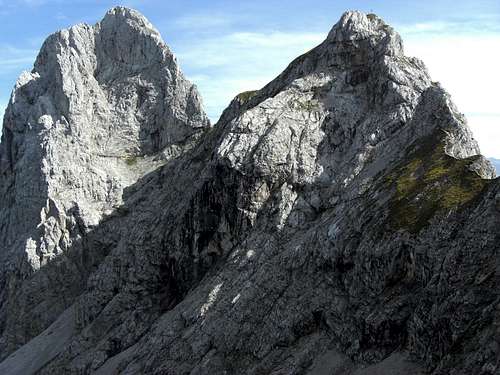
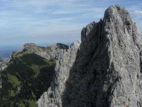
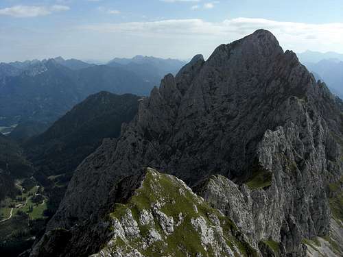 Summit view from Gimpel to Köllenspitze |  Gimpel west face and Rote Flüh (right) as seen from Schartschrofen |