Getting There
Six days into our 2012 Sierra Scree and Talus Tour, Ruvicha, Brian (still needs to join and get a Summitpost alias) and I were eager to nail a summit. The Sierra had not been kind, with shaky weather plus our aversion to being on mountain tops with graphite hiking poles leading us to turn back from a couple of summits. The most frustrating was Basin Mountain: two of us ascended to within 500 vertical feet of the summit when the snow/hail mix began. Five minutes later, the thunderclaps validated our decision to bail and head down.
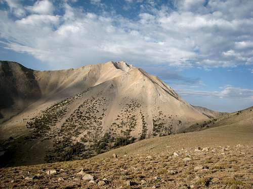
We had originally planned to attempt Boundary Peak via the Trail Canyon route. But the White Mountains brochure we picked up at the Bishop Forest Service Visitor’s Center noted that, with a four-wheel drive vehicle with high clearance and a narrow wheel base, one could drive to the trailhead for the Queen Mine route, which would start almost 1,000 feet higher and be shorter than the Trail Canyon route. We had such a vehicle, so adjusted our plan and headed for the Queen Mine.
As described in dshoe’s route page, when coming from Bishop, we found the cut-off for the Queen Mine route two miles after crossing the California/Nevada border, immediately across Highway 6 from an abandoned ranch.
![Boundary and Montgomery from Highway 6]() Cut-off from Highway 6 toward southeast and Queen Mine
Cut-off from Highway 6 toward southeast and Queen Mine ![Abandoned Ranch]() Abandoned ranch just across Highway 6 from cut-off to Queen Mine
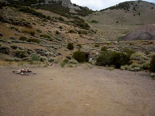
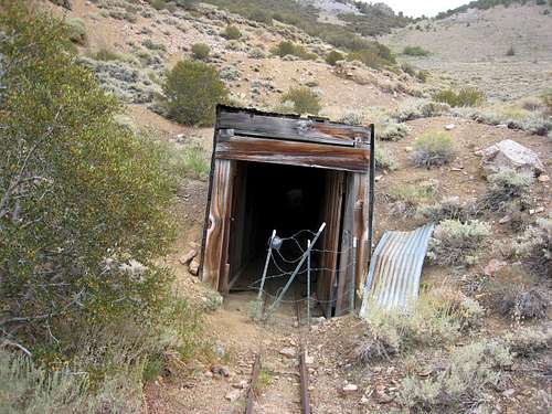
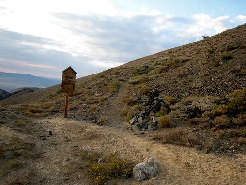
Abandoned ranch just across Highway 6 from cut-off to Queen MineTurning off from Highway 6 toward the southeast, with both Boundary Peak and its slightly higher California neighbor, Mt Montgomery, in view, we followed the obvious dirt/gravel road for 6.1 miles to the abandoned Queen Mine. The road was decent and, to that point, could probably have been navigated with a two-wheel drive vehicle (though high clearance is a must). The Queen Mine lies immediately to the left of the road with a small parking area. There are flat areas for tents, though it did not strike us as a particularly attractive camping site.
![Queen Mine]() Turn-out at Queen Mine, 6.1 miles from Highway 6
Turn-out at Queen Mine, 6.1 miles from Highway 6![Queen Mine]() Queen Mine entrance
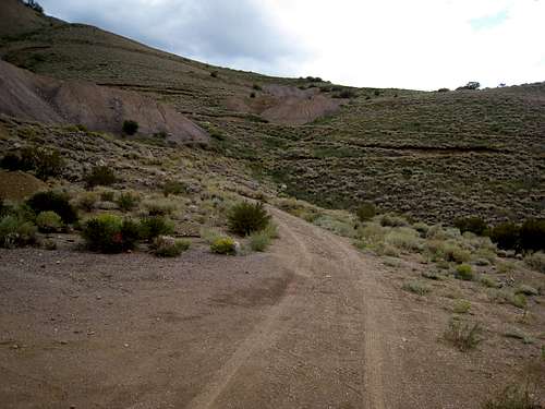
Queen Mine entranceHaving a four-wheel drive, high clearance, narrow wheel base SUV – coupled with a strong desire to minimize hiking distance the next day – we decided to drive on to the saddle at Kennedy Point, above the Queen Mine and immediately below the trailhead. This drive is NOT for the timid. It featured a very narrow road and tight switchbacks, and induced a strong desire to lean toward the uphill side so that the SUV wouldn’t roll off the road and down. But we were rewarded with an additional mile of driving and about 700 feet in elevation from/over the Queen Mine.
![Road to Trailhead]() The road from Queen Mine to the trailhead -- not for the timid
The road from Queen Mine to the trailhead -- not for the timidWe arrived at the saddle below Kennedy Point just before sunset, finding a rather bleak and blustery (wind gusts of 20-30 MPH) setting. We peered down the other side, where the road continues (ultimately to the Trail Canyon route). But the Forest Service brochure was adamant: DO NOT DROP OVER THE SADDLE. From what we could see, that certainly looked like good advice.
![Kennedy Point Saddle]() Kennedy Point saddle -- Queen Mine trailhead is up jeep track on back hill and to left
Kennedy Point saddle -- Queen Mine trailhead is up jeep track on back hill and to left![Tents]() Tents in the only wind-protected area on the saddle
Tents in the only wind-protected area on the saddleWe set up our two tents between some trees in just about the only place on the saddle that afforded protection from the wind, all the while unabashedly watched by an eight-point mule deer who clearly wondered what we were doing on his mountain. We were glad to have brought lots of water, because there was no source whatever on the saddle.
The Hike to Trail Canyon Saddle
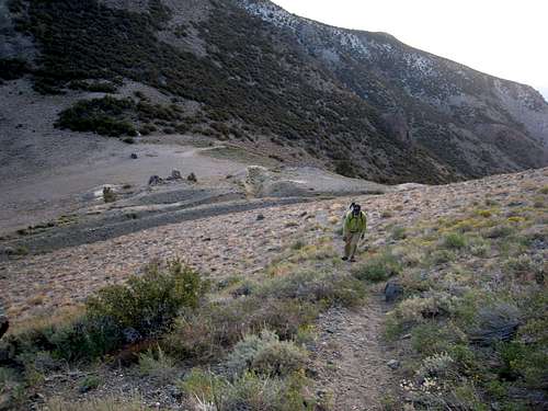
We arose before dawn the next morning and hit the clearly marked trailhead – above and to the southwest of the saddle – about 6:25 am. The trail rose sharply in a series of switchbacks, climbing 900 feet to an altitude of about 10,700 feet in the first mile. But it went fast, at least for us. By 7:00 am we gained our first view of Boundary Peak; shortly thereafter, the trail sidehilled over and onto the south side of the ridge.
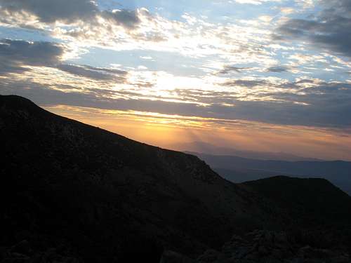
![Sunrise]() Sunrise from the Kennedy Point saddle
Sunrise from the Kennedy Point saddle![Trailhead]() Queen Mine trailhead
Queen Mine trailhead![On the Queen Mine Trail]() On the Queen Mine trail above Kennedy Point saddle
On the Queen Mine trail above Kennedy Point saddle![Queen Mine Trail]() On the Queen Mine trail
On the Queen Mine trail ![First View of Boundary Peak]() First view of Boundary Peak from Queen Mine trail
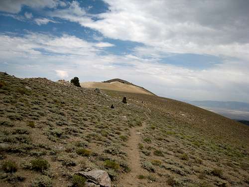
First view of Boundary Peak from Queen Mine trailThe next 1.7 miles was a well-used trail with gentle rises and falls, making for a fairly relaxing walk, except for the intimidating view of Boundary Peak, looming another 2400 feet above us. By 8:00 am we arrived at the Trail Canyon saddle, where the Queen Mine and Trail Canyon routes merge. Smack dab in the center of the saddle is a collection of rocks and old logs, which made a fine place to rest for a bit and to stash a couple of bottles of water for the return leg of the hike.
![Boundary Peak]() On Queen Mine trail heading for Trail Canyon saddle
On Queen Mine trail heading for Trail Canyon saddle![Boundary Peak]() Boundary Peak with Trail Canyon saddle just visible on right
Boundary Peak with Trail Canyon saddle just visible on right![Trail Canyon Saddle]() Trail Canyon saddle
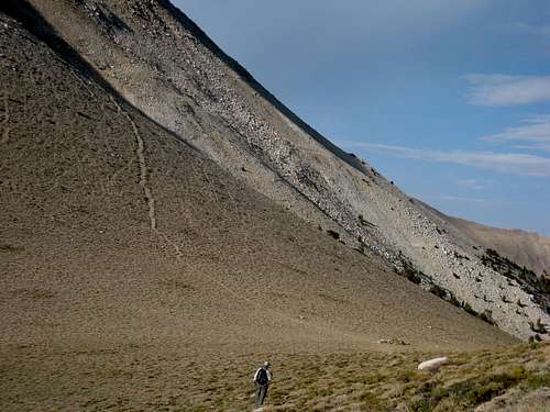
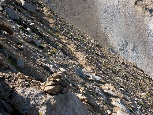
Trail Canyon saddleFrom the saddle at 10,800 feet, we had no view of Boundary Peak – just the sight of the trail heading almost straight up the mountain on the south side of the saddle. Happily, the trail was not the scree slog that we had feared it might be. While there was some loose gravel here and there, the footing was generally stable, and cairns clearly marked the trail’s ascent.
![Rising from Trail Canyon Saddle]() Trail rising from Trail Canyon saddle
Trail rising from Trail Canyon saddle![Heading for the Peak]() Ruvicha and Brian coming up from Trail Canyon saddle
Ruvicha and Brian coming up from Trail Canyon saddleClimbing Boundary Peak
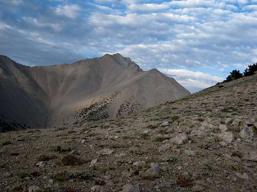
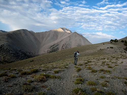
By 9:10 am, we had covered an additional .6 miles and gained another 1100 feet and had regained a view of Boundary Peak' summit. It loomed closer than before but still a way away and 1200 feet above us. The viewpoint provided another good rest stop.
![Boundary Peak]() First view of summit after leaving Trail Canyon saddle
First view of summit after leaving Trail Canyon saddle![Cairn and Trail]() The trail is generally well-marked
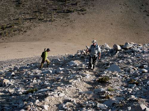
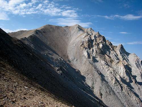
The trail is generally well-markedWe started hiking again and found that the trail divided into multiple trails, and after attaining the ridge, they wove back and forth between the west and east sides of the ridge leading to the summit. At a couple of points, the trail disappeared into boulder fields, but the scrambling was easy, and rock cairns – if sometimes difficult to spot – identified the right way to go. Picking up a trail on the other side was no problem.
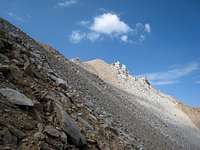
![Getting Close to the Top]() The trail reaches the ridgeline and thereafter stays just to one side or the other of the ridge
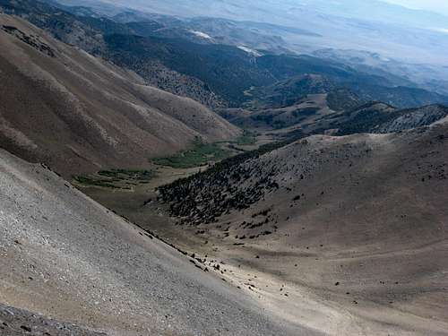
The trail reaches the ridgeline and thereafter stays just to one side or the other of the ridge![Trail Canyon]() Looking down on Trail Canyon
Looking down on Trail Canyon
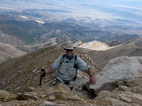
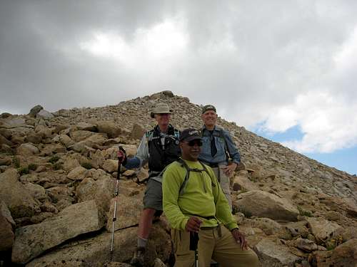
About 300 vertical feet from the top, we met a couple from Colorado who had just summited and were heading down. They ignored our suggestion that they return with us to take a picture of the three of us on top – geez, normally you meet such nice people in the mountains (☺) – but continued down and on to Las Vegas. I made it to the top just after 11:00 am and got great pictures of Ruvicha and Brian as they summited.
![Getting Closer]() Getting Close to the Top
Getting Close to the Top![On Top]() Ruvicha summits
Ruvicha summits![On Top]() Brian summits
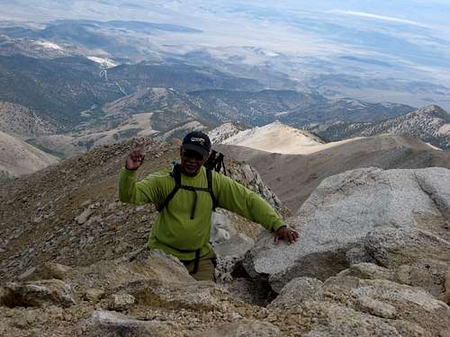
Brian summits![Atop Boundary Peak]() Atop Boundary Peak with flag from summit canister
Atop Boundary Peak with flag from summit canisterWe found and signed the register, and took pictures of one another with the “Boundary Peak – 13,140’” flag from the summit canister. Our GPS showed that we had come an additional mile from our last rest stop at 9:10 am, making for a total distance of just over 4.2 miles from the trailhead above the Kennedy Point saddle and a net elevation gain of 3340 feet.
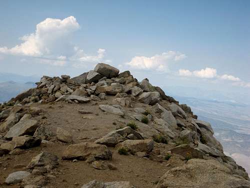
![Nevada s Highpoint]() Top of Boundary Peak
Top of Boundary Peak ![Mt Montgomery]() Mt Montgomery just across the state-line in California
Mt Montgomery just across the state-line in California
We lingered for 30 minutes, taking in the views. We looked across the traverse to Mt Montgomery, which seemed to be a rather tough and challenging slog. Boundary Peak would do. With clouds beginning to roll in, we took some last pictures and started down about 11:40 am.
The Descent
The descent went relatively fast (for us), though we took care with footing, especially when a hailstorm shortly after we had left the summit. It made some boulders a bit slick, but the footing on the trail remained generally good. Just after leaving the summit, we ran into three other hikers, who had ascended the Trail Canyon route. We told them they were almost to the top, but we declined to return with them to take their picture – yeah, yeah, normally you meet such nice people in the mountains.
![On the Way Down]() On the way down as weather gets ugly
On the way down as weather gets ugly![Heading Down]() Crossing boulders on way down
Crossing boulders on way down
By 1:20 pm, we were back at the Trail Canyon saddle. From there it was a relatively fast walk back to the campsite and the Kennedy Point saddle, which we arrived at about 2:20 pm – just in time to bolt into the car when a huge downpour opened up. At eight hours roundtrip, we certainly set no speed records, but it was a fun hike and gave us our summit for the week.
![Heading Back]() Heading back on Queen Mine trail between Trail Canyon saddle and Queen Mine trailhead
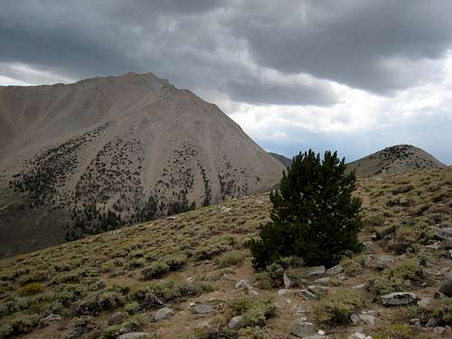
Heading back on Queen Mine trail between Trail Canyon saddle and Queen Mine trailhead![Dark Clouds over Boundary Peak]() Ugly clouds over Boundary Peak
Ugly clouds over Boundary PeakAfter the rain eased, we broke camp and slowly drove the 7.2 miles back to Highway 6, then journeyed to the small town of Benton for a cold soda and beer. There we ran into the group of three climbers. They had summited and then headed straight down into Trail Canyon, without returning via the saddle, clearly making excellent time.
All in all, a day well spent. Boundary Peak is kind of a rock pile, and the scenery doesn’t come close to what we have seen in the Sierra – few trees, no mountain meadows, creeks or lakes. But it is Nevada’s highpoint and a nice summit to tag.


Comments
Post a Comment