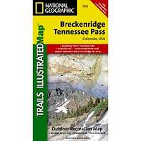
Breckenridge & Tennessee Pass, Colorado - Trails Illustrated Map # 109
| Page Type | Gear Review |
|---|---|
| Object Title | Breckenridge & Tennessee Pass, Colorado - Trails Illustrated Map # 109 |
| Manufacturer | National Geographic Maps |
| Page By | redsplashman23 |
| Page Type | Nov 10, 2011 / Nov 10, 2011 |
| Object ID | 7883 |
| Hits | 2752 |
| Vote |
Product Description
"Publication Date: September 1, 2006Coverage includes the Pike, San Isabel and Arapaho national forests, Alma State Wildlife Area and the cities of Leadville, Como, Breckenridge, Climax and Alma. Also included are the Blue River, Turquoise and Robinson lakes, and Montgomery Reservoir. 14ers: Mt. Lincoln, Bross, Democrat, Cameron and Quandary peaks. Boreas, Mosquito, Hoosier, French, Georgia, Freemont and Searle passes. Ski areas: Breckenridge, Copper Mountain and Fairplay cross-country. 10th Mountain Huts: Jackal Hut, Vance's Cabin, Janet's Cabin, Fowler Hilliard Hut and Francie's Hut. Portions of the Continental Divide Trail and Colorado Trail are included on this map. Includes UTM grids for use with your GPS unit."
Features
Map: 2 pagesPublisher: Natl Geographic Society Maps; 4 edition (September 1, 2006)
Language: English
ISBN-10: 1566953227
ISBN-13: 978-1566953221
Product Dimensions: 7.4 x 3.9 x 0.4 inches
Images
 |