
-
 15971 Hits
-
 86.37% Score
-
 22 Votes
|
|
Mountain/Rock |
|---|---|
|
|
40.48694°N / 121.5469°W |
|
|
Shasta |
|
|
Hiking |
|
|
Summer |
|
|
8658 ft / 2639 m |
|
|
Overview
 Brokeoff Mtn., Mt. Diller and Pilot Pinnacle
 Loomis Peak and Mt. Shasta
Getting There
 Chaos Crags from Loomis Peak
From the south entrance/Emerald Lake: From Interstate 5 turn east on Hwy. 36 at Red Bluff. Go 44 miles east to Hwy. 89. Turn left (north) and go 4 miles to the Lassen Park entrance. Continue another 5.4 miles to Emerald Lake on the left. Hike west up to the ridge and drop down to a small hanging valley. Then hike northwest through forest to the saddle below the southeast slope of Loomis Peak at 1.5 miles from Emerald Lake. Take the slope to the summit at about .5 miles staying to the right to avoid dense chaparral. This east side approach is the shorter and easier of the two.
Red Tape
 Lassen Peak from Loomis Peak
Camping
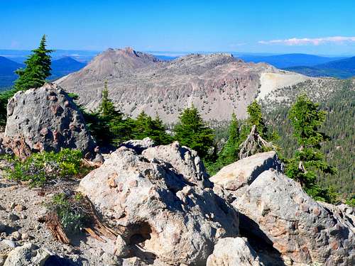
 Pilot Pinnacle and Mt. Diller from Loomis Peak
 Eagle Peak, Vulcans Castle and Ski Heil Peak from the west
For more information click on this link: Campgrounds of Lassen Volcanic.
Current weather and road conditions
 Brokeoff Mtn., Pilot Pinnacle and Mt. Diller from the ridge
For current weather and snow conditions click here.