-
 59173 Hits
-
 98.58% Score
-
 85 Votes
|
|
Area/Range |
|---|---|
|
|
41.40308°N / 122.19749°W |
|
|
Spring, Summer, Fall, Winter |
|
|
14162 ft / 4317 m |
|
|
California Cascades Overview
The Cascade Mountains stretch from the snowy reaches of southern British Columbia in Canada to the lonely heights of northern California. In between these two points the Cascades bisect the states of Washington and Oregon. The range’s character varies in each state, often exhibiting diverse rock compositions, volcanic activity and glacial influence. Nonetheless, from Canada to California, the distinguishing characteristic of the Cascade Mountains is the numerous volcanic peaks. Indeed, the cascades are in many ways the quintessential volcanic mountain environment, dominated by the spectacular string of volcanoes, scalloped like a pearl necklace from Lassen Peak in California to Mt. Garibaldi in British Columbia. The fame of these entrancing peaks is certainly justifiable. However, there are plenty of other excellent peaks in the Cascades that tend to be overshadowed by their more famous and visible cousins.
In no part of the Cascade Mountains is this more true than the southernmost section, running from the environs around Lassen Peak to the Oregon border. The undeniable majesty of Mt. Shasta and the gorgeous and fascinating region around Lassen Peak absorb the preponderance of people’s attention, knowledge and time budgeting. This leaves a striking number of peaks in blissful anonymity. For those who appreciate isolation and spectacular views found in a wild setting, these are the peaks to seek after. In some ways they are even more enjoyable than Shasta and Lassen. Not only does one get to enjoy the wilderness and solitude, but also the great stratovolcanoes dominate the views in a way that is impossible when actually on Shasta and Lassen themselves.
The purpose of this page is to bring together the disparate peaks in the California Cascades and to provide a cohesive view and understanding of the region.
Regional Map
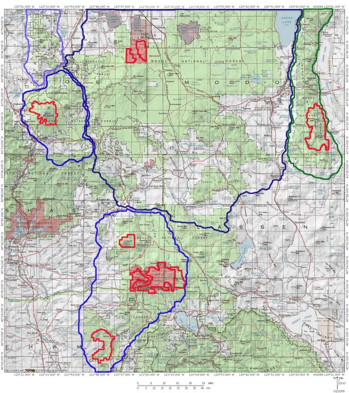
Regions Overview
The California Cascades can be divided into four general regions. In the south is the cluster of peaks surrounding Lassen Peak, the southernmost stratovolcano in the Cascade Range. In addition to the mountains around Lassen, there is a series of lower volcanic peaks that dot the crest of the range. The second section of the California Cascades is dominated by the Medicine Lake Caldera. Numerous peaks surround the volcanic basin that contains Medicine Lake. The Modoc Plateau extends east from the Medicine Lake highlands before terminating at the foot of the Warner Mountains on the fringes of the Great Basin. The third section of the California Cascades is dominated by Mt. Shasta. Some of the highest peaks in the entire Cascade Range huddle at the foot of Shasta, yet the magnificent, glacier clad mountain handily drapes them in a cloak of mystery and they are, for the most part, unknown to most people. The final stretch of the California Cascades extends north of Shasta to the Oregon border. This area closely resembles the mountains north of Lassen Peak in terms of composition and appearance.
To the south, Fredonyer Pass and the plain now occupied by Lake Almanor separate the California Cascades from the Sierra Nevada. The northern boundary of the range is artificial, since the Cascades continue into Oregon. However, the Klamath River, one of only three rivers to transect the Cascades (the other two being the Pit River to the south and the Columbia River) flows just south of the California-Oregon border. The Klamath serves as a functional physical boundary to the California Cascades.
Lassen Volcanic National Park
The national park, established in 1916, anchors the southern terminus of the Cascade Range. To the south, the mountains taper off into a mid-elevation plateau before transitioning into the northern end of the Sierra Nevada. In the past, this plateau was a vast meadow, called Mountain Meadows. The meadow functioned as the headwaters of the Feather River. The waters have been impounded and the meadow flooded. Lake Almanor now occupies the transition area between the Cascade Range and the Sierra Nevada.
It comes as no surprise that Lassen Volcanic National Park is centered around the excellent Lassen Peak. Surrounding the volcano are numerous peaks exceeding 8,000 and 9,000 feet. Several glacial lakes are found in these mountains. To the east the mountains flatten out into a broad wooded region before rising up again (albeit not as high as the Lassen Peak area) at the eastern most edge of the national park. Aside from Mt. St. Helens, Lassen represents the most active volcanic region in the cascades. Lassen Peak erupted continuously from 1914 to 1921. It experienced a cataclysmic eruption in 1915. All four kinds of volcanoes are found within the park, as well as all geothermal features except geysers.
Trails crisscross the area, climbing to the top of many of the peaks and leading to numerous volcanic features. The Pacific Crest Trail bisects the park. Five entry points provide access to trailheads. Most trails are accessed off of Highway 89 as it winds around Lassen Peak. Although the majority of the park’s usage occurs on this road, most people do not go far beyond their cars. Some trails certainly see a lot of use (Lassen Peak easily holding down the top claim on the most hikers) but even in that busiest part of the park, a lot of the trails remain empty. Highway 89 enters the Lassen area in the northwest and the southwest corners of the park. In the northeast, the road into Butte Lake provides access to the lake itself and the network of trails leading to the Cinder Cone and Juniper Lake, as well as connecting to trails in the west. To the south, a road accesses Juniper Lake and the same network of trails. The road leading to the Drakesbad resort accesses the south central part of Lassen.
North of Lassen are a series of volcanic peaks. Most of them are not craggy and have rounded summits and wooded slopes. One interesting variation is Crater Peak. From Redding, the peak is visible on the eastern horizon and looks exactly like what its name implies: a giant volcanic crater. From the east one can observe the direction of the blast that created the mountain, since the western rim is all that remains of the volcano’s former height. The area has numerous lakes and some spectacular vistas.
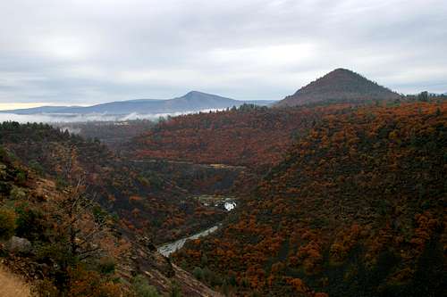
The Cascade foothills southwest of Lassen Peak offer excellent hiking and backpacking. Numerous creeks, particularly Mill Creek whose headwaters are on the southern slope of Lassen Peak, have carved spectacular gorges through the lava flows that moved southwest from the active volcanic regions higher up in the range.
Medicine Lake and the Modoc Plateau
The string of peaks extending north from Lassen Peak is separated from the Medicine Lake highlands by the Pit River, which flows out of the Modoc Plateau. The Medicine Lake area is, for the most part, much gentler than the Lassen region. The peaks do not reach as high, nor are they as plentiful. This belies the violence that once occurred in the region, the evidence of volcanic catastrophe that still exists and the geothermal activity that continues today. Medicine Lake is contained within a caldera, the remains of a once active volcanic feature. Along with the Newberry Caldera, near Bend in Oregon, the Medicine Lake Caldera is the largest volcanic feature by volume in the entire Cascade Range. These caldera are similar to the Valles Caldera found in the Jemez Mountains in New Mexico.
The area also contains numerous lava flows of immense size as well as active steam fields. The territory around Glass Mountain (a large peak composed of obsidian) is especially active. Power producers have long tried to exploit the area for the purposes of electrical generation but regulatory issues continue to hamper the development of this green energy source.
The Modoc Plateau is a broad plain with numerous lava flows. The Pit River flows west through the plain, carving an impressive canyon as it goes. The canyon walls reveal the volcanic origin of the area as it exhibits the layers of lava that slowly built up the plateau. The northern end of the Modoc Plateau is home to the Lava Beds National Monument, which contains numerous cinder cones as well as other volcanic highpoints, lava caves and even historical battlefields. Several lakes are found in the area, including Lower Klamath, Tule and Goose Lakes. Big Lake is located in the southern Modoc Plateau. On the north side of the lake is the Ahjumawi Lava Springs State Park, which contains a wilderness of lava fields and forests with excellent views of Mt. Shasta and Lassen Peak. The wilderness is accessible only by boating across Big Lake. Although the lake feeds the Tule River, it is in turn fed by the Ahjumawi springs. These springs are one of the largest fresh water springs in the world.
Mt. Shasta
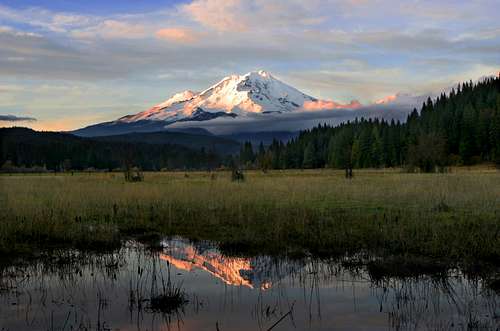
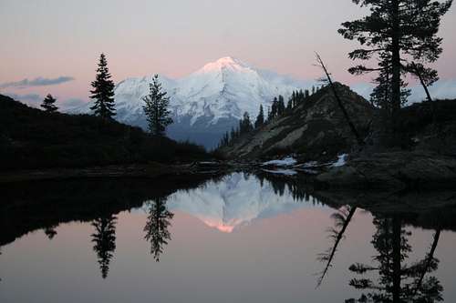
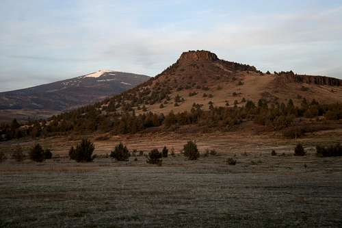
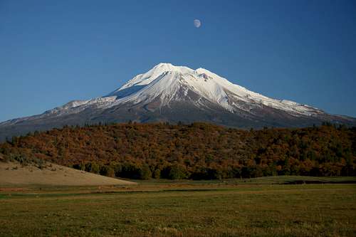
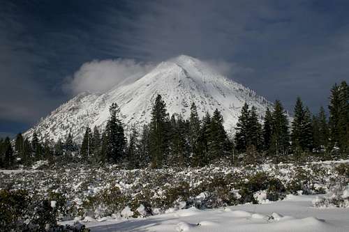
Mt. Shasta is one of the monarchs of the Cascades. Only Mt. Rainier in Washington is taller, and then only by a few hundred feet. Not only is the mountain tall, but also its bulk is nothing less than stunning. The third highest summit in the Cascades, Shastina is relegated to the role afterthought to Shasta, albeit a very large one. While Shasta is one of the primary attraction of the entire Cascade Range, it is not alone in its immediate vicinity. Aside from peaks such as Shastina, Green Butte and Gray Butte, which come off of Shasta itself, there are several other excellent peaks in the area. The three most prominent are the Whaleback, Ash Creek Butte and Black Butte. In many ways climbing these peaks can be more satisfying than Shasta itself, since the stratovolcano looms high above even these high peaks. Whaleback and Ash Creek Butte are located on the east side of the mountain while Black Butte rises at the western foot of Shasta. Indeed, a quick scan of a map will indicate that Black Butte is the western most peak of the California Cascades. Other peaks even more obscure than Ash Creek Butte or Whaleback dot the area as well, all providing views of Shasta with slightly different nuances.
The Forgotten Cascades
North of Mt. Shasta the Cascades continue into Oregon. The range in this area narrows considerably, forming a north south crest with a few high, prominent peaks. The highest point in this part of the California Cascades is the Goosenest but Willow Creek Mountain and Herd Peak are also high, prominent mountains. The chain of peaks forms the dividing line between the Shasta Valley to the west and Butte Valley to the east. Lacking any lakes and notably craggy peaks as well as low population density of the area and proximity to Mt. Shasta, this area remains the most obscure and least visited part of the California Cascades. Nonetheless, the peaks are certainly worth climbing and offer great views not only of Mt. Shasta and the two valleys but also north into Oregon.
The true Pacific Crest arcs between Lassen Peak and Mt. Shasta before heading north along the crest of this stretch of the Cascades. The Pacific Crest Trail was originally intended to follow this route. During the PCT's design process it was decided that a detour off of the true crest into the Klamath Mountains would provide for more interesting side trips and a great deal more reliable water in the form of both lakes and creeks. While Shasta dominates the view from many areas along the PCT the area to the north of the mountain are largely unseen. This makes these forgotten Cascades the portion of the Pacific Crest totally absent from the Pacific Crest Trail.
The Warner Mountains Question
Forming the eastern boundary of the Modoc Plateau, the Warner Mountains are a remote and spectacular mountain range. The Warners stretch from southern Oregon into California, passing through the width of Modoc County, into Lassen County. They reach just under 10,000 feet. Eagle Peak and Hat Mountain are the Modoc and Lassen County highpoints. Indeed, if Eagle Peak and its shorter but grander neighbor Warren Peak were included in the California Cascades, they would be the fourth and fifth highest peaks in the range.
A good deal of the literature dealing with the Warner Mountains (what little there is) claims the Warners are an isolated spur of the Cascade Range. This seems to be due to both proximity and the composition of the Warners. Other resources treat the range as a separate range, that while related in some ways to the Cascades, is nonetheless an entity unto itself.
While the question as to whether or not the Warners are part of the Cascades or not remains unresolved, for the purposes of this page, they will be treated as an entirely separate range, warranting their own Summitpost page (which is in the works by this pages author). The reasons for this are many. Their structure, being a fault-block range, is too dissimilar to the rest of the Cascades. Second, though they are volcanic, they were not volcanoes, being rather an uplifted fault that was previously covered by successive layers of lava flows. Third, they exhibit many characteristics of Great Basin mountain ranges, especially in terms of their flora. For these reasons, and others, they will be considered separate from the Cascades.
Peaks
Like the rest of the Cascade Range, the majority of peaks in the California Cascades are volcanic in nature. Mt. Shasta and Lassen Peak are the obvious examples of this. While most of the peaks in the California Cascades lie below 9,000 feet, the stratovolcanoes compensate for this seeming shortfall. Shasta, Shastina and Lassen are the second, third and ninth highest peaks in the Cascades Mountain, respectively. The following are the ten highest peaks in the California Cascades:
1. Mount Shasta 14,162 ft
2. Shastina 12,330 ft
3. Lassen Peak 10,457 ft
4. Brokeoff Mountain 9,235 ft
5. Eagle Peak 9,222 ft
6. Mount Diller 9,085 ft
7. Pilot Pinnacle 8,886 ft
8. Bumpass Mountain 8,753 ft
9. Reading Peak 8,714 ft
10. Crater Peak 8,683 ft
Wilderness Areas
Six wilderness areas are found in the California Cascades. Most of the areas are in the southern section of the range, clustered around the Lassen area. Only two wilderness areas are found in the northern stretch of the California Cascades.Lava Beds Wilderness
Divided into two units by the park road, the Lava Beds Wilderness contains 28,467 acres. It is located in the Lava Beds National Monument. Most of the area is covered by lava flows of various ages. Stark, jagged black lava spreads out into nearly impenetrable flows making travel extremely difficult. Where the lava has not flowed, the terrain is generally flat with sage and juniper being the dominant vegetation. Periodic cinder cones and volcanic buttes dot landscape. Views of Shasta are excellent, especially from the western unit of the wilderness.
Mt. Shasta Wilderness
The icon of the Jefferson Territory of northern California, Mt. Shasta is the highpoint of the California Cascades. From the south, the volcano is visible from nearly two hundred miles away. The Mt. Shasta Wilderness contains 33,845 acres. Few established trails are extant in the wilderness but numerous routes exist, most leading to the summit. The most popular trailhead is at Bunny Flat. Not only is this the trailhead for the most heavily used route to the summit, but it also leads to the popular destinations at Horse Camp, Hidden Valley and Green Butte. The Old Ski Bowl is located just beyond Bunny Flat. Trails to Panther Meadows, Grey Butte and Squaw Valley Originate there. The Clear Creek Trail skirts the eastern side of Shasta. The north side of the mountain sees very little visitation, meaning that isolation is virtually guaranteed. The largest glaciers in California are found on the north side of the wilderness.
Thousand Lakes Wilderness
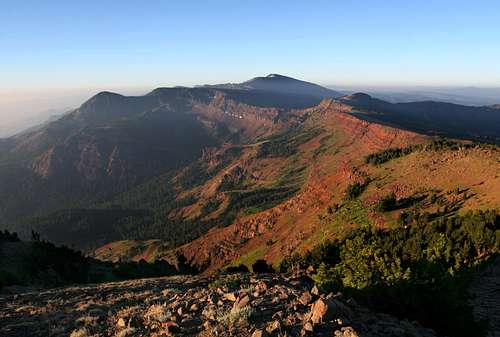
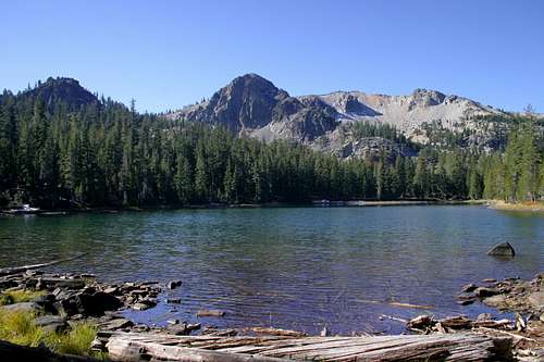
The smallest wilderness in the California Cascades at 16,335 acres, the Thousand Lakes Wilderness still packs a great deal of interesting terrain. The Crater Peak massif is the centerpiece of the wilderness area. The name of the wilderness area is somewhat misleading. There is nothing even approaching a hundred lakes, let alone a thousand of them. Nonetheless, there are plenty of lakes to go around. Lake Eiler, in the northeast corner of the wilderness is the largest. The best lakes, as well as the highest, are Magee and Everett Lakes. From here the rim of the volcano towers above the lake and the awesome Red Cliffs loom overhead. The lakes also serves as a good basecamp for climbing all three points on the rim; Crater, Magee and Fredonyer Peaks. In addition to the main volcanic peak the Thousand Lakes Wilderness contains numerous other volcanic features. Lava flows are found east of Crater Peak. Cinder Cones such as Eiler Butte also exhibit recent volcanic activity. Four trails access the wilderness area, each roughly corresponding with the four corners of the wilderness boundary.
Lassen Volcanic Wilderness
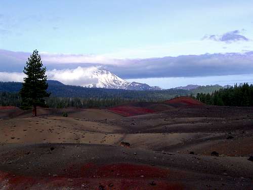
Constituting the core of the southernmost region of the Cascade Range, the Lassen Volcanic Wilderness is located entirely within Lassen Volcanic National Park. At 78,982 acres it is the largest wilderness area in the California Cascades. The bulk of the wilderness lies east of the main park road (Highway 89). The western section is nearly trailess, the most popular being the route to the top of Brokeoff Mountain and Cliff, Shadow and Terrace Lakes. The Manzanita and Crags Lake trails also penetrate into the wilderness. Although most of Lassen Peak is within the wilderness, the southern slope (which contains the trail to the summit) amd the summit itself, remain outside the wilderness boundary. The central part of the wilderness is the flattest, consisting of rolling forested ridges. The area has a few lakes and geothermal features. Most people enter this area to either connect the more interesting eastern and western portions or to hike the parks 17 miles of the PCT. The eastern third of the wilderness contains the large Butte, Juniper and Snag Lakes along with a host of other smaller lakes. While there are no active geothermal features in this area, evidence of volcanic activity is everywhere. The highlight is the Cinder Cone, surrounded by the Painted Dunes and Fantastic Lava Beds.
Caribou Wilderness
Totaling 20,546 acres, the Caribou Wilderness lies adjacent to the eastern boundary of Lassen Volcanic National Park, effectively enhancing the size of the Lassen Volcanic Wilderness. It shares characteristics with the eastern portion of the National Park, including numerous cinder cones and dozens upon dozens of lakes. The Caribou is generally flat, exhibiting significant terrain only where it shares the border with Lassen. At 8,347 feet, Red Cinder is the highest point in the wilderness. The overabundance of lakes and the flat terrain make this one of the easiest wilderness areas in California to explore.
Ishi Wilderness
The Ishi Wilderness encompasses 41,840 acres, making it the second largest wilderness area in the California Cascades. It is also the most unique. Rare among California wilderness areas, the Ishi takes in a large, low elevation area, ranging from 1,500 to 3,500 feet above sea level. The volcanic heritage of the area is evident in the spectacular canyons that have been carved through layers of ash and ancient lava flows. Lava columns resembling those in the Oregon's Menagerie Wilderness are found in the Canyons as well. A small volcano is present as well in the form of the Black Rock, a volcanic plug. The Ishi Wilderness is named after Ishi, the last Native American known to have lived an aboriginal existence.
Rivers
Six rivers drain the California Cascades. It is interesting to note that of the six only three actually have their headwaters in the Cascades. These three are the smallest and least significant of the ranges’ rivers. The rivers form an unusual watershed pattern. Nearly all the rivers and creeks in the California Cascades are contained within the Klamath River or Sacramento River watersheds. Neither of these rivers originates within the Cascade Range.The rivers of the California Cascades are:
Klamath River
Shasta River
Sacramento River
McCloud River
Pit River
Susan River
The Klamath River Watershed:
The Klamath River flows out of Upper Klamath Lake (some resources list Lake Euwana as the source of the Klamath. This lake is located only two miles downstream from Upper Klamath Lake and is an impounded body of water). The Williamson, Sycan and Sprague Rivers in turn feed Upper Klamath Lake. Once it enters California the Klamath is fed by the waters of the Shasta River, which is fed by waters flowing from Mt. Shasta and nearby Mt. Eddy. The Little Shasta River (more of a creek) flows into the Shasta River off of the Goosenest. The Klamath River quickly leaves the California Cascades and enters the Klamath Mountains where it is fed by the Scott, Salmon and Trinity Rivers.
Sacramento River Watershed:
Most of the water in the California Cascades finds its way into the Sacramento River, California’s longest and largest river. The source of the river is Gumboot Lake, located at the eastern edge of the Klamath Mountains system. Waters flowing south from Mt. Shasta quickly join it (the springs emanating from Spring Hill in Mt. Shasta City are touted as the spiritual headwaters of the river. Seeing the creek spring fully grown in Athena-like fashion from the base of Spring Hill is certainly inspiring, but Gumboot Lake lies a further 13 miles upstream). The Pit and McCloud Rivers eventually feed the Sacramento. Numerous substantial creeks coming out of the Cascades, most notably Mill Creek, which begins on the southern slopes of Lassen Peak and flows through the Ishi Wilderness, also contribute water to the Sacramento.
The Susan River drains the area around the Caribou Wilderness and flows east for forty miles before emptying into Honey Lake. It hardly touches any of the California Cascades. Since its source is in the range it has been included in the list of rivers.
Interestingly, only three rivers traverse the Cascades. In the north, the Columbia River passes through the range at nearly sea level. In California, the other two rivers to bisect the range are the Klamath and Pit Rivers, both of which cross the range in California.
Waterfalls
The California Cascades have numerous excellent waterfalls. Most are obviously focused around the Shasta and Lassen areas.
Mt. Shasta has four excellent waterfalls, although they are difficult to access. The base of the mountain also plays house to the trio of McCloud River falls while the transition zone between the Cascades and Klamaths contains the excellent Mossbrae Falls and Hedge Creek Falls. While some may say that these are not strictly found in the California Cascades, the springs constituting the source of Mossbrae Falls and the presence of columnar basalt formations at Hedge Creek Falls both indicate a volcanic heritage, which places them firmly in the Cascade region.
The Lassen area also has good waterfalls. The two most famous are Mill Creek Falls and Kings Creek Falls. While not as spectacular as those in the Shasta area, they are certainly well worth visiting.
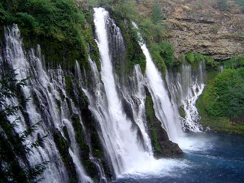
Nearly forming the linchpin between the Shasta and Lassen areas is Burney Falls. Theodore Roosevelt visited these falls and identified them as the Eighth Wonder of the World upon beholding the waters springing from the face of the cliffs. The falls are fed by a vast underground aquifer and their volume fluctuates little, even in drought years. The falls are contained in a state park with a campground and an impounded lake downstream from the falls. The PCT also passes alongside the top of the falls.
Getting There
Interstate 5 flanks the entire western slope of the California Cascades. Highway 395 traverses the range's eastern slope. From Interstate 5, six highways travel through the mountains. North to south the highways are:
97 – east from Weed.
89 – east from Mt. Shasta City.
299 – east from Redding.
44 - east from Redding.
36 – east from Red Bluff.
32 – north from Chico.
Highway 97 continues north along the eastern slope of the Cascades into Oregon. Goosenest, Whaleback, Ash Creek Butte and the north slope of Mt. Shasta are best reached from this highway.
Highway 89 travels south from Mt. Shasta and is routed through the heart of the California Cascades, passing by Burney Falls and is the main road through Lassen Volcanic National Park.
Highway 299 heads east from Redding (it actually begins on the Pacific Coast in Arcata and cuts through the Klamath Mountains on the southern border of the Trinity Alps). It crosses Highway 89 at Burney Falls before continuing east. This highway provides access to the Modoc Plateau. The Thousand Lakes Wilderness can be accessed from this highway.
Highway 44 is the best route to Lassen Volcanic National Park if coming from Oregon or the Pacific Coast. The highway continues along the north boundary of the National Park and, providing access to the Cinder Cone area and the Caribou Wilderness.
Highway 36 connects Lassen Volcanic National Park to Red Bluff. This is the best way to access the National Park if heading north on Interstate 5. This route also provides access to the Ishi Wilderness.
Highway 32 heads north from Chico and skirts the southern edge of the California Cascades. This is the best choice for getting to Lassen Volcanic National Park if heading north on Highway 99.
Camping
The National Park Service, the Forest Service, and various state parks operate dozens of campgrounds. The area also offers an abundance of excellent dispersed campsites on public land.Logistical Centers
Redding is the primary base of operations for most of the California Cascades. It is roughly equidistant to most of the range. Moreover, the highways radiate out from Redding to all parts of the California Cascades. The city contains all necessary stores and services.
Numerous smaller communities are found throughout the range. The city of Mt. Shasta is the primary base of operations for trips to Mt. Shasta itself, as well as trips north and east. Burney is found at the nexus of the Shasta and Lassen Cascades and the Modoc Plateau.
Redding, Red Bluff and Chico are all good options for trips to Lassen Volcanic National Park. The community of Shingletown is the largest village en route to the park.
Print Resources
Books
The bulk of the California Cascades appears infrequently in print resources that focus on recreating in the area. Wilderness Press produces books on the Mt. Shasta and Lassen Volcanic National Park areas. The book on Mt. Shasta covers all aspects of climbing the mountain, including routes as well as hikes in the surrounding area (some of which are located in the Klamath Mountains). The Lassen book covers the National Park as well as the Thousand Lakes and Caribou Wilderness Areas. Both books are excellent resources for the regions they cover. Falcon Press also produces a good book on Lassen Volcanic National Park. Other books covering all of California or the northern part of the state also provide information on the area, but nothing revelatory appears in these books that is not present in the aforementioned three. Finding print resources for the areas beyond the Shasta and Lassen spheres is difficult.
Maps
The usual suspects from the USGS are available for all of the California Cascades. In addition to these, numerous maps exist for Mt. Shasta, all of which are good. Only one good trail map exists for Lassen, although the Wilderness Press book also comes with a good map. The US Forest service produces a great map covering the Thousand Lakes, Caribou and Ishi Wilderness Areas. Other than USGS maps, this is the only map covering trails in the Ishi Wilderness.
Red Tape
Lassen Volcanic National Park
PO Box 100
Mineral, CA 96063
(530) 595-4444
Lava Beds National Monument
1 Indian Wells HQTRS
Tulelake, CA 96134
(530)-667-8100
Klamath National Forest
1312 Fairlane Road
Yreka, CA 96097-9549
(530) 842-6131
Shasta-Trinity National Forest
3644 Avtech Parkway
Redding, CA 96002
(530)226-2500
Modoc National Forest
800 West 12th Street
Alturas, CA 96101
(530) 233-5811
Lassen National Forest
2550 Riverside Drive
Susanville, CA 96130
(530) 257-2151
McArthur-Burney Falls Memorial State Park
(530)-335-2777
Ahjumawi Lava Springs State Park
(530)-335-2777
External Links
Lassen Volcanic National Park
Lava Beds National Monument
Klamath National Forest
Shasta-Trinity National Forest
Modoc National Forest
Lassen National Forest
Burney Falls State Park
Ahjumawi Lava Springs State Park
BLM - Redding Field Office
Sacramento River Bend Area


