

-
 12232 Hits
-
 80.49% Score
-
 12 Votes
|
|
Mountain/Rock |
|---|---|
|
|
40.47284°N / 121.52145°W |
|
|
Download GPX » View Route on Map |
|
|
Hiking, Scrambling |
|
|
Summer, Fall |
|
|
8927 ft / 2721 m |
|
|
Overview
Need a Peak that is near Mount Lassen to help make coming here worth your while and at the same time without too much effort? Ski Heil may be a good choice for you, especially considering that it is neighbors with Eagle Peak which is a easy walk from here for another summit. Although I must admit, it is perhaps the easiest eight thousand foot peaks I've ever been up. This peak like many in the area are far away from any towns which help give the place a more natural feeling unlike it's neighbor Lassen Peak which has well established trails and crowds of people. It is considered the 741st highest mountain in the state of California and is located in the Lassen Volcanic National Park.Views from the summit of Ski Heil Peak are pretty good. Brokeoff Mountain and Mount Diller really stand out the south. To the east is Bumpass Mountain and Mount Helen along with many other peaks in this region. To the northeast lies the grand summit of the park, Lassen Peak and closer neighbor Eagle Peak and to the north-northwest rises the towering Mount Shasta way off in the distance. To the west lies the gigantic Sacramento Valley and the Trinity Alps.
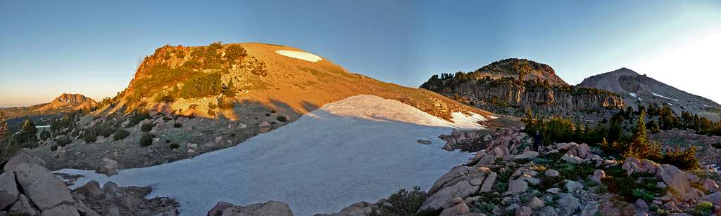
Ski Heil Panorama : Taken September 6, 2011
Getting There
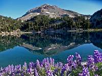
Lassen from the Trailhead

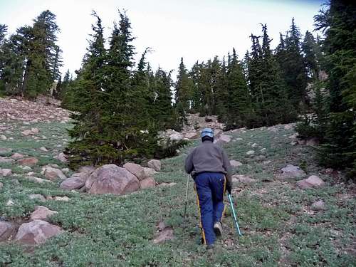
Hiking along the Road
There are two alternative routes to get to Ski Heil Peak, one is from Redding (North) and the other is from Red Bluff (South).
From Redding: From I-5 take exit 678A and head east onto Highway 44 for about 47 miles until you reach highway 89. From here take a right which goes for about 22.7 miles to the Lake Helen Trailhead.
From Red Bluff: From I-5 take exit 649 and head east (left) onto highway 36 for about 43.4 miles. From here turn left onto Highway 89 (Lassen Peak Highway) for about 11.4 miles until you get to the Helen Lake Trailhead.
Route Information
Eastking Heading Up
Ski Heil Peak has no established trail to the summit. You can either park at the Lassen Peak Trailhead or the Lake Helen Trailhead. The preferred route we took was from the parking area east of Lake Helen. From that parking you basically walk past the south shores of Lake Helen and find the gap between Ski Heil Peak and Eagle Peak. If done right this is nothing more than a simple walk up that is pretty much free of scrambling or exposure. Once in the gap between Ski Heil Peak and Eagle Peak head up the scree or snow slope (depending on season) and take it all the way to the summit. This route has a distance of 3 miles and 800 feet of elevation gain. One can also hike up the near by Eagle Peak which is a nice addition and is not far from this peak.
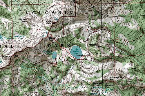
Topographic Map of the Route
Red Tape
Because Ski Heil is located in the national park, it requires a payment/pass to get into the national park which details be seen seen here: http://www.nps.gov/lavo/planyourvisit/feesandreservations.htm
Also if you plan on spending the night on this mountain, it requires a wilderness permit which is free of charge and supposedly has no quotas to them. They can be found at the ranger station at the Southwest entrance.
I would not recommend filtering water from many of the creeks in the area considering the sulfur content in it.
Camping

Summit Lake During Evening
Also there are two campgrounds in the area which are "Southwest Walk In" and "Summit Lake". Southwest Walk in is on the West Entrance to Mount Lassen while Summit Lake is on the East Side. Summit Lake Camp is divided into two camps, South Summit Lake and North Summit Lake Camp.
For availability check in with the National Park Service Website.
Southwest Walk In:
Location: Located on the east side of Visitor Center parking area (near Southwest Entrance Station).
Elevation: 6700'
Number of sites: 21
Daily Fee: $14 during the summer season; $10 dry camping after October 11.
North Summit Lake:
Open June 24 - September 19, 2011, weather permitting
Location: 12 miles south of Manzanita Lake, 17.5 miles north of Southwest Entrance. Elevation: 6695'
Number of sites: 46
Daily Fee: $18
Amenities: Picnic table, campfire ring, bearproof box, flush toilets, drinking water, swimming.
South Summit Lake:
Open June 24 - October 24, 2011, weather permitting.
* Reservations accepted July 1 - September 19, 2011.
* First-come, first-served and dry camping September 20 - October 24, 2011.
Location: 12 miles south of Manzanita Lake, 17.5 miles north of Southwest Entrance.
Elevation: 6695'
Number of sites: 48
Daily Fee: $16 during the summer season; $10 dry camping after September 20 until closure.
Conditions
Check in with the Noaa Forecast for weather information. Or be sure to call (530) 595-4480
For Road conditions check in with the National Park Service Website.
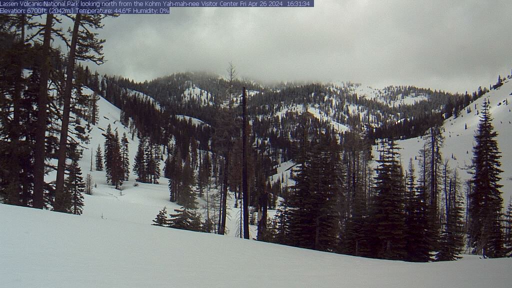
Kohm Yah-mah-nee Visitor Center Webcam
For Road conditions check in with the National Park Service Website.
Views from the Mountain
 Bumpass Mountain |  Mount Helen |  Sunrise to the South |
 Mount Shasta |  Green Volcanic Dome |  Choas Crags to the North |
Flowers
 Yellow Flowers |  Red Flowers |  Interesting Purple Flower |