
|
|
Mountain/Rock |
|---|---|
|
|
42.54100°N / 1.01214°E |
|
|
Hiking, Mountaineering, Scrambling |
|
|
Spring, Summer, Fall, Winter |
|
|
9711 ft / 2960 m |
|
|
Page history
* 22/07-2014: Peak climbed :)
* 10/11-2014: Page created
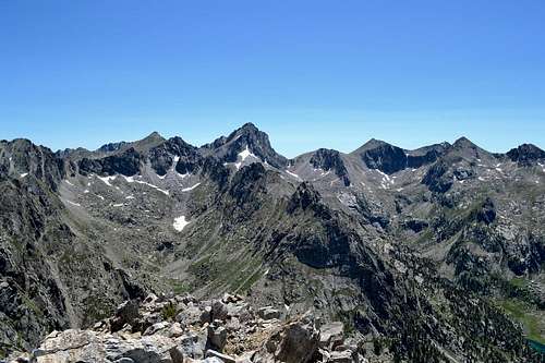
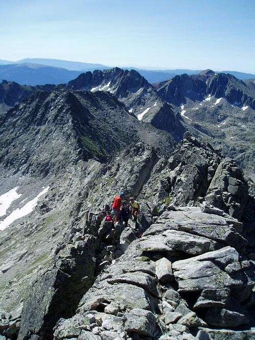
Pic de Peguera (the highest peak in the centre) seen from the summit of Gran Encantats
Overview
Pic de Peguera is the highest peak in the eastern part of the Aigüestortes / Estany de Sant Maurici national park in the Spanish Pyrenees. Falling just short of the 3.000 m mark the mountain is much less famous than its bigger brothers in the western part of the park; Punta Alta, Besiberri and Pic de Comaloforno. That is a shame because the peak offers nice scrambling and is located just next to one of the passes crossed by the highly popular Carros de Foc hiking trail. Most people hiking the Carros de Foc however are too lazy and/or scared by the steep eastern slopes - again a shame, since the views from the summit are great. You can see most of the national park and in clear weather you can see the massif of Aneto / Maladeta 30 km's to the west.Getting There
Access to the summit is from one of the refugios on the Carros de Foc route; Refugi J.M Blanc, Refugi Colomina or Refugi Mallafre. For getting to the national park and the refugios see the Pirineos: Aran-Aigüestortes page.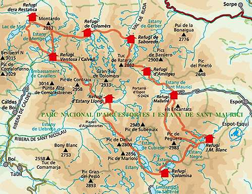
Carros de Foc route
Route
Entry points to the summit is either from Coll de Peguera (2.720 m) located west of the summit or Coll de Monestoro (2.715) located northeast of the summit.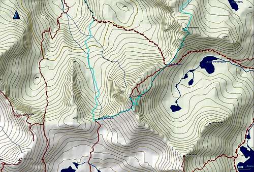
Routes to the summit of Pic de Peguera. TOPO PIRINEOS 6.1 as background map. Light blue track is my GPS trail. There is an official trail in the valley west of the summit, even though it is not shown in the TOPO map.
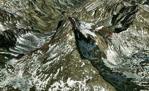
Google Earth map of Pic de Peguera showing the southwest ridge route (left) and east face route (right)
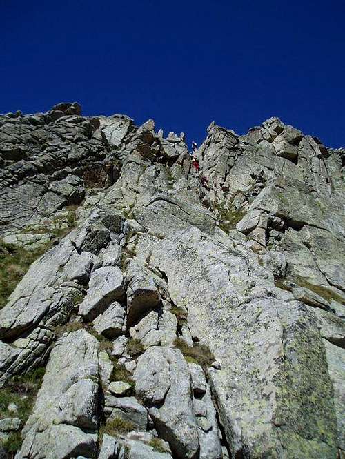
Southwest ridge: Follow a steep hiking trail from Coll de Peguera. The trail is sometimes a little slippery due to loose sand a gravel. The last approx. 30 vertical meters follows the ridge. Most of it is easy scrambling but the last 20 horizontal meters has a few challenging moves and the ridge is narrow (<5 m). The route is scarcely marked with cairns.
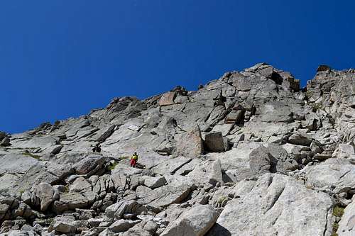
East face: From Coll the Monestero the route starts out crossing grassy slopes. As the slope gets steeper rocky slaps take over. Follow small ledges on this section. The last part of the face is overcome by climbing a narrow chimney for 10-15 meters. This is the crux of the route. On the top of the chimney the route merges with the southwest ridge route. The route is scarcely marked with cairns. Inexperienced climbers might want to bring a rope for the chimney.
Northwest ridge: The route starts out at Coll de Monestoro and follows the northeastern ridge. I haven't climbed it, but I was told by another climbed that the staff of the refugios advice people to use the eastern face route instead due to risk of rock fall.
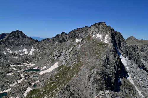
Pic de Peguera seen from the summit of Pic de Monestero. Red dotted line shows the east face route
Slabs on the eastern face of Pic de Peguera
The chimney (crux) of eastern route to Pic de Peguera
Summit ridge of Pic de Peguera
Red Tape
It's very advisable to make reservations well in advance in the refuges especially in the summer.Aigüestortes is a National Park with rules about the wildlife, the camping, etc.
When to Climb
Spring, summer and fall. If anybody know about winter conditions let me know.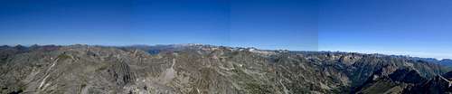
Panorama from Pic de Peguera. The glaciated peaks in the centre are Aneto/Maladeta