
-
 7264 Hits
-
 84.27% Score
-
 18 Votes
|
|
Mountain/Rock |
|---|---|
|
|
46.47534°N / 9.37649°E |
|
|
Lombardia |
|
|
Hiking, Mountaineering |
|
|
Spring, Summer, Winter |
|
|
8924 ft / 2720 m |
|
|
Overview
The easiest and most popular summit of the whole Valle Spluga.It rises from the northern bottom of the Val Scalcoggia (Madesimo) and, with its long ridge, divides the Val Niemet (NE-Switzerland) from the Valle Spluga (SW-Italy).
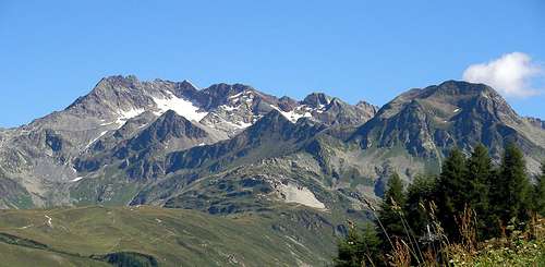
Though it is a minor summit this is not a small mountain: its only fault is the highness, but, for its location (central in the high valley) from its summit one can enjoy a very fine vision of the (more) important mountains surrounding.
The Eastern, Southern and Western sides are made of big granitic and gneiss slabs divided by big ledges, small basins and channels and can be tricky for hikers or beginners that don't know the site: no danger at all but it's really easy to loose the correct route being compelled to strange wanderings.
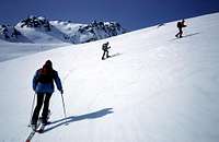
The Northern side is a big heap of stones and along it run both the easier summer normal route and the ski-mountaneering route.
Due to vicinity of the Rifugio Bertacchi (Emet lake) another normal and easy route has been tracked (with white & red marks) along the ESE side.
 |  |  |
Getting There
3 usual starting points to climb the mountain :from Italy
from Switzerland
the 3 normal easy Routes
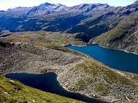
 the N side the N side | the shortest : from the road on the Eastern side of Lago di Montespluga : At the E limit of the viaduct a sign indicates the path to Lago Nero. Get this path and in little more than 1 hour you arrive to the Lago Nero (2310m) On its N side some red marks along a debris channel give access to a narrow exposed path that, turning toward N, turns round a spur and leads to the Passo del Lago Nero (2570m). Here you can see, on the E side of the debris slope, a track that leads to the N summit and, following the ridge, to the summit hosting a big Cross. This route is for Experienced Hikers |
 the long summital ridge seen from NE the long summital ridge seen from NE | the longest : from Innerferrera along the Val Niemet and the Val Ursareigls - this is the ski-mountaneering route - very long and not so fine : the descent along the Val Niemet is very flat ... Follow the long long and sweet valley up to almost the Niemet Pass: Little before it you have to turn to the right (N) and enter the Val Ursareigls that must be followed pointing to the saddle N of Spadolazzo. Once near the (very fine) Lago Ghiacciato, you join the path coming from Passo del Lago Nero and follow to the summit. Pay attention: on the right there is a marked path leading to the Passo Suretta, don't follow it ! This route is for Hikers |
 the SE side the SE side | the usual : from Rifugio Bertacchi. Follow the path to Niemet Pass, little before it a sign indicates a path starting on the left that leads to a fine small lake and to a border sign. Here a mark on a boulder indicates the "path" marked with white & red lines that, crossing the lower slabs, gives access to the debris upper part. The path goes along the E side of the mountain to get the final ridge a little S of the S summit. This route is for Experienced Hikers |
The best way to come down, if you're not in a hurry, is toward N, toward the Lago Ghiacciato, herefrom you can find,
 |  |  |
Accomodations
Rifugio Bertacchi al Lago d'Emet - 2175mRifugio Stuetta o the road of Passo Spluga - 1900m
Montespluga Hotels