
-
 6130 Hits
-
 84.27% Score
-
 18 Votes
|
|
Mountain/Rock |
|---|---|
|
|
47.07682°N / 9.56593°E |
|
|
Hiking, Mountaineering, Scrambling, Skiing |
|
|
Spring, Summer, Fall, Winter |
|
|
7293 ft / 2223 m |
|
|
Overview
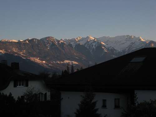
Rappenstein is a peak located in the small country of Liechtenstein, about 1.75 miles north of the border with Switzerland and the large Falknis-Grauspitz ridge. From the Rheintal, Rappenstein has quite a large appearance and strikes an impressive pose in a spiraling array of rock that towers almost 6000 vertical feet above the valley floor. The valley side, or west side, of the peak is thus very steep and craggy. The east side of the peak is comprised of lovely, mellow, grassy slopes that grace the peak in perfect Alpine style. Trails in the area are abundant, and the Rappenstein can be bagged during a pleasant outing involving as little as a 10 km/900 meter day, or during a strenuous peakbagging spree, with much more distance and elevation gain. It's your choice! Even by way of the easiest trail (described below), you can tag up to three bonus peaks on the trail en route to the Rappenstein: Heubüal (1936 meters), Kolme (1993 meters), and Goldlochspitz (2110 meters). Rappenstein from the north.
There is one trail that leads to the summit, and it leaves from a junction located about 1/4 mile north of the summit. yet there are many ways to approach this trail junction. See "Getting There" section for more info.
The summit is topped with a large cross and provides very good views in every direction, especially south, where the north faces of the Naafkopf, Schwarzhorn, Grauspitz, and Falknis are clearly visible.
 View from the Valley Floor.
Getting There

 Rappenstein SUMMIT!
Trails from the west will provide a much more involved hike, with close to 2000 meters of gain in a rather long distance. Most of these will involve tedious road walking up the Lawenatal, a large, but very scenic forested valley to the southwest of the peak. Follow signs to the Rappenstein. Though this may seem like sub-par route descriptions, the trails in the area are so very well marked and signed that further explanation is not needed.
Though Liechtenstein trails are very well marked, a trail map of the country is still a good thing to have. One can be bought in any of the larger town in the Rheintal.
Red Tape
None whatsoever.Camping
Rough camping is looked down upon in the back country of Switzerland and Liechtenstein. There are spots in the forests where you could camp and get away with it, but this really isn't a backpacking destination. There are several developed campgrounds in the Rheintal, and these provide what you'd expect from such establishments.