
-
 42228 Hits
-
 88.61% Score
-
 27 Votes
|
|
Area/Range |
|---|---|
|
|
39.22250°N / 105.6056°W |
|
|
Hiking, Trad Climbing, Bouldering, Scrambling |
|
|
Spring, Summer, Fall, Winter |
|
|
11902 ft / 3628 m |
|
|
Introduction & Definition
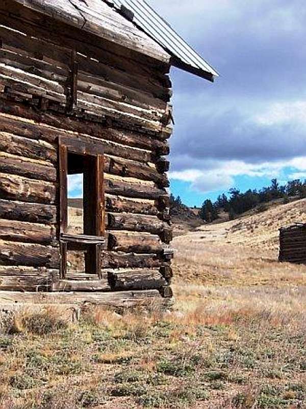
Tarryall Valley Homestead
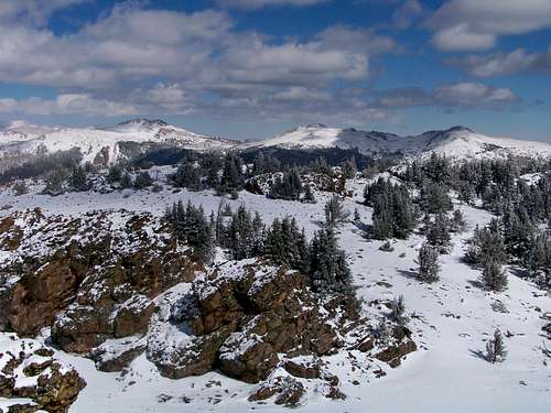
Bordered on the north by Kenosha Pass, Hwy 24 on the south, the Lost Creek Wilderness to the east and CR 15 to the west, the Tarryall is a very special place to those who know it well. This is a land of warm, soft beauty, not striking alpine contrast. This area reveals its secrets slowly and cautiously, and the best elements of the Tarryall are reserved for the patient and diligent explorer.
The Tarryall is cut roughly two-thirds, one-third by the Tarryall Creek and Park County 77 which parallels the waterway. The eastern third contains parts of the Tarryall Mountains. The Puma Hills run down the center in the southern end of the region. The western two-thirds consists of rolling hills and rugged outcrops gradually rolling down into South Park.
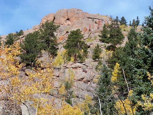
Tarryall Mountains: The Tarryall Mountains hug the eastern boundary of the Tarryall, running roughly parallel with the Tarryall Creek. The Lost Creek Wilderness boundary runs across these mountains; some of the Tarryall Mountains are protected within the Wilderness and some are not. The Tarryall Mountains high point is North Tarryall Peak (11,902 ft.)
Puma Hills: The Puma Hills are low, wooded mountains between the geological feature known as South Park and Tarryall Creek. Puma Peak is in the north Puma Hills, which run north from Wilkerson Pass. The highpoint of the Puma Hills is ”Puma Peak” (11,570 ft.)
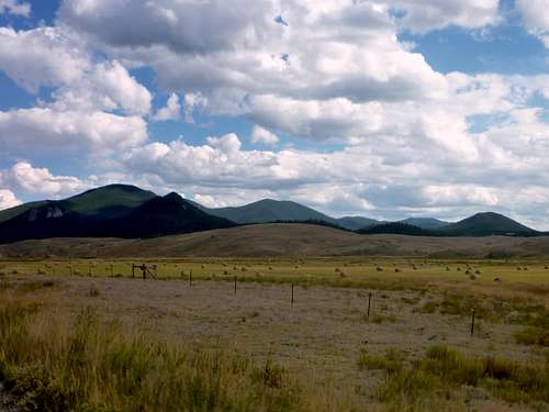
South Park: The southernmost of three large alpine parks in Colorado (along with North Park and Middle Park), South Park spreads out across nearly 650,000 acres. Especially in the winter, the South Park is teaming with large herds of elk and pronghorn.
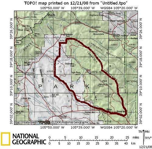 Map of the Tarryall area
In addition to long, peaceful hiking trails and trail-less summits, the area is well-known for its fly fishing along the Tarryall Creek. Additionally, ORV enthusiasts enjoy the web of old mining, logging and ranching roads while others relax and fish from the cool waters of the Tarryall Reservoir.
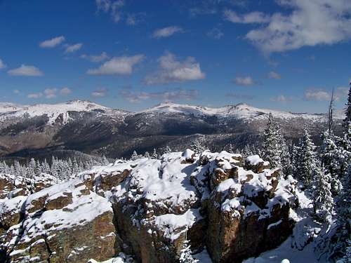
Tarryall Creek

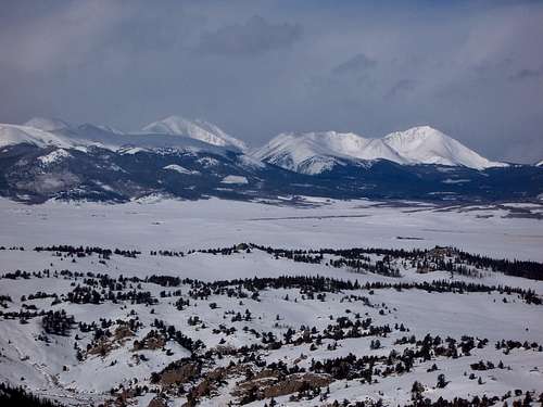
Southeast down the Tarryall Valley from the Sugarloaf Summit.
The Tarryall Creek flows like a lifeline through the area. The creek starts in the high country, just below the Continental Divide on the slopes of Mount Silverheels, running about 25 miles until meeting up with the South Platte. The Tarryall Creek apparently offers fine fly fishing, though public access can be an issue as much of the riparian habitat is privately owned, barring public access to the waterway.
Tarryall Reservoir

Tarryall Reservoir from Sugarloaf Summit.
The Tarryall Reservoir, located in the Tarryall State Wildlife Area, is a popular place for fishing, boating, camping, beer-drinking and just plain relaxing. While the banks of the Tarryall Reservoir can get a bit roudy with revelers during warm weather, the winter months bring more quiet, with ice-fishing rigs dotting the lake ice. At approximately 180 acres, it is a small reservoir but provides for scenic mountains-over-water vistas and, I’m told, decent fishing. The Tarryall Reservoir was drained in 2002 for damn repair and remained empty for two years during repairs. The Reservoir was on its way to refilling in 2005 and today is back to normal stage.
Human History
Tarryall Hay Farm in September

Though I can find little information in Native American culture in the area prior to European settlement, surely the Ute Indians and others hunted in the rich Tarryall Valley. In 1859, miners came to the in search of gold, but the region did not yield the riches found in other Colorado mountains. Farmers and ranchers followed the miners, and several ranching families to this day make a living running cattle in this area.
Today, a variety of solid, salt-of-the-earth folks call the Tarryall home year round. Numerous others, myself included, have a vacation home in the region for weekend relaxation and outdoor adventure.
Flora & Fauna
The Taryall includes a variety of ecological zones, ranging from high prairie land and rolling scrubland to dense mid-altitude forest and low alpine tundra. Trees found in the area include Aspen, Colorado Blue Spruce, Douglas Fir, Ponderosa Pine, Lodgepole Pine, Limber Pine and Bristlecone Pine. The area is generally relatively dry, but the Tarryall Creek courses through the area bringing vital water to the valley.
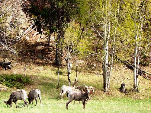
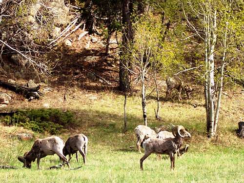
Animals that call the Tarryall home include puma (i.e., mountain lion, cougar, catamount, etc), black bear, elk, bighorn sheep, mule deer, pronghorn, coyote, ermine and a few varieties of squirrels. Birds in the area include Northern Flicker, Blue Grouse, Great Horned Owl, Western Bluebird, Mountain Bluebird, and Broadtailed Hummingbirds.
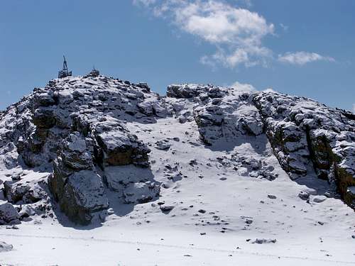
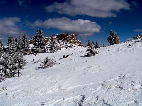
Area Summits
The summits in this area are, as a whole, lower than the high country peaks across South Park. They tend to be scrappy and offer nice, if short, summit scrambles and are free from the burden of trails to their summit. Tarryall summit registers see relatively few signatures.
| Image | Mountain | Elevation |
|---|---|---|
 |
North Tarryall Peak | 11902 ft. |
 |
Topaz Mountain | 11687 ft. |
 |
“Puma Peak” | 11570 ft. |
|
“Little Puma” | 11449 ft. |
 |
Farnum Peak | 11377 ft. |
 |
South Tarryall Peak | 11206 ft. |
 |
“Burntop” | 11085 ft. |
| Indian Mountain | 10358 ft. | |
| UN 10289 | 10289 ft. | |
 |
Observatory Rock | 10073 ft. |
 |
Sugarloaf Mountain D | 9951 ft. |
 |
UN 9928 | 9928 ft. |
 |
UN 9895 B | 9895 ft. |
 |
Eagle Rock | 9677 ft. |
 |
Baker Mountain | 9544 ft. |
 |
UN 9111 | 9111 ft. |
Camping & Lodging
Plenty of camping can be found along Park County 77 and spur roads off of it. In the case of rustic 4x4 campsites, remember to bring plenty of water, bury human waste and pack out what you packed in.

Little Puma, foreground, and Puma Peak from Farnum.

Fresh October Snow on Silverheels from FS 39.
Along Rt. 39 & 56
Several campsites off Rt 39 provide views of Mt. Silverheels, Buffalo Peaks, Horseshoe Mountain, Bald Mountain and Mount Guyot and other 13ers and 12ers that will bring tears to your eyes. Competition for these sites, however, is intense in the summer, with large armadas of ATVs and RVs staking weekend claims to favorite haunts.
South end of Hwy 77
The south end of Hwy 77 (Tarryall Road), near Hwy 24, provides several established U.S. Forest Service camping areas. South Park Ranger District Lake George Area Campgrounds include: Riverside, Spillway, Happy Meadows, Round Mountain, Spruce Grove, and Twin Eagles. Please contact the district office at (719) 836-2031 if you have additional questions about the campgrounds in the South Park Ranger District.
North end of Hwy 77
Plenty of camping can be found along Park County 77 and spur roads off of it. In the case of rustic 4x4 campsites, remember to bring plenty of water, bury human waste and pack out what you packed in.
North end of Hwy 77
The north end of Park County 77 and dirt spur roads are abound with off-road campsites.
Cabins, Lodges and Hotels
Numerous cabins can be rented in and around Lake George. There are also a few cabins/lodges along the Tarryall Creek catering especially to the fly fishing visitor. For example: Ute River Ranch. There are a few hotels in Fairplay.
Land Management & Ownership

Charred Sentinel near the summit of "Burntop".
The eastern third of the Tarryall is publically owned and lies within the Pike National forest. The estern two-thirds is a patchwork of privately ownership, National Forest, BLM, State Trust lands and State Wildlife Areas. This patchwork of ownership can make access a challenge. Please respect private property rights and beware of (and follow) use regulations governing the public lands you visit.
Getting There
 A picture says a thousand words
- From Denver: Take Hwy 285 to the town of Jefferson and turn left on Park County 77. (Keep an eye out for free range cattle.)
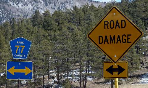
- From Colorado Springs: Hwy 24 West to Lake George. Just past lake George, turn right (northwest) on Park County 77 (Tarryall Road). Use caution with the minefields of potholes. Between dusk and dawn, deer and elk are incredibly numerous - watch your speed!
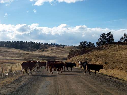 Tarryall Traffic Jam
Weather & Seasons
The summers in the Tarryall are pleasant by the standards of the bulk of the Colorado population that resides in Front Range metropolitan areas like Ft. Collins, Boulder, Denver, Colorado Springs and Pueblo. Still, on the hottest days of the year the heat here will be much more oppressive than in the high country.
Snowseason is a magical time in the Tarryall. Click on images to enlarge.
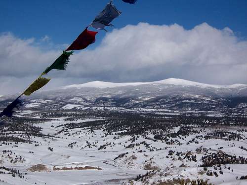
Park County 77 is the main thoroughfare serving this area. While the road is in bad shape (full of potholes) south of Stagestop Road, it is open year-round. Note that shaded areas of this road can be quite icy in snow season. Due to seasonal closures of Forest Service Roads, not all parts of the Tarryall are accessible in the winter, depending on snow pack. The access roads in this area melt out earlier and get snowed-in later than many higher-altitude, heavier-snowpack climbing areas in Colorado. Nonetheless, during snow season many mountains in the Tarryall are accessible only to the intrepid winter hiker looking for a multi-day outing or to those willing to opt for a snow-machine assisted approach.
Jeremy Hakes - Oct 30, 2011 11:18 am - Voted 10/10
More, Please!Sarah - since you've added more peaks in this nice area, this page is ready for you to add them here, too! :)
Sarah Simon - Nov 5, 2011 11:29 am - Hasn't voted
Re: More, Please!Good point, thanks Jeremy. I'll update the table, etc. Are there any peaks in particular you're thinking of that aren't attached? This would be a great help for me. Sarah
Jeremy Hakes - Nov 6, 2011 4:38 pm - Voted 10/10
Re: More, Please!Tappan, 8906, and China Wall aren't on the handy-dandy table. :)