My wife and I spent a couple days in Primm and she finally was tired of me losing money, so I got to climb Mt. Charleston.
I stopped at the Visitor Information Center in Charleston and picked up a free handout entitled "Welcome to the Spring Mountains National Recreation Area". There is a nice little map inside that let me find the Trail Canyon Trailhead I wanted to climb. I was the only car parked at the trailhead when I started the hike a little after 7:00AM. There was a pleasant chill in the air and the trail is well gravelled, wide, and at a comfortable grade.
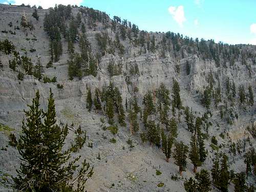
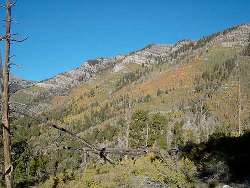
It took me just under an hour to reach the trail junction at the ridge and turn left on the North Loop Trail. A sign indicated it was 6 miles to Mt. Charleston. The trail follows the ridge on the Kyle Canyon side for the entire 6 miles to the summit, with only an occasional view to the north or west . This is one beautiful trail and the views are spectacular. The leaves were turning on some of the trees and the colors added to the joy of the hike. About half way to the summit the weather started to change and some dark clouds started forming to the north. They seemed to be blowing off to the east, so I kept going.
By the time I reached the summit, about 4 hours from the trailhead, the dark clouds were forming over Mt. Charleston. Off to the north there was lightning and rain a few miles back on the trail I just came up. It was 46 degrees with a 12 MPH wind on the summit. I quickly signed the register and headed down the South Loop Trail.
It took me only 1.5 hours to reach the trail junction that heads up to Griffith Peak. I took the side trip and signed that register also. The trail up Griffith is more of a goat track and is very steep. Up and down Griffith only took 45 minutres and then I headed down the 38 switch backs to the South Loop Trail trailhead. Since I was off the ridge now, I took my time going down. I got rained on a couple of times and a little hail but it wasn't bad.
When I reached the trailhead I then had to hike back up to the Trail Canyon Trailhead where my car was parked. This trail goes up and down a bit and it took me another 45 minutes to get to the car. All together it was about 8.5 hours, 18 miles, and 5,000+ Ft of elevation gain. This was a lot more fun than losing money in the casino.
Comments
No comments posted yet.