Hiking, Mountaineering, Trad Climbing, Sport Climbing, Toprope, Bouldering, Ice Climbing, Aid Climbing, Big Wall, Mixed, Scrambling, Via Ferrata, Canyoneering, Skiing
La montagna chiama i suoi figli, ed essi rispondono fedelmente al suo appello…
Osvaldo Cardellina, Diario alpinistico, 1964-65
Page texts: @ OsvaldoCardellina"Osva", passed away on May 2, 2022. Page owners: Christian Cardellina e Osvaldo Cardellina. Any updates from September 12, 2022: Antonio Giani, page administrator, friend and climbing companion.
Testi della pagina: @ OsvaldoCardellina "Osva", scomparso il 2 maggio 2022. Proprietari pagina:Christian Cardellina e Osvaldo Cardellina. Eventuali aggiornamenti dal 12 settembre 2022: Antonio Giani, amministratore della pagina, amico e compagno di salite.
Overview
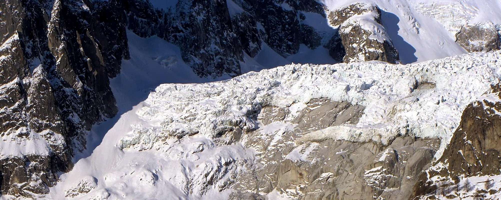
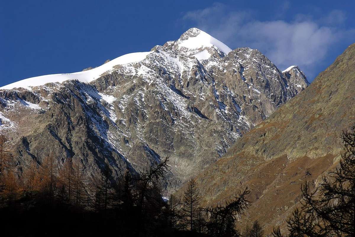
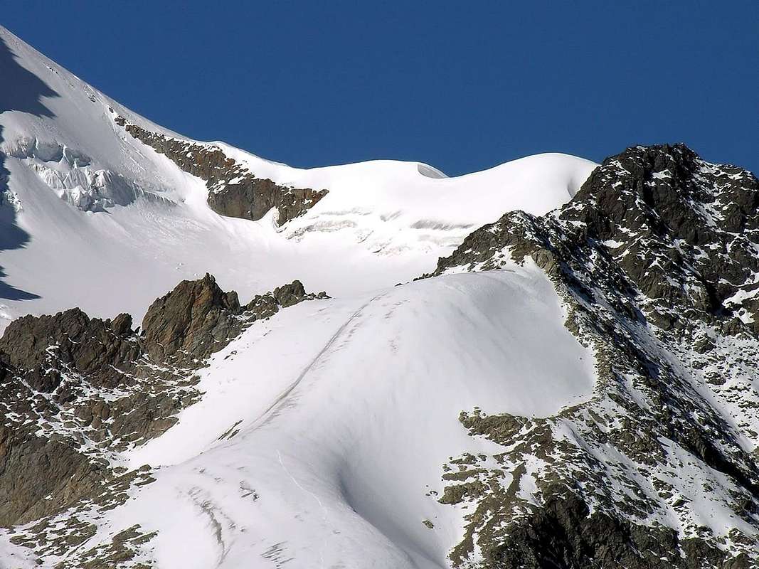
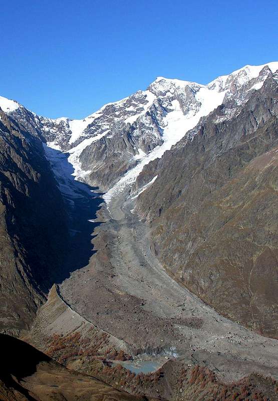
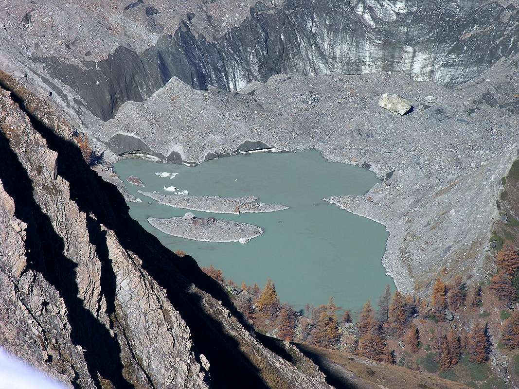
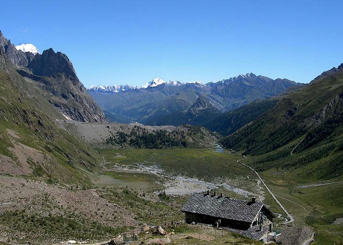
Val Veny originates from the Col de la Seigne (2.514m) where begins the Chain of Mont Blanc. In this final part or higher is placed, at the top of what is known as Valloon de La Lex Blanche, Rifugio Elisabetta Soldini-Montanaro (2.197m), reached by a private dirt road, but closed to vehicle traffic from Plan de Lognan (1.676m), near the "Jardin du Miage". But making the trip back and then starting near Courmayeur, bypassed the Doire de Vény to Ponte Goats or Pont des Chèvres (1.226m), immediately after the Villages of La Saxe or of Larzey (1.263m, 1.224/30m) and rounding to the North the "mythical" Mont Chétif (2.343m), you reach the small Church of Notre Dame de la Guérison (1.444m) "perched" on the Southern edge of the Regional Road that goes up the Val Veny. The same dominates upset moraines of the glacier Brenva with its murky sources. Then the same stretches toward the Southwest reaching successively Plan Ponquet, the Perthud (1.489m), Lassy Dèsott, the Barracks in Plan Veny (1.537m), the Camps of Dzerottaz, Gabba, the Chalets du Miage (1.572m), Cantina (Cave) of La Visaille and Plan de Lognan, where shortly afterwards ends becoming farm private dirt road.
La Val Veny prende origine dal Col de la Seigne (2.514 m) dove inizia la Catena del Monte Bianco. In questa parte finale o più elevata é collocato, al sommo di quello che é conosciuto come Vallone de La Lex Blanche, il Rifugio Elisabetta Soldini-Montanaro (2.197 m), raggiungibile da una strada poderale però chiusa al traffico dei mezzi da Plan de Lognan (1.676 m), nei pressi del "Jardin du Miage". Ma facendo il viaggio a ritroso e quindi partendo nei pressi di Cormayeur, scavalcata la Doire de Vény al Ponte delle Capre o Pont des Chèvres (1.226 m), subito dopo i Villaggi di La Saxe o di Larzey (1.263 m, 1.224/30 m), e doppiando a Settentrione il "mitico" Mont Chétif (2.343 m), si raggiunge la Chiesetta di Notre Dame de la Guérison (1.444 m) "appollaiata" sul ciglio Meridionale della Strada Regionale che risale la Val Veny. La stessa domina le sconvolte morene frontali del Ghiacciaio della Brenva con le sue torbide sorgenti. Poi la medesima si distende verso Sudovest raggiungendo in successione Plan Ponquet, il Perthud, Lassy Dèsott, la Caserma a Plan Veny, i Campeggi della Dzerottaz, Gabba, i Chalets du Miage, la Cantina di La Visaille e Plan de Lognan, dove poco appresso termina diventando strada poderale.
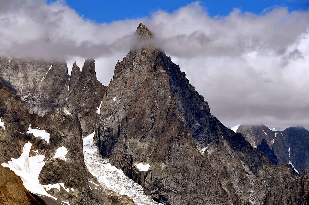
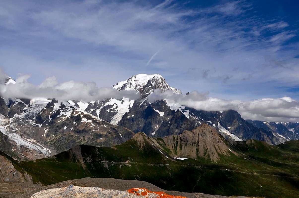
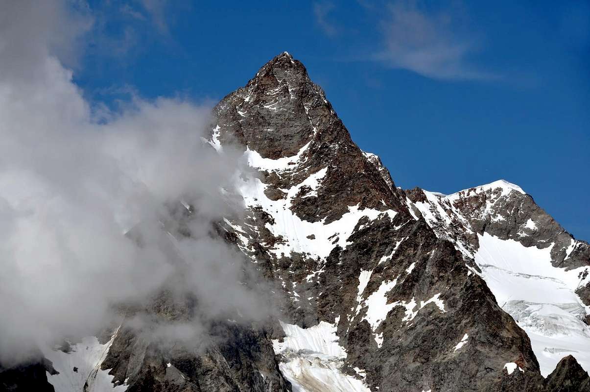
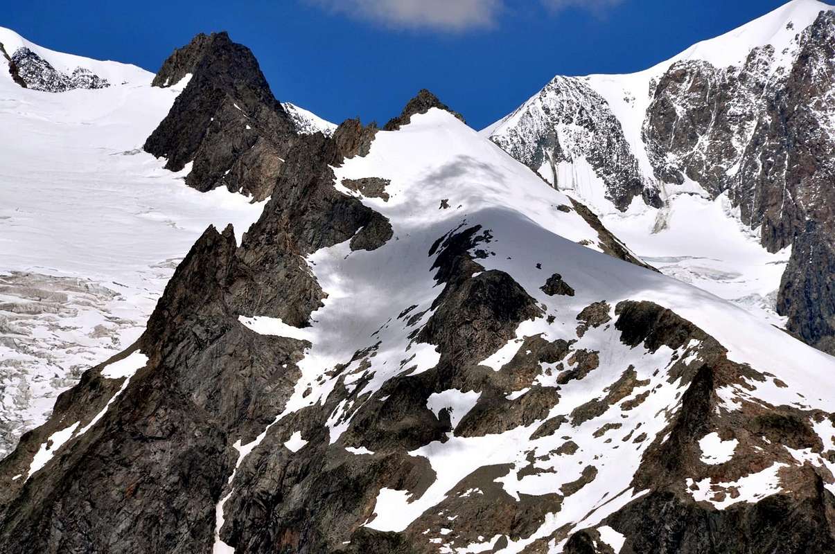
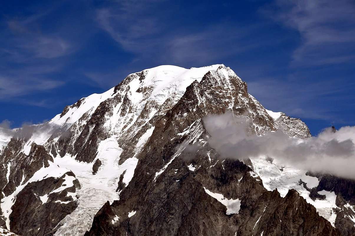
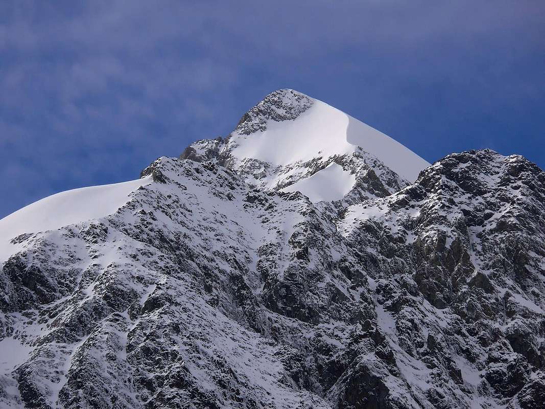
I'm not here to bore you with the list of the various refuges, bivouacs, the countless trails and endless Summit existing. If you want to have further details can be found in My Lists of the May 27th, 2010 with "A) - MOUNT BLANC / GREAT JORASSES / AIGUILLE VERTE - LEFT SIDE First Part" and in other published works always in SP, where you will have news about it in the long and wide with great satisfaction to your liking and just and healthy curiosity. This is beyond the aim of this work, which simply give a total hatch of the valley and its particular features, perhaps by offering some special characteristic and curious. Simply write down as the Northern side, ie from the Col de la Seigne in the Gigante Pass, presents giants that the Aiguille des Glaciers (3.817m) reach the Top of Mont Blanc (4.811m) and then declined further East towards the second of hills, where they placed the two "historical Refuges Torino" (3.371m). In addition to the Giant's Tooth (4.014m), the Ridge of Rochefort and especially from the Grandes Jorasses (4.208m) it goes to Val Ferret Italian; but this makes now part of a subsequent work. On the opposite side, or Southern, a watershed much more modest divides the valley from La Thuile with its secondaries walloons: from the Mont Chétif the same reaches a series of unpretentious summit, among which stands out of the Mont Favre (2.967m) just in front of the Mont Berrio Blanc (3.252m ), but now beyond the partition, to finally finish at the Col des Chavannes (2.603m) and the subsequent Quote 2.956 meters, where the ridge to the North-northwest folds reaching the Col de la Seigne. In its first part, ie from Plan Checroit at the foot of Mount Chétif, and up to the station of Crest Youlaz (2.631m), it is an area well known and popular for Skiing, in full view of Southern Face Mont Blanc and profile on the East known as the famous "Brenva".
Non sto qui a tediare Voi con l'elencazione dei vari Rifugi, Bivacchi, degli innumerevoli sentieri e delle infinite Sommità esistenti. Volendo avere maggiori ruagguagli li trovate in My Lists del 27 Maggio 2010 con" A) - MOUNT BLANC / GREAT JORASSES / AIGUILLE VERTE - LEFT SIDE First Part" ed in altri lavori pubblicati sempre in SP, dove avrete notizie al riguardo in lungo ed in largo con vostro gradimento ed ampia soddisfazione di giusta nonché sana curiosità. Questo esula dall'obiettivo del lavoro, che si limita a dare un tratteggio complessivo della valle e delle sue peculiarietà, magari offrendo qualche particolare caratteristico nonché curioso. Semplicemente annotiamo come il lato Settentrionale, cioé dal Col de la Seigne a quello del Gigante, presenti grandi colossi che dall'Aiguille des Glaciers (3.817 m) raggiungono la Sommità del Monte Bianco (4.811 m) per poi declinare più ad Oriente verso il secondo dei colli, dove sono collocati i due "storici Rifugio Torino" (3.371 m). Oltre con il Dente del Gigante (4.014 m), la Cresta di Rochefort e soprattutto dalle Grandes Jorasses (4.208 m) si và verso la Val Ferret italiana ; ma questa fà ormai parte di un successivo lavoro. Sul lato opposto, ovvero Meridionale, uno spartiacque ben più modesto divide la valle da quella di La Thuile coi suoi valloni secondari: partendo dal Mont Chétif la stessa raggiunge tutta una serie di Sommità senza pretese, tra le quali di distingue il Mont Favre (2.967 m) appena davanti al Mont Berrio Blanc (3.252 m), ma ormai al di là del divisorio, per infine terminare al Col des Chavannes (2.603 m) ed alla successiva Quota 2.956 metri, ove la cresta ripiega verso Nord-nordovest raggiungendo il Col de la Seigne. Nella sua parte iniziale, cioé da Plan Chécroit ai piedi dello Chétif, e fino alla Stazione di Cresta Youlaz (2.631 m) trattasi di area conosciutissima e frequentata per lo Sci, in piena vista sul Bianco e la "Brenva".
Getting There
BY CAR:
From TORINO, MILANO, etc: Motorway A5. Exit at IVREA or Quincinetto (PIEDMONT) From IVREA Town: in West towards Pont Saint Martin, Donnas, Bard, Champdepraz, Pontey, Fénis, Saint Marcel, Grand Brissogne, Pollein, Charvensod, Gressan, Jovençan, Aymavilles, to Villeneuve, Arvier, Avise, Morgex and to Pré Saint Didier, Courmayeur Municipalities. From Courmayeur Resort: in East to Morgex, La Salle, Saint Pierre, Sarre, Aosta Municipalities. From Courmayeur towards Col de la Seigne From Courmayeur(1.198m) towards Pont des Chèvres, Notre Dame de la Guérison, Lassy Dèsot/Perthud Villages, Gabba, Chalets du Miage, La Visaille Cave, Plan de Lognan Alp (1.676m), with Municipal Road; from this to Lake Combal (1.950m) and to Refuge Elisabetta-Soldini (2.197m), through dirt road. From Courmayeur-Notre Dame de la Guérison Sanctuary(1.444m), through private dirt road, to Monte Bianco Refuge (1.666m).
From FRANCE: through the Mont Blanc Tunnel to Entrèves-crossroads to Vény/Ferret Valleys - Mountain Guides of Courmayeur - La Saxe Rock Gym - Courmayeur. By Little Saint Bernard Pass, closed since November until half May to La Thuile Valley - Pré Saint Didier - Courmayeur. It is not necessary to take Motorway A5: you can drive on SS.26, in the direction of AOSTA - IVREA - TURIN.
BY PLANE:
Aeroporto "Corrado Gex" Saint Christophe (Aosta).
All its small valleys
VALLEYS & VALLONS In order to deploy clockwise from Pont de Chevrès (1.226m), near Larzey and La Saxe Hamlet up to the Pass of La Seigne (2514m).
In Courmayeur Municipality Vény Valley & La Lex Blanche Vallon with Northwestern, Western & Northeastern surroundings Veny Valley: from Courmayeur through Regional Road to Notre Dame de la Guérison (+ Sanctuary; 1.444m), Perthud, Camping Aiguille Noire, Chalets du Miage, La Visaille, Plan de Lognan (signal no transit; 1.676m), Lakes of Miage and Combal, with farm dirt road.
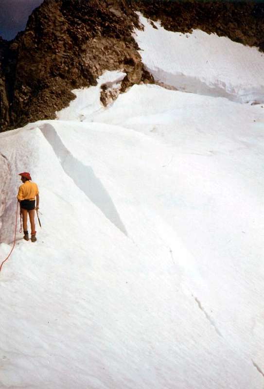
Lex Blanche small Valley: through Veni Valley to Lake of Combal (1.958m); from this to Refuge Elisabetta Soldini (2.197m), Tsa de la Lex Blanche (2.280m), Seigne Hill (2.514m), through dirt road concomitant with the path n° 2/TMB/Haute Route number 2, along Doire of Val Veny.
Echellettes small Valley: from Elisabetta Refuge, Northwest direction and by the path n° 13, to Hess or Echellettes Bivouac.
Petit Mont Blanc-Trélatête small Valley: from Bar Combal with path n° 14 to Gino Rainetto-Giovane Montagna/Petit Mount Blanc Bivouac (3.047m).
Miage Vallon: from Chalets du Miage (1.572m; signal no transit; parking) with path n° 16 to Breuillat/Marmotte Lochs (1.957m); from these with unnumbered path-traces to Miage Moraine to the connection with path n° 15 (starting from Combal Lake) in quota 2.300 meters about. Along Miage Glacier to Chaux de Pesse (2.524m) and through the overhanging rocky promontory to Gonella Refuge (3.072m) at the entrance on Dome Glacier.
Miage-Mount Blanc small Valleys: from the previous route through moraines up to the altitude about 2.450 meters and from this North-northeast route to Quintino Sella Refuge (3.368m), on rocky promontory at the foot of Mount Blanc Southwetern Face.
Chatelet-Brouillard-Freney small Valley: from Chalets du Miage, along Torrent of Miage with path n° 16 to Monzino Refuge (2.561m).
Noire-Fauteuil des Allemands small Valley: from Perthud (1.489m) through dirt road to Péuterey Alpages (1.507m; signal no transit); from this with path n° 19 to Borelli-Pivano Bivouac (2.316m), nearby "Fauteuil des Allemands".
Brenva Basin: from Praz Dèle (1.381m; nearby the entrance of Tunnel M. Blanc) to Brenva Desot/Damon Pastures (1.517m, 1.540m) and, always with unnumbered path and North direction, to Brenva Bivouac (3.140m), under Brenva Rochers in S-SE Ridge of Brenva Aiguille/Brenva Tower.
Entrèves small Valley: from Entrèves-la Palud (1.370m; parking; start of Glaciers Cableway) to Velà Chapy (1.467m) and with path n° 20 to Pavillon Refuge (2.174m), near Mount Fréty (first station of Mount Blanc Cable-way); from this, Northwest way, to fork 2.550 meters, below Les Portes. From this alternative to cross in West-southwest to altitude 2.557 meters with the path n° 20B, at the entrance of walloon. Variant: from Brenva Desot-Praz de la Brenva (about 1.600 meters) with unnumbered path to Sheperd Shelter below the Pavillon.
Thoula or Thoules small Valley: From preceding route go up with traces to altitude 2.701 meters at the beginning of Thoules Glacier.
Historical and some small notes Inquisitiveness
Little Histories & tiny Amenities
The little Sanctuary of Notre Dame de la Guérison (1.444m), is sited at the Northern foot of Mount Chétif and immediately above the great Glacier of the Brenva. Founded by the "gentleman" Michel-Joseph Lanier of La Saxe, in 1760, on top of an ancient Cross called the Croix du Berrier or Cross of Stony Ground; this building became an Oratory with a statue of the Madonna. The pious villagers offered alms in return of Grace by the Holy Virgin, the Lanier invariably put in his pockets. Discovered with the flagrant proof Church Authorities decided to complete the demolition of the building, which was rebuilt as a Votive Chapel in 1781 by the "Gentleman" Michel-Joseph Truchet by the Village of Chenalley. The same was destroyed in 1816 by the collapse of a huge seracs by Brenva Glacier, in those days of very different sizes. From the ruins appeared, however, the statue of the Madonna which was saved from complete destruction; the same came to be relocated in the new Sanctuary of 1866, resulting in a considerable cult of ex-Vow with considerable crowd feasts of July September, especially so dated. In 1866 the Parish Priest Menabreaz Courmayeur built the current Sanctuary clashing with the Civil Authorities, contrary to the danger of the whole area; but the Priest did not give the bone and with the cult of "Notre Dame de la Guérison" was consecrated August 25th, 1868 by the Bishop of Aosta, Monsignor Jans. July 21th, 1901 was celebrated a Mass for the Explorers who went to the North Pole, the present Duke of Abruzzi with all its Guides. Hermit Laurent Girard served as Guardian for 42 uninterrupted years sleeping in a room on the Sacristy, dying here April 21th, 1884.
Il piccolo Sanctuario di Notre Dame de la Guérison (1.444m), é situato alle pendici dello Chétif nonché subito sopra al grande e sconvolto Glacier de la Brenva. Fondato dal "gentleman" Michel-Joseph Lanier di La Saxe, nel 1760, al di sopra di un'antica Croce detta la Croix du Berrier o Croce della Pietraia; questa costruzione diventò un Oratorio con la statua della Madonna. I pii valligiani offrivano elemosine chiedendo in cambio delle Grazie da parte della Vergine Santa, che il Lanier immancabilmente metteva nelle sue tasche. Scoperto con prova flagrante le Autorità Ecclesiastiche decisero per la demolizione completa dello edificio, che venne riedificato come Cappella Votiva nel 1781 da parte del "Gentleman" Michel-Joseph Truchet del Villaggio di Chenalley; la stessa venne distrutta nel 1816 dal crollo di un'enorme seraccata del Ghiacciaio della Brenva, a quei tempi di ben altre dimensioni. Dalle rovine apparve però la Statua della Madonna che s'era salvata dalla completa distruzione; la stessa tornò ad essere ricollocata nel nuovo Santuario del 1866, dando vita ad un notevole culto di ex-Voto con notevole folla nelle feste di Luglio e Settembre, appositamente così datate. Nel 1866 il Parroco Menabreaz di Courmayeur costruì l'attuale Santuario scontrandosi con le Autorità Civili, contrarie per la pericolosità dell'intera area; ma il prete non mollò l'osso e con il culto di "Notre Dame de la Guérison" venne consacrato il 25 Agosto 1868 dal Vescovo di Aosta, Monsignor Jans. Il 21 Luglio del 1901 venne officiata una Messa per gli Esploratori che andavano al Polo Nord, presenti il Duca degli Abruzzi con tutte le sue Guide. L'Eremita Laurent Girard funse da Guardiano per 42 ininterrotti anni, qui morendo il 21 di Aprile 1884.
Campings
Remember that free camping is forbidden (except for emergency reasons, over 2.500m, from darkness until dawn).
Mountain Conditions
You can get meteo information at the official site of the Regione Valle d'Aosta:
"Guida delle Alpi Occidentali", di Giovanni Bobba e Luigi Vaccarone C.A.I. Sezione di Torino Volume II (parte II), 25 Maggio 1896.
"Guida dei Monti d'Italia-Monte Bianco" (Vol. II°) di R. Chabod, L. Grivel, S. Saglio, G. Buscaini-Club Alpino Italiano/Turing Club Italiano, 1968 (in Italian).
MAPS:
Kompass "Massiccio del Monte Bianco Valle d'Aosta Sentieri e Rifugi" Carta turistica 1:50.000.
I.G.C. Istituto Geografico Centrale Torino "Massiccio del Monte Bianco" (n° 4), Torino, 1998 1:50.000.
I.G.C. Istituto Geografico Centrale Torino "Monte Bianco-Courmayeur-Chamonix-La Thuile" (n° 107), 1:25.000.
Parents refers to a larger category under which an object falls. For example, theAconcagua mountain page has the 'Aconcagua Group' and the 'Seven Summits' asparents and is a parent itself to many routes, photos, and Trip Reports.


 7914 Hits
 80.49% Score
 12 Votes