Prologue
As I live in Amsterdam, many of the people I meet on my travels assume that I enjoy smoking a thing or two. Well, I can honestly say that I like to get high alright, but I don’t smoke anything. I get my regular fix by hiking and climbing. Pretty addictive too, if you ask me, but probably healthier, as long as you don’t fall off the mountain, get your extremities frozen or get lost, to name a few hazards.
Mind you, I have fallen occasionally, but typically that was on easy terrain, and I wasn’t focused enough. I’ve suffered from hypothermia once or twice and I’ve had very cold toes and fingers, but no frostbite. And while I’ve sometimes ended up far from where I wanted to be by nightfall, I knew where I was, and always found a safe place for the night. I suppose that’s all part of the learning curve you go through when spending a lot of time out and about in the mountains. As the saying goes, if it doesn’t kill you, it makes you stronger. I hope so.
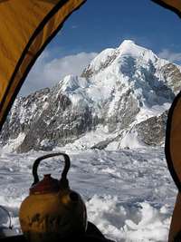
![Let s have some tea]() My favorite memory from Bolivia
My favorite memory from BoliviaBy the end of 2010, I reckoned I had made enough errors and thereby gathered enough experience to start planning a long trip to the Andes. The seed for the idea had been planted back in 2009, when I spent a wonderful time in Bolivia
[1]. I wanted more of that!
Big alpine peaks are what attract me most, so I knew that the Cordillera Blanca in Peru would
have to be the main course. In addition, I had read good things about Nevado Ausangate in John Biggar’s book
[2], and decided I would love to climb that one as well. But first I needed to get acclimatized, and for that I chose southern Peru. I had four months, so lack of time wouldn’t be an issue. I put out some feelers, posted my plans on SummitPost and booked a flight to Peru.
The arrival
Early May I landed in Lima. The capital of Peru is a huge city, but it lies on the coast. Nothing wrong with that, in principle, but it’s too low for acclimatization and, from what I had read about it, there’s nothing to attract a mountaineer. Early next morning I flew onwards to Arequipa, the second city of Peru, and very different in many respects. It’s relatively prosperous, and, as I would come to appreciate over the course of the next few weeks, it has a very nice feel to it. Sitting in the central square, you can easily strike up a conversation. It was a nice way to practice my Spanish, and getting to know the locals makes traveling much more rewarding, doesn’t it?
![Ampato, Sabancaya and Hualca Hualca]() Snow capped volcanoes and rolling hills north of Arequipa
Snow capped volcanoes and rolling hills north of Arequipa
You can safely walk in the down town area after nightfall – although I wouldn’t know what it’s like in the middle of the night, since I would be in bed by then.
![Arrival at Arequipa airport - Chachani in the background]() Chachani from the airport
Chachani from the airportBut for me, the main reason to come to Arequipa was that it was 2325m high, and surrounded by high ground dotted with volcanoes that can be easily climbed, the highest ones more than 6000m. Living at sea level myself, Arequipa would be a good first base, and the high ground would offer excellent easy hiking opportunities to get used to the thin air, get myself ready for the high volcanoes and then, hopefully, for the more demanding alpine peaks further north.
At the small airport, a few touts tried to get customers for their business. I had the Lonely Planet guide with me, and was about to walk out, when I noticed the stand for La Casa de Melgar. They had a favourable description in the guide. The woman at the stand was friendly and offered me a good deal, so I went with her. It turned out to be a really pleasant place in the center of town. Very friendly staff, good beds, hot showers and fine breakfast. And to hang out, a pretty enclosed garden. It would serve as my home between trips for the next few weeks, and whenever I had a rest day, I would relax, study a bit of Spanish and meet fellow travelers in that garden.
The day I arrived, I popped into the office of Carlos Zárate. By reputation, I had read, he was the guy to go to for information about climbing anything in the area, to book a trip or to get a guide. I didn’t want to book anything just yet; that would come later. I just wanted to find out what I could do while getting acclimatized. He wasn’t there. The ladies in the office said he would be back a bit later, so I went for a walk in the center instead. I stumbled across a shop that sold maps, and bought a topographic one
[3] of the area around the famous
Colca Canyon, which I wanted to visit later.
After lunch, I met Carlos in his office. He was quite helpful. We discussed a few options and I learned that the area around Chivay, a few hours up north, which just happened be on the same map (well, the scale of the map was 1:100 000, so it
did cover a large area) would be safe for a solo hiker. Importantly, there would be a few water sources; something not to be neglected, since large parts of the high plains are desert, and although they see some precipitation in the wet season, by May it often doesn’t rain at all anymore. Along Chivay flows the big Rio Colca. With all the people living on its banks, I would want to use its water only in an emergency, but, more importantly, there are a few small lakes and the occasional mountain stream. And, just to make sure, I carried a water filter.
Baby steps: Easy hiking and an unplanned scramble
Two days and a bit of shopping later, I got a taxi to the bus terminal and hopped on the bus to Chivay. Although in the tropics, being at 3600m now, it wasn’t hot. Very pleasant hiking weather. I started really slow, courtesy of my big pack and lack of acclimatization. I followed the dirt road upstream on the south side of Rio Colca. Before long, the road reached the hamlet of La Calera, where there are hot baths. I passed on those.
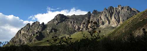
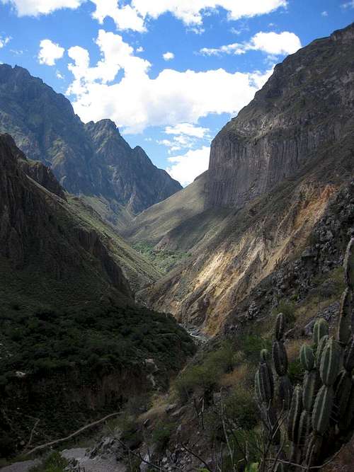
![Towering rocks panorama]() Towering rocks just past La Calera
Towering rocks just past La CaleraThe road petered out now and became a foot path. The sides of the valley got steeper too. I began to look for a water source and a place to put up my tent. I came across a mountain stream, but there was no flat space to be found.
A little later, at a big bend in the river, the terrain was a bit less steep. There was a ramshackle hut of sorts, some livestock, a dog and two shepherds. I asked their permission to camp there – in the middle of nowhere you can camp everywhere, but it’s bad form to camp in somebody’s backyard. They were very friendly and it was fine. They even showed me a nearby spring, which I never would have found on my own.
The dog kept barking for a while, but as it got dark, to my surprise the shepherds left and the dog got quiet. I had a mild headache by now. No surprise, after two nights at 2325m I was now camping above 3600m.
![Bird on the lookout]() Bird on the lookout
Bird on the lookoutNext morning I packed up and continued my trek. The trail left the river for a while, cutting off the bend, and wound its way up a steep slope. Once I got up there, I overlooked a fertile high plain, with crops growing, and a village not far away. Looking back, I could see snow covered mountains in the distance. The views were getting better all the time!
Strangely enough, since the sun was shining brightly, at some point I realized that I hadn’t seen my rain jacket when packing earlier that day. Normally, I pack it on top. “Ah well, it’s the dry season”, I thought, and I planned to look for it later.
![I ve got an itch!]() A young alpaca has an itch
A young alpaca has an itchHaving eaten some of my supplies, my pack was now marginally lighter than yesterday, and getting into a rhythm, I walked a good distance that day. In the end it proved to be easy to find a camp site. For a while I was following a small irrigation channel, with plenty of flat spaces around. And water and a flat space is all that I needed. I set up my tent at around 3800m.
For some reason, my calves were itching. Only when I took my socks off, I saw why. For some time already, I had not been on a trail anymore. Seeds from the grasses and low brush that I had been walking through had attached themselves to my socks and some were sticking through, irritating my legs. I’ve been at it for days afterwards to get all those prickly seeds out of my socks again!
As I emptied my pack, my rain jacket was nowhere to be found. Last time I remembered seeing it, was early yesterday the morning, when I popped out of the hotel to get some cash. Did I perhaps leave it in the hotel? In the taxi to the bus station? In the bus? Or had it been stolen even? For now, I wasn’t worried, because it was the dry season. But later, on Ausangate and beyond, I would surely need it. Besides, it was a really good one, and expensive too. In the mean time, it was just less weight to carry around.
Early on the third day the sun was shining brightly, as usual. A flock of condors were circling above me. I took a few pictures, but none came out good. Those are the times I wished I had a better camera. But I never buy one, because I want to keep the weight down.
![<i>This</i> is a hiking trail???]() The angled slab that I scrambled across: Is thís is a hiking trail? I don’t think so!
The angled slab that I scrambled across: Is thís is a hiking trail? I don’t think so!Soon I was following a trail along Rio Colca once more. I crossed the occasional small mountain stream feeding into the big river, and the fresh mountain water sure tasted good!
A little beyond a small hamlet I must have missed the main trail. The one that I was following got very small, and at one point I found myself scrambling over an angled slab of rock. If I would slide off, at best I would break a few bones, more likely I would be dead. Now, this can’t be right, can it? The people from that hamlet surely must have a safer way to get to civilization! I had a good look around before continuing, but didn’t see a junction with an easier trail. I must have missed it earlier on. I didn’t want to go back, so I stubbornly decided to go over the slab anyway. I told myself, it wasn’t quite hiking anymore, but I can climb, can’t I? And the friction of my boots should be good enough to stop me from sliding off.
I made it across safely, but my heart was pounding. I realized that I had done something risky. Being alone, perhaps I shouldn’t have. It would have been safer to go back and search for a junction with an easier trail. There
must have been one. Another learning experience.
The rest of the day was uneventful. A few hours later, I reached the bridge over Rio Colca near Sibayo and got on a
colectivo to Chivay. Back at the bus station, I asked about my jacket. I learned that the Spanish word for it is
abrigo. But nobody had found it, and they advised me to check again at the bus terminal in Arequipa. Well, I wasn’t planning to go back yet; I wanted to have a look at Colca Canyon. That meant another bus ride, to Cabanaconde, a few hours downstream along Rio Colca. Chivay is a small rural town that sees a regular flow of tourists. During my first trek, upstream from Chivay, I hadn’t met any of them. I read that some visit La Calera, but almost all go the other way, to see Colca Canyon. And this time, so did I.
Joining the other tourists
![Nevado Sepregina]() Looking across to the mountains on the other side of Colca Canyon from Cabanaconde. On the left is Nevado Sepregina (5432m).
Looking across to the mountains on the other side of Colca Canyon from Cabanaconde. On the left is Nevado Sepregina (5432m).Cabanaconde is a small village, and while the fertile fields around it show that there is more going on, tourism is a useful and welcome source of income. There are a few hotels and restaurants. I only spent two nights there, but I really got to like the lively atmosphere and the food at a place called Pachamama. It wasn’t crowded, but still there were plenty of other tourists.
![Cerro Bombaya]() Cerro Bombaya, the morning after my arrival in Cabanaconde
Cerro Bombaya, the morning after my arrival in Cabanaconde
After dinner, I asked around about possibilities to climb Cerro Bombaya, an easy mountain of 5200m or so, on the other side of the canyon. Earlier, I had talked about it with Carlos. Cabanaconde lies at 3300m and the canyon floor is roughly a 1000m lower, so, obviously, you would have to descend all that before having to go up almost 3000m again. That would take a few days.
On the bus ride in, I had seen a nice snow cap on top. Apparently, later in the dry season that would be all gone. A local agency explained that I would need a guide for Bombaya. Tourists had gotten lost and even died in that area, just hiking along its base, not even climbing. I didn’t want a guide, but they said that I couldn’t simply hire a mule driver for it, which is what I was thinking about; I
had to take a guide as well. However, at that time there was no one available, so I didn’t even have to decide if I wanted to hire one, and switched to another plan.
![Colca Canyon]() Colca Canyon
Colca Canyon
The shortest path from Cabanaconde to the canyon floor leads to a place called “The Oasis”, right next to the river, and there is a bridge to the other side. As the crow flies, it’s 3km to the north, but the winding trail is much longer. Not that it matters, it’s the 1000m altitude difference that counts. One of the more popular hikes in the area is a round trip from Cabanaconde, starting out towards the northeast. There is another bridge deep in the canyon down there.
![Colca Canyon near The Oasis]() Rio Colca
Rio Colca
Most people spend a night in one of several simple lodges on the other side or at The Oasis, and then hike back out the next day. As the trail didn’t seem too long, I decided to do it in one day instead. That meant I could go light.
The descent went fine, and the views were wonderful. Despite all the pictures I took, I made good progress. However, the trails on the other side of the canyon to the next bridge downstream, near The Oasis, were more twisted than I had expected, and I soon realized the hike was going to take longer than I had bargained for. So, I had only one short stop for lunch, and apart from that I just kept going. Eventually I reached the bridge, and figured I had made up a bit of time. Only 1000m to hike up now to get back to the rim, and Cabanaconde just beyond.
However, I had not been drinking enough, and there were no water sources anywhere along the trail. My legs started to feel pretty weak. The trail was wide and the slope was gentle, but I couldn’t manage to keep up a good pace anymore. After what seemed like forever, I finally made it to the rim, minutes after sunset. By the time I was back in town, it was dark. Nightfall comes fast in the tropics!
During the day, I had met friendly locals in the little villages and on the track, but surprisingly few other hikers. Probably most are content to watch the condors in the morning and see the canyon from the rim. I was glad I to have experienced it up close.
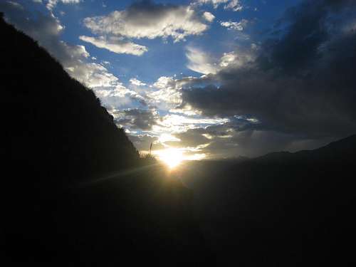
![Sunset over Colca Canyon]() Sunset over Colca Canyon
Sunset over Colca CanyonParts of the area were very dry, in particular the steep southern slopes, so it was no surprise to see plenty of cactuses. Other places, especially lower down and on the northern slopes, were more lush. I saw lots of pretty flowers all over the place
A plan, a plan, a kingdom for a plan!
After drinking and eating, I was fine again. Time to look at my map to find what else I could do in the area.
![Hualca Hualca]() Hualca Hualca to the south, from the fields near Cabanaconde
Hualca Hualca to the south, from the fields near Cabanaconde For acclimatization purposes, I wanted to sleep higher. Fortunately, there are ample opportunities for that, apart from Bombaya.
Just south of Cabanaconde lie the big volcanoes of
Hualca Hualca (6025m),
Sabancaya (5976m) and
Ampato (6288m). In fact, when I enquired about Bombaya, the agency said that a small group of climbers would be making an attempt at Hualca Hualca. I really would have loved to join, but I wasn’t acclimatized for that just yet, and if I was still tempted, my mountaineering gear was in Arequipa. There is snow on top of all three of them, and clear mountain streams running down the slopes. After studying my map, I decided to for a three day hike on the north eastern slopes of Hualca Hualca. The map had a few blue lines, some of them dotted, so I expected that water wouldn’t be too hard to find.
An elusive trailhead
The first day was easy. I didn’t plan for a long hike, just a couple of hours, enough to spend a night high up. With that in mind I got up late, rode the bus towards Chivay for a short while, studying the terrain and my map intensely, and decided to get out at a new building close to where I thought my trailhead should be. It turned out to be a new visitor center. I asked about the trailhead, but they had never heard of a tourist coming to that part of the region! Apparently everybody goes to Colca Canyon, and a few also go to the local villages. They explained that a little further east along the road, near the village of Pinchollo, was a trail to a geyser. I showed them my map, explained my plan and asked what they thought about it. They were very interested, but their reaction showed that they had never seen such a good map of the area, even if it was based on data collected more than 50 years ago. The only maps they knew were touristy ones, good enough for hiking along the clear trails in Colca Canyon. Mine was a topo map, with excellent contours. Its main drawback was its scale, 1:100 000. And, obviously, in the last 50 years there had been some developments in the way of roads and villages.
![Ruins in Quebrada Huayuray, Peru]() Ruins
RuinsWithout their help, I had another good look at my map, and headed out. Before long, I found the trailhead I was looking for. It wasn’t hard, really. A few minutes east of the visitor center, a small stream crossed the main road, and there it was. There was no actual trail and there were no signs, but the terrain matched what I saw on my map, and I knew I was at the right place. I followed Rio Huayuray, for that was the name of the stream, gradually gaining height.
![Donkeys (or are they mules?) in Quebrada Huayuray, Peru]() Mules
MulesI passed what looked like the ruins of a small dwelling. I guess those living high up in the mountains had long ago decided life was easier further down. I saw a few mules, and small herds of llama’s and alpaca’s. Before long, I came across an irrigation channel. That meant I now had two good water sources! After a few hours of easy hiking, I figured I was high enough. I came across a grassy meadow. It would have been ideal for camping, if the local livestock hadn’t made a bit of a mess of it. Instead, a little bit higher, I found a small, flat sandy area, surrounded by a bit of low brush. At 4200m, I was well above the tree line by now.
Reaching higher ground
I woke up to another day for which I didn’t have really big plans. I was very relaxed, and took my time getting on my way. I don't really recall the time I started walking, but from then on, it would become a day to remember. Having studied the map earlier, the plan was to go eastward, cross country, to where there would be a steep escarpment. According to my map, the elusive trail was also going up there, so even if I didn’t find it, that told me I wouldn’t be facing impossibly steep terrain.
From my campsite, I headed out towards the escarpment, looking at it, gauging where I could best work my way up. I picked a spot on the top, and a route up, and hiked towards it. Occasionally I came across vague signs of an old trail, but mostly it was cross country, with sand, a bit of bush and lots of rocks. Perhaps I simply wanted to see signs of a trail, and interpreted what I saw optimistically. Still, even without trail, the going wasn’t difficult, apart from the physical exercise of going up.
Half way up the escarpment, some tiny white flakes started to come down. Snow! I didn’t even realize it was cold; I was wearing only one layer. I guess the exercise had kept me warm nicely.
![Viscacha on the rocks]() I saw a Viscacha on the rocks, not long before it started snowing
I saw a Viscacha on the rocks, not long before it started snowing Visibility was still fine, as the snow was really very light. It stopped again, and restarted, but it never snowed hard. A bit higher, where it was less steep, I put on my fleece, both against the cold and as a replacement for my lost rain jacket. I had a large plastic bag with me from which I could have fashioned a makeshift rain coat, but snow was no problem, I could just wipe it off my fleece now and then.
My plan for the day was to go up the escarpment to the hills on the other side, descend a little bit and camp near one of the several blue dotted lines on my map. That shouldn’t take too long, I had reckoned when I made my plan.
A big cairn and a clear trail waited for me at the top of the escarpment, around 4800-4900m. It had stopped snowing. I followed the trail, which could well be the continuation of the path that I hadn’t been able to find the day before. It wasn’t far from where the map said it should be; only a little bit higher on the slopes. However, the trail didn’t descend, as it should. It kept hugging the contours of the terrain. And although I crossed some dry riverbeds, the blue dotted lines turned out to be just that – blue dotted lines on a map. I’m sure there would have been water in them in the rainy season, but not now.
After a few hours, the trail petered out. I was already higher and further west than where I wanted to be, and I made a decision. Instead of trying to follow the ever fainter trail, I went cross country to the east, and gently downhill. Still, every watercourse I passed was dry. The snow would return intermittently, and a thin white blanket covered everything by now. As I got lower, there were some brushes and thicker grass, and my pants got a bit wet. Higher up the vegetation had been thin, so they had had the chance to dry. Lower down, that didn’t work anymore. I put on my rain pants.
An unexpected road
Finally, with two hours of daylight left, I suddenly reached a dirt road, and it even had a distance marker, saying “12 km”. And I hadn’t expected anything better than trails! It would be good time to set up camp. However, without water, I would be thirsty and wouldn’t be able to cook. I had plenty of fuel, but the snow cover was still very thin. In hindsight, I thought that it would have been enough to melt, but at the time I rejected that idea in favour of another: Although I couldn’t possibly hike those 12km with my big pack before nightfall, with my head lamp I could now easily keep going after darkness. Just follow the road, wherever it would lead me. The only doubt was whether the “12 km” was in the direction I was going to, or the other way – where I knew from my map it wouldn’t lead to civilization, but only to a bigger road at best. Mind you, where I was, my map showed only trails, no roads at all. But then again, the small print on the map says that it is compiled from aerial photography taken in 1955, and that it is not field checked. Contours usually stay the same, but trails and roads are a different matter. So, is this road perhaps the same as one of the trails on my map, or something else altogether? Anyway, I started walking north, because that’s where I knew the Colca valley to be, with the main road and plenty of villages.
Not long after I started following the road, it crossed another of these blue dotted lines. As I approached it, I hoped for water, but again it wasn’t to be. And I learned something else too: although so far it appeared that the road could be driven by a 4x4, the banks of this river were way too steep for that, so in the direction I was headed there wouldn’t be any sort of a car. Strangely enough, after the riverbed the road was in good condition again.
I passed more trail markers. Fortunately, the numbers were going down, so I knew I was getting closer to civilization. For quite a while the road continued north without descending. Sure, it went up and down a bit, but the net effect amounted to nothing, except slowing me down. Still, I managed to keep a pace of 4 km/h for some time, as I could tell by the trail markers. I was happy with that, but I would be even happier had I found a source of water.
Eventually the road changed. It got rougher. By now it was getting dark and I had switched on my headlight. I had also descended a bit after all, which had the unwanted effect of changing the intermittent light snowfall to an intermittent light drizzle. Snow I can wipe off, but drizzle is different. It didn’t feel cold, but if I would get really wet, hypothermia could easily set in as soon as I would stop moving.
A few times it was hard to see where exactly the road was going, and I had to retrace my steps once. Then the character of the road changed drastically. It became a steep, rocky trail; the sort that extreme mountain bikers would like, but definitely no longer a road. Very easy for navigation, but tricky for your ankles when descending in the dark and in wet conditions. I had to go real slow now. I was so focused that I didn’t even realize that the drizzle had progressed to rain, until I got to an overhang where I sheltered. It was dry, but I stayed there only a few minutes, for it was small and would be an awkward place to spend the night, and waiting longer would only cool me down. Luckily, the rain made way for an intermittent drizzle again.
Signs of civilization in the distance
Lower still, the trail got confusing. I could now see the lights of the villages in the valley, and thoughts of warm food, a hot shower and a comfy bed were going through my mind. That was really motivating, so I kept descending – until at one point I noticed that I wasn’t on a trail anymore, but descending a rocky riverbed! Dry, of course, as if to emphasize how little rain the area must have had recently. Just my luck.
![Camping in the fields above Maca]() Next morning ...
Next morning ...
I only knew for sure that I was off track when I reached a spot where I could only continue downward by climbing. I didn’t want to do that. Instead I went cross country to where I hoped the trail would be, and quickly found it again. The same happened one more time, before the character of the trail changed a final time, but now for the better. It became an easier trail, and wider too. And, as luck would have it, at that point I heard running water!
By now I was at the “3 km” marker. And here I suddenly had what I had no longer expected to find: a stream, and, quite coincidentally, a flat grassy meadow right next to it! I only had to think about it for a few seconds before deciding to camp after all. I figured, it might still be an hour or two to town in these conditions, and camping would be safer than continuing in the dark. I quickly put up my tent and got out of my wet clothes. A fleece can only do so much as a rain coat.
![Somehow I came down there last night!]() Somehow I came down there in the darkness yesterday!
Somehow I came down there in the darkness yesterday! ![Budding Flower against the backdrop of Cerro Bombaya]() Waking up to blue skies, and Bombaya across the canyon
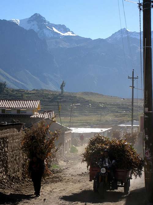
Waking up to blue skies, and Bombaya across the canyon ![The church of Maca]() Even tiny villages like Maca have an impressive church
Even tiny villages like Maca have an impressive churchNext morning I slept in a bit. As if nothing had happened, I woke up to the usual beautiful blue skies, with just a few clouds, and it was warm again. I had a great view of Cerro Bombaya from my camp site. I draped my wet clothes over a couple of nearby rocks. By the time I had finished breakfast and packed up camp, they were virtually dry.
In the bright sunshine, it didn’t take long to reach Maca, the village at the end – or beginning – of my road. I hopped on one of the frequent buses to Chivay, where I had a nice meal in a local restaurant, bought some supplies in the local market and hopped on another bus, direction Arequipa.
An unexpected cooking lesson
![Waterfall in the highlands, south east of Chivay]() A waterfall in the Achacullo valley
A waterfall in the Achacullo valleyHowever, Arequipa wasn’t my destination just yet. To complete my acclimatization process, I wanted to sleep higher still, so I got off the bus by the time it had climbed to 4400m or so.
![Lizard close up]() Local wildlife
Local wildlife From there, wise now from past experiences, I followed an irrigation channel eastwards. Shortly before it was time to set up camp, it crossed a stream. According to the map, it was called Achacullo. I camped nearby, at around 4650m. With the bus rides and the pit stop at Chivay, I had not hiked all that much, but that was fine. Camping high and enjoying the scenery is all that I was aiming for.
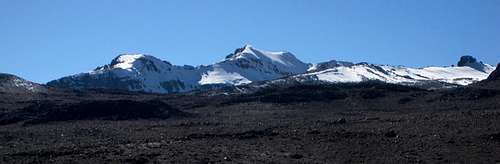
The next two days were uneventful, but the scenery only got better. I saw majestic snow capped mountains in the distance, clear frozen lakes, and, to my surprise, even a bit of snow on a mountain nearby. I wondered, could I climb it? At first I thought it was just over 5200m, but on closer inspection of the contours I saw it was 200 more. I was already at 4900m by then, but with only hiking gear, and not much time left before I wanted to be back in Arequipa, I decided against it. This was my first encounter with
Nevado Huarancante, but wouldn’t be the last. I’ll be back!
Oh, and in case you're wondering: I never saw my rain jacket again.
![Nevado Huarancante from the west, high in Quebrada Achacullo]() The first I saw of Nevado Huarancante
The first I saw of Nevado HuarancanteWhile camping on the slopes of Nevado Chucura, I learned that cooking green beans at 4900m is not a good idea. After an hour in boiling water, the beans had turned white – but there wasn’t much taste left in them, and they still weren’t quite ready. Barely “Al dente”. I ate them anyway, but after that, I stuck to vegetables that can be eaten raw as well, and cooked them primarily to disinfect them.
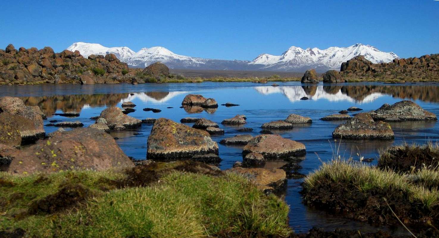
![Scenery]() Nevado Ampato
Nevado Ampato,
Volcán Sabancaya and
Nevado Hualca Hualca from the east, some 30km away, on the banks of a small lake next to
Nevado Chucura.
It may look as if there are only two mountains here, but that's because Sabancaya, left of center, with still an unusual amount of snow for the time of year, appears to be only a shoulder of its higher neighbor Ampato. All that snow, while great for pictures, would also prove dangerous. But that’s another story.
The story continues here: Climbing volcanoes, exploring the unknown and a whole lot of snow
Useful information
Eating and sleeping
- La Casa de Melgar, Melgar 108, Arequipa. A very friendly place and an oasis in the center of town.
- Plaza Vea. Av. La Marina 300, Arequipa. A big, modern supermarket in the center.
- Hostal la Posada del Conde, San Pedro, Cabanaconde. Friendly and enormously helpful staff. I had a nice, clean room, and my shower had plenty of very hot water.
- Bar - Restaurant Pachamama, San Pedro, Cabanaconde. Excellent food.
- Chivay has a lively outdoor market.
Agencies
Carlos Zárate Adventures, Santa Catalina 204, Arequipa.
Quechua Exploring, Calle Ugarte 109, Arequipa.
Notes
[1] The report of what's still my favorite climb:
Why should I get out of my perfectly warm sleeping bag? Oh, right, it's for Illampu!
[2] The Andes - A guide for climbers, by John Biggar. 3rd edition, 2005. ISBN 0953608727
[3] The best map is the Peruvian IGN sheet 2539 Chivay, 1:100 000. I learned to trust the contours, but not the location of the roads and trails.
In Cabanaconde, ask around for a tourist map with hiking trails. There are different ones around. Especially on the northern slopes of the Colca Canyon there are many more trails and more small villages than on your map, but if you have good navigational skills, it's good enough for a day hike.
The official site of the Colca region shows a few examples of maps.
![Nevado Huarancante]() Looking back at Nevado Huarancante from the west, not far from the main road
Looking back at Nevado Huarancante from the west, not far from the main road


Comments
Post a Comment