Previously in Four months in Peru: Off the beaten track, rain in the desert and getting high.
El Misti
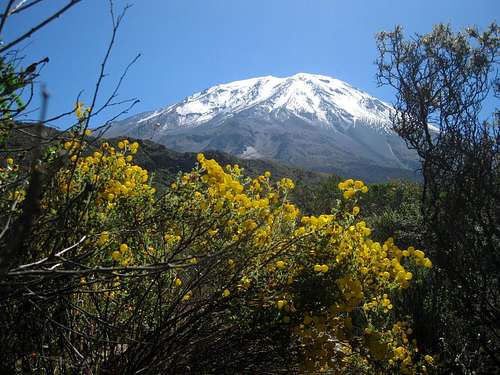
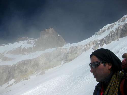
![Misti from near the trailhead]() El Misti from the trailhead. According to a sign, we were at 3415m. Only 2407 more to go!
El Misti from the trailhead. According to a sign, we were at 3415m. Only 2407 more to go!Thirteen tourists and three guides are driven to the trailhead.
Twelve tourists and three guides reach the camp site at 4500m.
About half way up, a Brazilian got a real bad case of altitude sickness, and made the only possible choice. One of the guides escorted him down to the trailhead and called for transportation. Of course, the Brazilian had to pay extra for that. The guide didn't take long to get back up; he arrived at our camp shortly after us. The three of them cooked us dinner, but it was a bit Spartan.
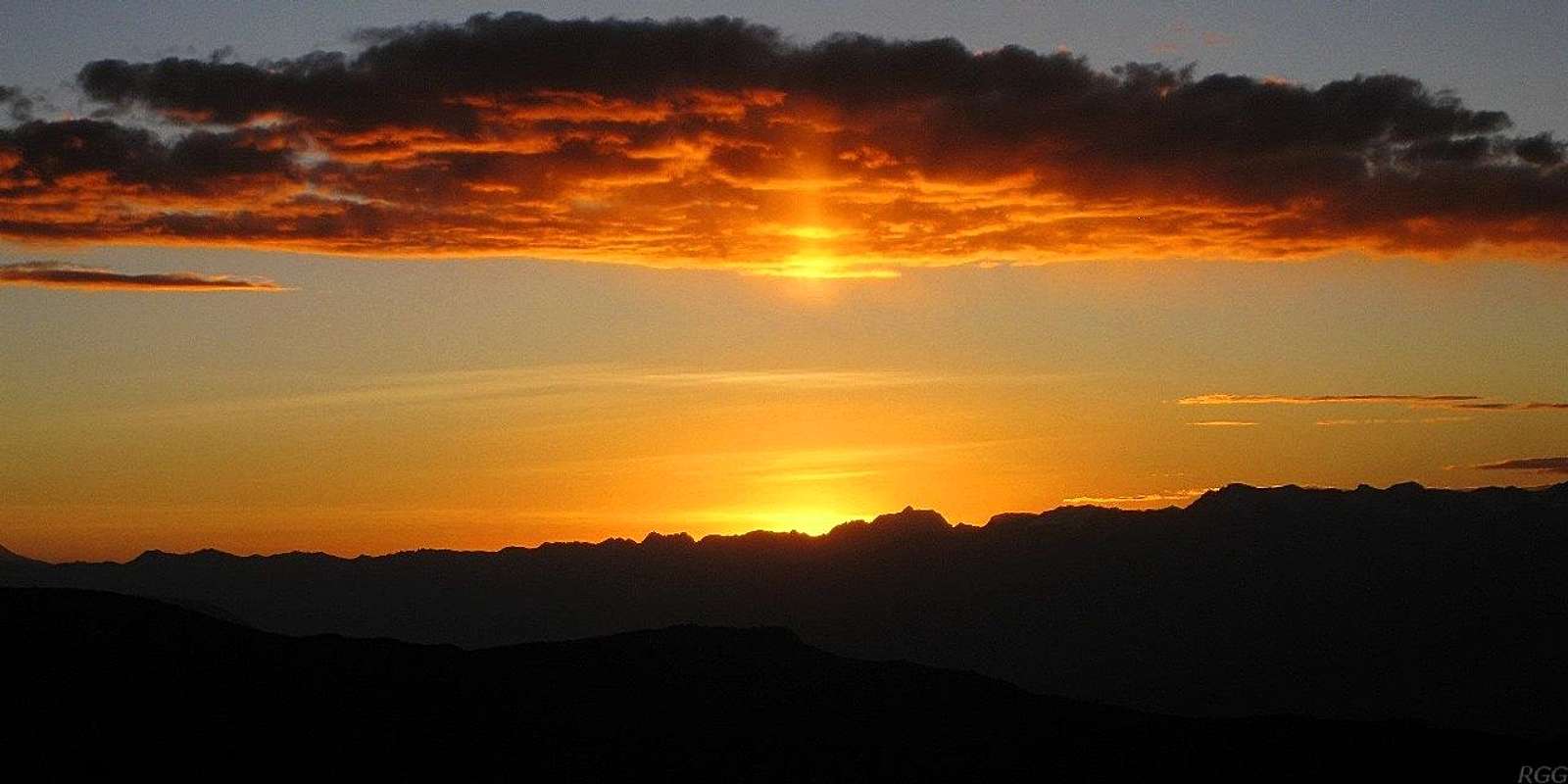
![Sunset from our camp on Misti]() Sunset from high camp
Sunset from high campEarly next morning, all of us were in good enough shape to go up the mountain. For myself, having camped at 4900m just a few nights before, I had expected that, but the others were not all acclimatized all that well. Some had spent time at lake Titicaca, at 4000m or so, others in Cuzco, around 3300m. I suppose the Brazilian had done neither.
It was going to be a long day, so we started in the dark of the night. Uncharacteristically, at first I walked near the front. Then, after no more than an hour, the leading guide surprised me by stopping for a break. Nobody had even asked for it!
As it turned out, the plan was to keep the whole group more or less together for as long as feasible. Now, I must admit that I see the logic in that. It means that if someone gets in trouble and has to descend, one guide can go down too, and the rest of the group still has two guides. That's the advantage of being a bigger group with several guides. Obviously, if all of us were spread out widely, people needing to be escorted down could pose a big logistical problem.
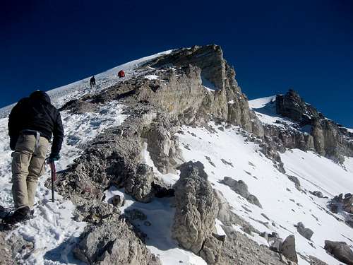
![Heading for the summit of Misti]() We can see the summit!
We can see the summit!
However, I really don't like to pause often, so, after that, I stuck with the rear of the bunch. At the next stop, shortly after we caught up with the rest, the first ones started moving again, and I didn't have to take a break at all. Just the way I like it.
Around 5400m, we reached the snow. Time to put on crampons – a new experience for many people that try to climb
El Misti.
![Heading for the summit of Misti - see that summit cross in the distance?]() The final meters - mind you, the summit is the one on the right!
The final meters - mind you, the summit is the one on the right!By the way, crampons and ice axes were provided as part of the tour package, but the only instruction given was how to put on crampons, up at the snow line. As for the axes, I believe it would have been safer without them. For climbing, they weren't necessary, and without knowing what to do with one, it's better not to have an axe if you fall. Most likely you'll just lose the axe, hopefully without injuring yourself in the process.
Within reach of the summit and on spikes now, we could go up at our own speed. There was no need to herd us together anymore. A few didn't want to go any higher and one of the guides stayed with them. When I was moving, I picked up the pace, but I stopped a lot to take pictures. I was having visions from scenes from the Alps, with all that snow. It was beautiful up there!
Eventually, eight tourists made it to the summit. All in all, a pretty good percentage on such a high mountain, considering the lack of experience and acclimatization for most.
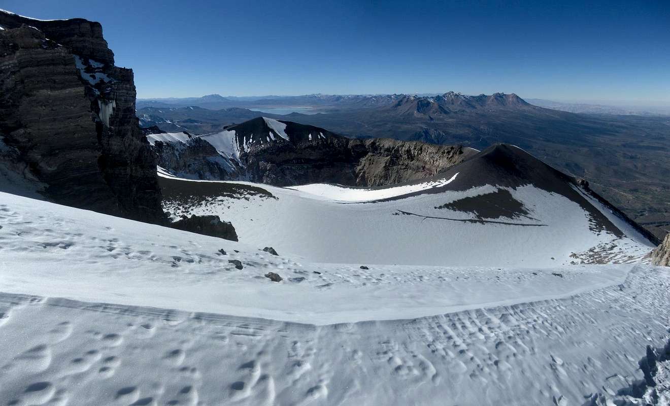
![Two craters]() The two craters of Misti. I'm standing on the outer rim, not far from the summit, looking over the inner crater. Further away in the distance is Pichu Pichu.
The two craters of Misti. I'm standing on the outer rim, not far from the summit, looking over the inner crater. Further away in the distance is Pichu Pichu. Earlier on ...
To climb a 5822m mountain, I knew I had to get acclimatized. Before Misti, I had been hiking and sleeping ever higher for the better part of two weeks. After my cooking lesson at almost 5000m, I had arrived back in Arequipa, well acclimatized and ready to go. The rainy season had ended not all that long ago, and had apparently dumped a lot more precipitation than usual, leaving the higher parts still covered with snow. That's not always the case in May, let alone later in the dry season, but I rather like snow on the mountains. It makes for better views.
El Misti is just a walk up, and many agencies offer guided tours. It wasn't expensive, so I booked one through Zárate Adventures ($85). Now, many agencies in Arequipa will take bookings, but don't organize the trip themselves, and that's how I learned about Quechua Exploring, a thriving company that does the actual work for most of the others.
![Chachani from Misti]() Chachani from Misti
Chachani from MistiAfter climbing Misti, I wanted to climb
Chachani (6057m), the second most popular volcano in the area. I tried to get a hold of Carlos Zárate again. No luck. So, I went directly to Quechua Exploring instead and booked a trip.
Avoiding the dishes on Chachani
Next morning at 8:30 sharp I turned up at the small offices of Quechua Exploring again. Unlike for Misti, where I had borrowed some gear, I brought almost everything myself this time, except for the tent and the dishes – why not use theirs and avoid having to wash up, right?
![Sunset on Chachani high camp]() Our camp at sunset
Our camp at sunsetIt was a longer drive to the trailhead, which, at around 5000m, was much higher. From there it was a short and leisurely walk to our camp site at 5200m or so. We had plenty of time to relax and enjoy the sunset – which, as on Misti, happened to be right when our guides announced that dinner was ready. How's that for timing! After the sun disappeared, temperatures dropped rapidly, so even if we would not have had to get up early, our warm sleeping bags were very inviting.
![Distant mountains]() Ampato, Sabancaya and Hualca Hualca from the slopes of Chachani
Ampato, Sabancaya and Hualca Hualca from the slopes of Chachani
Somehow I overslept, and I thought I would miss breakfast, but everybody else was late too. I still didn't eat much of what was provided: bread with cheese or marmalade. A bit sparse, just as on Misti. Wise from that experience I had brought a lot of snacks, to eat on the way up and to supplement breakfast. However, my bowels were a bit upset too, which was another reason I didn't eat much. I took a loperamide to calm things down and that worked well. There wasn't much said, but I concluded that the general lateness was caused by two other climbers in our camp who were worse off.
My guide started with me and Alex, a Frenchman. We left behind a sick fellow named John, who claimed to be from Wales but sounded totally American. I think that for some reason he didn't want to admit being American and picked Wales as his birth ground, thinking nobody would know a Welsh accent anyway.
Shortly above our camp, the route went up along an easy rocky ridge. Not much later, we saw only three lights following us in the second group. It was a guided group of three friends, minus one now, because he too had stayed in camp, sick. For a while at first, it looked like they would catch up, but eventually they started falling back again. As the first light struck the slopes, I saw them struggling below us. To be fair, I was lagging somewhat behind my guide and Alex myself at that point, feeling weaker than on Misti. Feeling cold too. I kept plodding on at my own pace, and I warmed up as the sun rose higher in the sky.
![Moon over Chachani, early in the morning]() Moon over Chachani just after sunrise. This isn't the summit yet, it's further left, and we can stay on the easy snow slope.
Moon over Chachani just after sunrise. This isn't the summit yet, it's further left, and we can stay on the easy snow slope.![Passing volcanic formations high on Chachani]() Passing volcanic formations high on Chachani
Passing volcanic formations high on ChachaniThe summit crater wasn't very pronounced. From the rim it turned out to be only a short stretch to the summit, much easier than on Misti. However, once again the beautiful snowscape was triggering visions of the Alps. By the time we reached the summit, the wind had become quite strong, making it uncomfortably cold again, despite the sun. It was no place to sit down and have a rest. We congratulated each other, took a few quick pictures and started back down. As quickly as the wind had picked up, it subsided once we were a bit lower again. Without the wind chill, it felt fine.
On our way down, we met the others. They had sort of collapsed, with less than an hour to go. Our guide stopped briefly to talk with them. I didn't hang around, because the snow was just right to make a quick descent, without sinking too deep. Later I heard that the other group had wanted to quit, but their guide had persuaded them to go on and they finally made it. Good job by that guide! After the snow, the descent continued on scree – a different route than the rocky ridge we had followed on our way up – and it was the ideal sort, lots of stones, nice and small. We went from the summit back to camp, some 900m down, in an hour and a half. Much easier than the hard work on Misti.
Planning and preparing
Now, Misti and Chachani are the only two high volcanoes in the area that are climbed often, as they are basically walk ups and both close to Arequipa. However, I wanted more. I contemplated my options and hatched another plan. Earlier, on one of my acclimatization hikes near Chivay, I had seen this white topped peak. According to my map it was
Nevado Huarancante, just over 5400m high. That meant it was too low to have a glacier. So, I studied the map and bought
(... eh, sorry, I have to put down my diary for a moment, because my durum kebab just arrived – Arequipa is full of surprises!) ... food for a four day trip. That should be more than enough to explore the area.
With my preparations complete, I went back to Quechua Exploring. I talked to Iván, the owner and a mountain guide himself, and explained that I would be more than interested to climb the likes of
Solimana,
Corupuna and
Ampato. I didn't want to go there alone, finding partners on the spot was virtually impossible and hiring a guide for me alone too expensive. However, if there would be more interest, I would be happy to join a group.
As I had expected, there wasn't anything scheduled in the near future. As a precaution, I also asked Iván what he thought of my plan to explore Huarancante. He said that it was possible, solo, and yes, there should be water up there too. Great! It's on! We said goodbye, and I said I would be back in his office in four days.
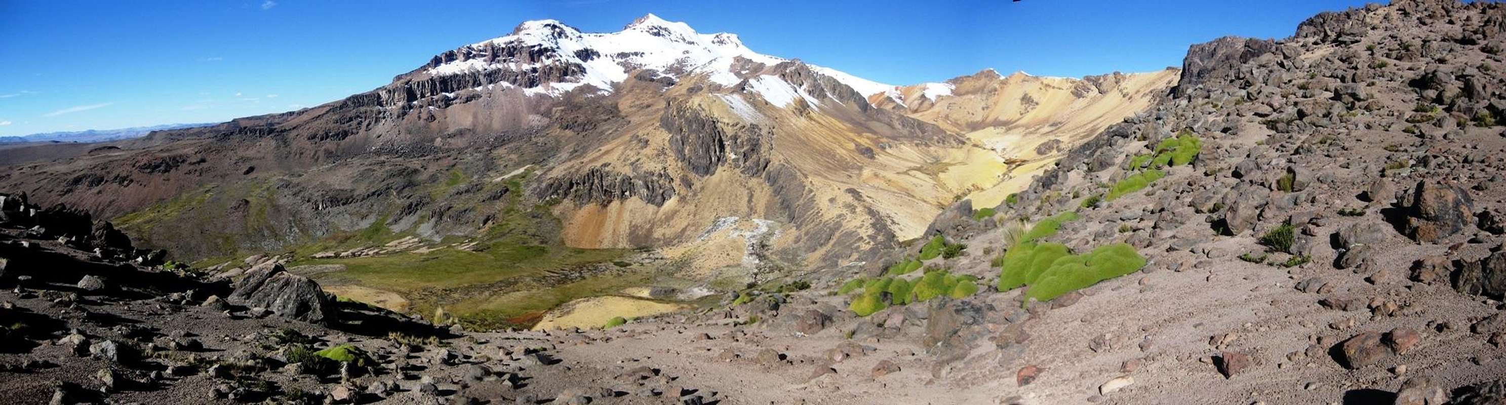
![Pano]() Panorama of Nevado Huarancante from west by southwest.It's my first day of exploring Huarancante. I've started at Mirador de los Volcanes and right now I'm almost at 5100m, crossing the north west ridge of Nevado Chucura. I plan to camp somewhere down in that green, grassy valley today. It's called Quebrada Huanta Occo. High in the valley, my map shows a dashed blue line, but at around 4800m the line is solid. Let's hope I don't have to descend too far to find water.
Panorama of Nevado Huarancante from west by southwest.It's my first day of exploring Huarancante. I've started at Mirador de los Volcanes and right now I'm almost at 5100m, crossing the north west ridge of Nevado Chucura. I plan to camp somewhere down in that green, grassy valley today. It's called Quebrada Huanta Occo. High in the valley, my map shows a dashed blue line, but at around 4800m the line is solid. Let's hope I don't have to descend too far to find water. Exploring on my own
Two days later,
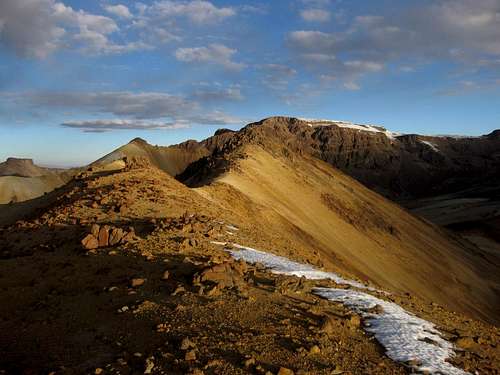
![Cerro Jello Jello summit ridge]() Late afternoon on the summit ridge of Cerro Jello Jello
Late afternoon on the summit ridge of Cerro Jello JelloI had leisurely made my way to the north side of Nevado Huarancante and enjoyed the sunset from the slopes of
Cerro Jello Jello, an easy hill next to my camp site. I had started at the Mirador de los Volcanes, west by south west of Nevado Huarancante. On the hike in, I had enjoyed a good look at the snow covered south side of Huarancante. I carried crampons, but no ice axe. It wasn't too steep, and I figured that it would be possible to go up there. But since I had enough time to investigate a bit more, I decided to go around to have a look at the other side. And while it wasn't quite as scenic, having no snow, it looked like an easier climb from there.
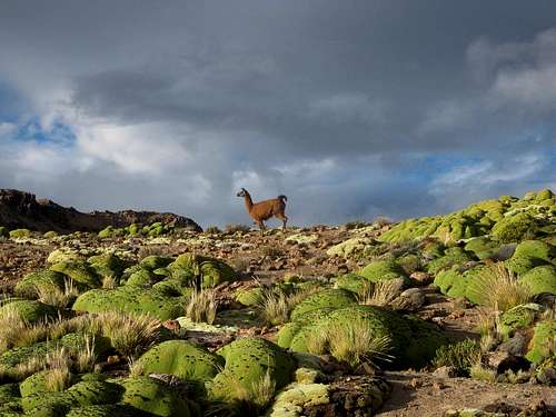
![An injured llama]() An injured llama near my camp.
An injured llama near my camp.
At first glance, it appears fine. However, it was strange that it was standing by itself and not making an effort to get away from me. Did it not see me? Then I realized that it was standing on three legs. If you look real close, you can in fact see the fourth, but completely pulled up. It must be broken.
The area seems well suited for pumas, and if there is one in the area, this llama doesn't stand a chance. I haven't seen any, but that doesn't mean anything since they would certainly be avoiding humans. Still, the fact that an injured llama is alive at all suggests that there are no large predators around. Perhaps the few local herdsmen scattered around the area have killed them to protect their livestock.Shortly after having dinner, I got sick. I think it must have been the water. Two small streams joined just above my camp site, one coming from the north, from nearby Laguna Jello Jello, and the other from the ridge between Cerro Jello Jello and Huarancante. I must not have boiled the water long enough while cooking dinner. And at 5000m, water boils at around 80º C, so it may take a little longer to kill all pathogens.
![Clouds on Nevado Huarancante]() Early morning view of Huarancante
Early morning view of Huarancante
The next day I was in no shape to climb anything, so that put a dent in my plan. I took water from the other stream, and this time filtered it first, then boiled it. I rested and lived on a diet of tea. By the end of the day, I managed to hold down a bit of soup.
I woke up the next morning, better but somewhat weak. I couldn't eat more than a light breakfast. Apart from that, I felt fine, so I decided to go for it. I know that, as long as I go slowly, I can keep going for a very long time. Besides, judging by the map, going over a few peaks, starting with Huarancante, was shorter than going around, although it did mean ascending a few hundred meters.
Instead of two, I now had just one day to climb Huarancante and get back to Arequipa. Alternatively, not having eaten much also meant I could stay out one more day, and I could decide anytime during the day that it was enough.
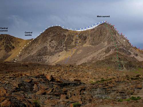
![Which route shall I take?]() Huarancante from the north. Which route shall I take? The two rocky ridges on the right look interesting, but I don't know what difficulties I might encounter. Feeling the way I did, and with a big pack, I didn't want to find out. That left the blue and white lines. The latter looked the easiest, so that's where I went.
Huarancante from the north. Which route shall I take? The two rocky ridges on the right look interesting, but I don't know what difficulties I might encounter. Feeling the way I did, and with a big pack, I didn't want to find out. That left the blue and white lines. The latter looked the easiest, so that's where I went.
After looking at the mountain, I identified several possible ways up, and picked what looked to be the easiest route. Not surprisingly, I wasn't very fast. I could feel the lack of food from the previous day, but kept going up anyway.
Part of the route was a short slope with sand and scree, but luckily it wasn't as bad as it looked and I had enough grip. I reached the central saddle on the ridge, where I left my pack. On the northern side, there was no snow (being on the southern hemisphere, north faces get more sun, remember?), but the ridge itself was covered with it, as were the southern slopes.
![Looking back at the steep pitch on Nevado Huarancante]() Looking back at my trail from the central saddle, after returning from the summit
Looking back at my trail from the central saddle, after returning from the summitI put on my crampons and started climbing. The steepest part started just above the saddle, but it wasn't difficult. The snow wasn't too hard. Since I didn't bring an axe, I punched my fists in and managed to make my way up without much trouble. After that, it was easy going to the summit. I even saw a cairn up on the ridge. Useless, since the ridge wasn't that wide, but definite proof of previous ascents. Then again, as it was pretty easy, I would have been very surprised if it hadn't been climbed a long, long time ago by the locals.
After enjoying the summit, I went back to my pack at the saddle and traversed the snowy slopes, heading straight for the lowest point on the south ridge. From there, I continued along a system of more ridges to Nevado Chucura. At one point I had to use my hands; apart from that it was easy hiking.
![A tired dude on the summit of Nevado Chucura]() One tired dude on Chucura. You can't miss it; it's the biggest cairn around.
One tired dude on Chucura. You can't miss it; it's the biggest cairn around.
Chucura doesn't have much prominence, but the views are excellent. I could see Misti and Chachani in the distance to the south and the threesome of Ampato, Sabancaya and Hualca Hualca to the west, but the best view was of nearby Huarancante. I was tired, but happy. I knew that it was only downhill from there, and not all that far to the road.
Nevado Chucura 360° summit panorama.
On the left, far away to the south, looms the dark volcanic cone of Misti, with a friendlier looking Chachani to its right. If you scroll about a third to the right, you'll see Ampato, Sabancaya and Hualca Hualca, somewhat obscured by clouds. If you scroll further, you first pass the northwest ridge of Chucura, and then you'll see door neighbor Nevado Huarancante, covered in snow and looking beautiful. |
On the south western slopes of Chucura, I came across tracks in the snow. I followed them for a short while, but I could see the main road in the valley below and the tracks went a different way, more westerly, in the direction of the Mirador de los Volcanes. I had started my exploration there a few days ago. As the highest point on the road, it's the best trailhead for both Chucura and Huarancante, but since I didn't have a car to get back to, I chose the shortest way to the road now, straight down into the Chucura valley to the southwest.
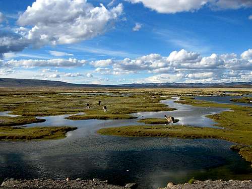
![Grazing in the wetlands]() Livestock grazing in the wetlands, not far south of Huarancante and Chucura
Livestock grazing in the wetlands, not far south of Huarancante and ChucuraFor the most part, the terrain wasn't difficult and it's far above the tree line, so you can walk almost anywhere. Below the snow, I came across a few cairns, which lead me to a clear trail and not much later to the road.
Within minutes I got a ride in the back of a pickup truck. The cabin was filled with a whole family, but I was fine being outside. It was a windy place, but it gave me great views towards the mountains I had just explored. Bouncing around too much in the back of the truck, I couldn't take good pictures. Anyway, soon they looked very small again.
We reached a checkpoint at the side of the road, with a few buildings and stalls selling food and local handiwork to those passing by. The driver asked me to step out of the truck. He was quite friendly, but I was still working on my Spanish, so I didn't quite understood why. Perhaps he didn't want to take a gringo past the checkpoint, or he was simply close to his destination and thought this would be a better place for me to get another ride. It certainly was. In no time at all did I find a seat on a regular bus back to Arequipa.
I made it to Quechua Exploring before they closed, and Iván surprised me by saying that someone else had turned up who wanted to climb Ampato – taking two days, starting tomorrow!
"Oh no", I said at first. "I need a rest, especially to eat and get some energy back." However, Anna, a young woman from Switzerland, already had more plans afterwards, and couldn't wait another day. It seemed a no go. Not fazed at all by my rejection, Iván started explaining the route, and that was a good thing. As soon as he said that the first day would actually only be a long drive to base camp, no hiking at all, I was persuaded. That meant I could have my rest, and I could eat during the drive.
Unlike Misti and Chachani, Iván would guide us himself this time. And so, after going over the details of the trip and the matter of payment ($280) we said goodbye 'till next morning. I wasn't sure if my stomach would appreciate meat just yet and so I decided on the veggy restaurant opposite my hotel and had a good, big dinner there.
![Ampato, Sabancaya and Hualca Hualca from Mirador de los Volcanos]() Ampato, Sabancaya and Hualca Hualca from the Mirador de los Volcanes
Ampato, Sabancaya and Hualca Hualca from the Mirador de los VolcanesA whole lot of snow on Ampato
Again, 8:30
en punto I was at Iván's. I sacrificed some breakfast time for that, because I still had to pack early in the morning. Normally I do that the evening before, but I just didn't have the energy yesterday.
Unlike what I had expected, the whole organizing took a bit of time. I had learned that getting underway for Misti and Chachani is fast and efficient. I didn't really catch what we were waiting for, but it's South America, so I didn't worry. I just wished I had had more breakfast; those fried eggs tasted great!
By 9:30 we were moving. Iván had said it would be a six hour drive, and he was right about that. However, either Julio's 4x4 was pretty crappy or he wasn't a good driver. To begin with, he wasn't fast on the fine tarmac from Arequipa to the Mirador de los Volcanos. Then he drove slow on the rough dirt road that we started following shortly thereafter, and when we went uphill, his speed dropped further still. With a proper 4x4 it would have been decidedly faster.
Judging by my altimeter, the camp site was between 4900 and 5000m, not 5100. That meant some 150m more to ascend tomorrow. I wasn't in a hurry, but Anna wanted to catch a bus in Arequipa tomorrow night, so we couldn't take forever. Iván told us that it normally takes 6 to 8 hours to the summit. Things would turn out a bit differently...
Another alpine start
Although I have eaten well yesterday, early in the morning my body can't handle much breakfast. Consequently I don't have all that much energy when we start walking. One more rest day would have been better after all, but it's too late for that now.
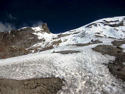
![The eastern slopes of Ampato]() At the edge of the glacier. The route goes towards what looks like the lowest point on the ridge. In fact, it's not a ridge at all, but the edge of the large summit plateau.
At the edge of the glacier. The route goes towards what looks like the lowest point on the ridge. In fact, it's not a ridge at all, but the edge of the large summit plateau.We hike up the easy lower slopes of the mountain. It's very cold. I don't eat or drink much, but keep going, fuelled by sheer determination. As the sun starts to rise, it's too cold to take off my mittens to take pictures. Higher up, we reach the glacier and the sun warms us up now. The mountain looks beautiful, and although we are slow, I hope we will still have time enough to make it.
"Thud".
That's the best I can describe it. A loud, low, abrupt sound it is. There is something breaking. We are traversing low on a steep snow slope, but the sound stops all three of us in our tracks. Iván turns around and tells us to go back carefully. Off the slope, on safe terrain, we talk about what just happened. We dodged a bullet here! Just as easily we could have triggered a real avalanche, instead of just getting a warning. There is no way any of us wants to cross that slope! In fact, I'm a bit surprised that Iván actually talks about it, giving us the impression that we actually have a say in the matter. On the other hand, it might simply be his way to let us have the bad news. He doesn't have to convince us though. As soon as we heard that sound, we knew what it was, so the discussion, if you can call it that, is real short.
![Anna on Ampato]() Anna on Ampato
Anna on AmpatoIván explains that crossing that slope is the normal way to the summit plateau. From there it would be only 1.5 to 2 hours. I look at the distance to the edge of the plateau and figure that, with the snow as it is, those 100m or so may still take an hour by themselves. We have already been walking in deep snow occasionally, and while I was the slowest one of our party earlier on, when Iván had to break trail I could keep up easily. And I fear that the plateau won't be any better. Nevertheless, I look up at the mountain and I see another possible route: straight up from where we are, until we will pass a rock band above the avalanche-prone slope. Above that band, I think we should be able to traverse.
Iván studies the route and decides to give it a go. But barely has he taken a few steps when we hear that same sound again.
"Thud".
Ok. That's it! Apparently even our supposedly safe position is at the bottom of an avalanche zone, if not actually in it!
![Iván on the slopes of Ampato]() Iván, right after the moment of truth
Iván, right after the moment of truthAnd so we descend. I come to think that Iván himself is the most disappointed of the three of us. Anna and I are philosophical about it: this sort of thing can happen on the mountains. Nothing to do about it; we gave Ampato our best, but sometimes the mountain wins. And at least we didn't become avalanche statistics.
As we approach our camp, another group of climbers comes up towards us. They want to camp a bit higher and climb tomorrow. Iván explains the avalanche risk, but they do not appear to be fazed. I presume they are going to try it for themselves. I'm not sure they have their priorities straight, but for their sake, I hope that the conditions improve, or that they find a safer route.
Although we didn't summit Ampato, I was happy. I had explored the south of Peru – well, part of it – climbed a couple of mountains, enjoyed the scenery and met some nice people. And, properly acclimatized by now, I was ready to climb some of the high peaks in the Cordillera Blanca. But before going there just yet, I had one more mountain on my mind that wasn't all that far away: Ausangate!
The story continues here: A Peruvian fiesta, struggling with deep powder and making new friends
Useful information
Eating and sleeping
- La Casa de Melgar, Melgar 108, Arequipa. A very friendly place and an oasis in the center of town.
- Plaza Vea. Av. La Marina 300, Arequipa. A big, modern supermarket in the center.
Agencies
Carlos Zárate Adventures, Santa Catalina 204, Arequipa.
Quechua Exploring, Calle Ugarte 109, Arequipa.
Maps
The best map is the Peruvian IGN sheet 2539 Chivay, 1:100 000. I learned to trust the contours, but the main road between Arequipa and Chivay does not always follow the map. No surprise, really, since the map is based on data from 1955.
![Sunset]() Sunset from Cerro Jello Jello
Sunset from Cerro Jello Jello


Comments
Post a Comment