
|
|
Mountain/Rock |
|---|---|
|
|
46.80811°N / 11.05697°E |
|
|
Trentino Alto-Adige |
|
|
Mountaineering |
|
|
Summer |
|
|
10285 ft / 3135 m |
|
|
Overview
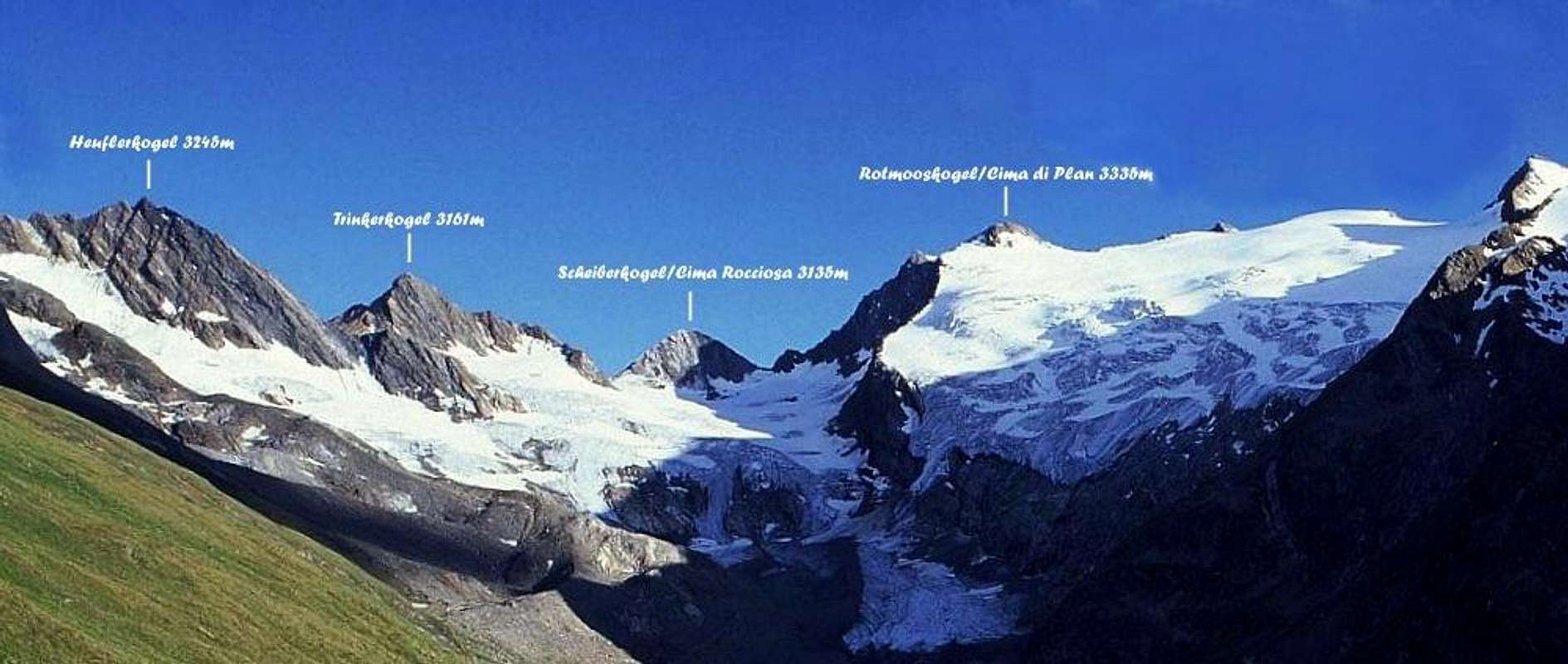
Scheiberkogel/Cima Rocciosa m 3135
Scheiberkogel/Cima Rocciosa m 3135 is a summit belonging to Alpi Venoste di Levante (Ötztaler Alpen), supgroup Alpi Passirie (Ötztaler Hauptkamm), located to the East of the main alpine watershed on which it runs the Italian-Austrian border. For that reason this fine summit is fully included in the Italian territory, Bolzano Alto-Adige province. The exact location of this summit is between Rotmooskogel/Cima di Plan 3335 m and Trinkerkogel/Cima Snella 3161 m. Notwithstanding its altitude overcoming the 3000 meters, Scheiberkogel/Cima Rocciosa is considered as a minor summit, but actually it's interesting to be climbed from Refuge Plan along the easy and panoramic South Ridge.

|

|
The location close to the Refuge Plan makes Scheiberkogel/Cima Rocciosa quite popular from this side, also as a complementary second goal after the Normal route to the nearby Cima delle Anime/Hinterer Seelenkogel. The two climbs can easily be combined starting from the shelter.
First ascent: K.A. Meyer with J.Pixner 1890
Getting There
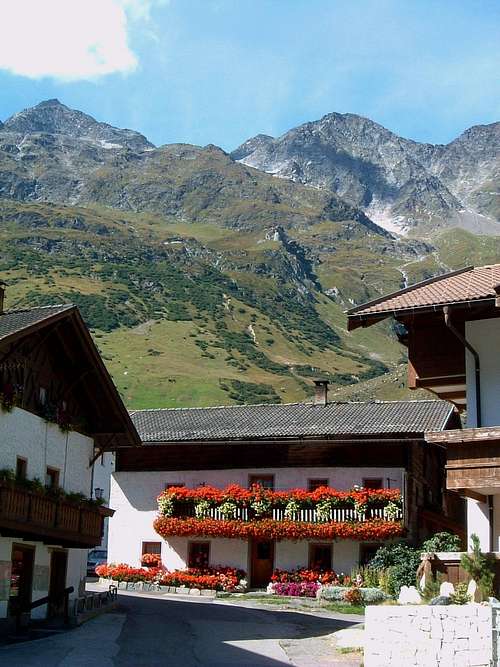
Small hamlet of Plan
Road access to Plan/Pfelders 1620m
From Brenner Motorway, exit Bolzano south and follow the road to Merano and then to Val Passiria/Passeiertal, reaching San Leonardo/St. Leonhard and Moso in Passiria; follow now the Plan Valley (Pfelderer Tal) to the very nice little settlement of Plan/Pfelders m 1620. Parking in Plan.
Public transport
Take the train to Merano. From Merano railway station directly by bus to Plan- Pfelders (Line 240).
From Plan/Pfelder m. 1620 to Refuge Plan (Zwickauer Hutte) m. 2980
From Plan/Pfelders (hotels) the itinerary always follows the path 6a. Climb the steep grassy slopes and debris, touching Malga Schneid (Schneidalm - m. 2.159). From the pasture we continue with steep serpentines up to the rocky buttress of Oberer Schneid (m. 2.371) and from here, along the back of a steep ridge, we arrive to Refuge Plan (Zwickauer Hütte - 2979 m, 4 hours), possible dinner and overnight.
Normal Route from Refuge Plan
Scheiberkogel/Cima Rocciosa m 3135 South Ridge (Normal Route from Refuge Plan)
Summit: m. 3135
Difficulty: Alpine F
Difference in level: 150 m. from Refuge Plan/Zwickauer Hütte
Exposure: South
Starting point: Refuge Plan/Zwickauer Hütte
The route is an easy and brief scramble up a rocky ridge with a quick approach from the shelter. The approach involves the crossing of a small glacier
Route description - From Refuge Plan/Zwickauer Hütte reach quickly the starting point of Vedretta di Plan/Planferner (Plan Glacier). Traverse the glacier in direction of the rocky South Ridge of the obvious peak located on the right of the glacier. Follow the easy crest getting quickly the wooden summit cross. Summit log.
Descent: reversing the same route
Other routes
")
|

|
- West Ridge
This route starts from Rotmoosjoch. It's an easy scramble from the col. Getting to the Rotmoosjoch involves crossing a glacier.
- North-East Ridge
Red Tape
No fees, no permits required.
When to Climb
Mountaineering: late Spring and Summer are the good season to climb
Ski-mountaineering: from March to May
Hut
")
|

|

|
Rifugio Plan 2980 m. stands on a rocky outcrop, the White Node, at the edge of the Plan Glacier in a dominant position over the Plan Valley. It was originally built by the section of Zwickau DAV back in 1899, was destroyed by an explosion in 1967 and has recently been rebuilt. It has 28 beds and 44 bunks in the dormitory.
Belongs to CAI Merano and it's open from early July to late September.
Shelter phone, fax: 0039-0473-646002
Guardian Phone: 0039-347-5164308
Bibliography

"Guida alle Alpi Venoste, Passirie, Breonie e Giogaia di Tessa" - Fabio Cammelli - Edizioni Panorama
Map
Tabacco Nr. 039 Val Passiria - 1:25 000
Meteo forecast
METEO PROVINCIA BOLZANO ALTO ADIGE