Introduction and Special Thanks...
This “essay” documents a journey spanning several winters from 2004 through 2011. At first, due to the headers with summarized data, it may appear as surface-level peak-bagging account. That was not my purpose. Rather, my real goals were exploration and learning to be comfortable in an environment that can be both beautiful and harsh, to appreciate the minutiae as well as all that is grand, to learn so I can share with others and to capture as much as possible on camera. In essence, I use the goal as ambition to be a student of the journey.
This journey started off with a few simple hikes to snap some photos…Big Slide, Cascade and Giant. They were relatively close to the road and, though challenging at the time, didn’t require a huge time commitment. Unfortunately, the first several are not well-documented. Then the bug bit me, especially after taking a particularly dramatic set of photographs. I established a desire to pursue a winter 46 round and collect more memories. The challenge of the deeper peaks also appealed to the adventurer inside.
So began the learning experience of a lifetime. The literal climb up each mountain was only equaled by the rhetorical climb up an often steep and unforgiving learning curve. You learn fast or quickly become extremely uncomfortable or worse. The margin of error narrows when trips are undertaken alone. Fifty-six percent of this winter round fell into that category. It was a blast. While the solo hikes were rewarding self-reflective days that offered a unique peace and solitude in God’s country, there was also an awesome feeling of kinsmanship on the days when I hiked with company.
Each day was a blessing and an indelible memory during a seven year journey. It had a beginning and end, though, its end was really the start of an even larger journey…
Thanks to...
First of all, I need to thank Christ. It’s my belief that He’s “walking” with me on every journey in every moment. Each hike began with a prayer for a safe journey based on grounded decision making. It’s an honor and a privilege to be able to walk in His creation.
Deb, my wife…Thank you for LOVE as well as your undying support, encouragement when things weren’t quite going well, suggestions, on-trail snacks/baked goods, dinners and humour for one of the two “idiots” that’s always running around the mountains looking for some remote slab or snowfield. You used to tell me to “rock a little”. I took it literally even if the rocks were covered with feet of snow for this journey!
Blanche MacKenzie…Thank you for all your trail food (banana bread) and support through the years, starting with breakfasts for Rico and I at 4 a.m. Thanks for your interest in reading the reports and seeing the pics!
Mac/Lois MacKenzie: Thanks for your interest and following me via the SPOT and contributions to my endeavors during each adventure!
Jan/Owen Taylor: Thank you for support and some vital pieces of equipment that kept me safe on the trail!
Rich McKenna and Mark Lowell: Thanks for being my hiking friends of old and being a part of the journey!
…and Thanks to all the countless new friends I’ve met on the trail over the last few years. Thanks to Glen (Mastergrasshopper), Nathan Crooker, Danielle Camastra, Jack, Alistair, Gérald, Geneviève, Whadever, Mtnhiker and Britdog and all of the “Santanoni Snake Dance Crew”. Forgive me if I’ve left anyone one…there are many to remember. Each smile or kind word either in person or on the forum has added a memory to the journey!
Thanks to Neil Luckhurst for
www.adkhighpeaks.com and his company on several trips over the last few years. The forum is an incredible source of information and interaction for all things hiking!
Thanks to the 46-R organization which puts a face to this journey and more importantly supports and helps protect the High Peaks so we and future generations can continue to enjoy it.
Initial Climbs:
The First Eight
The winter of 2007 marked the beginning of a conscious effort to hike the 46 in the winter season. The previous eight winter hikes were not really toward the goal, but just to get out a bit. I drafted a 14 hike “plan” for the remainder of 2007 and 2008 as the ideal end goal. Being that weather plays a vital role in my climbing schedule, 2008 may or may not be realistic in reality. The mountains will always remain and another year or so doesn’t really make any difference to me. It’s the journey that matters and obtaining the goal doesn’t mean I’ll hike any less. There are four other seasons and twelve other months after all!I documented the following hikes, but did not elaborate on them at the time, so the first eight winter ascents are very limited in information.
Phelps: 2/22/2004
First winter ascent
Solo Hike
Big Slide: 2/29/2004, 3/3/2007
2nd Winter Ascent
Solo Hike, Group on 2nd Ascent
Colvin/Blake: 12/24/2004 (Christmas Eve)
3rd & 4th Winter Ascents
Partner: Rico
Cascade/Porter: 2/1/2005
5th & 6th Winter Ascents
Solo Hike
Whiteface/Esther: 3/21/05
7th & 8th Winter Ascents
Partner: Rico,
Giant and Rocky Peak Ridge:
12/22/07 (9th & 10th Winter Ascents)
Duration: 6.5 hours; 10 am – 4:30 pm
Summits: Giant: 12:10 pm; RPR: 2 pm
Route: Chapel Pond - Washbowl – Ridge Trail – bypass to RPR and back to Giant – Descend ridge trail to Chapel Pond.
Total Mileage/Vertical Ascent: 8.25/4650
Trail Conditions: The ridge trail was semi packed though the roaring brook trail looked to be unbroken. About four or five feet of snow was underfoot on the summit ridges.
Temperature: 25-30 F at 1500 ft; estimate around 0-10 at Giant’s summit and upper 20’s at RPR with high winds.
Partner: None…solo hike
Diet: Small bag of sunflower seeds, 6 dried apricot slices, a cookie, small granola bar, 2 liters water.
Clothing: Bergelene, Techwick shorty, waterproof shell; bottoms: bergelene, poly, ski pants; gloves with fleece insert glove, pack weight about 30 lbs.
Thoughts:
This was an interesting hike logistically. I knew it was hard, but short in mileage compared to most of my usual and so opted to begin in 10 am after a leisurely wake up, coffee and breakfast. Combined with the time constraints, was the fact that 12/22 marked the shortest day of 2007.
The hike up the Ridge Trail was uneventful on a moderately packed trial. Recent snows made the trail only semi packed. Conditions were ideal in temperature and I was only cold at the top when remaining still for more than a couple minutes and when my gloves got soaked through. The trail to RPR from the ridge was broken by 3 people before me.
The most notable thing about the hike was the front moving in around 11 am. Thick clouds rolled in at about 3000 feet and, due to the temp and moisture, literally poured over the mountains. The upper level was about 4000 ft which put me well above the cloudline and allowed incredible photos of the clouds illuminated by the bright sun above. The next day temperature spiked to around 54 degrees with rain and wind.
Giant's Images
![Giant from Rocky Peak Ridge]() Giant as viewed from Rocky Peak Ridge.
Giant as viewed from Rocky Peak Ridge.![Rocky Peak Ridge (west side)]() Rocky Peak's west flank as viewed from Giant.
Rocky Peak's west flank as viewed from Giant.![Sea of Clouds]() Sea of clouds as viewed in late afternoon from Giant.
Sea of clouds as viewed in late afternoon from Giant.![Giant s Ridge]() Re-ascending Giant from Rocky Peak Ridge.
Re-ascending Giant from Rocky Peak Ridge.Tabletop/Colden:
12/27/07 (11th & 12th Winter Ascents)
Duration:7.5 hours; 7:30 am – 3:00 pm
Summits:TT: 2.5 hours, 10:00 am; Colden: 12:15 pm
Route: Loj – Vanhoevenberg Trail – Tabletop – west on VH Trail to “yellow” crossover trail to “yellow” trail to Mt. Colden via Lake Arnold – Descend via “yellow” trail to Avalanche Camp/Marcy Dam/Loj
Total Mileage/Vertical Ascent: 15.5/4400
Trail Conditions: 1-2 feet of packed snow; 3-5 feet packed snow on summits
Temperature: high 20’s at Loj
Partner: None…solo hike
Diet: 1 Fruit bar; 400 cal protein bar; 1 bag dried apricots, bag sunflower seeds, 1.50 liters water
Clothing: Bergelene, Techwick shorty, waterproof shell; bottoms: bergelene, poly, ski pants; gloves with fleece insert glove
Thoughts:
I wanted to test my endurance a little on this hike so I maintained a controlled but constant pace from the Loj to TT without stopping for a break. I put foot to summit at a mark of 2.5 hours. Tabletop was enveloped in a heavy blowing fog with winds of about 10/15 mph. It was the most humorous of descents. I normally “ski” down on my snowshoes (MSR which I swear by). This time I used a faster method. I rode my avalanche shovel. The shovel part perfectly fits my bottom, yup narrow…and the handle (facing forward) can be used for steering or “throttle”. Pull up on it to slow down and push to plane it correctly for the slope and type of snow. The more powder the steeper the slope required, though. Anyway, TT trail was moderately packed which have me a bit of speed. Three hikers yelling,
“Whoa, WHoa, WHOOAAAH"greeted me around a turn. I saw them before they figured out what the noise of my descent really was…just a hiker riding a shovel!
The rest of the hike went off without a hitch in a fraction of the time I prepared for. I cut across to Colden’s trail (.75 mile) where it started to snow and hiked the rest of the 2 miles to the summit at a descent pace as well. The snow began at about 11:00 am (3500 feet) and continued from sleet to large wet snow on Colden’s summit. While near the Great Slide on the summit I heard the eerie sound of a snow field settle. I was in no danger, though, on top of the ridge in the middle of cripplebrush.
The hike off Colden went quickly, again using the shovel as a sled where possible. I could have used it to Avalanche Camp if the trail hadn’t collected several inches of snow. I maintained pace and only got cold when calling Deb from a latrine at Marcy Dam…yup a latrine. It was protected from the snow and I needed its services as well!
![Colden s Summit During Snowstorm]() The summit of Mt. Colden at 12:15 p.m. during a snowstorm.
The summit of Mt. Colden at 12:15 p.m. during a snowstorm.Sawteeth:
1/1/08 (13th Winter Ascent)
Duration:6 hours; 7:30 am – 1:30 pm
Summit: 3.5 hours, 11:00 am
Route: Ausable Club parking lot – Lake Road - Alfred E. Weld Trail to Summit and back on same route.
Total Mileage/Vertical Ascent: 14/3500
Trail Conditions: Road was packed; trail packed snow with 4-15 or more inches of fresh sleet/powder
Temperature: Mid 20’s at 1200 feet
Partner: None…solo hike
Diet: 1 Fruit bar; part of a high protein bar; one deb cake, less than 1 liter water
Clothing: Bergelene, Techwick shorty, fleece vest under waterproof shell; bottoms: bergelene, poly, ski pants; gloves with fleece insert glove
Thoughts:
My initial thoughts were to hike Sawteeth, Nippletop, Dial. In the first mile, I’d decided to only summit Sawteeth…for the sole reason of spending the remainder of the day with my wife before returning to work.
First steps on the trail to Pyramid/Sawteeth col were covered with 2-4 inches of sleet/powder
As elevation rose to about 3000, the covering was 8 to 12 inches of fresh snow which was akin to breaking the trail. The path to Sawteeth from the col is .5 mile and 500 ft. ascent. To say it was grueling, understates the moment as the trail was non existent. Occasional yellow markers and strategic gaps between the trees served as the only clues that a trail existed. 12-15 inches of fresh snow and drifts of 2-3 feet covered the area. Wind whipped from the west up the col.
Sawteeth has several very steep areas on the ascent and I was forced to crawl up these. I’d become accustomed to kicking in the snowshoes to secure my footing, but the fresh snow was too deep and steep to serve as a solid foundation. The buried packed trail did serve as a guide in some areas since a step of a few inches off the trail in either direction buried me to my waist. I was only up to my knees while “on the trail.
The forecasted snow storm (yup I planned a hike in a storm) arrived while I was on the summit. In reality it fell short of what it was supposed to be. Only a fraction of the snow fell and the winds were relatively calm with gusts of only about 30 mph.
It took 3.5 hours to summit Sawteeth from my car. 2 hours were spent climbing from the road to the summit. Due to another session of snowshoe skiing, it took only an hour to slide back down. There was too much new snow to ride my shovel. The walk out of the road was uneventful and the subsequent nap in front of the fireplace, well…
Algonquin & Wright:
1/19/08 (14th & 15th Winter Ascents)
Duration:5.5 hours; 7:20 am – 12:45pm
Summits: Algonquin: 10:00 am; Wright: 11:00 am
Route: Loj - Algonquin – Wright – Loj
Total Mileage/Vertical Ascent: 9.75/3750
Trail Conditions: The trail was packed until intersection to Marcy dam with a base less than a foot. Trail thereafter was powder over a base that increased in depth to several feet with elevation.
Temperature: 20 F at 1500 ft; estimate around - 5 at the summits with windchill. Estimate wind at about 60 M.P.H. steady.
Partner: None…solo hike
Diet: 10 dried apricot slices, small granola bar, ½ liter water.
Clothing: 2 Bergelene tops, Techwick shorty, waterproof shell; bottoms: bergelene, spandex, ski pants; gloves with fleece insert glove, pack weight about 30-35 lbs.
![Clouds Over McIntyre Range]() Cloud over Algonquin, Wright and Iroquois.
Cloud over Algonquin, Wright and Iroquois.As I drove down the Loj road, the view was typical yet daunting as the calm air over the Plains of Abraham contrasted to what I knew waited at elevation. A cloud shrouded the McIntyre Range in gray icy dampness. Algonquin, the second highest point in the state, is the king of the McIntyre’s. It was nowhere to be found. I took the first of about a dozen less than acceptable photos of the day as I broke camera rule number one: check settings / don’t assume they’re correct. The 400 iso setting, high shutter speed and low aperture settings ensured dark grainy pics which I marginally corrected in Photoshop. The camera actually set the shutter at 1400…which would ensure sharpness if a mountain up and jumped to the side suddenly.
The weather was mild and I kept a subdued pace to the intersection with the Van Hoevenburg Trail. As expected, it was a packed snow highway. The path southwest to Algonquin, however, looked freshly broken by only a couple hikers. A layer of four-inch powder snow covered the ground beneath. The overall snow was not deep at this elevation due to the mild weather and rains just a couple weeks before. A few hundred yards after the intersection I stumbled into my first problem of the day: I forgot to drain the water bladder hose. It had frozen solid. I subsequently wasted about ten minutes holding the mouthpiece in my mouth or keeping the tube between my backpack and back to melt the outer layer of the ice core. The hot water inside would melt the remaining ice when I got even the slightest flow moving: After melting the mouthpiece ice I sucked for several minutes hard enough to make my toes get shorter…finally the water flowed. Did I mention the mouthpiece was also covered with road salt since I stored it in the back of my truck? C’est la vie, no salt tablets needed…
![Frozen Cascade]() Frozen cascade on Wright's flank marks the beginning of a steeper section of trail.
Frozen cascade on Wright's flank marks the beginning of a steeper section of trail.
The subsequent mile or so along the flanks of Whale’s Tail and Wright retreated into history without incident as I mentally amused myself. It amazed me that the people ahead would walk repeatedly through water with snowshoes. Wet snowshoes quickly gather ice and weight with the following steps as the water freezes to snow etc. A half mile prior to Wright’s intersection I passed two hikers at the small cascade marking the change to steeper terrain.
The plan was to hike Algonquin, Iroquois and Wright. I considered changing it to hike Wright first, but mentally, tackling the largest first seemed best. I almost switch my opinion when I realized the partly broken trail ascended Wright. Algonquin was virgin territory for at least this latest snow. I still had fresh memories of crawling up Sawteeth just weeks ago.
I began the .9-mile hike up the second highest peak in the state with some reservation, especially when I plunged past my knees into the powdery quagmire. Surprisingly the center of the trail…the hidden spine of packed snow…was only covered with a six to twelve inches of powder at most. Forcing the weight to my toes embedded the crampon portion of the snowshoes into the harder material. I slipped a few times, but ascended quickly.
The lesson portion of this hike was solidly afoot. My balaclava was really too small for my head and the facemask portion fit too tightly. In short, I couldn’t fully hook it to the Velcro on either side. This consequently caused vapor to rise under my sunglasses creating fog (frozen fog), which did not evaporate from the wind. The rest of the ascent was riddled with
![Wright]() Wright from Algonquin's summit trail. Beyond lies Heart Lake and Lake Placid.
Wright from Algonquin's summit trail. Beyond lies Heart Lake and Lake Placid.fights involving the facemask and glasses. My view of the beautiful trail was limited to what I saw either underfoot or over the rim. My peripheral vision did, however, pick up the majestic view of Wright. After removing my glasses, I saw the splendor of a winter day on its bare ridge and rocky crown. It looked nearly windless (I was wrong, but the dream was nice). The sun illuminated the snow in against a brown anorthosite base. Heart Lake peeked over its shoulder from relative warmth far below.
Wind howled around the protective shroud of trees enclosing Algonquin’s steep summit trail. The sound and its bite reminded me that the conditions and my clothing problems could jeopardize the rest of the hike and make it unsafe if I didn’t weigh reason against my desire to hike to the distant Iroquois Peak or even Algonquin. In naivety, I cursed the trees since they harbored the snow that occasionally undid my footing, though I thanked them silently for the shelter. In silence, I decided Algonquin was attainable as I approached the obvious end of the stunted krumholtz.
The last tree marked the first step into an apparent arctic wilderness bereft of life and sanity. I write this dramatically, now, to try and paint a picture of what was truly a very dramatic experience and environment. Writing after the fact always dilutes the actual moments experienced. Words just can’t create temperature or the many variables of the day…plus they are reflected against the reader’s own degree of experience.
My body and legs were warm, but stiff winds whipped up the frozen shoulder of the giant and bit hard into the exposed flesh of my face and under my glasses. The invisible hand of the southern breeze immediately tore the facemask away thus creating another battle in the war to stay warm. It took only a few steps to necessitate the use of my right hand as a shield for my face. This effectively removed my right trekking pole for balance, but eased the ache of my eyes. Algonquin’s cone was a paradox of beauty against a frozen hell. The entire summit was encased in a thin veneer of wind polished ice dotted with hardened snowdrifts. The remaining drifts were small and cut grossly from winter’s assault. Cairns were sometimes covered in frozen snow sculptures or even fully encased in a translucent ice.
On a side note, 90 M.P.H. winds support the weight of my body on a lean (or would when I weighted 135 lbs.). I tested this while body surfing during a tropical storm in FL. Anyway, I estimated this day’s wind at a steady 60 M.P.H. with gusts to 70 +. Walking headlong and upward into the onslaught was painful and exhausting. As the summit crept closer underfoot, the wind intensified. I watched clouds race by, which occasionally occluded the eerily glowing morning sun. Finally, the ground leveled and I saw the summit rock right where I left it the last time! I raced over and crouched behind its bulk to deflect the wind and ease the sting. I poked my head up after a brief respite and walked to the south side for a view of Iroquois…just a mile away.
![Algonquin from Path]() He-no-ga...Algonquin as viewed from below. Poor photography and clouds made for a less than perfect pic...
He-no-ga...Algonquin as viewed from below. Poor photography and clouds made for a less than perfect pic...
Well, I saw bits of Boundary Mtn. (the halfway point) below when it wasn’t obscured by the clouds funneling through the col at breakneck speeds. It looked like the view from an airplane window as one rises through and above the cloud layer. The pain in my face and hands told me I couldn’t safely make the second goal, Iroquois Mtn. There was no warm car to run back to. I was four miles into the wilderness. The hike to Iroquois involved a descent of Algonquin’s fully wind exposed southern side. Had I proper protection, I wouldn’t have hesitated. I know the route even when I can’t see it, but I was solo and conditions were prime for frostbite given my cover. I turned 180 degrees and tramped off the summit, seeking the shelter of the trees that I previously cursed…I begged for their embrace.
In the time it took to descend the exposed cone, I managed several quick breaks in the shelter of a “warm” frozen rock and fell only once. Finally, within the trees, I found a comfy nook to catch my breath and warm my hands under my armpits. I was alone on Algonquin…until now. The hikers I passed earlier had finally caught up. I told them it was less then desirable only a bit farther along. My hands fought warmth for the remainder of the descent as I passed several more people. Another four waited with questions at the intersection to Wright…my next conquest. I was warned that this too was covered with ice and windy…crap!
My fingers lost the fight for warmth and finally went numb as I swallowed my hesitation and turned up Wright. I didn’t use my hiking poles as I was still struggling to force heat to my hands. The descent had cooled my core temperature, which made the hands cooler as well. I needed exertion to create warmth. My internal “burner” actually didn’t ignite until Wright’s summit, though. The path up Wright winds for about .25 mile through stunted trees, which, again, abruptly stop growing and unveil an immediate view of Wright’s bare ridge. I heard the dreaded wind…again. As I said, I was wrong about it not being windy. I can’t fathom why I dared dream of a windless Wright since the last three warm weather ascents were identical in demeanor.
I crawled up the iced rocks that mark an entry upon the ridge. My footing was unsteady due to numb hands and a #*$*#! facemask that again defied me. Oh yes, the fog had frozen my glasses like a frosted beer mug. I didn’t dare slow my pace and, as a result, tired quickly. I needed the body heat and an increased pace increases heat output. The entire ridge was a polished sheet of ice more slick than Algonquin’s. For those who haven’t ascended Wright, it is moderately steep as one ascends to the east. The ridge drops off on either side, albeit gently. I dug my metal snowshoe crampons into the quarter inch of ice (rotten in places from the wind). The carbide tips of my trekking poles even fought for purchase, if placed carelessly.
I can’t remember most of the approach, but it passed quickly in time with the forced march. I was winded when the summit rock rising about eight feet above the “plateau” came into view. The wind was such that it actually knocked me sprawling onto the rock. I readjusted to avoid being blown off the north side. The careful 11:00 a.m. crawl over the summit proper and back down onto the path finally added enough heat to my hands where they slowly began to regain feeling. If you’d like to experience this feeling, simply immerse the fingers in a pot of boiling water for ½ hour.
![Algonquin s Path]() My snowshoe prints mar the virgin snow on the trail up (or down) Algonquin. Wright's ridge lies in the right background.
My snowshoe prints mar the virgin snow on the trail up (or down) Algonquin. Wright's ridge lies in the right background.
Now…the next portion, the descent of the ice sheet (broken only by occasional rock protrusions), required concentration and firm footing. I had no concentration, just hands regaining feeling! My slip and subsequent fall onto my right leg combined with a human snowboard imitation was inevitable. I managed to realize the implications of distracted focus somewhere during the thirty-foot ride down the ice chute, however. As I gained speed and momentum, I aimed my trajectory toward a rock prominence and bent my legs for impact. It was fairly soft given the situation. At this point, I’ll say the next fall and slide wasn’t as bad…though it tweaked my knee slightly.
The final descent of the frozen teflon ridge led me back to the beautiful, warm ice encrusted trees…my shelter from the wind. During my precipitous adventure down, I did complete the cycle of regaining feeling in my fingers. As I write (though I’m now warm) I still await feeling in the tip of my right ring finger.
The hike out was less than eventful and fully enjoyable due to that blessed uneventfulness. The previously unbroken trail wasn’t by 11:30. I counted over thirty people in groups as large as seven working their way up to the windy hell. Some looked unprepared and about fifteen of them asked one question or another including the dreaded, “how far until…” question. I griped to myself after meeting two that were committing a hiking sin…walking a main trail without snowshoes or skis. I followed their boot prints for the duration. Luckily, they didn’t ruin the trail, though they must have gone up to the crotch while walking over at least one stream!
Today’s main lessons were hard learned: I needed a few additional pieces of equipment…a correctly fitting facemask and ski goggles. I contemplated hiking over to Street and Nye to see what they were like, but decided against it. I’m local and wanted to spend the remainder of the day with Deb. I was happy to reach the “relative safety” of my truck and drove down the snow-covered winding Loj Road contemplating my trip. I remember gaining renewed respect for those who summit such mountains such as K2, Denali, Rainier, etc. Suddenlty, at a mere 30 M.P.H. the back end broke loose and I slid sideways, overcorrected and spun the other way coming to a hault mere feet from a streambed located below…a fitting end to the day.
An hour or so after arriving home and a warm shower, I worked outside for a few minutes with firewood…in a flannel shirt unbuttoned halfway down and some jeans. I was comfortable and asked myself, “Why didn’t I push for Iroquois?” I answered myself with a laugh at how a warm perspective can skew realities experienced just hours earlier.
Street & Nye:
2/3/08 (16th & 17th Winter Ascents)
Duration: 5:15 hours; 8:45 am – 2:00 pm
Summits: Street: 11:30 am; Nye: 12:15 pm
Route: Loj to herdpaths.
Total Mileage/Vertical Ascent: 8.5/3200’
Trail Conditions: Packed snow/ice with base in inches around the loj and to Indian Pass Brood. Obvious packed herd path most of the way until near “Y” for each mountain. Winds had hidden the path in some areas.
Temperature: 33 F at 1500 ft; moderate winds on Street.
Partners: WWBF and Jason.
Diet: 2 trail bars and a few handfuls of sunflower seeds, 1.5 liters of water.
Clothing: Bergelene, Techwick shorty, waterproof shell; bottoms: bergelene, poly, ski pants; O.R. Northwall gloves, pack weight about 30 lbs.
Thoughts:
![Crossing a Stream]() WWBF crosses a stream on the Street/Nye side of Indian Pass Brook. I had the camera ready for a fall into cold water, but the moment never arrived...his balance remained in tact.
WWBF crosses a stream on the Street/Nye side of Indian Pass Brook. I had the camera ready for a fall into cold water, but the moment never arrived...his balance remained in tact.
Once again this winter, the local forecast (which called for sun and a fairly nice day) was a bit off…if snow, low clouds and bleakness/gloom can be considered a “bit” off. Street and Nye actually lend themselves to this weather in spirit so, it’s actually not a complaint so much as an observation befitting the goals. My partners included the notorious WWBF and a friend of his named Jason, an aspiring 46er hiking number twenty four and twenty five. His humor and pace fit in with ours.
WWBF nudged me while Jason was signing in and motioned to the right of the sign-in register to the woods on the south side of Mt. Jo. I took the hint. After signing in, I said, “Ready?” I proceeded to trudge into the woods exactly 90 degrees off course; WWBF followed…as did Jason. After about 100 feet I stopped and said, “Just kidding…” He responded appropriately to such a joke this early in the day.
![Tree Sculptures]() Ice/snow encrusted tree.
Ice/snow encrusted tree.
The walk to Indian Pass Brook was a relaxing way to wake up. The atmosphere created by moderate temperatures and an open forest was only broken by the sound of our plastic snowshoes on ice. Indian Pass Brook was frozen solid with a few spots in which to peek through at the mild flow beneath. WWBF donned his sunglasses shortly after…I felt like I was hiking with Elton John. The path was a snow-packed highway and we ascended uneventfully except for WWBF, who wasn’t feeling up to par because of a flu bug that was hanging on to his lungs.
The path follows the drainage between Street and Nye and then exits at the col at the top. It winds toward a distinct divergence from that point. The “Y” is easily recognizable on sight…without several feet of snow to change perspective. Near the “Y”, I lost the trail. Wind had blown across and erased it for the most part. I continued on a short bushwhack before meeting up with the path at the “Y”. It was recognizable, though the convenient sitting rocks were well covered with snow. We decided to summit Street first.
The summit took about twenty-five minutes to reach. The trail grew faint several times along the way and former parties had taken the wrong direction and doubled back to the correct trail more than one time. These mountains can be a confusing maze if you’re not familiar with them or if you’re off trail. Several areas looked different to me and WWBF pointed out that the level of snow changed the landscape a bit since the normal perspective is several feet lower. Most of the blow down that needs to be navigated in warmer months is well under snow in February. Dramatic tree sculptures standing a thousand at a time, dotted the way…especially in the more exposed areas that were open to the knife of the wind. We arrived at the summit plateau at 11:30. I walked beyond the summit proper to the only open area to check for a view. I laughed at the gray that started back.
![The Flank of Street]() A relatively bare spot on Street.
A relatively bare spot on Street.
Nye is only five or ten minutes from the “Y” and we made the trek quickly. I announced we were on the top…and was wrong. WWBF asked if the path went farther; to my embarrassment it did, just under several trees leaning over the obvious path. Several hundred yards farther (12:15) we nodded to each other at the summit and promptly walked back…ready for the descent. WWBF and Jason needed to be back in Syracuse by about 6:00, in time for the Superbowl.
I’d been awaiting ideal conditions for a descent via my avalanche shovel and this day boasted such conditions. As the decline increased, I set the shovel down and took off on the polished shovel. The path was “fast” and I navigated the trees and rocks by leaning, grabbing trees, banking off the boulders or by using the back edge of the shovel as a rudder. I had to abruptly halt as three hikers were comfortably planted in the center of the trail. After startling them, I continued. As each stretch passed, I waited at the bottom for WWBF and Jason to catch up. WWBF announced that they were descending at 90 feet per minute. I was moving faster than that and it was a relief on my legs compared to the normal pounding of a fast descent. Of course, it was fun as well…but practical to boot.
![WWBF and Jason on Street]() WWBF and Jason on the summit path to Street.
WWBF and Jason on the summit path to Street.
My main lesson of the day, other than avalanche shovel control, was to stay alert. Nature has many little trials perched along every hike, but they can be avoided with a little caution. I was walking on level trail fiddling with my gloves, but looking down. An upcoming branch with a broken lower limb awaited at my head height. I walked into the downward pointing stub at full gait. It hit me in the forehead and slid instantaneously and painfully into my eye socket. The impact knocked my head back and me nearly off my feet. If it were sharper or perhaps if the top ridge of my glasses didn’t offer resistance, I’m pretty sure it would have taken an eye. I walked away grateful that the small cut on my forehead wasn’t worse.
The last section after Indian Pass Brook seemed to slog on forever, but that is always the way. At 2:00 pm we reached our respective cars. I drove the short distance home and WWBF and Jason returned to Syracuse.
Dial & Nippletop:
2/16/08 (18th & 19th Winter Ascents)
Duration: 8 hours; 9:30 am – 5:30 pm
Summits: Bear Den; Dial: 12:25 p.m.; Nippletop: 2:30 p.m.
Route: Lake Rd – Henry Goddard Leach Trail over Noonmark’s (shoulder) – Bear Den – Dial – Nippletop – Descent via Elk Pass and Gill Brook to Lake Rd.
Total Mileage/Vertical Ascent: 14/4500’
Trail Conditions: Mildly packed snow/ice until partway up Noonmark. Base of 3’ on Noonmark. Exponentially harder beyond Dial. Trail had 6-8 ft. base with fresh broken new snow depth of 12” +. Trail markers either about 6” above snow or buried. Winds mild.
Temperature: 5 F at 1200 ft; moderate winds on Street.
Partners: Solo.
Diet: 1 granola bars, dozen apricot slices, 1 energy bar, 1 liter of water.
Clothing: Bergelene, Polyester “jumpsuit”, techwick shorty, waterproof shell; bottoms: bergelene, poly, ski pants; O.R. Northwall mitts, gloves, pack weight about 30 lbs.
Picture Gallery:www.mackenziefamily.com/46/46r.html
Thoughts:
The purpose behind this day’s hike was to train, but take it easy on a “shorter” hike, hence the reason I began at 9:30 a.m. A high pressure system over the area promised good pictures as well. On the “take it easy” note, let me step back: the last two weeks has been wrought with an abundance of snow/ice/sleet and sometimes rain. Based on the hike up Street and Nye, just two weeks ago, I hoped to find conditions remotely similar to the hard packed and icy trails of that day. I suppose that I subconsciously knew better.
![Great Range from Noonmark]() Part of the Great Range and a ledge on Noonmark's south side.
Part of the Great Range and a ledge on Noonmark's south side.
I woke up and relaxed in the morning while watching deer in the front yard: a great example of how Deb and I prefer to start our weekend days. Making the final decision to follow through with my hiking plans (rather than succumb to further relaxation), I gathered my equipment and left the house about 9 a.m. The temperature had risen to about 10 F.
Several groups of hikers dotted the parking lot at St. Huberts. One gentleman awoke at 4 a.m. and drove from Ottawa to hike Colvin and Blake. The largest party was hiking Noonmark. As I signed the register (.5 miles from the lot) I noticed that I was the third person listed…the trail would not be hard packed. I set a quick pace (about 3 m.p.h.) to the Goddard Leach Trail which traverses the Dial/Nippletop ridge line. Originally, I planned to hike up via Elk Pass, but WWBF suggested it might be akin to swimming through the snow up the steep one mile trail at the base of Nippletop. I opted for the “safe” way; the long trek up the 6 mile ridge line spanning over 4400’ vertical feet. I swore in 2003 that I’d never hike the ridge route again, but decided it to be the best option for the possible conditions. As I arrived at the trail, I found it broken and icy…perfect. My looming concern was that no one had hiked it since the numerous snowfalls over the past week.
![Dial with Dix in the Background]() From left to right, Dix, Dial and the flank of Bear Den from the south side of Noonmark's shoulder.
From left to right, Dix, Dial and the flank of Bear Den from the south side of Noonmark's shoulder.
Noonmark’s shoulder is a significant hike in and of itself (about 3.5 miles and 1950 vertical feet). Its burnt shoulder from the 1999 fire is healing and the views of the Great Range are magnificent. I set a strong and constant pace up the snowshoe stepped trail, slowing only to adjust body temperature. I did not stop until on the shoulder and then only briefly for pictures. The wind gusted over the crusted snow on the south side as I approached. The south side boasted the best views as I walked on the thin crust over three to four feet of base snow. The wind, however, discouraged me from staying too long as well as the bright glare. My goggles had previously fogged to the point where I couldn’t see and then frozen. I cleared the mess every now and again, but it made for a distorted view when I wore them out of necessity. Giant icicles clung to the small cliffs facing south and Dix loomed like a sentinel with its great northern slides. Bear Den looked imposing, but I also knew would pass quickly. Dial’s non-impressive crown beckoned from beyond.
When I last hiked this ridge in 2003, the additional 600 vertical feet of Bear Den tired me after Noonmark’s exertion. This day, it passed quickly though the path began to get softer from the increased snowfall of more elevation. The solid steps on BD gave way underfoot requiring slightly more exertion than solid footing. As I dropped off the far side of the mountain and began to climb Dial, WWBF’s humorous words echoed in my mind, “Leave late and let someone else break trail, if you catch them (as we usually do) rest a bit and so on…” Well, I caught them as they were resting. I passed them and never heard their voices again.
![Nippletop from Dial]() The final climb up Nippletop's ridge. The far point along the ridge is just a false summit prior to the final.
The final climb up Nippletop's ridge. The far point along the ridge is just a false summit prior to the final.
Dial’s summit came underfoot after 2 hours and 55 minutes at 12:25. The summit rock was covered with snow and even with the trail elevation. The views were magnificent and I took the opportunity to photograph the various mountains of the range as well as Nippletop’s ridge and summit some 2.2 miles farther. Obviously, many had recently reached Dial’s summit and turned back, calling it a day at one high peak. The trail became much more obscured, broken only by a single set of snowshoe prints (which actually ended up being a pair of men). The gently descending ridge and subsequent second “summit” harbored a trail somewhere, but the two gentlemen ahead obviously lost it several times based on the circles of prints. I followed more than one of their searching tracks. The problem was that the trail markers (usually 6-8 feet above ground level) were no more than about 6 INCHES above the snow and some were undoubtedly buried. I eventually found the steep descent of the south slope and began the march up Nippletop. I soon met the men who broke the trail. They looked tired, but in better shape than I. More than once, I considered turning back. It was a cold day and I was solo hiking. The trail got more close and soft with each step.
![Nippletop Mountain s Ridge Trail]() An example of the trail partway up the ridge of Nippletop...beautiful, cold and challenging.
An example of the trail partway up the ridge of Nippletop...beautiful, cold and challenging.
About one half mile up Nippletop’s ridge, I gave serious contemplation to turning back, but the options of re-climbing Dial, Bear Den and Noonmark was less than appealing in comparison to Nippletop’s further elevation gain of not quite 1100’. I’d also not eaten enough so my mental state was not in top form. The route up and subsequently down via Elk Pass was the shortest and most sensible way to the car. I was concerned about my increasing exhaustion combined with uncertainty as to the condition of the one mile trail down to Elk Pass. If it was unbroken, I didn’t know if I had the energy to break it. On the other hand I also didn’t know if I had the oomph to retrace the soft trail from which I hiked. I was worn down from the snow depth which elevated the trail to at least normal head height. Falling “off” the spine of the hidden but packed trail meant falling into deep snow. Each fall drained valuable energy. The most challenging aspect was the trees, however. The snow depth forced the trail through the upper and unbroken limbs of trees. Each time the path traversed between trees, which is most of the way, they tore at forward progress and created a near near-bushwhack up the gradual, but wearing ascent. Many of the limbs were strong which, when they weren’t pulling me backward off balance, necessitated hundreds of crawls, ducks and pushes.
I again considered turning back. The burst of energy experience from “summit fever” as one nears a summit had not taken hold. In reality, I didn’t care if I made the summit. I couldn’t move fast enough to warm myself properly and my hands bordered on painfully cold. Increasing pace to warm my body meant increasing the exhaustion, however. Maintaining the balance was unnerving. Dix eventually came into close view to the east so I knew I was progressing. Finally, a solo hiker emerged from the opposite direction. I asked about his route. He’d broken the trail up from Elk Pass! I breathed a silent sign of relief. I now knew my escape route as well as knew the intersection was probably within a half mile. He cheerily went on his way not bothered by either cold, or breaking trail. I was apparently having a very “off” day. As the path veered west and the Great Range came back into view, the sun blared on the stunted trees…I was nearing my goal. Another few minutes found me at the intersection to Elk Pass (west) which was indeed broken by a single set of prints. I said a prayer of thanks. The intersection sign was buried in the snow.
![Elk Lake Trail Sign Comparison]() Comparison of the Elk Pass trail intersection sign in winter 2008 and summer 2003.
Comparison of the Elk Pass trail intersection sign in winter 2008 and summer 2003.
The summit proper is less than a quarter mile from the intersection. I was tired, but the goal was in sight. I trudged forward without stopping and quickly found myself on the summit where I took out the camera. The memory card was full…great. Changing a memory card requires dexterity or at least a glove free hand…which was cold. I swallowed good judgment and exposed my hand. The bright sun was the only warming factor. I quickly shot pics of the Dix range, and all of the Great Range which was now gathering some weather and partly obscured. Blake Slide, which WWBF and I descended several months prior, shone in snow covered glory as did Elk Lake…and a higher point a little farther south on Nippletop’s ridge.
![Nippletop s Summit and Elk Lake]()
As I noticed, I grumbled and decided to take pictures of the actual summit from my perch on the final false summit. I then took time to organize a few things such as replacing my gloves with mittens (complete with hand warmers) and unclipping my Avalanche shovel for use as a sled down the Elk Lake trail. I wearily reached the proper summit at about 2:30. It was time to get out and call it a day.
The trail down to Elk Lake was a much easier hike than the ridge and breaking it would have required only a fraction of the energy spent from Dial. I mentally relaxed and enjoyed the small icy precip descending off Colvin’s ridge. The snow level decreased with each step. Trail markers appeared higher and higher above the snow level until equalizing at a height of about three feet. The three ponds in the pass were under feet of snow and nowhere to be seen. A lonely path of prints led north toward my next goal…Colvin’s intersection. It was picturesquely serene. The valley offered protection and a warmer temperature as I looked up east and silently cursed the ridgeline so high above. It looked so peaceful.
![Elk Lake Pass Beaver Pond Comparison]() Elk Pass in winter of 2008 and summer of 2003.
Elk Pass in winter of 2008 and summer of 2003.
I set my pace for the march out and readjusted my pack several times. Somewhere on the aforementioned ridge, I pulled a muscle in my left shoulder. Hanging my arm slackly was the only thing that gave me relief. The intersection to Colvin (where the gentleman from earlier was heading) was unbroken. He had apparently changed his mind. I found out later that he’d searched for trail markers and decided against an attempt. The trail from the Colvin intersection to the Lake Road is as familiar as my driveway and I relaxed as the temperature continued to drop. The low for the upcoming evening was to be below zero.
![Nippletop s Ridge Looking North]() Looking north from the false summit of Nippletop. Look closely in the snow my waist deep trail is apparent.
Looking north from the false summit of Nippletop. Look closely in the snow my waist deep trail is apparent.
The road came underfoot before long. I took the time to re-strap the outside of my pack and grab an energy bar, the only food I ate other than a dozen apricot slices and a small granola bar on Dial. My mindset at this point became one of saving time. I set a fast pace of about 3-4 m.p.h. to pass the remaining miles quickly and settled my mind into a place far from the cold wet clothing for the hour’s hike on the road. The sun was setting in hues of pastel magenta and orange on Giant as I walked past the Ausable Club and to my car at 5:30.
Exhausted and sporting a headache, I looked forward to a hot shower and hot meal. The cell phone then rang and I found out that my grandmother’s bird was not feeling well, so my wife met me at her house. I showed up in full gear looking less than groomed…and wet. It was my first visit in her house (which is kept at about 85-90 F) wrapped in fleece and a blanket. I missed church the following day in an attempt to tame the leftover headache from dehydration and subsequently relaxed after noon by sawing and chopping a cord of firewood which, actually, served to loosen up a few stiff muscles from my “short take it easy” hike.
Donaldson, Emmons & Seward
12/27/09 (20th, 21st & 22nd Winter Ascents)
Duration: 12 hours; 4 a.m. –4:05 p.m.
Summits: Donaldson: 8:20 a.m. Emmons: 9:20 a.m., Donaldson (again) 10:30 a.m., Seward 11:30 a.m., Donaldson (yet again), yup the summit
Route: Coreys to Calkins Brook herdpath to Seward ridge
Total Mileage/Vertical Ascent: 16 Miles/4,200’
Trail Conditions: Truck trail was intermittent slush/running water/packed snow. Herd path in early morning (5 a.m.) was intermittently obvious with consolidated and rotten snow. Ridge herdpaths were the same until the temperature dropped when they hardened a bit. Calkins herd path was, by early afternoon, packed by about 8 others.
Temperature: 35-40 F at the trailhead; temp dropped on summit to below freezing with light winds. Rain was moderate to misty until Emmons at 9:20 a.m. Clearing occurred by 10:30 when system abated to cloudless sky by 12:00
Partner: None…solo.
Diet: 3 Liters water, 2 protein bars, 1 trailmix bar, 2 oz. walnut oil,3 e-gel, 2 scones, few bites of omlet.
Clothing: Columbia titanium top with Integral Designs rain jacket until Emmons then Northface Glacier Fleece top. Silk bottoms with Columbia snow-pants. MSR Denali Evo snowshoes with Northface boots/or gortex gaiters. Heavy smartwool socks with wrightsock coolmax next to skin. (Feet stayed dry for duration).Baseball cap. Outdoor Designs Absolute Zero mittens.
Pack: 40 lbs. with belt pack. Solo Hiking Equipment: Ice axe, avalanche shovel, msr stove, northface redpoint optimus primaloft jacket, extra black diamond guide gloves, fleece tops/bottoms, first aid kit, -20 sleeping bag, integral designs crysallis bivy sack, fleece hat, balaclava.
Picture Gallery:Click Here
![Seward Summit Contrast]() The stunning contrast of Seward's snow covered trees against the abating front late in the morning.
The stunning contrast of Seward's snow covered trees against the abating front late in the morning.
The last winter hike I’d accomplished was 2/16/08. Last winter was a low ambition year to say the least. I’d been planning this for some time in hopes for workable conditions during a time when Coreys Road was still passable since it’s technically closed after 12/10 (per the sign).
Perfect conditions never happen, but rain was an acceptable compromise. It was supposed to break in the late morning. My initial plan was to hike to Donaldson, assault the ridge, tramp from Seward to the Ward Brook truck trail and hike Seymour. I know it’s ambitions, but heck I can dream! In retrospect, I nearly took only Donaldson, but pushed myself in the end.
I drove to Coreys in an attempt to hike the Sewards without having the extra mileage of the closed road. Thank you to all on the forums for the updates on the area! My truck is not a 4by4 so I had some problems on the hill prior to the swamp close to the trial-head. It cost me about twenty minutes. Upon arrival I began worry about my drive out the next day. A couple people emerged from the woods around 8 p.m. They’d attempted Seward from the north and never made the summit, body-holing for most of the way in the unsupportive and rotten snow. This news did nothing for my confidence and nearly gave me an excuse to drive home.
I persevered in the battle with my mind and fell asleep near 9:00 p.m. The wind blew like a freight train for most of the night, shaking the truck and driving the, sometimes, heavy rains that made the road so treacherous. Again my hopes sank. I really didn’t want to hike in a winter downpour.
Trailhead to Calkins Brook:
My alarm went off at 3:20 a.m. I gave myself 10 minutes to warm up the truck. The following half hour was spent readying my wardrobe, some of which I slept in. Upon opening the door, the, now gentler breeze was pleasant and mild. The rain had become a drizzle. In an effort to give myself a little ambition, I said, “Well, I’ll at least go see what Calkins Brook herdpath looks like.” It usually takes about an hour to work the early morning nausea from my body and fall into a balanced pace. I mile from the truck I turned onto the intersecting trail to Calkins Brook Leantos. It was obviously used, but the details had long since melted into obscurity. Deer and other animal prints interrupted occasionally.
I’m really not sure what was wrong, but I found myself stopping every few minutes to adjust something or another including my continually fogging glasses. “Cat Crap” defogger works like its name minus the “cat” portion. Anyone have any good suggestions for eyeglass defogger?
The moon was waxing somewhere above the thick cloud layers. The early morning darkness felt oppressive in combination with the mist and drizzle, but bothered me little in my sluggish state. A lovely mixture of slush, wet snow, frozen mud and open runoff formed the path underfoot. I was warm though, and that’s all that mattered. The bucket/cairn where the main trail curves marked Calkins Brook HP. I arrived at 5:40 a.m.
Calkins Brook HP and Donaldson
The first portion was flat until shortly after the brook crossing (always fun when half asleep in total darkenss and rain). As I felt the grade increase, I began to baby step my way up the path. I hadn’t hiked since early October and felt out of shape. I was also watching an injury to my shin cause when a chainsaw caught and threw log endwise into my tibia. It felt tender to the touch, but strong none-the-less.
The path was mostly obvious, flattened from use now days old and melted. I only lost it a few times in the 2.5 mile ascent. Overall, the slow pace and darkness was relaxing. I did not rush myself as I sometimes do. I felt confident that I’d at least triumph over Donaldson, though I desperately wanted Emmons as well since I’d have to retrace my steps at a later date if I was thwarted...or opt for a different and more difficult route. Yes, by now, I was already beginning to revamp my plans for the four mountains in the range.
The rain-saturated trees added their continual dripping to the drizzle. I was soaked to the skin. Exertion kept me warm, so it mattered not while ascending Donaldson. The temperature seemed to remain fairly constant even with increased elevation. Several hundred vertical feet below the summit, intermittent sleet crept in with the rain.
The largest problem I contended with was that I just couldn’t get my breath under control no matter how slowly I poked along. Intermittent snacks and water breaks kept me hydrated and my blood sugar under control for a while. The rotten snow on the previously broken trail slid back if I didn’t carefully place my weight upon the shoes. High temps may seem like ideal winter hiking conditions upon first thought, but they create rather exhausting conditions at times. At least the snow didn’t ball under the snowshoes.
As the path pulled away from the brook, I lost the trail and stumbled around for awhile falling into a mild spruce trap. The light was, by this point, enough to illuminate without the headlamp. I didn’t notice when the blue Princeton Tech fell from my head (since I was lazy and didn’t put it away when I should have). My first thought was that I just lost my window to hike Seymour if I felt able. I always pack a backup flashlight, but wanted to keep my hands free. After looking in vain, I descended to pick up the trail about 100 feet lower.
The herd path finally erupted onto more level ground and snowbound spruce…bent from the weight of saturated snow. About four feet of snow covered the ground. I inadvertently tested its depth. The used herd path deviated from the normal Calkins Brook HP route and came out very close to the actual summit. This had the effect of completely disorienting me. I rarely lose direction in the mountains, but this did it! I’d planned to hike Emmons first which in relative terms placed it to the right. The path to the right, however, led to an overlook. I walked around for about fifteen minutes trying to get a sense of orientation. I finally, simply chose a different path than the one I ascended and checked the gps a few minutes later. The path veering slightly left was actually the path to Emmons, though it felt like it was heading toward Seward. A compass check affirmed I was heading south.
Along the way, I climbed up onto Donaldson’s proper summit at 8:20 a.m. and felt my first chill of cold. The wind was moderate and still blowing a rainy mixture. The conditions had drained me and I accepted that I may just have to settle for Emmons and walk Seward/Seymour another day. (Realistically, I know even Donaldson alone is a feat).
![Emmons Mtn.]() Emmons from the trail up Seward. Emmons as the front clears.
Emmons from the trail up Seward. Emmons as the front clears.
The descent from Donaldson seemed short compared to my memory from last May when ascending it after climbing Emmons Slide from the Cold River. I suppose the snow-covered ridge created the illusion and mellowed the ups and downs (and the bog). Regardless, my blood-sugar dropped in the col and I struggled to move forward. I kept my mind calm by reciting my usual passages from John and Psalms. The walk through the dense conifers sheltered and warmed me just a bit. After a rest and small bite of food, I pushed upward. The path was obvious in most parts and I slowly found the summit bump and disk at 9:20 a.m. The wind blew clouds of mist across the flanks of the mountain. My body felt miserable, but my mind was elated. What I consider one of the most difficult of the 46 peaks was now underfoot in winter…I was happy.
While retracing my steps back to Donaldson and in the protection of the conifers in the col, I dropped my pack and took an extended break to refuel and change clothes. I switched my numb hands from light soaked mittens into some of heavier design and switched from a wicking layer to a mid-weight fleece under the rain-jacket. My hands were painful, but the dry clothing felt comforting. The ascent back up Donaldson (for the second time as is necessary) seemed a bit easier with the thrill of Emmons fresh in mind.
![Seward Mtn.]() Seward at about noon...a stark contrast to the rain and fully obscured view from 8 a.m.
Seward at about noon...a stark contrast to the rain and fully obscured view from 8 a.m.
As I approached the herd path intersection at 10:30 a.m., I wanted nothing more than to descend. That was my amended plan. Then, I realized that another path paralleled the herd path before peeling away. I walked down it to explore as the clouds briefly blew to reveal the southwest summits of Seward. I rolled my eyes, assessed my limits and willed my mind to move forward. The pack weight was wearing on me, but I had all day to accomplish another mountain in weather that was finally clearing!
It took less than ten minutes to descent Donaldson, but the walk over to Seward was a bit longer as expected. The first ascent wore on me. It was followed by the “salt in the wound” descent before the final steep approach. The sun was now breaking through and blue sky increased my enthusiasm substantially. The steep chutes near the cliffs were beautiful in the sunlight. Water ran underneath the layer of surface ice. A look back to D/E was stunning. Clouds were breaking up over the terrain. Leftover whisps danced in the sunlight and broken layers of gray above created dramatic affects against the Cold River valley and the Santanonis. The scene re-emphasized why I brave the hardships of winter hiking. A perfect bluebird day from start to finish would never have revealed the scene at hand on the 27th.
The summit path was close with snow clumps frozen to contorted trees. The summit disk looked like the pot of gold at a rainbow’s end. Just for grins, I went beyond the summit a bit to explore. The trail had once been broken, but I quickly became mired in knee to waist deep snow. I was just too tired to chance a descent of unknown challenges and the day was a success already. So, I did the next best thing and pulled out my avalanche shovel. The icy trails back down Seward to Donaldson were quite the ride using the shovel as a sled. I caught some air as I hit a rock beneath the snow. The ding in my shovel was transferred sharply to my rear.
I didn’t see a soul all day, but finally met three people on my third ascent up Donaldson (remember the herd path was near the summit). 12:15 p.m. found me riding the shovel back down the herd path along Calkins Brook. Droplets of rain on all the trees had now frozen over under the cooler front overhead. It was a pleasant walk off the mountain. As the terrain leveled, I found the open water I desperately needed to refill my water bladder so I could stop rationing. Other than a slip off a log (landing in a straddle position) while crossing the brook, the rest of the herd path was uneventful and relaxing.
It was 2:30 p.m. and only 3.5 miles remained until the truck. My feet were a bit tired with a hot spot and my stomach had still not settled from awakening at 3:30 a.m. The path was now more frozen than earlier and had only occasional slush. Additional open water showed, however. The walk back gave me time to be introspective. I felt accomplished and broke my cycle of un-ambition for winter hiking. It also set a baseline for my hiking fitness (moderately low). Only one question mark remained…could I get out of Coreys? I arrived at the truck at 4:00 p.m. and easily drove out. The road vacillated between glare ice, rough frozen slush and slushy snow.
God Bless, Stay Safe and Happy hiking!
Allen
1/16/10 (23rd Winter Ascent...Halfway to 46W)
Duration: 11 hours; 6 a.m. – 5 p.m.
Benchmarks: Gravel road past Lake Sally: 7:00 a.m, Opalescent crossing: 8:00 a.m., Marcy trail intersection: 8:30, Skylight Brook: 9:30, Allen’s base: 10:00, Summit 11:38, Base (from descent) 12:10, Back to skiis: 2:30
Summit: Allen: 11:38
Route: Upper Works
Total Mileage/Vertical Ascent: 17 Miles/3,300’
Trail Conditions: Broken trail on packed snow.
Temperature: 25-35 F at the trailhead; temp dropped on summit to below freezing with light winds.
Partner: None…solo.
Diet: Deb pancakes for upon waking, 4 Liters water, 2 ‘big bar’ protein bars, 1 trailmix bar, 1 yogurt bar, 3 e-gel, ½ bag walnuts/almonds, a dozen jolly ranchers.
Clothing: Loose knit polyester wicking layer, light fleece long sleeve, ems rainjacket. Polyester leggings, Columbia snow-pants. MSR Denali Evo snowshoes with Northface boots/or gortex gaiters. Heavy smartwool socks with wrightsock coolmax next to skin. (Feet stayed dry for duration).Baseball cap/light knit hat. Light fleece gloves, heavy fleece gloves for summit.
Pack: 40 lbs. with belt pack. Solo Hiking Equipment: Avalanche shovel, msr stove, northface redpoint optimus primaloft jacket, extra black diamond guide gloves, fleece tops/bottoms, first aid kit, integral designs crysallis bivy sack, fleece hat, balaclava.
Picture Gallery:Click Here for Pics.
Video: An Avalanche Shovel Ride
Thoughts:
Before I begin, I need to thank JoeCedar and all those who had a part in breaking the trail prior to my hike! Thank you, it made this one of the easiest hikes I’ve ever done.
I’d originally set my mind on getting some pics from the Santanonis, but as the weather got warmer and I found Allen to be broken to the summit, I couldn’t look a gift horse in the mouth. I then planned a night hike of Allen, but laziness and a comfortable sleeping bag got the best of me at the trailhead and I decided to relax and begin at dawn. I also had a personal score to settle with Allen…I’d been to it’s base in both May and June of 2009, but not gone to the summit. The last time I’d walked its path was on in 2004.
For those not familiar with Allen, I consider it one of the most remote mountains. The path to its base is a series of old roads, treks across private and state land, a river crossing and often confusing herd paths as one gets closer.
![Allen Mtn. View]() A view north from the ascent trail.
A view north from the ascent trail.
It was late morning and I was readying my pack when I realized one of my snowshoes was inexplicably broken in pieces. Equally as disturbing, was that fact that it was 9:00 a.m. and I’d overslept…it would be a late exit from Allen if I felt like doing it after getting the shoe fixed. I did, however, find a nearby surf-shop to replace the missing parts. Then the red flags in my mind jolted me awake! Such was the dawn of a new day.
In reality, my alarm hadn’t activated and I was only slightly late in awakening at 5:15 a.m. I slowly crawled out of my sleeping bag, readied my pack and pulled the forty-year old x-country skis out of the back. My backpack weighed about 40 lbs. with the snowshoes and winter boots packed within and upon it. This would be the first ski I’d done for a winter peak. I knew it would be amusing and could almost hear the wildlife chortling at the stupid off-balance human that was sliding by. Retrospectively, I commented to myself several times, “Give an idiot two skis and this is what happens.”
I slid off in the morning darkness toward Lake Jimmy. The trail was well packed and the skis tracked nicely as I tried to get used to them with the weight of my gear and in the dark. The walkway over Jimmy was still loose in places and remained unfrozen underneath the planks. Stars visible a few hours earlier were now hidden by low-hanging clouds. Temps near freezing made it perfect weather especially with the barely noticeable breeze.
I soon sank into a comfortable pace and enjoyed the tranquil surroundings under the faint glow of a dawn still some time away. The occasional fleck of snow drifted lazily from above and into the glow of my headlamp. Only the hiss of the skis broke the incredible silence. Such was the peace of the morning…until it was broken by the thunk of my body crashing into the ground…with an accompanied grumble from the pain in my left knee. I inadvertently used my knee-cap to stop all forward motion on the sharp edge of some ice. Darn turns! If the trails were perfectly straight without hills, I’d have been JUST fine.
The pain in my knee really was excruciating for a time. Once the nausea disappeared, I flexed it and made the decision to try skiing past Lake Sally. If the swelling increased or it stiffened, I would turn around, but movement kept it limber and tolerable. The temptation of hiking Allen under ideal conditions pulled me forward. I also took great pleasure in skiing the usually mud-rutted road adjacent to Sally. The wet spring, summer and fall conditions make it a slow, dirty portion with mud-holes of immeasurable depth.
Soon, I was upon the gravel road along the Opalescent River. The ski trial was still ideal and passed quickly. Concerns about the river’s flow at the upcoming crossing disappeared as I realized most of it was frozen. Some beaver activity at the gate was also interesting. The little rodents had a slide traversing from the river to a group of saplings. They entered the river in a strong flow of water that quickly disappeared under the ice. Ahh, to be so insulated from the cold!
Crossing the Opalescent at the 3.5 mile point was as easy as avoiding the small open areas nearest the road. The barren fields after crossing the river offered the first glimpse of the sun on the mountains. Clouds still clung begrudgingly in the soft light as I enjoyed the relatively straight path to the trail intersection with Marcy. I continued on skis until just after the summer sand pit. The first clothing change [henceforth referred to as the “unstrap snow shoe (or skis) - boot/gaitor/boot dance”] was now at hand. I left the skis standing along the trail with my ski boots hung on each tip. My back felt unburdened as I unstrapped the snowshoes and pulled my winter boots out of the top.
![Allen Mtn. Slide Top]() Top of Allen Slide.
Top of Allen Slide.
WalksWithBlackflies and I hiked to Allen’s base one evening in May on our way to a Redfield bushwhack via the south slide. We found ourselves off-trail and bushwhacking from 11 p.m. until about midnight near this point. Tracks in the snow briefly showed that another soul started along the same off-trail route as we did. Whoever left these tracks, however, become wiser and veered to the left along the marked herdpath. An hour passed from the time I dropped skis until the gently babbling Skylight Brook.
As always, I found MUD while trekking to Allen Brook. As I ascended the snow thickened it’s grip. I always find it amazing how winter shrouds the landscape with another personality, sometimes delicate and gentle or sometimes powerful and terrifying. Today was a gentle day. Allen Brook was nearly indiscernible from the surrounding forest floor. The normal cascade at the bottom was still running, but insulated by over a foot of snow-covered ice. Every few hundred feet of elevation marked a transition of nature’s artwork.
The path was still well broken thanks to “Viewseeker” and several others last week so the ascent up the 1,200 or so feet over a mile was as easy as could be expected. The bottom portions opened on occasion to show trickling water over small anorthosite steps. A bit higher, the transition into the cloud layer frosted the trees ever so lightly, still allowing the trees color through the crystals. A bit higher, long ice crystals developed on tree limbs. I quickly dubbed the evergreens “Spiny Adirondack Conifers of Death”, as I licked the delicate crystals onto my tongue.
The slide began the final transition into the summit zone. Snow and ice gathered densely on anything that dared to be upright. Visibility decreased and wind increased. The ice flows at the top of the slide were almost enveloped by the snow-ice-snow layering. It was steep hard work that promised an awesome shovel ride on the way down. As quickly as it began, the slide ended in a tight tunnel of a path up to the ridge. The weight of the ice and snow on the trees bent them in what appeared to be painful positions (for a human). The wind ceased its assault under their protection, however.
Within a few minutes at 11:40 a.m., I emerged onto the ridge and ascended the final bump…home to the “Allen Mountain” sign on the wooded summit. It was relatively warm and I took the opportunity to eat, video and snap some more pics.
I’d assessed the snow on the way up well before the slide and knew it would be good butt-sliding consistency especially with the steep grade. Add a high gloss avalanche shovel into the mix and the formula was complete. I began the slide as soon as the grade would allow. It was a quick journey that kept me on my toes or rather my butt. Sections were steep enough that I had to pull up on the handle to dig the shovel in and decelerate.
I stopped on the slide to talk to the first person I’d seen since the day before. It was a group of five men…Thank you very much to all of them for returning my lost mitten! I continued the slide on the slide, but it was too fast to remember. The mid section went quickly under butt as well until I met the next group of five people ranging from 16 years of age to 71…awesome. I resumed the descent. Somewhere along the way I hit a piece of root that jarred my front teeth into my colon. After thirty minutes (top to bottom), I’d reached the bottom once again! It was time for a water refill in Allen Brook, which involved briefly falling through the ¼ of ice covered with two feet of snow.
Nothing else bears mentioning until the next “unstrap snow shoe - boot/gaitor/boot dance” back to skis. I examined the loose binding on the skis…not good. Only two of the three screws holding the binding were in place on the right foot. The front had torn loose. The range of motion to either side was about 20 degrees. So, now I had a complete lack of talent on skis, some downhill portions and a rotating binding…great! I discovered a whole new set of muscles while trying to keep the ski straight in motion. I placed a silent bet with myself as to how far I could make it. As I was gliding past the intersection to Marcy, I stepped forward and watched the ski slide in one direction and the binding in the other. I’d made it ½ mile.
Soooo, I again performed the “unstrap ski - boot/gaitor/boot dance” and lashed the skis to the pack. The remaining walk was considerably slower, but I wasn’t cold or in a rush, so it mattered not. I noticed a couple species of woodpeckers in the barren land along the Opalescent, a hairy and a pileated. They were in heaven amongst the standing dead trees. As the rhythm of my pace stabilized, my mind resorted to various musings as it sometimes does on a long walk out from a mountain…thoughts such as, “What did this area look like before Hurricane Floyd decimated it?”…Thoughts such as, “EXACTLY how long had the fly on my snow-pants fly been open?” and “Would I have noticed sooner if the day had been colder?”
The trek went on in similar accord as the sun slowly disappeared. I reached my truck in the failing light at 5 p.m. It had been a wonderful day…a thorough success that was relaxing as well as fulfilling. My ski adventure was a partial success and I actually only fell one time…well, that is unless you count the other four!
Algonquin, Wright & Iroquois
2/13/10 (24th Winter Ascent...Iroquois)
Duration: 11 hours; 8 a.m. – 7:00 p.m.
Benchmarks: Summits: Wright: 10:40, Algonquin: 11:40, Iroquois 1:00. Cold Brook Pass: 3:40 p.m.
Route: Loj – Wright – Algonquin – Boundary – Iroquois – Bushwhack past Shepherd’s Tooth to Cold Brook Pass and Lake Colden. Return to Loj via Avalanche Lake.
Total Mileage/Vertical Ascent:13 miles (1/2 mile bushwhack) /
Trail Conditions: Broken trail on packed snow to Algonquin. Spruce traps, some broken trail to Iroquois. Open rock/ice on all summits. Partially supportive snow down Iroquois to cliffs. Unbroken trail on Cold Brook Pass. Hard packed trail back to Loj from Lake Colden.
Temperature: -4 F at the trailhead; about 10 degrees with approx. -5 F windchill on summits. Strong winds south down Avalanche Lake.
Partner: WWBF.
Diet: Bars: 1 Nature Valley Trail Mix, 1 Power, 1 Big 100, 1 Zone Perfect. Jolley Rancher, 7 dried apricot slices, 1 poptart, 2 Glucose 15 gels, 3 liters water.
Clothing: Loose knit polyester wicking layer, Northface Glacier Fleece, Integral Designs Event rainjacket. Lightweight tights, polyester leggings, Columbia snow-pants. MSR Denali Evo snowshoes with Northface boots/O.R. gortex gaiters. Heavy smartwool socks with wrightsock coolmax next to skin. (Feet stayed dry for duration). Fleece hat. O.R. Absolute Zero Mitts & Burton Mitts with fleece mitt inserts, goggles.
Pack: 35 lbs. with belt pack.
Picture Gallery:Click Here for Pics
Video: A quick Rappel from Iroquois’ Cliffs (WWBF on the rope)...yes, the video's title is misspelled!
Thoughts:
WWBF and I met back in 2004 when he was bushwhacking off Iroquois and I was arriving from the Indian Pass area. So, what better way to celebrate our hiking partnership than to have a nice Valentine’s weekend hike!....uhm…just kidding, though we (my wife included) have been getting some good mileage out of that joke.
It had been nearly a half year since WWBF and I had tramped together. After some discussion, we opted for an easy hike of the MacIntyre Range and threw in Marshall for good measure. The latter did not figure into the plan by the day’s end, however, even though we were a mere ½ mile from its summit.
The temperature was a brisk 6 F at my house at 7:30 a.m. and a touch below zero at the Loj around 8:00 a.m. We were both cold even though WWBF’s core usually runs at about 300 degrees kelvin. I normally run cold for about a mile, which meant that I was swapping mittens to gloves by the third or fourth intersection (Marcy Dam/Algonquin).
The trail was packed down as expected and my snowshoes on the crunchy surface made talking all but impossible. WWBF bare booted (snowshoes attached to his pack) and barely made a mark on the trail. We maintained a slow pace to regulate heat and breathing and only took breaks to deal with essentials like thawing WWBF’s water hose. The sun rose on the adjacent hills as we trekked through pink casted birch stands and passed MacIntyre Falls…now a frozen marvel of thick blue ice…a big difference from its 3 season trickle. The nub west of the fault line prior to Wright’s intersection beckoned as a possible bushwhack/picnic destination …likely on the way to a future slide bushwhack (if I have any say in the matter).
Wright’s intersection was in full sun and we leisurely dropped our packs, ate a snack and made the call to ascend packless. We already knew the summit was mostly bare rock…a huge difference from 2008 when it was entombed in a shell of slick verglass. Today, the wind was calm. We began the ascent and found ourselves on the summit rock at 10:40 a.m. watching clouds drift along Algonquin’s mass and over Avalanche Lake. Marcy and Colden captured clouds on their summits. The steel blue color of the distant mountains was awesome. We nimbly, especially since by now neither of us were wearing snowshoes, made our way back down the peak to the packed trail. The ensuing butt-slide (I was Avalanche Shovel-less) brought us back to our packs in mere minutes.
The next portion of hard-packed trail up to Algonquin was a pleasant difference from my last winter journey up Algonquin when I broke the trail. Several groups passed us on their descent. A look over our left shoulders showed that Wright Peak had disappeared in the steadily increasing cloudcover as if engulfed in a spell that left only a cold grey void. Ahead, the sun shone through the clouds making it appear larger than life, but without warmth. Again, bare rock was present along with plenty of ice as we broke tree-line. The steadily increasing wind climaxed into a face-freezing blast as we passed the summit rock at 11:40 a.m. The temperature was around 10 degrees on the peak which put the wind chill around 0 or perhaps a little below at times depending on the wind speed.
Iroquois, my 24th for the 46W and our final mountain was as shrouded as Wright. Only Boundary, the intermediate bump between Algonquin and Iroquios peeked through the clouds. We descended around 400’ to the col and shelter of the stunted trees and protective path. It felt warm in comparison, but that again changed as we climbed Boundary and descended its windy south side into yet more protective trees and softer snow…riddled with spruce traps. WWBF checked the ground beneath the surface while I walked on top in typical MacKenzie fashion…(I’m lighter than he is). I snickered as my hiking partner crawled a couple times to decrease his pounds per square inch to remain on the surface. He picked this moment to verbally question our commitment to the upcoming bushwhack after Iroquois’ summit. I voiced that I was second guessing the quest as well, but didn’t really care.
A Winter Bushwhack past the Shepherd’s Tooth
So, we ignored our little voices and, after continuing to the south side of the summit, agreed to make a route decision at the Shepherd’s Tooth (another cone of rock on Iroquios’ south side). We’d continue if it was somewhat supportive snow. I fell in a few spruce traps, but the trip to the tooth only took 10-15 minutes. Great progress was made via more butt-sliding. I heard a yelp as a stick abruptly halted WWBF on his slide! I’ll make no further comments about that…snicker, snicker, snicker.
The drainage near the tooth was easy to locate and we either progressed on foot amongst the loosely woven trees or more sliding as we descended. I noticed what, with some imagination, looked like a path. A varmint of some sort or another had followed it as well. The path/drainage made for a decent glissade down to the top of the cliffs where things got interesting.
I knew the location of the exit chute through the cliffs (having climbed it in 2008), but didn’t bother listening to myself. Instead, I led us to the bottom of the drainage and a nice cascade of ice. It had taken about an hour (maybe less) to get to this point from the summit, but took another hour and a half to reach Cold Brook Pass just a few hundred yards away. Our first task was to climb a bit in elevation and to the east. We got hung up a various points amongst the hungry trees and now unsupportive snow. It drained us of energy.
Finally, we reached another lesser drainage close to where I knew the chute to be. I was tired and a navigable cliff of about 25 feet looked promising. I made it to the top of the location a few minutes ahead of WWBF and had already stripped taken my gear off and readied the rope around the base of a tree when he arrived. The cliff was nearly vertical and offered a series of small one-inch footholds about ten feet down. We were both comfortable with the decision to rappel(despite the fact that we’d never done it before) and began the effort.
I lowered myself over the edge and made a less than graceful show of the descent until lodging my back against some adjacent rock to regrip. Using the rope as leverage, I lowered myself until touching the first small ledge. I was comfortable after that albeit with frozen hands…gloveless to maintain my grip. I jumped down on the steep bank at the bottom and immediately fell to my crotch in a hole in the boulders. It was much deeper than I penetrated.
WWBF then lowered each pack, the snowshoes and trekking poles via the rope. It was then his turn. I told him just to jump and I’d catch him, but he must not have believed me! Anyway, I got the camera ready for his turn on the rope. Neither of us had rappelled before (if you can call what I did a rappel), but he learned from my mistakes and made a comfortable looking job of it. The large flow of ice on the side did nothing to warm me, nor did the lack of motion while at the bottom.
After donning the pack once again, I bushwacked another couple minutes before finding a trail marker on the unbroken Cold Brook Pass trail. It was 3:40 p.m. and the 2:40 minute bushwhack had drained us. The herd path to Marshall was close, but a quick scout yielded no sign of it. I can’t say we looked extremely hard as neither of us really wanted to make another ascent. We’d had a fun and relaxing day to this point. WWBF had added two peaks to his W and I, one…no need to kill ourselves for Marshall with over six more miles to walk out…even if the summit was less than ½ mile away!
Cold Brook Pass trail to Lake Colden had gathered between 6” – 18” of snow. We made a constant push only broken when I fell through to my waist in a boggy area prior to the steep descent. I didn’t get wet because of the boot/gaiter combo, but water covered my leg to mid calf. I spent the next few minutes knocking the sticking/freezing snow off my boot and snowshoe, extra weight I just didn’t need on my feet. For those who haven’t had the experience (i.e. my family and FL friends)…snow loves to freeze in clumps to anything wet as you walk.
I needed some sugar by the time we reached the Ranger Station at Lake Colden. The wind blew gently upon the shore, but bit my skin painfully as I ate and prepared for the walk out. A ranger came out of the log cabin to see what we were up to…the smoke from the chimney made me dream of a warm fireplace. Instead, we walked on and soon found ourselves in the wind tunnel known as Avalanche Lake as both the sun and temperature began to drop. Overcast skies removed the color from the area as we walked across the frozen lake. The trap dike looked uninviting. A small tent pitched under the hitchup matildas across from the dike looked cold and remote. I pondered the wisdom of camping hundreds of feet directly below large sheets of ice/icicles even if they were securely affixed to the anorthasite.
We arrived at Marcy Dam (2.4 from the truck) at about 6:15 p.m. in the failing light. My eyes were tired from walking in the twilight dimness so a headlamp was added some comfort to the walk. My stomach was also beginning convulsions that later turned into a 48-hour bug…good timing to get out. The hoot of a great horned owl distracted me from my ponderings as we approached the intersection to Algonquin where I changed into gloves earlier in the morning. 7:20 p.m. found us back at the truck. A dinner of chili, chicken and dumplings and other goodies was hot and ready thanks to my wife, Deb, when we got home. All’s well that ends well.
A Slide up Grace, South to Macomb with a Pough and Hough to Dix
2/21/2010 (Winter Peaks 25-29)
Duration: 12 hours; 6:15 a.m. – 6:15 p.m.
Benchmarks & Summits: Grace:10:00 a.m., Carson: 10:45 a.m., Macomb: 11:35, Carson (again) 12:15, Hough: 1:30, Dix 3:05,Descent to Slide bottom: 3:15-3:35, out 6:15.
Route: North Boquet River to South Boquet River. Ascend Great Slide on Grace, Carson, Macomb, Carson, Pough, Hough, Dix to Round Pond.
Total Mileage/Vertical Ascent: 17 Miles/6,500’
Trail Conditions: Slide was icy/blown snow mixture. Snow pack about 3-4 feet with about 2” new snow. Ridge trails were packed, but blown over in places. Hough to Dix was only a little softer. Dix to Round Pond was hard packed. In all, the trails were obvious and easy to follow.
Temperature: 25 F at the trailhead and summits with light winds.
Partner: None…solo.
Diet: Power Bar Berry Blast, 2 Glucose 15, 1 E-Gel,2 oz. walnut oil,1 Luna Bar,1 Zone Perfect Bar, 2 Jolly Ranchers, 1/3 loaf of banana bread.
Clothing: Loose knit polyester wicking layer, light fleece long sleeve, integral designs rain jacket. Polyester leggings, bergelene Columbia snow pants. MSR Denali Evo snowshoes with Northface boots/or gortex gaiters. Heavy smartwool socks with wrightsock coolmax next to skin. (Feet stayed dry for duration). Fleece hat. Medium fleece gloves until Macomb the O.R. Absolute Zero mitts (a bit overkill). Changed to light mitts at Boquet Leanto.
Pack: 35 lbs. with belt pack. Solo Hiking Equipment: Avalanche shovel, msr stove, northface redpoint optimus primaloft jacket, extra black diamond guide gloves, fleece tops/bottoms, first aid kit, integral designs crysallis bivy sack, fleece hat, balaclava.
Picture Gallery:HERE
Thoughts
A Bit of History Leading Up to Feb 2010
I've been on Dix several times, but I only visited the other four mountains of the range once in October of 2003. It was, at the time, pouring with a cloud ceiling of 3500' and 60 mph winds. Though I was practically raised in the ‘dacks on vacations from CT and then FL, I still didn't live here or have an understanding of some hiking safety standards. I was, therefore, clothed in a semi-breathable rain jacket, the heaviest hiking boots I could find and cotton jeans. I’d never heard the term “cotton kills”. I ascended the range via Macomb Slide in dense fog. Visibility was about 30' and continued as such for all five mountains. I was soaked from then on. It was a miserable and grueling hike with cold jeans that weighed what seemed like several pounds per leg. They also chaffed my legs to the point of bleeding by the second peak. I wore the scars on my inner thighs for several years. So, to say I wanted to enjoy the range under clear skies with a camera is an understatement. I got my wish on Sunday, February 21st.
This range, for some reason, has been mentally defeating me for three winter seasons...defeating me before I even stepped foot on the trail. A lack of ambition or several other convenient reasons seemed to inevitably stop me. Maybe this year’s excuses were because the last BIG hike I did was back in July with WalksWithBlackflies when we hiked over Tabletop, Phelps, Colden, Redfield and over to Allen via Redfield Slide and I'd slacked a bit since.
![Elk Lake from Dix]() Weather moving in toward Elk Lake While on Dix.
Weather moving in toward Elk Lake While on Dix.
This day began with the urge to continue sleeping beyond my 5:00 a.m. alarm. I refused another pre-attempt defeat and got up, popped a few raw eggs and donned my gear next to the wood stove. I planned to, at least walk a mile or so to give it a chance. It took over an hour to get my body running smoothly at pace and until the first summit to catch up mentally, but the day and my mood was near-perfect once upon the ridge. Would I have overall success for the five of them? I just let the day play out and hoped for the best.
We'd had several bursts of snow over the last week, so I figured there would be up to a foot of accumulation on the peaks...boy was I wrong on that assumption. The Boquet River herd-path was defined and packed. Only a few inches of snow covered the ground. This was a new herd-path to me, one that I've wanted to explore since WalksWithBlackflies talked of it a few years prior. Heck, it's right down the street from my house and I'd just never made the time. I walked the open hardwoods semi-consciously humming the tune, “Over the river and through the woods to Grandmothers house we go…” I guess it was appropriate since I was walking through the woods, over the Boquet and my Grandmother lives a few miles north. I was just thankful that my mind didn’t latch on to the Nuvaring birth control jingle that my wife put in my head last week!
I missed a river crossing at some point and followed tracks that went over a small hill adjacent to Lillypad pond (I think). It dropped down into some flats that must be beaver heaven. Twelve-inch trees lay on the ground with fresh teeth marks. I figured the path was just cutting a corner and was rewarded with affirmation as I met up with the herd path on the crossover to the south fork of the river. On a side note, the Boquet River is listed as the steepest river in NY.
This site provides some interesting facts regarding the river. Anyway, the slow consistent climb through the beautiful hardwood forest was the perfect wakeup even if I still questioned my ambition. The mountains of Elizabethtown4 and Spotted began to get closer though they'd been in view for some time. There was both a comforting and oppressive feel being so deep in a valley surrounded by the mountains I love so much. Ever so slowly, Grace began to peek above Spotted Mountain, which gave my legs some spring. I needed that…especially since I'd just felt a small twinge in my left knee. It was still a decent hike up and away, but that much closer than earlier. E-town4 beckoned a later bushwhack with its summit crown of stone.
The south fork's traverse through the small ravines below the path and then underfoot a bit farther along tempted me to a summer return to explore both it and several nearby slides on Dix. As it diminished in size, I could almost feel the Great Slide's presence...which I really didn't plan to climb in the winter so much as photo before climbing the open woods to the col. I wanted to save energy if possible.
![Grace from Hough]() Grace from Hough. The right slide was my ascent route.
Grace from Hough. The right slide was my ascent route.
I reached the bottom of the Great Slide about 9:15 a.m. after passing the steeper east slide. Both wore the winter garments of ice flows and condensed snow with the occasional drifts. Tracks led up the slide and the temptation was too great to avoid. I ignored its appearance as a sheer wall as I traversed upward. I knew it to be a trick of perspective. I did, however, take care since I hadn't bothered to bring crampons, just msr snowshoes as usual. The surface for the most part was a thin crust that offered excellent traction. The ledge work near the center of the slide did, however, collect some less supportive snow that drained my energy as I kicked in and slid backward. I was pleased with my progress and purposely explored a different option from the tracks...center rather than far left. In retrospect, I would have saved energy had I just followed the tracks, but it somehow felt like cheating. Near the top where it got steeper (>35 degrees), I took more care and had to switch to bare-booting to take advantage of cracks in the exposed rock to circumvent the ice flows. I lost time in the process, but eventually made it up to the cliffy areas and walked east around them. They looked to be an easy fun climb, but not with snowshoes in hand.
Views from the top were magnificent as expected. They extended well beyond Lake Champlain to the east. The Boquet River Valley from whence I came, spread out before me, thousands of feet below. My beard began to freeze in the slight winds so it was time to move on, but not before shooting pics down the ridge toward Carson (aka South Dix), Macomb and the route to Dix. The Beckhorn of Dix stood out like a frozen monument towering high above the other mountains of its range.
![Carson and Macomb]() Carson (ridge in the foreground) and Macomb in the rear.
Carson (ridge in the foreground) and Macomb in the rear.
The walk from Grace to Carson allowed me to relax a bit in the sheltering pines. As I was descending, movement caught my eye...a downy woodpecker. Then the surprise flew in...a three-toed woodpecker...distinguished by the bright yellow cap on its head and white/black back. He seemed as curious about me as I was he. His curiosity disappeared with the appearance of my camera. The sun was just gaining some warmth as I continued. The path was mildly distinguishable and completely blown-over in some areas. Broken tree branches were, at times, the only cue to visually navigate. It was apparent when I walked off the path...I plunged past my knees.
Carson was easily under foot at 10:45 a.m. The sun was warm and Macomb towered to the south. It was my next target and the outlier of the route given where I entered and where I planned to exit. The south side of Carson has roughly five rocky areas separated by short stints of trees over its easy .2-mile descent. The openness allowed a beautiful view of Macomb.
Macomb
Macomb's herd path started at the bottom and immediately cut east. I followed it down over a hundred feet before realizing that I was on the very packed Lillian Brook descent to the Elk Lake area. I knew something felt wrong since I was descending, but I'd put my mind in autopilot. I just forgot that autopilot doesn't work all the time, at least before noon. So, back up I trudged, grumbling all the way until I found the more faint traces of the ascent path to my next summit. The climb traversed upward about 600’ over a bit less than 1/2 mile. It was a pleasant and moderate climb before flattening a bit on approach to the summit.
The little white sparkles dancing in the center of my vision told me that I was short of either food and/or water. My legs were slowing and my pulse was increasing. I paid attention and caught the "bonk" early with some food. Upon continuing, snow bombs assaulted from the trees above to distract me. I stepped onto Macomb’s treed summit at 11:40 a.m. to magnificent views of Elk Lake frozen in its valley. Pine covered islands spotted the pure white lake and made for a stunning photos from what would be the day’s closest vantage point to the lake. I don’t know if anyone had hiked the area the day before, but summit and paths felt very isolated and peaceful. I ate more to refuel my attitude for the descent and attack on Pough, Hough and Dix and couldn’t resist a self-portrait on Macomb. I’m still wearing my “I need more food” face with accessorized frozen mustache stalactites.
The descent went easily with the avalanche shovel as a sled, once again. The packed snow was perfect for intermittent glissading. On the way up Carson, I dropped my pace and fought to keep it slow and deliberate for the steep climbs up Hough and Dix. I was tiring but even with my mistake, I'd climbed Macomb 30 minutes earlier than planned. My timing was geared toward being out of the woods by dark and home for the U.S./Canada Olympic hockey game. I stood on Carson once again at about 12:15. A thin red-leaved tree grew near the herd path in 2003. Its leafless form still remained next to the obvious but blown-over path.
![Near Hough s Summit]() View of Haystack from the ledges just prior to Hough's summit.
View of Haystack from the ledges just prior to Hough's summit.
For the non-hikers reading this…these mountains are pronounced Puff and Huff. Pough was a quick descent/ascent and quickly underfoot. It felt good to be upon this beautiful trail again...this time with visibility and low winds. Hough began as I remembered: steep, long, constant...but beautiful. I quickly took the opportunity to photograph a crystal clear icicle in a translucent array. I then heard a rather odd chickadee behind me, obviously upset by my presence. The series of noises were different from the black-capped chicks around the house. As I expected, I saw the gray/brown colors of a boreal chickadee. I managed one blurry picture as the camera chose the trees as a focus point rather than the bouncing pissed-off chickadee. I continued my slow plod up the flank of Hough until briefly talking with AlgonquinBob traversing in the opposite direction.
The ridge of Hough was one of two photographic high points for the day. The beautiful sky and unique ledge work against the backdrop of the partially obscured Haystack was amazing. For just a moment, I cared not about anything else…the scene before me was all that existed. It was this trip’s reward for hard work and perseverance. A mild wind made it only a little cool as I climbed the ledges to the next section of trail prior to the summit.
Dix from Hough is awe-inspiring. It’s the sixth highest peak and towers over the other mountains of its range. A little winter icing transforms it into an even more stunning sight to behold from near or far. Each approach, on or off-trail, is steep and rugged. When you’re on top of Dix, you can be sure that it was earned.
The herd path dropped steeply from Hough providing a couple quick glissading sections and then attacks the flank in an effort to wind its way to the ridge top. Spectacular photo opportunities of Grace’s Great Slide framed by Hough’s trees waited to the southeast.
![Dix from Hough]() Dix.
Dix.
I knew to expect 800’ more of climbing, and refueled my body and mind in the protection of the col. The snow was deeper and softer, but the trail still supportive. The trees were relatively open and sun shone brightly. After food, a water bladder refill and some reorganization, I began the trek up to the ridge. In 2003, a mess of various herd path would up the flank. It wasn’t much different this day since the path diverged in several directions in one area. Only one had been trod upon recently, though (thanks Bob!). Once upon the ridge, the trail traversed its several definitive sections. Each brought me higher and closer to my goal until I was finally upon the steep climb up the Beckhorn. I slowed my pace further and kicked in the crampon portion of the shoes to prevent slippage and energy loss. Breaking tree line was breathtaking in the contrast of snow and bright sun.
The Beckhorn Slide snaked east toward the Boquet…a goal for this summer. Trees on the west side of the ridge hid several other slides, but their memory stood clear in my mind from climbing them in 2006. I owe the most vivid summit memories of this trip to Dix to the interplay of the clouds, sun and strong northern winds. I looked over and down upon the cold floating phantoms, some hundreds of feet below. They captured the sunlight and flew past changing the scenery by the moment…obscuring, but at the same time emphasizing scenery still in view. Grace held her own for a bit before fading into a soft opaque world where it seemed only half-real. The darker clouds seemed to further illuminate the still brightly lit summit ridge. Miles south, the lowering cloud ceiling pressed ever closer to the Elk Lake, overtaking its protective mountains mid-slope.
The Descent
I stood, gazed and took pictures until the winds finally chilled me into movement. I had to face the wind to overcome it…my path down began by walking the ridge north before finally dropping into the trees. The path was like a bobsled run and my bobsled was in the form of an avalanche shovel…again. I descended nearly 600’ to the path intersection with the “red” trail. The “blue” trail led north toward the Boquet River Leanto and Round Pond…my goal. It took less than five minutes to reach this point.
The next portion was extremely steep and I aimed for a couple trees to stop myself before gaining too much speed. Thereafter, I resorted to a simple butt slide using the shovel’s blade under my elbow to dig into the snow and self-arrest. A bit lower, I used the shovel and learned that you can effectively apply enough pressure with your cheeks to turn the shovel at speed. The descent stopped about fifteen minutes later at the icy bottom of the North Dix Slide intersection…approximately 3250’ in elevation or almost 1600’ lower than twenty minutes prior. That’s progress! Oh, somewhere along the way my blue sil-nylon pack cover tore off my backpack. If you find it, can you drop me a note? : )
At 3:30 p.m., I had around five miles to go to get back to the road, then a 1.2-mile walk back to the truck. The chill of approaching evening was riding the wind, but my body was still warm and comfortable from the exercise. The Boquet River Leanto served as a good place to reorganize and eat once again. I changed to lighter mittens and set my body to the drudgery of getting back to civilization. I’d never hiked the full duration of this trail before so the gradual walk down was both pleasant and new. My mind did wander, however, in the direction of what to entitle this trip report. Could I resist the dozens of double entendres that Dix brings to mind? On that same note, could I avoid incorporating the fact that Dix and Nippletop are adjacent to each other? I guess not completely, but I did leave those thoughts out of the title, at least.
Open forest allowed the final rays of the sun to penetrate to the forest floor, eliminating any need for a headlamp. The final half mile prior to Round Pond, a familiar destination when I was a child, dropped steeply in comparison to most of the trail. Open ground and thin ice intermittently created problems with the snowshoes, so I finally took them off to make walking easier. I even found mud in places. The wind was now strong once again and howled across the pond as the forest floor took on the steel blue tinge of deepening twilight. The partial moon then began its reign upon the area. Dark rocks jumped out against the contrast of ice and snow. Even the trees began to cast shadows on the forest floor. The mood deeply relaxed me and pulled me into the glory of the moment, a moment I couldn’t capture on film and can hardly scratch with words, but a moment retained in memory. The stars became brighter and I finally began to hear the cars about halfway down from Round Pond. I put foot to pavement at 6:15 p.m., 12 hours after an uncertain beginning.
I’ve taken many a walk back to the car on roadsides, but none had the relaxing and unrushed mood of this evening. I wanted to get back to see the U.S./Canada hockey game, but that was my only concern (if you can call it that). About halfway back to the truck, a car stopped on the opposite side of the road. A woman’s voice asked if the truck down the road was mine and if I wanted a ride. I gladly accepted and so ended another day in the woods.
Midnight on Lower Wolfjaw
3/20/2010 (Winter Peak 30)
Benchmarks: Summits: LWJ: Midnight
Route: JBL east up Wjaws col to summit.
I've actually only a small bit to say since this ended up as less than planned, but ended up wonderfully. WWBF and I planned a nighttime assault of the Great Range. Neither of us felt up to the task, but tried non the less. We were up to our eyeballs in personal stressors, however. We began about 7 p.m. and found the trail easily. The temps were in the mid 30 degree range. Even as we climbed, the trail remained soft underfoot. We were far off our normal pace and found the summit under a blanket of bright stars at about midnight.
I think we both knew that the hike was done at that point and remained for about 20 minutes. The breeze was cool, but not cold. Spring was just around the corner...by hours. It was beyond relaxing in the pitch black with only the wind stirring the trees. We slowly began the walk back down to the col. The normal shovel riding was complicated by the soft snow. At the col, we solidified our commitment to not finish the original plan and happily walked back down to the closest leanto where Rookie, another forum hiker, was solidly asleep. Conversations led to sleep at around 3:30 a.m.
It was a good end to winter 2009-2010.
Seymour
1/21/2011 (Winter Peak 31)
Duration: 8 hours; 5:30 a.m. – 2:30 p.m.
Benchmarks: Start 5:30 a.m., Blueberry Lean-to: 7:55, Startup Seymour from Ward Brook Lean-to: 8:45 a.m., Summit: 10:40, Ward Brook Truck Trail after summit: 11:40, Trailhead: 2:30 p.m.
Summit: 10:40 a.m.
Route: Coreys Summer Trailhead Parking Lot
Total Mileage/Vertical Ascent: 16.5 Miles/2,950’
Trail Conditions: Broken trail/2’-3’ snow
Temperature: 10-15 F at the trailhead; 12 on summit. Light icy snow until 7:00 a.m. Heavier “fluffy” snow on post-summit hike out.
Partner: None…solo.
Diet: (cal/sug/protein): Deb pancakes for upon waking, 9 starburst, 1 Powerbar Pure and Simple (130/10/5), 1 Blueberry Luna Bar (180/13/8), 1 Blueberry Cliff Bar (240/21/9), 3 Power Bars Fruit Smoothie/Vanilla Crisp (220/27/6), ½ Big Protein Bar (185/12/14), 3 bites banana bread. (note to self…did not eat enough).
Clothing: Polyester wicking layer, northface glacier fleece mid-layer, ems rain jacket. Capilene leggings, Polyester wicking mid-layer, Columbia snow-pants. MSR Denali Evo snowshoes with Northface boots/gortex gaiters. Heavy smartwool socks with wrightsock coolmax next to skin. (Feet stayed dry for duration). Outdoor Research Gorilla balaclava. Burton light mittens switch to O.R. Absolute Zero mitts for summit and duration.
Pack: 35 lbs. with belt pack. Solo Hiking Equipment: Avalanche shovel, northface redpoint optimus primaloft jacket, extra mitts, fleece tops/bottoms, first aid kit, emergency bivy and extra socks/hat.
Picture Gallery w/Video: Click Here
![Seymour s Ridge Conifers]() Trees along Ward Brook Truck Trail.
Trees along Ward Brook Truck Trail.
The winter hiking season kicked off at the usual time and I watched the forum as everyone departed from the starting line in their various directions toward their respective destinations. I, however didn’t bolt off the line this year, but was creating other lifetime memories…Christmas with family in Oklahoma; building around the house and just relaxing…the mountains are always there. That’s such a comfort to know. Then, then cold from hell descended on December 20th and overlaid itself over all the pre-described memories. This gripped my wife and I until a few days ago. It was just one of those illnesses that keeps its claws in you, releasing for a moment to give you false hope and then re-gripping for another week etc.
As January wore on, my eagerness to enter the world of winter hiking, alpine photography and solo/group suffering increased exponentially. This was further exacerbated by my inability to NOT read the forum. I vicariously hiked via others’ trip reports. As I looked at your online photo albums, my index finger began to twitch…as if I was the one taking the pictures and capturing the memories myself. So, January 21st arrived and I started from my own winter start line toward my own goal sets and unknown challenges.
The usual winter unknowns of the Seward Range played in my head as usual the week leading up to this hike…
-Is the gate open or closed?
-Will I need chains on the truck?
-To ski or not to ski?
-Has it been broken or would I have the pleasure?
The answers didn’t really matter because I was going to do it either way…my heart was set. The answers only changed the logistics for me.
The Trip
I arrived at the parking lot close to 9 p.m. for the night and settled in to some music and a sermon from a few weeks prior. Pastor Derek from Lake Placid Baptist Church was talking on wisdom…an appropriate topic before a solo winter hike to Seymour. Some friends and family believe that wisdom eludes me…for hiking where and how I do in any weather.
I awoke at about 5:00 a.m. and took my normal 20-30 minutes to start up. It had snowed an icy fine grained snow throughout the night. This added an inch or so the current amounts on the ground. I’d signed in the night before so as not to tax my mind with thought that early. The first trail junction about ½ miles in didn’t register in my mind. I saw trail arrows pointing in both directions and simply chose the one that displayed the most travel. Yup, I chose the horse path and subconsciously questioned the choice until I reached the truck trail…about 45 minutes later. It was only when I saw the “mud caution sign” and did NOT see the gate to the left that I felt something amiss. I’d still not really assimilated the error. So, again in a pre-thought state…and dismissing the foreknowledge that the trail had been broken; I continued forward and broke the horse trail for a few hundred yards. Reality finally settled in that I was probably a bit south of where I wanted to be. I retraced and plodded north on the road which quickly led to the ampersand property gate and the proper trail junction. At that point, I was finally awake.
![Seymour Overlook...Ouluska Pass]() Ouluska Pass from Seymour's Overlook.
Ouluska Pass from Seymour's Overlook.
For those who don’t know the area, the next portion treks east about five miles, gradually ascending in a series of continual ups and downs past Blueberry Ponds and magnificently large glacial erratics. In essence, it’s a serene walk through a beautiful hardwood forest. Little effort was required Friday because of the trail breaking work of CoreyD and CedarJoe…an unexpected surprise for me.
Walks like this open me up to self-assessment…the forest was calming and the walk required little effort thus allowing my mind to wander its own corridors…some a bit dusty. I came to blueberry lean-to around 7:55 and Ward Brook Lean-to around 8:30 where I regrouped for the trek up the summit. The snow had subsided around 7:00 and added about 2” at the elevation of Ward Brook…around 2100’.
It’s been awhile since I’ve climbed Seymour so I mentally noted that the herd path followed the stream through the hardwoods before crossing and climbing between the two main forks. It then settled along the right side of the LEFT branch. As expected it got steep as it paralleled the slide in the rime covered trees. I itched to climb an open slide, but that would have to wait another six months. Occasional rocks peeked through the snow cover, but it was a smooth climb for the most part. Here’s where some more self-assessment came in. The month of being ill with a cold really took a toll on my pace. I felt ok, but not as strong as I’d hoped.
On a positive note, I seem to have nearly mastered a problem that I’ve battled off and on in the past. I had excellent bladder control and my nipple didn’t often freeze…that is to say, my 3 litre hydration bladder didn’t freeze including the bite-valve.
The trail upon the ridge wound a bit over 1000’ feet southwest through a typical winter wonderland of snowy creations. The clouds filtered the sun which only a few times fully illuminating the rime covered trees. At other times it hung like a bright orb with a huge aura until it smothered to a smoothly defined circle only slightly brighter than the clouds. The wind was still in contrast to several earlier reports from Seymour this year. A perfect and beautiful silence reigned over the landscape when I stopped walking. It was one of those magical moments that defines itself as one of the primary reasons that I winter hike.
Upon the summit, I shed my mitts and grabbed the camera to explore the overlooks. Clouds obscured all things beyond Ouluska Pass. This was ¼ mile more visibility than the last time, so I considered it an improvement. The gray sky and variably sullen sun only slightly illuminated the sea of frozen krumholz. It was dramatic in any light, however. I hadn’t seen a person all day and the misty landscape and non-existent breeze filled me with a blissful feeling of peaceful solitude. My soul was at peace. I packed up and began moving downhill from whence I came when the winter chill overwhelmed the heat I’d generated from climbing. Another hike, another summit, another perfect day.
![Seymour Summit 2011]() Mitts aside on the summit. The summit sign is immediately to the left out of the frame.
Mitts aside on the summit. The summit sign is immediately to the left out of the frame.
As usual, I used my avalanche shovel to expedite the descent and found myself back at the trail at 11:40 a.m. I’d contemplated breaking Seward from the north and followed the faint trail for a few hundred feet to satisfy my curiosity about a few things. I then turned around and decided not to push my luck. I still felt the “winter cold” from a month earlier lingering in my muscles.
Nothing was left to do but enjoy the walk out in the sun and snow. Four people who’d signed in for Seward/Don/Emmons were on their way in as I approached the trail head. It was 2:30 p.m…much earlier than my planned finish.
After Thoughts:
I have to admit that the conditions for Seymour were all too perfect, so much so that I almost feel like I somehow cheated. The road was easily navigable, there was no trail to break, no navigational issues (other than my first hair-brained horse trail mistake), and no harsh conditions to overcome. I’m sure that a subsequent hike will even the playing field soon, however.
Marshall, Redfield & Cliff
1/28/2011 (Winter Peaks 32, 33 & 34)
Duration: 14.5 hours; 5:40 a.m. – 8:15 p.m.
Benchmarks & Summits: Avalanche Lake 7:30 a.m., Herbert Brook Herdpath: 8:25 a.m. , Marshall: 10:45 a.m., TH: 11:40 a.m. , Uphill L2: 12:45 p.m. , Redfield Finish: 2:15 p.m., Cliff Start: 2:53 p.m., Cliff Finish: 3:58 p.m., Finish: 8:40 p.m.
Route: Loj to Avalanche Lake/Lake Colden to Herbert Brook to Lake Colden to Uphill Lean-to to Redfield to Cliff. Exit same way.
MapTech Total Mileage/Vertical Ascent: 23.5 Miles/6,160’
Trail Conditions: Mixed. The Marcy Dam superhighway was hard packed. Trail on Avalanche lake and Lake Colden largely unbroken. Peak herd paths ranged fro 2”-6” powder.
Temperature: 15-20 F, no wind. Partly sunny on Marshall, obscured view of Shepherd’s Tooth, Snowing for duration thereafter.
Partner: None…solo.
Diet: (calories, sugar, protein): Breakfast of 2 raw eggs & Deb’s pancakes. 3 Fruit Smoothy Powerbars (22 ,27, 6), 3 glucose 15 (60, 15, 0), 2 1,000 mg Vitamin C “Emercen-C” paks, 1 toffee chocolate chip Harvest Energy powerbar (250, 20,10),
2 Kind Plus Mango Macadamia bars (190,15,2), 1 Powerbar Pure & Simple Bar (130, 10, 5), 15 starburst, ½ loaf banana bread
Clothing: Loose knit polyester wicking layer, Northface Glacier Fleece mid-layer, EMS rain jacket shell or upper body. Capilene tights base layer, bergelene mid layer, Columbia snow pants for legs.. MSR Denali Evo snowshoes with Northface boots/or gortex gaiters. Heavy smartwool socks with wrightsock coolmax next to skin. (Feet stayed dry for duration). Fleece hat. Medium fleece mitts until Marshall herd path, Burton mitts for All summits, O.R. Absolute Zero mitts for hike out.
Pack: 35 lbs. with belt pack. Other Hiking Equipment: Avalanche shovel, northface redpoint optimus primaloft jacket, extra mitts, fleece tops/bottoms, first aid kit, emergency bivy sack, balaclava, extra socks and upper body mid layer.
Picture Gallery: Click HERE
![A Ski Across Lake Colden]() Early morning on Lake Colden heading for Beaver Point.
Early morning on Lake Colden heading for Beaver Point.
The hike up Seymour last Friday was a wonderful day, a day of self-assessment. It gave me an idea of where I stood physically. The hike this day, on January 28, had many goals, one of which was to push a little closer to my limits and to get in better shape... It’s been awhile since I’ve done that. I just didn’t know how hard I could push myself. I also wanted to be sure I was ready for Couchsachraga (and Santanoni/Panther ) on February 12th for forum winter gathering “assignment”. The primary peak goal for this day, however, was Marshall. I’ve always wanted to take the Herbert Brook route in winter. I also wanted to finish what I started last year. WalksWithBlackFlies and I hiked Wright, Algonquin and Iroquois in 2010. Our plan was to finish the day on Marshall after bushwhacking from Iroquois via the Shepherd’s Tooth to Cold Brook Pass. The ‘whack was fine, but we’d burned a lot of energy finding a suitable place to descend the cliffs. By the time, we hit the pass we were exhausted and it was nearing dark. The herd path was non-existent so we just hiked out. Marshall would wait until another day…enter the 28th of 2011.
Marshall
Sometimes the hardest part of climbing/hiking is simply getting out of bed. That’s what was in my mind when the alarm went off at 4:30 a.m. I’d taken the day off specifically to hike Marshall and I didn’t want to waste it. So, the hike began at 5:40 a.m. from a near deserted parking lot at the Loj…only 2 cars, the fewest I’ve ever seen. The vacancy and silence was eerie. My body operated in “walk don’t think” mode as I started slowly walking. I let doubts and aspirations on peaks gently pass through my mind without disturbing my focus of just getting to Marcy Dam. I was behind my normal pace when I did arrive, but fell into a better pace while climbing to Avalanche Lake which I reached in 1 hour 50 minutes…about my norm for summer. The lonely scene consisted of the towering cliffs surrounding a couple sets of ski tracks on the snow covered lake. Last year it was wind blown ice when I crossed.
![Herbert Brook Slide]() A glance down Herbert Brook Slide.
A glance down Herbert Brook Slide.
It felt like a good time for a snack. I’d garnered an idea from one of Neil’s trip reports recently that he cuts his bars up and just nibbles on them at regular intervals. So I did that with several types of bars and threw a few hand warmers in to keep them soft. These went into my waist pack. Smart eh!? No. I took out the bag. They’d compacted when warm, the hand warmers subsequently stuck to them and the other 95% of the mass was frozen in a lump that resembled multi-colored dog crap. Each snack was an effort of prying and tearing. Luckily I’d left some uncut and still in their wrappers, but not the primary ones.
Anyway, after prying off a frozen lump, I stepped onto the north end and something felt…odd. I then realized that I was breaking through the first few inches of snow into a layer of slush several inches think that was sitting on top of the ice. I didn't want to deal with battling with frozen snowshoes so I veered toward the western edge. It seemed the slush was gone from that area. Twenty minutes later found me well past the trap dyke and walking a ski packed trail through the woods to Lake Colden.
I took the trail left at the sign in register and was walking the .5 mile distance of the lake soon after. The first few hundred feet was still packed by skis, but I aimed for the western point of land (Beaver Point)near the lean-tos to keep my line straight. The ski tracks followed the shoreline. It only took about 15 minutes to break trail across the lake through the 12” of snow. Intermittent drifts made the snow harder on occasion. Before I knew it, Lake Colden was behind me and I was on the trail to Flowed Lands and the start of Herbert Brook. I’d planned on a trek of about 4 hours to reach the herd path, but the near-ideal conditions allowed me to get there in 2 hours and 45 minutes.
I’m glad that I knew the brook’s location because winter changes the character of even the most familiar areas and the herd path unobtrusively started amidst the tight evergreens choked with snow. It was mildly obvious from hikers earlier in the week and had only gathered about 2” of snow from the light but constant snowfall over the previous days. There was a bit of ducking and crawling both before and after the intersection of the brook (follow the left fork). Before I knew it I was on the slide, enjoying the gentle climb and open views. It was a perfect wonderland. Trouble came after the slide’s exit at the top. I zigged when I should have zagged while following what I thought was the soft outline of the path before being eaten to the waist by a spruce trap. The correct route paralleled the slide and didn’t veer south (left). It’s amazing how twenty feet of struggling can zap my energy. I corrected after backtracking. It also pointed out that no matter how close you are to the summit and how clear the path may seem, nothing is guaranteed until you’re firmly atop of your goal. To complicate matters, the heat of exertion kept fogging my glasses. Through them, everything looked like a trail and without them nothing looked like a trail.
![Marshall False Summit]() Snow covered false summit of Marshall to the north and the first blue of the day.
Snow covered false summit of Marshall to the north and the first blue of the day.
The slide boasted a clean attractive tract of snow while the top leading up to the ridge boasted beautiful snow creations atop drainage boulders and uprooted trees. After it leveled a bit, I again fell to my waist off the trail. The barely visible path veered right into the woods before veering southwest up the final steep climb to the summit. Except for further snow, I pretty much de-snow-bombed the trees for subsequent hikers.
The encrusted trees contrasted with the patches of bright blue sky. As the sun broke the veil of mild gloom, my spirits rose even higher than the thrill of reading the summit disk. Iroquois was obscured, but the anorthosite Shepherd’s Tooth stood out on it’s flank. Little did I realize that this would be the last sun of the day.
I began the day with Marshall as the primary goal and a possible trek up Redfield and/or Cliff as secondary goals. I did tire going up Marshall mainly from freeing myself from the traps and questioned the wisdom of anything more. It took me almost two hours to climb Marshall, but a mere 55 minutes to slide/scamper back down. I was refilling my water supply and eating a mild lunch at Colden Dam, the only place I saw free flowing water, by 11:45 a.m. There was certainly enough time to try another peak or at least make a loop via Lake Arnold if I hadn’t the energy for another summit.
Redfield
Marshall had worn me down slightly. Uphill Lean-to is about 750’ vertical climb over 1.7 miles so I adopted a slow pace and concentrated on each step. Little did I know that I simply needed sugar and a bit of water to give a bit more energy and a psychological boost. The beautiful Opalescent River and it’s gorges and waterfalls were transformed into gentle flows of pure white.
During my ascent, I pondered back and for between which, if either, peak I’d try first. I wanted to at least TRY, even if I turned back. If I did the shorter climb of Cliff first and felt too tired, I had a feeling that the much taller Redfield would psychologically defeat me before I began. If I did Redfield first, then I risked running into darkness while climbing Cliff and navigating the maze on the summit bumps. I’d rather be on Redfield in the dark than Cliff. I finally decided to do the tallest first and risk foregoing Cliff to another day.
I arrived at Uphill Lean-to around 12:45 p.m., roughly an hour after starting from the dam. My pace wasn’t as slow as it felt. As most do, I took a quick break at the lean-to to eat and ready myself for the Redfield attempt. I decided to just put one foot slowly in front of the other and not worry about anything except the segment under foot. Even if the nausea (this ended up being food related) continued and I had turn back, it was worth a shot. Besides, I’d plenty of time and, even if it took three hours to ascend, I’d still be back to the lean-to before dark, not that I didn't’ have a headlamp, but it was a long walk out to my truck. My tact with food is usually to eat a gel pack just prior to the final steep approach when I needed the most serious energy boost. I did this at the divergence from Skylight Brook. This, and a healthy drink of water reinvigorated my body to keep pressing on. Redfield always taxes me…every time I’ve been up it, but it’s one of my favorites.
The path stayed on the right of the drainage, for those who haven’t been up there yet. Snow bombs, the light snow of recent days and blown in snow added about five or six inches of powder to the obvious path creating the occasional step forward/slide back routine. I summited at 2:45 p.m. just 1 hour 30 minutes after starting. That’s my usual summer pace, but for the second time today, my pace was better than it felt even with numerous breaks. I was trilled to connect two such peak in a single winter hike.
The descent was incredible. I felt invigorated and sliding down the steep sections augmented my pace considerably as well as saved energy. The powdered snow allowed my snowshoes to easily slide without gripping into the packed trail below. This was a stark contrast to my last time on Redfield with snow even though it was mid spring.
WalksWithBlackFlies and I had descended Redfield in the spring of 2008 after bushwhacking from Allen. There was up to a foot of snow on the south side which unexpectedly (though in retrospect we should have anticipated the north side to be socked in) led to about 4’ of snow at the top and north side…a mistake, especially in sneakers. A four-hour downpour including hail turned the melting north side into a flash flood situation. It took us a total of four hours to descend since we had to bushwhack the entire way to Skylight Brook. That was a stark contrast to the 35 minutes it took me to slide down this day.
![Colden from Cliff]() Colden's 90's SE slides from Cliff.
Colden's 90's SE slides from Cliff.
I felt wonderful until I took the first steps up hill toward Cliff…my body needed more carbs. I began at 2:53 p.m. which meant I’d plenty of time before darkness fell. I waited until reaching the cliffs of Cliff before sugaring up for the climb. It had been almost eight years since I’ve been up Cliff from this direction (we ‘whacked it via the slide in 2007). I’d forgotten about the beautiful anorthosite cliffs that one had to zigzag up/through. As they were mostly encrusted with ice, it became a crawl on all fours using trees for purchase. I felt the lactic acid burning in my legs and slowed my pace slightly. The summit path was well defined and hadn’t gathered much snow. I fell off trail into spruce traps twice. Hint…keep taking the left-hand choice when reaching a fork…at least for now. It was a beautiful little trek through open spaces as well as dense evergreen areas before the final climb. I recognized the area well. The slide was only a few hundred feet below to the east. I reached the summit at 3:58 p.m., just over an hour after I started.
I was elated, but very tired. I suppose fulfillment describes it best.. Truly, I didn’t expect to reach the summit of the three in a day…I’d hoped, just not too hard. And I’d been ready to forego the latter two if I felt my body would suffer too badly or if I felt it unsafe. I knew I’d not had enough water even though I was steadily drinking…a theme of the day.
After taking a few pics, I began my descent. I wanted to be off the cliffs before dark since I was solo. I also wanted to begin the long trek out…nearly ten miles from Cliff’s summit.
The descent through the cliffs was a combination of controlled back stepping and careful sliding using trees. The sides of my snowshoes kept the speed of the slides under control. I slowly walked back to Uphill Lean-to and after 35 minutes of descent I arrived...the same time it took off Redfield, but over a shorter distance. I needed to get some carbs in my system and more water. It was hard to keep up, but my legs felt sluggish. I pulled my heavy jacket out and wore it while inhaling the last half of my grandmother’s banana bread and rifling through the pack for dry clothing. My mitts were soaked as was my upper body. It took nearly ½ hour of hiking to regain the feeling in my fingers.
The Exit
I left the lean-to at 4:45. Darkness fell quickly and I donned a headlamp just prior to Lake Colden. The trip that took an hour uphill took about thirty-five minutes downhill. As I retraced my steps, the DEC Interior Outpost cabin shone in the distance. It’s windows delicately glowed with lamplight. The scene looked like it was pulled from a quaint frontier photo from yesteryear.
![Kevin s beard stalactites.]() Evening beard icicles.
Evening beard icicles.
I saw the first person of the day when I was about halfway across Avalanche Lake. Four headlamps shone in the distance. They were skiers getting ready to camp at one of the lean-tos. As they passed I stopped and listened to their voices echoing from the massive cliffs between which I stood. You could almost see their voices bouncing to and fro.
I pondered the day trying to keep my mind off my now aching feet for the rest of the trip and arrived back at the trailhead at 8:15 p.m. It had taken about 3.5 hours from Uphill. It took another 20 minutes for the ice stalactites to melt from my beard! I reflected on the day as I drove home and realized that this represented one of my longest hikes in mileage and a personal best as my longest winter hike.
Couchsachraga, Santanoni & Panther
2/12/2011 (Winter Peaks 35, 36 & 37)
Duration: 15.25 hours; 4:45 a.m. – 8:00 p.m.
Benchmarks & Summits: Begin: 4:45 a.m., Bradley Pond 6:40, Couchsachraga 10:40 a.m., Times Square Intersection 12:00 p.m., Santanoni: 3:00 p.m., Times Square: 4:20 p.m., Panther: 4:40 p.m., Trailhead: 8:00, Winter Gathering 10:00 p.m.
Route: Santanoni Trailhead – Couchi – Santa. - Panther
MapTech Total Mileage/Vertical Ascent: 18 miles/5,300’ approx.
Trail Conditions: Packed trail to Times Square/Panther/Broken Trail to Couchsachraga Swamp, 8” fresh snow to Couchi summit, Unbroken trail to Santanoni from TS
Temperature: 10-20 F
Partners: 4 in original party (Mastergrasshopper, Ben W, Kayaker), 15 in party for Santanoni, 5 in party to Panther.
Diet: (calories, sugar, protein): Breakfast of Deb’s pancakes. 4 oz. Agave nectar, 6 starburst, 3 L water, 1 hammer bar (220, 17, 9), 1 kind plus mango macadamia bar, 1 hammer gel (90,2,0s), 1 Protein Plus power bar* (300, 18, 23) , 1 power bar pure and simple energy (130, 10, 5), 1 Luna Chocolate Peppermint Stick (180, 12, 8), 1 glucose 15 gel (60, 15, 0), 4 shot blocks
Clothing: Loose knit polyester wicking layer, Northface Glacier Fleece mid-layer, EMS rain jacket shell or upper body. Capilene tights base layer, mid-weight fleece mid layer, Columbia snow pants for legs.. MSR Denali Evo snowshoes with Northface boots/or gortex gaiters. Heavy smartwool socks with wright sock coolmax next to skin. (Feet stayed dry for duration). Fleece balaclava. Burton Medium fleece mitts w/liners until Times Square, OR Absolute Zero mitts for duration.
Pack: 35 lbs. with belt pack.
Other Hiking Equipment: Northface redpoint optimus primaloft jacket, extra mitts, fleece tops/bottoms, first aid kit, emergency bivy sack, balaclava, extra socks and upper body mid layer.
Picture Gallery
Background
Valentine’s Day weekend marked the ADKhighpeaks Forum’s Winter Gathering 2011, a benefit where the forum members annually try to reach the summit of each of the 46 high peaks in winter on the same Saturday. I volunteered for Couchsachraga in the Santanoni Range, one of the deeper and harder to achieve mountains. The day turned into an ever increasing team effort to achieve the three peaks in the range. My doubts on achieving the goal waned early and vacillated to and fro several time. In the end, we won the day.
![Cold River]() Cold River from Couchsachraga ridge.
Cold River from Couchsachraga ridge.
I awoke around 3 a.m. as Photobug65 arrived at the trailhead and began walking. I contemplated the upcoming day and just couldn’t fall back asleep so I simply relaxed until my alarm went off at 3:55 a.m. My gear was ready and I slept in my winter attire, but it still took me 30 minutes to get ready. Mastergrasshopper (MG) and Kayaker were awake and getting ready. Ben W, the last of our team arrived shortly after. We began walking the snow mobile packed road at 4:45 a.m. MG led the way and I settled into my morning pace which is about 2.5 to 3 m.p.h. with snowshoes. MG’s headlamp disappeared from sight within five minutes at nearly double my pace…amazing. I figured we’d catch up somewhere atop the ridge later in the morning.
The three of us talked on occasion, getting to know one another at various intervals when we’d take a micro break. For those who aren’t hikers reading this, the Santanoni Range is accessible after a walk that barely falls short of 2 miles. This is followed by a trek of another couple miles to Bradley Pond. It took us the remainder of the darkness and about 2 hours to reach this point via a nice packed trail. MG had written a time in the snow indicating that he was 20 minutes ahead of us.
I ran into my first problem, a possible show-stopper, when we exited the road and I went to grab a piece of power bar. (This is going to sound like dejavu for those who’ve read my report of Marshall/Redfield/Cliff). I’d placed my supply of heavily flour-coated pieces of power bar, my primary energy source, into a Nalgene bottle. Two weeks ago I did this without flour and put them in a baggy…they froze into a solid lump. MarkL suggested the flour/Nalgene solution…perfect, or so I thought.
I think they may have been near one of the heating vents in the truck during the two hour drive from work to the trailhead. In any case, I discovered my supply molded into another solid lump at the bottom of the bottle. At least the bag allowed me to manipulate the lump. Short of shattering the bottle, I could hardly touch the lump with my finger. I took a knife and tried to pry a piece away, then subsequently put it in my jacket for a couple hours in an attempt to warm the mass. Nothing worked. I’d have to rely on my backup food. The main question in mind was, “Do I still have enough for the task of the Santanonis?” I felt a wave of panic that I quickly stifled. I surmised that I could at least manage my day’s mission: Couchsachraga.
The herd path began just north of the pond and steeply ascended west below some beautiful cliffs decorated with the winter splendor of icicles of varying shades of clear to brown. The various ups and downs then led to Panther Brook where the real ascent began. Grasshopper tracks (MSR Snowshoes) led up the left side of the brook as expected. The steep ascent was pleasant compared to summer conditions since it was a mean grade rather than climb up running water amidst roots, rocks etc.
Another note at the top of the ridge, just north of the intersection called Times Square indicated that MG was now 40 minutes ahead of us! He was also there waiting, having already re-broken and summited Panther, the peak he’d volunteered to climb.
![Couchsachraga Summit Crew]() Couchsachraga summit crew: Ben W, Kayaker, MudRat, Mastergrasshopper.
Couchsachraga summit crew: Ben W, Kayaker, MudRat, Mastergrasshopper.
The micro break that we took near the square could be counted in mere minutes or seconds…I was cold and needed to keep moving. My concerns about my food shortage were also weighing heavily on me, but things seemed in relative balance for the time.
MG, Neil and crew had broken Panther, Couchi and some of Santanoni the prior weekend just escaping the wrath of the winter thunderstorm that passed through. The trail was again broken just before we went down which set my mind partly at ease. That would save a little energy and I’d at least live up to what I’d volunteered for, even if I didn’t have enough fuel for the full three peaks of the range. It’s amazing how the smallest mishap can ripple across the mental and physical bounds.
MG pointed out the various areas and landmarks he uses to navigate the ridge each year. I recognized some area and landmarks from various ascents I’d done, but winter changes everything and this was my first winter ascent of this range. There is one particular outlook on the north side of the ridge that I always enjoy…the view of the Cold River. The Seward Range was completely obscured from view by the snow blowing up Panther. The river itself wound like a hibernating serpent that disappeared into white obscurity. The descent to Couchi swamp passed without incident while the ridge sheltered us from the wind. Temps were rising as we hiked until they became quite pleasant. Some all natural humor came about when MG began to talk and then yelped as a 30 lb. snow bomb hit him on the head from somewhere above. I heard grumbling and the word “whiplash” in reference to the incident. I laughed, but got mine shortly after when I was pinned to the ground by an even heavier chunk while crawling under some blow down.
We met and passed Photobug65 just before the swamp (in summer, at least). The obvious trail was filled with about 8” of fresh snow and needed to be re-broken the rest of the way. They’d done a nice job thus far! It was easy on the flats but a bit harder on a few steep portions of each false summit as I played 1 step forward 2 slides back. This was about 7 miles into the journey and gave me a workout as I stopped a few times to lower my heart rate and expel CO2. MG kindly volunteered to lead, but I at least wanted to re-break “my” mountain. I didn’t really feel like I’d done enough work to earn it yet. It’s an infamous mountain and had been too “easy” so far. We reached the summit at 10:40 a.m. (I’ve no kind words for whoever stole the summit sign, by the way.) I subconsciously relaxed as I fulfilled my part of the bargain for the day…yes, I took this quite seriously.
We joked, refueled, took summit pics and met a few other hikers as they arrived…ones we’d not seen this day, but would spent hours with in a little while. We also met the Santanoni crew along the way. MG looked at me and said, “We’re going to break Santanoni next.” “Yup,” I replied. Couchi had been easy for many reason, but I’d finally get to work a bit. We knew it would be a team effort, but not the exact numbers at that point.
The easy part of Couchi was done, but it’s always a mental and physical challenge to climb back up to Times Square…the only sane way back to the car or other subsequent mountain. It is just over a mile and about 900’ vertical. MG took off ahead of me and I slowly and steadily made my way back up the ridge after refueling with an energy bar and some agave nectar. I took several small breaks along the way to conserve energy. I just didn’t have enough unfrozen food with me and needed to ration a bit. I was looking forward to breaking trail, but leery about my food supply. The corridor of conifers began to close in tightly which indicated that I was close to arriving back at Times Square. It was noon.
![Santanoni Ascent]() First false summit of Santanoni.
First false summit of Santanoni.
I didn’t bother to stop for a break at the square, but followed the singular tracks in the soft snow over the large boulder I knew to be buried feet below. I knew it could be a long day up Santanoni and success wasn’t assured. Again, I remembered the lay of the trail vaguely from a couple years ago, but soon followed the tracks into deeper snow and unknown territory where I found MG plummeting through the unbroken terrain a few hundred yards later.
MG, Neil and crew had made it to the first false summit wall the prior weekend. The ridge, however, was constantly blasted by winds. That and the fresh intermittent snow from the previous week had obscured traces of the trail they’d worked so hard to imprint. MG recognized it by the relative firmness of the snow underfoot and the broken branches of the not-so-obvious corridor in the trees before falling off trail. In hindsight, we were already over 100’ too far east among many seemingly obvious corridors in the trees. The downhill direction errantly “felt” correct since we were supposed to be heading downhill toward the col.
The lay of the land and look of “obvious” corridors through the snow encrusted ridge continued to draw us east until we broke down and pulled out a compass. This was when I assumed by my role as “compass boy”. I called out directions and we plowed through. The snowy conditions denied us any visual bearing of the mountain ahead or the sun for that matter.
A short time later others in my party as well as other groups began arriving from Couchi. Plugging along at less than ½ m.p.h. in zigzag AND circular fashion created quite a bottleneck, but also created the magic that only teamwork can evoke. The deep snow, spruce traps and low visibility all harbored a group with a collective sense of humor that was off the charts. I had a fun listening to the stray blast of comic relief as well as making my own retorts and sarcastic suggestions.
We kept trying to push south, though Glen later figured that we were following magnetic rather than true south…(we didn’t account for the declination---oops). At various points, we’d redirect slightly to get around obstacles to large to overcome directly. Within ½ hour, our little meandering summit party was fifteen strong. Finally, a member pulled out a gps with an accurate track. She established that we were about 150 ft. off the track. Over the next hour(ish) we tried to correct our bearing to intersect the herd path. No visual signs in the snow existed, so again, we were searching for corridors through the pines. It took some time to really work our way back to the right direction due to the snow depth…over 6’, if I had to guess based on the spruce traps that were set off in the ensuing hours. We’d have to re-track right, left or at times backward when encountering a minefield of spruce traps or topography that was difficult to surmount in the snow (for my family…spruce traps are hollows under the snow created by buried spruce trees. The invisible hollow won’t bear your weight and you fall through to your knee, waist, and shoulders or in some cases well over your head. Needless to say it takes energy to climb back and untangle yourself. We all complain about them, but we really love them since they make for great stories!)
Glen did the main bit of breaking. At times I or a few others would take off to explore another seemingly viable option…all the while still trying to get off the side of the ridge and back on top. Our meandering led us in two nearly complete circles though it roughly paralleled the herd path. It was true winter bushwhacking for a while. It’s so hard to truly describe the experience unless you’ve lived it, but it was a fun time…you know that “exhausted in the wilderness and only halfway done with the task kind of fun” that the rest of the non-hiking world simply summarizes as “crazy, stupid or insane.”
As we were going through the ordeal, eking our way ever closer to the col, a subconscious drive kept pushing me forward, but this time it didn’t originate from within. Neil made use of the word “mission” in a post earlier in the week. It stuck in my mind like a thorn…and reminded me that I was part of something bigger than just a day hike for a personal agenda. It was a good feeling. By the time we finally intersected the path, which we lost several times again, I was pretty drained and hadn’t properly kept up with my food or hydration due to my focus upon the task. The “mission” and the synergistic energy of the group were the only things that kept me going. In retrospect, the lack of food didn’t hurt me too bad overall except for some cramping in my stomach. It did not, however, leave much in reserve to help with the final ascent.
We finally reached an area where the trees loosened a bit. We were at the initial ascent of the first false summit (of three). There were a few times that the group came to a grinding halt for discussion as to the next tact. This was one such time. I’d actually fallen back a bit to explore another option which petered out in the end. By the time I’d come back, the train of hikers was moving again up to a near vertical wall and then left around it.
![Santanoni Ice Beard]() Santanoni beard...a bit of added facial weight!
Santanoni beard...a bit of added facial weight!
Soon after, we were trekking up the open ridge among the stunted trees indicative of elevation. The snow was considerably more supportive, though some spruce traps were still available for the exploration. I finally took time to unfreeze my bladder’s bite-valve and have a quick nip off an energy bar. The group was slightly more fragmented than in the trees and could move a little more quickly based on individual energy levels.
Upon the second false summit, I heard Glen in the distance pointing out the express route (Old/New Trail) down the mountain, buried under more snow than anyone cared to think about. We made the final ascent and conquered Santanoni at 3:00 p.m. to the collective relief and joy of 15 people. I was going to say weary people, but I can’t speak for anyone but myself, and weary I was! A brief patch of blue sky appeared for mere seconds before succumbing to the snow and clouds.
The slide back down the mountain went quickly and without incident. The maze of various herd paths we’d created fooled us once or twice with dead ends. We’d then check the compass after backtracking to the preceding intersection. I was moving slowly until I finally bonked and leaned on a tree. My cramping was getting a bit worse. Glen pulled a couple shot blocks out and I took a deep drink off the water bladder as I talked with Ben who was bonking as well. After gathering what was left of our senses (which in retrospect were probably still asleep in the truck at the trailhead) we made the final ascent to Times Square for the third time at around 4:10 p.m. One more peak remained…Panther.
Panther
I’d made it clear a few minutes earlier that I planned to climb Panther no matter how I felt (within safe limits, of course). Ben agreed. Others wanted to ascent it as well. MG had reported it was very windy, so I was ready for the beating. After a few minutes’ walk upon the broken trail, the final ascent up the open rock was upon us. The full glory of the gale hit instantly. I pulled the facemask over my nose and mouth which immediately fogged my glasses which immediately froze. Between my glasses and the wind driven snow, it was difficult to see. My eyes stung and the sweat on my face froze as well. What a great feeling!
I more or less stumbled my way over the next few hundred yards to the summit as the gusts hit me in unexpected ways. Panther is close to the intersection, but by no means easy in these conditions. It was an incredible contrast to Couchi and even Santanoni. The diversity added to the intrinsic value of the day. Summit pics were quickly taken at 4:40 p.m. and we made our exit as quickly as possible to the shelter of the ridge trees and intersection. There, we regrouped, ate and made a quick descent to warmer temps 1000’ feet below.
The Exit
Darkness settled upon us near Bradley Pond. MG and most of the others that had already done Panther were an hour ahead of us, so only a few remained including Ben W, Kayaker and Photobug65. We paced ourselves and set to the task in the glow of our headlamps. The feeling of a mild foot cramp also began to manifest. With time to reflect over four miles under the brilliant half-moon light, it was amazing to rehash the details of the day in my mind. It was a completely satisfying hike with memories that will last a lifetime. Thanks to all involved.
In a final jab of all-natural humor, the skies all but cleared. There would be beautiful views the next morning for those, if any, who climbed the range.
In Retrospect
The underlying theme of the day was overwhelmingly teamwork. Solo, I could not have accomplished most of what we did collectively. Others in the group may have, but not I. It was a great pleasure to meet people I’ve only known by monikers and trip reports. Thanks to everyone who made the day happen. Thanks to Glen for the inspiration of his example and all who broke trail the weekend before.
Gray, Skylight & Marcy
2/20/2011 (Winter Peaks 38, 39 & 40)
Duration: 12.25 hours; 6:00 a.m. – 6:15 p.m.
Benchmarks & Summits: Begin: 6:00 a.m., Gray: 11:20 a.m., Skylight: 12:58 p.m., Marcy: 2:30 p.m., Trailhead: 6:15 p.m.
Route: (Loop) Loj-Lake Arnold-Feldspar Brook-Gray-Skylight-Marcy-Phelps Trail to Loj
MapTech Total Mileage/Vertical Ascent: 19 miles/5,200’ vertical
Trail Conditions: Packed trail to Gray, Bushwhack on strong crust to summit, Packed ice/snow all other times. Summits were bare rock, patchy ice and intermittent consolidated snow.
Temperature: 5-20 F
Partners: Danielle Camastra & Nathan Crooker, Neil and Gerald for Gray, Nancy on other parts of the journey.
Diet: (calories, sugar, protein): 4 raw eggs, 1 Protein Plus power bar* (300, 18, 23), 2 Fruit Smoothy Powerbars (22 ,27, 6), 2 oz. Agave nectar, 1 crank e-gel, 2 starburst, 3 L water, two power bars,
Clothing: Loose knit polyester wicking layer, Northface Glacier Fleece mid-layer, EMS rain jacket shell or upper body. Capilene tights base layer, mid-weight fleece mid layer, Columbia snow pants for legs.. MSR Denali Evo snowshoes with Northface boots/or gortex gaiters. Heavy smartwool socks with wright sock coolmax next to skin. (Feet stayed dry for duration). Fleece balaclava. Absolute Zero mitts.
Pack: 35 lbs. with belt pack. Other Hiking Equipment: Northface redpoint optimus primaloft jacket, extra mitts, fleece tops/bottoms, first aid kit, emergency bivy sack, balaclava, extra socks and upper body mid layer.
Picture Gallery:
Background and the First Many Miles
Saturday, February 19th, was a dark windy day of moderate snow and a day that I stayed inside anticipating the blue-bird skies forecast for the 20th. I yearned to take pictures of the vistas from the open summits of Skylight and Marcy. Each of this year’s three previous hikes provided an incredible day, but lacked the visibility for great pics.
I figured the wind would create some drifting and the snow, which amounted to only a few inches at my house, would add only a bit more to the trails. I think I dreamed of more dramatic amounts as the wind howled through the night until my alarm went off at 4 a.m. Sunday morning.
The drive down the Loj road was an adventure in and of itself. Strong winds blowing across the Plains of Abraham drifted halfway across the road and created whiteout conditions. The sharp curve in the road before the bridge put my truck into a slight slide even at a mere ten m.p.h. I can’t imagine what would have possibly happened if I’d taken it with a bit more speed or had a different car without snow tires like, oh, a Mazda 3 (inside joke).
![Marcy from Gray]() Marcy from Gray.
Marcy from Gray.
As usual at such an early hour, I was still in the process of awaking and the wind blew what little ambition I’d mustered right out the window. I struggled with the, “What am I doing here?,” question that so many of us ask at various times. Two of the three peaks for today’s venture involved open summits and would be wind-swept. One was the peak with the most acreage of bare anorthosite on the summit and the other was New York’s highest point. Gray would be the most protected, but mostly open due to the snow depth.
I parked, readied my pack and tilted my seat back to relax while waiting for the other. A few minutes later at about 5:30 a.m., I saw Neil at the trailhead sign-in and walked over to talk to him. He’d planned a route of Marcy, Skylight, Gray, Redfield and Cliff. After watching him disappear into the darkness, I stretched out in my truck to wait for Nathan and Danielle, my partners for the day. Both live in Manhattan and were on a quest to both start and finish their winter 46 in the 2010-2011 season. They’re the forum’s actor-director/actress hiking couple. Both have an impressive list of film and commercial appearances and credits behind them. Their newest movie and bios can be found at
http://www.stufferthefilm.com/ . They’d yet to appear, but there’s a funny story behind that which they can share if they so desire (nudge-nudge-wink-wink).
…But appear, they did and we began at about 6:00 a.m. upon a hard packed trail from both traffic and the warm weather earlier in the week. Temps had been near 60 F, but were only about 5 F this day. We talked and walked and I eventually fell into a comfortable pace near Marcy Dam. Shortly after, they asked where I was from. I rattled off birthplace and then mentioned that I’d lived in Fort Myers, FL for about 19 years. I figured something was up when they stopped dead and looked stunned…much as I did when Danielle said she graduated from the same high school that I did. The “small world” cliché gained another notch in its belt. That and further conversations, humor and distractions set the stage for a relaxed and compelling day.
Our route would bring us over the ridge near Lake Arnold then to three of the same mountains as Neil, but from a different direction. The three of us agreed on this ahead of time, but it also served to aid Neil and vice versa, should the trails be unbroken. That was not a worry this day, however, as we followed a packed snow-mobile trail that all but made the snow a sidewalk until about 4.5 miles into the route.
Another forum member, Nancy, who Neil mentioned to me a few days earlier, caught up to us next to Lake Arnold. She had a present for Nathan…a glove that he’d dropped earlier. Hikers are such honest and good people as a rule! She ran to and fro between our group and hers, sharing stories and listening in turn. Meanwhile, we re-broke the slightly snow-drifted trail to Feldspar Brook. The low hanging sun illuminated the snowy décor of the birches and pines in a soft light. Colden’s crown, by contrast was boldly reflecting its magnificence from high above. The SE 90’s slide looked compelling as I passed below.
At Feldspar Brook, over six miles into the trip, our groups coalesced briefly for a snack before Nancy and friends took off up the next segment: a 1000’ climb over about a mile to our first mountain: Gray.
![Danielle Camastra, Kevin and Nathan Crooker on Gray]() Nathan Crooker, Kevin and Danielle Camastra on Gray.
Nathan Crooker, Kevin and Danielle Camastra on Gray.
In the course of our conversation, we tinkered with different route ideas. The first idea was to climb Skylight then backtrack to Gray with a subsequent bushwhack over to Marcy. This would have, in retrospect, been the perfect tact. However, we met up with Neil and his friend Gerald at Lake Tear he reported the snow to be less than supportive. Ironically, I’d fallen through the crust up to my hips as I listened. We decided to attack Gray as a unified group of five and simply retrace our steps back down.
The herd path began where expected…opposite the path over the outlet of the lake. It disappeared underfoot within 100’. We explored a few options and continued upward in the correct direction searching for obvious corridors, of which, there were several. Each was incorrect in hindsight. As we plodded up the mountain, we quickly noticed that the snow quite supportive. This didn’t go unnoticed by my conscious mind since I was still pondering the bushwhack option over to Marcy. You see, we were climbing three mountains and, if we wanted to bushwhack from Gray to Marcy, we should have done Skylight first. We didn’t, so a bushwhack was now a less efficient option.
Anyway, we continued along, I with a gps track as guidance. Neil occasionally yelled out to question our proximity to the herd path. We never intersected it, but paralleled it, much as we paralleled Santanoni’s track the week prior. We were making great progress so a true bushwhack really didn’t hurt in the long run. Besides, as I later told Neil with icy sarcasm, I’d always wanted to bushwhack up an unknown icy cliff on Gray…just for the added effort. Mere feet before the summit we did, indeed, find the gulley that was the herd path. 11:20 a.m. found us on the summit of Gray, admiring the summit sign, nearly buried in snow.
The wind was mild and the sun added some meager warmth from the cloudless sky. Temps were in the teens and the views were beyond incredible. I’ve only hiked a few times in such pristine winter conditions. The attached photo gallery shows more than I can possibly describe in words. In short, it was perfect and the type of day that would later yield a nearly black-blue sky when looking up and north. Skylight, the next summit, beckoned from about a mile away and Marcy overlooked the “little bump” on which we stood from just over ½ mile away. We took pics and relaxed for about twenty minutes before heading down the true herd path and back to the blue marked trail to rejoin Neil and several others.
Meanwhile during the descent and in a parallel story on the setting of my face… It seems that the ice formations on my beard have become a common theme and are dwarfed only by the incredible ice flows attached to the cliffs of the region. Each hike’s yielded an interesting facial feature based on the humidity and temperature. The “Santanoni” beard was, perhaps, the densest thus far. I felt my beard at times during this hike and it hadn’t coalesced as much on my chin. During our time on Gray’s summit, however, I noticed an irritating sensation on the right side of my mustache…a sensation caused by an icicle swinging like a trapeze artist on speed. Somewhere about halfway down, I just couldn’t take it and managed to break the majority of the rather thick formation off without de-hairing my mustache. Ah, the trials of winter and personal grooming.
Another walk over Lake Tear and on flat ground found us at the four corners intersection to Marcy, Skylight, Panther Gorge and the route from which we came. The next plan was to drop our packs and walk the 600’ elevation gain to the windblown summit of Skylight next.
![Skylight from Gray]() Skylight from Gray.
Skylight from Gray.
The climb was constant and easy without a heavy pack. The wind got stronger as we climbed the gentle dome and neared the tree line. I felt the sting of the wind and cold dry air on my exposed face. The sensation signaled the time to don our goggles, close our balaclavas and zip the vents on our outer layers. It was only about 30 or 40 m.p.h., but enough to quickly numb anything that was exposed.
Above tree-line, the snow quickly disappeared to expose large open swaths of anorthosite and intermittent patches of ice. The bare rock isn’t good for the snow shoes so, when I had to step on rock, the steps were delicate and deliberate until the next comfortable patch of brittle ice. The 360 degree view was enthralling and out came the cameras at about 1:00 p.m. as I forgot about any sensation of cold.
My beloved slides stood out like white beacons. Nostalgia set in as I recalled sitting on Skylight last summer for hours studying the Phelps Slide set on Marcy’s south flank. I spent a couple hours on the slide earlier and Skylight was the perfect stage from which to view my route. Deep blue sky contrasted with the earthy mountain tones and white blanket to create stunning pictures. The long walk was worth the picture set and memories.
Meanwhile, our film director was, well…directing and shooting HD video with a head mounted camera and still camera in hand. We did the normal summit shots and slowly made our way off the dome to the shelter of the four corners, our packs and lunch. Banana bread called loudly from my pack as I descended the trail…I could almost hear it.
![Marcy from Skylight]() Marcy from Skylight.
Marcy from Skylight.
We were making such good progress that we took plenty of time for lunch in the shelter of the col under a now warm sun. My food mishaps over the last two hikes ended today. MarkL’s suggestion of cutting up power bars and coating them with flour reached the crux of perfection when my wife suggested wrapping them in wax paper. We then froze them to keep the in an un-melted state to eliminate even the slightest possibility of sticking to the paper. It worked flawlessly and I managed my food perfectly throughout. Thanks, Deb!
![Snowfield on Marcy]() Marcy snowfield above tree line.
Marcy snowfield above tree line.
The next segment up Marcy was about a mile in distance over around 1000’ of climbing. I’d descended the route a couple times after bushwhacking the mountain in previous years. Once was in a fog so dense that I couldn’t see more than a few feet ahead. I’d never climbed the route and looked forward to the snowfields above the tree-line. We set a fairly consistent pace and I strategically took breathers at various points under the guise of taking more pictures. Just kidding, pics were a primary point of the day for me and the dramatic ridge of Marcy was the perfect subject. Meanwhile shadows were gathering on Skylight’s northern slope which contrasted sharply against the bright sun.
Nathan and Danielle were taking turns with the HD video camera and playing with various camera angles/perspectives as we climbed…either that or Nathan was just tired and wanted to lay down in the snow as we walked…? Dani asked what the mountain to our left was. I answered, “Gray”, to which she replied, “That little bump?” I snickered and knew I’d found the day’s catch phrase. Perspective really is an amazing thing. Objects can look and feel so large at certain times only to be later dwarfed under the oppressive hulk of another object such as Marcy. Distance has a way of doing the same, at least to me.
I thoroughly enjoyed the snowfields on Marcy. The dense snow barely gave way underfoot as we cross traversed it, paralleling the cairns. It reminded me of slide climbing and again gave me the canvas for many a picture. The rock formations, snow, deep shadows of Haystack’s seemingly infinite drainages, and distant vistas distracted me from every direction…as did the low battery notification on the camera. I’d only brought one battery and had a short window with which to take pictures. I knew it would die, then gather some strength and give me a few more pics, but didn’t know the timing of each event. It lasted longer than expected, however, given the cold winds of the day.
We reached the summit of Marcy at 2:30 p.m. and did another round of summit photos. I was comfortably tired, but knew I’d plenty of energy to easily walk the 7.5 miles downhill to the trailhead. Descending from the summit was fun as expected and went quickly. As we dropped in elevation, our position changed the perspective of Marcy in relation to the sun. It appeared low over the summit as the wind blew wisps of snow off various rock formations. This made for dramatic photos in a harsher light than just moments before.
The Exit
We really couldn’t have asked for a better day, better company or better trails to accomplish said goals. The exit was no different upon the hard packed trail. Only a ride on my avalanche shovel could have made it easier, but I hadn’t bothered to bring the extra weight. I like taking it when I’m solo, but not necessarily when company is around.
Things went without incident and we stopped for a quick break every couple miles and at Indian Falls. The MacIntyre Range was lit only by a sun nearing the horizon. The brilliant colors of earlier were losing saturation as twilight approached. Grays mixed into the palette of both the sky and the mountains making the pictures from the ledge nearly black and white.
The humor of the day continued without ceasing until we finally reached the trailhead at 6:15 under the last remnants of twilight and without need of headlamps. I briefly reflected on the coming weeks. I’d been hiking regularly over the last month and planned to take a week or two to get some logging done for next year’s firewood. I then planned one more hike to finish my multi-year quest for the winter 46…not as fast as some, but it’s all about the journey. At the trailhead, I noticed Neil and crew weren’t out yet, but they’d done two additional mountains. Nathan and Dani had a long ride back to Manhattan and we quickly departed, each of us with another adventure under our belts. Thanks again to all who made the day a great one!
![MacIntyre Range from Marcy]() MacIntytre Range from Marcy's Summit.
MacIntytre Range from Marcy's Summit.![Kevin, Nathan Crooker and Danielle Camastra]() Kevin, Nathan and Dani on Marcy.
Kevin, Nathan and Dani on Marcy.Haystack, Basin & Saddleback
3/12/2011 (Winter Peaks 41, 42 & 43)
Duration: 14 hours 50 minutes; 5:20 a.m. – 8:20 p.m.
Benchmarks & Summits: Haystack Summit: 11:50, Basin Summit 1:50, Saddleback Summit: 4:00
Route: The Garden to John’s Brook Lodge to Haystack via Phelps/Marcy intersection at height of Panther Gorge. Back via Orebed Brook Trail and swing bridge near ranger’s station to avoid high water.
MapTech Total Mileage/Vertical Ascent: 18.5 miles/5,500’ approx.
Trail Conditions: Packed trail to JBL, moderately broken trail to Basin Brook, Unbroken trail (crust and damp snow 1’ depth to Haystack), heavy ice on Haystack/Little Haystack, Supportive crust from Basin to Saddleback. Moderately broken on Orebed trail.
Temperature: 20’s F on summits, heavy winds, sleet, snow, heavy cloud-cover
Partners: 9 in original party to Slant rock, then 4 in alternate group that intersected
Diet: (calories, sugar, protein): Breakfast of Deb’s pancakes. 3 raw eggs, 6 starburst, 3.5 L water, 2 hammer gel (90,2,0), 2 pieces of dark chocolate, 1 Gu Gel, 2 E-Gels, 2 Powerbars, 1 Chocolate power bar, 1 Luna Lemmon Zest (180, 12, 8), 1 hammer bar (220, 17, 9), 1 kind plus mango macadamia bar, , 1 Protein Plus power bar* (300, 18, 23)
Clothing:Burton gloves/fleece liners through haystack. OR Absolute zero mitts with loose fitting fleece liners. Capilene with rain pants. Light fleece top with EMS rain jacket. MSR Denali Evo snowshoes with Northface boots and gortex gaiters. Heavy smartwool socks with wright sock coolmax next to skin. (Feet stayed dry for duration). Baseball cap for first 6 miles then fleece balaclava.
Pack: 35 lbs. with belt pack.
Other Hiking Equipment: Northface redpoint optimus primaloft jacket, 3 extra mitts, fleece tops/bottoms, first aid kit, emergency bivy sack, balaclava, extra socks and upper body mid layer.
Picture Gallery
Background
I’d been “saving” the six mountains from Haystack to Upper Wolf Jaw for a couple years in hopes of climbing them in combination with a winter Great Range Traverse. The timing just never worked out for me to do them. I whittled the goal down to just the six I needed to finish the winter round. Conditions didn’t lend themselves for that either. Neil’s finish on three of these peaks gave me the perfect incentive to get back on the trail. It would be exciting to accompany him at the end of his quest and boost my proximity to mys goal by three mountains as well. I’d only one thing standing in the way.
Two weeks prior to this hike I hurt my knee. Thankfully, the chainsaw was off at the time. It was mildly point-tender so I was a bit apprehensive on how much stress it could take. I knew this set of mountains would be physically demanding. A snowstorm six days prior had added another 30” to my yard, after which, it had then rained for a couple days prior to the hike. Conditions would be interesting. I hoped the rain and freezing temps would add a crust thus making the day “easier” and I was partially correct.
Beginnings & the Walk to Haystack
The alarm rang at 4:00 a.m. I allowed myself about 7 seconds (literally) to awaken and get out of bed. Three raw eggs, a glass of water, a quick dance with my toothbrush and a kiss on Deb’s cheek found me donning my winter armour a few minutes later. I exited the driveway at 4:25…a new personal record for the bed to driving process. That was good since I was working against Neil’s start time and not my own.
Alistair was sitting in the Rooster Comb parking lot when I arrived at 4:45 a.m. He said he’d wait for anyone that needed a ride up the icy road leading to the Garden trailhead. Most of the rest of the group, eight in total were already there in a state of near-readiness and excitement.
5:20 a.m. found our herd migrating at a comfortable pace toward Johns Brook Lodge on the firmly packed trail. Neil set a nice pace over the next 3.5 miles where we regrouped and took care of some necessities. Our firmly packed trail ended at the lodge where it was replaced by a broken, but rather unstable trail of snowshoe prints that gently exercised the ankle muscles needed to keep the shoes from rolling left or right.
Our first real trial of the day was the crossing of Johns Brook. Neil had wanted to conquer saddleback, basin and Haystack in that order. I looked forward to descending the saddleback cliffs in the winter, but was concerned about a brook crossing later in the day since we’d had substantial melting over the past week…as well as substantial snow. In hindsight, we’d have been fine either way.
![Johns Brook Crossing]() Crossing Johns Brook.
Crossing Johns Brook.The snow bridge was gone…replaced by a thin, but supportive layer of ice. About 6” of water flowed over it and several feet of current flowed beneath the blue mass. The snowshoes gripped well and no was sacrificed to the stream at this juncture. Over the next couple miles of gentle elevation gain, we caught and surpassed a group of four hikers with similar goals. All subsequent brook crossings were eventless and snow covered.
Slant Rock marked the beginning of a tiresome trail breaking process up about 1,300’ vertical over the course of 1.5 miles. The first goal along the way was the Marcy/Haystack intersection. Each step of breaking entailed punching through a thin crust and into a foot or so of dense snow. As a result, the snow shoes didn’t glide forward but had to be lifted out of the aforementioned hole. As the path gained in pitch, we kept ourselves on a 200 pace rotation. The front person, being well-exercised after their duty, then fell to the back of the 13 person line and enjoyed the then broken path.
Upon reaching the intersection, it was my turn and we began the trek up the steepest portions after a short route finding conversation. Neil and I led for a bit and took a couple rotations of 25 paces each before letting the rest pass. The moderate grade at the top of the ridge was welcome and we progressed upon a more supportive crust until reaching the base of Little Haystack.
The wind intensified as we climbed the height of land before the Little Haystack/Haystack Mountain set. The stinging sleet reminded me that I’d not brought goggles, the only true planning mistake of the day. I knew the summit would be uncomfortable, but it in no way jeopardized my plan. I was here, I’d climb it. Winter climbing (or any season) is sometimes about making do with your prior decisions even when wrong.
The trail descended into an area of moderate protection where we ate, hydrated and donned our various articles of protection against the strong winds and sleet: goggles, hard-shell jackets, layers, balaclavas etc. Without my goggles I knew what waited. Neil and I briefly discussed the option of bypassing Little Haystack or climbing it as is usual. We opted for the latter. The dome of anorthosite was almost entirely encased in ice or snow with a thick crust. This was a stark contrast to Marcy and Skylight a few weeks earlier. Their domes, about a mile away, were mostly bare rock ast the time. Over five hours had passed since our departure from the Garden…a short time given the conditions and a testament to the collective strength of the group.
![Haystack, March 12, 2011]() Heavy cloud-cover, sleet, snow and strong winds pelt the ice-encased dome of Haystack.
Heavy cloud-cover, sleet, snow and strong winds pelt the ice-encased dome of Haystack.
The first major gust of wind hit me as I neared Little Haystack’s summit. It felt like walking into a tropical storm and nearly knocked me over, but I counterbalanced and instead lost a hat from my pack. Another gust tore my pack-cover off. It flapped wildly from a bungee cord that managed to catch on part of my pack. Neil quickly pulled it free and we left the hat and cover under a cairn rock that Neil pried loose. It was too cold and blustery to undo my pack and re-organize. I’d have to retrieve it on the way back. Slowly and steadily I walked forward, leaning hard into the wind, but careful to keep a firm bite into the ice with the crampons of the snowshoe.
The mountain isn’t that broad at the top, so we were on the precipitous downhill portion a few minutes later. Jen and John from our group led the way. Neil followed and then I, “Mr. Grace Under Pressure”, suddenly lost my footing, landed on my side and slipped down a short slope before catching myself. The wind masked my utterances. I stayed low at that point and down stepped each of the pitches. Others descended according to their comfort zones which included a butt slide that cut the time down substantially for the “slidee”. Both Neil and I watched others in the group to make sure they made it safely to the col. The short walk over to Haystack was easy on the supportive snow.
It quickly became a frustrating climb for me. Again the summit dome was solid rock and covered with varying degrees of brittle ice, snow and crusted snow. The SE winds blasted us at varying speeds depending on the level of protection from various stone protrusions. This was no huge surprise and even my numb fingers were no hindrance. The stinging sleet against the bare skin of my cheekbones and around my eyes was the price I paid for leaving my goggles behind.
The lack of goggles created a larger problem that left me nearly blind and lacking depth perception. My glasses had quickly fogged from exertion and from my breath rising out of the mask. The fog had frozen instantly on Little Haystack’s summit. This gave the driving sleet a base on which to stick over the ensuing 45 minutes. The layer of ice was about 1/16 of an in thick so my glasses were opaque at best. I gleaned a quick glance at Neil’s back every now and again…out of the small crack from between the top of my glasses and either my jacket’s hood or my mitt which I used to protect the windward side of my face. A clear view of anything including my footing was never in the cards. I probably appeared drunk as I progressed forward and up. Either way, it’s all in a day’s climbing and I had fun in spite of my self-inflicted problems.
The views, even with perfect vision, were only of sleet and a heavy blowing cloud-cover…a blue gray that obscured all but the closest features. Marcy, Skylight, Basin etc. only existed in memory. The only thing that gave me a sense of direction was my recognition of the occasional anorthosite shape along the ridge.
Our group reached the summit at 11:50 a.m. We were, at this point a group of only six since Gerald, Jack and Alistair didn’t “need” this peak for any particular goal and had begun the descent and subsequent climb up to Basin.
Our climb down from the summit and back to our gear took only a portion of the time for the ascent as is normal. My vision was better and my eyes stung less with the wind at my back. I glanced to the east down the abyss of the Johanssen Face…well, as far as I could see. The steep slope dropped seemingly into an endless and eerie pit of gray. The ascent of Little Haystack went easily, but with my glasses encased in ice I was unable to find the cairn marking my hat and pack cover. They became a sacrifice to the mountain.
Once back at the trail intersection and in the cover of the trees, my now warm fingers thawed and chipped the ice from my glasses. The trip had tired me…from fighting the wind and, mainly, from battling my vision issue. It was more of a mental rather than physical drain, though it manifested physically a bit later while climbing Basin.
![Basin Summit Party, March 12, 2011]() Basin Summit Party...9 strong.
Basin Summit Party...9 strong.
The hike to Basin first involved finding the trail down to the col. It was already broken by the three party members who departed earlier. Their tracks led the way. The col is narrow at the bottom and quickly begins its steep ascent, nearly constant and sometimes cliffy climb up 800’ to Basin. The protective col gave us time to change base layers, eat and relax for a few minutes. We took the climb slowly and steadily, though I quickly drained of energy after a few hundred vertical feet. This just meant I had to trim my pace back. The view toward Haystack’s east face is normally phenomenal, but it was completely obscured. The northern ridge of Haystack was much closer and its ledges were ominously beautiful in the mist and now light sleet/snow.
There’s a ladder ascent up a ledge on the southwest side of Basin. It’s normally about 10-15 rungs in length, but had 3 rungs exposed at the top. The rest of it and the underlying ledge was buried deep in the snow and ice. I dropped my pace further while climbing several steep pitches. Each required us to kick our crampons in and let the snow settle before applying weight. I heard Neil uttering something about Van der Waals forces as an explanation. I hadn’t heard that term since reading an article in The Chronicle of Higher Education about geckos. They use the same principle to “stick” to glass. That at their agility make them a challenge to catch as well…they were all over in FL where I lived. Anyway, I was too tired to ponder molecular physics at that point, but couldn’t get the gecko visual out of mind.
Finally, we caught up with Gerald, Jack and Alistair. What had taken them over two hours to break, took us only an hour to follow. That was a great testament to the harsh breaking conditions on the Haystack side of Basin. One half hour later, we were climbing the icy dome of Basin. We arrived at the summit at 1:50 p.m. I was thrilled with our progress, given the conditions.
The winds were calmer and the summit experience was much warmer, though a light sleet still fell. After about fifteen minutes of pictures, rest and food, we continued to the far side and steep pitches of the northeast descent. We recognized a few areas of the trail at the top, mainly by the top of a few exposed ledges…encased in ice. I and a few others decided to avoid an icy chute in lieu of a different type of ice…the supportive crust of snow. We down-climbed slowly and deliberately, carefully digging our crampons into the crust. A long steep slope with buried ledges waited below. I hadn’t taken my ice axe out, but used a few scattered trees to add confidence to my stance. One by one we caught up to each other and enjoyed a good butt slide down an icy slope to a level section below.
![North Side of Basin, March 12, 2011]() Descending the ice covered dome of Basin, on the way to Saddleback.
Descending the ice covered dome of Basin, on the way to Saddleback.We’d only just descended the top cone of the mountain and wandered in circles for a bit...looking for traces of the trail buried below. The upper portions of the exposed trees yielded no hints or obvious corridors. We couldn’t see Saddleback, our next mountain or even Basin’s false summit below. We finally acquiesced and accepted the use of a gps on occasion as we headed northeast. With such a supportive surface, the exact path didn’t matter as long as we were travelling along the correct heading. Gerald eventually found the corridor in the first col below and yelled that he’d found a blue trail marker. The snow was not as deep…only 5 or 6 feet. As we descended, the crust continued to be mostly supportive, but the mid to upper branches of the trees hindered progress as they grabbed at various items in our packs…especially the ice axe handles.
The second steep descent from the false summit to the Saddleback col was the true test of route finding. Gerald, John and I led the way on either two or three different, but parallel variations in search of the true path. John kept saying we were criss-crossing it, but very little looked obvious. We managed to avoid several small cliffs and found a few spruce traps on our travels down the steep terrain. Finally, again, Gerald yelled that he was next to a trail marker. He was quite skilled in finding the right “way”. We could hear the other four hikers somewhere behind our main group working their way down our route as well. I also noticed my beard-sickle building in weight. 2011 had been a great year for these facial ice formations.
Sometime during the descent, I noticed my previously injured knee reminding me that it had, indeed, been injured. When I was back-stepping the descent, there was no pain, but walking forward on a decline became an increasing problem…one to be aware of, but not worry about.
![Saddleback Ascent, March 12, 2011]() Ascending Saddleback. Picture taken from the base of the "cliffs".
Ascending Saddleback. Picture taken from the base of the "cliffs".
We began the steep climb through the pines and birches in anticipation of the cliffs and ledges ahead. Within moments, the other four hikers caught up to us. One asked, “Did anyone lose a pack cover and hat?” I’d silently hoped one of them would fine them and reunite them with me. I was quite happy!
We regrouped at the base of the cliffs, each of us with a camera out at some point. Neil’s original plan was to climb these peaks in reverse order and descend either the cliffs of Saddleback or adjacent to them via the Chicken Coop Slide, depending on conditions. The ice encased cliffs (ledges) didn’t appeal to a climb, so we simply skirted them on the south side and ascended via a chute through the trees and stones at the top. This happened to be the same chute that I used to access Saddleback’s South slide a couple years ago. The ascent was continuous but slow because of the steep slope and combined with the loose snow from thirteen travelers. We put foot to summit at 4:00 p.m. sharp and commenced a celebration of the completion of the three peaks, Gerald’s 46 finish and Neil’s single season winter 46 finish. It was quite the celebration and went off with a bang! I’ve never seen a celebration quite like it…
![Saddleback Cliffs, March 12, 2011]() Saddlebacks "cliffs".
Saddlebacks "cliffs".The summit winds weren’t as strong as Haystack, but were far from calm, so after about fifteen minutes we began the trek across the saddle of the mountain down to the col. We also managed one quick descent error off the ridge, but corrected ourselves quickly. The crust was thinner on this side and broke under foot more easily. It was not difficult breaking, however, since gravity was on our side. I again noticed my knee and then felt the outer tendon of the opposite knee begin to throb. I must have been unconsciously favoring my right thus affecting the left. By the col to Orebed it was affecting my stride.
On a positive note, the clouds were lifting slightly as if to say, “It was fun messing with you during the strenuous parts of the climb!” I mentally noted that this was the fourth out of five winter hikes that lacked blue sky and unfiltered sunlight.
The walk back was filled with great conversation amongst all, but my mind was partially occupied with thoughts for the following day…and a darkening reality. I’d originally planned a two day hike. This day gave me the portions of the Upper Range that I needed and I’d hoped to ascend Gothics, Armstrong and Upper Wolf Jaw the following day to complete my journey for the 46W. I had a feeling by Saddleback that such a plan was in jeopardy. By the time I’d reached JBL again, I’d accepted my plan to call MarkL to cancel for the thirteenth in lieu of the following weekend… if I’d healed enough.
The dark exit from JBL to the Garden took about an hour and one half at a deliberate and comfortable pace. Even slightly downhill portions were extremely painful after the first mile. I knew it would go away, but wondered about the timing. In all, though, I can’t really complain since it held up through the hardest portions when it was most critical. Retrospectively, the timing was also good…it never really got me down since I was riding high on the accomplishment of Neil’s completion. The memories of the day are wonderful…memories of companionship, humor and two great 46r finishes. The fact that I added another three toward my goal was just a nice bonus that happened to coincide.
![Self Hydration Growths, March 12, 2011]() A MudRat beard-sickle.
A MudRat beard-sickle.Upper Wolfjaw, Armstrong & Gothics
3/20/2011 (Winter Peaks 44, 45 & 46)
Duration: (from warming hut at JBL to Garden Trailhead) 7:30 a.m. – 7:40 p.m.: 12 hrs. 10 min.
Summits: Upper Wolf Jaw: 10:37 a.m. , Armstrong: 11:40 a.m , Gothics: 1:50 p.m.
Route: Garden – Johns Brook Lodge – Cross Orebed Brook to Upper Wolfjaw – Armstrong – Gothics – Descend via Gothics’ True North Slide – Orebed Brook Trail - Garden
Total Mileage/Vertical Ascent: 14.5 miles, 4,500’
Trail Conditions: Hardpacked/granular snow – icy trails, icy/crusted snow slide conditions
Temperature: 10 F at beginning, 30’s on summits
Partner: Mark Lowell
Diet: (calories, sugar, protein): Breakfast of Deb’s pancakes, 3 Deb triple berry loaves, 2 starburst, 2.5 L water, 4 oz. Agave nectar, 2 Powerbars, 2 Luna bars (lemon and chocolate peppermint) (180, 12, 8),
Clothing: Wool mitts/fleece liners through Armstrong. Burton mitts w/fleece liners then fleece liners through duration. Capilene with rain pants. Light fleece top with EMS rain jacket. MSR Denali Evo snowshoes with Northface boots and gortex gaiters. Heavy smartwool socks with wright sock coolmax next to skin. (Feet stayed dry for duration). Baseball cap for first 6 miles then fleece balaclava.
Pack: 35 lbs.
Picture Gallery:
Video
46W Finishing Thread on ADKHighPeaks
A Pensive Mood: 3/14/11
The days leading up to March 20th and the completion of my winter round found me burdened with a bit of nostalgia. I hadn’t pressed extremely hard to reach “the finishing point” and never even set it as a firm goal until around 2007 or 2008. I’d hiked eight in the winter between 2004 and that time just to get some trail exercise, de-stress and grab some pictures. I remember actually telling someone in 2004, “I really don’t have the desire to hike all of the 46 in the winter.” I probably doomed myself with that admission.
I found it to be so enjoyable that I set the goal. Thereafter, I averaged four or five hikes per year, trying to strike a balance between life and hiking every few weeks (on average) over the three month window each winter season. Some years were harder than others as my ambition dropped sharply during the 2008-2009 season when my only outing was a ski up Whiteface’s memorial highway. I didn’t even bother with the summit climb. My core temperature ran consistently cold that year which really de-railed my self-confidence. I got back on the horse in December of 2009 by soloing the Seward-Donaldson-Emmons triplet first and, thereafter, took four more decent hikes in the same season.
This season marks the first year that I’ve completed every peak in each hike that I’ve embarked upon. Each went off flawlessly which is quite amazing given that it’s been one of the five snowiest seasons since the 1800’s. In the past, I wasn’t as lucky since I’m not squeamish about turning around if something doesn’t “feel right”. I’m usually solo, and since I live in the region, waiting doesn’t really have any adverse effects.
Now, as spring knocks on my door, and, if all goes well, my next hike will complete this seven-year journey. I’ve watched some complete their goal and then stop hiking. As for myself…like every goal completed, it only marks the beginning of a new hiking journey. It only ends a small chapter, though it’s been a part of my life for some time. The anticipation of completion currently tastes slightly bittersweet like an old friend about ready to move away…but the taste will fade and be overlaid with an indelible cache of memories from the journey.
![Mark L on Upper WJ Path]() Mark Lowell rounding a bend on the way up Upper Wolfjaw.
Mark Lowell rounding a bend on the way up Upper Wolfjaw.
It’s hard to put this hike into words…there was so much humor and relaxation. Mark, who I met in 2004 at a 46r meeting when I completed my first round, has been a friend for quite a few years now. We work together (in different department) and he sometimes provides a safe haven on extremely cold nights when I’m stuck in Canton overnight. SLU’s Outing Club’s Peak Weekend brings us together as well since he is their advisor and I’m usually the event photographer. So, thus far, we’ve done three hikes together including this one. Each, it seems, involves a slide climb or descent…Marcy East Face, Trap Dike and Colden SE to be exact. His easy dry humor made each a pleasure. So this trip was, yes, about the mountains and the “W”, but it was also about fine company.
Upper Wolfjaw & Armstrong
I spent some time in the JBL warming hut until 7:30 a.m. with Mark while he readied himself and fixed breakfast (thanks for the buckwheat pancake). The temperature was a brisk 10 degrees F which is fine for winter hiking, but the temperature had, again, been in the fifties just prior. The body adjusts to warm weather quickly. Neither of us worried about stream crossings, so we took the path past camp Peggy O’Brien and hopped across Orebed Brook. I lifted each foot upon the exit to get as much water off my snowshoes as possible and looked like a cat with tape around each foot. Our pace, thereafter, was comfortable and controlled so my body heated gently without sweating too much. My thumbs remained numb for nearly the first hour.
![Kevin on Armstrong]() Kevin climbing over a buried ladder on the flank of Armstrong.
Kevin climbing over a buried ladder on the flank of Armstrong.The path underfoot was riddled with postholes from the warming weather in combination with hikers bare-booting. That is always irritating. I came near to rolling my angle a couple times and needed to concentrate on footing more than I wanted. I really yearned to simple pay attention to the crystalline sky and sun that, after an hour of hiking, was beginning to peek through the Wolfjaws col. It signaled the dawn of a beautiful, relaxing day, and also the second time out of six 2011 winter hikes that boasted clear skies and not strong winds, sleet and snow. We weren’t shy about taking a break when we felt the urge. There was no rush this day. It was the type of day to savor.
Temperatures started to warm up at the col. The early morning sun was warm on my skin and no breeze chilled the air. Mark stopped to make some adjustments and I shot a few pics and relaxed on my ski poles. I hadn’t gotten out of breath to this point and the climb up UWJ was slow enough to be relaxing in its entirety. The profile of Lower Wolfjaw loomed closely to the north. It’s icy ledges stood out dominantly. It’s been a couple years since I’d visited this area except a year ago to the day when Rico and I climbed LWJ for a midnight hike.
The first glorious picture subject presented themselves on the false summit of UWJ…open woods and a glacial erratic…in combination with Marks bright red and blue articles of clothing…a bright and cheerful sight. The snowpack was still around 4-5 feet, though lower elevations were beginning to show signs of spring.
Upon the summit, at 10:37 a.m., I balanced the camera on a tree branch and set the timer. Mark commented that these were the first winter peaks we’d hiked together so he couldn’t attest to the other 43 and therefore my eligibility as a winter 46r was in question…I looked for nearby cliffs to do a Lowell toss, but luckily didn’t find any of suitable height so we moved on. My amusement rose as I briefly watched Mark walk backward on snowshoes down a steep section to save his knees…that’s talent!
Our descent to the col with Armstrong went quickly and as the path turned west, I noted the area from where I began my ledge bushwhack of Armstrong in 2009. The climb up the first bump of the mountain was moderately steep and I thought we were fast approaching the ladder section of a ledge and the steepest part of the climb. The pitch of the ledge was obvious, but the ladder was buried in the ice and snow. Here’s where the fun began.
![Kevin/Mark on Armstrong]() Mark/Kevin on the warm anorthosite of Armstrong...Gothics looms in the background.
Mark/Kevin on the warm anorthosite of Armstrong...Gothics looms in the background.Mark took a few shots of me climbing the area. At the top, I anchored myself against a tree and waited for him. He climbed past and up near the small ice flows on the steep pitch. He blazed a route above them…the more difficult route. While I heard him clawing away at the ice above, I watched my mitt slip and roll ever downward to the bottom of the pitch. My change in weight (to watch the mitt and mutter under my breath); broke my footing and I followed the mitt…sliding and clawing at the crust until crashing into a small tree. I felt like I’d torn my fingernails loose (I keep them long for classical guitar). My hands had gotten cold while trying to take pictures of Mark and the clawing had simply bent them backward.
I retrieved my mitt after more muttering and re-climbed to take a video of Mark and his demonstration of climbing a route that I made sure to avoid. I vividly recall him yelling, “Did you get that?” as he was staring upside down from between his legs…enough said.
An Eden awaited at Armstrong’s summit ledge. The anorthosite, at 11:45 a.m., was radiating heat making the distant view of Big Slide Mtn. shimmer. We dropped packs and sat down on the comfortable stone to enjoy some food, laughter (following a MarkL summit jig…also on video) and views. The Upper Range and Gothics was bathed in white while some of its dark trees contrasted against the blue sky. I also spotted the serpentine track left by a snowboarder on the True North Slide…a good sign. A light breeze felt good on my skin and I soaked in the view of Gothics, my final peak for the coveted “W”.
On the way off Armstrong, we crossed paths with Wadever, Genevieve and Gerald from last week’s hike. They were playing in the Lower Range as well. Ten minutes later found us at the col with Gothics and then at an area before the summit climb that I always enjoy. The trees are sparse and the views are beautiful of Gothic’s false summit climb. Here, Mark realized he’d lost his ice axe. While he backtracked, I attended to other “business” including taking some interesting tree photos and relaxation. The area was completely sheltered from even the slightest whisper of wind. The sun tempted to put me to sleep until Mark’s return and our climb up the steep slope. It was our last ascent of the day.
![Kevin on Gothics Snow Cornice]() Kevin climbing the snow cornice of Gothics...thanks for the picture, Mark.
Kevin climbing the snow cornice of Gothics...thanks for the picture, Mark.
Gothics holds special meaning for me. It was the first mountain that my wife, Deb, and I climbed during my first ascent. I happened to drag her over Pyramid, Armstrong, UWJ and LWJ the same day, but that’s a different story. The winds were also stronger that day in the early 2000’s.
This time on my eighth ascent of the anorthosite behemoth, I was also looking forward to traversing the snow cornice. Just prior to the top of the false summit, I noticed footprints traversing west. These, I knew would lead to the True North Slide and provide access if a direct descent from the upper ledges was unsafe (we didn’t have crampons or rope). The snow cornice was the first sight to my eyes once upon the false summit and it didn’t disappoint.
A well-trodden path snaked its way up the center of the ridgeline to the summit proper. The northwest side fell away sharply down the “north face”, a technical face descending well over 1000’ to the bottom. Mark and I noted the “ski” marks that seemed to traverse over the side and down the face. We were later corrected…they were rope marks. The opposite fell away down the Rainbow Brook slide, a goal for when the ice clears. The top of the summit spruces poked intermittently from the snow until the slope dropped out of site. It was the most dramatic site I’ve seen this winter and well worth the wait for a pristine day.
![Mark and Kevin Handshake: Gothics]() Kevin/Mark in a congratulatory hand-shake atop Gothics.
Kevin/Mark in a congratulatory hand-shake atop Gothics.Atop Gothics, we met several groups of people including hikers from my latest Santanoni trek. It was 1:50 p.m. (well before the 7:21 p.m. vernal equinox that marks spring) and my journey to become a winter 46r was now over, but the trip was not. It was a moment lost in time. My wife had baked some celebratory triple berry and banana/chocolate chip loaves for Mark and I. Mark also presented me with a “winter 46r” patch and car sticker. Thank you so much, Mark, that was a great surprise! We spent about 45 minutes on the summit under the calm breeze and relatively warm sun. The true summit looked like a beach, so I stripped to my snow pants and set up a “beach” scene of soaking in the moment. It wasn’t quite as warm as I tried to make it look, but it was significantly warmer than any other trip this winter. As one of the top five snowiest winters since the late 1800’s, it felt good to do over 1/3 of the peaks and finish the quest on such a note. My hiking journey will never be over, but it’s nice to achieve such a worthy benchmark with such friendly and fun company. Thanks for making it so special Mark and Deb!
True North Slide Descent
I wanted to end the hike on an adventurous note, something other than the typical trail descent. I ran a True North descent by Mark and he agreed it would be fun. Having climbed it in summer a couple years ago, I knew the access points. My hiking partner Rico rightly expresses some concern regarding avalanches and requested that I check it out and be careful of a surface avalanche. The snow was highly condensed and very icy…not a problem.
We tried the direct descent from the false summit ledges, but it was too icy and precipitous without crampons and possibly some rope. I opted to take us down around the cone and drop in from the side. It was still a slope of about 40 degrees, but the trees aided our down-climbing adventure until we reached the slide top. Our tact was to body slide down, but the upper pitches were a combination of hard crust snow with the occasional exposed icy flow.
![True North Slide]() A look down True North Slide from just under its ledges.
A look down True North Slide from just under its ledges.Two telemark skiers had just climbed the north face and sought to ski the slide. After talking with them up top, I told them where the access point was and left an arrow indicating where we went. They followed soon after us and the four of us descended together. The ice slowed them down a bit as they skinned the slope and dug their edges. Meanwhile, Mark and I tested the sliding conditions of the slide. Our concern was that the thin end of our ice axes wouldn’t create enough drag for a good self arrest/descent rate. The other end would likely offer too much drag.
After a few minutes of testing in a controlled area with trees below, we found it to be fine. We could either slide rapidly or stop ourselves on cue. We took turns filming each other. Near the midsection, I did get enough speed to warm the seat of my pants from the friction…an odd feeling. I yearned for my avalanche shovel…next time I would bring it. There are three or four decent pitches on the slide before it levels to a more insignificant slope. Mark felt more comfortable using his homemade butt sled at that point…made out of a 5 gallon water jug. He’s extremely ingenious with his homemade gear. The lower portion contains a few short sections that are a bit steeper, but they gradually taper off as one nears the drainage.
Eventually the slide tapered and neared the north face drainage until we were traversing along an icy stream and finally intersected the Orebed Brook Trail. The slide decreased our mileage as opposed to trekking down to the Saddleback/Gothics col and certainly saved our knees. It did, however, add some time, which was not a concern this day. Most importantly, it was extremely fun!
I had to take a layer off once at the bottom. The warm day below had taken its toll on some of the snow and made it soft, though the trail was easily traversable in snowshoes. Back at the JBL porch, we celebrated again with a Mark Lowell tradition…blowing bubbles. Gothics’ summit, now far off and only minutely in view, peeked over a ridge and I captured a picture of Mark, a bubble and Gothics in the background. I regrouped back at the hut, thanked Mark for a fantastic day and his dry humor…one that compliments my own.
![Sign in Book from Deb]() Trail register with congrats from my wife, Deb.ILYMM
Trail register with congrats from my wife, Deb.ILYMMMy wife Deb had correctly interpreted the SPOT signals on the internet and was waiting at the trailhead at about 7:30 p.m. with my 91 year old grandmother. She was thrilled beyond words for me and the three of us celebrated at the Noonmark Restaurant. I hadn’t expected my grandmother, but it was a perfect cap on an already wonderful day. Deb filled me in on the day’s events which included Facebook updates on my progress as she watched the SPOT track. Her humour lit up the evening as we bantered back and forth and via the computer with various friends and family. Thanks for a special evening, Deb…and for everything!!!
So, in all, it was the perfect day! Thanks to all who played a part in it.
![Grandmother and Grandson]() Picture of my grandmother, Blanche MacKenzie and I at the trailhead. Thanks for the picture Deb. ILYMM
Picture of my grandmother, Blanche MacKenzie and I at the trailhead. Thanks for the picture Deb. ILYMM![Gothics Summit Beach]() Atop Gothics on the "beach" of snow.
Atop Gothics on the "beach" of snow. The End as a New Beginning
Little did I know that the end of my 'winter' 46 was just a catalyst that introduced me to the basics of winter travel and survival. The next year I met a person, NP, experienced in ice climbing. Consequently, he shared my passion for slides. Never did I think that I'd come to view slides as winter season goals. That's what happened however. In the ensuing years he and I (sometimes solo) began to climb slides and the big faces - Gothics North, Gothics South, Pyramid South, Basin East, Giant East etc. - when the ice got fat. Other times the climbs were mixed with snow, ice and and areas of bare stone. We'd begun a new adventure of Adirondack Mountaineering. A new even more exciting world opened before me as other friends joined me to "put up" new ice climbing routes on Gothics and in Panther Gorge. Visit the "Bushwhacks and Slides" & the "Rock and Ice Climbing" page at www.adirondackmountaineering.com for a full list including trip reports, photo albums, mosaic reference photos and video. It's all about the journey!


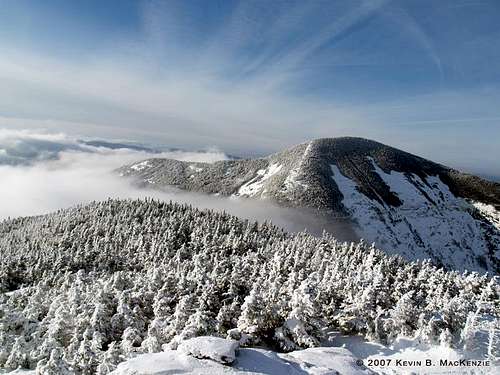
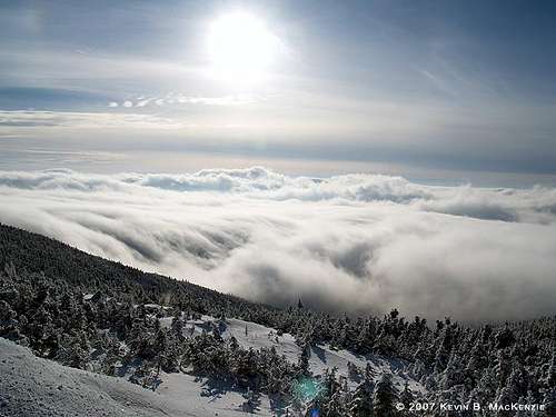
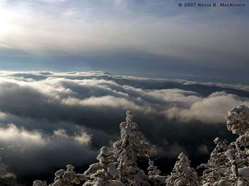
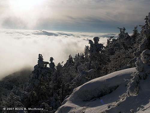
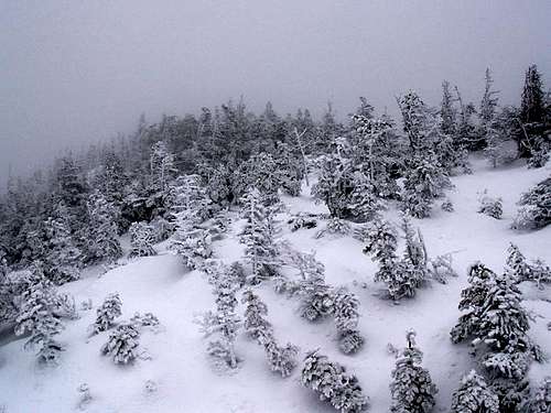

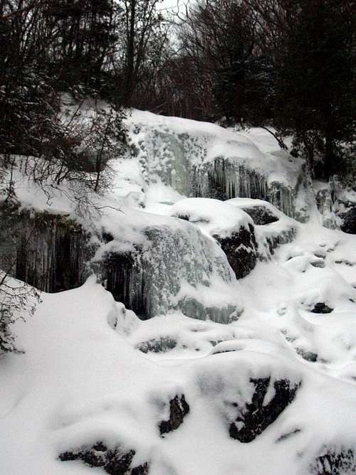
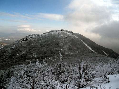

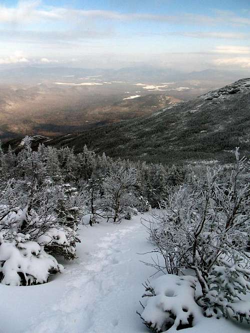


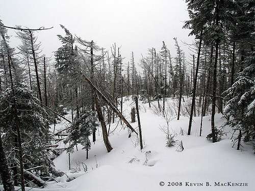


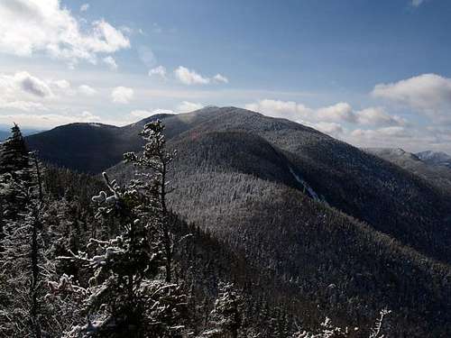

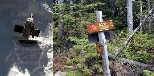
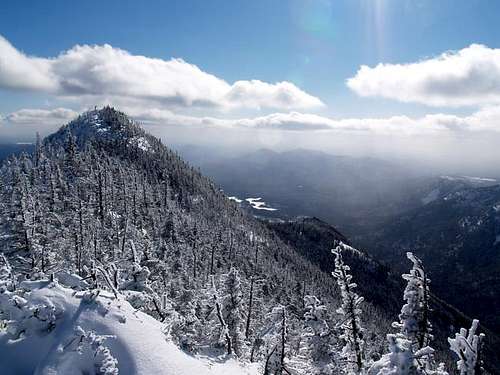
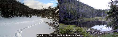

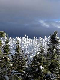
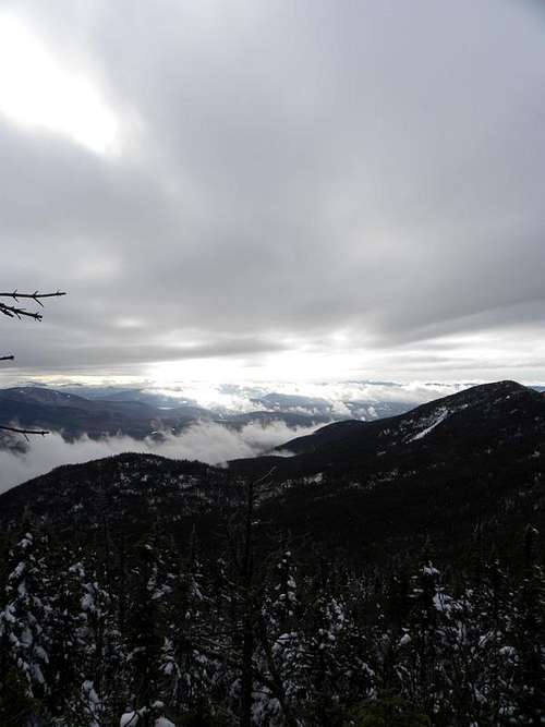


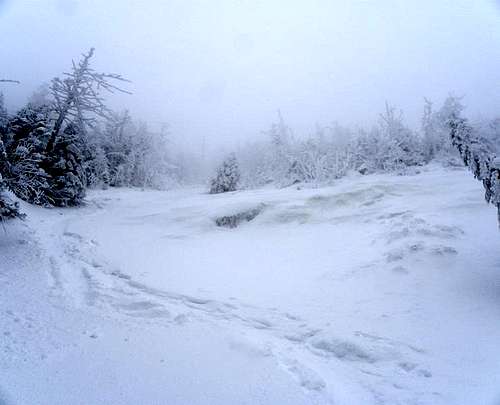
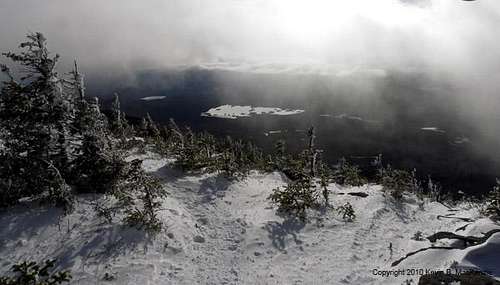


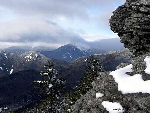


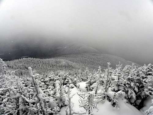


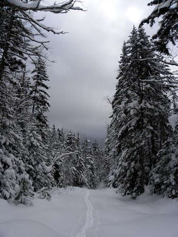

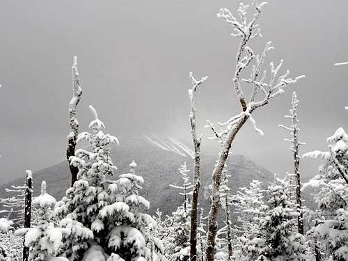


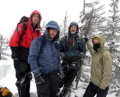
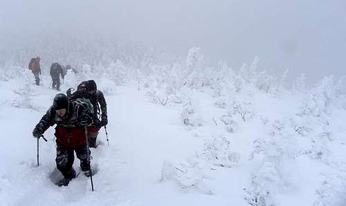
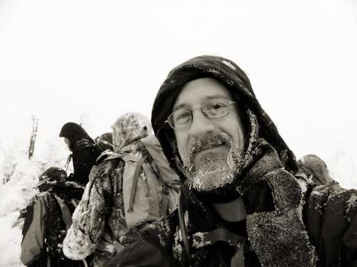
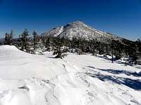


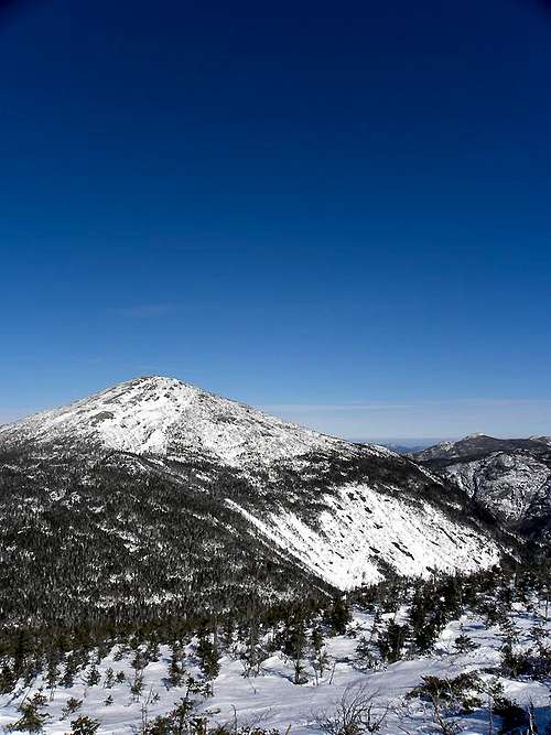

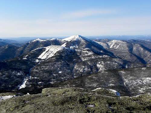

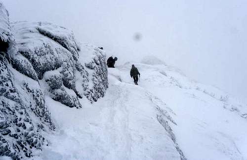

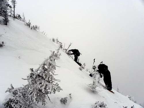

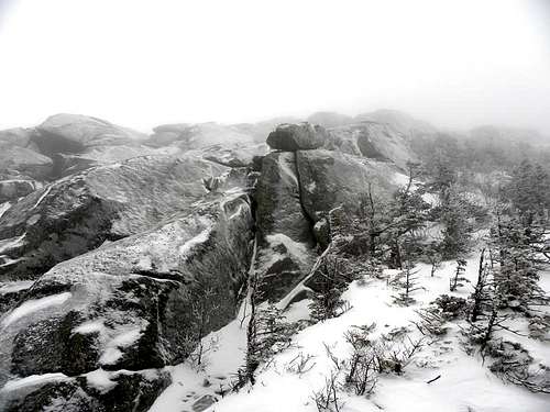
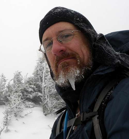

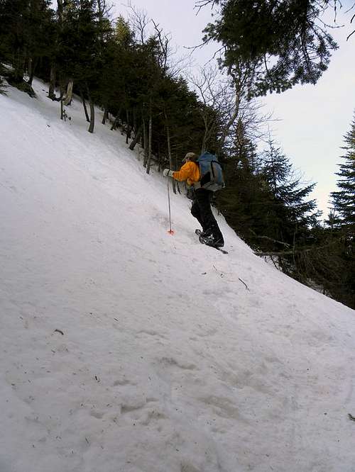

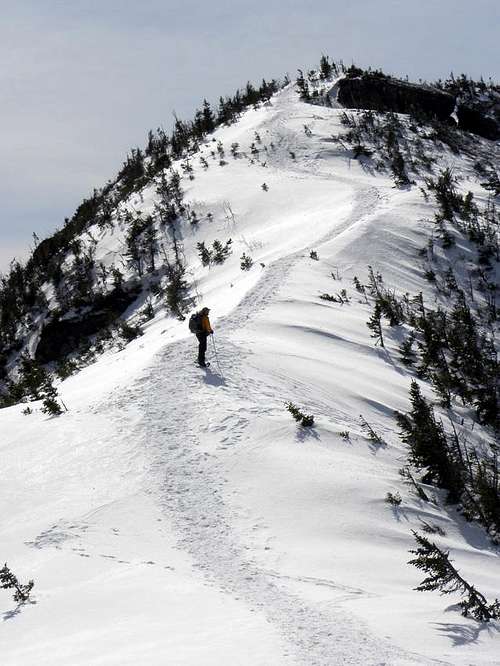


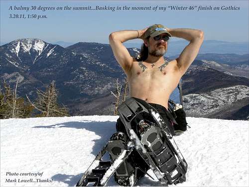


Comments
Post a Comment