GPS Coordinates: UTM
Intersection with path 18 T 0587696, 4907661
Headwall 1 18 T 0587737, 4907620
Top Headwall 4 18 T 0588421, 4907210
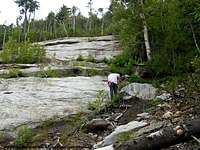
Approach and the Drainage
The entrance to the path to Kilburn is directly across from Monument Falls on Route 86. The path continues for about 1.5 miles over and ascent of a couple hundred feet. There are several wet areas and a couple streams to cross. The drainage from the slide flows into Owens Pond. The most memorable vegetation of the trek was some large mushrooms and dozens of clusters of Indian Pipe,
![Indian Pipe]() Indian Pipe along the path.
Indian Pipe along the path.a parasitic plant that generally grows near pine. It is perfectly white, lacking the chlorophyll that creates the green in most plants. It turns black and dies as fall approaches.
The slide drainage intersected the path about 1.5 miles from monument falls. Piles of trees and rubble roughly six feet in depth block the obvious path, though a herd path winds its way over and through the mess. This was the beginning of what is to come. As we followed the stream, it quickly opened up to a wider area at the base of a small cascade. It was at this point that I questioned my judgment about my mother as a hiking partner. She exclaimed, “We have to climb that?” in questioning exclamation at the site of the fifteen foot cascade. I chuckled, thinking, “I can’t wait to see her face at the site of the slide proper!”
My second outing to Kilburn on August 6, 2006 was with my wife, Deb “Crazy Dog” and friend Jeff, a geologist from the Potsdam area. The base of the cascade offered a plethora of geologic distractions…much of it in the form of marble in various states and other metamorphosed rocks/minerals. Jeff explained in detail the various geologic highlights of the area. I took the opportunity to explain in detail the tale of my mother ascending the cascade. A cascade of amusement followed.
We followed the brook easily for about ¼ mile. Along the trek, there were several more quick climbs up boulders and light blowdown. It hadn’t been raining so walking in the brook was, really, no problem. Raspberry bushes littered the banks on both occasions, though more in July than August. Iron deposits were present on many of the rocks.
The Slide Proper
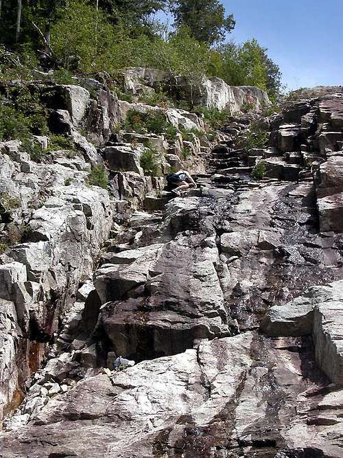
The headwall suddenly appeared through the head high raspberry bushes like a dramatic glacier of stone…what a beginning to the slide. Most that I’ve hiked start less dramatically. The water drainage ran from the center. A staircase of stone and a jumbled herdpath was located to the left. During my first visit, I circumvented the staircase and led my mother on a haphazard bushwhack to the right of the headwall. She was in ill temperament by this point, being tired and unhappy about pushing through the brush…not what she’d planned! The headwall continued on either side of the wall into the forest, so we still had to climb sharply upward, only with trees in opposition to our ascent.
During my second visit, Jeff nearly ascended the staircase before Deb and I got to the base after talking a bit. Deb nimbly scrambled up afterward, with me in tow…uneasily trying not to look down.
![Crazy Dog climbing headwall]() Crazy Dog climbing the stairs of the headwall.
Crazy Dog climbing the stairs of the headwall.The staircase ascended nearly vertically and within about thirty feet turned into a scramble at a 45 degree incline. The challenge was finding the tight stones as handholds. Many of the tempting holds looked solid, but weren’t. Putting faith in the wrong stone could have potentially deadly consequences from this height.
The view from the top was exhilarating if not extremely high. Moss Cliff and the swamp near Owen’s Pond were viewable as we rested on both hiking occasions. My mother wanted to know if this was it for the hike and Deb was looking forward to more. Jeff was already gone from sight exploring the slab intricacies. The hike with Mom up the slab started in a humorous fashion. Five foot up the first incline she froze on all fours exclaiming, “I can’t move,” in a panicked voice. I snickered and scampered back down remembering my own experiences on Whiteface Slide with that feeling. She followed me up using switchback motions to ascend and gradually became more accustomed to the pitch.
Deb and Jeff used a more direct “walk straight up anything in the way” approach. I was the most apprehensive of the three on that hike…the whole gravity issue still tugs on me. Jeff was so caught up in the rocks etc. that his fear of heights was deeply buried. Deb had no such limitations guiding her except level headed caution, giving more credence to her hiking name, “Crazy Dog”.
Some notable features of the hike included numerous dikes which were present on most ADK slides. Kilburn seemed to have even more inclusions of differing contest than I remembered seeing on other slides. The second headwall could be climbed carefully up and over or skirted via a diagonal dike about two feet in width made of brown stone.
![Dike on Kilburn]() My mother sitting astride one of the larger dikes on the slide.
My mother sitting astride one of the larger dikes on the slide. The stone was broken and offered the best grip on which to ascend.
![Crazy Dog on Kilburn]() Crazy Dog climbing mid-slide.
Crazy Dog climbing mid-slide.The most dramatic slab was located between the second and third headwalls. It was the widest area of the giant scar and could be easily traversed without worrying about grip or pitch. This gave ample opportunities to enjoy the ever widening view of the surrounding mountains.
The entire slide was covered in sundews, a carnivorous plant that absorbs nutrients from its prey using a sticky digestive fluid. Many of them were the size of my palm, larger than I’ve seen in the past. The day before, I hiked the Great Range…26 miles worth. It was at this area that I started tiring. Deb did as well. This was the first substantial hike that she’d been on in several years. We were both bonking on food as well.
![Headwall 3]() Third headwall of Kilburn.
Third headwall of Kilburn.
On the first hike, I left my mother at the base of the third headwall to eat and relax, dropped my pack and jogged up to the final headwall which veered a bit to the right. The second hike left me yearning to climb the headwall, which we did. The footing, once on top of the wall, was less sure became more filled with sand and debris. We quickly ascended and walked to the base of the final wall to eat, relax and enjoy the splendid day. The final wall was not vertical, but definitely more technical in nature, so I only climbed about halfway up the rough stone and descended after satisfying my need to at least attempt it. Views on the first hike were somewhat spoiled by haze and what appeared to be impending rain. Deb, myself and Jeff enjoyed wonderful views on a clear crisp day.
![Headwall 4 of Kilburn]() Final headwall of Kilburn.
Final headwall of Kilburn.
The hike down was uneventful on both accounts, though when I pointed out (to my mother) where she initially froze, she exclaimed, “It was here, there’s nothing here!” I said, “See you learned today…” The walk back down allowed us to explore different routes across the slabs and enjoy the view without turning to look.
The base of the cascade served as yet another break on the second hike for Deb, myself and Jeff to eat and further explore the mineral content of the area. My pack, somehow, became heavier on the way out!
Comments
No comments posted yet.