


-
 2468 Hits
-
 84.82% Score
-
 19 Votes
|
|
Mountain/Rock |
|---|---|
|
|
45.59190°N / 7.57965°E |
|
|
Hiking, Mountaineering |
|
|
Summer, Fall |
|
|
8665 ft / 2641 m |
|
|
Note
La montagna chiama i suoi figli, ed essi rispondono fedelmente al suo appello… Osvaldo Cardellina, Diario alpinistico, 1964-65 Page texts: @ OsvaldoCardellina "Osva", passed away on May 2, 2022. Page owners: Christian Cardellina e Osvaldo Cardellina. Any updates from September 12, 2022: Antonio Giani, page administrator, friend and climbing companion. Testi della pagina: @ OsvaldoCardellina "Osva", scomparso il 2 maggio 2022. Proprietari pagina: Christian Cardellina e Osvaldo Cardellina. Eventuali aggiornamenti dal 12 settembre 2022: Antonio Giani, amministratore della pagina, amico e compagno di salite. |
Mulère Overview Mollère
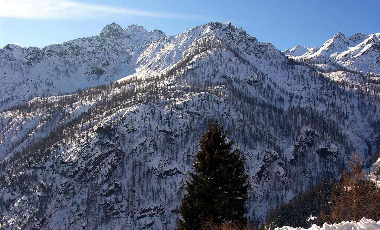
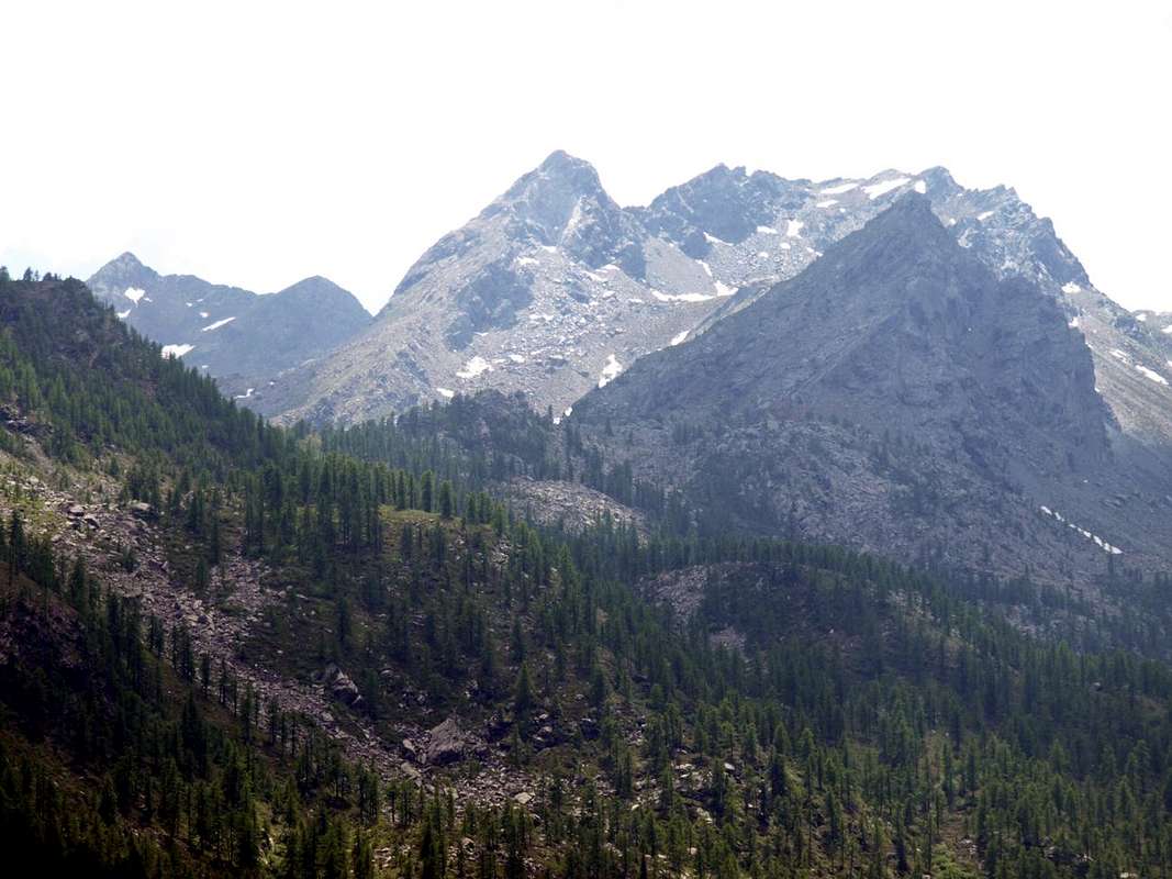
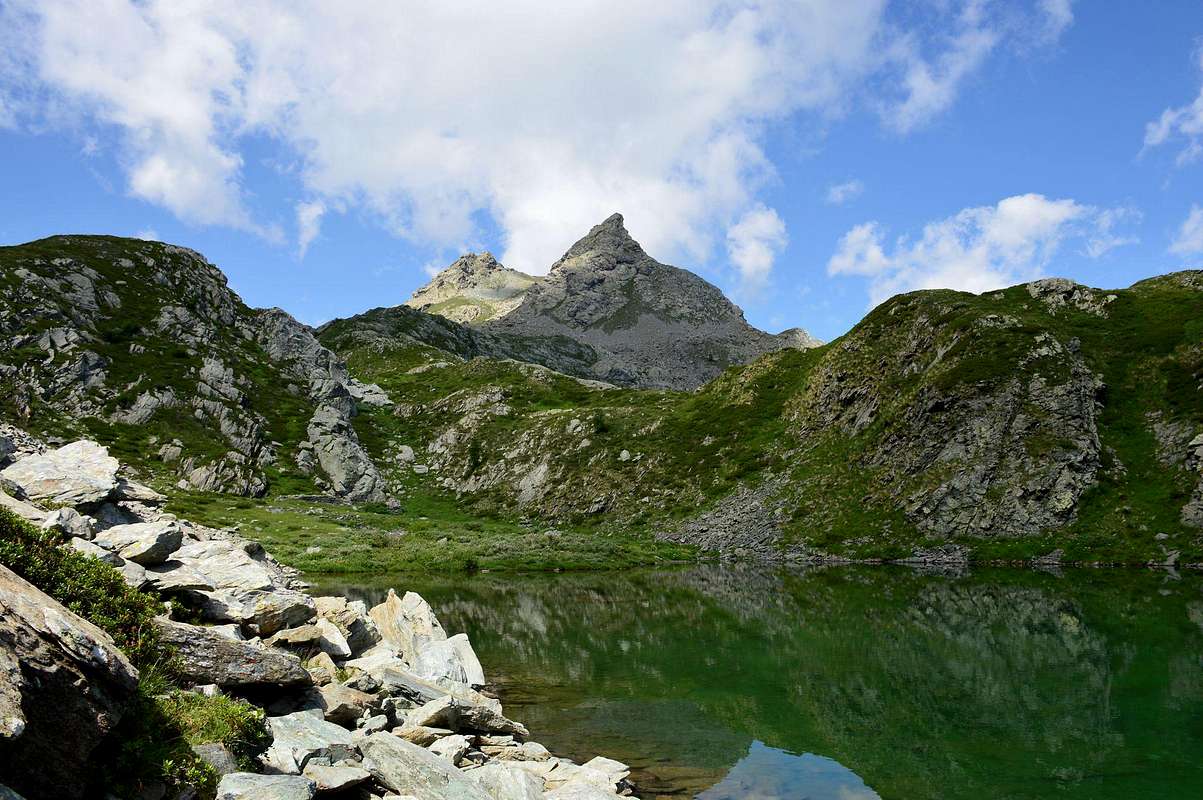
This Summit is part of Group Rosa dei Banchi (3.164m), located between the Valleys of Champorcher Pianprato Soana and Campiglia in adjacent Piedmont. In fact the group membership is, though less known, that of Monte Nero (2.737m), this being the highest Summit in this part of the watershed with the Aosta Valley and immediately to the West of the previous vallon. From this last down towards the North a secondary buttress act to separate the Valley of Legna to the East by the West to that of Vercoche. The central head of this valley, after reached the Monte Marzo (2.756m), Mount Facciabella (2.654m) and the underlying Colle di Santanel (2.464m), is split between Monte Nero (Black Mountain; 2.737m) and Mount Santanel (2.721m). But wanting to comprehensively analyze topographically this valley is necessary to start from the Monte dei Corni (Mount of the Horns; 2.778m). After the Fricolla Pass (2.542m) (*** connecting the two in their highest part through Bruillet Col (2.450m), but in reality is divided from the next Vallon of Brenve) stands up to the crest of the same name Point (2.676m) above Lake Cornuto (2.450m; Horned); then the ridge continues, sinuous, forming the Ridge Chenessy (2.756m) that "serrated" form a series of at least four elevations (2.616m, 2.665m, 2.650m, 2.616m) before reaching the Punta Chenessy (2.630m ). This, call B & V 1896, page 26 of Costa Canessi with altitude 2.631 meters, even if only slightly less high stands out more as isolated. At his feet to the East lies the small lake of the same name (2.383m), while on the opposite side down with rocky cliffs-grassy above Alpe Chenessy (2.051m) in the adjoining Vallon of the Legna (Wood). A ridge facing North-northeast continues steeply towards the Hills of Manda (around 2.390 meters) and Detrà (about 2.350 meters), separated by a small Summit 2.414 meters. Besides the watershed continues further Northeast forming the rounded Mont Giavin (2.431m), Col de Creuset (2.121m) to end with the Mont Digny (2.145m) above the Crest Lutta and small Villages Frassiney and Trambesere, now on the bottom of the valley. Mountains are little known and even less popular, if not by the locals or somewhere fancier of rarities, as evidenced by the poor mound found on the Summit of the adjacent Pointe de Chenessy, even though the reality "Guide of the Western Alps", same page, noted: "... highlight (trigonometric signal) of the dividing Range between the valleys of the Legna and Amanda ...". Sign that more than 100 years before it was already known and quite frequented. At least by "Topografi" (Surveyors) of State Piedmont-Sardinian, but also demonstrating that "King Toio" was jealous of his possessions and controlled them better than they do today. But stepping back we must return to the Mont Santanel from which part to the Northeast an intermediate ridge between that of Chenessy (East) and the next that from Colle Larìs reaches the namesake Bec, after overtaking the Bec Mollère even known as Pic Mulère (2.638m) and with first place name always in B & V 1896, page 26, of Becco (Beak) Molère (2.500m). This watershed offers a buttress that by flexing in the Northeast, runs out on the Alpe di Ourty (1.527m) where the valley splits sending towards the South "Vallone della Legna or of Wood" and Southwest towards the Lakes Vercoche, Piana and Molère. The same is formed by a rocky ridge, apparently quite tricky at the sight, coming down with Punta, Collar, Crest and Tower Vorèa (2.544m, 2.450m, 2.442m) to the just above mentioned pasture. However remain Vallons most frequented by Fishermen that the Mountaineers or Hikers, and perhaps especially because of the long and exhausting approaches. This vast area, which stretches to the East towards the Canavese and Ivrea and Southeast to the Po Valley and the City of Torino, constitutes the extreme offshoots of the Gran Paradiso after the last major Summits of the Tower of Lavina and the Rosa dei Banchi, for which it still belongs to the Mountain range of Graian from here dates back to the Mont Blanc. From this you can enjoy pleasant views of the surroundings from Monte Marzo, but also on the number of small seeds Summits abandoned that stretch towards the Lower Valley. Frontally instead, taking advantage of the Chain from Mont Glacier (3.186m) slopes down more and more towards East-Northeast "opening" the view, you can admire the Valleys Marmore, Lys, Gressoney until their term, ie Matterhorn and the extended Monte Rosa from Breithorns, Lyskamms, Zumstein, Dufour, Gnifetti and the partition with Piedmont. In fact this Summit is twofold and therefore propose, in order to preserve both place names, like that of most Western as Bec Mollére and Eastern Pic Mulère.
Questa Cima appartiene al Gruppo della Rosa dei Banchi (3.164 m), collocato tra le Valli di Champorcher e Pianprato Soana e Campiglia nell'adiacente Piemonte. In realtà il gruppo d'appartenenza risulta, anche se meno conosciuto, quello del Monte Nero (2.737 m), essendo questa la Sommità la più elevata in questo tratto di spartiacque con la Valle di Aosta e subito ad Occidente del precedente vallone. Da questo ultimo scende verso Settentrione un contrafforte secondario, atto a separare il Vallone della Legna ad Est da quello di Vercoche ad Occidente. La testata centrale di questo vallone, raggiunto il Monte Marzo (2.756 m), il Monte Facciabella (2.654 m) ed il sottostante Colle di Santanel (2.464 m), si sdoppia tra il Monte Nero (2.737 m) ed il Monte Santanel (2.721 m). Volendo però in modo completo analizzare topograficamente questo vallone risulta necessario partire dal Monte dei Corni (2.778 m). Dopo il Colle della Fricolla (2.542 m) (*** collegamento tra i due nella loro parte più elevata tramite il Col Bruillet (2.450 m), ma in realtà si divide dal successivo Vallone di Brenve) la cresta si rialza all'omonima Punta (2.676 m), sopra il Lago Cornuto (2.450 m); quindi la cresta prosegue, sinuosa, formando la Cresta di Chenessy (2.756 m) che "seghettata" forma una serie di almeno quattro elevazioni (2.616 m, 2.665 m, 2.650 m, 2.616 m) prima di raggiungere la Punta di Chenessy (2.630 m). Questa, chiamata in B & V 1896, pagina 26 Costa di Canessi con quota 2.631 metri, anche se di poco meno alta si distingue maggiormente poiché isolata. Ai suoi piedi ad Est si trova il laghetto omonimo (2.383 m), mentre sull'opposto versante scende con dirupi roccioso-erbosi al di sopra dell'Alpe Chenessy (2.051 m) nel Vallone attiguo della Legna. Una cresta rivolta a Nord-nordest continua ripida verso i Colli della Manda (2.390 metri circa m) e Detrà (2.350 metri circa), separati da una piccola Sommità 2.414 metri. Oltre lo spartiacque continua più a Nordest formando il tondeggiante Mont Giavin (2.431 m), il Col de Creuset (2.121 m) per terminare con il Mont Digny (2.145 m) sopra la Cresta di Lutta ed i piccoli Villaggi di Frassiney e Trambesere, ormai sul fondo valle. Sono montagne poco conosciute ed ancora di meno frequentate, se non dagli abitanti locali o da qualche amatore delle cose rare, come dimostra il misero tumulo trovato sulla Sommità dell'adiacente Punta di Chenessy, anche se per la verità "Guida delle Alpi Occidentali", identica pagina, segnala: "... punto culminante (segnale trigonometrico) della catena divisoria tra i valloni della Legna e della Amanda ..."; segno che oltre 100 anni prima era già abbastanza popolare. Almeno dai Topografi dello Stato Piemontese-Sardo, ma anche a dimostrazione che "Re Toio" era geloso dei possedimenti controllandoli meglio di come fan oggigiorno. Facendo però un passo indietro dobbiamo ritornare al Mont Santanel dal quale parte verso Nordest una cresta intermedia tra quella di Chenessy (Est) e la successiva che dal Colle Larìs raggiunge l'omonimo Bec, dopo aver scavalcato il Bec Mollère conosciuto anche come Pic Mulère (2638m) e con prima denominazione in B & V 1896, pagina 26, di Becco Molère (2.500 m). Questo spartiacque propone un contrafforte che, flettendo a Nordest, si esaurisce sopra l'Alpe di Ourty (1.527m) dove la valle si sdoppia inviando verso Meridione il Vallone della Legna ed a Sudovest quello dei Laghi Vercoche, Piana e Molère. Il medesimo é formato da una cresta rocciosa, apparentemente piuttosto ostica allo sguardo, che scende con Punta, Colletto, Cresta e Torre di Vorèa (2.544 m, 2.450 m, 2.442 m) fino sull'alpeggio citato. Comunque rimangono valloni più frequentati dai Pescatori che dagli Alpinisti od Escursionisti, anche e forse soprattutto a causa dei lunghi ed estenuanti avvicinamenti. Questa vasta area, distendentesi ad Oriente verso il Canavese ed Ivrea ed a Sudest verso la Piana del Po e la Città di Torino, costituisce le propaggini estreme del Gran Paradiso dopo le ultime importanti Sommità della Torre di Lavina e della Rosa dei Banchi, per la qual cosa appartiene ancora alla Catena montuosa delle Alpi Graie che da qui risale fino a quella del Monte Bianco. Da questa si godono piacevoli vedute sul circondario a partire dal Monte Marzo, ma anche su quella serie di piccole Cime semi abbandonate che si allungano verso la Bassa Valle. Frontalmente invece, approfittando della catena che dal Glacier (3.186 m) digrada sempre più verso Est-nordest "aprendo" la vista, si posson ammirare le Valli del Marmore, Lys e Gressoney fino a lor termine, cioé al Cervino ed all'estesa Catena del Rosa dai Breithorns, Lyskamms, Zumstein, Dufour, Gnifetti ed al divisorio col Piemonte. In realtà questa Vetta risulta duplice e quindi proponiamo, onde preservare ambo i toponimi, quella più Occidentale come Bec Mollère e l'Orientale Pic Mulère.

First Ascents
- First on the Summit: unknown.
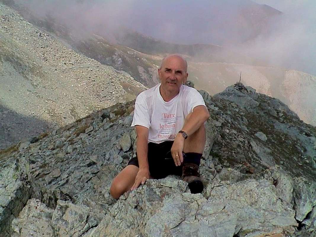
- In winter: Osvaldo Cardellina and Emilio Bertona; January 04th, 2001, in ascent from Cimetta Rossa by snowshoes through Western Face.
- Southwest Ridge (Normal Route):unknown and in winter Osvaldo Cardellina and Emilio Bertona; January 04th, 2001, in descent towards Col Larìs.
- North-northeast Ridge (from Vercoche Hill): Felice Bechon and Company; Summer 2004?, in ascent from Larìs Vallon and West Slope of pass.
- Northeast Face (Direct): Osvaldo Cardellina, lone; August 31th, 1982, in ascent from Outre-Leve to Vercoche Lake, round trip.
- Eastern Crest (with traverse on West/East Tops): Osvaldo Cardellina, Emilio Bertona, Nicola Colajanni and Gianfranco Vicentini; August 26th, 2001, before from Cimetta Rossa (2496m), Larìs Loch, West Hill and SW Crest with traverse to East Top; after in descent through Eastern Ridge to East Hill , Vercoche Lake.
Getting There
BY CAR:
- From TORINO, MILANO, etc: Motorway A5. Exit at IVREA or Quincinetto (PIEDMONT).
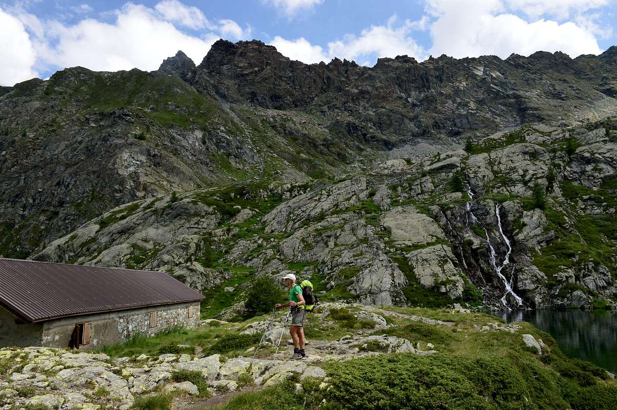
- From IVREA Town: Pont Saint Martin, Donnas, Hône, Bard, Pont Bozet, Champorcher Municipalities. From Hône Commune (364m), crossing the bridge above Dora Baltea, to Bard Municipality (566m; renowned Austrian Fortress) and through Regional Road towards Pont Bozet (775m) with the asphalt road to Champorcher Valley, up to the Outre l'Eve Hamlet (1.229m) and until the Alp of Ourty (1.344m) at the beginning of Legna Vercoche Vallons. After by meletrack or various paths. Or from Champorcher-Château in West with asphalt road towards Chardoney or Chardonnay (1.455m) and from this through trail in South near the chairlift from Ciardoney until Larìs Hill (2.584m) amongst Cimetta Rossa (2.466m), Bec Pendente (2.826m) and Bec Mollère.
- From FRANCE: through the Mont Blanc Tunnel to Entrèves-crossroads to Vény/Ferret Valleys nearby Courmayeur Resort. By Little Saint Bernard Pass, closed since November until half May to La Thuile Valley - Pré Saint Didier - Courmayeur. It is not necessary to take Motorway A5: you can drive on SS.26, in the direction of AOSTA - IVREA - TURIN.
BY PLANE:
- Aeroporto "Corrado Gex" Saint Christophe (Aosta).
Approaches & Routes
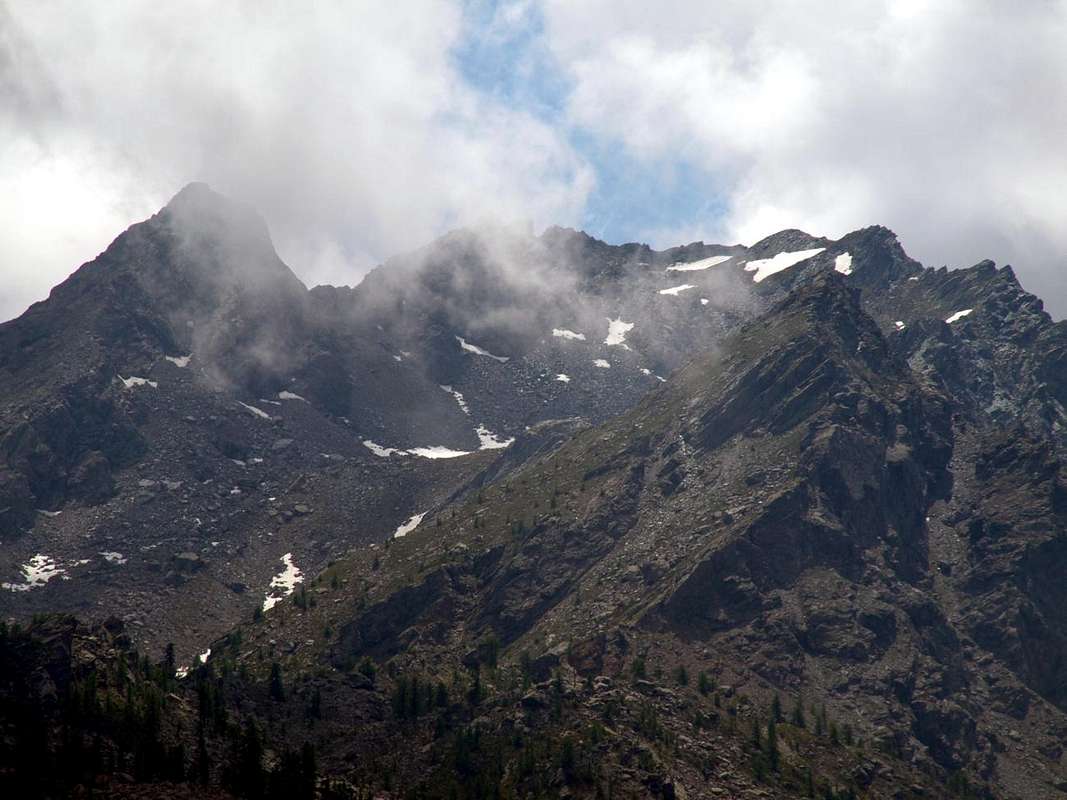
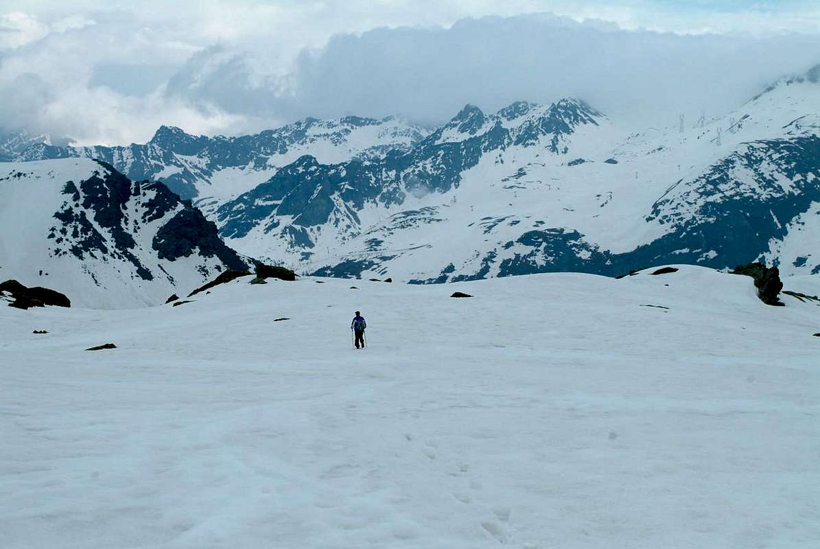
Route A) - (Southwest Crest): from Dondena (2.110m), passing through the dirt road concomitant with the trail n° 4/4F former 6 the refuge of the same name (2.193m) and Pendent Alps Lower (2.297m) and Middle (2.391m), reaching the Red Cimetta or Rossa (2.466m; here also comes the chairlift from Ciardoney); entering into the small vallon called "Rio Gran Comba" reach the Larìs Pond (2.483m) and immediately after the Eastern Hill, below the characteristic Quota 2.581 meters. Or reach the same location through the Vallon of Larìs, always starting from Ciardoney. In a short time (1h'30 from the first and 3h'00 for the second route) you reach the Col Laris 2.584m). From the hill in the more Eastern passage easily climb into the Northeast through grassy slopes interspersed with rocks and debris to reach the big and rounded shoulder on the Southwest brief crest at an altitude of around 2.625 meters. From this continue on the ridge to the East until you reach with a short descent a more exposed passage. The same is bypassed with caution on the right (South) and then resume the edge of the ridge and with this easily conclude the two next peaks (EE/F/F+; 0h'30/0h'40 from Eastern Larìs Hill).
Via B) - (North-northeast Ridge): using the second approach from the Fraction Ciardoney along the Vallon of Larìs, reach along the slopes leading down from the stony notch Southern Bec Laris to 2.275 meters. Achieving this through the rocky debris-strewn gully with blocks and then, bending to the right, reached by easy rocks (I°) Col Vercoche (2.340 meters about; EE/F/F+; 1h'45/2h'15). From this turn to the right along an easy stretch until reaching an elevation of dark rock who wanders to the East. A more challenging next step (II°+), moreover avoidable, leads again to the edge of the ridge, often covered with grass. After a small sharp tooth (II°) followed by insignificant rocky elevation, you can reach other small bumps (avoidable or with steps of I°+) preceding a more challenging final jag. Climbed on the left the same (III°) is finally easy to reach the Summit of Bec Mollere and quickly always in East to the nearby Pic Mulère, the highest (2.638m, 2.641m; EEA/F+/PD-/AD-; 0h'45/1h'15 from Vercoche Pass).
![]()
MAPS:
Via A) - (Cresta Sudovest): da Dondena (2.110 m), passando l'omonimo rifugio (2.193 m) e le Alpi Pendent di Sotto (2.297 m) e di Mentein (2.391 m) tramite strada poderale concomitante con il sentiero n° 4/4F ex 6, raggiungere la Cimetta Rossa (2.466 m; qui giunge anche la seggiovia da Ciardoney); entrando nel valloncello detto "Rio Gran Comba" raggiungere il Laghetto Larìs (2.483 m) e subito appresso il colle Orientale, al di sotto della caratteristica Quota 2.581 metri. Oppure raggiungere la medesima località attraverso il Vallone del Larìs, sempre partendo da Ciardoney. In breve tempo (T; 1h'30 dal primo ed E; 3h'00 per il secondo itinerario) si raggiunge il Col Larìs (2.584 m). Dal colle nel passaggio più Orientale salire dapprima facilmente verso Nordest tramite pendii erbosi alternati a roccette e detriti fino a raggiungere lo spallone arrotondato sulla Cresta Sudovest a quota 2.625 metri circa. Da questo proseguire sul filo di cresta verso Est fino a raggiungere con breve discesa un passaggio più esposto. Lo stesso viene aggirato con cautela sulla destra (Sud) per poi riprendere il filo di cresta e con questo facilmente concludere alle due Cime Mollère e Mulère (EE/F/F+; 0h'30/0h'40 dal Colle Larìs Est).
Via B) - (Cresta Nord-nordest): tramite il secondo avvicinamento dalla Frazione di Ciardoney raggiungere lungo le piste da sci la pietraia che scende dallo intaglio a Meridione del Bec Larìs a quota 2.275 metri circa; raggiungere tramite questa il canalino roccioso-detritico con blocchi sparsi per poi, piegando più a destra, raggiungere con rocce facili (I°) il Col Vercoche (2.340 metri circa; EE/F/F+; 1h'45/2h'15). Da questo volgere a destra percorrendo un tratto facile fino a raggiungere una elevazione di roccia scura che si aggira ad Est. Un successivo passaggio più impegnativo (II°+), peraltro evitabile, conduce nuovamente al filo di cresta, spesso ricoperto da erba. Superato un piccolo dente acuto (II°) seguito da un'elevazione insignificante, si raggiungono altre piccole asperità (evitabili oppure I°+) che precedono un dente conclusivo più impegnativo. Salito sulla sinistra il medesimo (III°) si raggiunge infine facilmente prima il Bec Mollère e subito dopo il Pic Mulère (2.638 m, 2.641 m; EEA/F+/PD-/AD-; 0h'45/1h'15 dal Col Vercoche).
![]()
Watching between two watersheds from North, by emilius
Difficulties & Equipment
DIFFICULTIES From F to F+ for the Route A. From PD- to AD- for the Route B.
Da F a F+ per la Via A. Da PD- a AD- per la Via B.
EQUIPMENT For Hiking, better with rope, carabiners and some lanyard for the Route B.
Da Escursionismo, meglio con corda, moschettoni e qualche cordino per la Via B.
Campings
Remember that free camping is forbidden (except for emergency reasons, over 2.500m, from darkness until dawn).Mountain Conditions
- You can get meteo information at the official site of the Regione Valle d'Aosta:
- Valle d'Aosta Meteo
 |
 |
 |
 |
 |
Books and Maps
BOOKS:- "Guida delle Alpi Occidentali" di Giovanni Bobba e Luigi Vaccarone C.A.I. Sezione di Torino Volume II (parte II), 25 Maggio 1896.
- "Guida dei Monti d'Italia–Emilius Rosa dei Banchi Parco del Mont Avic" di Giulio Berutto e Lino Fornelli-Club Alpino Italiano/Touring Club Italiano, Marzo 2005 (in Italian).
- "I Rifugi della Valle d'Aosta" di Stefano Ardito, Ed. Guide iter, Febbraio 2003.
- "Guida della Regione Autonoma Valle d'Aosta" di Mario Aldrovandi; Ed. S.P.E. di Carlo Fanton, Torino 1964.
- "Diari Alpinistici" di Osvaldo Cardellina e Indice Generale accompagnato da Schedario Relazioni Ascensioni 1964-2019 (inediti).
 |
 |
 |
 |
 |
- Enrico Editore Ivrea-Aosta "Gruppo del Gran Paradiso" 1:50.000.
- I.G.C. Istituto Geografico Centrale Torino "Ivrea Biella e Bassa Valle d’Aosta" (n° 9), 1:50.000.
- L'Escursionista "Valle di Cogne Carta dei Sentieri" 1:25.000.
Important Information
- REGIONE AUTONOMA VALLE D'AOSTA the official site.
- FONDAZIONE MONTAGNA SICURA Villa Cameron, località Villard de la Palud n° 1 Courmayeur (AO) Tel: 39 0165 897602 - Fax: 39 0165 897647.
- SOCIETA' GUIDE ALPINE DI COGNE Tel. 347/9473526 – 328/1373728.
- A.I.NE.VA. (Associazione Interregionale Neve e Valanghe).
Useful Numbers
- Protezione Civile Valdostana località Aeroporto n° 7/A Saint Christophe (Ao) Tel. 0165-238222.
- Bollettino Meteo (weather info) Tel. 0165-44113.
- Unità Operativa di Soccorso Sanitario Tel. 118.