
|
|
Mountain/Rock |
|---|---|
|
|
45.30252°N / 7.12035°E |
|
|
11824 ft / 3604 m |
|
|
Overview
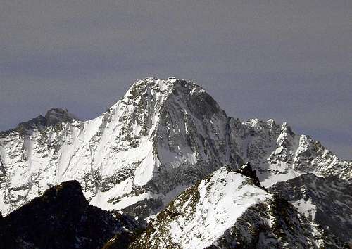
This beautiful and characteristics mountain called "Úja di Bessanese" is one of the highest point of Valli di Lanzo a wonderful area about 30 km north of Turin made by three valleys Valle di Viù, Val d' Ala and Val Grande. The summit is a long ridge, about 150 meters longs, with three main points called "segnali", in the middle there is the highest, Segnale Baretti, on the north Segnale Rey, and on the south Segnale Tonini, both few meters less high.
Getting There
- Italy: from Turin motorway A55 exit Venaria Reale follow indications for Lanzo Torinese and go on through Germagnano and Ceres, here you enter in Val d'Ala, continue passing Ala di Stura and Balme and reach Pian della Mussa (1830 m.) where the road ends (78 km from Turin). From here in 2.30 h on a good path you can reach the Rifugio Gastaldi. Balme and Bessanese web-cam: http://www.comune.balme.to.it/webcam/webcam.html - France: from Modane motorway A43 exit Le Freney follow indications for Val Cenis, Bessans, Bonneval sur Arc and Col de l'Iseran. Just after Bessans turn right towards Les Vicendieres and Averole. Reach the parking just before Les Vicendieres (1880 m., 45 km from Modane), only allowed person could go on with the car. From here in 1.30 h on the road or 1.10 h on a good path you can reach the Refuge d'Avérole.
 Pian della Mussa on 07-02-06
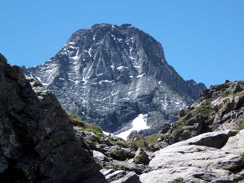 Bessanese ascending to Gastaldi hut (photo by Luca P.)
Red Tape
There are no fees or permits. Pay parking at Pian della Mussa, at the start of the route to Rifugio Gastaldi, there are no limitations for climbing and hiking. No problem for one night free camping, take care of nature as usual! Park at Les Vicendières, at the start of the route to Refuge d'Avérole, it is free and there are no limitations for climbing and hiking. Free camping is forbidden, the whole region is part of the Parc National de la Vanoise you should take care of nature as usual limitations of natural parks.
Normal route
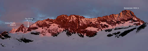
Here we describe the normal route on the south side and south-east ridge , this route is used both from Italian and French side. ITALY - From Rifugio Gastaldi(2659 m) descent on a good path to the Crot del Ciausiné, reached a terrace turn right and proceed on rocks and grass ledges till the slope (snow in spring and summer start) who finish with the Colle d'Arnas (1.15 h). FRANCE - From Refuge d'Avérole (2210 m) proceed to SE on the path to the torrent, go on following the right bank (hydrographic, left bank mounting) and reach the Arnès Glacier. The glacier is easier, without big crevasse and finish a few meters below the Colle d'Arnas (3 h), but for Bessanese summit it isn't necessary to reach it.
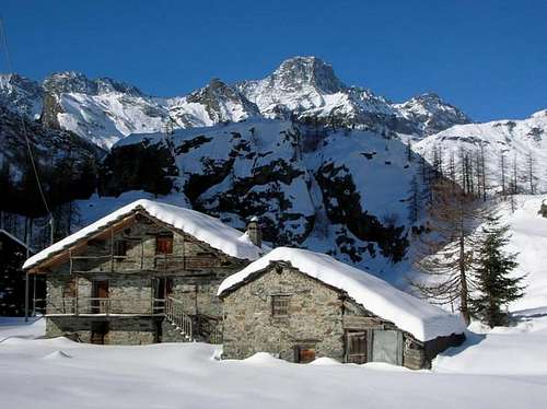
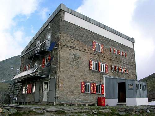 Gastaldi hut
From Colle d'Arnas (3010 m) descent on the French side and proceed a bit on the right side of Arnès Glacier (~10 min.), than turn right on tracks and ascent on noisy debris reaching moraines and snowfields, cross it on N direction to the start of the snow slope descending from the south-east ridge of Bessanese. Climb on the easy rocks on the right side of the slope and approach the south-east ridge (from here you can find white marks on the route), continue on the ridge and reach the evident ledge on the right who is the base of a small rock wall, climb it directly (PD, good hold), and by easy rocks reach Segnale Tonini. To reach the highest point, proceed to the carve below the tower of Segnale Baretti ,and on a ledge on French side go on the north ridge and by it the summit. (About 3.20 h from Colle d'Arnas, difficulty from F to PD, depending on the conditions). Ascent route to the summit include glaciers so may be you need crampons depending on the conditions. DESCENT: Descend on the same route, pay attention on the rock wall, in case of snow descent on the rope. Other interesting route: NE ridge or "Spigolo Murari". It is a beautiful and interesting route on the big rib on Italian side, direct to the summit, elevation of the rib 600 m. difficulty AD+, III/IV.
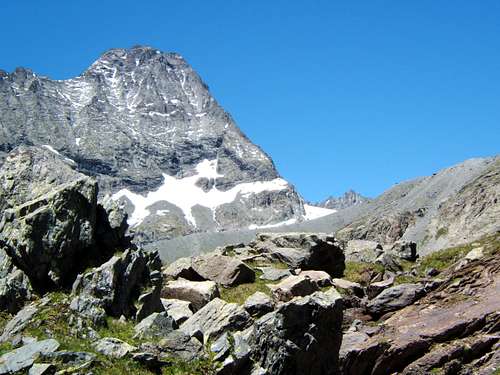 Bessanese - Spigolo Murari
When To Climb
The best time is from June or July (depending of snow quantity and conditions) to September. We suggest before July end with good snowfields who avoid noisy stones and debris zones.
First Ascents
Segnale Tonini SE ridge: A. Tonini and unknown person - Aug 31, 1857 Segnale Baretti SE ridge: M. Baretti, G. Cibratio "Vulpot" and Pertus - Jul 26, 1873 E wall: A. Balduino and A. Castagneri "Toni di Touni" - Jul 24, 1875 N ridge: G. Rey and A. Castagneri "Toni di Touni" - Sept 2, 1889 NNE wall: E. Canzio,C. Ratti, C. Toesca, N. Vigna, A. and G. Boggiatto- Sept 9, 1895 W wall: U. Valbusa, P. and S. Re Fiorentin - Sept 11, 1900 NE ridge: U. Murari Bra and A. Bricco "Travinel"- Aug 23, 1920
Accomodations
You can find accommodations in all villages of Valli di Lanzo and Vallée de l'Arc. You can use Rifugio Gastaldi as base for the ascents to: Uja di Ciamarella (3676 m), Albaron di Savoia (3627 m), Bessanese (3604 m), Piccola Ciamarella (3540 m), Punta Chalanson (3466 m), Punta Maria (3302 m.). Refuge is open from 01/04 to 21/05 and from 1/06 to 17/09 Contacts: Rifugio Gastaldi phone +39 0123 565008 www.rifugiogastaldi.it You can use Refuge d'Avérole as base for the ascents to: Albaron di Savoia (3627 m), Bessanese (3604 m), Punta d'Arnas (3560 m), Punta Maria (3302 m.). Contacts: Refuge d'Avérole phone +33 04 79 05 96 70, Club Alpin Français de Lyon phone +33 04 78 42 09 17
Books and Maps
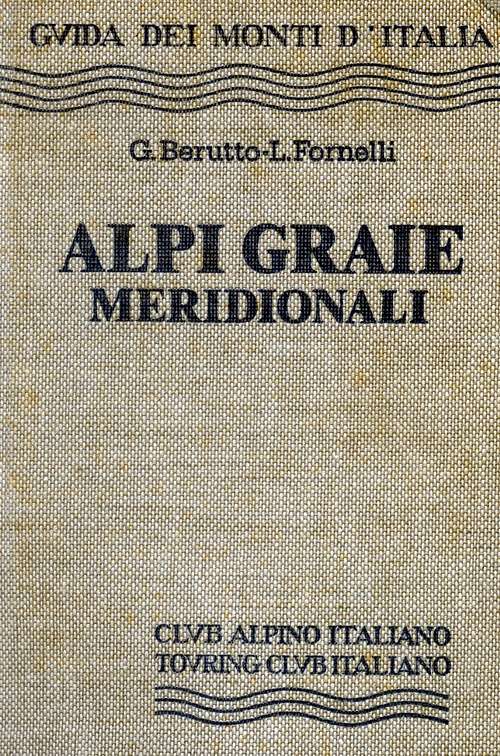
-BOOKS - G. Berruto, L. Fornelli " Guida dei Monti d'Italia ? Alpi Graie Meridionali" Club Alpino Italiano/Touring Club Italiano (1980). (Italian) google books - Guida dei Monti d'Italia - Alpi Graie Meridionali
MAPS - IGC- Istituto Geografico Centrale N° 103, 1:25.000 Rocciamelone Uja Di Ciamarella Le Levanne - ASF- Alpi senza frontiere / Alps without frontiers (IGN Institute Geographique National) N° 13, 1:25.000 Mont-Cenis Ciamarella - IGC- Istituto Geografico Centrale N° 2, 1:50.000 Valli di Lanzo e Moncenisio
Mountain Conditions
You can get whether forecast at this site: www.nimbus.it www.regione.piemonte.it official site of the Regione Piemonte www.meteofrance.fr
Miscellaneous Info
Useful: Mountain Rescue phone n°: Italy 118 , France 04 79 05 11 88 Avalanche Bulletin: www.aineva.it Union of Mountain Guides (Piemonte-Valle d'Aosta) phone n°: +39 011 5171628
Acknowledgements
Thanks to my father Beppe and our friend Dario, that climbed with me this mountain in summer 2005.
signorellil - Mar 25, 2006 10:48 am - Voted 10/10
Spigolo MurariThe Murari route at the "spigolo Murari" is now equipped with new bolted belays, thanks to a group of local mountain guides.