
|
|
Mountain/Rock |
|---|---|
|
|
15.7167°S / 71.5085°W |
|
|
Hiking |
|
|
Spring, Summer, Fall, Winter |
|
|
17126 ft / 5220 m |
|
|
Overview
Note: A lot of information on this page is the same as for Nevado Huarancante. Since I don't expect anybody to climb Cerro Jello Jello without going to Nevado Huarancante as well, while sometimes repeating information, I frequently just refer to it.The highlands south east of Chivay are dotted with hills and mountains. One of the higher hills is Cerro Jello Jello.
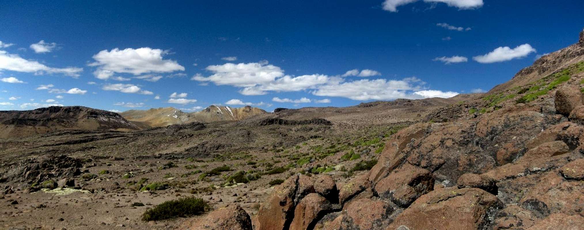
It lies about two kilometers northeast of the much bigger old volcano of Nevado Huarancante. In all other directions, it's hills, hills and more hills - all lower - and although at first glance the landscape looks arid, in the valleys you can spot small streams and little lakes. I won't say that Cerro Jello Jello is interesting enough to go there for itself, but it is easily combined with Nevado Huarancante on a multi-day trip.
The saddle south of the hill leads to a ridge that connects to Nevado Huarancante. According to the contours on my map, this saddle lies just below 5100m, giving Cerro Jello Jello a prominence of over 120m. In fact, had my map not put a name to this hill, I would have considered it part of Huarancante itself.
There are valleys both to the east and to the west, and a little more than 1 km to the northwest lies Laguna Jello Jello, a small high altitude lake.
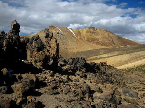
Cerro Jello Jello from the west, right after coming around the northwest ridge of Nevado Huarancante
It's a simple walk-up to the summit. If you like that sort of terrain, you could head straight up a scree slope from the west. I don't, so I looked for an easier way. Besides, I wanted to do a traverse, because from looking at it, I couldn't tell which of the local highpoints on the north-south summit ridge was the highest. Based on my altimeter and on what I saw on the ridge, I found that the south summit is the true one. My map gives no elevation, but based on the contours and my altimeter readings, I estimate it to be about 5220m.
The best part of Cerro Jello Jello is that you can camp right next to it, and then watch the sunset from the mountain. It's easy to descend the scree in twilight, or even in darkness.
In Quechua, "q'illu q'illu" means yellowish. The photos show that that adjective fits, so perhaps that explains the name.
 |
 |
Getting There
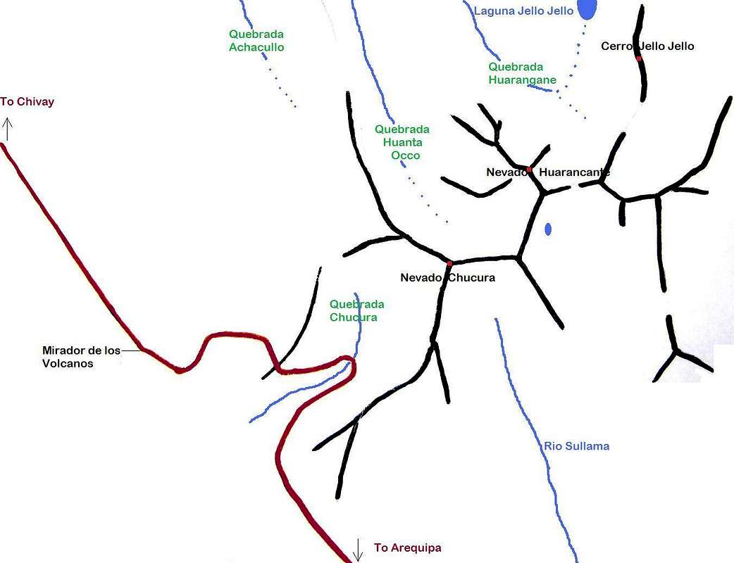
As for Nevado Huarancante, the best trailhead is the Mirador de los Volcanes. See the Getting There section of Nevado Huarancante.The Approach
To get to the mountain from the Mirador de los volcanes, start with the approach for Nevado Huarancante to Quebrada Huanta Occo. From there, more or less following the contours, go north and around the northwest ridge of Huarancante, then east, ending up high in Quebrada Huarangane. This is also the route to follow when you want to climb Nevado Huarancante from the north. I was acclimatized, and with an early start I could have done it in one day, but I started late and took two short ones instead.Laguna Jello Jello
if you don't see an image, try right-clicking and refreshing the frame
if you don't see an image, try right-clicking and refreshing the frame
My map showed a small body of water, Laguna Jello Jello, and in Arequipa I had learned that I could expect water in it. However, I didn't go quite that far at first.
 A llama near my camp site
About 1 km south of the laguna, a little stream came trickling down from it, and was joined by another small stream from the east. This was high in Quebrada Huarangane and I camped there. I took water from the stream from the laguna. Unfortunately, not long after dinner I got sick, even though I had boiled the water. Then again, at 5000m water boils at 82 degrees or so, and it takes longer to kill any pathogens. I guess I didn't boil it long enough. After a forced rest day, in which I took water from the other stream, and filtered it this time before making tea, my stomach was all right again. I should have know better though. The laguna would be an important water source for the alpacas and llamas in the area, and therefore I should have realized it might not be particularly clean.
 View from the approach from the west, almost at my campsite. See that bit of green down there? That means water!
Routes
From almost all sides, it's scree, with a few small rocky sections thrown in. You could basically go up from any direction. As I approached from the west, I couldn't tell which was the highest point. I decided to make my way up from the north west.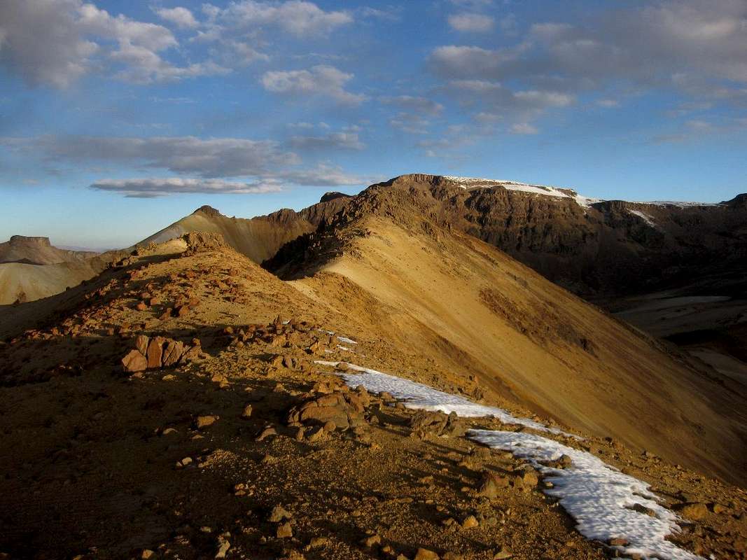
The summit ridge
From my camp site high in Quebrada Huarangane, I followed the stream up, almost to Laguna Jello Jello. From there I headed up the scree. It wasn't too bad. As I got higher, I saw a bit of rock, and thought that I might have to do a bit of scrambling. However, when I got closer it turned out to be easier than it looked. No need to use my hands. I followed the summit ridge from the north to the south, where on one occasion I did use my hands. It took about an hour to get to the summit. After enjoying the scenery, I quickly descended the scree to the west, back to my tent.
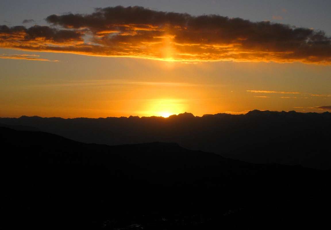
Sunset from Cerro Jello Jello
Red Tape
None.Camping
All around the mountain you can camp wild. Lower in the valleys there are a few huts, but I saw no people at all. Finding a flat spot is easy, and I found plenty of streams and a couple of small lakes. However, well into the dry season the situation might be different.Maps
Frankly, there are no good maps of the area. The best one in existence is the Peruvian IGN sheet 2539 Chivay, 1:100.000.The small print on the map says that it's based on aerial stereophotography from 1955, but during my time in the area I found that I could trust the geographical features, notably the relative altitudes of the valleys, ridges and peaks, as denoted by the contours, very well. I can't say much about the absolute altitude though, since my own altimeter isn't all that accurate with absolute altitudes unless recently calibrated. As for human-made features like roads? Well, that's a totally different matter. I learned not to trust the map on that point.
Note: At just over 3600m, Chivay lies much lower than Cerro Jello Jello.