
|
|
Mountain/Rock |
|---|---|
|
|
15.7304°S / 71.5251°W |
|
|
Download GPX » View Route on Map |
|
|
Hiking, Scrambling |
|
|
Spring, Summer, Fall, Winter |
|
|
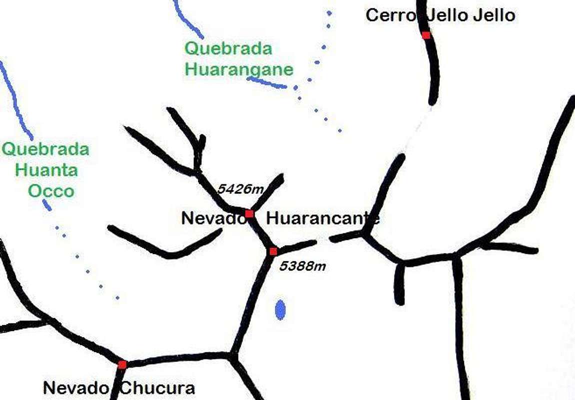
17802 ft / 5426 m |
|
|
Overview
The landscape around Arequipa, the second largest city in Peru, is dominated by big volcanos.
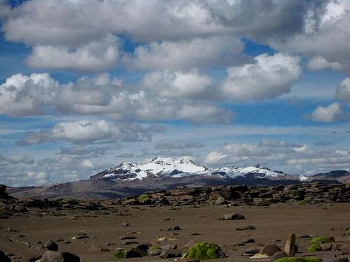
Ampato, Sabancaya and Hualca Hualca from the plane, shortly before landing in Arequipa
It's easy to see why few people have a second glance at Nevado Huarancante, assuming they see it in the first place: there are few good views from the road between Arequipa and Chivay. From the highest point on the road, the Mirador de los volcanes (15.7526°S / 71.5820°W), almost 4900m high, you can hardly see it at all! However, if you come closer, and are lucky enough to catch the mountain when there is a bit of snow on it, you might see something like this:
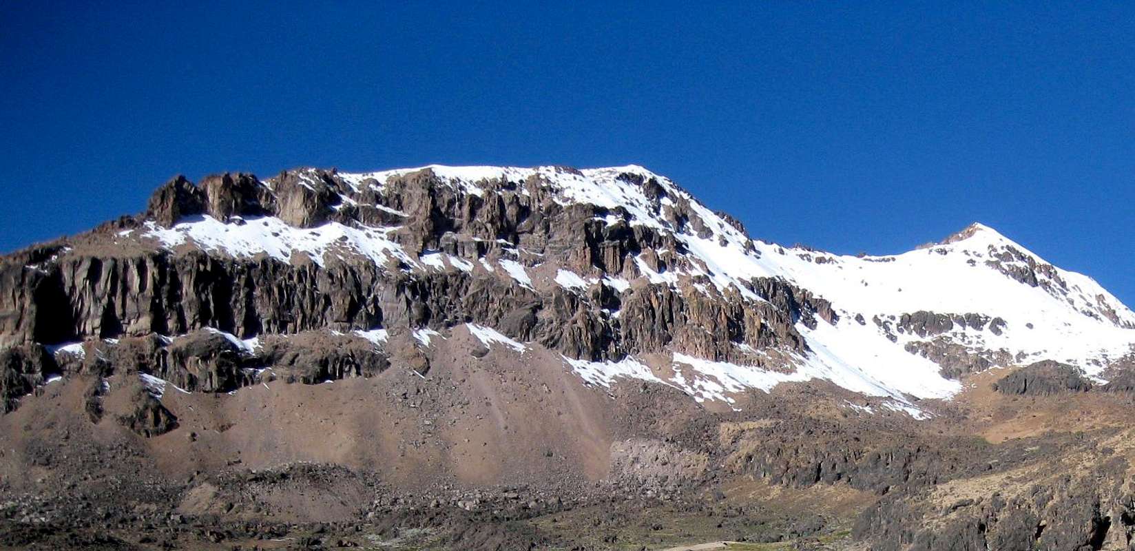
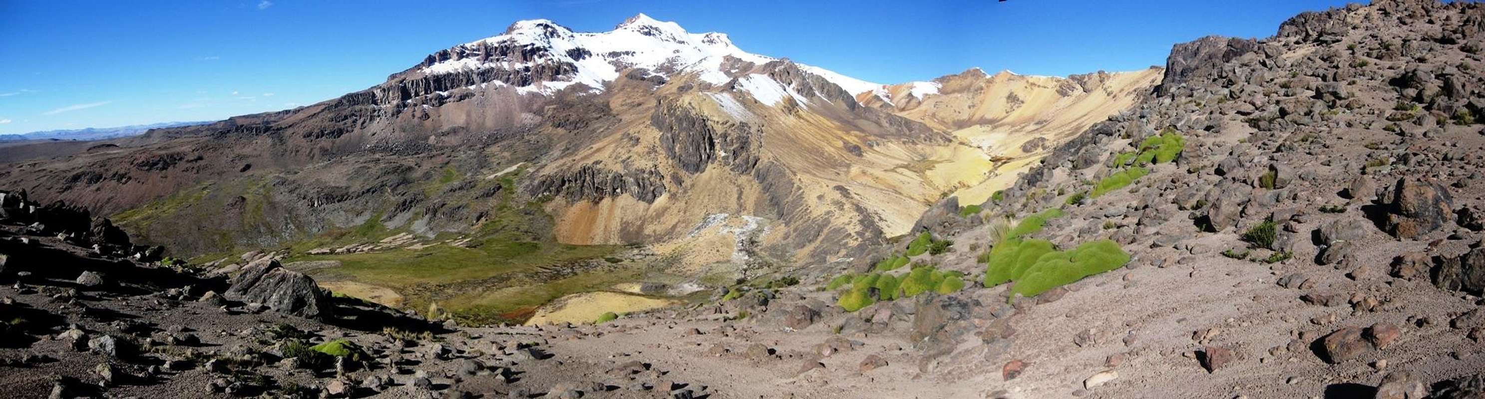 Panorama of Nevado Huarancante from the west, from the northwest ridge of Nevado Chucura
 The mountain is a rather complex one, with several summits (more about that later), many ridges and a whole lot of scree slopes. A bit of snow makes the scree less tiresome to ascend, and besides, I believe that it looks much more beautiful! Either way, with or without snow, it's an easy mountain to climb. It makes a fine acclimatization peak, especially if you spend a couple of days and combine it with other nearby peaks like Nevado Chucura, Cerro Jello Jello or Cerro Santo Domingo. Alternatively, if you are already acclimatized and in good shape, you can climb it in one long day.
Huarancante (and Chucura) from the west, from the badlands between the Mirador de los Volcanes and Ampato
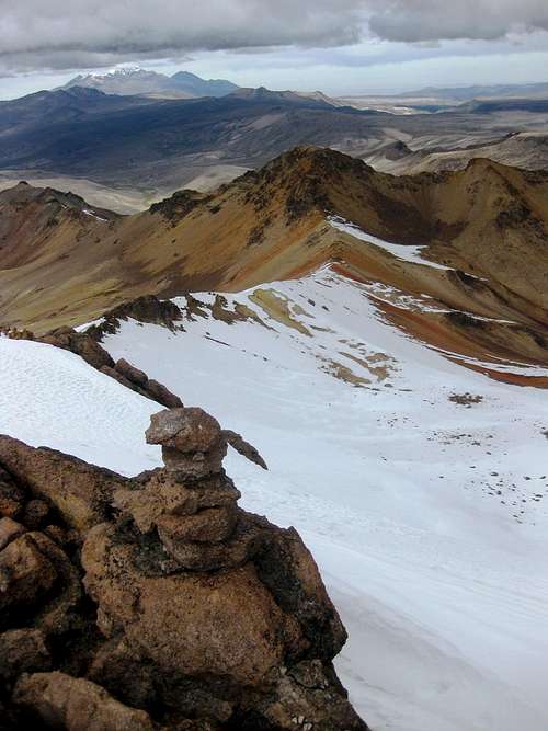
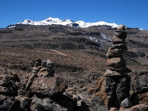
A useless cairn on the summit ridge
I saw nobody else around, nor any footprints in the snow. In Arequipa, one of the mountain guides I talked to had climbed it many years ago. Obviously, most climbers coming to this area aim for higher peaks.
Like every other peak in the area it's of volcanic origin, but it has eroded so much that it doesn't look like a volcano at all. The rock type in the area is predominantly andesite. It wasn't particularly good quality for climbing, but most routes are not really steep so that doesn't matter much.
 |
 |

Mismi from high in Quebrada Achacullo
Getting There
Arequipa is the nearest airport, with many daily connections with Lima and a few with other Peruvian airports. In addition, several companies offer long distance bus transport. A lot cheaper, but more timeconsuming. I flew into Arequipa from Lima, and later I departed on a night bus to Cuzco.
An inconspicuous view of Nevado Huarancante from the southeast, from the bus from Arequipa

Mirador de los volcanes
From Chivay to the Mirador de los volcanes takes the better part of an hour by public bus, depending on its engine - the bus has to climb 1200m or so, up a long and winding road. Going down takes just half an hour.
The Approach

The summit ridge seen from high in Quebrada Achacullo.
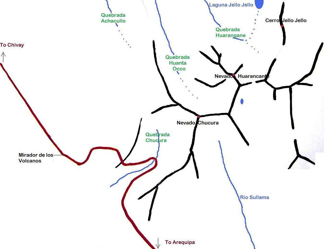
On a straight line, it's almost 7km from the Mirador to the summit. The shortest routes are the northwest ridge, the west or southwest slopes, and the south ridge. For all routes, from the Mirador the easiest approach starts by heading up the gentle slope to the northeast, heading 40°.
A few minutes from the Mirador you get to see Nevado Huarancante and Nevado Chucuru. Look closely, and you'll make out the telecom tower. Easier to spot is the winding dirt road just ahead.

The dirt road at the turnoff NW of the Mirador

The telecom tower
If you have your own transport, you can actually drive as far as the tower, making a one day ascent easier. There are two turnoffs from the main road that can get you there. One is about 2km NW of the Mirador (15.7564°S / 71.5752°W), heading east, the other one is about 1 km SE of the Mirador (15.7388°S / 71.5918°W), heading north. On my first encounter with Huarancante, I hiked out along this road for a bit and it was in good shape. You might even be able to drive it with a regular car, but a 4x4 would be a safer bet. The tower is already visible at the turnoff. I can't vouch for the condition of the other road. No matter which one of these two you take, soon you'll reach a junction with a smaller road leading to the tower itself.
At the tower, you have to make a choice where to go next: either to Quebrada Huanta Occo to the northeast, or over the summit of Nevado Chucura to the east.
 |
|
Routes
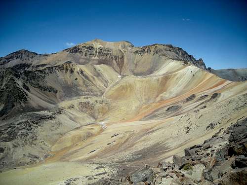
On my first encounter with Huarancante, I only came to within a few kilometers, but the second time I came back to climb it. Below is the route that I followed - don't take it too literal, because I didn't record it at the time, but created it later, using my map and photos.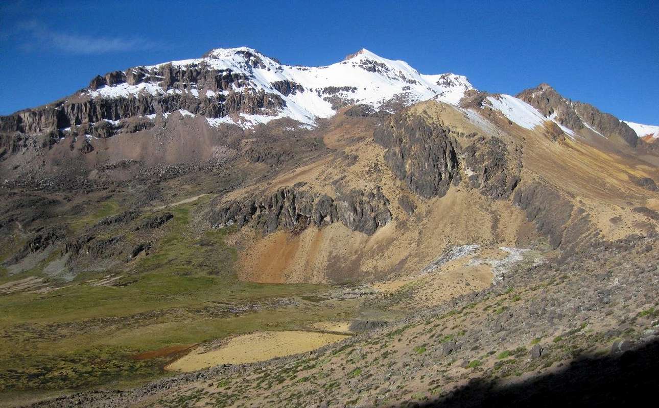 The summit ridge seen from the west. It runs from northwest to southeast.
 From the west
The northwestern summit is the highest one. In the photo above, it's the nicely shaped snow-capped peak in the middle. The more rounded one on the right, which looks like no more than shoulder from this angle, is the central summit, and is about 40m lower.
As there are no trails, from the tower you have to find your own way. Mostly, the terrain isn't steep, so you can go anywhere. However, for the western routes, at some point you'll have to get down from the northwestern ridge of Nevado Chucura into Quebrada Huanta Occo, and that involves a short steep scrambling section (if you don't like that, a longer alternative is go around the northwest ridge of Nevado Chucura and approach from Quebrada Achacullo).
About 2km northeast of the tower, you'll get to the ridge, which is the viewpoint of the photo above. You need to descend some 200m into Quebrada Huanta Occo from here. The higher parts of the slopes require a bit of scrambling.
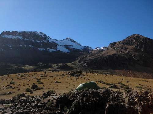
Camp site in Quebrada Huanta Occo. The summit of Huarancante is in the center.
Depending on where you find yourself down in the valley, you have to ascend between 500 and 600m to get to the summit. Without snow, it's a scree slope, which will be tiresome. I reckon that the route to the saddle directly left of the summit is the shortest. However, I didn't climb it from this side.
A much longer route would be climb the extended northwestern ridge. It looked like an interesting scramble, but because I was alone, and carried a big pack, I didn't want to risk it.
 A closer view of the interesting northwestern ridge - well, most of it. The start would be a bit further left, and the summit is on the right.
 From the south
Although a bit longer than the direct routes from the west, the route from the south is probably easier, since you don't have to descend 200m, and don't have to work your way up a scree slope. From the tower, head steadily uphill, direction about 80°, until you get to the northwestern ridge of Nevado Chucura. You'll recognize that you're on the ridge when you see its somewhat steep northeast face.

Nevado Chucura summit
Now follow the gently rising ridge, with the occasional false summit, until you get to a huge cairn: congratulations, you've climbed Nevado Chucura! If the weather is good, you'll have wonderful views all around from here.
Continue further along the ridge, which changes direction slightly and now goes due east, to point 5310. From this unnamed peak, it's just 1km along the south ridge to the central summit of Huarancante.
Well after the rainy season, these are more common conditions. View from the southwest, high on the east ridge of Nevado Chucura. Photo by Smiley.
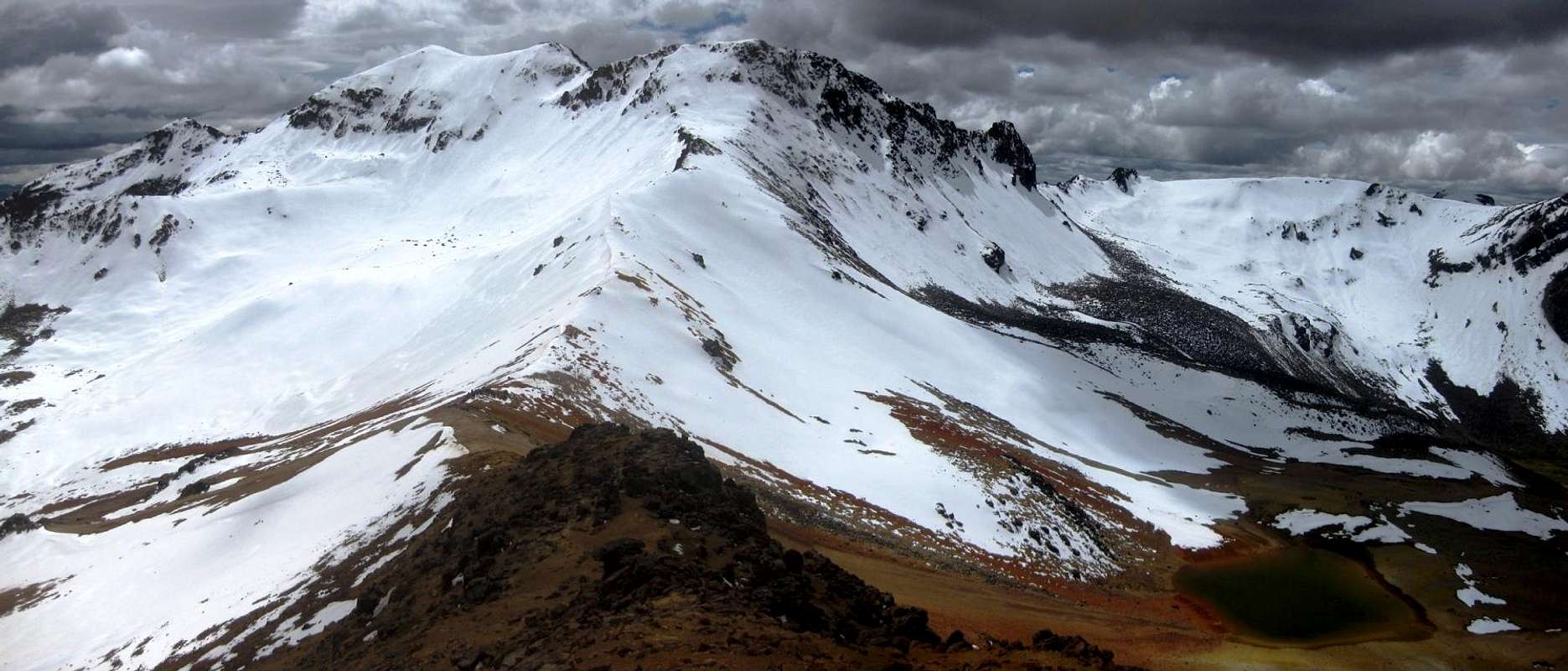 Looking from Point 5310 along the south ridge to the central summit
If there is no snow, a little scrambling is required on the crux - the saddle and central summit are right behind the climber. Photo by Smiley.
I didn't ascend by this route, but used a variation of this route on my descent: from the saddle, I traversed the snow slopes below the central summit to gain the south ridge at its lowest point. With the snow, the traverse looked easier than scrambling up the central summit. However, without snow, it's a steep scree slope. And while that wouldn't be too bad on the descent, I wouldn't like to use it on the way up; These scree slopes can be hard work, I would rather scramble over the central summit.
From the north
Laguna Jello Jello

A llama near my camp site
Clouds on Nevado Huarancante - looking up the northeastern ridge from my camp site
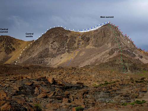
Looking for possible routes from the northeast
| White: | To the central saddle via a short scree slope, then along the southeastern ridge to the summit. |
| Blue: | To the shallow saddle via a longer scree slope close to the summit. |
| Green: | Scramble up the northeast ridge. |
| Red: | Scramble up the northwest ridge. |
Being alone and carrying a full pack, I didn't want to go scrambling without knowing what difficulties I might encounter. That meant I had to choose one of the scree slopes. I decided on the left one, because the other one looked rather steep higher up, and it was much longer. I reckoned that I could leave my pack on the saddle before scrambling up the ridge. If the ridge itself would prove to be tricky, a viable alternative would be to traverse below it on the other side, which, as I had seen a few days before, was covered in snow and didn't appear to be too difficult (mind you, I did pack crampons).
The scree turned out to be easy. There were enough larger rocks to provide good purchase, and it wasn't long anyway. Later, when I got close to the summit, I had a good look down the other scree slope. From above it didn't look very difficult.
The white route joins the southern ridge route (see above) at the saddle in the left of the photo. Consequently, I had to make my way up that 45° slope again. However, although you cannot see it from this angle, it was covered by snow. Instead of a short bit of scrambling, it was now an easy snow climb. To save weight, I had not brought an ice axe, so I punched my fists into the snow on my way up instead. The snow was just soft enough to do that.

Looking back at the crux, after the climb
I wouldn't advise on Quebrada Chucura as an ascent route though, because the roadside is almost 200m lower than the Mirador de los volcanes.
Red Tape
None.Accommodation
There are lots of hotels in Chivay and Arequipa. Between treks and climbs, I stayed in Casa de Melgar, a nice midrange hotel in the center of Arequipa. If you want to climb the mountain in one day, starting from Chivay makes a lot more sense.
Waterfall in Quebrada Achacullo
In Arequipa, the best place I found for buying supplies was the big Plaza Vea supermarket at Avenida La Marina 300. Chivay has a well stocked open market in the town center.
When to Go
Huarancante is low enough to be safe to go all year round. Temperatures usually drop below freezing at night, but as soon as the sun comes out it's not really cold anymore. Peru being close to the equator, it's not much colder in the dry winter months of June thru August. If you have a choice, you might want to avoid the rainy season, from December to March. That said, with snow on it, the mountain is a lot more interesting, so the ideal time would be during a dry period in, or just after the rainy season, or after an unseasonal bit of snowfall later on.Weather Chivay
Note: At just over 3600m, Chivay lies much lower than Nevado Huarancante.
Gear
Depending on the conditions, you may need crampons and perhaps even an ice axe. You could ask around in Arequipa, or simply look at Misti from down in Arequipa: Misti is 400m higher and if you don't see snow up there, there won't be snow on Huarancante either.Maps
Frankly, there are no good maps of the area. The best one in existence is the Peruvian IGN sheet 2539 Chivay, 1:100 000.The small print on the map says that it's based on aerial stereophotography from 1955, but during my time in the area I found that I could trust the geographical features, notably the relative altitudes of the valleys, ridges and peaks, as denoted by the contours, very well. As for human-made features like roads? Well, that's a totally different matter. I learned not to trust the map on that point.
Finding the Precise Location and Elevation of the True Summit
Long after climbing the mountain, I browsed the web in search of more information about it. I found hardly anything useful, and some incorrect information. For example, I learned about a village named Huarancante, supposedly located a few kilometers southeast of the mountain, with a few thousand inhabitants. Knowing the area abit, I did not expect that. Very few people live that high. It just doesn't make sense, especially with the fertile Rio Colca valley nearby. And, sure enough, the satellite view, which is pretty detailed for this region, shows no houses, only a few simple huts: see (15.7685°S / 71.4588°W) and (15.7764°S / 71.4540°W). It looks just like the few other places that I had passed while hiking in the highlands in southern of Peru, which are occasionally used by local herdsmen tending a few alpacas, llamas or sheep.
Alpacas
All this was inconsistent with my map (Peruvian IGN sheet 2539, 1:100.000), which has two 5400m contour around the summits, placing it between 5400 and 5450m. Of course, the map may be wrong. So, I took a closer look at my map, and at Google Maps and Google Earth, and saw that the incorrect location (15.7333°S / 71.5228°W) did corresponded with one of the two summits on my own map, but it clearly wasn't the highest. When I climbed the mountain, I got up to the saddle between the two summits, and it was obvious that the northwestern summit was higher than the central one. You can see for yourself on the photos.
Based on my altimeter readings, my map and with some help from Google Earth, I estimate the elevation of the northwestern summit as 5426m. I'll leave it up to the Peruvian Instituto Geográfico Nacional to make a more accurate measurement.
External Links
The two agencies where I dropped in from time to time and got useful information about the area:Quechua Exploring, Calle Ugarte 109 Cercado Arequipa Perú
Carlos Zarate, Calle Santa Catalina 204, Arequipa.
An interesting PhD dissertation:
Nicholas Tripcevich. Quarries, Caravans, and Routes to Complexity: Prehispanic Obsidian in the South-Central Andes (Ph.D. Dissertation, UC Santa Barbara Anthropology). , 2007.
Available at: http://works.bepress.com/tripcevich/8
Some Useful Words
| Nevado: | Snow covered mountain or hill |
| Cerro: | Hill or mountain, usually without a sharp peak |
| Quebrada: | Valley or ravine |
| Rio: | River |
| Laguna: | Small lake |
| Mirador: | Viewpoint |
| Sol: | 1. Sun 2. Peruvian currency |
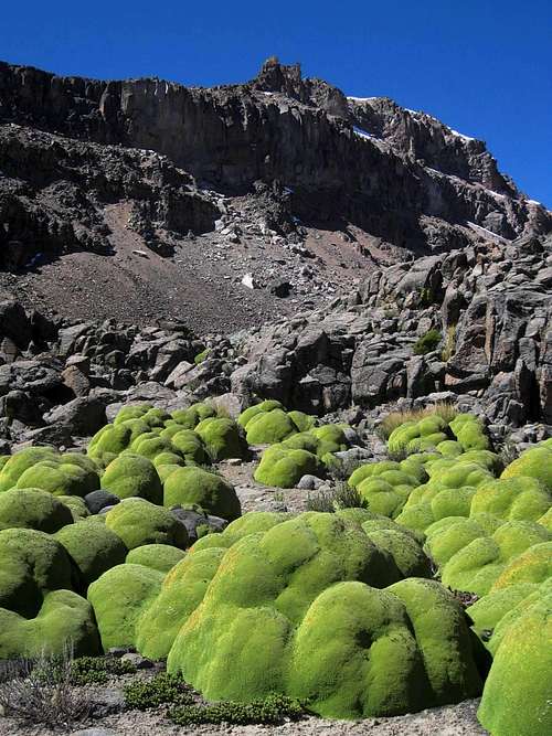
Yaretas in Quebrada Huanta Occo, below the northwest ridge