
|
|
Route |
|---|---|
|
|
34.88355°N / 111.78357°W |
|
|
Hiking |
|
|
Spring, Summer, Fall, Winter |
|
|
Half a day |
|
|
Hike |
|
|
Overview
A network of trails runs along the outer edges of the city of Sedona. These trails are far enough from the city to provide the hiker with a wilderness experience.The trails described in this page sit to the north of Sedona. I have arbitrarily lumped them together in a single page. They can be combined with many other nearby trails that share a trailhead to create much longer day hikes (Huckaby Trail, Brins Mesa Trail, Teacup Trail etc to name a few).
 Map |
Getting There
Midgley Bridge Trailhead on Route 89AThis area serves as trailhead to 4 different trails: Huckaby Trail, Jim Thompson Trail, Wilson Canyon Trail and South Wilson Mountain Trail. It is also a scenic viewpoint. The parking area can fill up fast on the weekends so get an early start. From the intersection of Routes 89A and 179 in Sedona (The “Y”), drive roughly 2 miles north on 89A to Midgley Bridge. The trailhead is immediately on the north side of the bridge on the left (west) side of the road.
34 Deg 53.158 Min North
111 Deg 44.498 Min West
Jordan Rd. Trailhead
From the intersections of Route 89A and 179 (The “Y”) in Sedona, drive a short distance north on 89A to Jordan Rd. Turn left on Jordan Rd and drive to the end of it. Turn left on West Park Ridge Drive and go a short distance to the end of the neighborhood and then on a well graded dirt road to reach a trailhead common to many trails. You will see the signs for Brins Mesa Trail on the left (west side).
34 Deg 53.289 Min North
111 Deg 46.136 Min West
Soldier Pass Rd. Trailhead
Drive north on Soldier Pass Rd. (off of 89A, a few miles west of The “Y”) to near its end, then turn right onto Shadow Rock Rd, which quickly becomes Rim Shadow Rd and then Canyon Shadow Drive (all in a very short distance). You will see a gated trailhead on the left. This gate is usually locked 5 p.m. to 8 a.m. If the gate is locked, you will not find any other place to park.
34 Deg 53.013 Min North
111 Deg 47.014 Min West
Cibola Trail
Cibola Trail is 1.4 miles long.This description takes you from Soldier Pass Trailhead to Jordan Rd. Trailhead. The trails are well-signed.
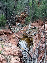
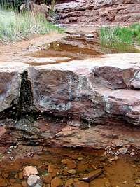
Follow the Soldier Pass Trail north. After 0.27 miles, turn right on Jordan Trail. You will soon reach a big sink hole known as Devils Kitchen.
 Devils Kitchen |
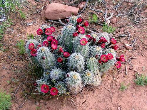
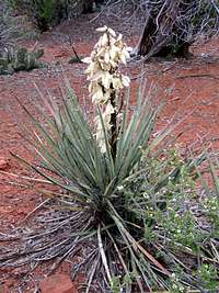
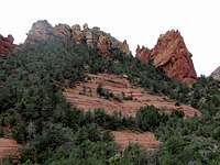
Follow the Jordan Trail until you reach a sign for Cibola Trail. You will have good views of the red rock country around you.
 | |
 |  Wilson Mtn & Canyon |
The trail goes up to a high point as it passes on the south side of Morning Glory Spire and Cibola Mitten.
 Morning Glory Spire |  Cibola Mitten |
The trail then descends to reach Jordan Road Trailhead.
 |
Jim Thompson Trail
Jim Thompson Trail is 2.8 miles longJim Thompson Trail takes you from Jordan Road Trailhead east onto the southern slopes of Wilson Mountain and a formation known as Steamboat Rock.
 MGS & Cibola |  |  |
 Steamboat Rock | ||
 Capitol Butte |  |  Wilson Mountain |
Near the end of the trail, you can follow a spur trail on the right to a spot where you can have a view of Midgley Bridge on Route 89A. Jim Thompson Trail ends at the middle section of Wilson Canyon Trail.
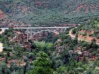 Midgley Bridge |
Wilson Canyon Trail
Wilson Canyon Trail is 1.4 miles long.At the Midgley Bridge Trailhead, you will have good views of Midgley Bridge and Wilson Canyon.
 Midgley Bridge | 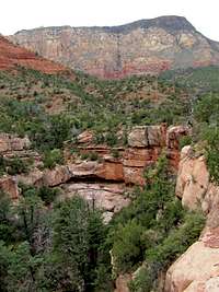 Wilson Mtn & Canyon |
The trail heads north up the canyon. After half a mile, it goes by the intersection with Jim Thompson Trail. Continue north.
 |  |  |
 | ||
 |  |  |
You will soon reach a sign that indicates the end of the trail. You will not have much of a view from this spot. You can go some 50-75 vertical feet up a beaten path on a steep slope to get good views.
 |  |  Munds Mountain |
 Wilson Mountain | ||
Essential Gear
Hiking EquipmentWeather
See the forecast for the town of Sedona, AZ.Red Tape
You will need a Red Rock Parking Pass. See the link below:http://www.redrockcountry.org/passes-and-permits/where-to-purchase.shtml
External Links
Cibola Trail: http://www.greatsedonahikes.com/cibola/cibola.html.Jim Thompson Trail: http://www.greatsedonahikes.com/cibola/cibola.html.
Wilson Canyon Trail:
http://www.greatsedonahikes.com/wilsoncanyon/wilsoncanyonl.html.