
|
|
Mountain/Rock |
|---|---|
|
|
46.23280°N / 8.93860°E |
|
|
Hiking, Scrambling |
|
|
Spring, Summer, Fall |
|
|
7841 ft / 2390 m |
|
|
Overview
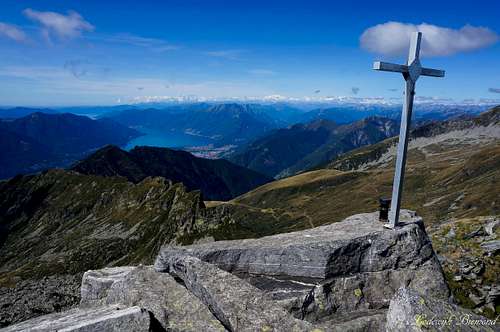 Cima dell'Uomo (2390m) summit Cross | 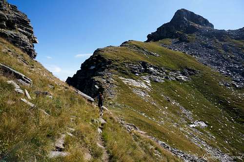 Cima dell'Uomo (2390m) from above Passo Ruscada |
Cima dell’Uomo is a mountain located in the Ticino Alps in the vicinity of the grand Lago Maggiore. Cima dell’Uomo rises over 2000 meters above Bellinzona and Locarno and therefore the Lago (Lake) Maggiore as well. The mountain should not be confused with the Cima dell’Uomo in the Dolomites (link). The mountain is located on the southernmost part of the Leventina West Ridge and is surrounded by some other well-known peaks of the Ticino area like Pizzo di Vogorno, Cima d’Erbea and Cima Gaggio.
 Cima dell'Uomo (2390m) South Face | 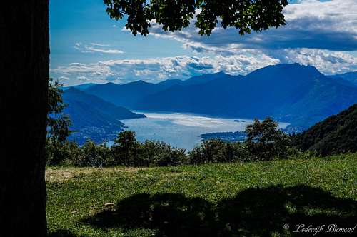 Lago Maggiore from Monti della Gana | 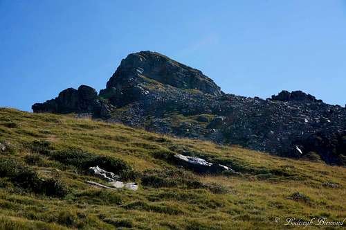 Cima dell'Uomo (2390m, W-Face) |
Cima dell’Uomo offers some spectacular hiking routes to its summit. There are two main routes leading up to the summit. The first one ascends the mountain from the southeast from the Capanna Borgna Hut. The second one ascends the mountain from the southeast from the Capanna Albagno Hut. There is also a third main route coming from the Leventina valley. It starts in Lumino at an altitude of 270 meters and leads through the entire Moleno valley (Valle di Moleno) to the Bochetta di Medee (2149m) saddle from which the summit is reached. This route includes a 2000 vertical meter gain and is therefore the less popular route. The other two routes are more popular because of the mountain huts present on the route and the Mornera cableway that brings you up to an altitude of 1400meters to shorten the climb by several hours.
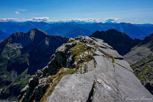 On the summit looking East towards Leventina | 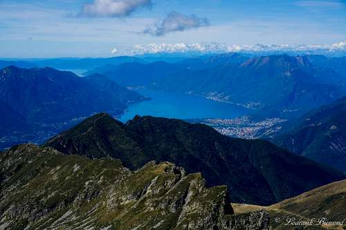 Summit view towards Lago Maggiore (S-SW) |
The routes are all graded T4, since the climb of the summit block has this grade and all three routes pass this last part to the summit. The biggest part of all routes have grade T2 and T3 though.
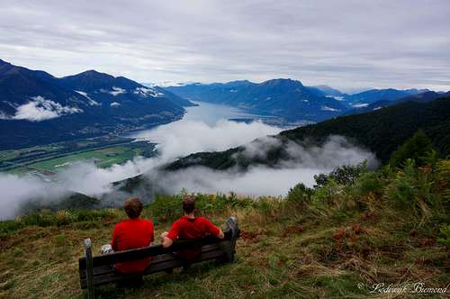
Cima dell’Uomo is an often visited mountain in Ticino and this is for a reason: The views from the summit are spectacular. Towards the southwest you have a fantastic view over the Lago Maggiore and the cities surrounding it. Towards the east you can see Bellinzona and above it Monte Tamaro and Monte Lema. Towards the north and NE Pizzo di Claro and Torrone Alto are dominating the view together with the Leventina ridge mountains. Especially the views to the Lago Maggiore are wonderful.
 Scenic Trails after Corte di Fondo |  Corte di Mezzo |  Scenic Monti della Gana |
Route 1: Monti della Gana

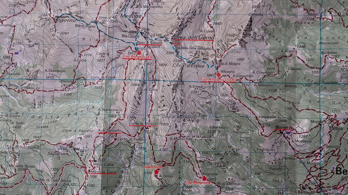
Cima dell'Uomo Route Map (Both route 1 and 2 are visible on this map; see the red underlined names)
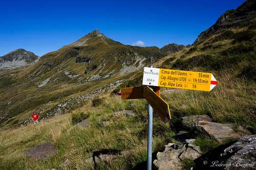
The first main route starts at Monti della Gana (1286m), a small settlement where the road ends. Because the road brings you up to over 1200 meters from the valley floor at just over 200 meters, it is a popular objective to start hikes and climbs from. From Monti della Gana there are two options to climb Cima dell’Uomo. The first one goes up to Forcola (1790m), a saddlepoint that connects Monti Della Gana with the Val della Porta. From here the trail goes up to the Capanna Borgna Mountain Hut at 1912meters. Near the hut is a big yellow signpost. Follow the trail up to passo di Ruscada at 2069m). At this point the other route from Monti della Gana joins.
This other route heads east from Monti della Gana (follow the signs Alpe Ruscada) and goes straight into the dense woods and traverses to the east into the Alpe di Ruscada valley. Once you reach the valley the trail more goes north through the whole valley up to Passo Ruscada at 2069 meters. Both routes from Monti della Gana to Passo di Ruscada take about 3 hours to get there. In my opinion, the route through the Ruscada valley is more beautiful, but it is a great option to take one of the routes up and the other one down. Both routes are graded T3- with the biggest part being T2. Both routes are marked by white-red-white markings.
 Lago Maggiore from below Forcola | 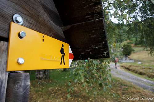 Signpost at Monti della Gana |
As already mentioned both routes join at Passo di Ruscada. From this point the route leads up to the saddlepoint (Bochette di Medee (2149m)) that connects Cima dell’Uomo with Madone di Vogorno (2395m). From the saddle you can look down into the Valle di Moleno and Moleno (260m), starting point of the third route to Cima dell’Uomo. From the saddle the route becomes more difficult and gets a blue-white-blue gradation (T4). The route crosses underneath the south flank of Cima dell’Uomo until you will eventually reach the base of the summit block. At this point some climbing (I / I+) is required to reach the summit ridge. Nothing difficult, but watch your step here. After passing the crux, the summit is reached within minutes.
 Passo Ruscada with Madone di Vogorno behind | 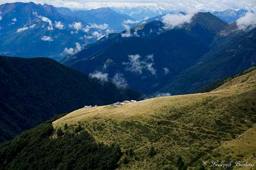 Ticino scenery: Corto di Fondo settlement |
Route 2 : Albagno
The second main route starts at the end of the Mornera cableway at 1347meters above sea level. A big yellow signpost marks the start of the trail. The sign says: ‘’Capanna Albagno’’. It takes about a hour and a half to get there on well-marked trails (T2). 10 Minutes after leaving Mornera you will pass a small lake, which is created to take water from by helicopters in case of (forest) fires.
From the Capanna the trail becomes more difficult (T4) and is recognized by white-blue-white markings. The trail goes up to the Bochetta d’Erbea at 2250 meters, just east of the Cima d’Erbea summit. Continue along the trail towards Bochetta della Cima Dell’Uomo (2280m) until you reach the base of the summit block. At this point some climbing (I / I+) is required to reach the summit ridge. Nothing difficult, but watch your step here. After passing the crux, the summit is reach within minutes.
Route 3: Moleno
A third route starts in the village Moleno at 260 meters a.s.l. This route follows the entire Moleno valley towards the Bochette di Medee (2149m) saddle almost 2000 vertical meters higher. The trail is marked and not difficult (T3-) and leads through the wild and lonely Moleno valley. From the Bochette di Medee the final part to the summit is the same as described in the Monti Della Gana section and graded T4. Because of the elevation gain this route is less frequently climbed compared to the other two.
Labelled Summit Panorama
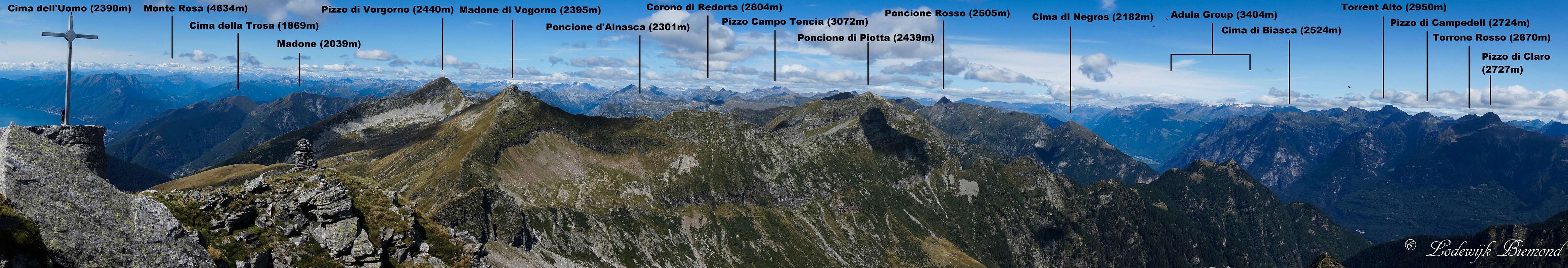  Cima dell'Uomo Labelled |
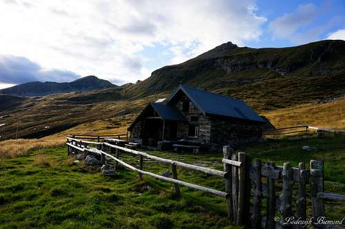
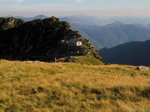
Capanna Borgna
Capanna Borgna is a nice, cosy mountain hut with excellent views towards the Lago Maggiore. This hut is not guarded and always opened for visitors. It is maintained very well and all basis facilities (beds, blankets, running water, a stove, dishes) are present.
telephone: +41 091 85900 69
Altitude: 1912m
Website: http://www.fondazioneverzasca.ch/it/41/borgna.aspx
Capacity: 18 + 9 sleeping places
Capanna Albagno
Capanna Albagno UTOE (1870m)
Telephone:
+4179274 22 50
Coordinates: 717.100/120.140
Capacity: 28 beds
Opened: Only closed from 01.12 until 31.03
Website: Click Here
Hotel & Camping
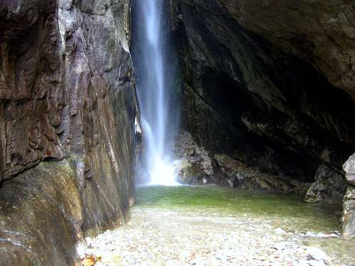
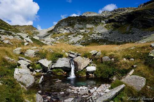
Waterfall near Al Censo Camping
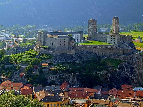
Bellinzona & Castelgrande by Vid Pogachnik
Campings in Ticino can be found on: Camping search
Personal Favourite: Camping Al Censo, Claro
Camping Al Censo
For hotels and other places to stay:Visit the Major cities: Bellinzona, Lugano or Locarno
Hotels
Personal Favourite: Camping Al Censo, Claro
Camping Al Censo
For hotels and other places to stay:Visit the Major cities: Bellinzona, Lugano or Locarno
Hotels
Weather
How to get there
Route 1 starts at Monti della Gana. See the google-Map below for directions.
Route 2 starts at the Mornera cableway. See the section below for directions.
Mornera Cableway
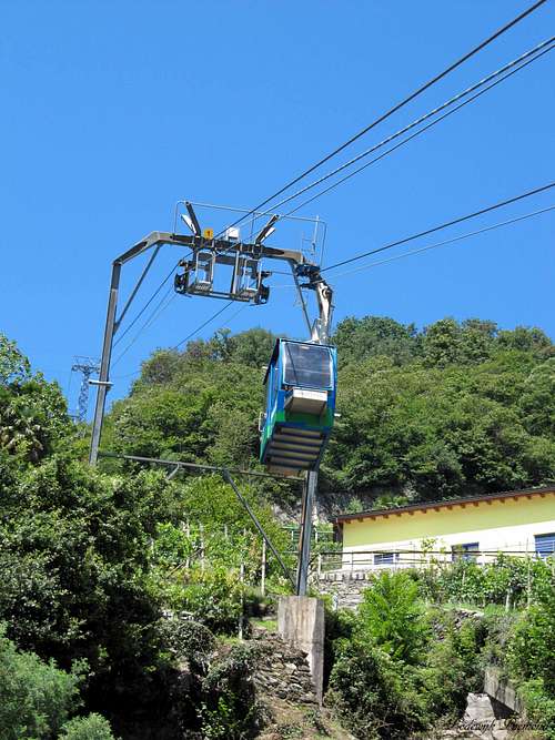
Mornera Cableway
Follow this link for the official page of the Mornera cableway. The Mornera cableway starts in the small village of Monte Carasso, which is located just outside the city of Bellinzona. As mentioned above, the cableway is opened every day in the summer months between 08:00 and 17:00. The cableway runs automatically between 06:00 and 08:00 and between 17:00 and 21:30. For the exact operating hours click here.
Adress & Telephone:
I Fracc 1
CH - 6513 Monte Carasso
+41 91 825 81 88
Maps and Books
 | 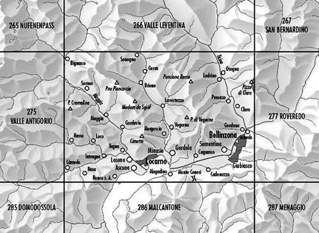 Bundes Landkarte (BLT) 276: Verzasca-Locarno-Bellinzona |
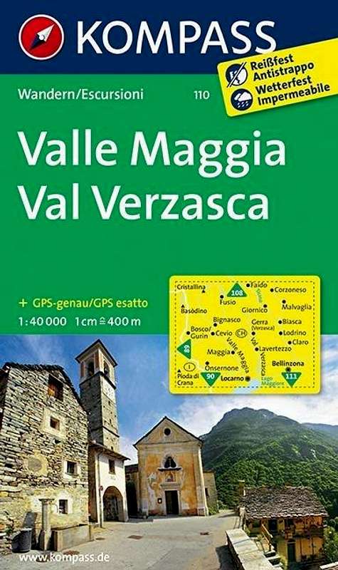
Kompass Map WK110 Valle Maggia ValVerzasca
Scale 1:50.000
ISBN13: 9783854913368
Bundes Landkarte (BLT) 276
Scale 1:50.000
Verzasca-Locarno-BellinzonaISBN13 : 9783302002767