

-
 7447 Hits
-
 88.61% Score
-
 27 Votes
|
|
Mountain/Rock |
|---|---|
|
|
46.49198°N / 10.62909°E |
|
|
Hiking, Mountaineering, Skiing |
|
|
Spring, Summer, Fall, Winter |
|
|
10712 ft / 3265 m |
|
|
Overview
Cima Madriccio - Madritschspitze 3265 m
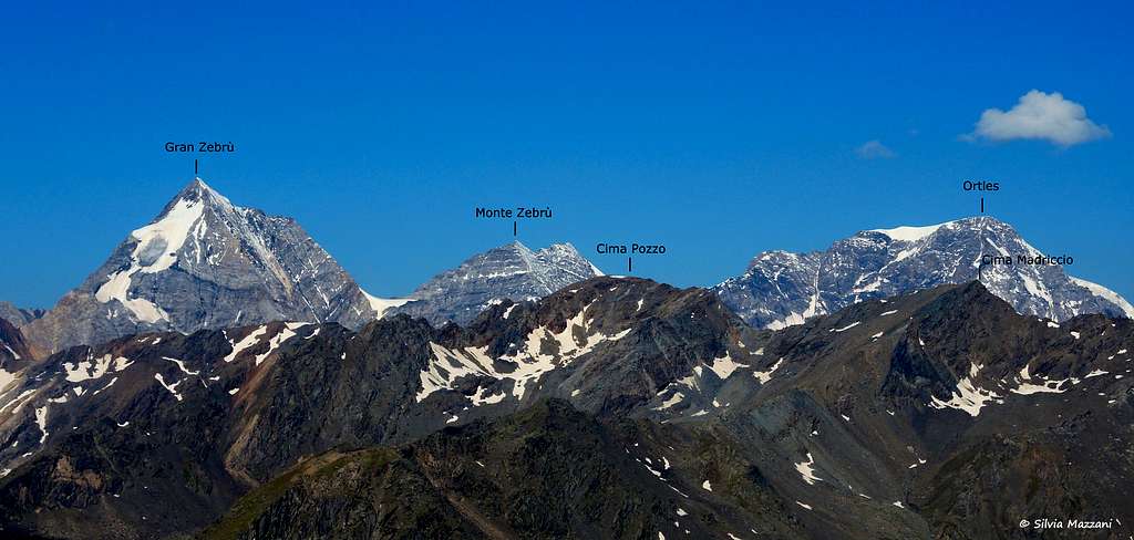
As all the mountains in the county South Tyrol/Bolzano Alto Adige, located near the boundaries between Italy and Austria, this peak has two names: Cima Madriccio, the italian name, and Madritschspitze, the original tyrolese place-name. Cima Madriccio lies in the Eastern part of the Ortles Group and offers great views on some of the famous mountains all around, especially the big three, Ortles, Monte Zebrù and Gran Zebrù, but also the Cevedale.
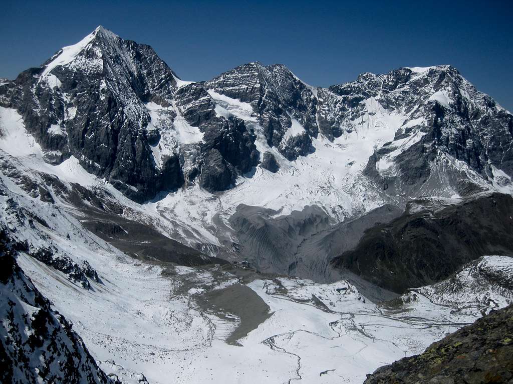
 Ortler |
 Gran Zebru |
 Cevedale |
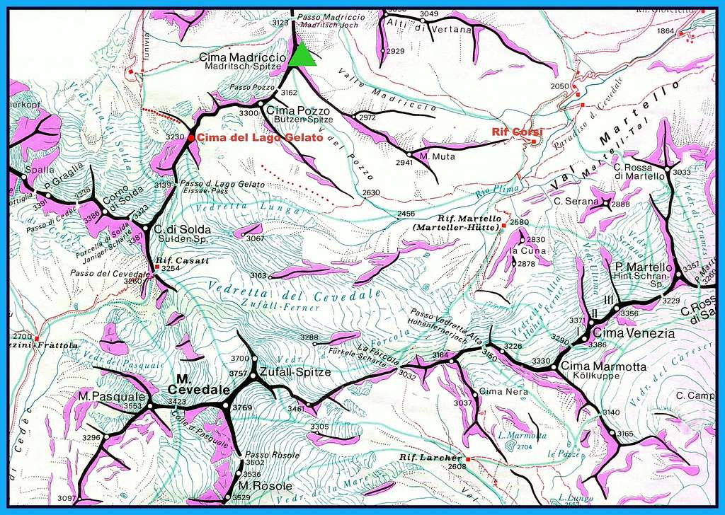
Cima Madriccio is the first peak on the ridge connecting Passo del Madriccio / Madritschjoch (3123 m) to Passo del Lago Gelato / Eisseejoch (3139 m). The other peaks on the ridge are Cima Pozzo / Butzenspitze (46.4862, 10.6230) (3300 m) and Punta del Lago Gelato /Eisseespitze (46.4805, 10.6087) (3230 m).
East of the peak lies the Valle Madriccio /Madritschtal, to the south east the Valle del Pozzo / Butzental, to the west lies the Solden ski area.
Passo del Madriccio
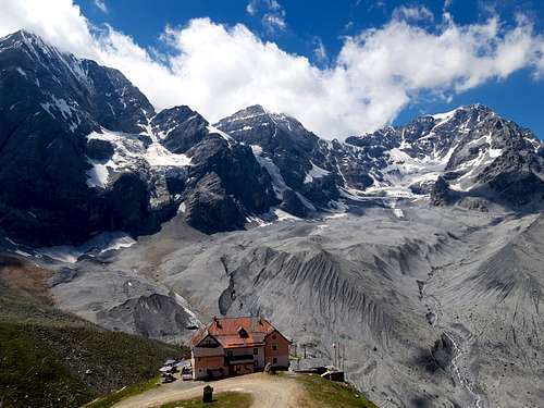
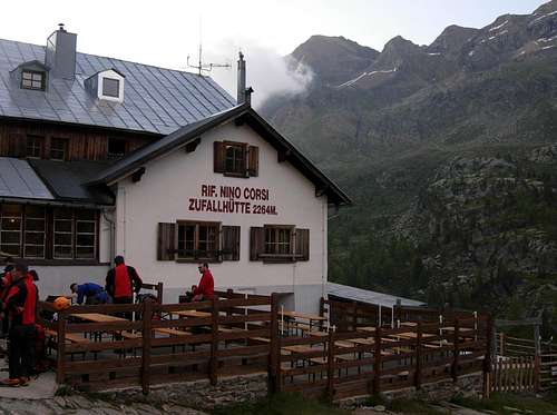
Passo del Madriccio lies about 2,5 km east by north east of the Rifugio Città di Milano / Schaubachhütte (2581 m) and is the highest point in the route to the Rifugio Nino Corsi / Zufallhutte (2265 m). This route is popular for hikers and mountainbikers alike. If there isn't too much snow, the hike to the pass from the Rifugio Città di Milano takes about 1.5 hours, from the Rifugio Nino Corsi about 3. Just north of the pass lies the Punta Beltovo / Schöntaufspitze.
The Eisseejoch lies about 2 km south by south east from the Schaubachhütte and is on of the glacier route from the Schaubachütte to the Casati refuge, from where many people climb the Cevedale. In fact, quite a lot of people climb Cevedale directly from the Schaubachhütte, and considering the prices at the Casatihütte, I cannot blame them. Note that this is a glacier route, with lots of crevasses!
Getting There
The best access is either from the small town of Sulden / Solda, or from the Martell valley to the east. See Punta Beltovo / Schöntaufspitze for more information.
The Easiest Route
The easiest route is hiking up from the Rifugio Nino Corsi through the Martell valley and the Butzental. Count on 3-4 hours to the summit.
From the hut, follow a good path into the Martell valley, initially going south, but soon it turns westward. Ignore the turnoff to the left (or south) that descends to the river and the Martellerhütte and continue along the path up into the valley, ascending gradually. The path doesn't follow the valley floor, but stays on the slopes, and very gradually turns towards the north west.

Butzental / Valle del Pozzo
By now you're into the Butzental, which ends at the ridge connecting the Butzenspitze on the left and the Madritschspitze on the right.

Butzental / Valle del Pozzo
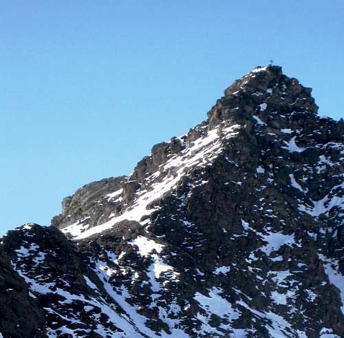
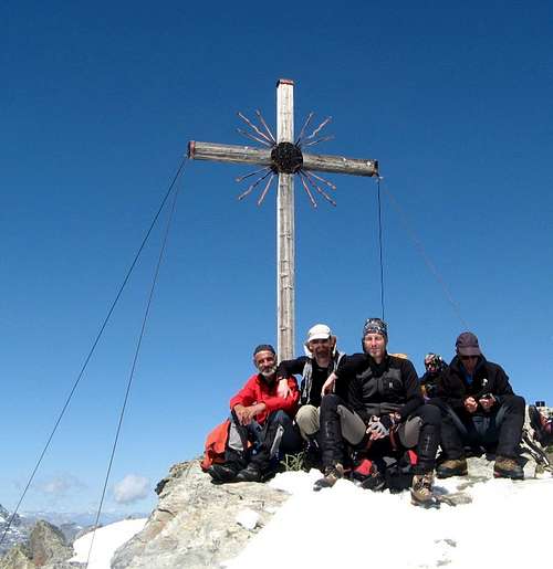
Basically, follow the good path up into the valley until it disappears. From there it doesn't really matter anymore, just continue up the valley. The last few hunderd meters to the summit can be approached directly from the south, or along either the south east or the south west ridge, all easy. The summit is marked by a big cross, which is visible from far away.
We followed this route on the descent.
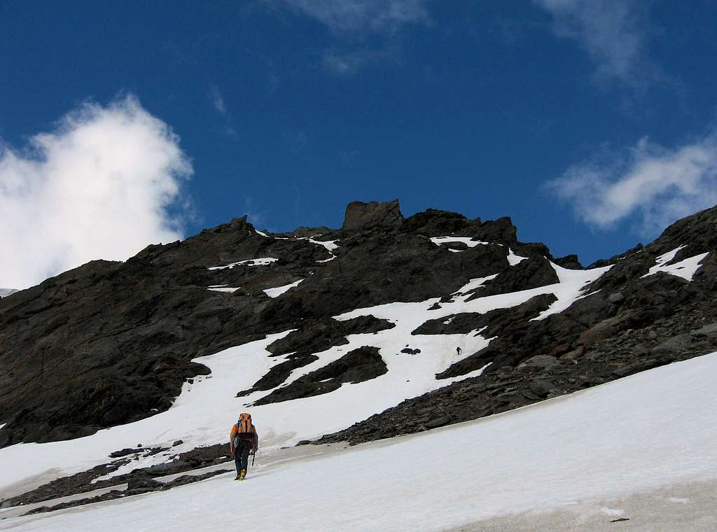
North Ridge
The approach from the north, from the Madritschjoch, is a nice scramble along the north ridge leading to the summit, UIAA grade I-II.
The ridge is quite exposed at some places. Route finding is easy, just follow the ridge. You can see the summit cross on and off while on the ridge, but you'll have to pass quite a few false summits before you finally see it up close. We took a leasurely two hours, but it shouldn't be too hard to climb it within an hour.
Other Routes
There are two more easy routes worth mentioning, though I have no personal experience with these.
- It's possible to hike in through the Madritsch valley and cross the SE ridge in a gap at about 500 m distance from the summit. From there, walk to the summit on or along the ridge.
- Traverse the ridge from the Butzenspitze, which lies to the SW.
Red Tape
There are no fees or permits needed to climb Cima Madriccio. The peak is located inside Parco Nazionale dello Stelvio, one of the most important National Parks in Italy. You should take care of nature as usual within the boundaries of all the natural parks. Free camping is not allowed and fires are strictly forbidden. The whole fauna and flora are protected. Don’t disturb fauna and other mountaineering and hikers’ peacefulness with every kind of noise.

Huts
Wild camping is not allowed, but there are plenty of alpine huts nearby. In winter, Sulden is a ski town, with lots of accommodation options. In summer, it is a pleasent town and not so busy anymore, so it's easy to find a place to stay.
The two most relevant huts are:
Before moving to the Schaubachhütte, we stayed at Garni Ortlerhof and I can certainly recommend that.
Meteo
Guidebooks and maps


“Ortles-Cevedale – Parco Nazionale dello Stelvio” by Gino Buscaini – Collana CAI-TCI Guide dei Monti d’Italia
Map
Ortles - Cevedale Tabacco, foglio 08, 1:25.000